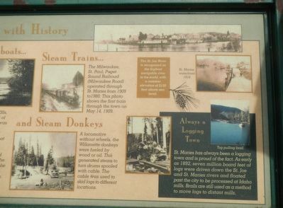
St. Maries, named by Jesuit Father Pierre DeSmet during the 1840s, sits at the confluence of the "Shadowy" St. Joe and St. Maries rivers. It was recognized as a settlement in the 1880s. Incorporated as a village in 1902, and as a city in 1913, it . . . — — Map (db m122624) HM
When two trains met on the single track Milwaukee mainline one train would have to “go in the hole”. One train moved onto a side track or siding, letting the other train pass by.
Timing a “meet” was extremely . . . — — Map (db m45635) HM
Bitterroot winters are frigid and long-lasting, with the snow staying on the ridges and packed into the draws and gullies well into the spring.
Roland and East Portal can receive up to a foot of snow an hour during a big storm. The snowpack . . . — — Map (db m45561) HM
Wood to Steel
The Milwaukee Road built temporary wood trestles at all but Kelly Creek and Clear Creek. Fire danger prompted the railroad to immediately begin replacing the wooden structures with earth-filled embankments or building steel . . . — — Map (db m45614) HM
In 1925, the Chicago, Milwaukee and St. Paul Railway Company suffered the largest business failure in the history of the United States up to that time.
The bankruptcy resulted from a combination of problems related to the construction of . . . — — Map (db m45650) HM
A logging railroad known as Bogle Spur snaked from here up the North Fork of the St. Joe River for seven miles. The spur was built to salvage timber killed during the 1910 fires. The little railroad operated from 1912 to 1915. When the logging . . . — — Map (db m45654) HM
When Water Powered the Road
It made a great deal of sense to the Milwaukee Road’s directors to electrify portions of the mainline when building the western extension.
They could reduce the high cost of oil-fired, steam powered . . . — — Map (db m45624) HM
For the price of a Pullman ticket, a common rail passenger could be waited upon and pampered in the grand manner of privileged gentry.
The Pullman porter provided the labor for that luxury…
After the Civil War, the Pullman Palace . . . — — Map (db m45648) HM
[Cyrillic text]
(Little Joes, The Locomotives Big Joe Stalin Never Got!)
Made for Joseph Stalin’s Soviet Union, the United States embargoed these magnificent locomotives as strategic material at the start of the “Cold . . . — — Map (db m45633) HM
If you stood on this spot with a railroad surveyor in 1906, you would have gazed across a lush patchwork forest of large trees. The super hot 1910 fires burned the valley below and for years afterward the area presented travelers with a bleak view . . . — — Map (db m45567) HM
It took a lot of mechanical muscle to pull the Milwaukee Road’s long, heavy passenger and freight trains over the rugged Rocky Mountains and tough Bitterroot Range. The Milwaukee Road used a great variety of powerful locomotives to do the . . . — — Map (db m45625) HM
It's nature’s “fault” this tunnel is closed…
Several major geologic fault lines run under these mountains. The mountainside here is slowly shifting along a fault line into the right side of this tunnel, collapsing it. . . . — — Map (db m45613) HM
Driving across the country today, fueling up at fast food outlets, it is hard to imagine that travel was once much more luxurious. The Milwaukee Road's Olympian and Columbian passenger trains carried elegant dining cars the entire distance from . . . — — Map (db m45632) HM
The Milwaukee Road transported tons of war material and thousands of troops during World Wars I and II, the Korean War and the Vietnam War.
During World War I, the Federal Government seized railroads in the United States including the . . . — — Map (db m45641) HM
Primitive construction camps dotted the Bitterroot Mountains between 1906 and 1912.
Hardy colorful gangs of workers from around the globe called these bleak and often ugly temporary settlements home.
The hard work and disagreeable . . . — — Map (db m45553) HM
You are standing on what was Falcon, Idaho, a lonely but important Milwaukee Road siding named for the raptors that nested in the area. Train passengers gave the place scant notice, but by 1915, a depot, a section house and several other . . . — — Map (db m45634) HM
Patrolling for problems on the track was the job of the section foreman and his “section gang” of 2 to 7 hardy laborers.
In the early 1900s the Milwaukee Road’s mainline was divided into 5.5 to 9.5 mile-long sections. A . . . — — Map (db m45610) HM
Grief could come to a big, fast train suddenly. Railroaders needed to see and hear warnings and orders clearly and quickly.
The engineer and crew watched for standard signals over each section of track and kept their eyes and ears open . . . — — Map (db m45623) HM
Get the Line Open Quickly!
That was the policy of the Milwaukee Road. To do this in 1907 and 1908, the Chicago, Milwaukee & Puget Sound Railroad built numerous sturdy, but short-lived, wood trestles to prepare the new line for track as . . . — — Map (db m45579) HM
Time Runs Out for “America s Resourceful Railroad”
Never-ending financial problems, speedy new interstate highways and jets killed Milwaukee's passenger service to the Pacific Coast by 1961. Stiff freight competition and . . . — — Map (db m45651) HM
On June 29, 1947 the pride of the Milwaukee Road was introduced-- an all new streamlined train called the “Olympian Hiawatha”.
The name “Hiawatha” originated with Henry Wadsworth Longfellow’s poem “Song of Hiawatha” written in the . . . — — Map (db m45631) HM
Looking for the Right Route
In 1905, the Milwaukee and St. Paul Railway began looking for a route for their western extension over the Bitterroot Mountains. After five and a half months, exploring 930 miles, the railroad chose a route . . . — — Map (db m45559) HM
The Last Transcontinental Railroad
“It was the finest railroad in America.”
Those were the words of many former employees of the Chicago, Milwaukee, St. Paul and Pacific (Milwaukee Road). This trail follows the route of . . . — — Map (db m45652) HM
Snaking its railroad down the western side of the Bitterroot Mountains, the Milwaukee Road burrowed 16 tunnels to maintain a uniform grade down to Avery.
These tunnels were dug largely by hand using sledgehammers and hand drills. In some cases . . . — — Map (db m45608) HM
A powerful man-made jet of water blasted the mountainside…
…washing soil and loose rock downslope to fill in the trestle.
By 1911, the Milwaukee Road filled twenty-two temporary wooden trestles between St. Regis, Montana and Avery, . . . — — Map (db m45568) HM
Who’s Been Working On The Railroad?
If you stood here sometime between 1907 and 1911, you would have heard a multitude of languages.
The hundreds of people employed during the construction of the Milwaukee Road included; . . . — — Map (db m45637) HM
This distinctive example of a railroad suburb, platted in 1894, was built near the Chicago, Milwaukee & St. Paul Railroad, and many early residents were company officials. — — Map (db m242955) HM
• Asymmetrical "bob-tail" style swing-span bridge
• Designed by Chicago, Milwaukee & St. Paul Railway (Milwaukee Road)
• Superstructure is made from 210 tons of steel, with a 140 ton concrete counterweight
• Bridge spans 120 feet over the . . . — — Map (db m261144) HM
The Milwaukee Road (Chicago Milwaukee St. Paul and Pacific Railroad) was one of the three railroads that built Chicago’s Union Station. In 1956, the Milwaukee Road was the third largest railroad in track mileage (15,846) and sixth largest in . . . — — Map (db m298730) HM
This historic railroad-switching power was built some time in the 1890's. Steel arms inside the building and down along the tracks were manually operated by levers in the upper portion of the building. For over one hundred years, the building stood . . . — — Map (db m257283) HM
Most early cabooses used a cupola to permit the crew to watch over the train ahead. The bay window design, developed in 1923, was considered safer for crews and provided a better view of the side and wheels of the cars ahead.
The Chicago, . . . — — Map (db m286413) HM
This bell came from a steam locomotive of the Chicago, Milwaukee, St. Paul & Pacific Railroad, commonly known as the Milwaukee Road. The number on the bell indicates that it came from locomotive number 6168; records indicate that only one Milwaukee . . . — — Map (db m286410) HM
In 1841, Dr. Elijah Smith of New Jersey, Itasca's founding father, first came to the area which would one day become the Village of Itasca. On the initial leg of his journey, he experienced train travel as he went west to the city of Detroit. From . . . — — Map (db m286405) HM
Along with long-distance passenger service from Chicago to Milwaukee, the Twin Cities, Omaha, and the Pacific Northwest, the Milwaukee Road also ran an extensive commuter service to Chicago's Western and Northern suburbs.
Electro-Motive's . . . — — Map (db m39242) HM
In the 1920's, Chicago had six major "steam road" passenger depots, along with numerous rapid transit and electric interurban stations.
The main building, or "headhouse," of only one of the six grand old stations (Dearborn) has survived, though . . . — — Map (db m39155) HM
This caboose was built in 1929 at the Milwaukee Road shops, in Milwaukee. It was originally numbered MILW 01612, as part of an order for 15 drovers cars. They were the first steel cupola cabooses built by the Milwaukee.
The car was rebuilt in . . . — — Map (db m39231) HM
For over 90 years, this classic Midwestern interlocking tower protected the junction of the Milwaukee Road and the Elgin, Joliet & Eastern at Spaulding, just east of Elgin, Illinois.
Originally built around 1890 when the EJ&E extended north . . . — — Map (db m39263) HM
Waukee History
Adapted from "The Road to Waukee's Future" By Deborah Mikelson (Originally published in the July 2014 issue of myWaukee Magazine)
Looking Back-The Very Beginning
The first people to lay the cornerstone for . . . — — Map (db m236582) HM
In 1881, a narrow gauge rail line was built by the Wabash, St. Louis and Pacific Railroad from Des Moines through Green County to Spirit Lake. Ten years later, it was widened to standard gauge and taken over by the Milwaukee Road until . . . — — Map (db m168832) HM
Guthrie County Est. 1851 History Panora is located in eastern Guthrie County along the Western Skies Scenic Byway and the old Milwaukee Railway, which is now called the Raccoon River Valley Recreational Trail. Established in 1851, Panora is . . . — — Map (db m238347) HM
How 101-A Got to Cresco
The 101A is a Model FP 7 diesel electric locomotive built by General Motors in La Grange, Illinois in 1951. It is the first such model ever sold to the Milwaukee Road rail line and was put into service in December . . . — — Map (db m141975) HM
Originally built in 1888, the C.M. & St. Paul Depot was located on 6th Ave. between 11th and 12th Streets. In 1938, an extension was added to the original building for additional office space. The two-floor depot was the railroad hub of Marion . . . — — Map (db m239278) HM
The railyards in January 1914 (left) and 1919 (right), before and after expansion. (Great Northern Railway Company Records, Minnesota Historical Society)
A Minneapolis Eastern locomotive, 1954, with the engine house on First Street . . . — — Map (db m268745) HM
[Caption:] Looking northwest along Washington Avenue, circa 1920
During Washington Avenue's development, it has been most impacted by commerce via three modes of transportation on the central riverfront: Rapids . . . — — Map (db m257383) HM
Milwaukee Road station agents affectionately referred to the quaint little Minnehaha Depot as "the Princess." Its delicate gingerbread architecture is reminiscent of the Victorian era when ladies in bustles and gentlemen in high collars traveled . . . — — Map (db m17233) HM
New Products for New Consumers
During the 1920s, manufacturers and producers reached mass markets like never before. Newspaper, radio, and billboard advertising urged consumers to buy goods ranging from bread to automobiles. Mail-order . . . — — Map (db m236671) HM
Fulda's depot, the only surviving Eastlake - style two-story depot in southwestern Minnesota, was built in 1880 just to the southeast of the present location, on a platform between two sets of tracks. Boarding the train and loading freight was . . . — — Map (db m101287) HM
Living on Railroad Island
The small residential neighborhood immediately to the east of here is known as "Railroad Island," named so because it was at one time entirely surrounded by railroads. Railroad Island has long been . . . — — Map (db m232442) HM
In 1885 board members of The Chicago, Milwaukee, and St. Paul Railroad approved the extension of their line from Ottumwa, Iowa, to Kansas City. The entry of the "Milwaukee Road," as the railroad was later called, into Missouri occurred during its . . . — — Map (db m199582) HM
Built in 1887 for the Chicago, Milwaukee and St. Paul Railroad, the expansive brick building, known in Kansas City as the "Freight House," was originally used as a freight terminal for the historic rail line. The combination freight and office . . . — — Map (db m199579) HM
Created from an original painting by Fred Irvin, this scene portrays a pre-World War I Chillicothe setting. The Milwaukee [Road] Depot (demolished in 1977) serves as a backdrop for period vehicles and a drawn streetcar used to transport patrons . . . — — Map (db m67201) HM
Chillicothe was a point of convergence for three railroads serving northern Missouri, Burlington, Wabash, and later the Milwaukee Road. This mural includes a scene of a steam engine traveling the local countryside in the last years of the 1890s. . . . — — Map (db m67202) HM
Built by General Electric to pull transcontinental passenger trains through the Cascade Mountains, number E-2 is one of five 1+B-D-D-B+1 "gearless bi-polars" which means the 12 traction motors are mounted directly on the driving axles thus . . . — — Map (db m306107) HM
Built by General American Transportation Corporation, this car is a steel bodied reefer with ice bunkers at each end. These ice bunkers hold 10,400 lbs. of chunk ice or 11,500 lbs. of crushed ice. Ice stations were located every 100-150 miles along . . . — — Map (db m132932) HM
This electric locomotive uses a drive system that eliminates the gearing normally used between the motor and axle. It does this by making the axle part of the motor itself. The armature of the motor is mounted on the axle, and the motor's poles . . . — — Map (db m306400) HM
The Chicago, Milwaukee and St. Paul Railway was constructed between 1907 and 1909, the last transcontinental railroad to cross Montana. Its service to Great Falls during the homestead boom supported the city’s establishment as a major urban center . . . — — Map (db m141948) HM
Ismay’s bustling business, wicked ways, and itinerant population of cowboys and railroad men earned it the nickname “Little Chicago.” This town, born with the construction of the Milwaukee Road across Montana, began in 1908 with the name . . . — — Map (db m164230) HM
High maintenance steam engines required railroads to locate large repair shops every two hundred miles. After the Chicago, Milwaukee, St. Paul and Pacific Railroad chose Miles City for a division point in 1907, the town grew rapidly. Population . . . — — Map (db m164145) HM
Sometimes called “labor’s aristocracy,” locomotive engineers were the highest paid workers on the railroad. That fact gave William Kelly, an engineer for the Milwaukee Road, the means to purchase this one-story home. In 1920 he lived here with his . . . — — Map (db m164172) HM
Determined to bring the Chicago, Milwaukee, and St. Paul Railroad to Miles City, land developer, cattleman, and banker Lorenzo Stacy organized his fellow businessmen to secure and donate property for the railroad’s right-of- way. In 1908, the . . . — — Map (db m164147) HM
(Three panels, presented left to right, make up this marker)panel 1:
The railroad era in Lewistown ended in 2003. Subsequent to the end of rail service, the BNSF Railway Company negotiated an interim trail use and . . . — — Map (db m143508) HM
The Judith Basin occupies a central place in Montana's history. For centuries, the lush grasses of the region attracted large numbers of buffalo, antelope, and deer. The abundant game, in turn, drew Indian hunting parties to this area. But the late . . . — — Map (db m143626) HM
Open air porches, a half-hexagonal bay window, stained glass, and an irregular roofline make this late-nineteenth-century residence a classic example of the Queen Anne style. Built in the mid-1890s likely from pattern book plans, the substantial . . . — — Map (db m192377) HM
The gold strikes at Alder Gulch in 1863 yielded Nelson Story a fortune and laid the foundation of an economic empire spanning three generations. In 1866, a desperate need for beef in Montana's gold camps prompted the young entrepreneur to bring the . . . — — Map (db m253583) HM
The Milwaukee Land Company, a subsidiary of the Milwaukee Road, established the town of Three Forks in 1908. Company land agent John Q. Adams chose this townsite and held a lot sale in 1908. Buyers came by the trainload, purchasing 250 lots. . . . — — Map (db m192666) HM
T. C. Power’s stage line established a stop in 1883 where the town of Lavina was born. In 1907, the Milwaukee Road came through attracting new businesses, among them the Slayton Mercantile Co., established in 1908 by Daniel Webster Slayton. A . . . — — Map (db m188968) HM
Rancher Ludwig C. Lehfeldt sold 33,000 acres of ranch land to the Milwaukee Road in 1907 prompting the relocation of the Lavina townsite. Realizing the need for a hotel, Lehfeldt hired architects Link and Haire—who drew the plans for the 1910 . . . — — Map (db m188964) HM
The Montana Heritage Commission’s state-owned collection of railroad equipment represents the construction era of railroads in Montana. The wooden Soo Line cars representative of cars used by the Northern Pacific, Great Northern and Union Pacific . . . — — Map (db m128402) HM
During the last ice age about 15,000 years ago, an enormous glacier pushed down from British Columbia and blocked the Clark Fork River in northern Idaho. The glacier functioned as an ice dam creating the largest glacial lake known to have existed, . . . — — Map (db m123059) HM
The Milwaukee Road faced the daunting task of drilling a tunnel 23 feet high, 16 feet wide and 1.7 miles long into Idaho.
It was a damp, dark, dirty dig. After the approaches were prepared in 1906, and a faltering start in 1907, work . . . — — Map (db m45550) HM
Once a critical part of the longest electrified railroad in the world, the broken concrete foundation to your left is all that remains of the two-story, brick East Portal Substation.
Essentially a gigantic electric vault, East Portal was . . . — — Map (db m45542) HM
The Last Transcontinental Railroad
The Chicago, Milwaukee and St. Paul Railway’s Pacific Extension survived for 71 colorful years. Racing silk trains sped along the route, and long, rumbling troop trains carried men and materiel through . . . — — Map (db m45548) HM
…and Historians Trace the History along the Trail.
When the Milwaukee Road abandoned its route over the Bitterroot Mountains, salvage companies stripped the line of all the rails, ties, signals, posts and everything else of value. The . . . — — Map (db m45549) HM
"Our work ... from the 16th of August to the 4th of December, 1859 consisted of cutting through this densely timbered section of one hundred miles, building small bridge were required, and grading thousands of places.... the work was heavy, and . . . — — Map (db m123025) HM
Railroad logging was an important facet of the history of Montana's lumber industry. The Big Blackfoot Railroad was one of several logging railroads created to sustain the Anaconda Copper Mining Company's sawmill at Bonner. Built by the Chicago, . . . — — Map (db m144065) HM
Poised on the brink of the homesteading boom, Missoula prospered at the turn of the twentieth century with signs of urban growth evident in the hotels and row houses that began to line this busy corridor. Local contractor/architect Eugene Morin . . . — — Map (db m130298) HM
The construction of the Milwaukee Road and the reconstruction of the Northern Pacific Railroad through Missoula sparked a second railroad-era building boom in the early twentieth century. The need for accommodations for both railroad workers and . . . — — Map (db m144769) HM
The last spike of the Chicago, Milwaukee, St. Paul and Pacific Railroad’s (better known as the Milwaukee Road) Puget Sound Extension connecting Chicago to Seattle was driven near Gold Creek, Montana some 17 miles west of here on May 19, 1909. This . . . — — Map (db m127775) HM
The Anaconda Company’s Butte, Anaconda & Pacific Railway converted from steam to electric locomotives in 1914. Aware of Anaconda’s success, Milwaukee electrified its Rocky Mountain division between Harlowton through Deer Lodge to Avery, Idaho in . . . — — Map (db m127777) HM
Work on the 225 mile Eastern Mountain scion of the Milwaukee Railroad took place 1907-1908
The Milwaukee ran through a region of river and creek valleys making for the building of many bridges. The Yellowstone was crossed three times between . . . — — Map (db m282915) HM
When the Milwaukee road arrived in 1907, Forsyth boomed, and carpenter Maurice S. Lord decided to open his own business. “It won’t cost you anything to talk to me,” he advertised, “and if I can’t suit you as to price and quality, . . . — — Map (db m165145) HM
Founded in 1908, Ingomar became a hub of commerce when the Milwaukee Road Railroad completed its line across Montana. The community had no source of water and relied on the railroad to provide 22,000 gallon water tank cars each week for the town . . . — — Map (db m189089) HM
Founded in 1908, Ingomar became a hub of commerce when the Milwaukee Road Railroad completed its line across Montana. The community had no source of water and relied on the railroad to provide 22,000 gallon water tank cars each week for the town . . . — — Map (db m189095) HM
Completion of the “Milwaukee Road” brought hundreds of homesteaders to Ingomar during the 1910s. By 1914, wood-frame homes and a small commercial district proclaimed the town a permanent settlement. On July 2, 1914, the Ingomar Index announced that . . . — — Map (db m189093) HM
Welcome to Thompson Park, a 3,500-acre municipal recreation area with a story to tell. The Park offers unique opportunities to view past mining activity, rock formations, scenic vistas, and wildlife. The Park is jointly managed by the City-County of . . . — — Map (db m128441) HM
From the 1880s to the 1950s, trains assured Butte's survival by transporting everything from passengers and mail to ore. This marvelous depot with its 95-foot clock tower was constructed in 1916 to serve passenger trains of the Chicago, Milwaukee & . . . — — Map (db m253077) HM
The Milwaukee Road 657 mile electrified railroad ended at 11:40 PM June 15, 1974 when Engineer Art Morang stopped the E57B & E34C on the Harlowton roundhouse track. They were the last operating locomotive of the original 84 locomotives built by . . . — — Map (db m188906) HM
This Milwaukee Road Ice Bunker Reefer Car was
used to transport fruit & vegetables across the
U.S. Crushed ice was dumped into the ends of
the car and fans would blow the cold air through
the car. This insulated car now houses our
displays on . . . — — Map (db m199623) HM
Builder - Fairbanks
Morse Horsepower - 1200 Hp
Model H-12-44
Built - 1952
Built in Beloit, Wisconsin for the Milwaukee Road,
it was originally #2310. It was one of 75 total units
for the Milwaukee Road. The 740 was donated to
us by Mr. . . . — — Map (db m199628) HM
Where Highways US 212 and SD 73 meet, at the end of the Cheyenne Branch of the Milwaukee Road, we live, a half mile above sea level of the Fox Ridge Divide, our souls nourished by the picture sunsets.
Our Grass is unsurpassed anywhere, . . . — — Map (db m185219) HM
Following the establishment of the 1897 Taopi Creamery at the future townsite of Colton, discussions began about the need for a farm-to-market railroad. Paul F. Sherman of Sioux Falls and John E. Colton, village founder, spearheaded a movement to . . . — — Map (db m186914) HM
Restored and rededicated by Sound Transit on October 16, 1999 to link the past and future of public transportation and serve the Central Puget Sound community. Union Station served as the Seattle passenger terminal for the Oregon - Washington . . . — — Map (db m48168) HM
Jennie and Lot Wilbur celebrated their wedding anniversary on April 8th; she was 24 years old and he was two years younger when they married in 1868. The union produced no children, but together they established the first drug store in . . . — — Map (db m179211) HM
Prior to 1871, the area where you are now standing was populated by the Upper Band of the Spokane Tribe of Indians. It was one of their most important salmon fisheries. Following the passage by Congress of the 1864 Northern Pacific Railroad Land . . . — — Map (db m148700) HM
The early 1970s were a time of growing environmental awareness and a worldwide desire to reduce pollution, recognize and protect endangered species and take better care of the planet. Spokane and its river became a perfect venue for this . . . — — Map (db m148696) HM
Back when the Packers traveled exclusively by train, they were welcomed home here at the Milwaukee Road Depot by throngs of joyous fans after clinching three of the six NFL championships they won under Curly Lambeau. The celebrations took place . . . — — Map (db m145618) HM
The Chicago, Milwaukee and St. Paul Railroad…
later known as the Milwaukee Road came to Green Bay in 1873.
This depot was built in 1898 and was the only passenger depot located on the east side of the river. It served as a . . . — — Map (db m43821) HM
The DeForest Depot was built in 1871, at the time of the construction of the railroad line which connected Madison to Portage. Land for a depot was donated to the railroad by Isaac DeForest. Recognizing the importance of rail service to the growth . . . — — Map (db m37570) HM
The Neoclassical Revival style former depot was designed by Frost and Granger of Chicago, regionally prominent designers of train depots. It is locally significant, representing the national dominance of rail for the transport of goods and people. . . . — — Map (db m53070) HM
The Mazomanie Depot is the oldest wood frame depot in Wisconsin. It was built in 1857 by the Milwaukee & Mississippi Railroad Company to replace the original depot which had been destroyed by fire earlier in the same year.
During the heyday of . . . — — Map (db m167554) HM
106 entries matched your criteria. The first 100 are listed above. The final 6 ⊳