By Michael Herrick, August 2, 2022
Sun Tavern Marker
| Near Old Post Road at Beach Road, on the right when traveling north. |
| Near Old Post Road at Beach Road, on the right when traveling north. |
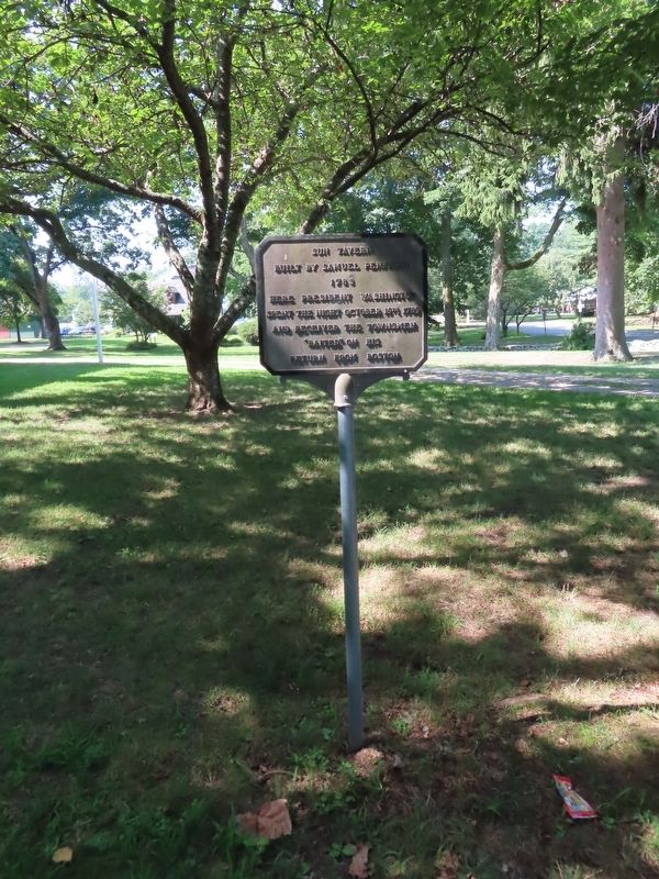
| On Ridgebury Road at George Washington Highway, on the right when traveling south on Ridgebury Road. |
| On Ridgebury Road at George Washington Hwy., on the right when traveling south on Ridgebury Road. |
| On Main Street at Gold Street, on the right when traveling north on Main Street. |
| On South Carolina Avenue Southeast just east of 6th Street Southeast, on the right when traveling east. |
| On South Liberty Street (U.S. 25) 0 miles south of West 6th Street (Georgia Route 80), on the right when traveling south. |
| On North Liberty Street (U.S. 25) near Sixth / Peace Street (Georgia Route 56). |
| On E. 6th Street at N. Liberty Street, on the right when traveling west on E. 6th Street. |
| On Augusta Road (State Highway 21/30) north of Drakie Road, on the right when traveling north. |
| On W State Street at Barnard Street, on the right when traveling west on W State Street. |
| On Abercorn Street at E.St Julian Street, on the right when traveling north on Abercorn Street. |
| Near Bull Street near East Congress Street, on the left when traveling north. |
| On Ebenezer Road (State Highway 275) at Rincon-Stillwell Rd, on the right on Ebenezer Road. Reported missing. |
| On Greene St at 6th St, on the left when traveling west on Greene St. |
| On 13th Street (U.S. 1) near Independence Drive, on the left when traveling north. |
| On Washington St near Reynolds St. |
| On Newington Highway (State Highway 24), on the right when traveling south. |
| On Burton's Ferry Highway (U.S. 301) at Waynsboro Highway (State Highway 24), in the median on Burton's Ferry Highway. |
| On Greene Street at Bridge Street on Greene Street. |
| Near Greene Street at Bridge Street. |
| On Oldtown Road (Maryland Route 51) at Opessa Street, on the right when traveling east on Oldtown Road. |
| On Conduit Street near Gorman Street, on the left when traveling south. |
| On Muddy Creek Road, 0.1 miles east of Galesville Road, on the right when traveling east. |
| On Solomons Island Road (Maryland Route 2) at Harwood Road, on the left when traveling south on Solomons Island Road. |
| Near Washington Boulevard. |
| On Frederick Street (Maryland Route 194) 0.1 miles south of Baltimore Street (Maryland Route 140), on the right when traveling south. |
| On Market Street at Bladen Street, on the right when traveling east on Market Street. |
| On Hermitage Drive, 0.2 miles north of East Main Street, on the right. |
| On Broad Street, 0.1 miles west of River Road, on the right when traveling west. |
| On Cecilton-Warwick Road (Maryland Route 282) at Worsell Manor Road on Cecilton-Warwick Road. |
| On Cecilton-Warwick Road (Maryland Route 282) 0.1 miles west of Church Road, on the left when traveling east. |
| On Liverpool Point Road at Beaverdam Road, on the right when traveling east on Liverpool Point Road. |
| On Port Tobacco Road (Maryland Route 6) at Poorhouse Road, on the right when traveling west on Port Tobacco Road. |
| On Chicamuxen Road (Maryland Route 224) at Sweden Point Road, on the right when traveling south on Chicamuxen Road. |
| On Catoctin Mountain Highway (U.S. 15) at Willow Road, on the right when traveling north on Catoctin Mountain Highway. |
| On Woodsboro Pike (State Highway 194) 0.1 miles south of Renner Road, on the right when traveling south. |
| On Tuscarora Road (Maryland Route 28) west of Buckeystown Pike (Maryland Route 85). |
| On Urbana Pike (Maryland Route 355). Reported missing. |
| On Old Creagerstown Road just west of North Main Street (Woodsboro Pike), on the right when traveling west. |
| On Hutton Road (Maryland Route 39) west of Old Crellin Road, on the right when traveling west. |
| On National Pike (U.S. 40) 0.8 miles east of the Pennsylvania state line, on the right when traveling west. |
| On National Pike (Alternate U.S. 40) east of Chestnut Ridge Road (U.S. 219), on the right when traveling east. |
| On Garrett Highway (U.S. 219) at Paul Friend Road, on the left when traveling south on Garrett Highway. Reported damaged. |
| On Norrisville Road (Maryland Route 23) at Troyer Road, on the left on Norrisville Road. |
| On Old Washington Road, 0.1 miles south of Washington Boulevard (U.S. 1), on the right when traveling south. |
| On Washington Boulevard (U.S. 1) 0.2 miles south of South Street, on the right when traveling south. |
| On Washington Road (U.S. 1) 0.2 miles north of Waterloo Road (Maryland Route 175), on the right when traveling north. Reported missing. |
| On Waterloo Road (Maryland Route 175) 0.1 miles west of Washington Boulevard (U.S. 1), on the right when traveling east. |
| On High Street at Cross Street (Maryland Route 289), on the left when traveling south on High Street. |
| On Queen Street at Cannon Street, on the right when traveling east on Queen Street. |
| On South Main Street (Maryland Route 313/290) at W. Cross Street (Maryland Route 213), on the left when traveling north on South Main Street. |
| On Maryland Route 213 at Queen Street, on the right when traveling south on State Route 213. |
| On Sharp Street at Main Street (Maryland Route 445), on the right when traveling east on Sharp Street. |
| On Darnestown Road (State Highway 28) 3 miles south of Martinsburg Road. |
| On Baltimore Avenue (U.S. 1) at Prince Georges Avenue, on the right when traveling north on Baltimore Avenue. |
| On Fort Washington Road, 0.8 miles west of Old Fort Road, in the median. |
| On Broad Creek Church Road, 0.1 miles south of Oxon Hill Road, on the right when traveling south. |
| On Largo Road (Route 202) 0.1 miles south of Kettering Drive, on the right when traveling south. |
| On Laurel Bowie Road (Route 197) at Montpelier Drive, on the right when traveling south on Laurel Bowie Road. |
| On Old Marlboro Pike (Maryland Route 725) 0.5 miles east of Woodyard Road (Maryland Route 223), on the left when traveling east. |
| On Old Marlboro Pike (Maryland Route 725) at Main Street (Maryland Route 725), on the left when traveling east on Old Marlboro Pike. |
| On South Potomac Street at West Memorial Boulevard, on the right when traveling south on South Potomac Street. |
| On Western Pike (Maryland Route 144), on the right when traveling west. |
| On E. Potomac Street (U.S. 11) at Springfield Lane, on the right when traveling east on E. Potomac Street. |
| On Brattle Street, on the right when traveling west. |
| On Massachusetts Avenue (Massachusetts Route 2A) west of Holyoke Street, on the right when traveling west. |
| On Tremont Street south of Court Street, on the left when traveling south. |
| On Hunking Street west of Mechanic Street, on the right when traveling west. |
| On Palisade Avenue, on the left when traveling south. |
| On Court St., on the left when traveling east. |
| On Franklin Avenue at Ramapo Valley Road (U.S. 202), on the right when traveling west on Franklin Avenue. |
| On Franklin Avenue at Ramapo Valley Road (U.S. 202), on the right when traveling west on Franklin Avenue. |
| On Forest Avenue, on the left when traveling north. |
| On Forest Avenue, on the left when traveling north. |
| On E Glen Avenue, on the right when traveling east. |
| On Bloomfield Avenue (County Route 506) at Valley Road, on the left when traveling west on Bloomfield Avenue. |
| On Valley Road (County Route 621) at Claremont Avenue (County Route 654), on the right when traveling south on Valley Road. |
| On Elwood Avenue at Elwood Place, on the right when traveling west on Elwood Avenue. |
| On N. Main Street, on the right when traveling north. |
| On New Bromley Road, on the right when traveling east. |
| On George Street (County Route 672), on the left when traveling west. |
| On Albany Street (New Jersey Route 27) at Neilson Street, on the left when traveling west on Albany Street. |
| On S James Street, on the right when traveling west. |
| On S James Street, on the right when traveling west. |
| On Main Street (County Route 124), on the left when traveling east. |
| On North Park Place at West Park Place, on the right when traveling south on North Park Place. |
| Near N Park Place, on the left when traveling west. |
| Near Chestnut Street, on the left when traveling west. |
| On Washington Place at Morris Avenue, on the right when traveling east on Washington Place. Reported missing. |
| On Main Street (U.S. 202) at Heritage Ct., on the left when traveling north on Main Street. |
| On River Dr, on the left when traveling north. |
| On Totowa Road, on the left when traveling east. |
| On Totowa Road, on the left when traveling east. Reported missing. |
| On Totowa Road, on the left when traveling east. Reported missing. |
| On Hamburg Turnpike (U.S. 202), on the right when traveling east. |
228 entries matched your criteria. The first 100 are listed above.
Next 100 ⊳