Near Old Highway 6, 0.5 miles east of Panther Creek Road, on the right when traveling east.
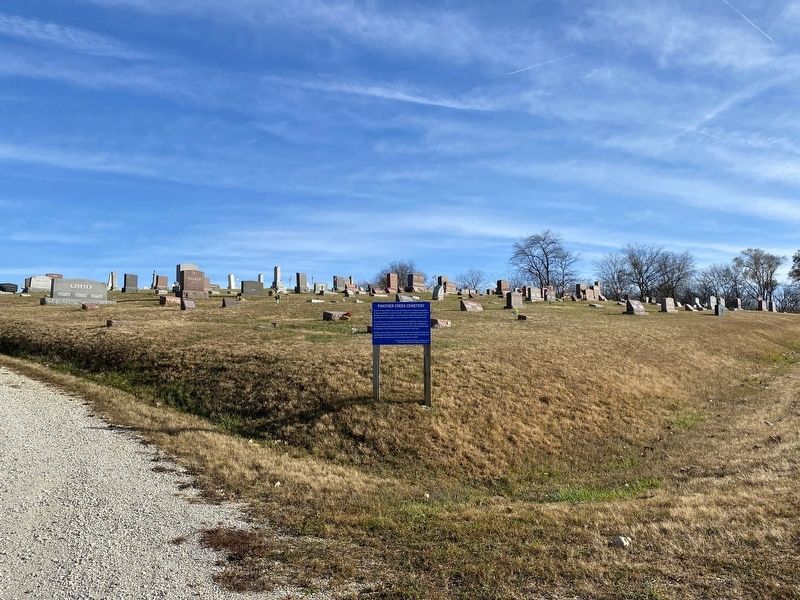
Panther Creek Cemetery has a long and notable place in history dating back to the early settlement of Dallas County. The first recorded burial was that of Benjamin Van Cleave in 1854. Records show the land for the cemetery was purchased from the . . . — — Map (db m237718) HM
On R Avenue north of Highway 6 (U.S. 6), on the right when traveling north.
At one time the community of Ortonville included a cafe and grocery store, gasoline station, elevator, post office, stockyard and two telephone companies. Ortonville was named after the Orton family, who moved to this area in 1866.
Hiram Orton, . . . — — Map (db m236585) HM
On Estates Way at Homestead Drive, in the median on Estates Way.
Dedicated to the original homestead families and their descendants. Brought to fruition through the efforts of the U.S. Government, the Franklin Roosevelt, MGSR. Luigi Ligutti and the Grace of God. In commemoration of the 50th anniversary of the . . . — — Map (db m83950) HM
On First Street north of Omaha Street, on the right when traveling north.
John Brown's Last Iowa Trip 1859
On February 16, 1859 John Brown, with twelve men, women, and children escaping slavery from Missouri, plus his own men, stopped near here at the farm of Jonathan M. Murray.
Murray, a fifty-five . . . — — Map (db m236587) HM
Near Interstate 80 at milepost 119,, 1.9 miles east of Ute Avenue (County Road R22), on the right when traveling east. Reported permanently removed.
The fork of the Des Moines and Raccoon Rivers was recognized as an ideal site a military post as early 1834. Fort Des Moines was established in 1843, but was abandoned in 1846 following the treaty whereby the Sauk and Mesquakie Indians relinquished . . . — — Map (db m33004) HM
Near North 10th Street north of Hickman Road (U.S. 6), on the right when traveling north.
Waukee History
Adapted from "The Road to Waukee's Future" By Deborah Mikelson (Originally published in the July 2014 issue of myWaukee Magazine)
Looking Back-The Very Beginning
The first people to lay the cornerstone for . . . — — Map (db m236582) HM
On Washington Street (U.S. 63) south of Jefferson Street, on the right when traveling south.
Built in 1877 at a cost of $45,201, the Davis County courthouse is an outstanding example of Second Empire architecture with its distinctive mansard roof and dormer windows. The structure measures approximately 97 by 87 feet with walls made of . . . — — Map (db m90341) HM
On South West Street, 0.3 miles south of Karr Avenue, on the left when traveling south.
Site of
The Confederate Invasion of Iowa
12th Day of October 1864.
This monument marks the northern most point of incursion into Iowa by Confederate Forces. On October 12, 1864, Lieutenant James “Bill” Jackson led twelve heavily . . . — — Map (db m36092) HM WM
Near Interstate 35 north of County Highway J52, on the right when traveling north.
The Mormon Trail The Mormons of Nauvoo, Illinois, forced from their homes following the murder of their prophet, Joseph Smith, Jr., began their trek across Iowa in 1846 on the way to the Great Salt Lake Valley. From their first permanent . . . — — Map (db m224588) HM
On Linden Street south of Main Street (U.S. 69), on the right when traveling south.
Graceland College began classes here on September 17, 1895 with 18 students and 3 faculty. The college moved to the campus on "the hill" upon completion of the Administration Building in January, 1897. — — Map (db m86719) HM
On Main Street north of 1st Street (Iowa Highway 2), on the left when traveling north.
1850 • Decatur County was organized
1853 • County seat moved from
Decatur City to Independence
1855 • Town name change from
Independence to South Independence
to Leon
1871 • Chicago, Burlington & Quincy
Railroad arrives in Leon
1874 • . . . — — Map (db m89356) HM
On Main Street south of 3rd Street, on the left when traveling south.
With the faith and courage of
their forefathers who made
possible the freedom of these
United States
The Boy Scouts of America
dedicate this replica of the
Statue of Liberty as a pledge
of everlasting fidelity and
loyalty . . . — — Map (db m72390) HM
On 1st Street (U.S. 69) at Church Street (U.S. 69), on the right when traveling west on 1st Street.
From the late 1840s through the 1860s, an exodus of more than 70,000 Mormons passed by here on their way to their "New Zion" in Utah. Starting from Nauvoo, Illinois in February 1846, the first group of at least 13,000 Mormons crossed into Iowa . . . — — Map (db m72391) HM
On Park Street, 0.1 miles east of 3rd Street, on the left when traveling south.
Medal of Honor
WWII Iwo Jima Campaign
15-16 March 1945
Pharmacist's Mate 1st Class
2d Battalion, 24th Marines, 4th Marine Division
U.S. Navy — — Map (db m22944) HM
On South Main Street at Division Street, on the right when traveling north on South Main Street.
No. 3003This S-4 Hudson class passenger locomotive was the fourth engine produced by the Baldwin Locomotive Works for the Chicago, Burlington and Quincy Railroad (CB&Q). In 1930 when the steam engine was built it was considered to be . . . — — Map (db m238371) HM
On North 4th Street just south of Washington Street, on the left when traveling south.
At this site, on the 26th day of September 1864, the Donahue and McCosh Marble Shop put on display the first Civil War Monument west of the Mississippi River. It is now located at the Kossuth Cemetery east of Mediapolis Iowa. — — Map (db m238379) HM
On Jefferson Street west of North 4th Street, on the left when traveling west.
This property has been placed on the National Register of Historic Places by the United States Department of the Interior Hedge's Building 1881 — — Map (db m238376) HM
On Washington Street at North 6th Street, on the right when traveling west on Washington Street.
Built in 1894, Burlington, Iowa’s Snake Alley is unbelievably crooked — boasting five half-curves and two quarter-curves that span 275 feet! The street rises over 58.3 feet at a 21% grade and has 1100 degrees of turns! Ripley’s . . . — — Map (db m175883) HM
Near Main Street, 0.1 miles north of Mediapolis Road (County Road H38), on the left when traveling north.
[east side]To the memory of our brave soldiers from Yellow Spring Township who died in the service of their country, and their comrades. Dedicated July 4, 1866 [north side]Co. C 30th Iowa Inf. Wm. F. Long • Mort E. . . . — — Map (db m181888) WM
On Main Street (County Road H38) at South Curve Street, on the right when traveling east on Main Street.
☆ Jimmie Howard, a Marine Corps SSG, served in Viet Cong and Korea. He was awarded the Medal of Honor for his actions on Hill 488, along with many additional honors. ☆ The Iowa Army Ammunition Plant has been an important asset . . . — — Map (db m181877) HM WM
Fourteen thousand years ago the spot on which you are standing was covered under a mile-high ice sheet. The fourth Wisconsin glacier carved the cluster of lakes into Northwest Iowa. While this north-south cut is typical of glacial lakes, West . . . — — Map (db m142094) HM
Near Circle Drive north of Miriam Lane, on the right when traveling north.
This is the site of the famous
"Spirit Lake Massacre,"
a violent conflict in March 1857 that led to the deaths of 36 settlers. Survivor Abbie Gardner (thirteen years old at the time of the massacre) returned to Arnolds Park and purchased the . . . — — Map (db m233751) HM
On Lake Street, 0.2 miles north of Okoboji Grove Road.
American Indians called the Lakes Region home for thousands of years. They were enticed to the lakes for many reasons: the tallgrass prairie provided ample grazing for an abundance of buffalo and elk; the lakes were a flyway for flocks of . . . — — Map (db m142095) HM
On Monument Drive at Miriam Lane, on the right when traveling south on Monument Drive.
The pioneer settlers named below were massacred by Sioux Indians March 8 to 13 1857. This barbarous work was commenced near this spot and continued to Springfield now Jackson Minn.
Robert Clark ·
Rowland Gardner ·
Frances . . . — — Map (db m245504) HM
On Lake Street, 0.2 miles north of Okoboji Grove Road.
The Lakes Region was settled in the 1850's. By 1884, small towns had developed and two railroads: The Burlington, Cedar Rapids & Northern; and the Chicago, Milwaukee & St. Pal laid tracks into the area. As hotels were built around the lakes, . . . — — Map (db m142093) HM
On Lake Street, 0.2 miles north of Okoboji Grove Road.
In 1889, a water toboggan slide near this pier was the beginning of the Arnolds Park Amusement Park. Toboggans and wool swim suits could be rented by the day.
Over the next century, the area, named after pioneer developer Wesley Arnold, . . . — — Map (db m142092) HM
On Hill Avenue just south of 18th Street (U.S. 71), on the right when traveling south.
In Memoriam Honoring our Veterans of Dickinson County, both Men and Women. “America will never be destroyed from the outside, if we falter and lose our freedoms, it will be because we destroyed ourselves.” Abraham . . . — — Map (db m238889) WM
On Hill Avenue at 18th Street (U.S. 71), on the right when traveling north on Hill Avenue.
This property is listed in The National Register of Historic Places Iowa State Historical Department Division of Historic Preservation — — Map (db m238671) HM
On 18th Street (U.S. 71) at Hill Avenue, on the left when traveling west on 18th Street.
This tablet marks the spot where the people of this community were sheltered during the Indian Uprising of 1861 and 1862
Dedicated to the pioneer men and women of Dickinson County — — Map (db m233805) HM
Near 340th Avenue (County Highway N22) 0.3 miles north of 110th Street, on the left when traveling north.
State Line Congregation, Augustana Synod was organized April 11, 1871. A number of families had been active in the State Line Trustee District of the Estherville Lutheran Church. In 1887 these two groups organized the Union State Line Lutheran . . . — — Map (db m232785) HM
Built in 1882 by J.K. Graves for his own convenience; and rebuilt after a fire in 1884. It was then opened as public transport.
Originally operated by steam, then by electricity in 1893, the elevator was incorporated as the Fenelon Place . . . — — Map (db m43133) HM
On Iowa Street at West 13th Street, on the right when traveling north on Iowa Street.
Abraham Lincoln Dedicated to the Grand Army of the Republic and The Women Who Served by Dubuque Memorial and Historical Assn
Lincoln’s Address Delivered at the dedication of the cemetery at Gettysburg, November 19, 1863.
Fourscore . . . — — Map (db m128961) WM
On South Locust Street (State Highway 946) at Dodge Street (U.S. 20), on the right when traveling north on South Locust Street.
Jolliet and Marquette, journeying on the Father of Waters, passed here June 16, 1673. Here in 1690, Nicholas Perrot built his trading post. Here in 1788, at the site of the city, incorporated in 1833, bearing his name, Julien Dubuque founded his . . . — — Map (db m202829) HM WM
On East Commercial Street, 0.3 miles east of East 7th Street, on the left when traveling east.
Built in 1856. Used for making lead shot and bullets. In use commercially for three years. Later used as a watchtower by a lumber company to guard against fire. The interior woodwork and the top were destroyed by fire in 1911. Restored in 1961 by . . . — — Map (db m43129) HM
Dubuque's Mines of Spain
The city of Dubuque was named for Julien Dubuque, a swarthy French Canadian who came to this area around 1785. Dubuque wooed Potosa, the daughter of Peosta, a Fox Indian chief whose village stood at the mouth of . . . — — Map (db m231312) HM
Dubuque's Mines of Spain
The city of Dubuque was named for Julien
Dubuque, a swarthy French-Canadian who came
to this area around 1785. Dubuque wooed
Potosa, the daughter of Peosta, a Fox Indian
chief whose village stood at the mouth . . . — — Map (db m231298) HM
On Main Street north of West 4th Street, on the right when traveling south.
4th and Main Streets has hosted public entertainment since the 1840’s. Designed by America’s premier theater architects, CW and George Rapp, the Majestic is a Renaissance Revival style with French and Italian influences. The original structure, the . . . — — Map (db m126600) HM
Near Monument Drive, 0.2 miles east of Mines of Spain Road.
Historic Dubuque - the Key City of Iowa - formed a part of what became French Louisiana when Joliet and Marquette paddled by in 1673. Perrot taught the Miami Indians how to mine lead here in 1690. France ceded Louisiana west of the Mississippi . . . — — Map (db m224587) HM
On Main Street south of West 12th Street, on the right when traveling south.
St. Luke’s United Methodist Church is the outcome of the first church organized in what is now the State of Iowa.
Reverend Barton Randle was appointed to the Dubuque circuit and mission and preached his first sermon in the Bell tavern on . . . — — Map (db m128952) HM
On Central Avenue (U.S. 52) at East 8th Street, on the left when traveling south on Central Avenue.
Dubuque’s first jail stood on this site (1836) and was superseded by this building which has been in continuous use since 1857 as sheriff’s residence and jail. Its design is the finest example of Egyptian architecture to survive the classical . . . — — Map (db m126598) HM
Julien Dubuque was born on January 10, 1762 at Trios Rivieres near Quebec, Canada. In 1788, he established a trading post and lead mining smelter at the mouth of Catfish Creek. He was active in fur trading and lead mining with the Mesquakie . . . — — Map (db m133496) HM
Oldest log cabin in Dubuque County.
About 1827.
Occupied by the pioneer settler William Newman.
1834.
Brought to this site and restored
through the efforts of
Frederick E. Bissell, Sr.
Aided by interested citizens
and members of
the . . . — — Map (db m43131) HM
On Locust Street at Sixth Street, on the left when traveling north on Locust Street.
On this site a Methodist Chapel was constructed in 1834.
As the first church in Iowa, it served not only as a place of worship but as a community center in an early spirit of civic concern, ecumenism and racial integration. At various times . . . — — Map (db m22957) HM
On Central Avenue (U.S. 52) north of East 8th Street, on the left when traveling north.
Old Dubuque County Jail was built in 1857 by architect John Francis Rague. The Old Jail is one of only three surviving Egyptian Revival buildings in the entire United States. It is listed on the National Register of Historic Places and is also an . . . — — Map (db m126597) HM
The Shot Tower was constructed in 1856 to manufacture lead shot ammunition. Molten lead was poured from the top of the tower and passed through a series of sieves to form the shot into its proper size. The shot then landed in a tank of cold water . . . — — Map (db m43645) HM
On Main Street at West 1st Street, on the left when traveling south on Main Street.
Terminus of the Old Military Road from Dubuque to the Northern boundary of Missouri Authorized by Congress 1839 Marked by Iowa Daughters of the American Revolution 1937 — — Map (db m150707) HM
On Mines of Spain Road, 0.3 miles east of Monument Drive.
The burned and "dug-out" canoe and the bent and stitched together birch-bark canoe are surely close to the "wheel" as one of the most important inventions of man. Paddling south of the great Mississippi River from the Wisconsin River were the . . . — — Map (db m133495) HM
Mines of Spain Recreation Area
There is evidence of prehistoric Native American cultures, some dating back as many as 8,000 years. Mounds, village sites, rock shelters, trading post sites, and campsites dot the landscape of this region. . . . — — Map (db m133497) HM
Near Tuttle Lake Road, 0.2 miles north of 110th Street (County Highway A13), on the left when traveling north.
Discovered by Jean Nicollet 1838
Camp site of General Fremont
and later of Major T. W. Sherman
on Government Road surveyed in 1860
Okamanpadu Park
Donated by E.L. and J.C. Williams
Tablet placed by Okomanpado Chapter . . . — — Map (db m232789) HM
On Central Avenue (Iowa Route 9) just west of North 7th Street, on the right when traveling west.
Memorial honoring Emmet County Veterans Erected by Estherville Chapter Service Star Legion originally War Mothers of America 1918 1938 Paul Atbey • Glen A. Alt • Stanley Alt • Steven Andrea • Dewey Allgood • Harvey L. Arnett • Norman Andrews . . . — — Map (db m238196) WM
Near West North 1st Street south of West 2nd Avenue North, on the right when traveling north.
This suspension cable swinging bridge was built at the site of the "Old Mill Dam" in 1937. Labor for the construction was furnished by the Works Progress Administration (WPA), part of Franklin D. Roosevelt's "New Deal" Program. The bridge was . . . — — Map (db m233860) HM
Near West North 1st Street south of West 2nd Avenue North, on the right when traveling north.
This suspension cable swinging bridge was built at the site of the "Old Mill Dam" in 1937. Labor for the construction was furnished by the Works Progress Administration (WPA), part of Franklin D. Roosevelt's "New Deal" Program. The bridge was . . . — — Map (db m233861) HM
On North 6th Street just north of Central Avenue (State Route 9), on the right when traveling north.
Donated to Estherville by the Elmer Weir family, Sept. 1, 1985 in memory of Stanley Larsen who exemplified good health & vigor and refused to grow old. — — Map (db m238190) HM
On North 6th Street north of 1st Avenue North, on the right when traveling north.
1863 1911
Erected on block 59, original plat of Estherville, Iowa, by Company A, Northern Border Brigade, for the protection of settlers against marauding Indians.
To the memory of the pioneers of Emmet County, Iowa and in honor . . . — — Map (db m232788) HM
On State Highway 4 at 390th Avenue, on the right when traveling north on State Highway 4.
Fell 482 feet due west of this spot on May 10, 1879. • • • It was one of the three greatest “falls” on record. • • • Parts of the meteorite are found in important museums of the world. — — Map (db m176315) HM
Near Mill Street (U.S. 18) at Stone Street (County Road B60), on the right when traveling north.
Erected in 1902 in memory of the Soldiers and Sailors of the Civil War 1861-1865 Abraham LincolnThe statue of Abraham Lincoln along with the four bronze plaques, which are unique, were sculptured by George Edwin Bissell and commissioned by . . . — — Map (db m162102) HM WM
On North Walnut Street just north of East Elm Street, on the right when traveling north.
Fayette County Historical Center has been placed on the National Register of Historical Places by the United States Department of the Interior as the Maple View Sanitarium Built 1903 — — Map (db m162152) HM
On N Jackson Street at Blunt Street, on the left when traveling south on N Jackson Street.
Presented by
Charles City Woman’s Club
In memory of
Those who lost their lives
In the tornado of
May 15, 1968
Sadie Chambers · Ruth Dawson · Harry Hall · Marie Greenlees · May Gault · Arthur Jacobs · Minnie Kneisel · John Kneisel · . . . — — Map (db m104112) HM
On Gibert Street (U.S. 18) at Hildreth Street, on the left when traveling north on Gibert Street.
Andres Memorial Park
Winnebago Indian Encampment Area
Park of Village of Freeman – 1853
McKinley School Site
1871 to 1968
Destroyed by Tornado May 15, 1968
Original McKinley Schoolbell used as
Memorial to
Leonard & Matilda . . . — — Map (db m104060) HM
On Riverside Drive just west of North Main Street, on the right when traveling west.
Iowa Historic District Central Park–North Main Street Historic District ———————— Farmer’s Trust and Savings Bank ca. 1900 This district is listed in The National Register of Historic Places — — Map (db m236691) HM
On Main Street at Court Street, on the right when traveling south on Main Street.
Duty Honor Sacrifice
This memorial is dedicated to all Floyd County area veterans who have honorably served, are currently serving or will serve in the uniformed services of the United States during peacetime, conflict or war.
Let this . . . — — Map (db m103648) WM
On North Main Street just south of Riverside Drive, on the right when traveling south.
Has been placed on the National Register of Historic Places by the United States Department of the Interior Main Street Bridge and Central Park Lighting Project Contributors Dr. Robert & Norma Breitbach • Dr. Robert & Mary . . . — — Map (db m236684) HM
On North Main Street just south of Riverside Drive, on the right when traveling south.
1855 — Used at Joseph Kelly’s Feed, Flour and Sawmill at original dam one block west at Jackson Street 1875 — Mill closed – wheel laid on bank of river for years 1897-1947 Marten Brothers Blacksmiths used wheel to shrink wagon-wheel tires . . . — — Map (db m236643) HM
[Fleet Admiral William Daniel Leahy was born in Hampton, Iowa and was an American naval officer who served during World War II.]
_ _ _ _ _ _ _ _ _ _
[Folded flag a solemn piece in honor of those who've served and made the ultimate . . . — — Map (db m135909) WM
On Raven Avenue at 105th Street (County Highway C47), on the right when traveling north on Raven Avenue.
James B. Reeve
Adaline Reeve
Fernando, Henry, Orrilla, Orson, Beulah, Rumsey, Susan, Albert, Ellen, Herman, Emily.
August 5, 1855
County organized and first election held in a log house 40 ft. west. County business was transacted . . . — — Map (db m172624) HM
On 110th Street, 0.2 miles west of Olive Avenue, on the right when traveling west.
1936 The Rural Electrification Act (R.E.A.) signed by President Franklin Roosevelt provided loans for the purpose of construction of rural electrical generating plants.
1937, Feb. 10 - The Federated R.E.A. was incorporated forming together . . . — — Map (db m172575) HM
On 110th Street (County Highway C47) at Raven Avenue, on the right when traveling east on 110th Street.
In 1853, Leander Reeve and James Reeve broke 10 acres of native prairie before returning to Ohio for their families.
In 1854, Leander Reeve build a house of native lime stone. It remained a family home throughout the 1950s. After this, the empty . . . — — Map (db m172626) HM
Near Foote Street, 0.2 miles east of South Main Street, on the right when traveling east.
In memory of Alva R. “Rex” Darst 1895-1988 and in honor of all veterans This memorial donated & erected by Veterans of Foreign Wars Post 7064 Tabor, Iowa 1988 — — Map (db m176648) HM WM
On Bluff Road (County Road L44) just south of 242 Avenue (185th Street), on the right when traveling north.
A world class landform; rare geologic features including peak-and-saddle topography and stair-like catsteps; rare flora and fauna such as biscuitroot. These are important reasons why Rosie Hall and her late husband Phil wanted to protect this land. . . . — — Map (db m193992) HM
On East Lincolnway Street east of South Wilson Avenue.
Albert "Cap" Head, early-day Jefferson land developer and banker, at one time owned 4,300 acres across six Greene County townships. Like his brother Mahlon, he served as mayor of Jefferson as well as four terms in the House of Representatives, where . . . — — Map (db m168844) HM
On East Lincolnway Street west of North Chestnut Street, on the right when traveling west.
This monument, moved here from Wiesbaden Germany, was rededicated June 12, 1993. Jefferson native Capt. Darrell Lindsey, on his 46th mission on Aug. 9, 1944, led a 30-plane group to attack a bridge near Paris, France, in World War II. Near the . . . — — Map (db m168838) WM
1164 entries matched your criteria. Entries 201 through 300 are listed above. ⊲ Previous 100 — Next 100 ⊳