Near Laurel Mountain Road (County Route 15), on the right when traveling east.
Union and Confederate forces clashed along the Beverly-Fairmont Turnpike (the narrow paved road in the foreground) on July 7-11, 1861. Union General Morris was ordered to "amuse" General Garnett at Laurel Hill - to make him believe the main . . . — — Map (db m34439) HM
Near Serpell Avenue east of Side Street, on the right when traveling east.
The "Battle of Laurel Hill,” a series of lively skirmishes between Union & Confederate Troops, took place here on July 7 - 11, 1861. Armies struggled for control of the strategic Beverly & Fairmont Turnpike leading to Confederates . . . — — Map (db m165056) HM
On Philippi Pike (U.S. 250) at Watkins Street (County Route 15), on the right when traveling north on Philippi Pike.
Union troops under Brigadier General T.A. Morris, advanced from Philippi on July 7, 1861 and established a fortified camp near this site. Battle of Belington took place July 7-11. Confederates were two miles to east at Laurel Hill. — — Map (db m34424) HM
On Philippi Pike (U.S. 250) at Watkins Street (County Route 15), on the right when traveling north on Philippi Pike. Reported unreadable.
On the nearby heights, Confederate General Robert Garnett's Army of Northwestern Virginia built fortifications to defend the Beverly-Fairmont Turnpike in June 1861. Many received their baptism of fire here as Garnett's 4,000 Confederates skirmished . . . — — Map (db m34423) HM
On Laurel Mountain Road (County Route 15), on the right when traveling east.
Fortified camp occupied by Confederates under Brig. Gen. Robert S. Garnett. June 16 - July 12, 1861. The scene of sharp skirmishes July 7-11. Garnett retreated early in the morning of July 12 after the Rich Mountain defeat. — — Map (db m34425) HM
Near Laurel Mountain Road (County Route 15), on the right when traveling east.
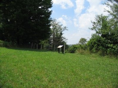
Confederate artillery was posted here. The cannons were placed behind protective earthworks, still faintly visible today. Their fire swept the Beverly-Fairmont Turnpike below. Model 1841 6-pounder field guns were used at Camp Laurel Hill. Although . . . — — Map (db m34440) HM
Near Laurel Mountain Road (County Route 15), on the right when traveling east.
To honor all who served North and South April 12, 1861 to April 9, 1865 donated by Laurel Mountain Post 410 Veterans of Foreign Wars of the United States Belington, West Virginia March 1, 1999 — — Map (db m34447) HM
On Laurel Mountain Road (County Route 15), on the right when traveling east. Reported unreadable.
"A few dozen of us who had been swapping shots with the enemy's skirmishers, grew tired of the result less battle and by a common impulse - and I think without orders or officers, ran forward into the woods and attacked the Confederate works. We . . . — — Map (db m34456) HM
Near Laurel Mountain Road (County Route 15), on the right when traveling east.
Within this fenced burial ground lie Confederate soldiers who died at Laurel Hill. Their number is unknown. Inscribed headboards once marked the graves. During the Civil War, disease killed more men than bullets. One soldier reported 14 graves in . . . — — Map (db m34441) HM
Near Laurel Mountain Road (County Route 15), on the right when traveling east.
By July 10, 1861, Federal cannons bombarded the interior of Camp Laurel Hill. Confederates may have sought shelter among the boulders nearby. On July 11, General Garnett learned of defeat at Rich Mountain. Fearful of being trapped, Garnett . . . — — Map (db m155082) HM
On Laurel Mountain Road (County Route 15), on the right when traveling north.
Commonwealth of Virginia
Sgt John B Pendleton-Co G 23rd VA Inf
Pvt John H Blake-Co H 23rd VA Inf
Pvt Charles H Goff- Co H 23rd VA Inf
Pvt Robert M Oney-Co B 37th VA Inf
Pvt Fendall C Whitlock-Co G 23rd VA Inf
Pvt James K Davis-Co E . . . — — Map (db m165046) WM
On Laurel Mountain Road (County Route 15), on the right when traveling east.
Battle of Laurel Hill, July 8, 1861, between Confederates and McClellan's army, followed by actions at Rich Mountain and Corrick's Ford, gave Federals control of State and established communication lines to the West. Fine view from peak. — — Map (db m34426) HM
Near Laurel Mountain Road (County Route 15), on the right when traveling east.
Soldiers of the Confederate Army of the Northwest occupied this ground from June 16 to July 11, 1861. Led by General Robert S. Garnett, a West Point instructor of tactics, they dug fortifications on the Mustoe farm to block the Beverly-Fairmont . . . — — Map (db m34437) HM
On Laurel Mountain Road (County Route 15), on the right when traveling north.
Pvt D. Adams
Co D 1st GA
Killed July 8
Pvt J. Davis
Co E 23rd VA
Died July 9
Pvt R. Oney
Co B 37th VA
Killed July 11
Ilt W. Wheeler
Co I 1st GA
Killed July 8
Pvt J. Blake
Co H 23rd VA
Killed July 9
Pvt C. Goff
Co H 23rd . . . — — Map (db m165051) WM
Near Laurel Mountain Road (County Route 15), on the right when traveling east.
Confederate forces retreated from this area after the "Philippi Races" (June 3, 1861), first land battle of the Civil War. At Huttonsville, 26 miles south, Confederate General Robert S. Garnett took command of the Army of the Northwest. His goal was . . . — — Map (db m34455) HM
On Junior-Philippi-Grafton Road (U.S. 250), on the right when traveling south.
Barbour County. Formed from Harrison, Lewis, and Randolph in 1843. It is named for a distinguished Virginia jurist, Philip Pendleton Barbour. Scene of opening hostilities on land between the armies of the North and South in 1861.
Randolph . . . — — Map (db m33928) HM
On North Main Street (U.S. 250) west of Museum Street, on the right when traveling east.
As Union artillery fired on Philippi, Col. Dumont's infantry pounded across the covered bridge into the 500 people who lived here. In April, when the war was still a lark, local attorneys Thomas Bradford and Albert Gallatin Reger recruited men to . . . — — Map (db m212007) HM
On Circle Drive East, on the right when traveling north.
(Preface):In the spring of 1861, Union forces rushed into northwestern Virginia to secure the vital Baltimore and Ohio Railroad, protect important turnpikes, and support Unionists against Confederates. The two sides fought numerous . . . — — Map (db m58700) HM
On Mansfield Drive (U.S. 250) at North Main Street, on the right when traveling east on Mansfield Drive. Reported missing.
(preface)
In the spring of 1861, Union forces rushed into northwestern Virginia to secure the vital Baltimore and Ohio Railroad, protect important turnpikes, and support Unionists against Confederates. The two sides fought numerous . . . — — Map (db m211897) HM
On Mansfield Drive (U.S. 250) at North Main Street, on the right when traveling north on Mansfield Drive.
Born in New Hampshire in 1807, he moved to Wheeling and worked as a merchant and as a freight agent for the B&O. He was appointed colonel of the 1st WV (90-day regiment) in
1861 and led the unit at Philippi, where he was seriously wounded. He . . . — — Map (db m211566) HM
On Mansfield Drive (Bypass U.S. 250) at North Main Street (U.S. 250), on the right when traveling north on Mansfield Drive.
Churchville cavalry flag made by women of Augusta County, Virginia, and presented to the 14th Virginia Cavalry before they left for Phillipi, captured by Union troops on June 3, 1861. Original flag is at Battle Abbey in Richmond, Virginia. — — Map (db m211895) HM
On Mansfield Drive (Bypass U.S. 250) at North Main Street (U.S. 250), on the right when traveling north on Mansfield Drive.
Flown over the Confederate headquarters at the Virginia house on the main street in Philippi. Headquarters flag was cut down and taken by First Lieutenant Charles A. Griffin of the First (West) Virginia Volunteers from Wheeling. Original flag (6 . . . — — Map (db m211905) HM
On Pike Street at Bosworth Street, on the left when traveling north on Pike Street.
You are standing in the epicenter of the battlefield. Federal artillery shells rained down on this spot, and two Union infantry charges were converging here. Col. Dumont's 1,400 troops thundered across the bridge to your left just as another . . . — — Map (db m212006) HM
On Church Street south of North Walnut Street, on the right when traveling south.
On this site, in a Methodist Church, used as a temporary hospital, on June 3, 1861 J. E. Hanger of Mount Hope, Virginia, underwent a leg amputation by Dr. James D. Robison of the sixteenth Ohio Volunteers. This was the first amputation of the . . . — — Map (db m211849) HM
On Mansfield Drive (Bypass U.S. 250) at North Main Street (U.S. 250), on the left when traveling south on Mansfield Drive.
On June 3, 1861, at 4:30 a.m., Matilda Humphrey, whose house stood on the hill to your left, discharged a pistol at Col. Ebenezer Dumont's Union troops, trying to pull her son, Oliver, off his horse and prevent him from warning the local . . . — — Map (db m211890) HM
On Beverly-Fairmont Pike (U.S. 250), on the right when traveling south. Reported permanently removed.
First land battle between the North and South here, June 3, 1861. Confederates under Col. Porterfield were dislodged by Federal troops from Gen. McClellan's army under Col. Kelley. The old covered bridge here was used by both armies. — — Map (db m211563) HM
On Blue & Gray Expressway (Bypass U.S. 250) west of South Main Street (U.S. 250), on the right when traveling west.
First land battle between the North and South here, June 3, 1861. Confederates under Col. Porterfield were dislodged by Federal troops from Gen. McClellan's army under Col. Kelley. The old covered bridge here was used by both armies. — — Map (db m211625) HM
On Church Street south of North Walnut Street, on the left when traveling south.
Confederate J. E. Hanger's leg was mangled by a cannonball during the Battle of Philippi on June 3, 1861. Hanger survived a surgery that made him the first amputee of the war. After serving time in a Union prison, he returned to his home in . . . — — Map (db m211591) HM
On North Main Street (U.S. 250) at Church Street, on the left when traveling south on North Main Street.
As Col. Porterfield's Virginians fled past here, surgeons quickly began to help the injured. The church that stood on the left side of the street served as a hospital. James E. Hanger of the 14th Virginia Cavalry was one of the Confederate . . . — — Map (db m212032) HM
On Mansfield Drive (Bypass U.S. 250) at North Main Street (U.S. 250), on the right when traveling north on Mansfield Drive.
One of the Confederate flags captured at the Battle of Philippi, June 3, 1861. The Palmetto Flag was raised over the Philippi Court House on January 1861, the first Confederate flag to be flown in Virginia. — — Map (db m211894) HM
On College Hill Drive, on the right when traveling south. Reported permanently removed.
On June 2, 1861, Federal troops advanced on Philippi from the Baltimore & Ohio rail hub at Grafton in two columns of about 1500 men each. The left column, under Col. Benjamin Kelley, took the train six miles east to Thornton, and then marched . . . — — Map (db m211560) HM
On Mansfield Drive (U.S. 250) at North Main Street (U.S. 250), on the right when traveling east on Mansfield Drive.
Col. Benjamin F. Kelley
Kelley, a railroad agent in Philadelphia and former resident of Wheeling, was called back to command the First Virginia (Union) Infantry--the first Union regiment raised in the South. He planned and led the attack on . . . — — Map (db m211896) HM
On Main Street (U.S. 250), on the right when traveling east. Reported missing.
Col. George A. Porterfield moved his newly recruited Confederates from Grafton on May 28, 1861, after receiving word of a Federal advance on the B&O Railroad. Porterfield's force a Philippi totaled no more than 775 volunteers. Few were fully trained . . . — — Map (db m211925) HM
On North Main Street at Church Street, on the left when traveling south on North Main Street. Reported missing.
As Col Benjamin Kelley’s Federals pursued the Confederates through Philippi, he was shot in the upper right chest by Col. George A. Porterfield’s quartermaster. A surgeon declared it a mortal wound but Kelley recovered. In a show of respect, his men . . . — — Map (db m212033) HM
On South Main Street (U.S. 250) at School Street, on the right when traveling south on South Main Street.
As Union soldiers entered the town, Virginia troops came pouring out of Philippi's streets, alleys, and buildings, some getting dressed as they ran.
The Confederates were soon streaming past this location as they fled to Beverly. Northern . . . — — Map (db m212148) HM
On Main Street (U.S. 250), on the right when traveling east.
The Philippi Covered Bridge across Tygart Valley River was built in 1852 by Lemuel Chenoweth of Beverly. Made of wood, with the exception of the iron bolts used to hold the segments together, it is an example of the best in covered bridge . . . — — Map (db m33665) HM
On Mansfield Drive (U.S. 250) at North Main Street, on the right when traveling east on Mansfield Drive.
Constructed in 1852 by Lemuel Chenoweth; masonry by Emanuel J. O'Brien, cost $12,151.24. The covered bridge, erected in 1852, is the only two-lane bridge in the federal highway system. During the Civil War the bridge served both North and South in . . . — — Map (db m33762) HM
On Mansfield Drive (Bypass U.S. 250) at North Main Street (U.S. 250), on the right when traveling north on Mansfield Drive.
The 34-star United States Flag was in the possession of the Federals. West Virginia became the 35th state of the Union on June 20, 1863.
Kiwanis Flag Circle
Made possible by the estate of Dr. Hu C. Myers, a bequest to the Kiwanis Club . . . — — Map (db m211893) HM
On Runnymeade Road (County Route 26) at Soldier Drive, on the right when traveling west on Runnymeade Road.
300 yards west is one of the oldest Episcopal churches in West Virginia. Built in 1740 by Morgan Morgan. Five Revolutionary soldiers buried in church yard. Used as a barracks during war between the states. — — Map (db m134064) HM
On the northbound Welcome Center and Rest Stop (Interstate 81) north of the state line, on the right when traveling north.
After stunning victories at Fredericksburg and Chancellorsville, Virginia, early in May 1863, Confederate Gen. Robert E. Lee carried the war through Maryland, across the Mason and Dixon Line and into Pennsylvania. His infantry marched north through . . . — — Map (db m1975) HM
Due west of this tablet, 650 feet, is the Boyd House in which died, July 17, 1863, Brig.-Gen. James Johnston Pettigrew, of North Carolina, C. S. A. At Gettysburg he commanded and led Heth’s Division in the assault on Cemetery Ridge, July 3; and . . . — — Map (db m2615) HM
On Runnymeade Road (County Route 26) at Soldier Drive, on the right when traveling west on Runnymeade Road.
At Bunker Hill in 1726, Colonel Morgan Morgan founded the first permanent settlement of record in what is now West Virginia. In commemoration of this event, the state of West Virginia has erected a monument in Bunker Hill State Park, and has . . . — — Map (db m134056) HM
On Williamsport Pike (U.S. 11), on the right when traveling north.
On the morning of July 2, 1861, Federal troops under Gen. Robert Patterson crossed the Potomac River from Maryland and marched south toward Martinsburg. Colonel Thomas J. Jackson sent his men north from their camp north of town to block them and to . . . — — Map (db m41631) HM
On Hammonds Mill Road (West Virginia Route 901) at St. Andrews Drive (County Route 3/1), on the right when traveling west on Hammonds Mill Road. Reported damaged.
Here at Stumpy’s Hollow on the morning of July 2, 1861, Confederate Lieutenant Colonel J.E.B. Stuart captured a Union infantry company almost single-handedly. The Federals – Company I, fifteenth Pennsylvania Volunteers – were acting as . . . — — Map (db m45596) HM
On Williamsport Pike (U.S. 11) at Hammonds Mill Road (County Route 901), on the right when traveling south on Williamsport Pike.
On the morning of July 2, 1861, Federal troops under General Robert Patterson crossed the Potomac River from Maryland and marched toward Martinsburg. Confederate Colonel Thomas J. Jackson’s command marched from Camp Stephens, four miles north of . . . — — Map (db m58078) HM
On Hammonds Mill Road (County Route 901) at Williamsport Pike (U.S. 11), on the left when traveling east on Hammonds Mill Road.
On the morning of July 2, 1861, Federal troops under General Robert Patterson crossed the Potomac River from Maryland and marched toward Martinsburg. Confederate Colonel Thomas J. Jackson’s command marched from Camp Stephens, four miles north of . . . — — Map (db m58080) HM
On Williamsport Pike (U.S. 11) 0.2 miles north of West Virginia Route 901, on the right when traveling north. Reported missing.
On the morning of July 2, 1861, Federal troops under General Robert Patterson crossed the Potomac River from Maryland and marched toward Martinsburg. Confederate Colonel Thomas J. Jackson’s command marched from Camp Stephens, four miles north of . . . — — Map (db m180733) HM
On Williamsport Pike (U.S. 11) at Foster Drive, on the right when traveling south on Williamsport Pike.
Early on July 2, 1861, Union forces under Maj. Gen. Robert Patterson crossed the Potomac River from MD to march on Martinsburg. Alerted to the enemy's movements by Stuart's cavalry, Col. Thomas Jackson fought a masterly delaying action that led . . . — — Map (db m206003) HM
On Encampment Road east of Williamsport Pike (U.S. 11), on the left when traveling south.
During the Civil War, the strategically important Valley Turnpike crossed the stream just above the small waterfall here. Two battles were fought nearby. The first occurred on July 2, 1861, half a mile south on the Porterfield Farm. On the morning . . . — — Map (db m58083) HM
On Williamsport Pike (U.S. 11), on the right when traveling north.
In Memory of General “Stonewall” Jackson This tablet is erected by the Berkeley County Chapter United Daughters of the Confederacy to commemorate an instance of General Jackson’s remarkable bravery at all times in the face of the gravest . . . — — Map (db m41626) HM
On North Mary Street (West Virginia Route 901) south of East Poplar Street.
This boulder marks the site on Camp Hill where the batteries were fired during the War Between the States in the raid on the federal blockhouse, located at North Mountain. On July 4, 1864, the 14th, 16th, and 17th Regiments of General McCausland's . . . — — Map (db m154841) HM
Fresh from victory at the Second Battle of Manassas, Gen. Robert E. Lee’s Army of Northern Virginia crossed the Potomac River on September 4-6, 1862, to bring the Civil War to Northern soil and to recruit sympathetic Marylanders. Union Gen. . . . — — Map (db m60605) HM
On North Queen Street (U.S. 11) at East Commerce Street, on the right when traveling north on North Queen Street.
One of the most noted female spies for the Confederacy, Boyd was born in Martinsburg in 1844. After she killed a Union soldier in 1861 who was threatening her mother, Belle began spying on local Union troops. Her efforts at the Battle of Front . . . — — Map (db m206099) HM
On East Race Street at North Spring Street when traveling east on East Race Street.
Isabelle “Belle” Boyd, the Confederate spy, lived here during part of her childhood. The ten-year-old and her family moved here in 1853 and left in 1858 for a dwelling (no longer standing) on South Queen Street. According to Boyd, . . . — — Map (db m63496) HM
On East Race Street at Spring Street, on the right when traveling east on East Race Street.
Built in 1853 by Benjamin Reed Boyd, a merchant, Confederate soldier and the father of Belle Boyd. Belle Boyd was a famous Confederate spy, author and actress. — — Map (db m149428) HM
This is one of the last surviving antebellum buildings in the area. It was constructed shortly after the Baltimore and Ohio Railroad reached Martinsburg in 1842. The adjacent railroad yards twice were Confederate Gen. Thomas J. “Stonewall” Jackson’s . . . — — Map (db m208792) HM
On South Queen Street (West Virginia Route 9) at East King Street on South Queen Street.
One of the earliest brick buildings constructed in Martinsburg. Home of Rear Admiral Charles Boarman, who served in the War of 1812 and the Civil War. — — Map (db m132397) HM
On South Queen Street (West Virginia Route 9/45) south of East Addition Street, on the right when traveling south.
Born in Martinsburg, July 6. 1806. Member of Virginia legislature and served in Congress, 1851-1859. In 1860 he was appointed Minister to France but was arrested in 1861 on charges of negotiating sales of arms for the Confederacy. Enlisted in . . . — — Map (db m203911) HM
On East King Street (U.S. 11) at South Queen Street (State Highway 45) on East King Street.
Martinsburg, strategically located on the Valley Turnpike (present day U.S. Route 11) and the Baltimore and Ohio Railroad, was a major transportation center and the northern gateway to the Shenandoah Valley. Both sides contested for it frequently . . . — — Map (db m167591) HM
On West Martin Street west of Raleigh Street, on the left when traveling west.
Born 1848 in Hardy Co. A Civil War vet., Storer College graduate, teacher and principal at local Sumner School. Published Pioneer Press (1882), first African American paper in state. First of race to pass state bar exam (1887); argued two . . . — — Map (db m1210) HM
On Edwin Miller Boulevard (West Virginia Route 9) east of Interstate 81, on the left when traveling west.
Founded, 1778, by Gen. Adam Stephen. Named for Thomas Martin, nephew of Lord Fairfax. Home of Admirals Charles Boarman and C.K. Stribling. Locomotives seized here, 1861, in Jackson’s raid were drawn by horses to Winchester, Va. — — Map (db m1973) HM
On King Street (U.S. 11) near North Maple Avenue, on the left when traveling east.
Martinsburg. Established, 1778, by Gen. Adam Stephen. Named for Col. Thomas Martin, nephew of Lord Fairfax. Home of Admiral C.K. Stribling and Admiral Charles Boarman. In Jackson’s raid, 1861, captured B&O locomotives were drawn by horses to . . . — — Map (db m1976) HM
On East Commerce Street just north of East race Street, on the right when traveling north.
In April 1861, as the Civil War erupted, Confederate forces seized the Baltimore and Ohio Railroad from Harpers Ferry west. On May 24, Gen. Joseph
E. Johnston ordered Col. Thomas J. (later “Stonewall”) Jackson to destroy
the rolling . . . — — Map (db m149430) HM
On South Queen Street (West Virginia Route 9), on the left when traveling west.
Here on July 4, 1861, Belle Boyd, at the age of 17, shot and killed a Union soldier. She was imprisoned on several occasions as a result of her later spying activities. — — Map (db m193346) HM
On East Burke Street just west of Swartz Street, on the left when traveling west.
Looking Upstream and Northeast at the Colonnade Bridge, Circa 1860
In 1849, the Baltimore and Ohio established its railroad shops in Martinsburg and erected here two most noteworthy roundhouses and workshop buildings. The B&O erected a . . . — — Map (db m148872) HM
In December 1862, Union Gen. Benjamin F. Kelley stationed detachments of the 54th Pennsylvania and 1st West Virginia Infantry regiments here to guard and repair the Baltimore and Ohio Railroad, a main supply route between the Ohio River and the . . . — — Map (db m58628) HM
On Winchester Avenue (U.S. 11) 0.1 miles north of Evans Run Road, on the left when traveling north.
Fort Evans, built here, 1755, was attacked by Indians, 1756. The men were absent but Polly Evans, whose husband, John, had built the fort, led the women in its defense. The Big Spring here was noted camping ground of both armies, 1861-1865. — — Map (db m134041) HM
On Hammonds Mill Road (West Virginia Route 901) east of Harlan Springs Road (County Route 1), on the right when traveling west.
Dr. Allen C. Hammond constructed this Greek Revival-style house about 1838. During the Civil War, both sides used it periodically for a headquarters or a hospital. The war ruined Hammond, a strong Southern sympathizer.
In October 1859, . . . — — Map (db m154839) HM
On West Virginia Route 85, 0.1 miles north of Country Estates Road, on the left when traveling south.
Born in 1810 in present-day Boone
County, Methodist minister Robert
Hager was a delegate to the state’s
first constitutional convention in
Wheeling. 1861-1863. He supported
including a provision for gradual
emancipation in WV and also a . . . — — Map (db m138447) HM
On Coal River Road (West Virginia Route 3) at Red Martin Lane, on the right when traveling west on Coal River Road.
War comes to the Big Coal River. Emboldened by a resounding victory against Confederates at Boone Court House (Madison), Union General Cox ordered Federal troops back into the Coal River Valley. This time the target was the Big Coal River.
. . . — — Map (db m137753) HM
Bulltown. Important point in plan of Washington to establish water transportation to West. Salt was made here as early as 1792. Attack of whites in 1772 upon Captain Bull's Indian village here was among the causes of Dunmore's War. . . . — — Map (db m37050) HM
On Gauley Turnpike (U.S. 19) at Corley Caress Road, on the right when traveling north on Gauley Turnpike.
On October 13, 1863, Confederate troops under Col. W. L. "Mudwall" Jackson attacked Union forces at Bulltown, where they were repulsed by elements of the 6th and 11th WV infantries. Compelled to withdraw, Jackson’s men retreated to Salt Lick Bridge . . . — — Map (db m161248) HM
On the hill in front of you are two fortifications that Union Gen. George B. McClellan ordered constructed late in1861. They guarded the wooden covered bridge located here on the Weston and Gauley Bridge Turnpike. In October 1863, Capt. William H. . . . — — Map (db m58727) HM
On Main Street, 0.1 miles east of Camden Avenue (West Virginia Route 4), on the right when traveling east.
On December 29, 1861, Confederate partisans attacked a company of the 1st West Virginia Cavalry at Sutton. After ammunition ran low, the Federals left with part of the Confederate force in pursuit. When the Confederates returned, they found the town . . . — — Map (db m173334) HM
On Main Street (County Highway 19/40), on the right when traveling east.
The scenic Elk River now flows peacefully before you, but in 1861, the conflict raged here. That year, Col. Erastus B. Tyler's 7th Ohio constructed earthworks near this location to protect an important suspension bridge. About 100 men of Capt. . . . — — Map (db m208238) HM
On Main Street at Camden Avenue (West Virginia Highway 4), on the right when traveling east on Main Street. Reported permanently removed.
In 1861, Col. Erastus B. Tyler’s 7th Ohio Infantry constructed earthworks near Suttonville to protect the suspension bridge across the Elk River. Later in the year, Capt. Weston Rowand’s Co. K, 1st Virginia Cavalry (US), about a hundred men, . . . — — Map (db m58728) HM
On Main Street at 3rd Street, on the right when traveling west on Main Street.
(Preface): On April 20, 1863, Confederate Gens. William E. “Grumble” Jones and John D. Imboden began a raid from Virginia through present-day West Virginia against the Baltimore and Ohio Railroad. Taking separate routes, . . . — — Map (db m58729) HM
On Main Street (West Virginia Route 67) 0.2 miles east of West Virginia Route 88, on the right when traveling east.
Bethany
Here Scots-Irish Alexander Campbell founded a religious movement which he called the Disciples of Christ. In this place Amos Dolbear perfected parts of the telephone, and longtime Speaker of the House "Champ" Clark, Supreme Court . . . — — Map (db m79899) HM
On Commerce Street (West Virginia Route 2) north of 12th Street, on the right when traveling south.
Born in Wellsburg. January 8. 1819, Tarr opposed Virginia secession in 1861. A staunch Unionist. he was a delegate to the first and second Wheeling conventions, raised Union Troops, and was treasurer for the Restored Government of Virginia. He . . . — — Map (db m189408) HM
On Main Street at 6th Street, on the right when traveling south on Main Street.
This giant Sycamore tree stands at the top of the Wellsburg Wharf it was planted in the early years of the 19th century by Dr. Albert Wheeler who practiced medicine in Wellsburg until his death in 1864.
It was under this tree that militiamen . . . — — Map (db m21641) HM
On Main Street west of Central Avenue, on the right when traveling west.
Confederate Gen. Henry A. Wise’s army occupied the Lower Kanawha Valley in June 1861. Union Gen. George B. McClellan assigned the task of driving them out to Gen. Jacob D. Cox, who massed his troops in Gallipolis, Ohio. Cox planned to cross the Ohio . . . — — Map (db m73692) HM
On Water Street at Midland Trail (U.S. 60), on the left when traveling north on Water Street.
Site of early Civil War battle fought July 13, 1861. Border Rangers and local citizens met on “Fortification Hill” to repel an advance by five companies of the 2nd Kentucky Inf. After firing several volleys, Union troops made a bayonet charge up . . . — — Map (db m239111) HM
On Guyan St north of 5th Avenue, on the right when traveling north.
Born January 1809 in Massachusetts, he was a lawyer who came to Cabell County shortly before the Civil War. A Unionist, he fled when A. G. Jenkins called for his arrest. From 1861 to 1863, he was a delegate to the constitutional convention for the . . . — — Map (db m178192) HM
On Guyan Street north of 5th Avenue, on the right when traveling north.
First located in Gallipolis, Ohio,
the house, owned by James Gallaher.
was floated down the Ohio River to
Guyandotte in 1810. Obtained by the
Carroll family, it was used as an
inn and site for Catholic Mass.
On November l1, 1861, Mary . . . — — Map (db m178157) HM
Near Guyan Street north of 5th Avenue, on the left when traveling south.
When the Civil War began, few of Guyandotte’s residents were slaveholders, but many townspeople resented any infringement on their right as Virginians to own slaves. Guyandotte was reportedly the only town on the Ohio River that voted in favor of . . . — — Map (db m144784) HM
Near Guyan Street north of 5th Avenue, on the left when traveling south.
After capturing Guyandotte on November 10, 1861, and rounding up civilian Unionists and Federal recruits, Confederate forces under Col. John Clarkson and Col. Albert G. Jenkins began the next day to leave the town with their prisoners. At the . . . — — Map (db m238229) HM
On Bridge Street (West Virginia Route 2) at Richmond Street, on the left when traveling west on Bridge Street.
Indian name. Founded in 1810. Site chosen as county seat, 1809, and court first met here, October, 1810. Important point in river traffic, connecting with the James River and Kanawha Turnpike. Burned during the War between the States. — — Map (db m73705) HM
On 11th Street at Veterans Memorial Boulevard (U.S. 60), on the left when traveling south on 11th Street.
Born 1830 in Utica, NY, Oley was
in that state's National Guard and
came to western Virginia in 1861
to drill Union troops. He rose to
rank of brevet brigadier general
by war's end. In 1871 Oley settled
in Huntington and worked as land
agent . . . — — Map (db m178145) HM
On Bridge Street (West Virginia Route 2) at Richmond Street on Bridge Street.
Born 1839 in Cabell County, Witcher
was clerk of the court, and in
1862 he began distinguished service
with the 3rd West Virginia Cavalry
and was appointed brevet brigadier
general by end of war. Served as
state delegate, secretary of . . . — — Map (db m125938) HM
On Guyan Street north of 5th Avenue, on the left when traveling south.
During the Civil War, this was the home of Mary Carroll, who narrowly managed to save it from destruction when much of Guyandotte was burned on November 11, 1861.
After capturing the town on November 10, 1861, and rounding up civilian Unionists . . . — — Map (db m73708) HM
On Main Street north of Hagan Street, on the left when traveling south.
On the night of November 10, 1861,
Confederate cavalry led by Colonels
John Clarkson and Albert Jenkins
raided the town of Guyandotte and
surprised Union recruits of the 9th
WV Infantry. Following a heated
battle, Confederate soldiers . . . — — Map (db m125979) HM
On Norway Avenue at Huntington State Hospital Road, on the right when traveling south on Norway Avenue.
War Between the States Generals Two of seven War Between the States generals buried in W. Va. interred here: Albert Gallatin Jenkins, C.S.A., in Confederate plot; John Hunt Oley, Union, and over 200 soldiers. Confederate Monument dedicated in . . . — — Map (db m73730) HM
881 entries matched your criteria. The first 100 are listed above. Next 100 ⊳