On Elk Run Road (County Route 806) 0 miles Midland Road (County Route 610), on the right when traveling north.
Settlers began to arrive in Elk Run during the early 1700s, and when Hamilton Parish was established in 1730, there were several hundred persons living in this frontier village.
A wooden Chapel existed at this site by 1740, when Prince William . . . — — Map (db m2738) HM
On Leeds Manor Road (County Route 688) just north of Exit 18 (Interstate 66), on the right when traveling north.
In 1765, John Marshall, then nine, moved with his family from his birthplace 30 miles southeast to a small, newly constructed frame house one-quarter mile east known as The Hollow. The house built by his father, Thomas Marshall, was his home until . . . — — Map (db m23940) HM
On Grove Lane (Virginia Route 185) at Justice Lane, on the right when traveling west on Grove Lane.
Thomas Marshall, the father of future Chief Justice John Marshall, built Oak Hill about 1773 and relocated his family there from The Hollow, their former home nearby. John Marshall resided at Oak Hill for two years until he entered the Continental . . . — — Map (db m1362) HM
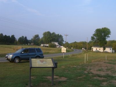
On Catlett Road (Virginia Route 28) 0.1 miles south of Smith Midland Lane, on the right when traveling south.
About one half mile southeast, just across the railroad, a stone marks the site of the birthplace, September 24, 1755. He died at Philadelphia, July 6, 1835. Revolutionary officer, Congressman, Secretary of State, he is immortal as Chief Justice of . . . — — Map (db m1779) HM
On Germantown Road (County Route 649) 0.3 miles east of Catlett Road (Virginia Route 28), on the right when traveling west.
JOHN MARSHALL, Chief Justice of the United States, and principal founder of judicial review and of the American system of constitutional law was born in a log cabin just east of here on September 24, 1755. At that time, . . . — — Map (db m2208) HM
On East Main Street (U.S. 221) at North Locust Street (Virginia Route 8), on the left when traveling east on East Main Street.
Army
American Revolution, 1775 - 1781
Civil War, 1861 - 1865
Operation Desert Storm, 1990 - 1991
Navy
War of 1812, 1812 - 1814
Spanish-American War, 1898
Air Force
World War I, 1917 - 1918
World War II, 1941 - . . . — — Map (db m152068) WM
On East River Road (Virginia Route 6) 0.9 miles east of Bremo Road (Virginia Route 656), on the right when traveling east.
Here was an important supply depot and arsenal of the Virginia government in 1781, and here Baron von Steuben, commanding the American forces, trained recruits for Green's army in the South. Threatened by Cornwallis's approach, Steuben moved stores . . . — — Map (db m31602) HM
On James Madison Highway (U.S. 15) at Virginia Route 6, on the left when traveling south on James Madison Highway.
Four miles southeast is Point of Fork, near which an Indian village stood in 1607. In the Revolution a state arsenal was there. In June, 1781, Simcoe, sent by Cornwallis with a small force to destroy the stores there, succeeded in making Baron . . . — — Map (db m17760) HM
On Three Notch Road (U.S. 250) west of Three Chopt Road (Virginia Route 653), on the right when traveling east.
Fluvanna County. Area 285 Square Miles. Formed in 1777 from Albemarle. Named (in Latin) Anne's River, the early name for the upper James given in honor of Queen Anne. Point of Fork was an important supply depot in 1781. . . . — — Map (db m54220) HM
On Stone Jail Street (Virginia Route 1004) just north of Main Street (Virginia Route 1001), on the right when traveling north.
These millstones were found in the vicinity of the Revolutionary War arsenal at the Point of Fork in an area that was called Mt. Misory Branch. The millstones were likely used to supply meal to the soldiers at the arsenal (circa 1780). Donated by . . . — — Map (db m181076) HM
On Booker T. Washington Highway (Virginia Route 122) just west of Inglewood Road (Route 672), on the left when traveling west.
Here stood Taylor’s Store, established in 1799 by Skelton Taylor, a lieutenant in the Bedford County militia during the Revolutionary War. After Franklin County was formed, Taylor became a militia captain and overseer of the poor. His store and . . . — — Map (db m65624) HM
On Main Street (U.S. 11) just south of Fairfax Street (County Road T-631), on the right when traveling south.
This lot was purchased by Andrew Pitman (1760-1838) on August 17, 1782, upon his return from service in the Revolutionary War. He enlisted in the Virginia Militia from 1777 to 1781, and was at Yorktown when Cornwallis surrendered. Upon his . . . — — Map (db m158598) HM
On Berryville Pike / Harry Byrd Highway (Virginia Route 7), on the right when traveling east.
Clark County. Area 171 Square Miles. — Formed in 1836 from Frederick and added to from Warren. Named for George Rogers Clark, conqueror of the Northwest. Lord Fairfax and General Daniel Morgan, Revolutionary Hero, lived in this . . . — — Map (db m156734) HM
On Millwood Pike (U.S. 17 / 50) at Front Royal Pike (U.S. 522), on the right when traveling west on Millwood Pike.
General Daniel Morgan. Morgan used this road in traveling from his home, “Saratoga,” to Winchester. He was a frontiersman, Indian fighter and the commander of Morgan’s famous riflemen in the Revolution. He won glory at Quebec and Saratoga, . . . — — Map (db m2290) HM
On Opequon Church Lane, on the right when traveling east.
In Memory of the many soldiers of the Revolution interred at Opequon Church of whom only seven are known.
Major John Gilkeson •
Captain William Chipley •
Captain Samuel Gilkeson •
Captain James Simrall •
Captain Samuel Vance • . . . — — Map (db m2633) WM
On Princess Anne Street, 0.1 miles south of Dixon Street, on the right when traveling south.
Hazel Hill, the home of John Minor (13 May 1761 – 8 June 1816), a close friend of President James Monroe, once occupied this site. Minor served as a soldier in the American Revolution, as a colonel of the Spotsylvania County militia, and as a . . . — — Map (db m195328) HM
On Gunnery Road, 0 miles north of Dunmore Street, on the right when traveling north.
Camp Cobb at Gunnery Springs N-30 In 1775, during the Revolutionary War, this “noble spring” was part of a 10½-acre tract purchased for the Fredericksburg Gun Manufactory. On this site in 1898 stood Camp Cobb, a Spanish-American War . . . — — Map (db m1711) HM
On Clarke Street just north of Ferdinand Street, on the left when traveling south. Reported missing.
The Fredericksburg Gun Manufactory was established by an ordinance passed by Virginia's third revolutionary convention on 17 July 1775. Built on this site soon thereafter by Fielding Lewis and Charles Dick, it was the first such factory in America. . . . — — Map (db m111279) HM
On Caroline Street (Business U.S. 17) at Canal Street, on the right when traveling west on Caroline Street.
In 1787, a free black man named John DeBaptiste rented a portion of this property from Henry Fitzhugh. DeBaptiste established a shipping wharf at the foot of this lane and eventually purchased the land in 1796. He came from the French-speaking . . . — — Map (db m175687) HM
On William Street at Prince Edward Street, on the right when traveling east on William Street. Reported permanently removed.
In 1774, St. George’s Parish purchased the land around you for a cemetery. Following the American Revolution and disestablishment of the Anglican Church in Virginia, the Fredericksburg government appropriated this land for a public burying ground. . . . — — Map (db m11430) HM
On Washington Avenue at Lewis Street, in the median on Washington Avenue.
In grateful acknowledgement of the valor and the strategic victories of General George Rogers Clark, Son of Old Virginia, the Paul Revere Chapter of the Daughters of the American Revolution of Muncie, Indiana, devote this tablet.
No hero of . . . — — Map (db m1077) HM
On Interstate 95, on the right when traveling south.
(Front): George Washington: Soldier George Washington gained his first military experience during the French and Indian Wars where his bravery and leadership made him a hero. When discord between the American colonies and the British . . . — — Map (db m14186) HM
On Washington Avenue at Fauquier Street, in the median on Washington Avenue.
Sacred to the memory of Hugh Mercer, Brigadier-General in the Army of The United States; He died on the 12th of January, 1777, of the wounds he received on the 3d of same month, near Princetown, in New Jersey, bravely defending the Liberties of . . . — — Map (db m14424) HM
On Caroline Street (Business U.S. 17) just south of Amelia Street, on the left when traveling north.
This 18th century building was restored to house the Hugh Mercer Apothecary Shop, a museum of medicine and military affairs. Dr. Mercer, a Revolutionary War hero, served the citizens of Fredericksburg for 15 years. His patients included Mary . . . — — Map (db m149247) HM
On William Street at Caroline Street (Business U.S. 17), on the right when traveling east on William Street.
"After passing through a small town called Falmouth at the Falls of the Rappahannock, we crossed in a Ferry boat and arrived at Fredericksburg, putting up at an In[n] or Public House kept by one Weedon, who is now a General Officer in . . . — — Map (db m148073) HM
On Lafayette Boulevard (U.S. 1) at Caroline Street (Business U.S. 17), on the right when traveling north on Lafayette Boulevard.
This tablet marks the only home in America of John Paul Jones. He was appointed a lieutenant in the Continental Navy while still a resident of Virginia. — — Map (db m14420) HM
On Caroline Street, 0.1 miles north of Lewis Street, on the left when traveling north.
Four blocks west stands Kenmore, built in 1775 by Col. Fielding Lewis for his wife, Betty, sister of George Washington. Near here, between Kenmore and the Rappahannock River, stood Lewis’s warehouses and docks. Kenmore’s intricate plasterwork is the . . . — — Map (db m1149) HM
On George Street at Charles Street on George Street. Reported permanently removed.
The Masons of Fredericksburg Lodge #4, Ancient, Free and Accepted Masons, organized as a lodge in 1752. They established this cemetery in 1784 and there are now approximately 270 graves within these grounds. Most are members and family members of . . . — — Map (db m34823) HM
On George Street at Charles Street, on the right when traveling west on George Street.
The Masons of Fredericksburg Lodge #4, Ancient, Free and Accepted Masons, organized as a lodge in 1752. They established this cemetery in 1784 and there are now approximately 270 graves within these grounds. Most are members and family members of . . . — — Map (db m216700) HM
Here
Mary Ball Washington prayed for the safety of her son and country during the dark days of the Revolution.
This tablet was presented by
The National Mary Washington
Memorial Association
(Chartered February 22, 1890 . . . — — Map (db m9194) HM
On Washington Avenue at Pitt Street, in the median on Washington Avenue.
(Front) From a meeting in Fredericksburg, January 3-17, 1777, of a Committee of Revisors appointed by the General Assembly of Virginia, composed of Thomas Jefferson, George Mason, Edmund Pendleton, George Wythe and Thomas Ludwell Lee to . . . — — Map (db m1078) HM
On Charles Street north of George Street, on the left when traveling north.
Revolutionary War Patriots and War of 1812 Veterans Memorialized in this Historic Masonic Cemetery
Revolutionary War
Captain (Navy) Eliezer Callender •
Leiutenant John Chew, Jr. •
Lieutenant Robert B. Chew, Sr. •
Major . . . — — Map (db m216712) HM WM
Near Gordon W Shelton Boulevard, 0.7 miles north of Willow Lane, on the right when traveling west.
Although most runaway slaves sought freedom individually, often resulting in leaving behind family members who may never be seen again, there are instances of bold and courageous efforts at emancipation that should be told. Clearly there was very . . . — — Map (db m176107) HM
On William Street (U.S. 3) at Caroline Street on William Street. Reported permanently removed.
On October 7, 1776, three months after the Continental Congress had adopted the Declaration of Independence, the Virginia Assembly held its first session, in Williamsburg. The Assembly appointed Thomas Jefferson and four delegates to a Committee of . . . — — Map (db m1061) HM
On William Street (Virginia Route 3) at Caroline Street, on the right when traveling east on William Street. Reported permanently removed.
Constructed shortly after Fredericksburg’s founding in 1728, the tavern across the intersection became a popular gathering place under the proprietorship of its first owner, John Gordon, and then of his son-in-law, George Weedon. George Washington . . . — — Map (db m1060) HM
On Wenonah Avenue (Business U.S. 460) at North Main Street, on the left when traveling east on Wenonah Avenue.
James Adair • Jacob Albert • John Alsup • Hezekiah Atkins • Milliton Atkins • Parker Atkins • James Bane Jr. • William Bradley • Lowe Brown • William Brown • Humphrey Brumfield • James Brumfield Jr. • James Brumfield Sr. • John Burke • Capt. Thomas . . . — — Map (db m162874) WM
On Cascade Drive (County Route T-623) at Virginia Avenue (U.S. 460), on the right when traveling south on Cascade Drive.
To the sacred memory of
John-Jacob and Elizabeth (Helm) Snidow and their children: Barbara, Philip, Christian, Jacob, John, Theophilus and
two daughters.
John-Jacob, of Lancaster County, Pennsylvania, visited this vicinity ca. 1766. He went . . . — — Map (db m162890) HM
On George Washington Memorial Highway (U.S. 17) at T C Walker Road (Route 629), on the right when traveling south on George Washington Memorial Highway.
John Page, planter, scholar, and Revolutionary patriot, was born in 1743 at Rosewell, three miles west of here. He attended the College of William and Mary with Thomas Jefferson. The two men developed a lifelong friendship and shared an interest in . . . — — Map (db m30115) HM
On John Clayton Memorail Highway (Virginia Route 3) at Main Street (Virginia Route 14), on the right when traveling north on John Clayton Memorail Highway.
Two miles east is Toddsbury, home of the Todd family, built in 1722. Farther east, in Mathews County, are the old homes, Green Plains, Auburn, and Midlothian. Some miles beyond them is Gwynn's Island, where General Andrew Lewis drove the last royal . . . — — Map (db m30111) HM
On Greate Road (County Route 1208) at Spencer Road (County Route 1203), on the left when traveling south on Greate Road.
Settled by the English around 1610, Gloucester derived its name from Henry, Duke of Gloucester, third son of King Charles I. The town was formed in 1651 from York County soon after the settlement of Jamestown. Chief Powhatan established his . . . — — Map (db m239903) HM
On Hayes Road (County Road 1216) at Hook Road (County Road 1219), on the right when traveling north on Hayes Road. Reported permanently removed.
At this point, known formerly as "The Hook" on the 3rd Oct., 1781, a fierce engagement took place between the British forces under the command of Tarleton and the Continentals under command of Lauzun. This was the last engagement of the opposing . . . — — Map (db m167802) HM
On Hayes Road (County Road 1216) at Hook Road (County Road 1219), on the right when traveling north on Hayes Road.
At this point, known formally known as "The Hook", on the 3rd October 1781 a fierce engagement took place between the British Forces under the command of Tarleton, and the Continentals under command of Lauzun. This was the last engagement of the . . . — — Map (db m167804) HM
“They have one or two little works to preserve a communication with the Country.” American General Anthony Wayne describes the British defenses at Gloucester Point, 1781
In 1781, large armies and important events came to Gloucester Point . . . — — Map (db m185273) HM
On Vernon Street near Riverview Street, on the right when traveling south.
Near this place on October 19, 1781, a surrender occurred one hour after the Surrender at Yorktown. The British troops under Lieutenant Colonel Banastre Tarleton surrendered to the French Brigadier General M. de Choisy, Commander of the French . . . — — Map (db m18697) HM
On Hayes Road (County Road 1216) at Hook Road (County Road 1219), on the right when traveling north on Hayes Road.
Here at the Hook on October 3rd, 1781, in the largest cavalry action of the American War of Independence, the Duc du Lauzun's Legion and Lieutenant Colonel John Mercer's Select Battalion of Militia defeated Lieutenant Colonel Banastre Tarleton's . . . — — Map (db m167803) HM
Near Greate Road (Virginia Route 1208) at Franklin Road.
"I have the mortification to inform your Excellency that I have been forced to give up the posts of York and Gloucester, and to surrender the troops under my command, by capitulation on the 19th instant, as prisoners of war to the combined forces . . . — — Map (db m30142) HM
On Vernon Street near Riverview Street, on the right when traveling south.
“The works on the Gloucester side are in some forwardness, and I hope a situation to resist a sudden attack.” General Charles Lord Cornwallis to General Sir Henry Clinton, August 12, 1781.
On Vernon Street near Riverview Street, on the right. Reported permanently removed.
Known first as Tyndall's Point. The colonists built a fort here in 1667. In 1676 Bacon led his rebels across the river here. Tarleton and Dundas occupied the place in October, 1781, in the siege of Yorktown. Cornwallis planned to break through the . . . — — Map (db m18643) HM
On Hayes Road at Hook Road, on the left when traveling south on Hayes Road.
Here, at the Hook, Tarleton, commanding the cavalry of Cornwallis's army, fought an action with Choisy's French force and Virginia militia, October 3, 1781. The Duke de Lauzun's cavalry charged Tarleton, who retired to Gloucester Point. There he was . . . — — Map (db m7584) HM
“Thus expired the last hope of the British army.” Colonel Banastre Tarleton
On the night of October 16, 1781, after almost three weeks of the American-French siege, the British defenses at Yorktown were crumbling. In a last ditch effort . . . — — Map (db m185274) HM
On Vernon Street near Riverview Street, on the right when traveling south.
You are standing at the entrance to Tyndall’s Point Park. These protected remains of a Civil War fort survive to help take us back into the history of Gloucester Point. Nearby, you will find signs and brochures explaining events that occurred here . . . — — Map (db m18698) HM
On George Washington Memorial Highway (U.S. 17), in the median.
Middlesex County. Area 146 Square Miles. Formed in 1673 from Lancaster, and named for an English County. Rosegill, frequented by colonial governors, is here.
Gloucester County. Area 223 Square Miles. . . . — — Map (db m7414) HM
On River Road West (Virginia Route 6) at Elk Hill Road (Virginia Route 608), on the right when traveling west on River Road West.
Two miles south is Elk Hill, once owned by Thomas Jefferson. Lord Cornwallis made his headquarters there, June 7-15, 1781; this was the western limit of his invasion. On June 15 he turned eastward, leaving the place pillaged and carrying off slaves. — — Map (db m31605) HM
On River Road West (Virginia Route 6) at Hadensville Fife Road, on the right when traveling east on River Road West.
In 1792 Captain William George (1760-1827), a veteran of the Revolutionary War, established near this site on River Road an ordinary which stood until about 1900. During the campaign of 1781, General Von Steuben crossed the James River at . . . — — Map (db m18356) HM
On River Road West (Virginia Route 6) 0.1 miles east of Scott Road, on the right when traveling west.
Near here the ancient trail used by the Iroquois Indians in their raids crossed James River. This trail later became the main north-south road through Virginia. In 1781, Lord Cornwallis, in his invasion of Virginia, marched by this point and his . . . — — Map (db m18375) HM
On West Broad Street (U.S. 250) east of Wilkes Ridge Parkway, on the right when traveling east.
Goochland County
Area 287 square miles
Formed in 1727 from Henrico and named for William Gooch, Governor of Virginia, 1727-1749. Cornwallis and Lafayette passes though this county in 1781.
Henrico County
Area 280 square miles . . . — — Map (db m190161) HM
On North Independence Avenue (U.S. 21) at Davis Street (Virginia Route T 1101), on the left when traveling south on North Independence Avenue.
[side 1]List of persons who hath sworn allegiance to the State in 1777We whose names are hereunto subscribed to swear or affirm that we renounce and refuse all allegiance to George III, King of Great Britain, his heirs and successors, . . . — — Map (db m174491) HM WM
On Halifax Road (U.S. 501) at Greens Folly Road (Virginia Route 654), on the right when traveling north on Halifax Road.
Built about 1789 by Captain Berryman Green, a quartermaster in Washington's army at Valley Forge and later a deputy clerk of Halifax County. — — Map (db m30971) HM
On South Main Street (U.S. 501) at Edmunds Boulevard (Virginia Route 349), on the left when traveling north on South Main Street.
The town of Halifax has been the county seat of Halifax County since 1777. It is named for George Montague, the second Earl of Halifax, an English statesman. Previously this community had been called Banister, Houston, and Halifax Court House. . . . — — Map (db m30974) HM
On James D Hagood Highway (U.S. 360) at Terry's Bridge Road (Virginia Route 613), in the median on James D Hagood Highway.
A short distance south is the grave of Nathaniel Terry, colonial soldier and statesman. Terry served as sheriff of Halifax County, 1752, and captain of Rangers, 1755. He was a member of the House of Burgesses, 1755-1765, 1771-1775, and also sat in . . . — — Map (db m66029) HM
Near Seymour Drive at Ferry Street, on the left when traveling west.
This quiet crossing awaited its place in history.
John Boyd and his family began operations of Boyd's Ferry here in 1749, carrying people, wagons, and supplies across the river on long flatboats. In early 1781, General Nathanael Greene . . . — — Map (db m205833) HM
On Broad Street (Business U.S. 501) at Wren Street, on the right when traveling north on Broad Street.
Boyd's and Irwin's ferries to the west were used by Nathanael Greene in his passage of Dan River, in mid-February, 1781, while Cornwallis was in close pursuit. Edward Carrington collected the boats for the crossing. — — Map (db m30944) HM
Near Main Street (U.S. 501) at Factory Street, on the left when traveling north.
13-14 February 1781
225th Anniversary
11 February 2006
Dedicated to thos brave patriots who
prepared the way for victory at Yorktown — — Map (db m205845) WM
Near Seymour Drive at Ferry Street, on the left when traveling west.
In honor of those who crossed the Dan here February 13-14 1781
Honoring the citizens of Halifax County who revived Greene's American army
In admiration of General Nathaniel Greene's military genius
With gratitude to those who fought . . . — — Map (db m66064) HM WM
On Broad Street (Business U.S. 501) at Main Street (Business U.S. 501), in the median on Broad Street.
The Berryman Green Chapter,
Daughters of the American
Revolution donated this
memorial cannon in memory
of Halifax County patriots
who aided Gen. Nathanael
Greene's army in crossing
the swollen waters of the
Dan, February 14, 1781, . . . — — Map (db m30953) HM
Near Seymour Drive at Ferry Street, on the left when traveling west.
The Americans crossed this river again to face the nation's challenge.
"I have some expectation of collecting a force sufficient in this country to enable me to act offensively and in turn race Lord Cornwallis as he has done me ..." . . . — — Map (db m205843) HM
Near Seymour Drive at Ferry Street, on the left when traveling west.
An outpouring of support for the army from this land and its people.
Out of reach of the British, General Greene's army moved north into Halifax County and encamped at Halifax Court House. The army rested, renewed by the welcoming lands and . . . — — Map (db m205844) HM
Near Wren Street at Broad Street (Business U.S. 501).
You are looking toward a site of American Patriot General Nathanael Greene’s strategic “Retreat to the Dan” which occurred on February 14, 1781. This retreat foiled British General Cornwallis’s southern strategy and was a turning point in the . . . — — Map (db m30951) HM
Near Seymour Drive at Ferry Street, on the left when traveling west.
Thousands of feet scrambled up this riverbank.
Greene's army arrived at the far bank of the surging river on February 14, 1781. Along the river, at Boyd's Ferry and nearby Irwin's Ferry, bloody feet stumbled into boats to cross, and horses . . . — — Map (db m205842) HM
Near Seymour Drive at Ferry Street, on the left when traveling west.
The American Revolution was raging, and it was headed this way.
Hopes for American liberty were carried by the army of General Nathanael Greene. In early 1781, after five long years of war, Greene's American army retreated across the . . . — — Map (db m205841) HM
Near Seymour Drive at Ferry Street, on the left when traveling west.
Boats like this carried an army over the Dan River right here.
This kind of boat is called a ferry. A long time ago there weren't any bridges over the river, and a ferry like this crossed the Dan River here, back and forth, carrying people . . . — — Map (db m205839) HM
On West Queens Way just west of West Queens Court, on the right when traveling west.
Virginia Founders
Wilson, William, born VA 1646, died 1713 •
Wilson, Willis, born VA 1670, died 1701 •
Wilson, Miles, born VA 1673, died 1701
Revolutionary War Patriots
Brown, Benjamin 1766-1806 •
Jennings, Charles 1749-1816 • . . . — — Map (db m166542) HM WM
On Lincoln Street at Wine Street, on the right when traveling west on Lincoln Street.
The Native American village of Kecoughtan stood across the Hampton River in 1607. Soon after the English forcibly removed the inhabitants in 1610, the colonists settled there and the village grew. By the early eighteenth century, the royal . . . — — Map (db m33890) HM
On South King Street, 0.1 miles south of West Queens Way, on the right when traveling south.
On this site in 1726 John McDowell, who appraised estates and witnessed wills in Elizabeth City County, owned and operated an inn. It was bought by Dr. John Brodie in 1765. British Marine Captain Brown was treated here and died from wounds received . . . — — Map (db m33924) HM
On West Queens Way at High Court Lane, on the right when traveling east on West Queens Way. Reported permanently removed.
When Confederate Gen. John B. Magruder learned that the Federals intended to house troops and escaped slaves in Hampton, he burned down the town. Local soldiers, led by Capt. Jefferson C. Phillips, completed this “loathsome yet patriotic . . . — — Map (db m33847) HM
On West Queens Way at High Court Lane, on the right when traveling west on West Queens Way.
The oldest Anglican parish in continuous existence in America. Established in 1610, this is the fourth church built in the parish. It was erected in 1728 in the shape of a Latin cross. Its walls are two feet thick. The bricks are laid in Flemish . . . — — Map (db m33858) HM
On West Queens Way just west of West Queens Court, on the left when traveling west.
Henry Cary, Jr. built St. John's Church, the oldest building in Hampton, in 1728. It is the fourth such structure to serve Elizabeth City Parish, established in 1610, and is America's oldest active parish in the Anglican Communion. St. . . . — — Map (db m166559) HM
On Kings Way, 0.1 miles south of Lincoln Street, on the right.
The first Courthouse served Elizabeth City County (one of eight counties established in 1634) and Hampton, the county set. It was probably near the second church site of Elizabeth City Parish now the property of Hampton University. Court buildings . . . — — Map (db m33857) HM
On East Queens Way at Kings Way, on the right when traveling west on East Queens Way.
On this corner in the 1750's was a large brick house owned by Captain Alexander Hamilton. John Paul, who owned and ran an ordinary during the Revolutionary War, sold the fifteen corner feet of the one-half acre lot to Thomas Latimer, Jr. It was . . . — — Map (db m33919) HM
On East Queens Way at Kings Way, on the right when traveling west on East Queens Way.
The oldest surviving commercial structure in Old Hampton was built by William S. Sclater following the War Between the States. The lot is part of an original one-half acre on which, by the 1750's, was a large brick house belonging to a Captain . . . — — Map (db m33920) HM
On East Mellen Street, on the left when traveling south.
This quaint waterfront community traces its origin back to April 30th 1607. It was here that the first English-speaking Colonists set foot in the New World and called this "safe harbor" Cape Comfort.
It began as a settlement for defenders and . . . — — Map (db m33633) HM
On Settlers Landing Road (U.S. 60) at South King Street, on the left when traveling west on Settlers Landing Road.
Hampton entered its second century as Virginia’s most important town. With merchant ships calling at its docks, paying customs duties and taking on hogsheads of tobacco, the growing village bustled with activity. Crews and ship captains, dockworkers . . . — — Map (db m76810) HM
On West Patrick Henry Road (Virginia Route 54) at Scotchtown Road, on the right when traveling west on West Patrick Henry Road.
A mile north is Scotchtown, Patrick Henry's Home, 1771-1777. Dolly Madison, President James Madison's wife, lived here in her girlhood. Layfayette was here in May, 1781, retreating northward before Cornwallis. Cornwallis passed here in June, 1781, . . . — — Map (db m21924) HM
On Jefferson Davis Highway (U.S. 1) 0.3 miles south of Oxford Road, on the right when traveling south.
The Marquis de Lafayette and his outnumbered colonial troops abandoned Richmond on 27 May 1781 to avoid Gen. Charles Cornwallis's approaching forces. Lafayette marched north from Richmond through Hanover County and likely crossed the nearby North . . . — — Map (db m9212) HM
On Hanover Courthouse Road (U.S. 301) 0.2 miles south of Courtland Farm Road, on the right when traveling south.
Lord Cornwallis, marching northward in pursuit of Lafayette’s American force, camped near here, May 30, 1781. He entered this road from the east on his way from Hanover Town to the North Anna at Chesterfield Ford (Telegraph Bridge). — — Map (db m1918) HM
On Hanover Courthouse Road (U.S. 301) 0.2 miles north of Depot Road, on the right when traveling north. Reported permanently removed.
(Obverse)
Near here lived in 1610 Machumps, brother-in-law to King Powhatan.
Near here were born Patrick Henry and Henry Clay.
In this building on 1st December 1763 Patrick Henry lighted the torch of liberty in the Parson’s . . . — — Map (db m226209) HM
Near Hanover Courthouse Road (U.S. 301) at County Complex Road.
Hanover County was organized in 1720 and named for George I, King of England and former elector of Hanover in Germany. Seventeen years later (between 1737 and 1738), construction of the courthouse structure began and was completed in 1743. The . . . — — Map (db m32691) HM
On Williamsville Road at Cabannis Lane, on the left when traveling north on Williamsville Road.
Newmarket stood on the Little River near Verdon in northern Hanover County until 1987, when to preserve it Robert W. Cabaniss moved it to this site. The seat of the Doswell family for whom the town of Doswell was named, the house is the sole . . . — — Map (db m15852) HM
Near Courtland Farm Road (Virginia Route 820) 0.2 miles east of Hanover Courthouse Road (U.S. 301), on the right when traveling east.
(side 1)
The Colonial River Road
After centuries of use by native people and the colonists of New Kent County, the road along the Pamunkey River was extended past the tobacco ports of Newcastle and Page’s Warehouse (later . . . — — Map (db m53801) HM
On Hanover Courthouse Road (U.S. 301) 0.2 miles north of Depot Road, on the right when traveling north. Reported permanently removed.
General Washington and General Rochambeau passed here on Sept. 13, 1781 on their way to victory at Yorktown. One mile south, they turned east on state route 605.
The marking of this route is a gift from the French Government. Committee of the . . . — — Map (db m226210) HM
On Mechanicsville Turnpike (U.S. 360) 1.2 miles east of River Road, on the right when traveling east.
Gen. Charles Cornwallis and his British forces left Petersburg on 24 May 1781 to attack the Marquis de Lafayette and his troops stationed in Richmond. Learning of Cornwallis's movements, Lafayette abandoned the city on 27 May and moved north through . . . — — Map (db m22373) HM
On Mechanicsville Turnpike (U.S. 360) 1.2 miles east of River Road when traveling east.
One mile east on the river was Newcastle. There, on May 2, 1775, Patrick Henry put himself at the head of the Hanover volunteers and marched against the royal governor, Lord Dunmore, who had seized the colony's powder. — — Map (db m22374) HM
Near Rural Point Road (County Route 643) at Heatherwood Drive (Virginia Route 1750).
For more than a century the Polegreen Church stood as a monument to the Hanover Dissenters and Samuel Davies in the struggle for religious liberty. Though Davies died fifteen years before the American Revolution, his influence and revolutionary . . . — — Map (db m32674) HM
Near Rural Point Road (County Route 643) at Heatherwood Drive (Virginia Route 1750).
From Virginia’s founding until the American Revolution 170 years later, the Anglican Church was the only state recognized religion. The government built the churches and the parsonages and paid the clergy with tax money. All other religious groups . . . — — Map (db m32679) HM
Near Studley Road (Virginia Route 606) 0.1 miles west of Shelton Pointe Drive, on the left when traveling west.
Rural Plains, home of the Shelton family for nearly three centuries, stands on the northern bank of Totopotomoy Creek. Eighteen-year-old Patrick Henry married Sarah Shelton in 1754. Family tradition places the wedding ceremony in the first floor . . . — — Map (db m35014) HM
800 entries matched your criteria. Entries 201 through 300 are listed above. ⊲ Previous 100 — Next 100 ⊳