On South Technical Boulevard south of U.S. 6, on the right when traveling south.
The U.S. Naval Ammunition Depot, known locally as "the NAD," was the largest of the navy's World War II inland munitions depots, occupying almost 49,000 acres of Adams and Clay County farmland. Construction began in July 1942; loading, assembly, and . . . — — Map (db m78005) HM
On Perkins Road (State Highway 2) just east of County Road 57, on the left when traveling east.
In the spring of 1942 the U.S. Army selected a site one mile south of here for an airfield. The dry climate and open landscape afforded ideal flying conditions. Ample water, cheap land, and Alliance’s new power plant, new hospital, and railroad . . . — — Map (db m178807) HM
On State Highway 12, on the right when traveling west.
On August 3, 1944, a C-47 transport carrying twenty-eight men of the U.S. Army Air Forces crashed in a ravine six miles southwest of Naper during a severe storm. There were no survivors. It was the largest single military air disaster in Nebraska . . . — — Map (db m70623) HM
On U.S. 20 at milepost 235, on the right when traveling west.
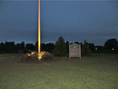
Ainsworth Army Air Field, completed on November 30, 1942, was a satellite of Rapid City Army Air Field and under command of the Second Air Force. The field was one of eleven Army Air Force training bases built in Nebraska during World War II. The . . . — — Map (db m77760) HM
On West Franklin Street (State Highway 84) east of South Robinson Avenue, on the left when traveling east.
This marker, dedicated on the 100th anniversary of Hartington High School, June 25, 1988, is in honor of two graduates who became governors of Nebraska. Dwight Burney, born in 1892, graduated from Hartington High School in 1910. Burney attended . . . — — Map (db m181317) HM
On U.S. 20 at milepost 221 east of Main Street, on the right when traveling west.
At 10:45 a.m. on February 5, 1944, 1st Lt. John B. Beatty of Sandusky, OH, and 2d Lt. Earnest W. Fanslau of Mantua, NJ took to the air from the Ainsworth Army Air Field in two P-47 "Thunderbolt" fighter planes for an instrument training flight. Lt. . . . — — Map (db m77754) HM
On Highway 20 (U.S. 20), on the right when traveling east.
In March, 1874, the U.S. Government authorized the establishment of a military camp at the Red Cloud Indian Agency on the White River. Home of some 13,000 Indians, many of whom were hostile, the Agency was one of the most troublesome spots on the . . . — — Map (db m173982) HM
Near Bridges to Buttes Byway (U.S. 20) 1.3 miles west of 1st Street, on the left when traveling west.
This camp, constructed to house three thousand men, received the first German prisoners of war in June 1943. Most of the soldiers were members of the Afrika Korps. The prisoners were allowed to work on farms and ranches in the area and
received a . . . — — Map (db m223434) WM
Near Bridges to Buttes Byway (U.S. 20) 0.1 miles south of Soldier Creek Road, on the right when traveling north.
In September 1942 the Fort Robinson War Dog Training Center was established. Barracks, classrooms, administrative offices, and other support buildings were located west and north of here. To the east and north was a sprawling kennel area housing . . . — — Map (db m223435) HM
Near Bridges to Buttes Byway (U.S. 20) 0.1 miles south of Soldier Creek Road, on the right when traveling south.
The Post Headquarters was constructed in 1905. The Post Commander's office was located here, along with other administrative offices, post office, and the Fort's telephone exchange. An ornate auditorium on the second floor was often used for parties . . . — — Map (db m223439) HM
On State Highway 25A at County Route 165, on the right when traveling north on State Highway 25A.
During World War II Nebraska was home to eleven air bases, which filled the sky with planes engaged in training aircrews. On June 7, 1944, fifteen B-24 bombers departed from the Lincoln Army Air Base en route to the west coast. During a thunderstorm . . . — — Map (db m223444) HM WM
On Farnam Street at 18th Street, on the left when traveling west on Farnam Street.
American servicemen have displayed exemplary courage in all our nation's wars. They have sacrificed their time, their energy, given their blood and thousands their lives, to help keep America free.
This flag is a special tribute to the Medal of . . . — — Map (db m35168) WM
On East Road at South Road, on the right when traveling north on East Road.
Originally a filtration plant constructed in 1912, this building was remodeled and enlarged to become the Post Exchange Building in 1923. All incoming or outgoing calls, whether emergency or routine, would pass through the Post switchboard housed . . . — — Map (db m58118) HM
To maintain discipline among a large garrison, Fort Omaha commanders strictly followed the military code of the frontier era. Facing occasional problems with drunkenness, insubordination, fighting and desertion, officers were quick to punish . . . — — Map (db m58122) HM
Constructed in 1906, this double barracks building housed noncommissioned officers of the U.S. Army Signal Corps, which had reactivated Fort Omaha in 1905. During World War I, this building served as South Post Headquarters for the Army’s first . . . — — Map (db m58106) HM
Maintaining the health and well-being of soldiers at Fort Omaha was accomplished only after overcoming serious obstacles.
One such obstacle was the shortage of potable water. By 1869 only two of the Fort’s wells were considered safe for . . . — — Map (db m58090) HM
On the Alley between 2nd and 1st Roads, on the left when traveling north.
This small, tin-roofed building hardly suggests its central role in the mission of the officers and troops once stationed at Fort Omaha. Constructed in 1883-84, the ordnance magazine was the chief storage place for weapons and ammunition.
It was . . . — — Map (db m58117) HM
On 11th Street near Jackson Street, on the right when traveling south.
In 1903, George Fisher and Harry Lawrie designed Fire Substation No. 1 in the then-popular Chateauesque style. The gabled third floor gave the building the look of a French chateau. On April 9, 1917, firefighters were sunning themselves out front . . . — — Map (db m35244) HM
On State Highway 61, 8.5 miles north of U.S. 34, on the right when traveling north.
In May 1944 German prisoners of war from Camp Atlanta, Nebraska, were sent to a side camp near here to help area farmers complete the 1943 corn harvest. Seven farmers employed forty-four Germans, who harvested some ten thousand bushels of corn. Six . . . — — Map (db m180995) HM
On County Road H, 0.1 miles east of U.S. 81, on the left when traveling east.
Construction began on the Fairmont Army Air Field September 17, 1942. Located east of here, it was one of eleven built in Nebraska during World War II.
The 1,980-acre field began as a satellite of the Topeka Army Air Base. Early in 1943 the name . . . — — Map (db m82566) HM
On County Route 15 south of U.S. 6, on the right when traveling south.
Fairmont Army Air Field, located 3 1/2 miles south, was one of eleven army air force training fields built in Nebraska during World War II. The 1,980-acre field provided final training for the 451st, 485th, 504th, and 16th Heavy Bombardment Groups . . . — — Map (db m78009) HM
On State Highway 41 just east of N Street (Road 24), on the left when traveling east.
On September 8, 1944, P-47 “Thunderbolt” fighters from the Bruning Army Air Field conducted training attack maneuvers with two formations of B-17 “Flying Fortress” bombers from the Sioux City Army Air Field. When one P-47 attempted to terminate its . . . — — Map (db m206738) HM
On State Highway 41 just east of N Street (Road 24), on the left when traveling east.
On May 10, 1944, an instructor pilot and a student pilot were flying a BT-13B “Valiant” aircraft back to the Bruning Army Air Field after a training session. At the same time, a P-47D “Thunderbolt” fighter, whose pilot had been conducting . . . — — Map (db m206700) HM
On State Highway 41 just east of N Street (Road 24), on the left when traveling east.
On October 25, 1943, four B-24 “Liberator” bombers from the Fairmont Army Air Field were flying in formation. At approximately 4 p.m., one bomber broke formation and the pilot of a second, as trained, moved toward the vacated position. When the . . . — — Map (db m206699) HM
On S. Main Street at Grafton Street, on the right when traveling north on S. Main Street.
The Ohiowa Auditorium, completed in 1940 and preserved in near original condition, is one of several Nebraska buildings constructed by the Works Progress Administration during the Great Depression. The WPA, a federal government relief program, . . . — — Map (db m82530) HM
On Main Street at Quincy Street (County Route 74), on the left when traveling north on Main Street.
North side of monument:
World War I
Pvt. Robert J. Wilkinson; Am. Expeditionary Force, U.S.A.; Sept. 6, 1889 - Oct. 12, 1928; Died in France from battle wounds.
World War II
Pvt. John Gerhard Trapp, Jr.; Co. B, 30th Replacement . . . — — Map (db m82531) WM
On 16th Avenue (U.S. 136) near Q Street, on the right when traveling south.
World War I
They Died for Freedom
[Roll of Honored Dead]
World War II
The Supreme Sacrifice
[Roll of Honored Dead]
Korea
They Died for Freedom
[Roll of Honored Dead]
Vietnam
[Roll of Honored Dead] . . . — — Map (db m59000) WM
Organized as a local militia, the Paddock Guards were named in honor of Nebraska Senator Algernon S. Paddock. Established June 9, 1875 to protect Beatrice from outlaws and bandits, the Guard furnished their own equipment; city residents furnished . . . — — Map (db m48375) HM
On Grant Street near 6th Street (U.S. 77), on the left when traveling east.
To honor all men and
women who honorably
served their country
in the Armed Forces
of the United States
Dedicated
November 11, 1995 — — Map (db m47654) HM
In Beatrice, industries pooled resources to obtain defense contracts by creating Homestead Industries, Inc. This "war production pool of industries" included Dempster Industries, Store Kraft Manufacturing, W.M. Haith Tank Works, Beatrice Steel . . . — — Map (db m48270) HM
December 7, 1941, Japan bombed Pearl Harbor and the United States declared war. On December 11, 1941, the United States declared war on Germany and Italy. Gage County residents served in Europe and in the Pacific. They fought in major battles, . . . — — Map (db m48279) HM
On Smith Avenue (U.S. 283) north of Rockford Street, on the right when traveling north.
In memory of those who gave their lives in World War II ☆ ☆ ☆ Frank F. Wendland John J.W. Wendland Ervin Eugene Koch Raymond August Herman Meyer Harvey William Rader William Clifton White Leland Earl Thomas William . . . — — Map (db m176825) WM
The men and women of the 6th Bomb Group Association thank the people of Grand Island for their warm hospitality when we trained here in 1944/1945 before leaving for the Pacific Theatre of War to fly 1,750 World War II B-29 combat missions over . . . — — Map (db m59854) HM
On Saint Paul Road, 0.5 miles north of East White Cloud Road (County Road 41), on the right when traveling north.
On February 25, 1944, a B-17G bomber from the Grand Island Army Air Field crashed half a mile east of here on the Langenheder farm, killing nine aboard. The Grand Island base served as a training location for aircrews prior to their leaving for . . . — — Map (db m181684) HM WM
Near Sky Park Road, 0.6 miles north of East Airport Road, on the right when traveling north.
B-29 Superfortress Purpose: Very Heavy Bomber (increased speed, range, and bomb load) Features included pressurized cabin, electronic fire control system, remote-controlled gun turrets. Manufacturer: Boeing First Flown: September . . . — — Map (db m181656) HM
Near Sky Park Road, 0.6 miles north of East Airport Road, on the right when traveling north.
The first Grand Island airport, a grass field, was located approximately 1½ miles south of the present terminal building on land owned by H. O. “Doc” Woodward. It was used by the Grand Island Aero Company, organized in 1919 by former World War I . . . — — Map (db m181602) HM
On 1st Street (U.S. 30) at Walnut Street, on the right when traveling east on 1st Street.
Old Dodge School served as one of two branch camps in Hall County housing German prisoners of war. On July 9, 1944, Leo B. Stuhr, president of the county Non-Stock Labor Association, announced plans to use the school for this purpose. About one . . . — — Map (db m53254) HM
On Interstate 80 at milepost 316.5, on the right when traveling west.
The Purple Heart medal was originated by General George Washington on August 7, 1782 for distinguished valor and is now awarded only to members of the armed forces of the United States who have been wounded in combat against an armed . . . — — Map (db m79693) HM WM
On West Husker Highway, 0.9 miles west of State Highway 11, on the left when traveling west.
On August 17, 1943, a B-17F bomber from Kearney, Nebraska, Army Air Field crashed 300 yards south, killing all aboard. The plane was on a routine training flight before going overseas. Losing their lives were 2nd Lt. Sylvester J. Diebold, Benton, . . . — — Map (db m182051) HM
On West Old Potash Highway, 0.2 miles west of North 90th Road, on the right when traveling west.
Commonly known as the Cornhusker Ordnance Plant, the facility opened in 1942 and covered nearly 20 square miles. During World War II it produced artillery shells and various bombs weighing up to 2,000 pounds apiece. An explosion on May 26, 1945, . . . — — Map (db m181700) HM
On 12th Street north of L Street, on the right when traveling north.
The People of
Hamilton County
dedicate this memorial
to the men and women
who served our country
[Honor Roll of Veterans]
[not transcribed]
[Roll of Honored Dead]
World War I
Guy Nowlin • Emil G Post • John R Richardson . . . — — Map (db m79847) WM
On North Main Street (Nebraska Route 25A) north of East Carrigan Street, on the right when traveling north.
In January 1944 German prisoners of war from the Indianola camp came to a side camp here to help area farmers complete the 1943 corn harvest. Over the next two years the Palisade camp was activated and deactivated as needed to supply labor to . . . — — Map (db m176961) HM
On Washington Street (State Highway 4), on the right when traveling east.
Schopp - Ewing - Nispel Post No. 243
Plymouth, Nebraska
Gratefully dedicates this memorial to all the servicemen and women who so gallantly served this great country during time of war and conflict.
Dedicated November 11, 1989
[Reverse . . . — — Map (db m110654) WM
On L Street (East Turbine Avenue) east of North Ash Street, on the left when traveling east.
Dedicated to the memory of the Men and Women from Keya Paha County who served their county, that Liberty shall not perish from the Earth World War II Adams Everett V. • Adkinson Charles L. • ☆Alexander Charles H. • . . . — — Map (db m237274) WM
Lincoln Army Air Field was constructed in 1942 on the former Lincoln Municipal Airport. The 2,750-acre property was leased to the army by the City of Lincoln. The base provided technical training for aircraft mechanics, basic training for army . . . — — Map (db m66966) HM
Nebraska Historic Site
Lincoln Army Air Field
Regimental Chapel
1942
This property is listed in
the National Register of Historic Places — — Map (db m66968) HM
Near North Buffalo Bill Avenue, 0.8 miles north of Lincoln Highway (U.S. 30), on the right when traveling north.
This is the boyhood home of William "Bill" M. Jeffers, president of the Union Pacific Railroad from 1937-1946. Remarkably he began his career as a janitor & call boy. As president, he prepared the railroad for the coming war and was appointed by . . . — — Map (db m191890) HM
Near North Buffalo Bill Avenue, 0.8 miles north of Lincoln Highway (U.S. 30), on the right when traveling north.
This shield is from the North Platte, NE. Union Pacific Depot 3-20-1918 to 11-1-1973 Home of WWII Canteen 12-25-1941 to 4-1-1946 — — Map (db m191939) HM
The scourge of every war has been service personnel that are missing in action or have not been accounted for as prisoners of war, and sadly, there is no definite closure for the loved ones, friends and comrades in arms of those for whom there has . . . — — Map (db m107399) HM
Near U.S. 30, 0.3 miles south of 6th St, on the right when traveling south.
Andrew Jackson Higgins, designer and manufacturer of World War II landing craft known as "Higgins boats," was born August 28, 1886, at Columbus, Nebraska. His parents were John Gonegle Higgins, a prominent lawyer and judge, and Annie Long O'Connor . . . — — Map (db m9775) HM
On 4th Street just east of D Street, on the right when traveling east.
Alfred Maximilian Gruenther, four-star general in the U.S. Army, was born in Platte Center, Nebraska, on March 3, 1899, to Christian and Mary Shea Gruenther. He graduated fourth in his class from the U.S. Military Academy at West Point in 1918. . . . — — Map (db m206951) HM
On D Street (U.S. 6/34) just east of 4th Street, on the left when traveling east.
The US built prisoner of war camps across the country during World War II. One such camp opened north of Indianola. It held mostly German soldiers captured in North Africa and Italy. Prisoners began arriving by train in November 1943. The camp was . . . — — Map (db m223474) HM
This Mark of Commendation is awarded to Doane College for effective co-operation in training naval personnel during World War II.
Navy V-12 Unit
James Forrestal
Secretary of the Navy — — Map (db m76770) HM WM
Near Washington Avenue at Nebraska Highway 33, on the left when traveling east.
PFC Charley Havlat of Dorchester, Nebraska, was the last confirmed American combat fatality in the European Theater during World War II. He was born in rural Saline County, the oldest son of Anton and Antonia (Nemec) Havlat, Czech immigrants to . . . — — Map (db m76758) HM WM
In Memory of U.S.S. Wahoo SS 238 and her gallant crew who sank 20 Japanese ships before being sunk by enemy action October 11, 1943.
Crew of the U.S.S. Wahoo still on patrol. — — Map (db m93184) WM
In memory of all submarines and crews on eternal patrol.
Honoring all U.S. Navy Submarine Sailors.
In memory of the USS Wahoo SS238 and her gallant crew who sank 20 Japanese ships before being sunk by action on October 11, 1943.
During . . . — — Map (db m80431) HM WM
Near Airport Terminal Street, 0.2 miles east of County Road 25, on the right when traveling north.
During World War II, the U.S. Army Air Forces operated a satellite airfield at this site. In the fall of 1942 twenty-eight farms were vacated so construction could begin. Some 600,000 cubic yards of concrete for three runways was poured in . . . — — Map (db m238996) HM
On Mari Sandoz Sandhills Trail (State Highway 27) 15 miles north of State Highway 2, on the right when traveling north.
During World War II the Japanese built some nine thousand hydrogen-filled, paper balloons to carry small bombs to North America, hoping to set fires and inflict casualties. The first was launched November 3, 1944. The balloons rose to about 30,000 . . . — — Map (db m180929) HM
On State Highway 4, 6.8 miles east of U.S. 81, on the left when traveling east.
Acree, William • Albert, John • Armstrong, William • Arnett, Willard • Blakeslide, Herbert • Boekman, George • Bohle, Robert • Brown, Jack • Brown, Richard • Burke, James • Clarkson, Donald • Hemphill, Lloyd • Hutslar, Orson • Johnson, Arthur • . . . — — Map (db m206988) HM
On State Highway 4, 6.8 miles east of U.S. 81, on the left when traveling east.
Bruning Army Air Field, located northeast of here, was one of eleven army airfields in Nebraska during World War II. Construction began in September 1942 on 1,480 acres of farmland, for which the government paid twelve landowners $73,400. The field . . . — — Map (db m206989) HM
On Holdredge Avenue west of South Avenue, on the left when traveling west.
The Civilian Conservation Corps (CCC) was authorized by Congress in 1933 to provide employment and vocational training to young men during the Great Depression. The CCC worked on forestry and soil conservation projects across the nation. Company . . . — — Map (db m79890) HM
On Interstate 80 at milepost 355.2, on the right when traveling west.
The Purple Heart medal was originated by General George Washington on August 7, 1782 for distinguished valor and is now awarded only to members of the armed forces of the United States who have been wounded in combat against an armed . . . — — Map (db m79826) HM WM