After filtering for Nebraska, 69 entries match your criteria.
World II War Topic
By Bill Kirchner, September 23, 2014
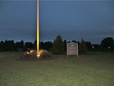
Naval Ammunition Depot Marker
| 1 ► Nebraska, Adams County, Hastings — 366 — Naval Ammunition Depot — |
| On South Technical Boulevard south of U.S. 6, on the right when traveling south. | |||
| 2 ► Nebraska, Box Butte County, Alliance — 416 — Alliance Army Air Field — |
| On Perkins Road (State Highway 2) just east of County Road 57, on the left when traveling east. | |||
| 3 ► Nebraska, Boyd County, Naper — 453 — Lost Airmen of World War II — |
| On State Highway 12, on the right when traveling west. | |||
| 4 ► Nebraska, Brown County, Ainsworth — 380 — Ainsworth Army Air Field — |
| On U.S. 20 at milepost 235, on the right when traveling west. | |||
| 5 ► Nebraska, Cedar County, Hartington — 321 — Hartington - Home of two Nebraska Governors — |
| On West Franklin Street (State Highway 84) east of South Robinson Avenue, on the left when traveling east. | |||
| 6 ► Nebraska, Cherry County, Wood Lake — 483 — Midair Collision of P-47 "Thunderbolt" Fighter Planes, 1944 — |
| On U.S. 20 at milepost 221 east of Main Street, on the right when traveling west. | |||
| 7 ► Nebraska, Dawes County, Crawford — 102 — Fort Robinson — |
| On Highway 20 (U.S. 20), on the right when traveling east. | |||
| 8 ► Nebraska, Dawes County, Crawford — 299 — German P.O.W. Camp — |
| Near Bridges to Buttes Byway (U.S. 20) 1.3 miles west of 1st Street, on the left when traveling west. | |||
| 9 ► Nebraska, Dawes County, Crawford — 333 — K-9 Training Area — |
| Near Bridges to Buttes Byway (U.S. 20) 0.1 miles south of Soldier Creek Road, on the right when traveling north. | |||
| 10 ► Nebraska, Dawes County, Crawford — 215 — Post Headquarters, 1905 — |
| Near Bridges to Buttes Byway (U.S. 20) 0.1 miles south of Soldier Creek Road, on the right when traveling south. | |||
| 11 ► Nebraska, Deuel County, Chappell — 348 — B-24J Bomber Crash — |
| On State Highway 25A at County Route 165, on the right when traveling north on State Highway 25A. | |||
| 12 ► Nebraska, Douglas County, Omaha, Downtown — "Among the Valiant" — |
| On Farnam Street at 18th Street, on the left when traveling west on Farnam Street. | |||
| 13 ► Nebraska, Douglas County, Omaha, North Omaha — 10 — Fort Omaha Fire Station — Fort Omaha Walking Tour — |
| On East Road at South Road, on the right when traveling north on East Road. | |||
| 14 ► Nebraska, Douglas County, Omaha, North Omaha — 8 — Fort Omaha Guardhouse — Fort Omaha Walking Tour — |
| On East Road, on the right when traveling north. | |||
| 15 ► Nebraska, Douglas County, Omaha, North Omaha — 14 — Fort Omaha Headquarters Building — Fort Omaha Walking Tour — |
| On South Road, on the left when traveling west. | |||
| 16 ► Nebraska, Douglas County, Omaha, North Omaha — 13 — Fort Omaha Hospital — Fort Omaha Walking Tour — |
| On West Road, on the right when traveling south. | |||
| 17 ► Nebraska, Douglas County, Omaha, North Omaha — 11 — Ordnance Magazine — Fort Omaha Walking Tour — |
| On the Alley between 2nd and 1st Roads, on the left when traveling north. | |||
| 18 ► Nebraska, Douglas County, Omaha, The Old Market — Omaha Firehouse 1903-1904 — The Old Market Historic Walking Tour — |
| On 11th Street near Jackson Street, on the right when traveling south. | |||
| 19 ► Nebraska, Dundy County, Benkelman — 446 — Prisoners of War in Dundy County — |
| On State Highway 61, 8.5 miles north of U.S. 34, on the right when traveling north. | |||
| 20 ► Nebraska, Fillmore County, Fairmont — 360 — Fairmont Army Air Field — |
| On County Road H, 0.1 miles east of U.S. 81, on the left when traveling east. | |||
| 21 ► Nebraska, Fillmore County, Fairmont — 381 — Fairmont Army Air Field — |
| On County Route 15 south of U.S. 6, on the right when traveling south. | |||
| 22 ► Nebraska, Fillmore County, Milligan — 474 — B-17G "Flying Fortress" and P-47D "Thunderbolt" Crash, 1944 — |
| On State Highway 41 just east of N Street (Road 24), on the left when traveling east. | |||
| 23 ► Nebraska, Fillmore County, Milligan — 476 — BT-13B "Valiant" and P-47D "Thunderbolt" Crash, 1944 — |
| On State Highway 41 just east of N Street (Road 24), on the left when traveling east. | |||
| 24 ► Nebraska, Fillmore County, Milligan — 475 — Two B-24 "Liberators" Crash Near Milligan, 1943 — |
| On State Highway 41 just east of N Street (Road 24), on the left when traveling east. | |||
| 25 ► Nebraska, Fillmore County, Ohiowa — 460 — The Ohiowa Auditorium — |
| On S. Main Street at Grafton Street, on the right when traveling north on S. Main Street. | |||
| 26 ► Nebraska, Fillmore County, Strang — In Memory of the Sons of Strang — |
| On Main Street at Quincy Street (County Route 74), on the left when traveling north on Main Street. | |||
| 27 ► Nebraska, Franklin County, Franklin — Franklin County Veterans Memorial — Freedom Is Not Free — |
| On 16th Avenue (U.S. 136) near Q Street, on the right when traveling south. | |||
| 28 ► Nebraska, Franklin County, Franklin — Lockheed F-80 — (P-80 & T-33) — Shooting Star — |
| On 16th Avenue (U.S. 136) near Q Street, on the right when traveling south. | |||
| 29 ► Nebraska, Gage County, Beatrice — Beatrice's Own - Company C 134th Infantry Regiment Nebraska National Guard — We Answered the Call — 1861 - Today — |
| 30 ► Nebraska, Gage County, Beatrice — Gage County Veterans Memorial — |
| On Grant Street near 6th Street (U.S. 77), on the left when traveling east. | |||
| 31 ► Nebraska, Gage County, Beatrice — War Efforts at Home — We Answered the Call — 1861 - Today — |
| 32 ► Nebraska, Gage County, Beatrice — World War II — We Answered the Call — 1861 - Today — |
| 33 ► Nebraska, Gosper County, Elwood — Gosper County World War II Memorial — |
| On Smith Avenue (U.S. 283) north of Rockford Street, on the right when traveling north. | |||
| 34 ► Nebraska, Hall County, Grand Island — 6th Bomb Group — 24 Bomb Sqd. • 39 Bomb Sqd. • 40 Bomb Sqd. — 1944 • B-29 C.B.I.-Guam-Saipan-Tinian • 1945 — |
| 35 ► Nebraska, Hall County, Grand Island — 163 — B-17 Bomber Crash, 1944 — |
| On Saint Paul Road, 0.5 miles north of East White Cloud Road (County Road 41), on the right when traveling north. | |||
| 36 ► Nebraska, Hall County, Grand Island — B-29 Superfortress / 6th Bomb Group / Tinian Island — |
| Near Sky Park Road, 0.6 miles north of East Airport Road, on the right when traveling north. | |||
| 37 ► Nebraska, Hall County, Grand Island — 464 — Central Nebraska Regional Airport — |
| Near Sky Park Road, 0.6 miles north of East Airport Road, on the right when traveling north. | |||
| 38 ► Nebraska, Hall County, Grand Island — Hall County Veterans Memorial Park — |
| 39 ► Nebraska, Hall County, Grand Island — 490 — Old Dodge School — World War II POW Branch Camp — |
| On 1st Street (U.S. 30) at Walnut Street, on the right when traveling east on 1st Street. | |||
| 40 ► Nebraska, Hall County, Grand Island — The Purple Heart — |
| On Interstate 80 at milepost 316.5, on the right when traveling west. | |||
| 41 ► Nebraska, Hall County, Wood River — 435 — B-17 Crash, 1943 — |
| On West Husker Highway, 0.9 miles west of State Highway 11, on the left when traveling west. | |||
| 42 ► Nebraska, Hall County, Wood River — 553 — Cornhusker Army Ammunition Plant — |
| On West Old Potash Highway, 0.2 miles west of North 90th Road, on the right when traveling west. | |||
| 43 ► Nebraska, Hamilton County, Aurora — Veterans Memorial — |
| On 12th Street north of L Street, on the right when traveling north. | |||
| 44 ► Nebraska, Hamilton County, Aurora — War Memorial — |
| On 12th Street north of L Street, on the right when traveling north. | |||
| 45 ► Nebraska, Hitchcock County, Palisade — 451 — Prisoners of War in Hitchcock County — |
| On North Main Street (Nebraska Route 25A) north of East Carrigan Street, on the right when traveling north. | |||
| 46 ► Nebraska, Jefferson County, Plymouth — Veterans Memorial — |
| On Washington Street (State Highway 4), on the right when traveling east. | |||
| 47 ► Nebraska, Johnson County, Tecumseh — Johnson County Veterans Memorial — |
| On 3rd Street near Clay Street, on the left when traveling south. | |||
| 48 ► Nebraska, Johnson County, Tecumseh — Johnson County World War II Memorial — 1941 - 1945 — |
| On 4th Street at Clay Street, on the right when traveling south on 4th Street. | |||
| 49 ► Nebraska, Keya Paha County, Springview — Keya Paha County War Memorial — |
| On L Street (East Turbine Avenue) east of North Ash Street, on the left when traveling east. | |||
| 50 ► Nebraska, Lancaster County, Lincoln — 376 — Lincoln Army Air Field - Lincoln Air Force Base — |
| Near NW 44th St at W. Cuming St. | |||
| 51 ► Nebraska, Lancaster County, Lincoln, Arnold Heights — Lincoln Army Air Field Regimental Chapel — |
| Near NW 48th Street at W. Douglas Street. | |||
| 52 ► Nebraska, Lincoln County, North Platte — Jeffers Family Home — |
| Near North Buffalo Bill Avenue, 0.8 miles north of Lincoln Highway (U.S. 30), on the right when traveling north. | |||
| 53 ► Nebraska, Lincoln County, North Platte — Union Pacific Depot — North Platte, Nebraska — |
| Near North Buffalo Bill Avenue, 0.8 miles north of Lincoln Highway (U.S. 30), on the right when traveling north. | |||
| 54 ► Nebraska, Lincoln County, North Platte — United States POW-MIA History — |
| On South Jeffers Street. | |||
| 55 ► Nebraska, Platte County, Columbus — 424 — Andrew Jackson Higgins — (1886-1952) — |
| Near U.S. 30, 0.3 miles south of 6th St, on the right when traveling south. | |||
| 56 ► Nebraska, Platte County, Platte Center — 431 — Alfred Maximilian Gruenther — 1899-1983 — |
| On 4th Street just east of D Street, on the right when traveling east. | |||
| 57 ► Nebraska, Red Willow County, Indianola — 552 — Indianola POW Camp — |
| On D Street (U.S. 6/34) just east of 4th Street, on the left when traveling east. | |||
| 58 ► Nebraska, Saline County, Crete — Navy Department - United States of America — |
| Near Osterhout Lane. | |||
| 59 ► Nebraska, Saline County, Dorchester — 469 — PFC Charley Havlat — |
| Near Washington Avenue at Nebraska Highway 33, on the left when traveling east. | |||
| 60 ► Nebraska, Saunders County, Wahoo — U.S.S. Wahoo SS 238 — |
| On N. Chestnut St. | |||
| 61 ► Nebraska, Saunders County, Wahoo — USS Wahoo SS238 — |
| On Chestnut Street south of West 5th Street. | |||
| 62 ► Nebraska, Scotts Bluff County, Scottsbluff — 365 — Scottsbluff Army Air Field — |
| Near Airport Terminal Street, 0.2 miles east of County Road 25, on the right when traveling north. | |||
| 63 ► Nebraska, Sheridan County, Ellsworth — 505 — Japanese Balloon Bombs — |
| On Mari Sandoz Sandhills Trail (State Highway 27) 15 miles north of State Highway 2, on the right when traveling north. | |||
| 64 ► Nebraska, Thayer County, Bruning — Bruning Air Field Pilots Killed near Naper, Nebraska — August 3 1944 — |
| On State Highway 4, 6.8 miles east of U.S. 81, on the left when traveling east. | |||
| 65 ► Nebraska, Thayer County, Bruning — 397 — Bruning Army Air Field — |
| On State Highway 4, 6.8 miles east of U.S. 81, on the left when traveling east. | |||
| 66 ► Nebraska, Thayer County, Hebron — 452 — The Hebron CCC And POW Camps — |
| On Holdredge Avenue west of South Avenue, on the left when traveling west. | |||
| 67 ► Nebraska, Thayer County, Hebron — Veterans Memorial — |
| On 4th Street north of Olive Avenue, on the left when traveling north. | |||
| 68 ► Nebraska, York County, York — The Purple Heart — |
| On Interstate 80 at milepost 355.2, on the right when traveling west. | |||
| 69 ► Nebraska, York County, York — York County Veterans Memorial — Duty - Honor - Country — |
| On Lincoln Avenue at 6th Street, on the left when traveling south on Lincoln Avenue. | |||