Kathryn, a typical prairie town, sprang
from the landscape with railroad
construction. Although the area was
settled by pioneers in the late 1870s, the
arrival of a Northern Pacific Railroad line
in 1900 and the establishment of a
cooperative . . . — — Map (db m176712) HM
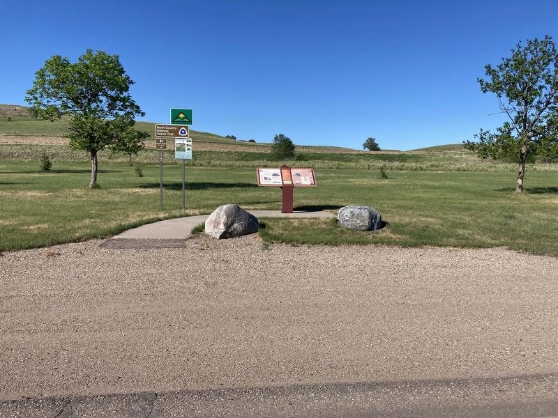
“Ribbon” Rail carries the heavier loads of today. Although this short section seems rigid, the ribbon rail is actually flexible. It is welded into long sections which may be up to a quarter mile long! Due to its flexibility, this rail can be . . . — — Map (db m242765) HM
These 1895 dated rails were taken up from the building site of the Rosebud Visitor Center. While the original Northern Pacific rails at this site were laid in 1872, lighter rail such as this tend to wear out more quickly. Early locomotives were . . . — — Map (db m242599) HM
The men who organized the Midland Continental had dreams that this line would be a successful transcontinental railroad carrying heavy trains loaded with the abundant grains of the north to the shipping lines of the Texas gulf. However, the . . . — — Map (db m242708) HM
The process of building a railroad has changed very little through the years (with the exception of the extensive use of power equipment today). The basic materials in a section of track is the same today as it was a century ago. After the . . . — — Map (db m242581) HM
Caboose BN11603 retired from Alliance, Nebraska and was donated to the Valley City Park District in 1989 by the Burlington Northern Railroad. A caboose though seldom used today, was used to protect the rear of the train, provide shelter and an easy . . . — — Map (db m242595) HM
The original line of the Northern Pacific Railroad, now the Burlington Northern Santa Fe, descended into Valley City, crossed the Sheyenne River and continued out of the valley. Because of the steep grades, "pusher" engines were required to push . . . — — Map (db m242298) HM
This 1908 steel viaduct across the Sheyenne River Valley allowed the railroad to avoid steep grades. At 3886 feet (1184 meters) long and 155 feet (47 meters) high, it is an excellent example of this bridge type. — — Map (db m242299) HM
As transportation technology advanced, locomotives became more powerful, carried bigger and heavier cargo, and required heavier rails. Older, lighter rails were updated with increasingly heavier ones. Rail sections are stamped with the . . . — — Map (db m242598) HM
At 581 miles, the Sheyenne River is the longest in North Dakota. When the Wisconsinan ice sheet melted about 13,000 years ago, it left behind the Sheyenne River and a trench that reaches up to 300 feet deep and a mile wide. Discover historic, . . . — — Map (db m242596) HM
Rails, regardless of weight, have to conform to the laws of physics. All rails will contract in severe cold, and expand in summer heat. With prolonged heat, rails can buckle into an "S"-shaped curve called a sun kink. Mild sun kinks may shrink . . . — — Map (db m242766) HM
The Valley City Street & Interurban Railroad was incorporated in June, 1905, by O.A. Beeman to transport passengers, goods, and rail cars between two larger lines. The Soo Line passed north of the city without a spur line to serve local . . . — — Map (db m242769) HM
The massive beam on which the rails are mounted was removed from the High Line Bridge about a quarter century ago. It is made by sandwiching different layers of wood and connecting the layers with steel rods. This beam can support the weight of . . . — — Map (db m242597) HM
1830 Beginning of the railroad era in the United States.
1850 9,021 miles of track are completed, all east of the Mississippi.
1869 The First Transcontinental Railroad is completed when the Golden spike is driven in Utah Territory, . . . — — Map (db m183737) HM
The railroad reached the Little Missouri River in 1880. The Northern Pacific Railroad named the stop Pyramid Park. When the Marquis de Mores and Theodore Roosevelt arrived in 1883, the train depot was on the west side of the Little Missouri River. . . . — — Map (db m87986) HM
On this site in September 1864 an immigrant train, under the command of Capt. James L. Fisk, bound for the gold fields of Montana, was besieged by hostile Sioux Indians, despite the fact that an armed escort of 50 U. S. Cavalrymen had been provided . . . — — Map (db m33923) HM
This was the site of one of the largest river warehouses built during the 1870s when river transportation was of primary importance. The warehouse was served by a spur track of the Northern Pacific Railway and until the railroad was built west of . . . — — Map (db m154055) HM
Presented by the French National Railroads
to the State of
North Dakota
in gratitude for the help given to France
by the American people — — Map (db m44706) HM
The State Historical Society of North Dakota acquired Camp Hancock in 1951 for preservation as a state historic site. Work began to repair fire damage on the lone remaining structure, the officers quarters from the 1870s, used later as the U.S. . . . — — Map (db m154548) HM
Camp Hancock was the location of an infantry post from 1872 to 1877 and a quartermaster depot and signal office until 1894. The post was originally named Camp Greeley in honor of Horace Greeley, an editor of the New York Times and candidate . . . — — Map (db m154971) HM
This coal-fired steam locomotive was built by the Baldwin Locomotive works of Philadelphia, Pennsylvania for the Northern Pacific Railway in 1909. Numbered 2164 by the Northern Pacific, the locomotive and coal tender weigh 298,600 pounds, are 78 . . . — — Map (db m154970) HM
In 1864, the Northern Pacific Railroad was charted to build a line from the Great Lakes to Puget Sound. The initial funding for construction would come from the sale of Northern Pacific bonds. However, in 1873 lack of funding halted construction, . . . — — Map (db m239986) HM
This Northern Pacific depot, designed by nationally known architect Cass Gilbert, was built in 1898. A park with gardens and fountain surrounded it. No longer in use because of declining passenger traffic in the 1960's, the depot was in danger of . . . — — Map (db m240296) HM
On Thanksgiving Day, November 24, 1904, the Fargo Streetcar Railway accepted its first passenger. Fare was 5¢ per person and service was available from 6 AM to midnight every day, except Sunday, when hours were shorter. Seven cars were available . . . — — Map (db m239997) HM
Just like the name hints, the Ford Building was built in 1915 as a Ford automobile plant and showroom to service the Dakotas. Built in a Chicago style along the Great Northern Railroad tracks, this building boasted the perfect location to . . . — — Map (db m240297) HM
This caboose was built by the Great Northern in August 1942 and is one of 50 wood sided, cupola cabooses. It was constructed in the St. Cloud shops. The original number was X227 (the X stands for non-revenue) and it was acquired by Burlington . . . — — Map (db m239898) HM
The Great Northern Railway started out in 1857 as the Minnesota & Pacific. It was not until 1890 that it became known as the Great Northern, and this name was given in honor of rails that crossed the great territory. The Great Northern entered . . . — — Map (db m240291) HM
On July 2, 1864 President Abraham Lincoln signed an Act of Congress creating the Northern Pacific Railroad Company. Following closely the route taken by a government expedition in 1854, the northern railroad route to the west coast would . . . — — Map (db m239998) HM
This tablet marks the site where Generals Grant and Sheridan stopped September 4th 1883, with a party enroute west to drive the Golden Spike which completed the Northern Pacific Railroad. — — Map (db m209097) HM
Moorhead and Fargo were platted when the Northern Pacific railroad arrived at the Red River in 1871 less than one block north of here.The towns grew up at this intersection of river and rail. Steamboats traveling the shallow Red River stopped . . . — — Map (db m100836) HM
Alsen/Storlie (est. 1905) This Soo Line Railroad townsite was named for local settlers who came from Alsen Island off the coast of Denmark. Alsen reached a peak population of 358 in 1930. Ambro (1891-1901) This small Bohemian settlement . . . — — Map (db m214096) HM
Not much is known of the very early history of Cavalier County. The Sioux are believed to have been the earliest residents. The first known white men to have set foot in Cavalier County were those in the Verendrye expedition, which camped in the . . . — — Map (db m214095) HM
Established in the spring of 1883 by a colony from New York state and named for the Hudson River. A railroad right-of-way was planned to serve the town from the east. Three years later the Northern Pacific and Northwestern railways met on the . . . — — Map (db m175276) HM
1/5 mile to the south is the site of the Stagecoach Relay Station. Benjamine and Mellinger operated the stage line, beginning in 1880, between Columbia, SD and Jamestown, ND. Service took two days each way and passengers could be fed and lodged . . . — — Map (db m112568) HM
The Hazelton Post Office was established July 6, 1903. It was located at this site in the home of Elise Longpre Perras. In December of 1903 the nearby Williamsport Post Office (Williamsport, N.D. about 3 ½ miles N.E. of Hazelton) closed and its . . . — — Map (db m231462) HM
In 1886, Erick and Marlene Watne and son Edwin moved to Dakota Territory from Wisconsin. They made their home in this abandoned dugout. Marlene died in 1891. Erick married Hannah Hystad in 1893, they continued to live there until toward the end of . . . — — Map (db m176690) HM
The Fairview Bridge crossing the Yellowstone River in North Dakota is named after the Montana town of Fairview located five miles west. Although it is considered the only lift span bridge in North Dakota, it has a twin structure located nine miles . . . — — Map (db m162155) HM
The only railroad tunnel in North Dakota is located some 300 feet from the east end of the Fairview Lift Bridge. Locally known as the Cartwright Tunnel, it is named after the town of Cartwright, located about 1 1/ miles east of the tunnel. As . . . — — Map (db m162157) HM
By 1912 the Northern Pacific, Soo, and Milwaukee railroads were in competition. Louis W. Hill, president of the Great Northern, and his father, James J. Hill, knew that a successful farming population on railroad territory was essential to the . . . — — Map (db m162154) HM
Custer Mine, owned and operated by the Truax Traer Coal Company, was a
working surface mine from 1947-1964. The surface or strip mining method of coal
mining is used when the coal seam is near the surface of the ground. The
lignite coal was mined . . . — — Map (db m164410) HM
People have lived in the area now called North Dakota for over 12,000 years. The people of prehistoric
times were nomadic hunters and gatherers. More recent Native American tribes of this area include the Mandan, Arikara and Hidatsa. These . . . — — Map (db m164407) HM
The first steamboat to reach the upper Missouri was the American Fur Company's Yellow Stone, which arrived at Fort Union in 1832. Nearly 30 years later, steamers began reaching Fort Benton, Montana, the head of navigation on the Missouri. From then . . . — — Map (db m235097) HM
In 1898, William Drew Washburn, a wealthy Minneapolis flour miller, railroad man, and U.S. Senator from Minnesota, purchased 115,000 acres of land along the line between McLean and Burleigh counties. He formed the Bismarck, Washburn & Great Falls . . . — — Map (db m235098) HM
The first Northern Pacific Railway Co. Train reached this point in September of 1910. The railroad linked the communities of Mandan, Huff, Fort Rice, Cannonball, Solen, Brelen, and Flasher together with Southwestern North Dakota.
It was a means . . . — — Map (db m161850) HM
In 1866-1868, Indian councils were held at the post. The most important of these was the Great Council with the Sioux bands in July 1886. A key leader of the Lakota, Thathanka Iyotake (Sitting Bull), refused to participate. Father Pierre Jean De . . . — — Map (db m154294) HM WM
The worst rail disaster in North Dakota history happened Aug. 9, 1945 at 7:20 PM, one thousand feet west of here, on a one degree curve to the West. The first section of a Great Northern passenger train had to make an emergency stop, then the . . . — — Map (db m206392) HM
Forty-seven downtown properties comprise the Historic Devils Lake Commercial District, a U.S. national Park Service recognized historic district, listed in the national Register of Historic Places. The Commercial District is contained within a . . . — — Map (db m242837) HM
Situated mostly on Sections 33 and 34, in Township 154, Range 64, Devils Lake was established by H. M. Creel in 1882. Originally known as Creelsburg, Devils Lake was incorporated in 1884 and secured a connection to James J. Hill's great northern . . . — — Map (db m242767) HM
Fort Ransom, a United States Military Post, established on this
site on June 18. 1867, was one of a chain of forts in Dakota
Territory established to protect frontier settlements. All
buildings were of substantial log construction and . . . — — Map (db m175426) HM
Pyramid Hill
Pyramid Hill has long been a topic of local debate sometimes heated. The hill's obvious geometric shape begs the question of just how it was formed.
Geologists believe that Pyramid Hill is a natural feature—the result of . . . — — Map (db m177165) HM
Fort Seward, formerly Fort Cross, was established June 3, 1872. The post was built on a bluff overlooking the confluence of the James River and Pipestone Creek. Although the Sioux Indians had recently been settled on reservations, occasional . . . — — Map (db m112678) HM
A United States military post providing quarters for two companies of infantry. It was named for Wm H. Seward, wo served as Secretary of State under Abraham Lincoln.
The post protected workers who were building the Northern Pacific Railway . . . — — Map (db m112683) HM