By Steven aTKIN
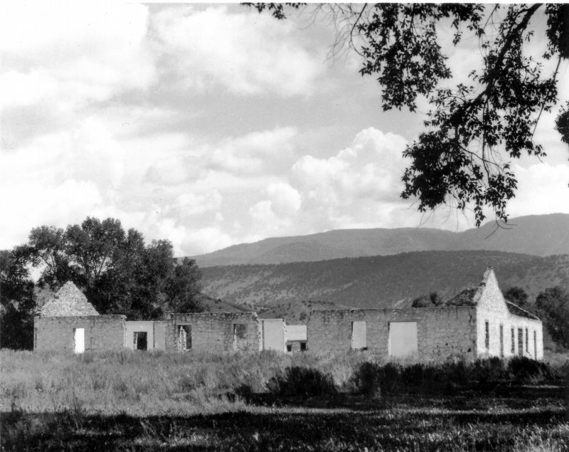
Fort Cameron Marker
| On North Main Street at 200 North Street, on the right when traveling north on North Main Street. |
| On Utah Route 153, on the left when traveling east. |
| Near Utah Route 161, 1 mile north of Interstate 70. |
| Near Utah Route 164, 1 mile north of Interstate 70. |
| On 400 West 700 North at 400 W 700 N, on the right when traveling east on 400 West 700 North. |
| On S 100 W at South Street, on the right when traveling north on S 100 W. |
| On South 200 West (U.S. 91 at milepost 40) near West Main Street, on the right when traveling north. |
| On Center Street (U.S. 89) at 200 E Center Street, on the right when traveling east on Center Street. |
| On North 200 West south of East 100 North, on the right when traveling south. |
| Near West Industrial Road. |
| On West 2700 South, 0.1 miles east of South Westview Drive, on the left when traveling east. |
| On Jones Road, 0.4 miles west of Enoch Road, on the right when traveling west. |
| On South Main Street, on the right when traveling south. |
| On North Main Street, on the right when traveling south. |
| On West 200 South at 200 West and 200 South, on the right when traveling north on West 200 South. |
| On North 100 East Street north of East 500 North Street, on the left when traveling north. |
| On North 100 East Street north of East 500 North Street, on the left when traveling north. |
| Near North 300 West south of West 100 North. |
| On U.S. 89A, 0.4 miles north of Arizona State line, on the left when traveling north. |
| On Utah Route 257, 4.4 miles south of U.S. 6, on the right when traveling south. |
| Near Utah Route 257, 4.4 miles south of U.S. 6, on the right when traveling south. |
| On South Main Street at East Center Street, on the right when traveling north on South Main Street. |
| On 100 East at 100 North, on the left when traveling east on 100 East. |
| Near 900 East south of East 12600 South. |
| On North Pioneer Street (6000 W), 0.1 miles south of Un Road, on the right when traveling north. |
| Near Union Park Avenue, on the right when traveling south. |
| On 1500 West, on the right when traveling north. |
| On 300 West at 400 South, on the right when traveling south on 300 West. |
| Near South Connor Street west of Red Butte Canyon Road. |
| On Potter Street west of Fort Douglas Boulevard, on the right when traveling east. |
| On Hempstead Road at Mario Capecchi Road, on the left when traveling east on Hempstead Road. |
| On De Trobriand Street west of Fort Douglas Boulevard, on the right when traveling west. |
| On Fort Douglas Boulevard at Lewis Drive, on the right when traveling east on Fort Douglas Boulevard. |
| On De Trobriand Street west of Fort Douglas Boulevard, on the right when traveling east. |
| On Officer's Circle west of Fort Douglas Boulevard, on the right when traveling west. |
| On Fort Douglas Boulevard west of Potter Street, on the right when traveling west. |
| On Fort Douglas Boulevard east of De Trobriand Street, on the right when traveling west. |
| On South Redwood Road (Utah Route 68) 0.1 miles north of Conifer Way, on the right when traveling north. |
| On East 100 North at North 100 East, on the right when traveling east on East 100 North. |
| On East 100 North Street east of North Main Street, on the right when traveling east. |
| On North Main Street north of 200 North Street, on the left when traveling north. |
| On South Main Street south of Union Street, on the right when traveling south. |
| On North Main Street at First N, on the right when traveling north on North Main Street. |
| On North Main Street at 200 North Street, on the right when traveling north on North Main Street. |
| On South 200 West Street at West 100 South Street, on the right when traveling south on South 200 West Street. |
| On North State Street north of Main Street, on the right when traveling north. |
| On West 200 North at North 100 West, on the right when traveling west on West 200 North. |
| On West 100 South, 0.2 miles west of South Main Street, on the right when traveling west. |
| On South 100 East at East 100 North, on the right when traveling north on South 100 East. |
| On S. Hoytsville Road at E 1100 S Road, on the right when traveling north on S. Hoytsville Road. |
| On Utah Route 36 north of Utah Route 73, on the right when traveling south. |
| On West Main Street (U.S. 40) at North 100 West, on the right when traveling west on West Main Street. |
| On South Main Street south of Center Street, on the right when traveling north. |
| On Grove Circle north of East 770 North, on the right when traveling north. |
| Near Grove Circle north of East 770 North. |
| On Moyle Park Circle north of East 770 North, on the right when traveling east. |
| On South 100 East south of East Main Street, on the right when traveling south. |
| On West 1540 North at 18040 West, on the right when traveling east on West 1540 North. |
| On North 200 East, on the right when traveling south. |
| On North 200 West, on the right when traveling north. |
| On North 200 East at East Utah Avenue, on the right when traveling south on North 200 East. |
| On West Utah Avenue at North 200 West, on the right when traveling west on West Utah Avenue. |
| On West 300 South at South 100 West, on the right when traveling west on West 300 South. |
| On North 100 West at 100 North, on the right when traveling north on North 100 West. |
| On North 300 East at East 100 North, on the left when traveling north on North 300 East. |
| On South 300 East at East 300 South, on the right when traveling south on South 300 East. |
| On North 2050 West, 0.1 miles north of West Center Street, on the right when traveling north. |
| On North 500 West, on the right when traveling north. |
| On East 820 North west of North 1100 East, on the right when traveling east. |
| Near West 1460 North Street west of North 1500 West. |
| On North 1200 East south of East 2620 North. |
| On South 300 West, on the right when traveling north. |
| On Palmyra Drive at West 5950 South, on the right when traveling south on Palmyra Drive. |
| On West 6400 South, 1 mile west of South 1050 West, on the right when traveling west. |
| On South Main Street, on the right when traveling north. |
| On West 6200 South, 0.5 miles west of 1050 West, on the right when traveling west. |
| Near Center Street North, on the left when traveling south. |
| On North 100 West, 0.4 miles north of West 650 North, on the right when traveling north. |
| Near 2900 East Street, 0.2 miles south of Utah Route 144. |
| On West Center Street, 0.1 miles west of Main Street, on the left when traveling west. |
| On West Santa Clara Drive, on the right when traveling west. |
| On Wall Avenue near 25th Street, on the right when traveling south. |