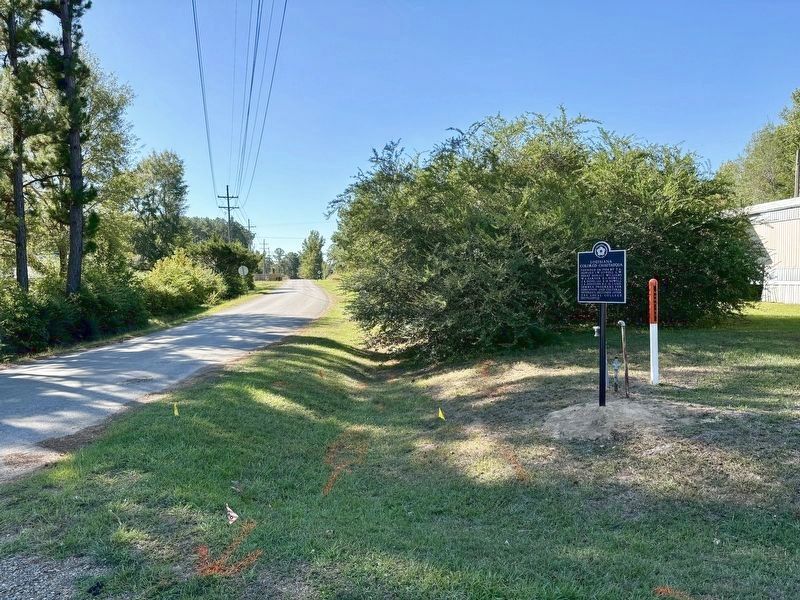
On Igoe Inn Road (Parish Route 32) at Railroad Drive, on the right when traveling south on Igoe Inn Road.
Founded in 1906 by T. A. Howard, I. W. Howell, L. W. Perry, Horace Williams, W. A. Garner, B. A. Howell, J. A. Douglass, E. M. Howell, J. S. Johnson & C. H. Land. Summer programs for education and cultural interests. Declined after the local college . . . — — Map (db m234404) HM
On Legends Avenue (State Highway 149) 0.3 miles south of Interstate 20, on the right when traveling south.
Mr. Earnie Miles was widely known for his pioneering
career at KNOE-TV in Monroe, Louisiana as the first
black news reporter and host of the "Earnie Miles
Gospel Show” which began in 1980. The show was
the most watched gospel show in the . . . — — Map (db m150962) HM
Near Legends Avenue (Highway 149) 0.3 miles south of Interstate 20, on the right when traveling south.
Paul "Tank" Younger, a Grambling,
Louisiana native, played college football at
Grambling State University and was the first
player from a historically black university to
play professional football. In 1955, "Tank"
became the last player named . . . — — Map (db m159996) HM
Near Legends Avenue south of Interstate 20, on the left when traveling south.
R.W.E Jones, affectionately known as "Prez", was
President of Grambling State University from 1936
until his retirement in 1977. He was the second
president of the historically black university.
Jones began his career at Grambling . . . — — Map (db m150362) HM
Near Legends Avenue (State Highway 149) 0.3 miles south of Interstate 20, on the right when traveling south.
Richard J. Gallot, Sr. is a well-known,
successful entrepreneur who served as
Grambling's mayor from 1981 to 1985.
His parish and government positions
included serving as a Grambling City
Councilman; Constable, Ward II, Lincoln
Parish; member . . . — — Map (db m150943) HM
On Legends Avenue (State Highway 149) 0.3 miles south of Interstate 20, on the left when traveling south.
As a Grambling native,
Richard Ludley served as mayor of
Grambling from 1985 until 1994. He helped
to organize Grambling's volunteer fire
department and served as a volunteer fireman
followed by six years of service as fire chief.
He . . . — — Map (db m150668) HM
Near Legends Avenue (State Highway 149) 0.3 miles south of Interstate 20, on the left when traveling south.
Sarah Jane Richmond, born in 1869, was appointed as
Grambling's first Postmistress on April 16, 1907, a post
she held for four years. She was also a founding
member of Grambling's first Chapter of the Order of
Eastern Star in 1944. Sarah's . . . — — Map (db m159071) HM
Near Legends Avenue (State Highway 149) 0.3 miles south of Interstate 20, on the left when traveling south.
The Honorable Pinkie Carolyn Wilkerson: a Grambling
native who was an attorney and member of the Louisiana
House of Representatives from 1992-2000, representing
District 11. She served as the Vice Chair of the Health &
Welfare Committee, served . . . — — Map (db m159407) HM
Near Legends Drive (Highway 149) 0.3 miles Interstate 20, on the left when traveling south.
Thomas Morehead is a native of Monroe, Louisiana,
and a graduate of Grambling State University. Instead
of a career in teaching, Morehead took a leap of faith for
an uncertain shot at learning the automotive business
from the ground up. In . . . — — Map (db m159014) HM
Near Legends Avenue, 0.3 miles south of Interstate 20, on the left when traveling south.
Tommie Lee Agee was a star at Grambling College and
a Major League Baseball center fielder. He signed with
the Cleveland Indians in 1962, and moved through the
ranks. In 1966, he earned the Rookie of the Year Award
and the Golden Glove Award. . . . — — Map (db m150991) HM
Near Legends Avenue (State Highway 149) 0.3 miles south of Interstate 20, on the left when traveling south.
Mr. Vernell J. Delafosse was widely admired for his loyalty
to the community of Grambling and Grambling State
University. He sought out every opportunity to get involved
in the religious, civic and social affairs of the community
and was also . . . — — Map (db m157215) HM
On Arlington Street just north of Hart Avenue, on the right when traveling south.
In 1885, a school was established to provide Negro citizens an education in Ruston, Louisiana and was chartered in 1891. In 1892, the Ruston Normal Colored High School started. The school was destroyed by fire. In 1924-1925, it was rebuilt in the . . . — — Map (db m237163) HM
Near Old Highway 80 East at Stafford Drive, on the left when traveling south.
On June 7, 1863, black troops fought a vicious battle to defend the Union supply base at Milliken’s Bend, 15 miles northwest of here. Their victory proved black troops could fight well and helped ensure that the siege at Vicksburg would end in Union . . . — — Map (db m84474) HM
Near Old Highway 80 East at Stafford Drive, on the left when traveling south.
During the summer of 1862, the Federals’ first attempt to bypass Vicksburg by digging a canal across DeSoto Peninsula failed. By January, 1863, the Federals had reoccupied the Louisiana shore opposite Vicksburg. Gen. U.S. Grant ordered work on the . . . — — Map (db m84467) HM
Near Old Highway 80 East at Stafford Drive, on the left when traveling south.
This canal was the third attempt by the Union armies to route gunboats around Vicksburg. Excavation was begun in January 1863, by order of General Grant with two regiments and 1,200 Negro laborers. Two dredge boats were used in February but were . . . — — Map (db m84469) HM
Near Old Highway 80 East at Stafford Drive, on the left when traveling south.
The remains of the canal you see here today are the result of the second Union effort to bypass Vicksburg.
In January 1863, laborers and troops under the command of Maj. Gen. Ulysses S. Grant resumed work on the canal begun in June 1862. They . . . — — Map (db m84472) HM
Near Old Highway 80 East at Stafford Drive, on the left when traveling south.
In 1862, powerful Confederate guns along Vicksburg’s high bluffs kept the Mississippi River closed to Federal shipping. Union leaders decided the army should take the city by land to gain control of the river. But General Thomas Williams had a . . . — — Map (db m84468) HM
Near Old Highway 80 East at Stafford Drive, on the left when traveling south.
U.S.
African Brigade
District Northeast Louisiana Army of the Tennessee
Col. Isaac F. Shepard
Post of Milliken’s Bend Louisiana
Col. Hiram Scofield
8th Louisiana, Col. Hiram Scofield
9th Louisiana, Col Herman Lieb, Maj. . . . — — Map (db m84475) HM
Near Old Highway 80 East at Stafford Drive, on the left when traveling south.
Rather than attack Vicksburg directly, the Federals at first tried to engineer their way around the Confederate stronghold.
In June 1862, Union troops started digging a canal across the foot of DeSoto Point. The theory: the river would adopt . . . — — Map (db m84470) HM
On Thomastown Road at Ashley Plantation Road, on the left when traveling north on Thomastown Road. Reported missing.
At daybreak on June 7, 1863, Gen. H. E. McCulloch led his Texas Brigade against the Union force which guarded the Union supply depot at Milliken’s Bend. In the savage fighting which ensued, the Confederates drove the Federals from their camp. While . . . — — Map (db m34798) HM
On West Madison Avenue at West Hickory Avenue, on the right when traveling east on West Madison Avenue.
Site of first school built for Morehouse Parish blacks. Built 1916 through efforts of parish school board and several Bastrop blacks. Subsequent buildings housed Morehouse High School until 1969. — — Map (db m109319) HM
On State Highway 494, 0.3 miles north of Cedar Bend Road, on the right when traveling north.
(side 1)
This c. 1836 center hall Creole cottage is of poteaux sur sole, (hand-hewn pegged cypress sills on brick piers) and bousillage construction on the 1780s land grant to Claude Pierre Thomas Metoyer. The lower 68 acres given to a . . . — — Map (db m70645) HM
In the 1720s, at a spot of land now eroded by the river, stood the barracks where enslaved Africans from the Senegal-Gambia region, were held before being ferried across the river to the slave auctions. Early Algiers Point was also the home of the . . . — — Map (db m116900) HM
On Bouny Street north of Morgan Street, on the right when traveling north.
Louis Armstrong, adoringly referred to as “Satchmo," was born August 4, 1901, but chose to celebrate his birthday on July 4th,America's Independence Day. He was the first important jazz soloist and became its most influential musician. As a . . . — — Map (db m116892) HM
On Morgan Street west of Bermuda Street, on the left when traveling west.
The transatlantic slave trade to Louisiana began in 1718, with the first of two ships bringing African captives to the region in 1719. The first ship to arrive at this site was the Expedition, which landed 91 enslaved people, most from the . . . — — Map (db m157916) HM
On L B Landry Avenue at De Armas Street, on the right when traveling north on L B Landry Avenue.
Lord Beaconsfield Landry, also known as L.B. Landry, was born March 11, 1879 in Donaldsonville, Louisiana. At a very early age, he was sent to Gilbert Academy, which was at that time located in Baldwin, LA. He later attended Fisk University, where . . . — — Map (db m116883) HM
On St. Peters at Chartres Street, on the right when traveling west on St. Peters.
Bankruptcy and probate cases were decided in the Cabildo's courtroom. When slaveholders failed to pay their debts or died without a will, their assets - including people they owned - were sold, often resulting in the separation of families and . . . — — Map (db m221542) HM
On North Broad Street (Business U.S. 90) at Orleans Avenue, in the median on North Broad Street.
In 1909, a group of laborers went to the Pythian Temple Theatre
to see a musical comedy by the Smart Set. A skit portraying a
Zulu Tribe had as its title,
"There Never Was and Never Will Be a King Like Me".
They made their first appearance as . . . — — Map (db m150049) HM
On St. Charles Avenue west of Fern Street, on the right when traveling west.
Located in the Carrollton neighborhood, this house has a rich history thanks to a succession of fascinating owners, including Placide Reynes, a free man of color; William Theodore Jay, a wealthy businessman; Philip Werlein IV, chairman of Werlein's . . . — — Map (db m229770) HM
On Common Street at South Rampart Street, on the right when traveling west on Common Street.
Nicknamed "Satchelmouth" or "Satchmo" was a world renowned transformational artist whose radiant and colorful interpretations of Jazz brought the art form into the mainstream. We salute the boy from the very streets around you with the raspy voice. — — Map (db m239605) HM
On Common Street east of Baronne Street, on the left when traveling west.
When an ordinance banned prison-like “slave pens” from the city’s core, traders moved just outside, to the present-day Central Business District. The slave trading structures on this site were operated by a number of traders, including Thomas . . . — — Map (db m239609) HM
On Loyola Avenue near Gravier Street, on the right when traveling east.
The architecturally acclaimed Pythian Temple building at 234 Loyola Avenue (formerly South Saratoga) is one of New Orleans' storied landmarks. From 1908 to 1941, members of the Knights of Pythias, under the leadership of Smith W. Green, served as . . . — — Map (db m115974) HM
On Oretha Castle Haley Boulevard at Martin Luther King Jr Boulevard, in the median on Oretha Castle Haley Boulevard.
Mass Lynching in New Orleans
July 24 to 27, 1900, White mobs unleashed a campaign of racial terror
throughout the city of New Orleans that resulted in the lynching of
at least seven Black people. Violence began after police tried to . . . — — Map (db m163962) HM
On Third Street south of Lasalle Street, on the left when traveling south.
Founded in 1921 by R.C. Matthews and 45 members, New Zion Baptist Church moved to 2319 Third Street in 1949. Here, under the leadership of Rev. A.L. Davis, Jr., the Southern Christian Leadership Conference (SCLC) became a permanent organization . . . — — Map (db m95835) HM
Near Iberville Street north of Canal Street. Reported permanently removed.
[ inscriptions, west face, base :]
September 14th 1874
In honor of those Americans on both sides who died in the Battle of Liberty Place
Members of the Metropolitan Police:
John H. H. Camp • John Kennedy • Edward Simon • . . . — — Map (db m34742) WM
On Chartres Street (Place John Paul II) north of St. Paul Street.
[Panel 1:]
Jackson Square has been designated a Registered National Historic Landmark under the provisions of the Historic Sites Act of August 21, 1935.
This site possesses exceptional value in commemorating and interpreting the . . . — — Map (db m21859) HM
On Conti Street, 0.1 miles south of Chartres Street, on the left when traveling south.
This building was the location of L'Union , the South's first Black newspaper (1862-1864), and the New Orleans Tribune, La Tribune de la Nouvelle-Orléans (1864-1869), the first Black daily newspaper in the United States.
These . . . — — Map (db m221514) HM
This Greek revival tomb is reputed burial place of this notorious "Voodoo Queen". A mystic cult, Voodooism, of African origin, was brought to this city from Santo Domingo and flourished in 19th century. Marie Laveau was the most widely known of many . . . — — Map (db m13699) HM
On Royal Street, 0.1 miles south of Toulouse Street, on the right when traveling south.
Jean-François Merieult, like many merchants involved in transatlantic shipping during the late 18th and early 19th centuries, was also a slave trader. In 1803, the year of the Louisiana Purchase, Merieult financed three slave ship voyages, which . . . — — Map (db m221563) HM
On Chartres Street at Saint Louis Street on Chartres Street.
Within this historic structures slaves were sold and Andrew Jackson met with the Lafitte Brothers and planned the defense for the historic and epic Battle of New Orleans. At this monumental battle the British surrendered to American troops commanded . . . — — Map (db m51385) HM
On Chartres Street at St. Louis Street, on the left when traveling north on Chartres Street.
The luxurious St. Louis Hotel included a bank, ballroom, shopping arcade, and trading exchange. Six days a week, under the hotel's domed rotunda, auctioneers sold off land and goods as well as thousands of enslaved people. — — Map (db m221556) HM
Near Chartres Street at St. Peter Street, on the left when traveling east.
[Panel 1:]
Erected 1795-1799,
Don Gilberto Guillemard, architect.
Constructed financed and directed by Don Andres Almonester y Roxas.
The mansard roof was added in 1847.
The illustrious Cabildo (Spanish colonial city council) held its . . . — — Map (db m21508) HM
Near St. Peter Street east of Decatur Street, on the left when traveling east.
The trade of human beings from Africa to Louisiana began in 1718 with the first slave ships, the Aurore and the Duc du Maine, arriving in 1719. Those ships carried 451 enslaved Africans to the Louisiana colony. Their voyage marked the beginning . . . — — Map (db m117276) HM
On Canal Street east of Badine Street East, on the left when traveling east.
Catch the Ferry in the Terminal Straight Ahead
Ride the Canal Street—Algiers Ferry across the river, pickup a FREE walking tour brochure in the Ferry Terminal and enjoy a leisurely stroll through the charming streets and historic . . . — — Map (db m122346) HM
On Saint Claude Avenue (State Highway 46) east of Alabo Street, in the median.
Civil Rights Pioneers On November 14, 1960, four six-year-old children in New Orleans became the first African-Americans to integrate "white only" public elementary schools in the Deep South. On that day, three girls enrolled in McDonogh No. 19 . . . — — Map (db m99584) HM
Louisiana provided the largest number of black Union troops during the Civil War. Many lie buried here. The most notable, Capt. Andre Cailloux, fell while courageously leading a charge of the Louisiana Native Guards in 1863 at Port Hudson, La. . . . — — Map (db m161738) HM
On June 7, 1892, Homer Adolph Plessy defied a Louisiana law that segregated railroad trains on the basis of race. He was arrested and became the defendant in the May 18, 1896 United States Supreme Court decision of Plessy v. Ferguson, which condoned . . . — — Map (db m13036) HM
Near North Claiborne Avenue just north of Iberville Street, on the right when traveling north.
"My name is Marie Justine Cirnaire. I was born in Guinea.
When I was
perhaps seven years of age I was carried to St. Dominique. I am as a result
not aware of the name of my father nor of my mother, nor do I know my age.
I was . . . — — Map (db m161741) HM
Near North Claiborne Avenue just north of Iberville Street, on the right when traveling north.
"… let our republican government be upheld by all citizens and derive its just power from the expressed consent of ALL governed. Being just it will feel stronger; resting on the base of Universal Suffrage, it will be . . . — — Map (db m161739) HM
Near North Claiborne Avenue just north of Iberville Street, on the right when traveling north.
Pioneers in education and in the care of orphans and the
elderly among the colored people, this society of colored
sisters was founded in New Orleans on November 21, 1842 by
misses Henriette Delille and Juliette Gaudin who became the first and . . . — — Map (db m161740) HM
On Jourdan Avenue at North Johnson Street, on the right when traveling south on Jourdan Avenue.
The Historic Lower Ninth Ward Side A On August 29, 2005, at about 7:45a.m., the Industrial Canal flood wall broke with an explosive sound, heard by many residents near North Johnson Street and Jourdan Avenue. At that time, the Lower Ninth . . . — — Map (db m102875) HM
On Esplanade Avenue at Frenchmen Street on Esplanade Avenue.
In 1805 Bernard de Marigny began the subdivision of his plantation, creating the first suburb below the original city. As Americans settled up-river, immigrants and free persons of color settled in Faubourg Marigny. — — Map (db m51600) HM
On Esplanade Avenue at Chartres Street, in the median on Esplanade Avenue.
(front side)
In 1808, the US Congress abolished the international slave trade, contributing to a significant increase in the domestic slave trade, or the trafficking of human beings within the boundaries of the United States. During the . . . — — Map (db m117438) HM
On Esplanade Avenue near Chartres Street, in the median.
Located in the Faubourg Marigny, from the corner of Esplanade Ave. and Chartres St., is the former site of Theophilus Freeman's notorious slave pen (demolished after the Civil War) where Solomon Northup, a free man of color from New York, was sold . . . — — Map (db m117277) HM
On South Carrollton Avenue at Tulane Avenue (U.S. 61), on the right when traveling north on South Carrollton Avenue.
Home of New Orleans' first professional sports team, baseball's New Orleans Pelicans. The "Pels" played home games here from the park's construction in 1915 through its demolition in 1957. Negro league teams such as the Black Pelicans and the . . . — — Map (db m100503) HM
On North Miro Street at Anette Street, on the left when traveling east on North Miro Street.
Fannie C Williams Pioneer in Public EducationAs one of New Orleans' premier educators in the first half of the twentieth century, Fannie C. Williams steered this school through decades of challenge and change. An active civic leader, she was . . . — — Map (db m115964) HM
On Esplanade Avenue at No. Claiborne Avenue, in the median on Esplanade Avenue.
Located on a portion of the Morand-Moreau plantation sold by Claude Faubourg Tremé in 1810 to the city of New Orleans, it became the city’s first subdivision and is considered to be America’s oldest existing African American neighborhood. It was . . . — — Map (db m35124) HM
On North Galvez Street west of Alvar Street, on the right when traveling west.
William T. Frantz Elementary School at 3811 North Galvez Street in New Orleans became a significant site in the Civil Rights Movement of the 1960s. On November 14, 1960, a six-year-old girl walked through its doors and changed the course of . . . — — Map (db m202739) HM
Congo Square is in the “vicinity” of a spot which Houmas Indians used before the arrival of the French for celebrating their annual corn harvest and was considered sacred ground. The gathering of enslaved African vendors in Congo Square . . . — — Map (db m20954) HM
Near St. Ann Street west of N. Rampart Street when traveling north.
His trumpet and heart brought everlasting joy to the world, embodying jazz as The Pulse of Life.
In appreciation National Park Service/Tourism Cares April 18, 2008. — — Map (db m21068) HM
On St. Claude Avenue south of Governor Nicholls Street, on the left when traveling east.
In 1841, this parish was established for the inhabitants of Faubourg Tremé. The joint beneficence of Bishop Antoine Blanc and the Ursuline nuns made possible acquisition of property and erection of the church. Until 1925, the buildings of the . . . — — Map (db m35056) HM
First Panel:
This bronze bust of Sidney Bechet is a faithful copy of the original by French sculptor Abel Chrétien. The original erected in 1960, a year after Bechet’s death in Juan-Les-Fins, France. This town was named in 1994 as a . . . — — Map (db m21987) HM
On Esplanade Avenue at North Derbigny Street, in the median on Esplanade Avenue.
In 1869, the American Missionary Association (AMA) and philanthropist Seymour Straight partnered to found Straight University, a school where African Americans could aspire to the highest education available after Emancipation. Classes were first . . . — — Map (db m213943) HM
On Governor Nicholls Street north of St. Claude Avenue..
On this October 30, 2004, we, the faith community of St. Augustine Catholic Church, dedicate this shrine consisting of grave crosses, chains and shackles to the memory of the nameless, faceless turfless Africans who met an untimely death in . . . — — Map (db m35067) HM
On Bienville Street west of North Tonti Street, on the right when traveling west.
Central Congregational Church 1872-2005Central Congregational Church of New Orleans was organized by Rev.
Charles H. Thompson, a theology professor at Straight College and
thirty-two incorporators on June 30, 1872. It was the result of . . . — — Map (db m157209) HM
On St. Charles Avenue at Valmont Street, on the right when traveling east on St. Charles Avenue.
5318 St. Charles Avenue
The site of Gilbert Academy
and
New Orleans University,
Black Educational
Institutions
Under the auspices of
The Methodist Church
1873 to 1949 — — Map (db m12678) HM
One half mile North. The Monroe Monarchs
played Negro League baseball in what was
known as Casino Park. Owned by local oil
and machine works businessman, Fred A.
Stovall, the Monarchs became champions
of the Negro Southern League in 1932 . . . — — Map (db m133753) HM
On Highway 418 near Sharkies Place, on the left when traveling north.
George “Buddy” Guy, one of the most dazzling performers in blues history, was born here in Lettsworth on July 30, 1936. His primary influences included local Louisiana musicians and many more who were born across the river in Mississippi, including . . . — — Map (db m127700) HM
On Third Street at St. James Street, on the right when traveling south on Third Street.
Bontemps, noted black author-poet, scholar and pioneer in children's literature, was born in Alexandria, Louisiana on October 13, 1902. he was baptized February 22, 1903 at St. Francis Xavier Caathedral. Arna, son of Paul Bismark and Marie . . . — — Map (db m117847) HM
On Water Tower Drive south of Middleton Drive, on the right when traveling north.
Completed in 1852 and owned by Edwin Epps, a former overseer of Oakland Plantation, the Edwin Epps House is located where LSU Alexandria stands today. This single story Creole cottage was originally built on Bayou Boeuf near Holmesville in Avoyelles . . . — — Map (db m116044) HM
On Water Tower Rd. (Acorn Dr.), 0.2 miles south of Middleton Dr., on the left when traveling south.
Built in 1852 by Edwin Epps. Originally located near Holmesville on Bayou Boeuf about three miles away. From 1843 to 1853, Epps, a small planter, owned Solomon Northrup, author of famous slave narrative Twelve Years A Slave. — — Map (db m87280) HM
On Water Tower Avenue north of Gregg Marshall Drive, on the right when traveling north.
Constructed in 1852 for the Edwin Epps' family, this single story Creole cottage was originally located on Bayou Boeuf near Holmesville in Avoyelles Parish. Relocated to Bunkie, LA in 1976, the house was moved to the LSUA campus in 1999 and . . . — — Map (db m116037) HM
On Lee Street north of 9th Street, on the right when traveling north.
Lee Street in Alexandria was the center of a thriving African-American community during the early 1940s, including two churches,
eight eating establishments, three funeral homes, five grocery
stores, eight entertainment venues, a pharmacy, a bus . . . — — Map (db m174165) HM
Over 1.2 million African-American soldiers proudly served
their country during World War II. Although, the military
did not officially desegregate the Armed Forces until after
World War II, African-American soldiers made many
important . . . — — Map (db m225168) HM
On Louisiana Route 112, 0.1 miles west of U.S. 165.
The 761st, a mostly black tank battalion, was activated at Camp Claiborne, LA on April 1,
1942. While at Camp Claiborne, the 761st trained on M5 Stuart light tanks. After reassignment
to Fort Hood, TX for final training, the 761st was assigned to . . . — — Map (db m224353) HM
On 3rd Street near F Street, on the left when traveling north.
From 1940-1944, Louisiana hosted a series of military maneuvers designed to train soldiers
for all aspects of Army Ground Forces operations. Approximately 75,000 black soldiers
maneuvered in Central Louisiana. The 761st Tank Battalion, an . . . — — Map (db m196204) HM
On River Road, 0.7 miles west of Pompano Drive, on the right when traveling west.
The destruction of their plantation during the Battle of New Orleans left the de Chalmet family in financial trouble. In 1817 brothers Hilaire and Louis St. Amand bought the land. The St. Amands were prominent free people of color who already owned . . . — — Map (db m97137) HM
On January 8, 1815, the guns positioned here fired at British counter batteries located almost ½ mile in front of you. During the battle, these guns caused heavy casualties as the British advanced along the levee road.
The troops attacking . . . — — Map (db m6218) HM
On Chalmette National Park Scenic Road (Tour Loop Rd), 0.2 miles east of Battlefield Road, on the left when traveling east.
Jean Pierre Fazende, a free man of color and New Orleans grocer, inherited land within the battlefield in 1857. After the Civil War, he divided it and sold it to freed slaves from local plantations. Eventually the community grew to more than 200 . . . — — Map (db m97172) HM
On West St. Bernard Highway at Chalmette National Park Scenic Road on West St. Bernard Highway.
Louis and Hilaire St. Amand, free men of color, purchased the Chalmette Plantation from Pierre Denis de La Ronde in 1817 and ultimately subdivided the plantation into five lots in 1832. The wealthy St. Amand family in turn conveyed parcels of the . . . — — Map (db m213935) HM
Constructed 1787-1790 for Robert de Logny, Inherited by Jean Noel d’Estrehan 1800. Bought from heirs of Pierre A. Rost in 1914 by Mexican Petroleum Co. Donated 1972 to River Road Historical Society by American Oil Co. — — Map (db m51607) HM
On River Road (State Highway 48) near 1st Street, on the right when traveling south.
After the Civil War in 1873, Palmer Elkins, a free man of color, purchased property, tracts 8, 9, & 10 for $943.50. Mr. Elkins was the President of the St. Mary Benevolent Association and helped to educate freed men of color. In 1880, he asked . . . — — Map (db m100384) HM
On State Highway 18 at Freetown Street, on the left when traveling south on State Highway 18.
Following the Civil War, thirty-one individuals bought lots from C. Oliver, who acquired portions of land that was formerly a part of the Pedesclaux-Landry Plantation in St. James, LA. Together, the group carved out and cultivated the land and . . . — — Map (db m85008) HM
Near State Highway 18, 1.5 miles east of State Highway 3213.
This monument records the names of 107,000 people held in bondage in Louisiana from 1719-1820. The records were gathered from the database Afro-Louisiana History and Genealogy, created by noted historian Gwendolyn Midlo Hall. We have named . . . — — Map (db m117304) HM
Near State Highway 18, 1.5 miles east of State Highway 3213.
Before the Civil War, the Whitney Plantation counted 22 slave cabins on its site. They were made of cypress and were located along River Road, downriver from the Big House.
Most of the original cabins were torn down in the 1970s to enlarge the . . . — — Map (db m117313) HM
On Airline Highway (U.S. 61) at Main Street (Louisiana Highway 44), on the right when traveling south on Airline Highway.
Acquired in 1793 & 1808 by Manuel Andry, a commandant of the German Coast. Major 1811 slave uprising organized here. Ory Bros. & A. Lasseigne were last owners of plantation. Its subdivision in 1923 spurred the growth of LAPLACE. — — Map (db m85243) HM
On Redemption Way east of Northwest 3rd Street, on the right when traveling east.
Formerly, Our Lady of Grace Catholic Church, this sanctuary represents an important historical phenomenon in the history of the Catholic Church in southern Louisiana, the formation of separate churches for black parishioners. Prior to its founding, . . . — — Map (db m85247) HM
On West Church Street near North Market Street, on the left when traveling west.
In 1897, when there were few local schools for Blacks, the 7th District Baptist School was founded and housed in the original church building on this site. It was 1 of 2 private schools for area Blacks. — — Map (db m98730) HM
The J.S. Clark walkway is a tribute to J.S. Clark High School, its faculty, staff, students and the people of Opelousas, Louisiana.J.S. Clark High School was an endemic institution located at 1100 E. Leo Street in Opelousas, Louisiana. The school . . . — — Map (db m108010) HM
On East St. Landry Street (U.S. 190) east of South Academy Street, on the left when traveling west.
The La Chapelle house stood at the corner of Union and Grolee streets in Opelousas for more that a century. Clerk of Court records indicate the home was built by Herbert La Chapelle, a French Canadian who moved to Opelousas where he purchased land . . . — — Map (db m107726) HM
On North Court Street north of East Landry Street (U.S. 190), on the right when traveling north.
Named for Manon Baldwin, a Free Woman of Color and one of the first known businesswomen in Opelousas. The businesses she owned included a tavern and boarding house that were operated on this corner until her death in 1858. — — Map (db m145918) HM
On Ronald Reagan Highway (Vine Street) (State Highway 190) east of South Academy Street (Highway 3253), on the right when traveling east.
Site of first public school for People of Color in Opelousas. Also known as St. Landry Parish Training School. School constructed on property donated by the City of Opelousas in 1918. — — Map (db m85216) HM
On East Landry (U.S. 190) south of Campus Street, on the right when traveling east.
Opelousas First and Famous Birthplace Of Zydeco Music
Birthplace Of Swamp Pop Music
First Protestant (Methodist) Church In Louisiana & Oldest Methodist Church
West Of The Mississippi - 1806
First Masonic Temple West Of The Mississippi- . . . — — Map (db m134002) HM
Near East Landry Street (U.S. 190) east of South Academy Street, on the left when traveling west.
On June 20, 1994, an assault occurred at Fairchild Air Force Base by a gunman during which 4 personnel were killed and 23 wounded. Rosa B., a civilian nurse at the base hospital, risked her life as a first responder to prevent further loss of life. . . . — — Map (db m108137) HM WM
Near East Landry Street (U.S. 190) east of South Acedemy Street, on the right when traveling east.
This small, single frame wood structure was built in 1948 as a house of worship for the African American Methodist congregation in the small, rural St. Landry Parish village of Palmetto. The church purchased a parcel of land located at the end of . . . — — Map (db m107925) HM
Near East Landry Street (U.S. 190) east of South Academy Street, on the right when traveling west.
The Venus House was the first building to be relocated to Le Vieux Village in 1973. This French Creole style home was donated by the Earl Fontenot family. The home was originally located in the small community of Grand Prairie. In 1975, the house . . . — — Map (db m107490) HM
On U.S. 167 west of Durio Road, on the right when traveling west.
Plaisance School was built in 1921 at a total cost of $4,500.00. Funds for construction were donated by Julius Rosenwald Fund - $1,200.00; the Plaisance black community - $3,100.00; and the St. Landry parish school authorities and the white . . . — — Map (db m107477) HM