After filtering for Virginia, 1619 entries match your criteria. The first 100 are listed. ⊳
African Americans Topic
By Beverly Pfingsten, April 20, 2008
Now a vacant lot.
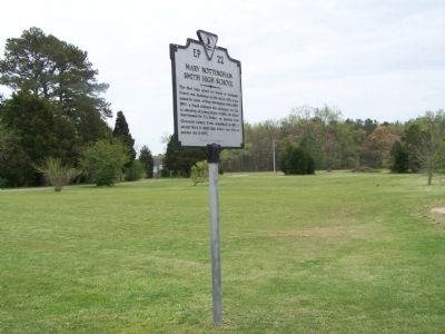
| 1 ► Virginia, Accomack County, Accomac — EP-22 — Mary Nottingham Smith High School — |
| On Alt. US 13 Front Street at T. C. Walker Drive, on the right when traveling north on Alt. US 13 Front Street. | |||
| 2 ► Virginia, Accomack County, Parksley — The Hopeton Passenger Station — Eastern Shore Railway Museum — |
| On Dunne Avenue at County Road T-1804, on the right when traveling south on Dunne Avenue. | |||
| 3 ► Virginia, Accomack County, Tangier — Old Shirt Factory — |
| On Factory Road east of West Ridge Road, on the right when traveling east. | |||
| 4 ► Virginia, Accomack County, Tangier — Welcome To Historic Tangier Island — |
| On Main Ridge Road at Thomas Road on Main Ridge Road. | |||
| 5 ► Virginia, Accomack County, Tangier — Welcome to Historic Tangier Island — |
| On Main Ridge Road at Parks Marina Lane, on the left when traveling south on Main Ridge Road. | |||
| 6 ► Virginia, Albemarle County, Charlottesville — “The Albemarle 26” — Pioneers of Equality in Education — |
| On North Milton Road (County Route 729) 0.1 miles south of Richmond Road (U.S. 250). | |||
| 7 ► Virginia, Albemarle County, Charlottesville — A Presidential Scandal: — The Jefferson - Hemings Controversy — |
| Near Monticello Loop, 0.4 miles north of Thomas Jefferson Parkway (Virginia Route 53), on the left when traveling north. | |||
| 8 ► Virginia, Albemarle County, Charlottesville — 11 — Charcoal — |
| Near Thomas Jefferson Parkway. | |||
| 9 ► Virginia, Albemarle County, Charlottesville — Contemplative Site — |
| Near Monticello Loop, 0.4 miles north of Thomas Jefferson Parkway (Virginia Route 53), on the left when traveling north. | |||
| 10 ► Virginia, Albemarle County, Charlottesville — Discovering Mulberry Row — |
| Near Monticello Loop north of Thomas Jefferson Parkway (Virginia Route 53), on the left when traveling north. | |||
| 11 ► Virginia, Albemarle County, Charlottesville — Forge & Quarters — |
| Near Monticello Loop, 0.4 miles north of Thomas Jefferson Parkway (Virginia Route 53), on the left when traveling north. | |||
| 12 ► Virginia, Albemarle County, Charlottesville — Henry Martin — 1826 - 1915 — |
| On McCormick Road. | |||
| 13 ► Virginia, Albemarle County, Charlottesville — 04 — Horses & Mules — |
| Near Thomas Jefferson Parkway. | |||
| 14 ► Virginia, Albemarle County, Charlottesville — Ice House — Thomas Jefferson's Monticello — |
| Near Thomas Jefferson Parkway. | |||
| 15 ► Virginia, Albemarle County, Charlottesville — Joiner's Shop — |
| Near Monticello Loop, 0.4 miles north of Thomas Jefferson Parkway (Virginia Route 53), on the left when traveling north. | |||
| 16 ► Virginia, Albemarle County, Charlottesville — Making Monticello — |
| Near Monticello Loop, 0.4 miles north of Thomas Jefferson Parkway (Virginia Route 53), on the left when traveling north. | |||
| 17 ► Virginia, Albemarle County, Charlottesville — Mulberry Row — Thomas Jefferson's Monticello — |
| Near Thomas Jefferson Parkway. | |||
| 18 ► Virginia, Albemarle County, Charlottesville — 02 — Mulberry Row — Mulberry Row's Evolution — |
| Near Thomas Jefferson Parkway. | |||
| 19 ► Virginia, Albemarle County, Charlottesville — Nail-Making — |
| Near Monticello Loop north of Thomas Jefferson Parkway (Virginia Route 53), on the left when traveling north. | |||
| 20 ► Virginia, Albemarle County, Charlottesville — North Terrace Wing — |
| Near Thomas Jefferson Parkway. | |||
| 21 ► Virginia, Albemarle County, Charlottesville — Sally Hemings — (1773-1835) — |
| Near Monticello Loop, 0.4 miles north of Thomas Jefferson Parkway (Virginia Route 53), on the left when traveling north. | |||
| 22 ► Virginia, Albemarle County, Charlottesville — Sally Hemings's Life — |
| Near Monticello Loop, 0.4 miles north of Thomas Jefferson Parkway (Virginia Route 53), on the left when traveling north. | |||
| 23 ► Virginia, Albemarle County, Charlottesville — 05 — Slave Housing — |
| Near Thomas Jefferson Parkway. | |||
| 24 ► Virginia, Albemarle County, Charlottesville — 08 — Smokehouse/Dairy — |
| Near Thomas Jefferson Parkway. | |||
| 25 ► Virginia, Albemarle County, Charlottesville — Textiles — Thomas Jefferson's Monticello — |
| Near Thomas Jefferson Parkway. | |||
| 26 ► Virginia, Albemarle County, Charlottesville — Vegetable Garden — |
| Near Monticello Loop, 0.4 miles north of Thomas Jefferson Parkway (Virginia Route 53), on the left when traveling north. | |||
| 27 ► Virginia, Albemarle County, Charlottesville — Wood Trades — |
| Near Monticello Loop at Thomas Jefferson Parkway (Virginia Route 53), on the left when traveling north. | |||
| 28 ► Virginia, Albemarle County, Charlottesville, Albemarle High School — “The Albemarle 26” — Pioneers of Equality in Education — |
| Near Hydraulic Road (County Road 743) at Hydraulic Ridge Road, on the left when traveling north. | |||
| 29 ► Virginia, Albemarle County, Charlottesville, Rivanna Ridge — Old Springs — |
| Near Earlysville Road at Woodlands Road, on the right when traveling south. | |||
| 30 ► Virginia, Albemarle County, Charlottesville, Roslyn Ridge — Legacy of Hugh Carr / The Village of Hydraulic Mills — |
| On Earlysville Road, 0.2 miles south of Woodlands Road, on the right when traveling south. | |||
| 31 ► Virginia, Albemarle County, Charlottesville, Roslyn Ridge — Six Miles of Trails — |
| Near Earlysville Road (County Road 743) 0.3 miles south of Woodlands Road, on the right when traveling south. | |||
| 32 ► Virginia, Albemarle County, Charlottesville, Roslyn Ridge — The Origins of Ivy Creek Natural Area — |
| Near Earlysville Road, 0.3 miles south of Woodlands Road, on the right when traveling south. | |||
| 33 ► Virginia, Albemarle County, Charlottesville, Venable — These Garden Walls — |
| Near McCormick Road south of University Avenue (Business U.S. 250), on the left when traveling south. | |||
| 34 ► Virginia, Albemarle County, Cobham — GA-48 — St. John School — Rosenwald Funded — |
| On St John Road (Virginia Route 640) 1 mile south of Gordonsville Road (Route 231), on the right when traveling south. | |||
| 35 ► Virginia, Albemarle County, Greenwood — “The Albemarle 26” — Pioneers of Equality in Education — |
| On Greenwood Road (County Route 691) 0.2 miles north of Greenwood Station Road (County Route 690), on the right when traveling north. | |||
| 36 ► Virginia, Albemarle County, Proffit, Red Hill — G-22 — Proffit Historic District — |
| On Proffit Road (County Route 649) near Mossing Ford Lane (County Route 741), on the right when traveling south. | |||
| 37 ► Virginia, Albemarle County, Rio — G-5 — Free State — |
| On Belvedere Boulevard, 0.1 miles east of Belvedere Place, on the right when traveling east. | |||
| 38 ► Virginia, Alexandria, Alexandria West — Cabin in Historic Fairfax County — City of Alexandria, est. 1749 — Alexandria Heritage Trail — |
| On Mark Center Avenue at Mark Center Drive, on the left when traveling west on Mark Center Avenue. | |||
| 39 ► Virginia, Alexandria, Eisenhower East — African American Heritage Memorial — |
| On Holland Lane at Jamieson Avenue, on the right when traveling north on Holland Lane. | |||
| 40 ► Virginia, Alexandria, Landmark — Reconstructing the Past — City of Alexandria — Est. 1749 — |
| Near Brenman Park Drive south of Duke Street (Virginia Route 236), on the left when traveling west. | |||
| 41 ► Virginia, Alexandria, Oakcrest — A Crossroads Through Time — City of Alexandria Est. 1749 — Alexandria Heritage Trail — |
| On King Street (Virginia Route 7) 0.1 miles east of Marlee Way, on the right when traveling east. | |||
| 42 ► Virginia, Alexandria, Old Town — A Very Different View: Living and Working in 1700s Alexandria — |
| Near North Lee Street south of Cameron Street, on the left when traveling north. | |||
| 43 ► Virginia, Alexandria, Old Town — 10 — African American Neighborhoods in the Civil War — City of Alexandria, est. 1749 — Alexandria Heritage Trail — |
| On South Lee Street just south of Wilkes Street, on the left when traveling south. | |||
| 44 ► Virginia, Alexandria, Old Town — Map — African American Waterfront Heritage Trail — City of Alexandria, Est. 1749 — Alexandria Heritage Trail — |
| Near Thompsons Alley east of North Union Street, on the right when traveling east. | |||
| 45 ► Virginia, Alexandria, Old Town — Alexandria Archaeology Museum — City of Alexandria Est. 1749 — |
| On King Street at North Union Street, on the left when traveling east on King Street. | |||
| 46 ► Virginia, Alexandria, Old Town — Alexandria Waterfront — |
| On Pioneer Mill Way just east of The Strand, in the median. | |||
| 47 ► Virginia, Alexandria, Old Town — Alexandria, D.C. — City of Alexandria Est. 1749 — |
| On King Street (Virginia Route 7) at North West Street, on the right when traveling west on King Street. | |||
| 48 ► Virginia, Alexandria, Old Town — Barrett Library / Black History Museum — |
| On King Street (Virginia Route 7) at North Alfred Street, on the right when traveling west on King Street. | |||
| 49 ► Virginia, Alexandria, Old Town — Carver School — City of Alexandria Est. 1749 — |
| On King Street (Virginia Route 7) at North Fayette Street, on the right when traveling west on King Street. | |||
| 50 ► Virginia, Alexandria, Old Town — City Jail: A Site of Racial Terror in Alexandria — Lynching of Benjamin Thomas, 1899 — City of Alexandria, Est. 1749 — |
| On North St. Asaph Street at Princess Street, on the right when traveling north on North St. Asaph Street. | |||
| 51 ► Virginia, Alexandria, Old Town — 2 — Fishtown — City of Alexandria, Est. 1749 — Alexandria Heritage Trail — |
| On North Union Street at Princess Street, on the right when traveling north on North Union Street. | |||
| 52 ► Virginia, Alexandria, Old Town — Foot of King Street — Alexandria Heritage Trail — City of Alexandria, est. 1749 — |
| On King Street east of Strand Street. | |||
| 53 ► Virginia, Alexandria, Old Town — Freedom House Museum — City of Alexandria Est. 1749 — |
| On King Street (Virginia Route 7) at North West Street, on the right when traveling west on King Street. | |||
| 54 ► Virginia, Alexandria, Old Town — 6 — George Henry, Enslaved Ship Captain — City of Alexandria, Virginia — Alexandria Heritage Trail — |
| On The Strand north of Prince Street, on the right when traveling north. | |||
| 55 ► Virginia, Alexandria, Old Town — 9 — Hayti — City of Alexandria, est. 1749 — Alexandria Heritage Trail — |
| On Wilkes Street east of South Royal Street, in the median. | |||
| 56 ► Virginia, Alexandria, Old Town — Living History |
| Near North Union Street south of Cameron Street, on the right when traveling north. Reported permanently removed. | |||
| 57 ► Virginia, Alexandria, Old Town — Market Square — Old Town — Welcome City of Alexandria 1749 — |
| On King Street at North Royal Street, on the right when traveling west on King Street. | |||
| 58 ► Virginia, Alexandria, Old Town — Old Town Alexandria — |
| On Cameron Street east of North Union Street, on the right when traveling east. | |||
| 59 ► Virginia, Alexandria, Old Town — 3 — Retrocession — City of Alexandria, Est. 1749 — Alexandria Heritage Trail — |
| On North Union Street at Queen Street, on the right when traveling north on North Union Street. | |||
| 60 ► Virginia, Alexandria, Old Town — 8 — Shipbuilding at Point Lumley — City of Alexandria, est. 1749 — Alexandria Heritage Trail — |
| On Duke Street east of The Strand, on the left when traveling east. | |||
| 61 ► Virginia, Alexandria, Old Town — 5 — The Domestic Slave Trade — City of Alexandia, Est. 1749 — Alexandria Heritage Trail — |
| On Strand Street just south of King Street, on the right when traveling north. | |||
| 62 ► Virginia, Alexandria, Old Town — The Edmonson Sisters — Alexandria Heritage Trail — City of Alexandria, est. 1749 — |
| On Duke Street (Virginia Route 236) at Holland Lane, on the right when traveling west on Duke Street. | |||
| 63 ► Virginia, Alexandria, Old Town — The Law Office of Cohen, Cohen, and Hirschkop — Loving v. Virginia — City of Alexandria, est. 1749 — |
| On King Street at North Pitt Street when traveling west on King Street. | |||
| 64 ► Virginia, Alexandria, Old Town — The Lynching of Benjamin Thomas — August 8, 1899 — |
| On King Street at South Fairfax Street, on the right when traveling east on King Street. | |||
| 65 ► Virginia, Alexandria, Old Town — 7 — The River Queen — City of Alexandria, Virginia — Alexandria Heritage Trail — |
| On Prince Street east of The Strand, on the right when traveling west. | |||
| 66 ► Virginia, Alexandria, Old Town — Visiting Old Town |
| Near Diagonal Road (Virginia Route 7) south of King Street (Virginia Route 7), on the right when traveling south. Reported permanently removed. | |||
| 67 ► Virginia, Alexandria, Old Town — Waterfront Archaeology — Alexandria Heritage Trail — City of Alexandria, est. 1749 — |
| Near Strand Street just south of Prince Street, on the right when traveling south. | |||
| 68 ► Virginia, Alexandria, Old Town — Wilkes Street Tunnel — City of Alexandria Est. 1749 — Alexandria Heritage Trail — |
| On South Union Street, 0.1 miles south of Wolfe Street, on the right when traveling south. | |||
| 69 ► Virginia, Alexandria, Old Town — Windmill Hill — City of Alexandria Est. 1749 — Alexandria Heritage Trail — |
| On South Union Street just north of Gibbon Street, on the left when traveling north. | |||
| 70 ► Virginia, Alexandria, Old Town — World War I Memorial — |
| On Cameron Street east of North Pitt Street, on the right when traveling east. | |||
| 71 ► Virginia, Alexandria, Old Town — 11 — Zion Baptist Church — City of Alexandria, est. 1749 — Alexandria Heritage Trail — |
| On South Lee Street south of Franklin Street, on the right when traveling north. | |||
| 72 ► Virginia, Alexandria, Old Town North — 1 — African American Neighborhoods — City of Alexandria, Est. 1749 — Alexandria Heritage Trail — |
| Near Madison Street east of Mt. Vernon Trail, on the right when traveling east. | |||
| 73 ► Virginia, Alexandria, Old Town North — Cross Canal — Historic Site — |
| On Montgomery Street at North Fairfax Street, on the right when traveling west on Montgomery Street. | |||
| 74 ► Virginia, Alexandria, Old Town North — Cross Canal Neighborhood, 1860s - 1960s — Alexandria Heritage Trail — City of Alexandria, Est. 1749 — |
| On Mt. Vernon Trail at Canal Center Plaza (First Street), on the right when traveling south on Mt. Vernon Trail. | |||
| 75 ► Virginia, Alexandria, Old Town North — Life in "The Berg" — Alexandria Heritage Trail — City of Alexandria, est. 1749 — |
| On Wythe Street just east of North Pitt Street, on the right when traveling east. | |||
| 76 ► Virginia, Alexandria, Old Town North — Next Door Neighbors — Alexandria Heritage Trail — City of Alexandria, est. 1749 — |
| On Wythe Street just east of North Pitt Street, on the right when traveling east. | |||
| 77 ► Virginia, Alexandria, Old Town North — Origins of "The Berg" — Alexandria's Freedmen — Alexandria Heritage Trail — |
| On Wythe Street just east of North Pitt Street, on the right when traveling east. | |||
| 78 ► Virginia, Alexandria, Old Town North — The Old Dominion Glass Company — Alexandria Heritage Trail — City of Alexandria, Est. 1749 — |
| On Mount Vernon Trail at Montgomery Street, on the right when traveling south on Mount Vernon Trail. | |||
| 79 ► Virginia, Alexandria, Old Town West — Alexandria Black History Museum — City of Alexandria, Est. 1749 — History — |
| On North Alfred Street just south of Wythe Street, on the right when traveling south. | |||
| 80 ► Virginia, Alexandria, Old Town West — Alexandria Library Sit-In — Alexandria Heritage Trail — City of Alexandria, est. 1749 — |
| On Queen Street just east of North Columbus Street, on the right when traveling west. | |||
| 81 ► Virginia, Alexandria, Old Town West — E-88 — Alexandria Library Sit-In — |
| On N. Washington Street at Queen St., on the right when traveling south on N. Washington Street. | |||
| 82 ► Virginia, Alexandria, Old Town West — Carver Nursery School / Post 129 — City of Alexandria Est. 1749 — |
| On North Fayette Street south of Queen Street, on the right when traveling south. | |||
| 83 ► Virginia, Alexandria, Old Town West — E-157 — Earl Francis Lloyd — (1928 - 2015) — |
| On Montgomery Street just east of Richmond Highway (U.S. 1), on the left when traveling west. | |||
| 84 ► Virginia, Alexandria, Old Town West — James Bland Homes — |
| Near North Alfred Street at Montgomery Street, on the left when traveling north. | |||
| 85 ► Virginia, Alexandria, Old Town West — Meade Memorial Episcopal Church Bell Tower — |
| On North Alfred Street south of Princess Street, on the left when traveling north. | |||
| 86 ► Virginia, Alexandria, Old Town West — E-137 — Parker-Gray High School — |
| On Madison Street. | |||
| 87 ► Virginia, Alexandria, Old Town West — Ramsey Homes — City of Alexandria, est. 1749 — |
| On Wythe Street at North Patrick Street (U.S. 1), on the left when traveling west on Wythe Street. | |||
| 88 ► Virginia, Alexandria, Old Town West — Robert Robinson Library 1940 — Alexandria Black Resource Center / History Museum - 1989 — |
| On Wythe Street at North Alfred Street, on the right when traveling east on Wythe Street. | |||
| 89 ► Virginia, Alexandria, Old Town West — Saint Joseph's Church — 1915-1990 — Alexandria, Virginia — |
| On North Columbus Street at Wythe Street, on the right when traveling north on North Columbus Street. | |||
| 90 ► Virginia, Alexandria, Old Town West — The Civil War & Archaeology of the Block — City of Alexandria, Est. 1749 — |
| On North Patrick Street (U.S. 1) just north of Pendleton Street, on the right when traveling north. | |||
| 91 ► Virginia, Alexandria, Old Town West — The First Parker-Gray School — Alexandria Heritage Trail — City of Alexandria, est. 1749 — |
| On Wythe Street just east of North Patrick Street (U.S. 1), on the right when traveling west. | |||
| 92 ► Virginia, Alexandria, Old Town West — The Hump: Open Lots For Blocks — |
| Near North Alfred Street at Montgomery Street, on the left when traveling north. | |||
| 93 ► Virginia, Alexandria, Old Town West — The Memorial Pool — Casualties of Segregation — |
| Near Wythe Street at North Patrick Street (U.S. 1), on the right when traveling west. | |||
| 94 ► Virginia, Alexandria, Old Town West — The Student-Athletes of Parker-Gray High School — Alexandria Heritage Trail — City of Alexandria, est. 1749 — |
| Near Madison Street just east of North Patrick Street (U.S. 1), on the right when traveling east. | |||
| 95 ► Virginia, Alexandria, Old Town West — E-147 — Third Baptist Church — |
| On Princess Street just east of North Patrick Street (U.S. 1), on the left when traveling east. | |||
| 96 ► Virginia, Alexandria, Old Town West — War, Rails, and Wells — Alexandria Heritage Trail — |
| On Pendleton Street west of North Fayette St., on the right when traveling west. | |||
| 97 ► Virginia, Alexandria, Potomac West — Alexandria War Memorial — City of Alexandria — est. 1749 — |
| On King Street (Virginia Route 7) at Callahan Drive, on the right when traveling east on King Street. | |||
| 98 ► Virginia, Alexandria, Potomac West — In Memory of an African-American Family — |
| On Charles Avenue at Shorter Lane, on the right when traveling north on Charles Avenue. | |||
| 99 ► Virginia, Alexandria, Potomac West — Ruby Tucker — (1932 - 2009) — |
| On Richmond Highway (U.S. 1) just north of Lynhaven Drive, on the right when traveling south. | |||
| 100 ► Virginia, Alexandria, Potomac West — Schools in the Town of Potomac — Town of Potomac — 1908 - 1929 — |
| On Mount Vernon Avenue at Stewart Avenue, on the left when traveling north on Mount Vernon Avenue. | |||
1619 entries matched your criteria. The first 100 are listed above. Next 100 ⊳