After filtering for Virginia, 1631 entries match your criteria. Entries 101 through 200 are listed.⊲ Previous 100 — Next 100 ⊳
African Americans Topic
By Sean C Bath, July 10, 2022
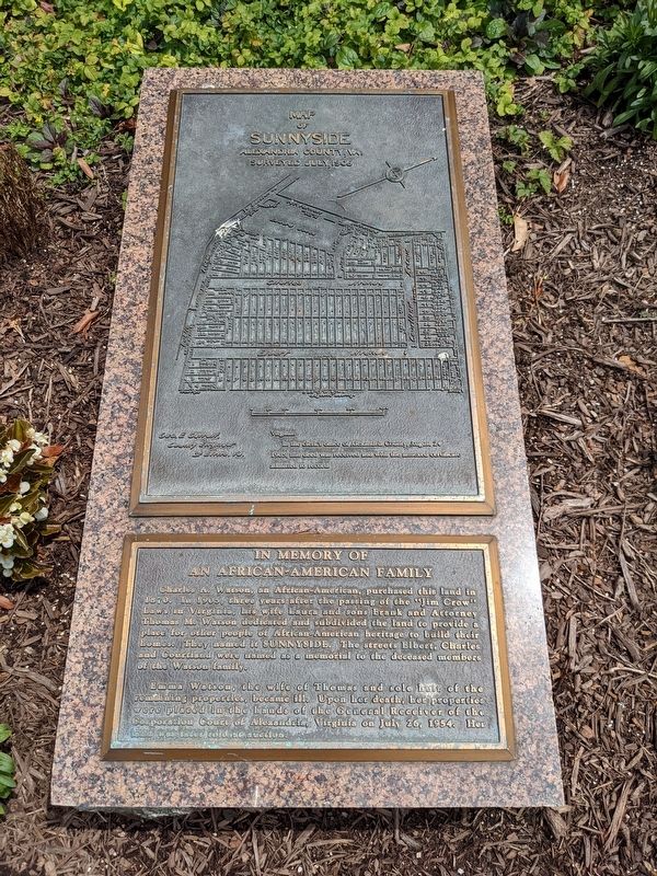
Map of Sunnyside / In Memory of an African-American Family Marker
| 101 ► Virginia, Alexandria, Potomac West — In Memory of an African-American Family — |
| On Charles Avenue at Shorter Lane, on the right when traveling north on Charles Avenue. | |||
| 102 ► Virginia, Alexandria, Potomac West — Ruby Tucker — (1932 - 2009) — |
| On Richmond Highway (U.S. 1) just north of Lynhaven Drive, on the right when traveling south. | |||
| 103 ► Virginia, Alexandria, Potomac West — Schools in the Town of Potomac — Town of Potomac — 1908 - 1929 — |
| On Mount Vernon Avenue at Stewart Avenue, on the left when traveling north on Mount Vernon Avenue. | |||
| 104 ► Virginia, Alexandria, Potomac West — The Alexandria Almshouse — 1908 Town of Potomac 1929 — |
| On East Monroe Avenue at Leslie Avenue, on the right when traveling west on East Monroe Avenue. | |||
| 105 ► Virginia, Alexandria, Potomac West — E-151 — Universal Lodge No. 1 — |
| On Mount Vernon Avenue at East Oxford Avenue, on the right when traveling south on Mount Vernon Avenue. | |||
| 106 ► Virginia, Alexandria, Potomac Yard — The Alexanders & Agriculture — City of Alexandria Est. 1749 — Potomac Yard — |
| On Potomac Avenue north of East Glebe Road, on the right when traveling north. | |||
| 107 ► Virginia, Alexandria, Seminary Hill — "The Fort" and "Seminary" Community — Civil War to Civil Rights — City of Alexandria, est. 1749 — |
| On West Braddock Road, 0.2 miles west of Marlboro Drive, on the right when traveling west. | |||
| 108 ► Virginia, Alexandria, Seminary Hill — African Americans and the Civil War — Fleeing, Fighting and Working for Freedom — City of Alexandria, est. 1749 — |
| On West Braddock Road, 0.2 miles west of Marlboro Drive, on the right when traveling west. | |||
| 109 ► Virginia, Alexandria, Seminary Hill — Jackson Cemetery — City of Alexandria Est. 1749 — |
| Near West Braddock Road, 0.2 miles west of Marlboro Drive, on the right when traveling west. | |||
| 110 ► Virginia, Alexandria, Seminary Hill — Oakland Baptist Church Cemetery — City of Alexandria Est. 1749 — |
| Near West Braddock Road east of North Howard Street, on the right when traveling west. | |||
| 111 ► Virginia, Alexandria, Seminary Hill — The Oakland Baptist Church — City of Alexandria Est. 1749 — |
| Near West Braddock Road, 0.1 miles west of Marlboro Drive, on the right when traveling west. | |||
| 112 ► Virginia, Alexandria, Seminary Hill — This is Cameron Run! — |
| Near Eisenhower Avenue, 0.4 miles west of Cameron Parke Court, on the right when traveling west. | |||
| 113 ► Virginia, Alexandria, Seminary Hill — Within Its Walls — A Foundation for Education and Opportunity — |
| Near West Braddock Road, 0.1 miles east of North Howard Street, on the left when traveling east. | |||
| 114 ► Virginia, Alexandria, Southwest Quadrant — 1323 Duke Street – From Slavery to Freedom and Service — Alexandria Heritage Trail — |
| On West Street at Duke Street (Virginia Route 236) on West Street. | |||
| 115 ► Virginia, Alexandria, Southwest Quadrant — 1955 Gas Station — |
| Near South Washington Street just south of Church Street, on the right when traveling south. | |||
| 116 ► Virginia, Alexandria, Southwest Quadrant — E-89 — Alexandria Academy — |
| On Washington Street (Virginia Route 400) at Wolfe Street, on the right when traveling north on Washington Street. | |||
| 117 ► Virginia, Alexandria, Southwest Quadrant — Alexandria National Cemetery — |
| Near Wilkes Street west of Hamilton Avenue when traveling west. | |||
| 118 ► Virginia, Alexandria, Southwest Quadrant — E-124 — Alfred Street Baptist Church — |
| On Alfred Street at Duke Street (Virginia Route 236), on the right when traveling south on Alfred Street. | |||
| 119 ► Virginia, Alexandria, Southwest Quadrant — E-139 — Beulah Baptist Church — |
| On South Washington Street north of Wolfe Street, on the right when traveling north. | |||
| 120 ► Virginia, Alexandria, Southwest Quadrant — Contrabands and Freedmen Cemetery Memorial — |
| On South Washington Street south of Church Street, on the right when traveling south. | |||
| 121 ► Virginia, Alexandria, Southwest Quadrant — Contrabands and Freedmen Cemetery Memorial — |
| On Church Street at South Columbus Street when traveling north on Church Street. | |||
| 122 ► Virginia, Alexandria, Southwest Quadrant — Corner of Building Erected in 1960 — [Southwest corner] — |
| Near South Washington Street just south of Church Street, on the right when traveling south. | |||
| 123 ► Virginia, Alexandria, Southwest Quadrant — Corner of Building Erected in 1960 — [Southeast Corner] — |
| Near South Washington Street just south of Church Street, on the right when traveling south. | |||
| 124 ► Virginia, Alexandria, Southwest Quadrant — Douglass Cemetery — circa, 1827 — |
| On Wilkes Street, 0.1 miles west of South Payne Street, on the right when traveling west. | |||
| 125 ► Virginia, Alexandria, Southwest Quadrant — Former USCT Burial Ground — Rather Die Freemen Than Live To Be Slaves — |
| Near South Washington Street at Church Street, on the right when traveling south. | |||
| 126 ► Virginia, Alexandria, Southwest Quadrant — E-131 — Franklin and Armfield Slave Office — (1315 Duke Street) — |
| On Duke Street (Virginia Route 236). | |||
| 127 ► Virginia, Alexandria, Southwest Quadrant — E-109 — Freedmen’s Cemetery — |
| On South Washington Street (Local Route 400) at Church Street, on the right when traveling south on South Washington Street. | |||
| 128 ► Virginia, Alexandria, Southwest Quadrant — Graves — |
| Near South Washington Street just south of Church Street, on the right when traveling south. | |||
| 129 ► Virginia, Alexandria, Southwest Quadrant — Graves Under South Washington Street — |
| On South Washington Street at Church Street, on the right when traveling south on South Washington Street. | |||
| 130 ► Virginia, Alexandria, Southwest Quadrant — E-134 — L’Ouverture Hospital — |
| On Prince Street east of South West Street, on the right when traveling east. | |||
| 131 ► Virginia, Alexandria, Southwest Quadrant — L'Overture Hospital HQ — February 15, 1864 — |
| On South Payne Street south of Prince Street, on the right when traveling south. | |||
| 132 ► Virginia, Alexandria, Southwest Quadrant — E-140 — Roberts Memorial United Methodist Church — |
| On South Washington Street (Virginia Route 400) south of Gibbon Street, on the right when traveling north. | |||
| 133 ► Virginia, Alexandria, Southwest Quadrant — E-136 — Shiloh Baptist Church — |
| On Duke Street (Virginia Route 236) at South West Street, on the right when traveling west on Duke Street. | |||
| 134 ► Virginia, Alexandria, Southwest Quadrant — The West End — Alexandria Heritage Trail — |
| Near Jamieson Avenue at Daingerfield Road, on the right when traveling west. | |||
| 135 ► Virginia, Alexandria, Southwest Quadrant — Welcome to Contrabands and Freedmen Cemetery Memorial — |
| On South Washington Street (Virginia Route 400) north of Capital Beltway Inner Loop (Interstate 95), on the left when traveling north. | |||
| 136 ► Virginia, Alexandria, Taylor Run — Chinquapin Trek — Alexandria Heritage Trail — |
| On Chinquapin Drive, 0.1 miles south of King Street (Virginia Route 7), on the right when traveling north. | |||
| 137 ► Virginia, Alleghany County, Clifton Forge — L-17 — Roger Arliner Young — (1898–1964) — |
| On Main Street (Business U.S. 60) at Jefferson Avenue, on the right when traveling east on Main Street. | |||
| 138 ► Virginia, Amelia County, Amelia Court House — 10 — Mrs. Samantha Jane Neil — Amelia Court House, Virginia — Civil Rights in Education Heritage Trail® |
| On Virginia Street at Church Street, on the right when traveling south on Virginia Street. Reported permanently removed. | |||
| 139 ► Virginia, Amelia County, Amelia Court House — AM2 — Mrs. Samantha Jane Neil — Amelia Court House, Virginia — Amelia County — |
| On Virginia Street (Virginia Route 1009) at Church Street (Virginia Route 1003), on the right when traveling south on Virginia Street. | |||
| 140 ► Virginia, Amelia County, Amelia Court House — 9 — Russell Grove Presbyterian Church and School — Amelia Court House, Virginia — Civil Rights in Education Heritage Trail® |
| On Otterburn Road (Virginia Route 614) 0.1 miles south of Leidig Street (Virginia Route 634), on the left when traveling south. Reported permanently removed. | |||
| 141 ► Virginia, Amelia County, Amelia Court House — AM1 — Russell Grove Presbyterian Church and School — Amelia Court House, Virginia — Amelia County — |
| On Otterburn Road (Virginia Route 614) 0.1 miles south of Leidig Street (Virginia Route 634), on the right when traveling north. | |||
| 142 ► Virginia, Amelia County, Jetersville — Amelia Springs — Two Days of Action — Lee's Retreat — |
| On Amelia Springs Road (Virginia Route 642) 0.2 miles south of St. James Road, on the right when traveling north. | |||
| 143 ► Virginia, Amherst County, Amherst — R-26 — Central High School — |
| On Gordons Fairgrounds Road (Virginia Route 777) 0.1 miles south of Richmond Highway (U.S. 60), on the left when traveling south. | |||
| 144 ► Virginia, Amherst County, Amherst — R-23 — The Courage of Frank Padget — |
| On South Main Street (U.S. 29) west of Star Street, on the right when traveling south. | |||
| 145 ► Virginia, Amherst County, Sweet Briar — Sweet Briar Plantation Slave Cabin — African-American Heritage at Sweet Briar College — |
| On Chapel Road just west of Elijah Road, on the right when traveling west. | |||
| 146 ► Virginia, Appomattox County, Appomattox — M-37 — African American Banjoists — |
| On Old Courthouse Road (Virginia Route 24) 0.2 miles south of Joel Sweeney Lane (Virginia Route 710), on the left when traveling east. | |||
| 147 ► Virginia, Appomattox County, Appomattox — 2 — Carver-Price School — Civil Rights in Education Heritage Trail — Appomattox, Virginia - Appomattox County |
| On Confederate Boulevard (U.S. 460), on the right when traveling west. Reported permanently removed. | |||
| 148 ► Virginia, Appomattox County, Appomattox — AP2 — Carver-Price School — Appomattox, Virginia — Civil Rights in Education Heritage Trail® — |
| On Confederate Boulevard (Business U.S. 460) at Virginia Route 9021, on the right when traveling west on Confederate Boulevard. | |||
| 149 ► Virginia, Appomattox County, Appomattox — 3 — Education in 1800's Rural Virginia — Civil Rights in Education Heritage Trail — Appomattox, Virginia - Appomattox County |
| On Old Courthouse Road. Reported permanently removed. | |||
| 150 ► Virginia, Appomattox County, Appomattox — M-68 — Popularizer of the Banjo — |
| On Old Courthouse Road (State Highway 24), on the right when traveling west. | |||
| 151 ► Virginia, Appomattox County, Appomattox — AP3 — The First African American School in Appomattox — Appomattox, Virginia — Appomattox County — |
| On Old Courthouse Road (Virginia Route 24) 0.2 miles east of Gordon Drive, on the right when traveling east. | |||
| 152 ► Virginia, Appomattox County, Appomattox — The Isbell House — (the white house in the distance) — |
| On National Park Drive, 0.2 miles north of Old Courthouse Road (Virginia Route 24), on the right when traveling north. | |||
| 153 ► Virginia, Appomattox County, Appomattox — 1 — Winonah Camp / Mozella Price Home — Appomattox, Virginia — Civil Rights in Education Heritage Trail® |
| On Confederate Boulevard (U.S. 460), on the right when traveling west. Reported permanently removed. | |||
| 154 ► Virginia, Appomattox County, Appomattox — AP1 — Winonah Camp / Mozella Price Home — |
| On Confederate Boulevard (Business U.S. 460) at Virginia Route 9021, on the right when traveling west on Confederate Boulevard. | |||
| 155 ► Virginia, Arlington County, Arlington, Arlington National Cemetery — Matthew Alexander Henson — Co-discoverer of the North Pole — |
| 156 ► Virginia, Arlington County, Arlington, Arlington View — Albert I. Cassell — 1895 - 1969 — |
| On South Quinn Street at 13th Street South, on the right when traveling north on South Quinn Street. | |||
| 157 ► Virginia, Arlington County, Arlington, Arlington View — George Washington Carver Cooperative Apartments — 1943 - 2015 — |
| On 13th Street South at South Quinn Street, on the right when traveling west on 13th Street South. | |||
| 158 ► Virginia, Arlington County, Arlington, Arlington View — Harry W. Gray House — |
| On 10th Street South at South Quinn Street, on the right when traveling east on 10th Street South. | |||
| 159 ► Virginia, Arlington County, Arlington, Bluemont — Human Rights — Ellen's Trace — |
| On Wilson Boulevard west of North Vermont Street, on the right when traveling west. | |||
| 160 ► Virginia, Arlington County, Arlington, Boulevard Manor — The W&OD Railway and Jim Crow Laws — |
| On Washington and Old Dominion Trail, 0.1 miles south of 8th Road North, on the right when traveling north. | |||
| 161 ► Virginia, Arlington County, Arlington, Cherrydale — Cherrydale Drug Fair Sit-In — |
| On Langston Boulevard (Route 29) just east of North Pollard Street, on the right when traveling west. | |||
| 162 ► Virginia, Arlington County, Arlington, Cherrydale — Stratford Junior High School — |
| On North Vacation Lane east of 23rd Street North, on the left when traveling north. | |||
| 163 ► Virginia, Arlington County, Arlington, Cherrydale — Take Action! — |
| Near Vacation Lane, 0.1 miles east of 23rd Street North, on the right when traveling east. | |||
| 164 ► Virginia, Arlington County, Arlington, Cherrydale — Taking Action: Barbara Johns — |
| Near Vacation Lane, 0.1 miles east of 23rd Street North, on the right when traveling east. | |||
| 165 ► Virginia, Arlington County, Arlington, Cherrydale — Taking Action: Dorothy M. Bigelow Hamm — |
| Near Vacation Lane, 0.1 miles west of Military Road, on the left when traveling west. | |||
| 166 ► Virginia, Arlington County, Arlington, Cherrydale — Taking Action: E. Leslie Hamm, Jr. — |
| Near Vacation Lane, 0.1 miles south of 23rd Street North, on the right when traveling east. | |||
| 167 ► Virginia, Arlington County, Arlington, Cherrydale — Taking Action: Michael Jones, Gloria Thompson, Ronald Deskins, Lance Newman — |
| Near Vacation Lane, 0.1 miles east of 23rd Street North, on the right when traveling east. | |||
| 168 ► Virginia, Arlington County, Arlington, Columbia Forest — Original Federal Boundary Stone, District of Columbia, Southwest 6 — Southwest No. 6 Boundary Marker — |
| On South Jefferson Street, 0.1 miles south of Columbia Pike (Virginia Route 244), in the median. | |||
| 169 ► Virginia, Arlington County, Arlington, Columbia Heights — Selina Gray — 🔑 — |
| On 12th Street South at South Ross Street, on the right when traveling east on 12th Street South. | |||
| 170 ► Virginia, Arlington County, Arlington, Court House — Korean War — |
| On Clarendon Boulevard just east of Washington Boulevard, on the right when traveling west. | |||
| 171 ► Virginia, Arlington County, Arlington, Court House — World War I — |
| On Clarendon Boulevard south of North Hudson Street, on the left when traveling west. | |||
| 172 ► Virginia, Arlington County, Arlington, Court House — World War II — |
| On Wilson Bouleard west of North Hudson Street, on the left when traveling west. | |||
| 173 ► Virginia, Arlington County, Arlington, Crystal City — Fort Runyon after the Civil War — |
| On 6th Street South east of Long Bridge Drive, on the right when traveling east. | |||
| 174 ► Virginia, Arlington County, Arlington, East Falls Church — Benjamin Banneker Park Playground — Dream Big! Explore Your World! — |
| On 18th Street North east of North Underwood Street, on the right when traveling east. | |||
| 175 ► Virginia, Arlington County, Arlington, Fort Myer — "Lest We Forget - We Stand on Your Shoulders" — |
| On Ord and Weitzel Drive. | |||
| 176 ► Virginia, Arlington County, Arlington, Fort Myer — Kingdom of my childhood — Arlington House, The Robert E. Lee Memorial — George Washington Memorial Parkway, National Park Service, U.S. Department of the Interior — |
| Near Sherman Drive, 0.1 miles north of Sheridan Drive, on the right when traveling north. | |||
| 177 ► Virginia, Arlington County, Arlington, Fort Myer — 555th Parachute Infantry Battalion — "Triple Nickels" "Smoke Jumpers" — 1943 - 1947 — |
| 178 ► Virginia, Arlington County, Arlington, Fort Myer — 92d Infantry Division — |
| 179 ► Virginia, Arlington County, Arlington, Fort Myer — A Garden Sustains — Arlington House, The Robert E. Lee Memorial — National Park Service, U.S. Department of the Interior — |
| Near Sherman Drive. | |||
| 180 ► Virginia, Arlington County, Arlington, Fort Myer — A Place of Division and Reunification — Arlington House — George Washington Memorial Parkway, National Park Service, U.S. Department of the Interior — |
| On Sherman Drive north of Sheridan Drive, on the right when traveling north. | |||
| 181 ► Virginia, Arlington County, Arlington, Fort Myer — African American Veterans of the Korean War — 1950-1953 — |
| 182 ► Virginia, Arlington County, Arlington, Fort Myer — Buffalo Soldiers — Centennial Ceremony — July 1, 1898 - July 1, 1998 — |
| 183 ► Virginia, Arlington County, Arlington, Fort Myer — Dependence on Slave Labor — Arlington House, The Robert E. Lee Memorial — National Park Service, U.S. Department of the Interior — |
| Near Sherman Drive, 0.1 miles south of Lincoln Drive, on the left when traveling south. | |||
| 184 ► Virginia, Arlington County, Arlington, Fort Myer — Division and Reunification — Arlington House, The Robert E. Lee Memorial — George Washington Memorial Parkway, National Park Service, U.S. Department of the Interior — |
| Near Sherman Drive, 0.1 miles north of Sheridan Drive, on the right when traveling north. | |||
| 185 ► Virginia, Arlington County, Arlington, Fort Myer — Evolving Vision — Arlington House, The Robert E. Lee Memorial — George Washington Memorial Parkway, National Park Service, U.S. Department of the Interior — |
| Near Sheridan Drive, 0.1 miles east of Humphreys Drive, on the right when traveling north. | |||
| 186 ► Virginia, Arlington County, Arlington, Fort Myer — Growing Season — Arlington House, The Robert E. Lee Memorial — George Washington Memorial Parkway, National Park Service, U.S. Department of the Interior — |
| Near Sherman Drive north of Sheridan Drive, on the right when traveling north. | |||
| 187 ► Virginia, Arlington County, Arlington, Fort Myer — Guardian of a Nation's Heritage — Arlington House, The Robert E. Lee Memorial — National Park Service, U.S. Department of the Interior — |
| Near Sherman Drive, 0.2 miles south of Lincoln Drive, on the left when traveling south. | |||
| 188 ► Virginia, Arlington County, Arlington, Fort Myer — Hallowed Ground — Arlington House, The Robert E. Lee Memorial — George Washington Memorial Parkway, National Park Service, U.S. Department of the Interior — |
| Near Sherman Drive, 0.1 miles north of Sheridan Drive, on the right when traveling north. | |||
| 189 ► Virginia, Arlington County, Arlington, Fort Myer — Long Haul — Arlington House, The Robert E. Lee Memorial — George Washington Memorial Parkway, National Park Service, U.S. Department of the Interior — |
| On Sherman Drive, 0.1 miles Sheridan Drive, on the right when traveling north. | |||
| 190 ► Virginia, Arlington County, Arlington, Fort Myer — Montford Point Marines — The First Black Marines — 1942 - 1949 — |
| 191 ► Virginia, Arlington County, Arlington, Fort Myer — Piecing the Past Together — Arlington House, The Robert E. Lee Memorial — George Washington Memorial Parkway — |
| Near Sherman Drive, 0.2 miles south of Lincoln Drive, on the left when traveling south. | |||
| 192 ► Virginia, Arlington County, Arlington, Fort Myer — Sailors, Coast Guardsmen and Marines of African and Asian-Pacific Descent — Cooks, Stewards, and Messmen — |
| 193 ► Virginia, Arlington County, Arlington, Fort Myer — Selina Gray |
| Reported permanently removed. | |||
| 194 ► Virginia, Arlington County, Arlington, Fort Myer — The "Buffalo Soldiers" — |
| On Marshall Drive west of North Meade Street, on the right when traveling west. | |||
| 195 ► Virginia, Arlington County, Arlington, Fort Myer — The Gray Family — Arlington House, The Robert E. Lee Memorial — George Washington Memorial Parkway — |
| Near Sherman Drive, 0.2 miles south of Lincoln Drive, on the left when traveling south. | |||
| 196 ► Virginia, Arlington County, Arlington, Fort Myer — The Path to Freedom — Arlington House, The Robert E. Lee Memorial — George Washington Memorial Parkway, National Park Service, U.S. Department of the Interior — |
| Near Sherman Drive at Sheridan Drive, on the right when traveling north. | |||
| 197 ► Virginia, Arlington County, Arlington, Fort Myer — The Tuskegee Airmen of World War II — They Accepted the Challenge — |
| 198 ► Virginia, Arlington County, Arlington, Fort Myer — Tree Ring Timeline — |
| On Sherman Drive north of Sheridan Drive, on the right when traveling south. | |||
| 199 ► Virginia, Arlington County, Arlington, Foxcroft Heights — Freedman’s Village — A New Home for African Americans — |
| On South Oak Street at Southgate Road, on the right when traveling north on South Oak Street. | |||
| 200 ► Virginia, Arlington County, Arlington, Foxcroft Heights — Freedman's Village — |
| On South Oak Street at Southgate Road, on the right when traveling north on South Oak Street. | |||
1631 entries matched your criteria. Entries 101 through 200 are listed above. ⊲ Previous 100 — Next 100 ⊳