After filtering for Texas, 902 entries match your criteria. The first 100 are listed. ⊳
Texas Independence War Topic
By James Hulse, April 25, 2024
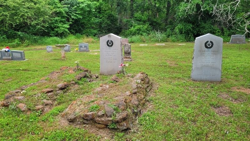
The Dickinson Parker Marker is the second marker on the right side
| 1 ► Texas, Anderson County, Elkhart — 8795 — Dickinson Parker — |
| 2 ► Texas, Anderson County, Elkhart — 8736 — Miles Bennett — |
| 3 ► Texas, Anderson County, Elkhart — 8794 — Rev. Daniel Parker — |
| 4 ► Texas, Andrews County, Andrews — 167 — Andrews County — |
| 5 ► Texas, Aransas County, Lamar — 1547 — John Fagan — |
| 6 ► Texas, Aransas County, Lamar — 5103 — Stella Maris Chapel — |
| 7 ► Texas, Archer County, Holliday — 722 — Captain John Holliday — (Dec. 8, 1811 - Aug. 19, 1842) — |
| 8 ► Texas, Atascosa County, Poteet — 4819 — Site of Jose Antonio Navarro Ranch Headquarters — (2.3 Mi. SSE) — |
| 9 ► Texas, Austin County, Bellville — 243 — Austin County — |
| 10 ► Texas, Austin County, Bellville — 366 — Early History of Bellville Methodist Church — |
| 11 ► Texas, Austin County, Cat Spring — 14296 — Elemelech Swearingen — (September 25, 1805 - May 15, 1887) — |
| 12 ► Texas, Austin County, Industry — 1941 — Charles Fordtran — (May 7, 1801-Nov. 1, 1900) — |
| 13 ► Texas, Austin County, Industry — 1499 — Friedrich Ernst — |
| 14 ► Texas, Austin County, Industry — 1500 — John Friedrich Ernst, Jr. — |
| 15 ► Texas, Austin County, Kenney — 17874 — Concord Cemetery — |
| 16 ► Texas, Austin County, Kenney — 6360 — James Bradford Pier — (Nov. 23, 1813 - Feb. 5, 1888) — |
| 17 ► Texas, Austin County, Kenney — 2925 — John Wesley Kenney — (1799-1865) — |
| 18 ► Texas, Austin County, San Felipe — A Home on Commerce Square — Lots 537 & 538 — |
| 19 ► Texas, Austin County, San Felipe — 5514 — A Town Hall — |
| 20 ► Texas, Austin County, San Felipe — Austin & Perry Stores — Lots 16 & 51 — |
| 21 ► Texas, Austin County, San Felipe — 3 — Austin's Colony: First Colony in Mexican Texas — |
| 22 ► Texas, Austin County, San Felipe — Bottomland Farms — Land Along the Brazos River — |
| 23 ► Texas, Austin County, San Felipe — Building the Town — Lot 20 — |
| 24 ► Texas, Austin County, San Felipe — Business District — Neighborhood to the West — |
| 25 ► Texas, Austin County, San Felipe — Clopper Store — Lot 17 — |
| 26 ► Texas, Austin County, San Felipe — Cotten Print Shop — Lot 50 — Cotten Print Shop - Travis Law Office — |
| 27 ► Texas, Austin County, San Felipe — 11707 — Early Roads To San Felipe — |
| 28 ► Texas, Austin County, San Felipe — Founding the Town — Lot 47 — |
| 29 ► Texas, Austin County, San Felipe — Governing the Town — Lot 19 — |
| 30 ► Texas, Austin County, San Felipe — 11704 — Hill House — |
| 31 ► Texas, Austin County, San Felipe — 2678 — J.J. Josey General Store — |
| 32 ► Texas, Austin County, San Felipe — Jane Wilkins' Home — Lot 82 — |
| 33 ► Texas, Austin County, San Felipe — John Bricker — |
| 34 ► Texas, Austin County, San Felipe — 6 — Remembering San Felipe de Austin — |
| 35 ► Texas, Austin County, San Felipe — Rio Brazos — Commerce Square — |
| 36 ► Texas, Austin County, San Felipe — 4536 — San Felipe de Austin — |
| 37 ► Texas, Austin County, San Felipe — San Felipe de Austin Town Site — |
| 38 ► Texas, Austin County, San Felipe — Spanish Town — Commerce and Mier y Terán Streets 1/2 Mile East — |
| 39 ► Texas, Austin County, San Felipe — Stephen F. Austin, Father of Texas — |
| 40 ► Texas, Austin County, San Felipe — 249 — Stephen F. Austin's Cabin — Reported missing |
| 41 ► Texas, Austin County, San Felipe — 5 — The Burning of San Felipe — |
| 42 ► Texas, Austin County, San Felipe — 4 — Toward Revolution — |
| 43 ► Texas, Austin County, San Felipe — Travis Law Office — Lot 50 — Travis Law Office - Cotten Print Shop — |
| 44 ► Texas, Austin County, San Felipe — 1 — Welcome to San Felipe de Austin — |
| 45 ► Texas, Austin County, Wallis — 6344 — Martin Allen — (November 28, 1780 - December 30, 1837) — |
| 46 ► Texas, Bandera County, Bandera — 18801 — Hendrick Arnold — Survey No. 59 — Colored Burial Ground — |
| 47 ► Texas, Bastrop County, Bastrop — 9233 — Campbell Taylor — |
| 48 ► Texas, Bastrop County, Bastrop — 9163 — Captain James Burleson — |
| 49 ► Texas, Bastrop County, Bastrop — 9151 — Early History of the City of Bastrop — |
| 50 ► Texas, Bastrop County, Bastrop — 9185 — Felipe Entrique Neri, Baron De Bastrop — 1770 - 1829 — |
| 51 ► Texas, Bastrop County, Bastrop — 9192 — Jesse Halderman — |
| 52 ► Texas, Bastrop County, Bastrop — 9202 — John Holland Jenkins — |
| 53 ► Texas, Bastrop County, Bastrop — 9220 — Robert Love Reding — |
| 54 ► Texas, Bastrop County, Bastrop — 9240 — Samuel Wolfenberger — (1804 - 1860) — |
| 55 ► Texas, Bastrop County, Bastrop — 13114 — Thomas H. Mays — |
| 56 ► Texas, Bastrop County, Bastrop — 9176 — William Dunbar — |
| 57 ► Texas, Bastrop County, Elgin — 9171 — Site of the Home of Col. Robert M. Coleman — (1799 -1837) — |
| 58 ► Texas, Bastrop County, Jeddo — 9175 — John Socrates Darling — |
| 59 ► Texas, Bastrop County, Jeddo — Rev. Benjamin F. Fry — |
| 60 ► Texas, Bastrop County, McDade — Capt. Jesse Billingsley — 1810-1880 — |
| 61 ► Texas, Bastrop County, McDade — 9194 — John Herron — |
| 62 ► Texas, Bastrop County, Smithville — 9228 — Stephen Scallorn — |
| 63 ► Texas, Bee County, Beeville — 2155 — George Home — |
| 64 ► Texas, Bee County, Beeville — 3315 — Medio Creek — Significant natural landmark — |
| 65 ► Texas, Bell County, Belton — 3516 — Mrs. Sarah Ann Hardin-Kelton — |
| 66 ► Texas, Bell County, Belton — 15622 — Norman Austin — (August 2, 1811 – May 12, 1890) — |
| 67 ► Texas, Bell County, Belton — 5859 — Wilson Van Dyke — (Dec 25, 1817 - Aug. 3, 1881) — |
| 68 ► Texas, Bell County, Salado — E.S.C. Robertson — |
| 69 ► Texas, Bell County, Salado — The Robertson and Sutherland Family — |
| 70 ► Texas, Bexar County, San Antonio, Alamo Plaza — 4 Pound Replica Cannons — |
| 71 ► Texas, Bexar County, San Antonio, Alamo Plaza — 86 — Adina de Zavala — (November 28, 1861 – March 1, 1955) — |
| 72 ► Texas, Bexar County, San Antonio, Alamo Plaza — 96 — Alamo Low Barracks and Main Gateway — |
| 73 ► Texas, Bexar County, San Antonio, Alamo Plaza — Alamo Sesquicentennial Monument — |
| 74 ► Texas, Bexar County, San Antonio, Alamo Plaza — An Archaeological Puzzle — Archaeology for Preservation — |
| 75 ► Texas, Bexar County, San Antonio, Alamo Plaza — Battle of the Alamo — |
| 76 ► Texas, Bexar County, San Antonio, Alamo Plaza — Cannon From the Battle of the Alamo — |
| 77 ► Texas, Bexar County, San Antonio, Alamo Plaza — Cannon From the Battle of the Alamo — |
| 78 ► Texas, Bexar County, San Antonio, Alamo Plaza — Cannon From the Battle of the Alamo — |
| 79 ► Texas, Bexar County, San Antonio, Alamo Plaza — Cannon From the Battle of the Alamo — |
| 80 ► Texas, Bexar County, San Antonio, Alamo Plaza — Clara Driscoll — Lest We Forget — |
| 81 ► Texas, Bexar County, San Antonio, Alamo Plaza — Clara Driscoll, Saviour of the Alamo — In Memoriam — |
| 82 ► Texas, Bexar County, San Antonio, Alamo Plaza — Colonel William B. Travis — |
| 83 ► Texas, Bexar County, San Antonio, Alamo Plaza — David Crockett — (1786-1836) — Frontiersman, American Humorist, Politician and Alamo Defender — |
| 84 ► Texas, Bexar County, San Antonio, Alamo Plaza — Defender of the Alamo — |
| 85 ► Texas, Bexar County, San Antonio, Alamo Plaza — Digging Back in Time — Archaeology for Preservation — |
| 86 ► Texas, Bexar County, San Antonio, Alamo Plaza — Emily West Morgan (1815-1891) — The "Yellow Rose of Texas" — |
| 87 ► Texas, Bexar County, San Antonio, Alamo Plaza — Founding of the Mission and Origin of Name — |
| 88 ► Texas, Bexar County, San Antonio, Alamo Plaza — From Republic to Early Statehood — 1837-1885 — |
| 89 ► Texas, Bexar County, San Antonio, Alamo Plaza — From Warehouse to Shrine — 1886-1997 — |
| 90 ► Texas, Bexar County, San Antonio, Alamo Plaza — Gonzales Men at the Alamo — |
| 91 ► Texas, Bexar County, San Antonio, Alamo Plaza — Hendrick Arnold (1804-1849) — Guide and Spy of the Texas Revolution — |
| 92 ► Texas, Bexar County, San Antonio, Alamo Plaza — Heroes of the Alamo — |
| 93 ► Texas, Bexar County, San Antonio, Alamo Plaza — In Honor of the Women and Children of the Alamo — February 23 - March 6, 1836 — |
| 94 ► Texas, Bexar County, San Antonio, Alamo Plaza — James Bowie — (1796-1836) — Frontiersman, Entrepreneur, Soldier and Alamo Defender — |
| 95 ► Texas, Bexar County, San Antonio, Alamo Plaza — Japanese Monument to The Heroes of the Alamo — |
| 96 ► Texas, Bexar County, San Antonio, Alamo Plaza — John William Smith, 'El Colorado' — (1792-1845) — Alamo Courier, Scout, Mayor of San Antonio and Senator — |
| 97 ► Texas, Bexar County, San Antonio, Alamo Plaza — Juan Nepomuceno Seguín — (1806-1890) — Statesman, Scout, Courier and Mayor of San Antonio — |
| 98 ► Texas, Bexar County, San Antonio, Alamo Plaza — Letter From The Alamo — |
| 99 ► Texas, Bexar County, San Antonio, Alamo Plaza — Lt. Col. William Barret Travis — |
| 100 ► Texas, Bexar County, San Antonio, Alamo Plaza — Masonic Heroes of the Alamo — |
902 entries matched your criteria. The first 100 are listed above. Next 100 ⊳