After filtering for Texas, 1254 entries match your criteria. The first 100 are listed. ⊳
Education Topic
By James Hulse, September 26, 2022
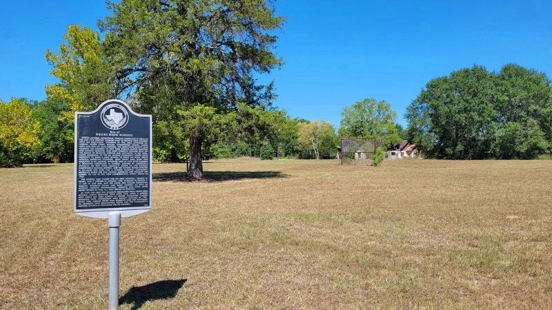
The Site of Henry High School and Marker
| 1 ► Texas, Anderson County, Elkhart — 13082 — Site of Henry High School — |
| On West Parker Street (State Highway 294) 0.1 miles west of Davis Street, on the right when traveling west. | |||
| 2 ► Texas, Anderson County, Frankston — 8783 — Mount Vernon United Methodist Church — |
| On County Highway 436 at County Highway 435, on the left when traveling south on County Highway 436. | |||
| 3 ► Texas, Anderson County, Palestine — 12859 — Alonzo Marion Story — |
| On Loop State Highway 256 at Moody Street, on the left when traveling south on State Highway 256. | |||
| 4 ► Texas, Anderson County, Palestine — 16336 — Dr. Bonner Frizzell — |
| On South Micheaux Street, on the right when traveling north. | |||
| 5 ► Texas, Anderson County, Palestine — 8790 — Palestine High School — |
| On South Micheaux Street, on the right when traveling north. | |||
| 6 ► Texas, Anderson County, Palestine — 17650 — Purvey Lee (P. L.) Chism — |
| On East Lacy Street, on the right when traveling east. | |||
| 7 ► Texas, Anderson County, Palestine — 17672 — Roy B. Wallace — |
| On South Micheaux Street, on the right when traveling north. | |||
| 8 ► Texas, Anderson County, Palestine — 12643 — Site of Woodhouse School — |
| On State Highway 294, 0.5 miles east of U.S. 79, on the right when traveling east. | |||
| 9 ► Texas, Anderson County, Palestine — 17554 — William Freeman — |
| Near Moody Street east of Birch Street, on the right when traveling east. | |||
| 10 ► Texas, Angelina County, Burke — 11655 — Burke School — |
| On Tidwell Road (County Road 62), on the left when traveling west. | |||
| 11 ► Texas, Angelina County, Burke — 6995 — Fairview School — |
| On Farm to Market Road 2108, on the left when traveling south. | |||
| 12 ► Texas, Angelina County, Central — 12780 — Central Consolidated School — |
| On U.S. 69, on the right when traveling north. | |||
| 13 ► Texas, Angelina County, Diboll — 8718 — Prairie Grove — |
| On Prairie Grove Road (County Road 263) near Farm to Market Road 1818, on the left when traveling south. | |||
| 14 ► Texas, Aransas County, Rockport — 13653 — Rockport School — |
| On North Live Oak Street at East Laurel Street, on the right when traveling south on North Live Oak Street. | |||
| 15 ► Texas, Armstrong County, Claude — 5524 — Town of Claude — |
| On 1st Street (U.S. 287) at Trice Street, on the left when traveling west on 1st Street. | |||
| 16 ► Texas, Atascosa County, Jourdanton — 17017 — Jourdanton Independent School District — |
| On Zanderson Avenue (State Highway 16) at Plum Street, on the left when traveling north on Zanderson Avenue. | |||
| 17 ► Texas, Atascosa County, Lytle — 61 — Atascosa Lodge No. 379, A.F. and A.M. — |
| On Somerset Road at Laredo Road on Somerset Road. | |||
| 18 ► Texas, Atascosa County, Pleasanton — 3797 — Old Rock Schoolhouse — |
| On West College Street at North Smith Street, on the right when traveling west on West College Street. | |||
| 19 ► Texas, Atascosa County, Pleasanton — 16243 — Pleasanton School Integration — |
| On W. Adams Street. | |||
| 20 ► Texas, Austin County, Burleigh — Grant School — |
| On Farm to Market Road 529, 0.8 miles west of Farm to Market Road 331, on the right when traveling west. | |||
| 21 ► Texas, Austin County, Nelsonville — Nelsonville School — |
| On Nelsonville Church Road, 0.1 miles west of Farm to Market Road 159, on the right when traveling west. | |||
| 22 ► Texas, Austin County, Phillipsburg — 4477 — Saint Paul Lutheran Church — |
| On Phillipsburg Church Road at Phillipsburg Church Road, on the right when traveling south on Phillipsburg Church Road. | |||
| 23 ► Texas, Austin County, Phillipsburg — 16904 — St. Paul Lutheran Church Cemetery - Phillipsburg — |
| On Sempronius Road at Phillipsburg Church Road, on the left when traveling west on Sempronius Road. | |||
| 24 ► Texas, Austin County, San Felipe — San Felipe School — |
| On 6th Street at Tres Palacios Street, on the right when traveling east on 6th Street. | |||
| 25 ► Texas, Austin County, Wallis — Hartsville Cemetery — |
| On 36th Division Memorial Highway (State Highway 36) 3 miles north of Farm to Market Road 1093, on the left when traveling north. | |||
| 26 ► Texas, Austin County, Wallis — J.O. Williams School — |
| On Columbus Road, 0.1 miles east of Marek Street, on the left when traveling east. | |||
| 27 ► Texas, Austin County, Wallis — Wallis High School — |
| On Guyler Street at Cedar Street, on the right when traveling north on Guyler Street. | |||
| 28 ► Texas, Austin County, Wallis — Wallis Independent — |
| On Columbus Road, 0.1 miles east of Marek Street, on the left when traveling east. | |||
| 29 ► Texas, Austin County, Wesley — Wesley School — |
| On Wesley Church Lane, 0.4 miles south of Farm to Market Road 2502, on the left when traveling south. | |||
| 30 ► Texas, Bandera County, Bandera — 2071 — Frontier Times Museum — |
| On 13th Street at Pecan Street, on the right when traveling north on 13th Street. | |||
| 31 ► Texas, Bandera County, Bandera — 5082 — St. Stanislaus Convent and First Catholic School — |
| On 7th Street, on the right when traveling west. | |||
| 32 ► Texas, Bandera County, Pipe Creek — Polly's Schoolhouse, 1892, — J.P. Rodriguez Settlement 1858-1935 — Help Us Save — |
| On Bear Creek Road at Privilege Creek Road, on the right when traveling north on Bear Creek Road. | |||
| 33 ► Texas, Bandera County, Vanderpool — 4862 — Site of Old Taylor School — |
| On Farm to Market Road 187, 0.3 miles north of West Sabinal Road, on the left when traveling north. | |||
| 34 ► Texas, Bastrop County, Bastrop — Kerr — |
| Near State Highway 95, 0.1 miles north of Farm Street. | |||
| 35 ► Texas, Bastrop County, Bastrop — 18314 — Mina Ward School — |
| On Main Street at Hawthorn Street, on the right when traveling north on Main Street. | |||
| 36 ► Texas, Bastrop County, Bastrop — 9149 — Old Bastrop Academy Bell — |
| On Main Street at Farm Street, on the right when traveling north on Main Street. | |||
| 37 ► Texas, Bastrop County, Bastrop — 9156 — Site of Bastrop Military Institute — |
| On Church Street at Buttonwood Street, on the right when traveling south on Church Street. | |||
| 38 ► Texas, Bastrop County, Elgin — 13463 — Pleasant Grove Cemetery — |
| On Pleasant Grove Loop (County Highway 91) 0.7 miles east of Pleasant Grove Road (County Highway 84). | |||
| 39 ► Texas, Bastrop County, Smithville — 9242 — Young School House and Cemetery — |
| On Young School House Road (County Road 280) west of Easley Road, on the right when traveling west. | |||
| 40 ► Texas, Baylor County, Seymour — 12746 — Westover School — |
| On State Highway 114, 0.4 miles east of Hale Road, on the right when traveling west. | |||
| 41 ► Texas, Bee County, Beeville — 15488 — Lott Canada School — |
| On West Corpus Christi Street (U.S. 59) at North Burke Street, on the right when traveling west on West Corpus Christi Street. | |||
| 42 ► Texas, Bee County, Beeville — Lott-Canada School — |
| On West Corpus Christi Street (U.S. 59) at North Burke Street, on the right when traveling west on West Corpus Christi Street. | |||
| 43 ► Texas, Bee County, Beeville — 3840 — McClanahan House — |
| On East Corpus Christi Street, on the right when traveling east. | |||
| 44 ► Texas, Bee County, Beeville — 13297 — West Side School for Mexican Americans — |
| On North Jackson Street at West 1st Street on North Jackson Street. | |||
| 45 ► Texas, Bee County, Beeville — 5824 — William E. Madderra Home — |
| On North Adams Street. | |||
| 46 ► Texas, Bell County, Bartlett — 314 — Bartlett Grammar School — |
| Near Bell Street. | |||
| 47 ► Texas, Bell County, Bartlett — 12974 — Site of Booker T. Washington School — |
| On Cryer Dr., on the right when traveling east. | |||
| 48 ► Texas, Bell County, Bartlett — 2177 — Site of German-English School — (50 Yards West) — |
| Near State Highway 95. | |||
| 49 ► Texas, Bell County, Belton — 45 — A Memorial to Civil War Education in Texas — |
| On Vann Circle west of College Street, on the left when traveling east. | |||
| 50 ► Texas, Bell County, Belton — 4296 — Distinguished Texan Robert Emmet Bledsoe Baylor — (1793-1873) — |
| On Moore Avenue north of West Martin Luther King Jr Avenue, on the right when traveling north. | |||
| 51 ► Texas, Bell County, Belton — 13713 — Luther Memorial — |
| On Vann Circle west of College Street, on the right when traveling west. | |||
| 52 ► Texas, Bell County, Holland — 12512 — Post Oak Cemetery — |
| On Farm to Market Road 1123, 0.2 miles west of Roberts Road, on the right when traveling west. | |||
| 53 ► Texas, Bell County, Killeen — 251 — Avenue D School — |
| On North College Street at West Avenue D, on the right when traveling south on North College Street. | |||
| 54 ► Texas, Bell County, Salado — 18413 — Alice Gray Hamblen — |
| On North Main Street at Old Town Road, on the right when traveling north on North Main Street. | |||
| 55 ► Texas, Bell County, Salado — 3237 — Birthplace of White House Aide Mary Elizabeth Carpenter — |
| Near Interstate 35 Frontage Road. | |||
| 56 ► Texas, Bell County, Salado — 12600 — Dr. Samuel J. and Charlotte H. Jones — |
| Near Baines St. | |||
| 57 ► Texas, Bell County, Salado — 13331 — Dr. Welborn Barton and Louisa Adeline Barton — |
| Near Baines Street. | |||
| 58 ► Texas, Bell County, Salado — From Salado College to Thomas Arnold High School (1890 to 1913) — Historic Salado College Park — |
| Near South Main Street (Farm to Market Road 2268) at College Hill Drive. | |||
| 59 ► Texas, Bell County, Salado — George Washington Baines — Dec 29, 1809 - Dec 28, 1882 — |
| On Baines Street at Salado Oaks Drive, on the right when traveling north on Baines Street. | |||
| 60 ► Texas, Bell County, Salado — 279 — George Washington Baines House — |
| On Royal Street, on the right when traveling west. | |||
| 61 ► Texas, Bell County, Salado — Hamblen-Aiken Cemetery — |
| On Van Bibber Road, 0.1 miles east of North Main Street, on the left when traveling east. | |||
| 62 ► Texas, Bell County, Salado — 14567 — Hermon and Margaret L. Aiken — |
| Near Baines St. | |||
| 63 ► Texas, Bell County, Salado — 2535 — Home of Elijah Sterling Clack Robertson — |
| Near Interstate 35 Frontage Road. | |||
| 64 ► Texas, Bell County, Salado — 5586 — Home of Orville Thomas Tyler — 1810 - 1856 — |
| On South Main Street, on the right when traveling south. | |||
| 65 ► Texas, Bell County, Salado — 16533 — James Lowry Smith — (1827-1883) — |
| On Baines Street at Salado Oaks Drive, on the right when traveling north on Baines Street. | |||
| 66 ► Texas, Bell County, Salado — Judge Paine L. Bush - Salado Son — March 3, 1890 - June 29, 1980 — |
| Near South Main Street (Farm to Market Road 2268) at College Hill Drive, on the right when traveling north. | |||
| 67 ► Texas, Bell County, Salado — 13500 — Louisa Adeline (Addie) Barton — |
| Near South Main Street (Farm to Market Road 2268) at Pace Park Road. | |||
| 68 ► Texas, Bell County, Salado — 4348 — Major Archibald Johnson Rose — 1830 - 1903 — |
| On Rose Way Circle, on the right when traveling north. | |||
| 69 ► Texas, Bell County, Salado — Old Salado Church of Christ — |
| On North Main Street (Farm to Market Road 2268) 0.1 miles south of Blacksmith Street, on the left when traveling north. | |||
| 70 ► Texas, Bell County, Salado — Salado and College Established Together — Historic Salado College Park — |
| Near South Main Street (Farm to Market Road 2268) at College Hill Drive. | |||
| 71 ► Texas, Bell County, Salado — 4491 — Salado Cemetery — |
| On Baines St, on the right when traveling south. | |||
| 72 ► Texas, Bell County, Salado — Salado College: The Early Years — Historic Salado College Park — |
| Near South Main Street (Farm to Market Road 2268) at College Hill Drive. | |||
| 73 ► Texas, Bell County, Salado — Site of Salado College — |
| On South Main Street (Farm to Market Road 2268) at College Hill Drive, on the right when traveling north on South Main Street. | |||
| 74 ► Texas, Bell County, Salado — 5464 — Site of Thomas Arnold High School — |
| On College Hill Drive at Main Street, on the right when traveling east on College Hill Drive. | |||
| 75 ► Texas, Bell County, Salado — The College Grows... — Historic Salado College Park — |
| Near South Main Street (Farm to Market Road 2268) at College Hill Drive. | |||
| 76 ► Texas, Bell County, Salado — The Robertson and Sutherland Family — |
| Near South Main Street (Farm to Market Road 2268) at College Hill Drive, on the right when traveling north. | |||
| 77 ► Texas, Bell County, Temple — 1954 — Former Site of Scott & White School of Nursing — |
| On South 31st Street at Scott Blvd, on the right when traveling north on South 31st Street. | |||
| 78 ► Texas, Bell County, Temple — 17670 — Knob Creek Lodge No. 401 — |
| On South 2nd Street at East Central Avenue, on the right when traveling south on South 2nd Street. | |||
| 79 ► Texas, Bell County, Temple — 16797 — Nora Lee Mayhew Wendland — (September 10, 1896 - April 15, 1988) — |
| Near North Front Street at East Shell Avenue. | |||
| 80 ► Texas, Bell County, Temple — 4613 — Scott & White Hospital — |
| On South 31st Street at Scott Blvd, on the right when traveling north on South 31st Street. | |||
| 81 ► Texas, Bell County, Temple — 5223 — Temple Public Library — |
| On N. Main Street at E. Adams Avenue (State Highway 53), on the right when traveling north on N. Main Street. | |||
| 82 ► Texas, Bexar County, Boldtville — 447 — Boldtville Schoolhouse — |
| Near New Sulphur Springs Road east of Foster Road, on the left when traveling east. | |||
| 83 ► Texas, Bexar County, Lackland Air Force Base, Lackland AFB — Aviation Cadets — |
| On Kenly Avenue at Truemper Street, on the right when traveling north on Kenly Avenue. | |||
| 84 ► Texas, Bexar County, Lackland Air Force Base, Lackland AFB — MTI Monument — |
| 85 ► Texas, Bexar County, Lackland Air Force Base, Lackland AFB — OCS Class 62-A — |
| On Kenly Avenue at Truemper Street, on the right when traveling south on Kenly Avenue. | |||
| 86 ► Texas, Bexar County, Lackland Air Force Base, Lackland AFB — USAF Officer Candidate School — Lackland AFB 1947 to 1963 — Enlisted Stripes to Officer Bars — |
| On Truemper Street at Kenly Avenue, on the right when traveling west on Truemper Street. | |||
| 87 ► Texas, Bexar County, Randolph Air Force Base, Northeast Side — 567 — Building 100 — "The Taj Mahal" — |
| On Washington Circle at Northwest Drive, on the right when traveling east on Washington Circle. | |||
| 88 ► Texas, Bexar County, Randolph Air Force Base, Northeast Side — Cessna T-37 Tweet — |
| On C Street East at Northeast Drive, on the right when traveling west on C Street East. | |||
| 89 ► Texas, Bexar County, Randolph Air Force Base, Northeast Side — Gas and Electric Sub Station — |
| 90 ► Texas, Bexar County, Randolph Air Force Base, Northeast Side — Post Chapel — |
| 91 ► Texas, Bexar County, Randolph Air Force Base, Northeast Side — PX Filling Station — |
| 92 ► Texas, Bexar County, San Antonio, Alamo Plaza — 3925 — Founding of the Pan American Round Table — |
| 93 ► Texas, Bexar County, San Antonio, Alamo Plaza — Menger Hotel — Literary Landmarks Register — Friends of Libraries U.S.A. — |
| 94 ► Texas, Bexar County, San Antonio, Arsenal — 15407 — Elias and Lucy Edmonds House — |
| On King William Street south of East Sheridan Street, on the right when traveling south. | |||
| 95 ► Texas, Bexar County, San Antonio, Arsenal — 18742 — Mary Virginia Burkholder — |
| On Madison Street north of Beauregard Street, on the right when traveling north. | |||
| 96 ► Texas, Bexar County, San Antonio, Downtown — 788 — Central Catholic High School — |
| On North St. Mary's Street at Augusta Street, on the left when traveling north on North St. Mary's Street. | |||
| 97 ► Texas, Bexar County, San Antonio, Downtown — 3819 — Old St. Mary's College — (1852 – 1966) — |
| On College Street, on the right when traveling east. | |||
| 98 ► Texas, Bexar County, San Antonio, Downtown — Saint Mary's Church — Founded 1852 — |
| On North Saint Mary's Street at College Street, on the left when traveling south on North Saint Mary's Street. | |||
| 99 ► Texas, Bexar County, San Antonio, Downtown — 4520 — San Antonio High School — |
| On North Main Avenue at Buffalo Run, on the right when traveling south on North Main Avenue. | |||
| 100 ► Texas, Bexar County, San Antonio, Downtown — 4269 — Site of Rincon/Douglass School — |
| On Augusta Street at Convent Street, on the left when traveling north on Augusta Street. | |||
1254 entries matched your criteria. The first 100 are listed above. Next 100 ⊳