After filtering for Colorado, 323 entries match your criteria. Entries 101 through 200 are listed.⊲ Previous 100 — Next 100 ⊳
Industry & Commerce Topic
By Mark Hilton, September 5, 2023
City Drug Marker on very corner of building.
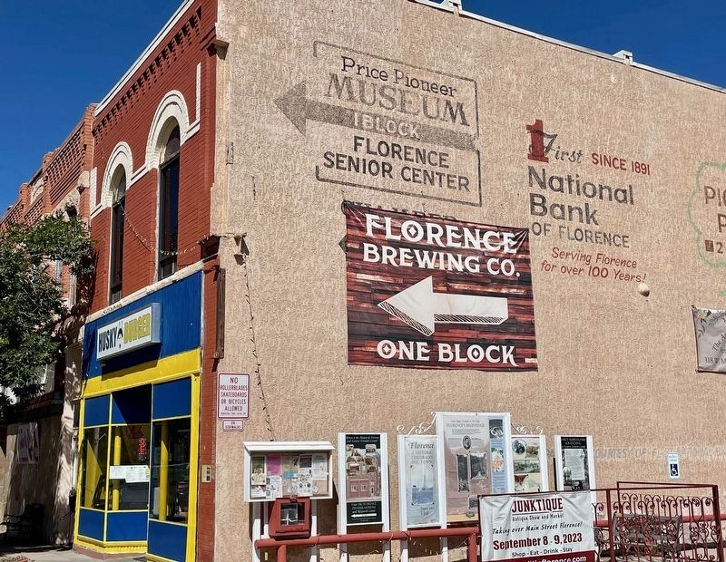
| 101 ► Colorado, Fremont County, Florence — City Drug — 106 West Main Street — Constructed 1890-1895 — |
| On West Main Street (Colorado Route 115) at North Pikes Peak Avenue (Colorado Route 67), on the right when traveling west on West Main Street. | |||
| 102 ► Colorado, Fremont County, Florence — Early Agriculture & Ranching — in Eastern Fremont County — |
| On West Main Street (State Highway 115) at North Pikes Peak Avenue (State Highway 67), on the right when traveling east on West Main Street. | |||
| 103 ► Colorado, Fremont County, Florence — J. C. Penney — 118 West Main Street — Constructed 1928 — |
| On West Main Street (Colorado Route 115) west of North Pikes Peak Avenue, on the right when traveling west. | |||
| 104 ► Colorado, Fremont County, Florence — James A. McCandless House — 120 North Pikes Peak Avenue — Constructed in 1889 • Architects: Balcomb and Rice — |
| On North Pikes Peak Avenue (Colorado Route 67) at East 2nd Street, on the left when traveling south on North Pikes Peak Avenue. | |||
| 105 ► Colorado, Fremont County, Florence — Julius McCandless Hardware — 124 West Main Street — Architect and Builder: Unknown — |
| On West Main Street (Colorado Route 115) west of West Pikes Peak Avenue, on the right when traveling west. | |||
| 106 ► Colorado, Fremont County, Florence — Lovell Block — 132 West Main Street — Constructed in 1894 — |
| On West Main Street (Colorado Route 115) at North Santa Fe Avenue, on the right when traveling west on West Main Street. | |||
| 107 ► Colorado, Fremont County, Florence — The Daniels Block Building — 112-114 West Main Street — Constructed in 1897 — |
| On West Main Street (Colorado Route 115) west of North Pikes Peak Avenue, on the right when traveling west. | |||
| 108 ► Colorado, Fremont County, Penrose — Arkansas River Valley |
| On U.S. 50, 0.2 miles east of Phantom Canyon Road, on the right when traveling west. Reported damaged. | |||
| 109 ► Colorado, Fremont County, Penrose — Arkansas Valley Country — |
| On U.S. 50, 0.2 miles east of Phantom Canyon Road (County Road 67), on the right when traveling west. | |||
| 110 ► Colorado, Fremont County, Penrose — Corrections Capital |
| On U.S. 50, 0.2 miles east of Phantom Canyon Road (County Road 67), on the right when traveling west. Reported damaged. | |||
| 111 ► Colorado, Fremont County, Penrose — The Royal Gorge — |
| On U.S. 50, 0.2 miles east of Phantom Canyon Road (County Road 67), on the right when traveling west. | |||
| 112 ► Colorado, Garfield County, Glenwood Springs — "The First National Bank Building" — 802 Grand Avenue — |
| On 8th Street at Grand Avenue (State Route 82), on the right when traveling east on 8th Street. | |||
| 113 ► Colorado, Garfield County, Glenwood Springs — Hughes-Anderson Building — |
| On Grand Avenue (Colorado Route 82) north of 9th Street, on the right when traveling north. | |||
| 114 ► Colorado, Garfield County, Glenwood Springs — Immigrants Found Future in Colorado — |
| On 8th Street east of Grand Avenue, on the right when traveling east. | |||
| 115 ► Colorado, Garfield County, Glenwood Springs — McCoy-Armory Building — |
| On Grand Avenue (Colorado Route 82) at 9th Street, on the right when traveling south on Grand Avenue. | |||
| 116 ► Colorado, Garfield County, Glenwood Springs — The Hotel Glenwood — |
| On Grand Avenue (Colorado Route 82) north of 8th Street, on the right when traveling north. | |||
| 117 ► Colorado, Garfield County, Glenwood Springs — When the Railroads Arrived in Glenwood Springs — |
| On 8th Street east of Grand Avenue, on the right when traveling east. | |||
| 118 ► Colorado, Garfield County, New Castle — 4 — Barry Building — New Castle Museum on the Street — |
| On West Main Street at North 5th Street, on the right when traveling west on West Main Street. | |||
| 119 ► Colorado, Garfield County, New Castle — New Castle Coal Mine Memorial — |
| On West Main Street at North 2nd Street, on the right when traveling east on West Main Street. | |||
| 120 ► Colorado, Gilpin County, Black Hawk — Fick’s Carriage Shop — |
| On Main Street (Mt, Thomas Drive). | |||
| 121 ► Colorado, Gilpin County, Central City — The Ignatz Meyer Building — |
| On Main Street. | |||
| 122 ► Colorado, Grand County, Grand Lake — Cairns-Humphrey Store — |
| On Grand Avenue east of Pitkin Street, on the right when traveling east. | |||
| 123 ► Colorado, Grand County, Grand Lake — The Smith-Eslick Cottage Camp — |
| On Lake Avenue at Cairns Street, on the left when traveling east on Lake Avenue. | |||
| 124 ► Colorado, Grand County, Grand Lake — The Smith-Eslick Family — |
| On Vine Street north of Lake Avenue, on the left when traveling north. | |||
| 125 ► Colorado, Gunnison County, Gunnison — Bell Grinder — |
| On Adams Street south of Tomichi Avenue (U.S. 50), on the left when traveling south. | |||
| 126 ► Colorado, Gunnison County, Gunnison — Engine #268 (Cinderella) — Denver & Rio Grande Western — |
| On Tomichi Avenue (U.S. 50) at Adams Street, on the right when traveling east on Tomichi Avenue. | |||
| 127 ► Colorado, Gunnison County, Gunnison — Gunnison Country — |
| 128 ► Colorado, Gunnison County, Gunnison — Ho For The Gunnison! — |
| On Tomichi Avenue (U.S. 50) east of Teller Street, on the left when traveling east. | |||
| 129 ► Colorado, Gunnison County, Gunnison — Jaw Crusher — |
| On Adams Street south of Tomichi Avenue (U.S. 50), on the left when traveling south. | |||
| 130 ► Colorado, Gunnison County, Gunnison — Jaw Crusher-Roll Jaw- — |
| On Adams Street south of Tomichi Avenue, on the left when traveling south. | |||
| 131 ► Colorado, Gunnison County, Gunnison — King Coal — |
| 132 ► Colorado, Gunnison County, Gunnison — Mine Ore Cart — |
| On Adams Street just south of Tomichi Avenue (U.S. 50), on the left when traveling south. | |||
| 133 ► Colorado, Gunnison County, Gunnison — Potato Digger — |
| On Adams Street south of Tomichi Avenue, on the left when traveling south. | |||
| 134 ► Colorado, Gunnison County, Gunnison — Potato Planter — |
| On Adams Street south of Tomichi Avenue, on the left when traveling south. | |||
| 135 ► Colorado, Gunnison County, Gunnison — Two Great Trains — |
| On Tomichi Avenue (U.S. 50) east of Teller Street, on the left when traveling east. | |||
| 136 ► Colorado, Gunnison County, Gunnison — Water Pump — |
| On Adams Street south of Tomichi Avenue (U.S. 50), on the left when traveling south. | |||
| 137 ► Colorado, Hinsdale County, Lake City — A Town with Three Names — |
| On County Highway 30, 1.5 miles east of County Highway 12, on the right when traveling west. | |||
| 138 ► Colorado, Hinsdale County, Lake City — Bonanza Empire Chief — |
| On Highway 20, 4.5 miles west of Highway 24, on the right when traveling west. | |||
| 139 ► Colorado, Hinsdale County, Lake City — Lee's Legacy — |
| On County Highway 20, 0.1 miles west of County Highway 24, on the right when traveling west. | |||
| 140 ► Colorado, Hinsdale County, Lake City — Rose Lime Kiln — |
| On County Highway 20, 4 miles west of County Highway 24, on the left when traveling west. | |||
| 141 ► Colorado, Hinsdale County, Lake City — Tellurium or Was It Whitecross — |
| On County Highway 30, 1.5 miles east of County Highway 12, on the right when traveling west. | |||
| 142 ► Colorado, Hinsdale County, Lake City — Troops Enroute — |
| On Highway 20, 4 miles west of South Gunnison Avenue (Highway 149), on the left when traveling west. | |||
| 143 ► Colorado, Hinsdale County, Lake City — Ute-Ulay — |
| On County Highway 20, on the left when traveling west. | |||
| 144 ► Colorado, Hinsdale County, Lake City — White Death — |
| On County Highway 20, 4.5 miles west of Highway 24, on the right when traveling west. | |||
| 145 ► Colorado, Jackson County, Walden — Fur Hat: The Opening of North Park — |
| Near Colorado Route 14, 3 miles south of Walden, on the right when traveling south. | |||
| 146 ► Colorado, Jackson County, Walden — Ranching: An Enduring Legacy — |
| Near Colorado Route 14, 3 miles south of Walden, on the right when traveling south. | |||
| 147 ► Colorado, Jackson County, Walden — Riches From the Earth — |
| Near Colorado Route 14, 3 miles south of Walden, on the right when traveling south. | |||
| 148 ► Colorado, Jackson County, Walden — Timber: A Growing Need — |
| Near Colorado Route 14, 3 miles south of Walden, on the right when traveling south. | |||
| 149 ► Colorado, Jefferson County, Golden — 922 Washington Avenue — Stewart Block Building — |
| On Washington Avenue north of 11th Street, on the right when traveling north. | |||
| 150 ► Colorado, Jefferson County, Golden — Arapahoe City — |
| On W 44th Ave (County Route 58) 0.1 miles west of McIntyre Street, on the left when traveling west. | |||
| 151 ► Colorado, Jefferson County, Golden — Brewing on Clear Creek-Coors History — |
| On Washington Avenue. | |||
| 152 ► Colorado, Jefferson County, Golden — Down by the Old Mill Stream — |
| Near Cheyenne Street. | |||
| 153 ► Colorado, Jefferson County, Golden — Ferrell/Berthoud Home (Miners Hotel) — |
| On Washington Avenue. | |||
| 154 ► Colorado, Jefferson County, Golden — First Building Site — |
| On Washington Avenue south of 10th Street, on the right when traveling north. | |||
| 155 ► Colorado, Jefferson County, Golden — Gold — |
| On Washington Avenue Bridge, on the right when traveling north. | |||
| 156 ► Colorado, Jefferson County, Golden — Gold in Clear Creek — |
| On Washington Avenue. | |||
| 157 ► Colorado, Jefferson County, Golden — 5JF1798 — Goosetown Tavern — |
| On 10th Street at Vasquez Street, on the right when traveling west on 10th Street. | |||
| 158 ► Colorado, Jefferson County, Golden — Jolly Rancher 1113 Washington Avenue — City of Golden, Downtown Landmark, Historic Preservation Board — |
| On Washington Avenue. | |||
| 159 ► Colorado, Jefferson County, Golden — Porcelain and Malted Milk — |
| On Washington Avenue. | |||
| 160 ► Colorado, Jefferson County, Golden — Settler Farm Wife’s Initiative — |
| On Washington Avenue Bridge, on the right when traveling north. | |||
| 161 ► Colorado, Jefferson County, Golden — Stop 7: Laramie Formation (68 mya) Clay Pits Fault, Fire Clay Mining, Reclamation — |
| On 12th Street. | |||
| 162 ► Colorado, Jefferson County, Golden — Stop 7a: White Ash Mine — |
| On 12th Street, 0.1 miles west of Maple Street, on the left when traveling west. | |||
| 163 ► Colorado, Jefferson County, Golden — The Astor House — |
| On 12th Street east of Arapahoe Street, on the right when traveling west. | |||
| 164 ► Colorado, Jefferson County, Golden — The White Ash Mine Disaster — |
| On Washington Avenue. | |||
| 165 ► Colorado, Jefferson County, Morrison — John Brisben Walker — |
| Near Vine Street. | |||
| 166 ► Colorado, Jefferson County, Red Rocks Park — Red Rocks Park — |
| Near Trading Post Road at Ship Rock Road. | |||
| 167 ► Colorado, La Plata County, Bayfield — 1 — Bayfield Drug Store — Bayfield Historic Walking Tour Stop 1 — 11 West Mill Street — |
| On Mill Street at Pearl Street, on the right when traveling east on Mill Street. | |||
| 168 ► Colorado, La Plata County, Bayfield — 6 — Glenn Bros General Store — Bayfield Historic Walking Tour Stop 6 — 24 E. Mill Street — |
| On Mill Street east of Pearl Street, on the left when traveling east. | |||
| 169 ► Colorado, La Plata County, Bayfield — 8 — H.C. Schroder House — Bayfield Historic Walking Tour Stop 8 — |
| On Mill Street east of Pine Street, on the right when traveling east. | |||
| 170 ► Colorado, La Plata County, Bayfield — 9 — Hotel Central & Akers Motor Co. Garage — Bayfield Historic Walking Tour Stop 9 — |
| On Mill Street east of Pine Street, on the right when traveling east. | |||
| 171 ► Colorado, La Plata County, Bayfield — 7 — Schroder Store / Coulson Bros. — Bayfield Historic Walking Tour Stop 7 — |
| On Mill Street east of Pine Street, on the right when traveling east. | |||
| 172 ► Colorado, La Plata County, Durango — Durango - Silverton Narrow Gauge Railroad — |
| On Main Avenue at 5th Street, on the right when traveling south on Main Avenue. | |||
| 173 ► Colorado, La Plata County, Durango — 6 — Early Durango circa 1889 — |
| On Main Avenue at 11th Street, on the right when traveling north on Main Avenue. | |||
| 174 ► Colorado, La Plata County, Durango — Rocky Mountain Chocolate Factory — |
| On Main Avenue south of College Drive, on the right when traveling south. | |||
| 175 ► Colorado, La Plata County, Durango — 17 — Southern Durango with views of Smelter Mountain — circa mid-1890s — |
| On Rim Drive south of West Campus Court, on the right when traveling south. | |||
| 176 ► Colorado, La Plata County, Durango — Trails to Rails — Routes to Southwest Colorado 1 — |
| On Main Avenue at East 5th Street, on the left when traveling south on Main Avenue. | |||
| 177 ► Colorado, La Plata County, Durango — Trails to Rails — Routes to Southwest Colorado 2 — |
| On Main Avenue at East 5th Street, on the left when traveling south on Main Avenue. | |||
| 178 ► Colorado, La Plata County, Hesperus — The Old Spanish Trail — |
| On U.S. 160, 0.8 miles west of Cherry Creek Road, on the left when traveling west. | |||
| 179 ► Colorado, Lake County, Climax — Climax — Where Colorado History is Still Being Made — |
| Near State Highway 91, 11 miles south of Interstate 70, on the right when traveling south. | |||
| 180 ► Colorado, Lake County, Climax — Highway in the Sky — |
| Near State Highway 91, 11 miles south of Interstate 70, on the right when traveling south. | |||
| 181 ► Colorado, Lake County, Climax — Life on the High Line — |
| Near State Highway 91, 11 miles south of Interstate 70, on the right when traveling south. | |||
| 182 ► Colorado, Lake County, Climax — More Than Just a Mine — |
| Near State Highway 91, 11 miles south of Interstate 70, on the right when traveling south. | |||
| 183 ► Colorado, Lake County, Climax — The Big Shot — |
| Near State Highway 91, 11 miles south of Interstate 70, on the right when traveling south. | |||
| 184 ► Colorado, Lake County, Climax — The Highest Compost Pile in the World — |
| Near State Highway 91, 11 miles south of Interstate 70, on the right when traveling south. | |||
| 185 ► Colorado, Lake County, Climax — Water Treatment Protects Downstream Users — |
| Near Colorado Route 91, 11 miles south of Interstate 70, on the right when traveling south. | |||
| 186 ► Colorado, Lake County, Climax — Welcome to Climax! — |
| Near State Highway 91, 11 miles south of Interstate 70, on the right when traveling south. | |||
| 187 ► Colorado, Lake County, Leadville — David May — |
| On Harrison Avenue south of West 4th Street, on the right when traveling north. | |||
| 188 ► Colorado, Larimer County, Bellvue — Bellvue Hydraulic Irrigation Laboratory — |
| On Rist Canyon Road, 1.5 miles west of US 287 B (U.S. 287 B), on the right when traveling west. | |||
| 189 ► Colorado, Larimer County, Bellvue — Old Flowers Store and Post Office — Built 1880's — By Jacob Flowers, Founder of Bellvue — |
| On Rist Canyon Road at North County Road 23 (County Road 23), on the left when traveling west on Rist Canyon Road. | |||
| 190 ► Colorado, Larimer County, Fort Collins — Mosman House — |
| On E Oak Street, on the left when traveling east. | |||
| 191 ► Colorado, Larimer County, Laporte — In 1862 This Log House was Used as a Station House — |
| On North Overland Trail Road, 0.3 miles south of US 287B Highway, on the right when traveling south. | |||
| 192 ► Colorado, Larimer County, Livermore — Site of Log Cabin, Colorado — 1888-1942 — |
| On Red Feather Lakes Rd (County Road 74E at milepost 16) at Boy Scout Rd (County Road 68C), on the right when traveling south on Red Feather Lakes Rd. | |||
| 193 ► Colorado, Larimer County, Loveland — Downtown Loveland Historic District — |
| On East 4th Street, on the right when traveling east. | |||
| 194 ► Colorado, Las Animas County, Kim — History of the Rourke Family and Wineglass Ranch, 1871-1900 — |
| Near Forest Road 2185 east of Rourke Road (County Highway 25). | |||
| 195 ► Colorado, Las Animas County, Ludlow — Company Towns — |
| On County Highway 44 at County Highway 61.5, on the right when traveling west on County Highway 44. | |||
| 196 ► Colorado, Las Animas County, Ludlow — Ludlow Tent Colony Site Memorial — The Ludlow Massacre — |
| Near Road 44 at 61.5. | |||
| 197 ► Colorado, Las Animas County, Ludlow — Tent Life — |
| On County Highway 44 at County Highway 61.5, on the right when traveling west on County Highway 44. | |||
| 198 ► Colorado, Las Animas County, Ludlow — The Story — |
| On County Highway 44 at County Highway 61.5, on the right when traveling west on County Highway 44. | |||
| 199 ► Colorado, Las Animas County, Trinidad — Coal Miners' Memorial — 1996 — |
| On West Main Street (U.S. 160) at North Convent Street, on the right when traveling west on West Main Street. | |||
| 200 ► Colorado, Las Animas County, Trinidad — The Last Coal Burning Steam Engine — |
| On Purgatoire Drive west of North Animas Street, on the left when traveling east. | |||
323 entries matched your criteria. Entries 101 through 200 are listed above. ⊲ Previous 100 — Next 100 ⊳