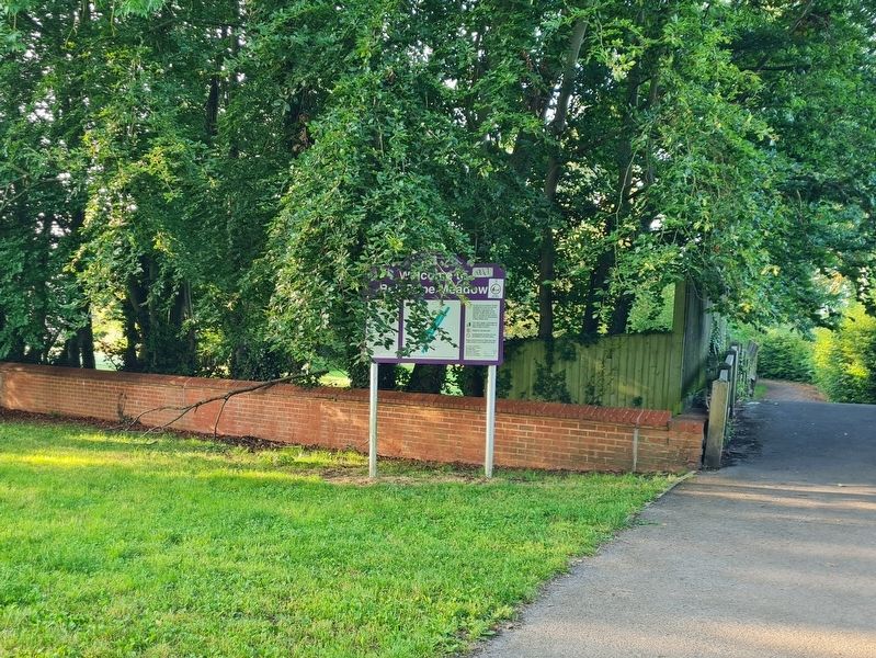
It is thought that the name Bell Rope Meadow originated from the meadow's past use, as a 'ropewalk'. All rope starts out as bundles of fibres, made into threads and stands and then into string or twine. Thick string is called cord. Rope is made by . . . — — Map (db m231969) HM
On Bartholomew Street, on the right when traveling south.
This building, called "Kimber's Corner" was from 1906 the site of Kimber's Grocers and Provision Merchants, the birthplace and home of
Elsie Lilly Kimber (1889-1954)
the first female Mayor of Newbury since the Council was created in 1596. . . . — — Map (db m234175) HM
You are now entering Forbury Gardens. In medieval times this was a rough patch of open ground, where horses grazed and pilgrims waited for services at the abbey church. At this time it was known as 'the Forbury'.
The Forbury became a town park . . . — — Map (db m242648) HM
Lawrence Hill, Warfield was named after TLB's founder Thomas Lawrence (1824-1901).
Thomas Lawrence and Sons thrived and is said to have produced ten million bricks per year in the 1890s.
Bracknell bricks were transported by cart and rail . . . — — Map (db m219500) HM
Church Street Gardens is the smallest public open space in Windsor. There used to be cottages here but these burnt down in around 1800. You can see the old cottage fireplaces on the wall at the back of the Gardens
Church Street is in the . . . — — Map (db m229531) HM
The first mention of The Carpenters Arms was in the Pigots Directory of 1844. It was listed in Queen Street, the original name for Market Street and James Humphreys held the licence. The name comes from the tradesmen who frequented the bar and it . . . — — Map (db m229522) HM
The earliest surving building connected with the government of Windsor. It was probably built in 1518 for the Trinity Guild which since the 13th century have provided the governing body for the town. The Three Tuns was alternatively known . . . — — Map (db m218892) HM
The Rose has been used as a name for inns since the Wars of the Roses in the 15th Century. The first Rose in Wokingham was on the north side of the market place, where it had been an inn since the 17th Century. It transferred to the present . . . — — Map (db m218675) HM
Originally named Bull Mansion, this was the residence of Chester's Recorder in 1533. It was refronted in the 18th century when it became an important coaching inn. George Borrow is thought to have stayed here during his tour of "Wild Wales" in . . . — — Map (db m216196) HM
On Pendennis Rise, 0.2 kilometers south of Castle Drive, on the right when traveling south.
Welcome to Falmouth Docks
The port of Falmouth’s greatest asset is its deep and sheltered harbour. Amny mariners throughout the centuries have long regarded Falmouth as the “First and Last Port” for ships crossing the Atlantic . . . — — Map (db m124042) HM
On Avenue Road at Campbeltown Way, on the right when traveling north on Avenue Road.
The granite pyramid was erected in 1737 by Martin Lister Killigrew the owner of Arwenack. He never stated specifically the purpose of it, but many have assumed it to be a memorial to the Killigrew family.
The Killigrew Family
The Killigrew s . . . — — Map (db m124012) HM
Near Castle Road, 0.6 kilometers west of Atlantic Road, on the right when traveling west.
The Haven
An Harber
The beach and headland at Tintagel appear to be wild and remote today, a haven for coastal plants and animals. But in the 19th century this area saw intensive use for mining, slate quarrying and fishing.
Beyond . . . — — Map (db m124110) HM
Near Kilburn Drive at Blackhills Road, on the right when traveling north.
British Coal Corporation
Horden Colliery
Shaft Ref. North
Shaft Diameter 6090 mm
Shaft Depth 438 M
Depth to top of cap from top of monument 2 M
Date of Capping Aug. 94 — — Map (db m125912) HM
On Great Dockray, on the left when traveling south.
Great Dockray is Penrith's largest open market and the location with Sandgate of the former Whitsunside and Martinmas hiring fairs, every Tuesday the street market held in earlier times bull-baiting took place here when it was an offence, punishable . . . — — Map (db m245889) HM
On Musbury Road at Church Street, on the right when traveling north on Musbury Road.
Historical Axminster
Cattle Market
A Charter was granted to the town in 1210, which included the right to hold a weekly market. The market was held in Market Square until 1834. It then moved to Trinity Square.
The Market then moved to this site . . . — — Map (db m123748) HM
On Silver Street at Church Street, on the right when traveling north on Silver Street.
Historical Axminster
The Old Carpet Factory
This large grey stone building was erected in 1828 on the site of Thomas Whitty’s original carpet factory, which was destroyed by fire two years earlier.
Closed as a factory in 1835, it was used as . . . — — Map (db m123751) HM
Near South Street at East Street (England Route B3162), on the left when traveling south.
No. 9 Last Street
This building originally The
George Inn was rebuilt by
renowned local Apothecary
Dr. Giles Roberts in 1804.
It was a Pharmacy until 1971. — — Map (db m123629) HM
Victoria Square's development in the 1860
came as a result of Portland Branch
Railway, which extended from Weymouth
to Portland. Construction on the line
commenced in 1860 and it opened on 16
October 1865. Terminating at a station at
the . . . — — Map (db m216342) HM
On St Mary Street, on the right when traveling north.
Built in the 16th century the Black Dog public house is one of the oldest pubs in the town. Although the date above the left ground floor window reads 1621 the back of the building is much older. The pub was originally called The Dove until the 16th . . . — — Map (db m216198) HM
On High Street at Fisher Street, on the left when traveling east on High Street.
Albion Russell (1821 – 1888)
opened a boot and shoe shop
here in 1861.
In 1873 he was joined by
George Bromley which led to
the founding of
today’s
Russell and Bromley. — — Map (db m129653) HM
On Herbrand Street at Colonnade when traveling south on Herbrand Street.
Friend at Hand was built in 1735 at the time of the Marylebone Road and adjoining Nash Terraces. The first ever omnibus service from Holborn stopped here. The original service of one coach each way was soon being increased to a dozen journeys per . . . — — Map (db m109813) HM
On Great Russell Street at Museum Street, on the right when traveling east on Great Russell Street.
The earliest record of the Museum Tavern was in 1723, although at that stage it was called "The Dog and Duck" after the hunting that took place in the surrounding Ponds and swamps. In 1759 the British Museum was established and the pub promptly . . . — — Map (db m109268) HM
On Gower Street at University Street, on the left when traveling south on Gower Street.
Close to this place
Richard Trevithick
Born 1771 - Died 1833
Pioneer of
High Pressure Steam
ran in the year 1808 the
first steam locomotive
to draw passengers — — Map (db m110144) HM
Near Holborn at Leather Lane, on the left when traveling west.
Sir Christopher Hatton (1540-1591), was Lord Chancellor of England and rumoured to be the lover of Queen Elizabeth I. In 1578 the Queen granted Christopher Hatton the grounds of Ely Palace on which Hatton House was built. In the 1600s Hatton . . . — — Map (db m118826) HM
On Wakefield Street just south of Tavistock Place.
Ernest
BOULTON
1847-1904
Frederick PARK
1846-1881
'Stella & Fanny'
Victorian
cross-dressers
lodged at
13 Wakefield Street
on this site
1868-1870 — — Map (db m115489) HM
On Museum Street at Little Russell Street, on the left on Museum Street.
The pub dates to the late Victorian era, and was much frequented by artists and writers before the war, when it was known as "The Baby's Bottom", perhaps because it was once painted pink. It was originally a Taylor Walker brewery pub (the original . . . — — Map (db m109267) HM
The earliest official reference to the tavern now known as The Queen's Larder is contained in a deed drawn up in 1710 when Sir Nathaniel Curzon let the house to a London Stationer named Matthew Allam. The mortgage was transferred during the . . . — — Map (db m109117) HM
On Fenchurch Street at Fenchurch Place, on the right when traveling east on Fenchurch Street.
East India Arms
The East India Company was incorporated on 31st December 1600.
Queen Elizabeth I signed the Charter creating ‘The Company of Merchants of London Trading to the East Indies’. Over 200 subscribers raised almost £70,000 — a . . . — — Map (db m121553) HM
Near Upper Thames Street at Queen Street Pl, on the right when traveling east.
This Foundation Stone was Laid by
The Duke of Gloucester G.C.V.O.
On the 31st October 1990
To Inaugurate the Construction of this Building on Behalf of
The Master, Wardens and Freemen and Commonality of the Mystery of Vintners
And
Wates . . . — — Map (db m117898) HM
On Goswell Road at Fann Street, on the left when traveling south on Goswell Road.
This frieze was removed from numbers 53 and 54 Barbican when it was demolished in 1962 and re-erected by the Corporation of London in 1975. Numbers 53 and 54 Barbican were the premises of W. Bryer & Sons Gold Refiners and assayers whose trade is . . . — — Map (db m118509) HM
On Noble Street at Oat Lane, on the right when traveling north on Noble Street.
This stone was laid by the Rt Hon
The Lord Mayor of London
Sir Edmund Stockdale
On March 10th 1960
G.B. Slater – Master
David Nye & Ptnrs Architects
Holloway Bros. Builders — — Map (db m118141) HM
Near Upper Thames Street at Queenhithe, on the right when traveling east.
Queenhithe was a thriving Saxon and medieval dock and is the only inlet surviving along the City waterfront today.
In AD 886 the Roman City was reoccupied by King Alfred the Great, the City walls providing some protection from Viking raids. . . . — — Map (db m117877) HM
On Broken Wharf at Trig Lane, on the right when traveling south on Broken Wharf.
This site was previously called
Sunlight Wharf
where the last working crane on the city waterfront
was operated by
LEP Transport Ltd
until
MCMLXXXII — — Map (db m117876) HM
Near Upper Thames Street at Kennett Wharf Lane, on the right when traveling east.
This plaque was erected in 1986 to mark the eleven hundredth anniversary of King Alfred's resettlement of the Roman city of London in 886, after the abandonment of the Saxon town which had existed for some three centuries in the Strand area to the . . . — — Map (db m117896) HM
On Fleet Street at Chancery Lane, on the right when traveling east on Fleet Street.
The Automobile Association opened
its first office in this building in the
year 1905.
This plaque was unveiled on the 28th June 1965 by
the Right Honourable The Lord Mayor of London,
Sir James Miller, D.L., LL.D., to mark the . . . — — Map (db m111121) HM
On Queen Victoria Street at New Bridge Street on Queen Victoria Street.
This Art Nouveau masterpiece was built in 1905 on the site of a former Dominican friary which existed from 1279 to 1539. Following the 260 years of the Dominican friars, the site became the parliament chamber of the monastery. It is believed that . . . — — Map (db m117074) HM
On Fleet Street at Whitefriars Street, on the right when traveling west on Fleet Street.
The pub was built on the side of a monastery which dated to 1300 where, amongst other duties, the monks brewed ale. This site was an island between the River Thames and River Fleet which still runs under the pub that is now little more than a . . . — — Map (db m116403) HM
Near Upper Thames Street at Bell Wharf Lane, on the right when traveling east.
Roman London
Walbrook Wharf is the point where the now buried Walbrook River fed into the River Thames. The Walbrook is one of London’s ‘Lost Rivers’, a watercourse which has been lost to time and history.
The Walbrook was a feature of . . . — — Map (db m117900) HM
On Fleet Street at Wine Office Court on Fleet Street.
Rebuilt 1667
in the reign of Charles II
and continued successively
in the Reigns of
James II 1685-1688
Interregnum Dec. 11, 1688 - Feb. 13, 1689
William III & Mary II 1609 - 1702
Anne 1702 - 1714
George I 1714 - 1727
George . . . — — Map (db m111396) HM
Near Cockspur Street at Whitehall, on the left when traveling east.
Imperial Standards of Length
Placed on this Site by the
Standards Department of the Board of Trade
By the Permission of the Commissioners of
Her Majesty’s Works and Public Buildings
MDCCCLXXXVI
( small plaque )
Imperial . . . — — Map (db m118036) HM
On Abbey Road just north of Grove End Road, on the left when traveling north.
Alan Dower Blumlein filed a patent for a two-channel audio system
called “stereo” on 14 December 1931. It included a “shuffling”
circuit to preserve directional sound, an orthogonal “Blumlein
Pair” of velocity microphones, the recording of two . . . — — Map (db m167118) HM
On Villiers Street at Watergate Walk, on the left when traveling south on Villiers Street.
Kipling House and the ground upon which it stands, enjoys an interesting and illustrious past. standing on the site of Norwich House, the town house of the Bishops of Norwich, which dates back to 1237. Upon the great dissolution of the monasteries . . . — — Map (db m122244) HM
On John Adam Street at Robert Street, on the right when traveling west on John Adam Street.
The
House of the
Royal Society for
The Encouragement
Of Arts Manufactures
and Commerce
Foundation Laid 28 March 1772
Completed 2 April 1774
Robert & James Adam
Architects — — Map (db m122120) HM
On Great Marlborough Street at Foubert's Place on Great Marlborough Street.
The Shakespeare's Head, which was built in 1735, was
originally owned by Thomas & John Shakespeare, who were
distant relatives of the poet.
In its early days, the tavern stood on the boundary line that
divided the lands of the Mercers Company . . . — — Map (db m120101) HM
On Bateman Street at Frith Street, on the right when traveling west on Bateman Street.
A Dog & Duck tavern has been on this site since at least 1734. The 18th Century pub was demolished in 1897, to be replaced by the present building.
It is thought to have one of London's most exquisite interiors of the late Victorian period. The . . . — — Map (db m111740) HM
On Essex Street at Devereux Court, on the left when traveling south on Essex Street.
Edgar Wallace was born April 1st, 1875 in Greenwich, London. When he was nine days old, Richard Horatio Edgar, was adopted by George Freeman, a porter at Billingsgate Fish Market, and grew up under the adopted name of Dick Freeman. At 11, he started . . . — — Map (db m111140) HM
On Oxford Street at Tottenham Court Road on Oxford Street.
The Flying Horse is the last remaining pub on Oxford Street. The current building was built in 1892 and had been called The Tottenham since then. Prior to 1892, another pub called The Flying Horse was located on the site which dates back to at least . . . — — Map (db m111433) HM
On Strand at Essex Street, on the left when traveling west on Strand.
The George was founded in 1723 as a coffee house, became Georges Hotel in 1830 and then a public house as it is today. Former regulars of The George include Horace Walpole, Oliver Goldsmith and Samuel Johnson, who for a while used The George as his . . . — — Map (db m111181) HM
On St. Martin’s Street close to Whitcomb Street, on the left when traveling south.
The
Hampton Site
In the sixteenth century this site adjoined the Royal Mews and was an area of stables and coach houses. Whitcomb Street was known as Hedge Lane. The Duke of Monmouth owned property here and gave his name to Monmouth Court which . . . — — Map (db m117769) HM
On Greek Street at Moor Street, on the left when traveling south on Greek Street.
The Three Greyhounds, an old English pub of around 1910, has a mock Tudor exterior made using artificial timbering, lead casements, small gables and big lanterns. The premises have been licensed since 1847, before when it was home to various shops, . . . — — Map (db m109256) HM
On Strand at Essex Street, on the right when traveling east on Strand.
Thomas Twining (1675-1741) founded the House of Twining by purchasing the original Toms Coffee House at the back of this site in 1706, where he introduced tea. In 1717 he opened the Golden Lyon here as a shop to sell tea and coffee.
In 1787 . . . — — Map (db m118773) HM
On Portugal Street at Carey Street, on the right when traveling east on Portugal Street.
This building was
the head office of
W.H. Smith & Son
from 1920 to 1976.
The above sign was
damaged by shrapnel
from a German bomb
during an air raid
on the night of
10th October 1940 — — Map (db m109549) HM
On Bateman Street at Frith Street, on the right when traveling west on Bateman Street.
Distiller, Politician, Cricket Player, Benefactor
This alehouse is part of the Nicholson's heritage collection. They're all different, yet they all owe something to the man who founded them. William Nicholson was a Victorian all-rounder - . . . — — Map (db m111741) HM
The original building on this site is believed to have dated back to the early 1700s when the area of Soho was being developed. Prior to this, the area was countryside used by King Henry VIII as a hunting ground.
White Horse is a popular London . . . — — Map (db m219523) HM
On Greenwich Church Street close to College Approach, on the right when traveling north.
A Brief History
of Britain's
Oldest Brewer
Records show that Faversham was first associated with brewing as early as 1147, when King Stephen founded the town's abbey which contained a brewhouse that produced ale for the monks.
Shepherd . . . — — Map (db m121704) HM
Near Plumstead Road at Woolwich New Road, on the right when traveling west.
The building on the East side of Number 1 Street, which now houses The Firepower Museum, used to be the Paper Cartridge Factory and The Royal Laboratory Offices.
The exact charge of powder for a firearm was placed in a cartridge case or . . . — — Map (db m118530) HM
Near Greenwich Church Street close to College Approach, on the left when traveling north.
The Greenwich Foot Tunnel is situated beneath the River Thames and connects Cutty Sark Gardens in the Royal Borough of Greenwich to the south, with Island Gardens in the London Borough of Tower Hamlets in the north. It is a listed building. . . . — — Map (db m121705) HM
Near Plumstead Road at Woolwich New Road, on the right when traveling west.
James Clavell Square
This Square is named after James Clavell, the famous author, screenwriter film director and producer. His connection to Firepower, The Royal Artillery Museum and Woolwich is through his service in the Royal Artillery. In May . . . — — Map (db m118539) HM
Near Blackheath Avenue at Great Cross Avenue, on the left when traveling north.
Ordnance Survey Bench Mark
The small plate (marked ‘G1692’) is an Ordnance Survey bench mark. Similar marks appear on walls and buildings across the country. The height of each above sea level has been measured and recorded. Dating from the . . . — — Map (db m117704) HM
Near Plumstead Road at Woolwich New Road, on the right when traveling west.
Institution of Mechanical Engineers
Engineering
Heritage Award
The Royal Arsenal
1671 to 1967
The Royal Arsenal produced much of the armaments required by this country during the growth of the British Empire and through two World Wars. Many . . . — — Map (db m118531) HM
Near Blackheath Avenue at Great Cross Avenue, on the left when traveling north.
The Shepherd 24-hour Gate Clock
This is one of the earliest electrically driven public clocks and was installed here in 1852. The dial always shows Greenwich Mean Time (GMT). In summer Britain converts to British Summer Time (BST), which is . . . — — Map (db m117703) HM
Near Plumstead Road at Woolwich New Road, on the right when traveling west.
Wellington HQ/ Royal Laboratory
The Principal Officers of the Ordnance gave an estimate to the Treasury in 1694 for a new laboratory to be built, which was completed in 1696. It consisted of two ranges of buildings with a courtyard in . . . — — Map (db m118533) HM
On Colebrooke Row at Vincent Terrace, on the right when traveling north on Colebrooke Row.
Regent’s Canal Islington
Maiden Lane Bridge to Sturts Lock
History
The eight and a half mile long Regent’s Canal was planned by Thomas Homer, a local businessman who saw the potential of a new waterway to link the Grand Junction . . . — — Map (db m118727) HM
On Colebrooke Row at Vincent Terrace, on the right when traveling north on Colebrooke Row.
A brief history of Regents Canal
The Regent's Canal is a 13.5km watercourse that extends from Little Venice in the west to Limehouse Basin in the east. Constructed as part of the Grand Union Canal system, it was the inspiration of engineer . . . — — Map (db m118725) HM
On Upper Street at Islington Green, on the right when traveling north on Upper Street.
Sir Hugh
Myddelton
B. 1555 D. 1631
( back )
The Statue
Presented by
Sir Samuel Morton Peto
Bart., M.P.
the
Pedestal and Fountains
Contributed by
Voluntary Subscription
Aided by
A Grant from the Vestry
Of Islington . . . — — Map (db m118258) HM
On Chelsea Embankment close to Cheyne Walk, on the right when traveling west.
In Affectionate Remembrance of the Late
George Sparkes
Of Bromley in Kent Formerly Judge at Madras
In the East India Company’s Civil Service
A great and Good Man
Gifted with Every Refined Feeling
And Much Esteemed by All Who Knew Him . . . — — Map (db m121419) HM
On Albert Embankment at Black Prince Road, on the left when traveling south on Albert Embankment.
The origins of a dock and slipway at this site can be traced back to the 14th century. The present retaining structure was built c1868 as a parish dock when the Albert Embankment was constructed by the Metropolitan Board of Works to improve . . . — — Map (db m241240) HM
On Railway Avenue at Rotherhithe Street, on the left when traveling north on Railway Avenue.
Brunel’s Engine House
The tunnel shaft and pumping house for
Marc Brunel’s tunnel was constructed
between 1825 and 1843. This was the
first thoroughfare under a navigable
river in the world. — — Map (db m128417) HM
186 entries matched your criteria. The first 100 are listed above. The final 86 ⊳