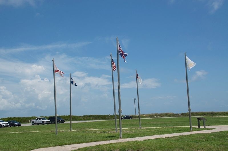
Near Fort Morgan Road (Alabama Route 180) 2 miles west of Dune Drive, on the left when traveling west.
Traditionally referred to as "colors", flags have long been used to identify nations, loyalties, and movements. As the sands have shifted through the ages, so too have the colors and loyalties of the Gulf Coast. Displayed here are a small section of . . . — — Map (db m187336) HM
On Larry Dee Cawyer Drive at Old Spanish Trail (U.S. 98), on the left when traveling north on Larry Dee Cawyer Drive.
During the Revolutionary War, France, Spain, Britain, and the United States were interested in the fate of this region. In March 1780, Spanish forces captured Mobile. They established a palisaded fort with trenches (one mile north of here) to . . . — — Map (db m61451) HM
On Spanish Fort Boulevard (U.S. 90/98) at Spanish Main, in the median on Spanish Fort Boulevard.
Spanish Fort is the gateway to the second largest delta in the United States. The Mobile-Tensaw, River Delta is 30 miles long and 12 miles wide. It covers more than 200,000 acres of swamps, river bottomlands and marshes and is considered the best . . . — — Map (db m285174) HM
On Alabama Route 225 just north of Lower Bryants Landing Road, on the left when traveling north.
Here on the banks of the Tensaw River -- named for the Tensa Indian tribe whose principal village was located at this place -- Major Robert Farmar developed a plantation c. 1772. Farmar was one of the most prominent and controversial Alabamians of . . . — — Map (db m66380) HM
On Public Square West (State Highway 21) south of Clinton Street Southwest, on the left when traveling south.
Jacob Forney III lived and operated a thriving mercantile establishment at Jacksonville from 1835-56 on the south-east corner of the square. He and his wife Sabina Swope Hoke were the parents of nine children.
1. Daniel Peter - b. Feb. 24, 1819, . . . — — Map (db m36450) HM
On Southeast Avenue A (County Route 50) 0.1 miles east of Southeast 3rd Street, on the right when traveling east.
LaFayette Cemetery, also known as Westview, began in 1934 with the death of Miss Sarah Gipson. Many early pioneers and veterans of East Alabama are buried here including Revolutionary War Patriot Capt. Alexander Dunn, Col. Charles McLemore, . . . — — Map (db m83263) HM
On County Road 752 0.2 miles south of County Road 480, on the right when traveling north.
This cemetery is the final resting place for thirty-seven
members of the Moore Family. John Moore, son of American
Revolutionary War Patriot and Battle of Charleston POW
Obadiah Moore, purchased this land on September 4, 1834.
The Moore family . . . — — Map (db m206684) HM
Lemuel Alston, William Armistead, Thomas Bradford, John Bradley, William Cochran, John Cox, John Creighton, Benjamin Darby, John Dean, Sr., Matthew Gayle, John Giles, William Goode, John Harvey, Aaron Lewis, Axom Lewis, Thomas Moody, Elijah Pugh, . . . — — Map (db m47748) HM
On U.S. 84 at milepost 40 at Crescent Road, on the right when traveling east on U.S. 84.
Side 1
Near this spot are the graves of American Revolution soldier Elijah Pugh and his son Issac, a War of 1812 veteran. Elijah, born in Guilford Co., N.C. in 1760, was 18 when he joined a patriot band led by Col. Elijah Clarke at the . . . — — Map (db m154482) HM
On Main Street at King Street (Old Route 20), on the right when traveling north on Main Street.
FrontByler Road
Pioneer's settled path to new lands, agriculture, transport and commerce that began in Northwest Alabama.
140 mile corridor/route designated on December 19th, 1819 by the State Legislature. This was . . . — — Map (db m205287) HM
On South Commons Street at South Hickory Street, on the right when traveling west on South Commons Street.
This burial ground was designated on General John Coffee's 1817 survey and original map "Plan of a Town at the Coldwater Spring." The oldest tombstone carries the burial date 1821 and the cemetery contains graves of veterans from all wars beginning . . . — — Map (db m28567) HM
On SW 14th Avenue near SW 7th Street, on the right when traveling east.
The Winston family settled this area in the early 1820s. Andrew Jackson purchased the property at the U.S. government land sale and conveyed it to Col. Anthony Winston (1782-1841) who lived nearby in a two-story brick Federal-style house (razed . . . — — Map (db m28566) HM
On Second North Street east of Vine Street, on the left when traveling east.
On the morning of April 5, 1825,
General Lafayette, the hero of the American Revolution, walked up this road from the steamboat landing while a band played "Lafayette's March." Supported on the arm of Governor Pickens, the old General moved . . . — — Map (db m244890) HM
On Water Avenue at Washington Street, on the right when traveling east on Water Avenue.
Soldier of France
Volunteer in the cause of
American Liberty
Guest of the Nation
Entertained in Selma
On his way to Cahaba
1825
Placed by the Cherokee Chapter
Daughters of the American Revolution
Selma, Alabama
June 14, . . . — — Map (db m37671) HM
On Tuscaloosa Street (U.S. 11) east of Springfield Avenue, on the right when traveling east.
Named for Revolutionary hero,
General Nathaniel Greene,
who drove British from Southeast.
Area explored by DeSoto, 1540.
Claimed as French Louisiana, 1699.
Ceded to England, 1763.
Ceded by Choctaw Nation, 1816.
Made a territorial . . . — — Map (db m37962) HM
On Main Street (U.S. 11) near Springfield Avenue, on the right when traveling west.
In 1838, Greene County citizens voted to change the town seat from Erie to Eutaw. The City of Eutaw, Alabama was incorporated as a town by an act of the State Legislature on January 2, 1841. Greene County had been named for General Nathaniel . . . — — Map (db m83752) HM
On Main Street at Demopolis Street, on the right when traveling east on Main Street.
Organized 1823 by Rev. James Hillhouse
of South Carolina, with
Patrick Norris and William Hillhouse,
veterans of American Revolution,
as founding elders.
Original wooden structure replaced
by brick building in 1841
under pastorate . . . — — Map (db m33746) HM
Near County Road 92 0.2 miles north of State Route 95.
In Memory of Rev. Nathan "Father" Grantham, born May 29, 1751, in South Carolina.
He served two terms South Carolina Volunteers during the Revolutionary War. As a circuit riding Methodist Minister, he served the Liberty Chapel Methodist Church, . . . — — Map (db m167084) HM
On County Road 89 at County Road 109, on the right when traveling south on County Road 89.
Old Center Methodist Church
The church was organized in 1859. The first building was a log structure located just NW of the present building. In the 1870's it was part of the Newton Circuit and was served by a minister who lived in the . . . — — Map (db m71831) HM
On Alabama Route 605 0.5 miles south of Boys Club Road, on the left when traveling south.
(side 1)
Big Creek United Methodist Church
One of the oldest churches in southeast Alabama and reportedly the oldest church in Houston County. The first church structure was a log building constructed about 20 yards north of the . . . — — Map (db m73356) HM
On County Road 42 0.2 miles east of County Road 442, on the left when traveling west.
Of German ancestry, Phillip Hamman was a
Colonial-era scout and a Revolutionary War soldier
hailed as the "Savior of Greenbrier" for his 1778
efforts to defend Ft. Donnally in present-day
West Virginia. In 1780. he married Christina . . . — — Map (db m289257) HM
So why was this war necessary?
Had the colonialist in April 1775 not fired the 'shot heard around the world' and fought for freedom and won, you would most likely be a British citizen. We would not have our Constitution and the great . . . — — Map (db m268439) HM
On Cahaba Road at Park Lane, on the right when traveling north on Cahaba Road.
In 1822 William Pullen, Revolutionary War veteran, acquired this land from the Federal Government for farming. In 1889 his heirs sold the land to the City of Birmingham for use as the New Southside Cemetery which operated from 1889 to 1909 with . . . — — Map (db m27096) HM
On Old Springville Road / County Road 30, on the left when traveling north.
Established about 1850, Wear Cemetery is located off Old Springville Road to the northeast at Countryside Circle. In the 1800's the Wear family was among the first settlers of the community later known as Clay. Twenty-three remaining graves were . . . — — Map (db m25113) HM
On County Road 47, on the right when traveling north.
The famous Kennedy Long Rifle was introduced at Philadelphia during the Revolutionary War by Alexander Kennedy who fled to Moore County, N. C., when the British invaded. About 1823 his son David moved the factory to Green Hill, Alabama locating, 400 . . . — — Map (db m208822) HM
On County Road 47 at County Road 140, on the left when traveling north on County Road 47.
This is one of the earliest community burial grounds in Lauderdale County. The oldest dated gravestone is for Catherine Hill, first wife of Green Berry Hill, for whom the community is named. She died on June 8, 1825. George Kennedy deeded five acres . . . — — Map (db m154332) HM
On County Route 136 0.6 miles east of County Road 640, on the right when traveling east.
Revolutionary War Veteran Benjamin French (1764-1847), a native of Virginia, is buried at this site. Arriving in Limestone County, Alabama, about 1808 French acquired this farm in 1837.
The nearby spring is the site of prehistoric Indian Village . . . — — Map (db m141982) HM
Gabriel Butler “Ole Gabe” was born in the Carolinas in 1779, about the time of the Revolutionary War. His name is on records in Kentucky in the 1800s. He married his first wife, Sarah Whitesides, in Warren County, KY, on December 26, 1803. Gabe . . . — — Map (db m216372) HM
On Lee Highway (U.S. 72) at County Route 66, on the right when traveling west on Lee Highway.
(side 1)
Samuel Burney: 1763-1849
Revolutionary War Veteran
Samuel Burney, Sr., was born on January 30, 1763, in Guilford Co., NC. He was among 17 known Revolutionary War veterans to settle in the area that became Lauderdale . . . — — Map (db m84299) HM
On Van Buren Street 0.1 miles north of Jefferson Street.
Side A
One of Alabama's oldest and most picturesque town cemeteries, this site was set aside as a burying ground by the Courtland Land Company in its original survey made prior to the incorporation of the town in 1819. Many of the area's . . . — — Map (db m84304) HM
On Lentzville Road 0.7 miles south of Barker Road, on the right when traveling south.
Lentzville Cemetery began as the family cemetery for the family of John Henry Lentz (7 Feb 1753-18 Jul 1835) and his wife Savilla. John Henry was a veteran of the American Revolution and pioneer settler of Limestone County, entering his land in . . . — — Map (db m114306) HM
Near Gardner Hollow Road west of Shoal Creek Road, on the right when traveling west.
Gourdsville / Gilbertsboro
Gourdsville is the colorful place-name of one of the earliest settlements in Limestone County. It was little more than a camp of shanties established by intruders on the Chickasaw lands who were driven back to the . . . — — Map (db m250554) HM
On Buck Island Road (State Highway 99) north of Sugar Way, on the left when traveling south.
Approximately 200 yards east of this site are the unmarked graves of Abner Alloway Strange, Sr., and other family members. (The markers were moved to Salem Methodist Cemetery in 1977.) A Sergeant in the Virginia Militia, Strange was at Yorktown . . . — — Map (db m32561) HM
On South Broad Street (County Road 29) at Cross Lane, on the right when traveling north on South Broad Street.
Frances Lewis II (1768-1837), a planter, was the first soul to
be interred in this family cemetery. Lewis was born a British
subject in the Colony of Virginia and migrated to Alabama in
the 1820s. The fathers of both Frances Lewis II and his . . . — — Map (db m245991) HM
Born About 1780 Died March 1852
Buried in Boram Cemetery
3 miles N.E. of this site
Wife of Revolutionary War soldier
Capt. Henry Key Jr. of S.C.
Born April 11,1759 in VA.
Died August 23,1810 in S.C. — — Map (db m190192) HM WM
On Huntsville Highway (U.S. 231/431) at Hunter Road, on the left when traveling north on Huntsville Highway.
Tennessee. Lincoln County. Established 1809; named in honor of MAJOR GEN. BENJAMIN LINCOLN of the Revolutionary Army. After service at Saratoga, he was put in Chief Command in the Southern Colonies. Later, he was Secretary of War under the . . . — — Map (db m30570) HM
On Moores Mill Road at Old Gurley Road NE, on the left when traveling south on Moores Mill Road.
Harris Hill Cemetery is located Sec. 17, T3, and R1E, on the south side of Highway 72 East at the intersection of Moores Mill Road and Highway 72 East in a large clump of trees on a small rise. This is the old home place and family graveyard of . . . — — Map (db m43878) HM
On Monroe Street Northwest at Washington Street Northwest, on the left when traveling east on Monroe Street Northwest.
I am Ezekiel Reynolds, a citizen of Concord, Massachusetts Colony. My neighbors and I banded together to defend our families and farms and resist the taxation without representation in the British Parliament. We are called Minutemen for our speed in . . . — — Map (db m71404) WM
On Ikard Road 0.3 miles north of Nebo Road, in the median.
John Whitaker, born 1761 in Pitt County, NC, was a Revolutionary War Soldier and established this cemetery. He and his second wife Winnie sold their land in Pitt County in 1801 and migrated to Rowan County where Winnie died, then to Mulberry, TN . . . — — Map (db m71341) HM
On Alabama Route 28 0.1 miles west of Jefferson Road (County Road 57), on the right when traveling west.
established as
Mt. Pleasant Baptist
by Elder James Yarbrough in 1820
with 27 charter members.
By 1834 it had 150 members.
Church among the oldest in Demopolis area.
Buried in church cemetery are John Gilmore, Reuben Hildreth and . . . — — Map (db m72974) HM
This American Liberty Elm was named after “The Liberty Tree: Our Country’s first Symbol of Freedom.” On the morning of August 14, 1765, the people of Boston awakened to discover two effigies suspended from an elm tree in protest of . . . — — Map (db m85848) HM WM
On Government Street (U.S. 98) at South Jackson Street, on the right when traveling east on Government Street.
On this site stood the home of Mayor Samuel H. Garrow, where the Marquis de Lafayette was entertained on his visit to Mobile, April 7, 1825. Lafayette, French officer, statesman, and hero of the American Revolution, visited the United States as . . . — — Map (db m86420) HM
On Columbus Street 0.1 miles west of North Decatur Street, on the left when traveling west.
Side 1
Abram Mordecai
1755-1849
Born October 24, 1755 in Pennsylvania; settled 1783 in Georgia where he became a successful trader among the Cusseta Indians. First U.S. citizen to settle (1785) in what became Montgomery County. . . . — — Map (db m71357) HM
On Water Street at Commerce Street, on the right when traveling east on Water Street.
Here at the Indian village of Encanchata, future site of Montgomery, Col. John Tate, last British agent to the Muscogee Nation, recruited and drilled Creek warriors in 1780 to relieve Tories in Augusta, Ga. being besieged by American patriots. — — Map (db m71373) HM
On North Perry Street south of Monroe Street, on the right when traveling south.
The town of Montgomery, formed on December 3, 1819, through the joining of New Philadelphia and East Alabama, is named for Major General Richard Montgomery, who was the first American general officer killed in America's war for independence. Richard . . . — — Map (db m142117) HM
Near Commerce Street at Tallapoosa Street, on the right when traveling south.
On this site stood, until December 1899, the house in which Marquis de Lafayette was given a public reception and ball, April 4, 1825, while on his last tour through the United States.
This tablet is placed by the Society of the Sons of the . . . — — Map (db m70727) HM
On Court Square at Montgomery Street, on the right when traveling east on Court Square. Reported missing.
Naming the City of Montgomery
Montgomery named for Richard Montgomery, first
American general killed in the Revolutionary War.
In 1819, the Alabama Legislature combined New
Philadelphia and East Alabama to form Montgomery.
Walter B. . . . — — Map (db m69297) HM
Washington took command of the American Army under grandparent of this elm, Cambridge, Mass., July 3, 1775
Raised and given by Maryland D.A.R. and Alice Paret Dorsey as part of 200th anniversary of birth of Washington, . . . — — Map (db m155635) HM
On Pines Church Road just north of Pines Road, on the right when traveling north.
Russell Cemetery AKA Pines Cemetery. Pvt. E. Thompson served in Revolutionary War 1776-1778. Fought at Germantown & White Plains. — — Map (db m285502) HM
Near Lower Vienna Road west of State Highway 14, on the right when traveling west.
who departed this life
November 24th 1840
Aged 82 years, 6 months
and 9 days.
The deceased was a soldier
of the Revolution and was at
The battles of Germantown,
Brandywine and Guilford
Court house, and was one of
Washington’s . . . — — Map (db m37522) HM
On Vienna Road 0.2 miles west of Route 14, on the right when traveling west.
Established in the 1830s, this cemetery is
the final resting place of generations of
persons with roots in the former town of
Vienna. Among those buried here are
Revolutionary soldier James McCrory.
bodyguard of Gen. George Washington . . . — — Map (db m302739) HM
On County Road 17 north of Longmeadow Road, on the right when traveling north.
In Honor of Revolutionary War Soldier and
Shelby County Pioneer
Pvt. David Lindsay served with the Pennsylvania
Militia during the Revolutionary War and moved
to Alabama with wife Mary Casey Lindsay before
1820. The David Lindsay Historical . . . — — Map (db m144907) HM
Near Montevallo Road (Alabama Route 119) 0.3 miles south of Alex Mill Road, on the right when traveling south.
(side 1)
The Liberty Bell was commissioned November 1, 1751, to commemorate the 50th anniversary of William Penn’s Charter of Privileges for his Pennsylvania colony. The radical charter granted religious liberty to persecuted faiths, . . . — — Map (db m101506) HM
Near Montevallo Road (Alabama Route 119) 0.3 miles south of Alex Mill Road, on the right when traveling south.
American colonists cherished Liberty as their birthright. On July 4, 1776, the Continental Congress adopted the Declaration of Independence, declaring, "We hold these truths to be self-evident, that all men are created equal, that they are endowed . . . — — Map (db m101503) HM
On 6th Avenue at Court Street West, on the left when traveling east on 6th Avenue.
Created in 1818 in first session of Alabama Territorial Legislature from lands ceded by Creek Indian Nation in Treaty of Ft. Jackson, 1814. Named for Gen. Arthur St. Clair, hero of Revolution, governor of Northwest Territory. First settlers from . . . — — Map (db m28143) HM
On 6th Street at 29th Avenue, on the right when traveling west on 6th Street.
Honor Roll of Soldiers and Patirosts
of the American Revolution
who came to
Tuscaloosa County Alabama
Robert Aiken • Isaac Jaudon •
Samuel Baker • Reuben Jones •
William Binion • Thomas Keates, Sr. •
Benjamin Blackburn • Daniel . . . — — Map (db m144863) WM
On 3rd Avenue at 19th Street and 3rd Avenue S, on the right when traveling north on 3rd Avenue.
Sergeant William Jasper was a soldier, hero, scout and namesake of Jasper, Alabama. During the June 28, 1776 defense of Charleston against the Royal Navy, Sergeant Jasper courageously retrieved the fallen standard of the 2nd South Carolina . . . — — Map (db m302965) HM
On Court Street north of Central Avenue ( Route 56), on the left when traveling north.
Created in 1800 by proclamation of
governor of Mississippi Territory.
This was first U.S. civil government
in area that was to become Alabama.
Its original boundaries:
East to west: Chattahoochee to Pearl River;
South, 31° lat. . . . — — Map (db m122343) HM
Jacob Pruet’s Stand (tavern) was a popular stopping place on the Byler Road in the 1830s and 1840s. A two story poplar log structure with four twenty-foot rooms per floor. It was located near a large spring and netted a handsome profit, as most of . . . — — Map (db m219825) HM
Under the forebearer of this American Elm George Washington assumed command of the Continental Army at Cambridge, Massachusetts, on July 3, 1775.
This sprig of the "Washington Elm" was donated to the Arizona State Teachers College at . . . — — Map (db m263603) HM
Near Old Post Road 0.8 miles south of State Route 169.
The succession of outposts here, remote from centers of New
World empire, symbolized a dream of the imperial age: to
connect the Gulf of Mexico to North America's vast interior
by the great rivers that drained it.
Following British . . . — — Map (db m108485) HM
Near Old Post Road 0.8 miles south of State Route 169.
During the American Revolution, Arkansas Post
belonged to the Spanish, allies of the American
patriots. In 1783, British partisans led by James
Colbert raided the Spanish village and fort here.
It was one of the last engagements of the . . . — — Map (db m108483) HM
On U.S. 165 0.1 miles south of Gander Street Road, on the right when traveling north.
Founded by France in 1686, Arkansas Post was the first European settlement in what is now the state of Arkansas. It was located along the Arkansas River at various sites near here over the years. The Spanish occupied it after 1763 until the . . . — — Map (db m294844) HM
The American Revolution was a conflict between England and thirteen of her colonies in North America. Following years of taxation, suppression, and subjugation by the British, fighting began at Lexington and Concord, Massachusetts in 1775. A scant . . . — — Map (db m91470) HM
On Jackson Place at McClure Avenue (Route 923), on the right when traveling north on Jackson Place.
This marker, set on the Butterfield Stagecoach Road, is placed near the spot where the trail crossed the east-west road between Huntsville and the Robinson settlement in western Benton County. John Robinson, a Revolutionary soldier, settled here . . . — — Map (db m68781) HM
On North Eagle Drive, on the left when traveling north.
Birthplace of Amna Sager Chastain
July 4, 1847 - 1919
Wife of 4th generation descendant of revolutionary patriot the Rev. John Chastain of Virginia, her husband Jehu Thomas Chastain
March 4, 1844 - 1931 — — Map (db m299583) HM
On Spring Street just east of Post Office Court, on the right when traveling east.
Near this spot around the year 1790 stood the first hotel and bath house built in the Hot Springs Territory. To mark the site of the first permanent citizen, the host of this tavern, JOHN PERCIFUL, reputed to have been a revolutionary soldier. This . . . — — Map (db m102954) HM
On West Barraque Street close to North Main Street, on the right when traveling west.
To honor Auguste La noir de Serville Hero of the American Revolution French Marine served under Count de Grasse Wounded Yorktown, VA Oct. 14, 1781 Died Jefferson Co. Ark. Dec. 30, 1828 — — Map (db m30579) HM
On Main Street near US 61/ Blues Highway, on the left when traveling north.
Flag pole erected to commemorate the 200th anniversary of the United States of America Bassett Arkansas Calvin Williams Mayor · Larry Joe Bell Alderman · Hugh Arue Jr. Alderman · Nardie Westbrook Alderman · Joe W Felts Alderman · Jewell Ryals . . . — — Map (db m298907) WM
Revolutionary War soldiers and brothers, Shared fought for North Carolina and Jacob fought for both North and South Carolina. In the winter of 1820-1821 they brought their families here from Williamson County, Tennessee and settled near this site. — — Map (db m116507) HM
Near President Clinton Avenue north of La Harpe Boulevard.
This heroic memorial bust of Count Casimir Pulaski was originally placed in the lobby of the Third and Spring street office of Pulaski Federal Savings and Loan Association, predecessor of Savers Federal Savings and Loan Association, in April, 1961, . . . — — Map (db m116213) HM
On W. Sevier Street at N. Main Street, on the right when traveling west on W. Sevier Street.
In honor of two Revolutionary War soldiers who chose Saline County, Arkansas as their home. After enlisting in the spring of 1777, they served through the winter at Valley Forge and to the end of the war in 1783.
ASHER BAGLEY, Private . . . — — Map (db m96595) WM
Near South Government Avenue at South Lt Col Leroy Pond Avenue.
Civil War in Northern Arkansas
The first battle in Arkansas occurred on February 16, 1862, at Big Sugar Creek just south of the Missouri border. The next day, Union Gen. Samuel Curtis' Army of the Southwest continued its southward march. . . . — — Map (db m224112) HM
On Cemetery Circle, on the right when traveling east.
In memory to those soldiers
who fought for American
Independence during the
Revolutionary War.
These veterans of the
American Revolution came to
live and died in Northwest
Arkansas
Benton County . . . — — Map (db m21227) HM WM
Near Mount Diablo Boulevard, on the left when traveling east.
This marker commemorates the men and women who achieved American independence. These Patriots, believing in the noble cause of liberty, fought valiantly to found a new nation.
1775 - 1783
Presented by Acalanes Chapter Daughters of . . . — — Map (db m246658) WM
On Campus Drive 0.6 miles east of Baldwin Avenue, on the right when traveling east.
On June 12, 1775, a party of Maine
mariners, armed with pitchforks
and axes, inspired by the news of the
recent victory at Lexington, used
an unarmed lumber schooner to
surprise and capture a fully armed
British warship, HMS Margaretta.
. . . — — Map (db m259766) HM
Near Bloomfield Avenue 0.8 miles south of the Artesia Freeway (California Route 91), on the left when traveling south.
This magnificent sculpture captures the bravery and
patriotism of Revolutionary War hero Paul Revere
who rode to warn American patriots northwest of Boston
that the British intended to raid Lexington and Concord.
Paul Revere made his famous . . . — — Map (db m243422) HM
On Cathedral Drive west of Arlington Road, on the left when traveling east.
Part of the chain stretched across the Hudson River in 1776 to prevent the passage of British ships, which could cut the colonies in two. Danger was imminent. The British had taken New York City, at the river's mouth. General Washington ordered the . . . — — Map (db m207317) HM
On Evergreen Drive just east of Memorial Drive, on the left when traveling east.
This church was inspired from a carpenter's primitive model of the
first parish meeting house of Portland, then Falmouth, Maine, which
was attended by Longfellow as a boy, and torn down in 1824. One of
his earliest poems, written at . . . — — Map (db m230114) HM
On Memory Lane just east of Memorial Drive, on the left when traveling east.
This church is a replica of Christ Church in Boston, long known
as Old North. It is a memorial to the early American patriots who
offered their lives and fortunes in the cause of liberty. Henry
Wadsworth Longfellow immortalized Paul Revere and . . . — — Map (db m212622) HM
On Memory Lane just east of Memorial Drive, on the right when traveling east.
Washington wears the uniform of the army
he had led through six bitter years of
war. In the midst of battle his fearless example
inspired his men; when hunger stalked his weary
troops, he shared their lot; when his own officers
betrayed him . . . — — Map (db m212621) HM WM
The American Revolution was a war for independence between the thirteen American colonies and their parent country, Great Britain. When it was over, the colonies became the United States of America. On July 4, 1776, the Declaration of Independence . . . — — Map (db m125419) HM WM
Near Church Streeet, on the left when traveling east.
The people of the Second Royal Spanish Presidio supported the American Colonies through their military preparedness and financial contributions following the Royal Spanish Decree of June 21, 1779. Their support directly aided the victory and . . . — — Map (db m63505) HM
The 13 Flags displayed along the top of the log stockade are like those carried by American troops during the REVOLUTIONARY WAR. These standards represent the home countries, colonies, divisions and regiments of the soldiers.
One of the first . . . — — Map (db m298503) HM
This American Liberty Elm was named after "The Liberty Tree:
Our Country's first Symbol of Freedom.” On the morning of
August 14, 1765, the people of Boston awakened to discover two
effigies suspended from an elm tree in protest of the . . . — — Map (db m143673) HM
Near Old Winery Road east of Lovall Valley Road, on the right when traveling east.
Marker One:
George Washington: 1732-1799
America’s first President, he was called by his fellow revolutionaries the “Indispensable Man” – without him we would still be enjoying tea and crumpets at 4pm. Appointed Commander in Chief of . . . — — Map (db m231240) HM
Two plaques have been placed at this memorial.
In This Cemetery is Buried
Capt. William Smith
Born in Virginia, November 14, 1768
Died in Sonoma, May 5 1846
Who served in the Virginia Navy during the American Revolution . . . — — Map (db m102559) HM WM
On Lincoln Street at 14th Avenue, on the left when traveling north on Lincoln Street.
Dedicated to you, a free citizen in a free land.
This reproduction of the Liberty Bell was presented to the people of Colorado
by direction of
the honorable John W. Snyder,
Secretary of the Treasury,
as the inspirational symbol of . . . — — Map (db m257734) HM
Near Washington Avenue, on the left when traveling north.
This marker commemorates the men and women who achieved American independence. These Patriots, believing the the noble cause of liberty, fought valiantly to found a new nation.
1775-1783 — — Map (db m305706) WM
9859 entries matched your criteria. The first 100 are listed above. Next 100 ⊳