1675 entries match your criteria. The first 100 are listed. ⊳
Immigration Topic
By James L.Whitman, January 21, 2023
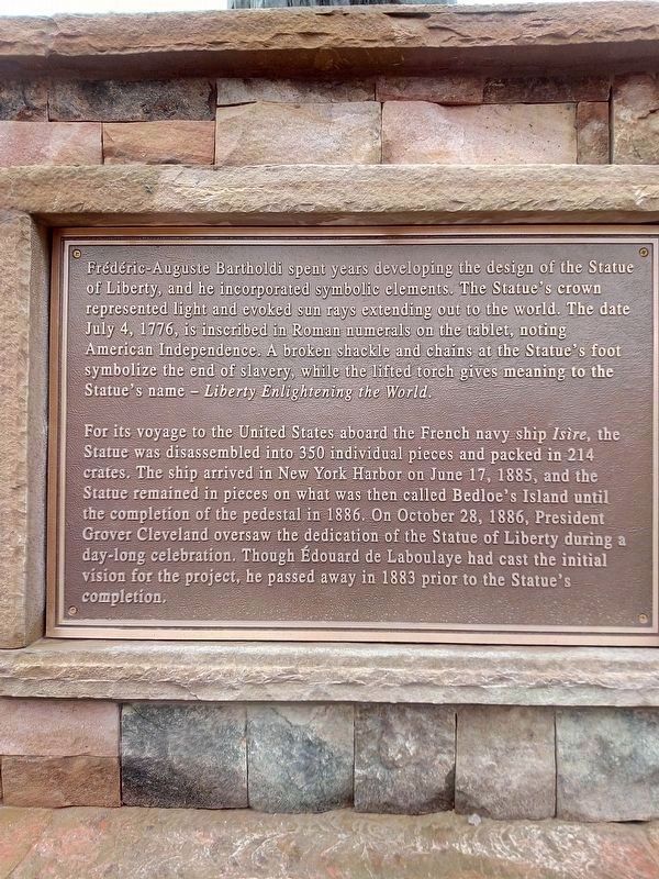
Liberty Enlightening the World Marker
1 ► Alabama, Henry County, Abbeville — Liberty Enlightening the World —  |
| On Alabama 10. | |||
| 2 ► Alabama, Mobile County, Mobile, Central Business District — The Pelican Girls — |
| On South Royal Street at Church Street, on the left when traveling south on South Royal Street. | |||
| 3 ► Alabama, Mobile County, Mobile, Spring Hill — Spring Hill — Early Nineteenth Century Settlement — |
| On Old Shell Road 0.1 miles east of N McGregor Ave, on the right when traveling west. | |||
| 4 ► Alabama, Montgomery County, Montgomery — Cassimus House — |
| On North Jackson Street north of Pelham Street, on the right when traveling north. | |||
| 5 ► Alaska, Anchorage, Downtown — Anchorage Area 1940-1949 — |
| On 4th Avenue, on the right when traveling west. | |||
| 6 ► Alaska, Fairbanks North Star Borough, College, Pike's Landing — 19 — Alphonso L'Kievicz — Goldsmith, Miner & Dredger — Cabin 19 — |
| Near Hoselton Road. | |||
| 7 ► Alaska, Fairbanks North Star Borough, College, Pike's Landing — 12 — Laura Foster O'Flanagan — The Hard Journey North — Cabin 12 — |
| Near Pikes Landing Road. | |||
| 8 ► Alaska, Fairbanks North Star Borough, College, Pike's Landing — 1 — Mary Hammer — Dome Creek Hoist Woman — Cabin 1 — |
| Near Hoselton Road. | |||
| 9 ► Alaska, Fairbanks North Star Borough, Fairbanks — Clay Street Cemetery — Established November 10, 1903 — |
| On Clay Street north of 7th Street, on the left when traveling north. | |||
| 10 ► Alaska, Fairbanks North Star Borough, Fairbanks — Fairbanks is Discovered — |
| Near Airport Way. | |||
| 11 ► Alaska, Fairbanks North Star Borough, Fairbanks — Mary Pedro — To The Memory Of — |
| Near Clay Street. | |||
| 12 ► Alaska, Fairbanks North Star Borough, Fairbanks, Downtown — Life Along the Chena River — 1903 - 1909 — Alaska Gold Rush Centennial — |
| On 1st Avenue west of Cushman Street, on the right when traveling west. | |||
| 13 ► Alaska, Fairbanks North Star Borough, Fairbanks, Downtown — The Settlement — Historic Fairbanks — |
| On Lacey Street north of 1st Avenue, on the right when traveling north. | |||
| 14 ► Alaska, Juneau Borough, Juneau, Downtown Juneau — Manila Square — |
| On Marine Way (Alaska Route 7) at South Franklin Street ( Route 7), on the left when traveling west on Marine Way. | |||
| 15 ► Alaska, Juneau Borough, Juneau, Downtown Juneau — The Early Days — Downtown Historic District — |
| Near South Franklin Street. | |||
| 16 ► Alaska, Juneau Borough, Juneau, Downtown Juneau — Wooshkeetaan Kootéeyaa — Kootéeyaa Deiyí • Totem Pole Trail — |
| On Marine Way at Admiral Way, on the right when traveling south on Marine Way. | |||
| 17 ► Alaska, Ketchikan Gateway Borough, Ketchikan — Northern Machine Works — Newtown — |
| On Schoenbar Road south of Water Street, on the right when traveling south. | |||
| 18 ► Alaska, Matanuska-Susitna Borough, Palmer — Colony Park — |
| On Alaska Street south of Dahlia Street, on the left when traveling south. | |||
| 19 ► Alaska, Matanuska-Susitna Borough, Palmer — Matanuska Valley Colony Project 50th Anniversary — 1935 • 1985 — May Their Generations Never Die — |
| On East Elmwood Avenue east of South Valley Way, on the left when traveling east. | |||
| 20 ► Alaska, Matanuska-Susitna Borough, Sutton-Alpine — If You Build It, They Will Come — |
| On Glenn Highway (State Highway 1 at milepost 61.6) east of Chickaloon Way, on the left when traveling east. | |||
| 21 ► Alaska, Skagway Borough, Skagway, Dyea — "The most important item on the list is good advice - — and plenty of it." — Tappan Adney, The Klondike Stampede — |
| On Broadway north of 1st Avenue, on the left when traveling north. | |||
| 22 ► Alaska, Skagway Borough, Skagway, Dyea — Broadway, Skagway, August 12, 1897 — |
| On Broadway north of 1st Avenue, on the left when traveling north. | |||
| 23 ► Alaska, Skagway Borough, Skagway, Dyea — Gateway to the Interior — |
| On Broadway south of the railroad grade crossing, on the left when traveling south. | |||
| 24 ► Alaska, Skagway Borough, Skagway, Dyea — Ho, for the Klondike! — |
| On Congress Way, on the right when traveling south. | |||
| 25 ► Alaska, Skagway Borough, Skagway, Dyea — Ho, for the Klondike! — |
| On Broadway near the railroad grade crossing, on the left when traveling south. | |||
| 26 ► Arizona, Coconino County, Flagstaff — Flagstaff — |
| On Route 66 at South Beaver Street, on the right when traveling east on Route 66. | |||
| 27 ► Arizona, Maricopa County, Scottsdale, South Scottsdale — How I Came to be Here — Historical Happenstance Markers — |
| On Scottsdale Road at Virginia Avenue, on the right when traveling south on Scottsdale Road. | |||
| 28 ► Arizona, Mohave County, Oatman — Fairchild, Olive and Oatman (1837 - 1903) — |
| On Main St, on the right when traveling north. | |||
| 29 ► Arizona, Navajo County, Winslow — 3 — The Railroads Build a Town: Early Days — Journeys to Winslow — |
| Near East 2nd Street 0.1 miles east of North Kinsley Avenue. | |||
| 30 ► Arkansas, Prairie County, Hazen — 46 — Kocourek and Son Hardware Store — |
| On East Front 0 miles east of North Hazen Avenue, on the right when traveling east. | |||
| 31 ► Arkansas, Pulaski County, Little Rock — 33 — Primrose Cemetery — Resting Place for Early Germanic Settlers — |
| On Dixon Road (State Highway 338), on the right when traveling west. | |||
| 32 ► California, Alameda County, Alameda — Tonarigumi — Alameda’s Historic Japantown — |
| On Park Street east of Pacific Avenue, on the right when traveling east. | |||
| 33 ► California, Alameda County, Hayward — A Chance Encounter — Un Encuentro Casual — |
| On City Center Drive near 2nd Street, on the right when traveling north. | |||
| 34 ► California, Colusa County, Colusa — Old Chinatown District--Circa 1890 — |
| On Main Street east of 8th Street, on the right when traveling east. | |||
| 35 ► California, Contra Costa County, Walnut Creek — Beniamino Bufano — 1898 - 1970 — Hand of Peace, 1967 — |
| Near North Broadway south of Civic Drive. | |||
| 36 ► California, El Dorado County, Coloma — Changing Life for the Nisenan — |
| Near Coloma Road (California Route 49) north of Mt Murphy Road. | |||
| 37 ► California, El Dorado County, Coloma — Fate Picks Marshall — |
| On Monument Road (California Route 153) at Marshall Park Way on Monument Road. | |||
| 38 ► California, El Dorado County, Coloma — Unstoppable News — |
| Near Coloma Road (California Route 49) north of Mt Murphy Road. | |||
| 39 ► California, Fresno County, Coalinga — 1948 Fresno County Plane Crash — Los Gatos Canyon — |
| On Los Gatos Creek Road 14 miles west of Derrick Avenue, on the right when traveling west. | |||
| 40 ► California, Humboldt County, Eureka, Downtown — Former Home of Daly Brothers Department Store — A Century of Style From 1895 to 1995 — |
| On F Street at Route 101, on the right when traveling south on F Street. | |||
| 41 ► California, Imperial County, Holtville — 145-8 — Schaffner Dairy — Celebrating 100 Years Of Continuous Operation — |
| On Casey Road 0.2 miles north of Worthington Road, on the left when traveling north. | |||
| 42 ► California, Kern County, Bakersfield — Basque Sheep Camp — |
| On Chester Avenue, on the left when traveling north. | |||
| 43 ► California, Kern County, Bakersfield — The Italian Heritage Farmhouse — |
| On Chester Avenue. | |||
| 44 ► California, Los Angeles County, Los Angeles, Downtown Los Angeles — Los Angeles Settlers — Italian, French, African American Settlers — |
| Near Spring Street north of U.S. 101. | |||
| 45 ► California, Los Angeles County, Pasadena, Old Pasadena — Yuen Kee Laundry — Fair Oaks Avenue — |
| On South Fair Oaks Avenue, on the left when traveling north. | |||
| 46 ► California, Marin County, Tiburon — Angel Island Immigration Station — "Guardian of the Western Gate" — |
| Near North Ridge Trail. | |||
| 47 ► California, Marin County, Tiburon — Arrivals from Around the World — |
| Near North Ridge Trail. | |||
| 48 ► California, Marin County, Tiburon — Immigration Hearings — |
| Near North Ridge Road, on the left when traveling north. | |||
| 49 ► California, Mariposa County, Bear Valley — 331 — Bear Valley — |
| On State Highway 49 south of Bear Valley Road. | |||
| 50 ► California, Mariposa County, Mariposa — Mariposa Cemetery — |
| On 17th Street south of Fournier Road, on the right when traveling south. | |||
| 51 ► California, Merced County, Stevinson — The Portuguese — |
| On 3rd Avenue at Nelander Road, on the right when traveling west on 3rd Avenue. | |||
| 52 ► California, Monterey County, Del Monte Forest, Pebble Beach — China Rock — |
| On 17 Mile Drive, on the left when traveling north. | |||
| 53 ► California, Monterey County, Monterey — Casa Amesti — |
| On Polk Street, on the left when traveling east. | |||
| 54 ► California, Monterey County, Monterey — Kalisa's La Ida Café — 1957-2007 — |
| On Cannery Row, on the left when traveling east. | |||
| 55 ► California, Monterey County, Monterey — The Cannery Row Monument — Dedicated February 26, 2014 — |
| On Cannery Row, on the right when traveling west. | |||
| 56 ► California, Monterey County, Spreckels — Spreckels Sugar Beet Factory — |
| On Spreckels Boulevard at Nacional Street, on the left when traveling west on Spreckels Boulevard. | |||
| 57 ► California, Nevada County, Truckee — Donner Summit - The Chinese Laborers — |
| Near Donner Pass Road. | |||
| 58 ► California, Orange County, Anaheim — Mother Colony House — |
| On West Street near Sycamore Street, on the right when traveling north. | |||
| 59 ► California, Orange County, San Juan Capistrano — 23 — Manuel Garcia Adobe — |
| On Camino Capistrano, on the right when traveling south. | |||
| 60 ► California, Orange County, Santa Ana, Lacy — Chinatown Memorial 2024 |
| On East 3rd Street at North Bush Street, on the right when traveling west on East 3rd Street. Reported missing. | |||
| 61 ► California, Orange County, Santa Ana, Lacy — Santa Ana Chinatown — |
| On East 3rd Street, on the right when traveling west. | |||
| 62 ► California, Placer County, Dutch flat — T-53 — Truckee Trail - Deadman Flat — |
| On Lowell Hill Road. | |||
| 63 ► California, Placer County, Rocklin — Rocklin Ranches — |
| Near Front Street. | |||
| 64 ► California, Riverside County, Riverside, Downtown Riverside — Chinese Memorial Pavilion — |
| On Orange Street just north of Mission Inn Avenue, on the right when traveling north. | |||
| 65 ► California, Riverside County, Riverside, Downtown Riverside — Dosan Ahn Chang-Ho Memorial — 도산안창호기념동상 — |
| On Main Street at University Avenue, on the right when traveling north on Main Street. | |||
| 66 ► California, Riverside County, Riverside, Downtown Riverside — 114 — Jackson Building — Circa 1886 — Cultural Heritage Board Landmark — |
| On University Avenue, on the right when traveling west. | |||
| 67 ► California, Riverside County, Riverside, Wood Streets — Welcome — Chinatown Site — |
| On Palm Avenue at Tequesquite Avenue, on the right when traveling west on Palm Avenue. | |||
| 68 ► California, Sacramento County, Walnut Grove, Locke — 打更 The Bok Bok Man 更夫 — |
| On Main Street south of Locke Road, on the right when traveling north. | |||
| 69 ► California, San Bernardino County, Rancho Cucamonga — 3 — Chaffey-Garcia House — The City of Rancho Cucamonga Landmark No. 3 — |
| On Etiwanda Avenue 0.2 miles north of Base Line Road, on the left when traveling north. | |||
| 70 ► California, San Bernardino County, Rancho Cucamonga — Guasti and the Italian Vineyard Company — The Vintners Walk — |
| Near Foothill Boulevard 0.1 miles west of Rochester Avenue, on the right when traveling east. | |||
| 71 ► California, San Diego County, San Diego, Little Italy — Pietro & Cristina Busalacchi — Family of Little Italy — |
| On India Street, on the right when traveling north. | |||
| 72 ► California, San Francisco City and County, San Francisco, Lincoln Park — Port of San Francisco — Canoes, Clipper Ships & Steamers — |
| Near El Camino Del Mar near Seal Rock Drive. | |||
| 73 ► California, San Joaquin County, Acampo — Dogtown Cemetery — |
| On Collier Road East west of Mackville Road, on the left when traveling west. | |||
| 74 ► California, San Luis Obispo County, Cayucos — 2 — Home of Capt. James Cass — |
| On North Ocean Avenue at Cayucos Drive, on the right when traveling west on North Ocean Avenue. | |||
| 75 ► California, San Luis Obispo County, Morro Bay — A Deep Dive into Morro Bay's History — |
| Near Embarcadero. | |||
| 76 ► California, San Luis Obispo County, Morro Bay — Landing of the First Filipinos - October 18, 1587 — Morro Bay - Coleman Park — |
| On Embarcadero south of Coleman Drive, on the left when traveling north. | |||
| 77 ► California, San Luis Obispo County, San Luis Obispo — 802 — Site of Ah Louis Store — |
| On Palm Street at Chorro Street, on the right when traveling west on Palm Street. | |||
| 78 ► California, San Mateo County, Montara, Montara State Beach — A Rich Native History — Montara State Beach — |
| On Cabrillo Highway (State Highway 1) at 1st Street, on the right when traveling south on Cabrillo Highway. | |||
| 79 ► California, San Mateo County, Redwood City — Alta California — 1795-1848 — |
| Near Broadway near Warrington Avenue. | |||
| 80 ► California, San Mateo County, Redwood City — Mezesville — 1850-1900 — Stanford | Redwood City — |
| Near Broadway near Warrington Avenue. | |||
| 81 ► California, Santa Barbara County, Solvang — Solvang Founders — |
| On Copenhagen Drive at 1st Street, on the right when traveling east on Copenhagen Drive. | |||
| 82 ► California, Santa Clara County, Gilroy — Gilroy — A True Community — |
| Near Gourmet Alley south of 5th Street when traveling east. | |||
| 83 ► California, Santa Clara County, Hollister — Ancient Paths — |
| Near Casa de Fruta Parkway near Pacheco Pass Highway ( Route 152). | |||
| 84 ► California, Santa Clara County, Morgan Hill — Catherine O’Toole Murphy Dunne — 1828 — |
| Near Monterey Highway south of Wright Avenue, on the right when traveling north. | |||
| 85 ► California, Santa Clara County, Morgan Hill — Italian Immigrants — 1880 — |
| Near Monterey Highway south of Wright Avenue. | |||
| 86 ► California, Santa Clara County, San Jose, Downtown San Jose — The Burning of San Jose Chinatown — May 4, 1887 — |
| On Paseo De San Antonio at South Market Street on Paseo De San Antonio. | |||
| 87 ► California, Santa Clara County, San Jose, History Park — Exodus and Entry — From Vietnam to America — |
| Near Phelan Avenue east of Senter Road, on the left when traveling east. | |||
| 88 ► California, Santa Clara County, San Jose, History Park — Lee's Sandwiches — |
| Near Phelan Avenue near Senter Road, on the left when traveling east. | |||
| 89 ► California, Sonoma County, Sonoma — The Count's Journey Maze — |
| Near Old Winery Road east of Lovall Valley Road, on the left when traveling east. | |||
| 90 ► California, Trinity County, Weaverville — Chinese Tong War — |
| On Trinity Lake Boulevard (California Route 3), on the right when traveling east. | |||
| 91 ► California, Tulare County, Yettem — Yettem — ԵԴԵՄ - “Garden of Eden” — |
| On Avenue 384, on the right when traveling east. | |||
| 92 ► California, Tuolumne County, Chinese Camp — 423 — Chinese Camp — Mark Twain Bret Harte Trail — |
| On Highway 120 at Main Street, on the left when traveling west on Highway 120. | |||
| 93 ► Colorado, Conejos County, Antonito — Warshauer Mansion — |
| On River Street at West 5th Avenue, on the right when traveling south on River Street. | |||
| 94 ► Colorado, Denver County, Denver, Ballpark District — The Bottoms — Panning Denver's History — |
| On 19th Street just south of Platte Street, on the right when traveling south. | |||
| 95 ► Colorado, Denver County, Denver, Ballpark District — The Reverend Yoshitaka Tamai — Born October 10, 1900 - Died September 25, 1983. — |
| On 19th Street at Larimer Street, on the right when traveling west on 19th Street. | |||
| 96 ► Colorado, Denver County, Denver, Central — 10e — Solid Investment — Wall Street of the Rockies — Seventeenth Street Denver, Colorado — |
| Near 17th Street, on the left when traveling south. | |||
| 97 ► Colorado, Douglas County, Castle Rock — Founders Village — |
| Near Enderud Boulevard, on the right when traveling west. | |||
| 98 ► Colorado, Douglas County, Littleton, Roxborough State Park — Henry S. Persse and His Beloved Roxborough — |
| On Fountain Valley Trail 1.6 miles north of Roxborough Drive. | |||
| 99 ► Colorado, Grand County, Fraser — Indian and Eagle — |
| Near Zerex Street (U.S. 40) at Clayton Avenue, on the right when traveling north. | |||
| 100 ► Colorado, Huerfano County, Walsenburg — Walsenburg — Scenic Highway of Legends — |
| On Main Street (Business Interstate 25) just north of East 5th Street (U.S. 160), on the right when traveling north. | |||
1675 entries matched your criteria. The first 100 are listed above. Next 100 ⊳