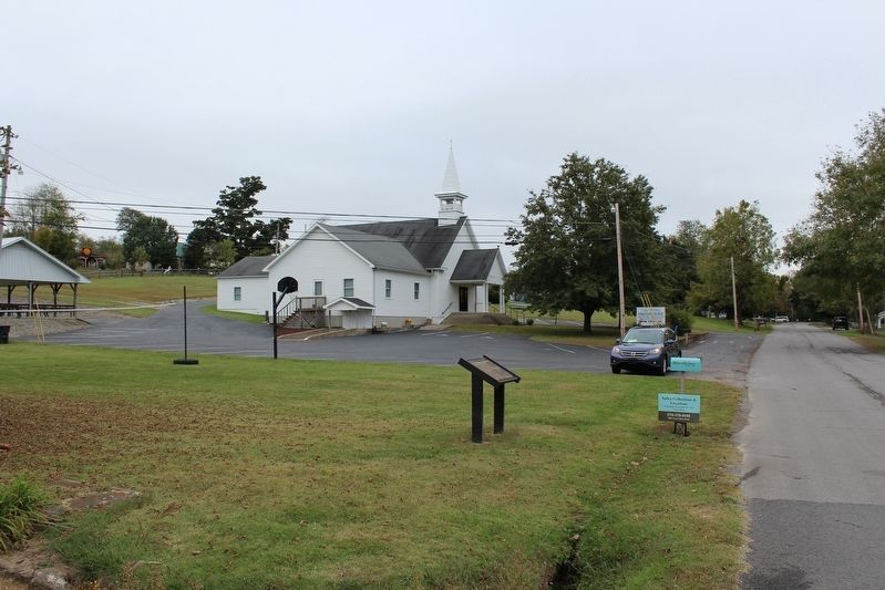
After engaging Union forces in Columbia the afternoon of July 3, Gen. John Hunt Morgan’s command continued north on the Columbia-Lebanon Pike. Just beyond the town, they passed Union Camp Gilbert, formerly named Camp Boyle, now abandoned - the . . . — — Map (db m170574) HM
On June 28, 1802, court ordered permanent seat of justice on the public square. First courthouse built in 1806. Present structure was designed by McDonald Bros., Louisville, and built by Wm. H. Hudson and Columbus Stone in 1887. A unique . . . — — Map (db m83384) HM
This tablet is to commemorate throughout the ages the valor and patriotism of the sons of Adair County who made the supreme sacrifice in the World War
1914-1918
Roll of Honor
Carley Ballou, Columbia, Ky. •
Jacob Biggs, Cane . . . — — Map (db m276351) WM
A foremost champion of the Union, a staunch friend of the stricken South, defender of constitutional freedom. Born Columbia 1817, died 1895 and buried in city cemetery. Veteran Mexican War, leader famed First Kentucky Union Cavalry, hero of many . . . — — Map (db m83387) HM
Active Presbyterian congregations formed early in the county’s settlement: 1803 on Col. Casey’s farm & 1827 in Columbia. Church was built in 1857 and has had continuous services ever since. County and city congregations merged in 1912. . . . — — Map (db m170507) HM
General John Hunt Morgan's cavalry, returning from second Kentucky raid, passed here on way back to Tennessee, Jan. 1, 1863. On raid, Union's rail supply line wrecked and $2,000,000 property destroyed. July 3, 1863, Morgan here again drove out . . . — — Map (db m83391) HM
For Gen. John Adair, Governor of Kentucky 1820-24. Born, 1757, in South Carolina, came to Ky., 1788. Member of Kentucky Constitutional Convention, 1792. Served in Ky. House of Representatives, 1793-95, 1798, 1800-03, 1817. US Senator, 1805-06, . . . — — Map (db m139816) HM
A founder of Columbia, Trabue built original house (SW corner of this structure) ca. 1823. He served as trustee, sheriff, and justice of peace; operated grist mill, inn and retail store. Here Trabue wrote memoirs, 1827, of pioneer era, which . . . — — Map (db m83406) HM
Frank Lane Wolford (1817 - 1895). Adair County native, organized 1st Kentucky Cavalry (US) in 1861. His men knew little about the drill and discipline but had the utmost confidence in Wolford and he in them. The soldiers supplied their own horses . . . — — Map (db m170508) HM
Home of Sergeant Dakota Meyer,
Medal of Honor recipient,
September 15th, 2011,
United States Marine Corps,
“For those who gave all“ — — Map (db m276348) WM
Girlhood home of Jane Lampton (1803-1891). Wife of John Marshall Clemens. Mother of "Mark Twain." Granddaughter of Colonel William Casey, original Adair County settler. — — Map (db m83397) HM
Male and Female High School Site
The Columbia College Joint Stock Company formed in 1853 to build the M&F School. It was conveyed to trustees appointed by Transylvania Presbytery and opened in 1855. The building was a Union Camp during . . . — — Map (db m170509) HM
Home of Col. William Casey, early Ky. pioneer and great-grandfather of Samuel L. Clemens (Mark Twain). Born in Va., came to Ky. in 1779. Built Casey Station on Dix River. In 1791 moved to Russell Creek near here. Member second Kentucky Const. Conv., . . . — — Map (db m244689) HM
John Hunt Morgan entered Kentucky July 2 with about 2,500 men who swam the rain swollen Cumberland River - many naked, not to be encumbered with soggy clothes. The rebel yell of the on-coming nude men took the Union scouts by surprise.
Columbia . . . — — Map (db m170510) HM
Historical novels by this talented author have sold more than three million copies. Most settings of her some twenty books reflect her adopted home, the Green River area where she lived with her husband Henry, and the Indian territory of Okla. and . . . — — Map (db m245361) HM
In November 1863, Dumont Hill looked like a city of tents. Each regiment arranged its tents according to army regulations. At one end was a guard station. The officers’ latrines, called sinks, were at the other end. In between was the baggage train, . . . — — Map (db m152742) HM
A Once Proud Army in Tatters
In early 1862, the Union Army of the Ohio numbered almost 70,000 men. New and veteran soldiers alike were eager for action. By November, the army was demoralized, angry that their commander, General Don . . . — — Map (db m152736) HM
Camps of Soldiers Surrounded Scottsville
Tents housing almost 5,000 soldiers—ten times the population of Scottsville in 1862—covered the hillsides around town. Imagine what it looked like. Imagine the sounds of men drilling, . . . — — Map (db m152739) HM
Bethlehem Missionary Baptist Church
Congregation founded 1801. Services held, uninterrupted, except for a Sunday in Nov. 1862, because of "Army passing down the pike and the house having sick soldiers in it." Called "Difficult" and located near . . . — — Map (db m143077) HM
Confederate forces of 200 under Col. John M. Hughs attacked here, Dec. 8, 1863. Twelve days earlier he had attacked Monticello, Ky., captured then paroled garrison of 153 men; no supplies. Continuing to harass USA forces, seek stores[,] he came . . . — — Map (db m170511) HM
For Lieut. Col. John Allen, born in Va., 1771, came to Ky., 1779. Practiced law in Shelby County. State Representative, 1801-07, and State Senate, 1807-13. Killed in battle at River Raisin, Jan. 22, 1813, and one of nine officers at that battle for . . . — — Map (db m131262) WM
Ebenezer Dumont twice served his country in time of war. He fought in the Mexican War, earning the rank of lieutenant colonel. Afterward the Vevay, Indiana native resumed his successful career in politics. When the Civil War began Dumont did not . . . — — Map (db m152741) HM
Halcomb House, c. 1900
Family home of Dr. and Mrs.
"F.J." Halcomb, Jr., for 67 years. Dr. Halcomb saw patients here as well as at his clinic and the local hospital. Patients would often visit the home, where the screened-in porch was . . . — — Map (db m270067) HM
Built in 1919 during an oil boom, Jacksonian gained wide prominence. It was third hotel on site and stood here for 54 years. Closed, 1973. Hotel received name because of its location on Jackson Highway, now 31-E, one of oldest roads in Kentucky. . . . — — Map (db m131260) HM
Captain Eli Lilly commanded the 18th Indiana Battery, the only battery known to have been at Scottsville. While here, the battery refitted, obtained ammunition, and procured horses to replace those that died in a fire at Allen Springs the night . . . — — Map (db m152745) HM
On August 29, 1862 at the beginning of the Confederate Invasion of Kentucky. Colonel John Hunt Morgan rode into Scottsville, leading a brigade of 1,100 cavalrymen. Morgan and his men were on their way to Lexington, where they planned to join . . . — — Map (db m131263) HM
Mt. Union Church
Organized in 1864 under the name of Mulberry Hill General Baptist Church. In 1869 the original log building burned. The congregation rebuilt on present site, changed the name to Mt. Union. Thirteen churches were invited from . . . — — Map (db m143075) HM
In early October Morgan’s cavalry swept through the Trammel Community in search food and supplies. Some, such as John Howard Morgan and his mother, Isabella, who were relatives of John Hunt Morgan and were sympathetic to the southern cause, . . . — — Map (db m170512) HM
Allen County was formed in April 1815. Scottsville was named for Gen. Charles Scott, 4th governor of Ky. In 1816, location was chosen for county seat because of abundant water supply from this spring. County bought 100 acres, which were laid off in . . . — — Map (db m143071) HM
1860 – A Bustling County Seat Town
Imagine Scottsville in 1860. A fine two-story octagonal brick courthouse dominates the busy court square. The prosperous rural town of 403 residents boasts a public spring, at least one church, a . . . — — Map (db m152751) HM
Each regiment had a quartermaster, who provided everything the men needed except food and weapons.
Quartermaster Wainwright
While in Scottsville, Lieutenant William A. Wainwright, quartermaster of the 75th Indiana, obtained and . . . — — Map (db m152750) HM
The Trammel Fork Church was founded in 1802 with seventy members. Elder John Hightower was first pastor. This church was instrumental in constituting ten area churches. The first meeting house was a log structure; church now occupies its third . . . — — Map (db m143073) HM
Seven regiments of infantry and one artillery battery encamped at Scottsville in November 1862. These regiments made up the 12th Division of the Army of the Cumberland under the command of General Ebenezer Dumont.
Among the soldiers at . . . — — Map (db m152747) HM
Vietnam Veterans Memorial
1960 - 1975
In remembrance of those who gave
the ultimate for patriotism.
Their lives
Wendell L. Wilson U.S. Army Oct. 28, 1966
George N. Walker U.S. Army May 28, 1968
Darrell W. Maynard U.S. Army June . . . — — Map (db m270064) WM
This Lawrenceburg native was one of the first black women in Ky. to enlist during World War II. She joined Women's Army Auxiliary Corps in 1942, and was commissioned a 1st Lieutenant the next year in newly named Women's Army Corps. While . . . — — Map (db m229583) HM
For Richard Clough Anderson, Jr., 1788-1826. Served in Ky. Legts. three terms. Elected Congress, 1817, for two terms. Returned Ky. Legis., 1822, chosen speaker. Appointed Minister to Colombia by Pres. Monroe, 1823, where he negotiated first treaty . . . — — Map (db m244638) HM
Oct. 8, 1862, during Battle of Perryville, Gen. Jones Withers' troops of Gen. Kirby Smith's CSA army attacked USA force of Gen. J.W. Sill near Fox Creek while Smith skirmished with Sill's rear guard. Many Union prisoners and 20 wagons captured. A . . . — — Map (db m162489) HM
Kavanaugh School.
Rhoda C. Kavanaugh founded school on Woodford Street which became known as "Little Annapolis." First boarding student came to prepare for Naval Academy in 1914. From then until 1945, Mrs. Kavanaugh launched 150 future Navy . . . — — Map (db m236572) HM
A Cumberland Presbyterian church organized by Rev. Laban Jones in 1827 in log cabin on Thomas McCall farm, overlooking McCall Spring. the itinerant pastor traveled his circuit on horseback visiting his "preaching places twice a year". This church . . . — — Map (db m105465) HM
Kavanaugh Academy 1904-09; Anderson Co. High School 1909-20; Kavanaugh High School 1920-49. Rhoda C. Kavanaugh, A.B., founder and principal 41 years. Under her direction it ranked among the nation's foremost preparatory schools for Annapolis and . . . — — Map (db m236573) HM
The McAfee bros., James McCoun, Jr. and Samuel Adams, first white men to explore this area, 1773. Cove Spring and Cove Spring Branch in Franklin Co. boundary line, 1794. Maj. Gen. Kirby Smith, CSA, and troops camped here on their way to join General . . . — — Map (db m105464) HM
James Beauchamp (Champ) Clark born near here, 1850. Attended U. of K. Taught school in county, 1870-71. Pres. Marshall College, 1873-74. Congressman from Missouri 24 yrs. Led defeat of Cannonism, control of House by Speaker. Then Speaker, 1911-19. . . . — — Map (db m313) HM
Mother church of Baptist witness in area. Constituted Feb. 3, 1798, by William Taylor and John Penney with seven charter members. John Penney, first pastor, served until his death, 1833. Great-grandfather of J.C. Penney, founder of Penney Stores. In . . . — — Map (db m244605) HM
This renowned scholar, raconteur, and lawyer was born in Anderson Co. Educated first in a one-room school at Glensboro, he graduated from U.K. Law School in 1912. Among his books was Lincoln and the Bluegrass (1955). His talk on Cassius Clay, . . . — — Map (db m34786) HM
In honor and memory of the veterans of Barlow, Kentucky who served their country faithfully and proudly in war and peace
"God Bless America"
Dedicated - May 17, 1990 — — Map (db m302399) HM
Site of the first courthouse in
Ballard Co., Kentucky, which, until
1886, was comprised of present
Ballard and Carlisle Counties.
Blandville, like Ballard Co.,
named for Captain Bland Ballard.
Established as the county seat by
Kentucky . . . — — Map (db m289924) HM
Settled by Scott family ca. 1845. Developed from family farmstead to highly diversified & productive cattle, jack stock and mule ranch. In 1998, recognized by National Cattlemen's Beef Assoc. as one of the oldest cattle ranches in U.S. under . . . — — Map (db m216302) HM
Blandville was the county seat and largest town in Ballard County during the Civil War. Blandville, like Ballard County, was named for Captain Biand Bailard, a veteran of the American Revolution, frontier Indian wars, and the War of 1812. Blandville . . . — — Map (db m289923) HM
Native American Indian of the Mississippian culture were buried in this cemetery mound sometime in the A.D. 1200s. First excavated in 1932 by owner Col. Fain King, the mound was referred to as “Mound C”. A building was constructed over . . . — — Map (db m58870) HM
Excavations have shown that building stood on several earlier levels of this mound.
We do not know how big those buildings were.
This structure is approximately the size of the posthole pattern in the architecture building (Mound B) — — Map (db m58872) HM
For Capt. Bland Ballard, 1759-1853. Born in Va. Came to Ky. in 1779. Devoted life protecting frontier. Scout for George Rogers Clark's Ohio expedition, 1780. '82; Wabash campaign 1786. In the battles of Fallen Timbers, 1793; Tippecanoe, 1811; River . . . — — Map (db m18550) HM
Fort Jefferson (also known as Camp Crittenden) was the second of two Union Army posts established in Ballard County in September 1861, following the Confederate occupation of Columbus. Fort Jefferson was first established during the American . . . — — Map (db m18493) HM
The story of the cross at Wickliffe began in 1937 when a few members of a community choir, spearheaded by Mrs. Noah Geveden, erected a small wooden cross on a hill at the Ancient Buried City (now known as Wickliffe Mounds Research Center) in . . . — — Map (db m113749) HM
Fort Jefferson Site Built in 1780 by George Rogers Clark as part of impressive plan of settlement, conceived by Gov. Patrick Henry of Virginia, later pursued by and named for Gov. Thomas Jefferson. The fort was to protect US claim to its . . . — — Map (db m18639) HM
Site of an ancient religious and commercial center of the Mound Builder. Approximately one thousand years old, situated on the only high ground at the confluence of the Mississippi and Ohio Rivers. Tombs, temples, altars, jewels, dwellings, tools, . . . — — Map (db m58869) HM
Long before Lewis and Clark stopped near Wickliffe in western Kentucky on their outbound trip to the west, Fort Jefferson had been built in 1780-81 by George Rogers Clark during the Revolutionary War as an outpost against British-led Indian . . . — — Map (db m18548) HM
(North Side):Lewis and Clark in Kentucky Fort Jefferson Lewis and Clark and a party of eight men visited the site of Fort Jefferson on Nov. 18, 1803, while on their epic 1803-1806 journey to the Pacific. Fort est. in 1780 by Clark's . . . — — Map (db m18545) HM
Division Patch ☆ Silver Star ☆ Purple Heart ☆ Regimental Crest Private First Class Robert Monroe Hammonds was born on January 9, 1926, the second of six children of Rufus D. and Jettie T. Hammonds. A native of Wickliffe, . . . — — Map (db m180132) HM WM
The Prince of the French Explorers
Commissioned by Louis XIV of France, the Sieur Robert de LaSalle, sweeping down the Mississippi with his flotilla of canoes, stopped in 1682 at this place, in his quest for the mouth of the Mississippi and . . . — — Map (db m18551) HM
One of first Kentucky positions, Fort Jefferson, occupied by Union troops after Confederate seizure of Columbus, Sept. 1861. From this base, Gen. U.S. Grant directed demonstration against Columbus, Jan. 1862. Troops from here joined in capturing . . . — — Map (db m18519) HM
Nearly one thousand years ago, this village was home for Native Americans of the prehistoric Mississippian culture. Peaceful farmers, these mound building Indians lived throughout the Ohio and Mississippi river valleys. Exhibits at Wicklffe Mounds . . . — — Map (db m58873) HM
The contruction of George Rogers Clark's Fort Jefferson was first proposed during a Council of War meeting between Clark and his junior officers at the Falls of the Ohio (Louisville) November 16, 1779, following Clark's succesful capture of . . . — — Map (db m278121) HM
Many people assume the only flag flown by Americans during the American Revolution
(1775 to 1783) was the Betsy Ross flag, but nothing could be further from the truth. The Betsy Ross flag was not created until 1777, two years into the . . . — — Map (db m278110) HM
Monument dedicated to the civilians/soldiers who gave their lives settling/defending George R. Clark's Fort
Jefferson & Town of Clarksville, 1780-1781 during the American Revolution in the West and the British-led Native Americans who gave their . . . — — Map (db m278127) WM
The purpose of George Rogers Clark's Fort Jefferson was multi-faceted. Both Great Britain and the American Colonies (Virginia) claimed the Confluence area, and both wanted to fortify this strategic, and potentially economically important area. . . . — — Map (db m278128) HM
Drawn by newspaper accounts, an estimated crowd of 10,000 people gathered around Sand Cave on Sunday, February 8th. If you were among the crowd that day you would have stopped at about this spot by a five-strand barbed wire fence constructed to . . . — — Map (db m285691) HM
In 1853, the Knob City Land Company, composed of Messrs. Graham, Quigly, Adams and Hopson, of Louisville, envisioned building a resort town close to the renowned Mammoth Cave. The L&N Railroad, under construction, would pass through the area in a . . . — — Map (db m286062) HM
CSA General John Hunt Morgan and a company of troops arrived here, May 11, 1862. They seized a train reported to be carrying some of Morgan's men captured at Lebanon, Tenn. Instead, it carried railroad employees whom he released. Morgan burned the . . . — — Map (db m321) HM
In memory of Dennison, Cortland Ellis -
Nov 18, 1947 to May 5, 1968
Hatcher, Anthony Dwight -
Oct 22, 1947 to May 22, 1968
and the 22 KY men still POW or MIA,
They gave their lives in
the service of their country.
Republic of . . . — — Map (db m276368) WM
As a town built for opportunity, Cave City naturally became famous for a man who risked it all in search of fortune. In January 1925, one of the greatest news stories between the two world wars broke across the nation, with Cave City at its . . . — — Map (db m286006) HM
Confederate Brigadier General, commanded famous “Orphan Brigade” in Civil War. In 1861 he conducted recruiting and training camp here. State legislature, 1850-54, 69-70. US Congress, 1870-73. Member of Kentucky Court of Appeals for 24 years, . . . — — Map (db m96727) HM
General Joseph H. Lewis, commander of the famous Orphan Brigade, established, at the outbreak of the Civil War, a recruitment and training camp here in Cave City. Here he formed the Confederate 6th Kentucky Infantry Regiment, for which he received a . . . — — Map (db m130009) HM
Clarence M. Reynolds and family was the proprietor of Handy and Reynolds, a general store that was built in 1915 on the corner of Broadway and First Street in Cave City. It was closed in the early 1970s and the building was soon demolished. As a . . . — — Map (db m285992) HM
Along this entrance road to Mammoth Cave, on Friday, January 30, 1925, local cave owner and well-known cave explorer Floyd Collins descended alone underground searching for a cave in a better location. The Collins family's cave, Crystal Cave, lay . . . — — Map (db m285689) HM
On May 11, 1862 Col. John Hunt Morgan and his advance guard seized the Cave City depot and captured the next train that stopped. Morgan's entire command arrived shortly thereafter. Morgan's troops proceeded to destroy the train; four passenger . . . — — Map (db m322) HM
Floyd Collins was first to explore Sand Cave. Fallen rock trapped him in narrow passage 150 ft. from entrance, Jan. 30, 1925. Rescuers reached him with food and heat for short time. Aid cut off by shifting earth closing passage. Engineers sank . . . — — Map (db m319) HM
For sixteen days in February of 1925, the world focused its attention on this remote corner of Kentucky as hundreds of people labored day and night to reach cave explorer Floyd Collins, trapped in a narrow passage of Sand Cave, 60 feet below the . . . — — Map (db m285680) HM
For 12 days volunteer work crews labored in 24-hour shifts under the lip of this rock ledge to sink a rescue shaft 60 feet to reach Floyd Collins. No contact with Floyd had been possible since a collapse on February 3rd. The work slowed due to . . . — — Map (db m285706) HM
Reorganized from the 106th A.A. Automatic Weapons Bn. and redesignated as the 623rd F.A. Battalion. Federally recognized January 29, 1947 with headquarters at Glasgow. Re-entered Federal service January 23, 1951 at Glasgow. The only unit of the . . . — — Map (db m88128) HM WM
October 6, 1863
On October 6, 1863 Confederate Col. John M. Hughes, commanding 129 men of the 25th Tennessee Infantry, attacked Fort Wiliams. The 37th Kentucky Mounted Infantry, some 420 men under the command of Maj. Samuel Martin, . . . — — Map (db m274983) HM
Korea
This conflict came within less than five years after World War II. A war fought by a few veterans and many men and women still in their teens. We were oftentimes poorly armed. Fought against a force far superior in numbers. Yet . . . — — Map (db m88011) WM
This memorial commemorates the sacrifice of those Barren Countians who received the Purple Heart for injury or death as the result of enemy action. They bled and died that we the protected might live in freedom. May we ever be mindful of their . . . — — Map (db m88121) WM
In honor of the men of this county
who served their country in the Revolutionary War
1775-1783
David Arnett •
John Brownlee •
Elisha Boon •
Jorn Bagley •
Callum Bailey •
William Boyd •
William Bell •
John Beavers •
James Bibb . . . — — Map (db m270056) WM
Viet Nam
This memorial has been placed here as a reminder of the heroism and self-sacrifice of those Barren Countians who answered their country’s call during the Viet Nam Conflict.
They did their duty in a trying and difficult time. . . . — — Map (db m88010) WM
This monument has been erected to the lasting memory of those men and women of Barren County who answered the call of their country in the Great War 1917-1918
Dedicated Nov. 11, 1988 — — Map (db m88124) WM
Taken from parts of Green and Warren counties. Glasgow, county seat, was founded in 1799. County received name from the “barrens” or prairies of this region.
Early explorers and settlers came through this area. In Civil War, first . . . — — Map (db m88132) HM
In Commemoration of Barren County’s
Two Congressional Medal of Honor Winners
First Sergeant William Logan Day
Co. E, 5th United States Cavalry
For gallant conduct during campaigns and engagements with Apaches during 1872-73.
. . . — — Map (db m88130) HM WM
(Front Side)
Native son of Glasgow.
Internationally acclaimed
musical genius,
instrumentalist,
recording artist,
composer, arranger
and conductor
Received eleven gold and
two platinum records
(Back Side) . . . — — Map (db m88123) HM
On Dec. 24, 1862, main body of Morgan's Raiders made camp south of here. Capt. Quirk and scouts entered town although USA troops patrolled area. CSA scouts wished to celebrate Christmas Eve, and dismounted at tavern. A patrol of 2nd Mich. Cavalry, . . . — — Map (db m73020) HM
(side 1)
Confederate Congressional Medal of Honour
The President (CSA), in 1862, was authorized to confer a Medal of Honour upon one enlisted man of each company for “every signal victory.” At first dress-parade, . . . — — Map (db m73018) HM
Fort Williams
Fort Williams was ordered constructed in Glasgow in the spring of 1863. It was during the spring and summer of 1863 that the Union army began to build defensive works at strategic points in Kentucky to defend transportation . . . — — Map (db m274982) HM
In 1855, John and Francis Marion Jones formed a partnership for selling goods at Myers Steam Mill on Beaver Creek in Barren County. A petition for a post office was granted in 1856 & name changed from Myers Mill to Coral Hill. Store was catalyst . . . — — Map (db m143082) HM
On Jan. 12, 1939, the Goodnight substation was energized. The circuit powered 107 homes along 51 miles of power line in Barren Co. This substation was the first in Farmers RECC service territory. Electricity improved rural life, increased . . . — — Map (db m96997) HM
Congregation formed ca. 1802, when Isaac Robertson, a member, donated lot for log structure erected here. Rev. John Howe was first minister. Present Gothic Revival sanctuary built ca. 1853. Church’s style of architecture features Tudor-arched window . . . — — Map (db m88133) HM
On 6 October, 1863, Confederate forces raided Fort Williams. Union losses were 9 KIA, 26 WIA and 226 POW. Confederate losses were 1 KIA and 4 WIA. — — Map (db m88142) HM
Site of Civil War fort built in spring of 1863. Attacked Oct. 6 by Confederate Col. John M. Hughs and his 25th Tenn. Infantry. US troops under Maj. Samuel Martin surprised. Over 200 horses captured, part of fort burned, and 142 men taken prisoner, . . . — — Map (db m39405) HM
4505 entries matched your criteria. The first 100 are listed above. Next 100 ⊳