By Tom Bosse, October 13, 2016
A Night in Cane Valley Marker
GEOGRAPHIC SORT Title Sort Marker Number Sort Marker Number Sort N Marker Number Sort T Publication Order Sort Publication Order Sort A Erected Year Sort Most Viewed Sort Most Recent-Interest Sort Most Recently Changed Sort SEE FAQ #33 FOR DESCRIPTIONS
On Cane Valley Road south of Cane Valley School Road, on the right when traveling north.
On Public Square at Jamestown Road (Kentucky Route 80), on the left when traveling north on Public Square.
On Public Square at Burkesville Street (Kentucky Route 80), on the left when traveling south on Public Square.
On Public Square at Campbellsville Street (Kentucky Route 55), on the left when traveling east on Public Square.
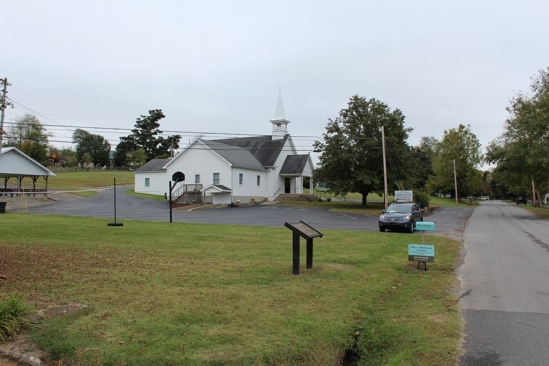
On Burkesville Street (Kentucky Route 80) at Church Street, on the right when traveling south on Burkesville Street.
On Public Square at Burkesville Street (Kentucky Route 80), on the right when traveling south on Public Square.
On Greensburg Street (Kentucky Route 439) at Public Square, on the left when traveling south on Greensburg Street. Reported missing.
On Jamestown Road (Kentucky Route 80) at Elm Street, on the right when traveling north on Jamestown Road.
On Campbellsville Street (Kentucky Route 55) at Lindsey Wilson Street, on the left when traveling north on Campbellsville Street.
On Greensburg Street (Kentucky Route 439) at Public Square, on the right when traveling south on Greensburg Street.
On East Guardian Street, on the right when traveling south.
On Edmonton Road (State Highway 80) west of Country Club Road, on the left when traveling west.
On Burkesville Street (Kentucky Route 80) at Hudson Street, on the left when traveling north on Burkesville Street.
On Sprout Springs Road at Elkhorn Road (Kentucky Road 76), on the right when traveling south on Sprout Springs Road.
Near North Bedelia Street (Kentucky Route 1386) 0.1 miles west of Dumont Hill Street, on the right when traveling west.
Paid Advertisement
Near North Bedelia Street (Kentucky Route 1386) 0.1 miles west of Dumont Hill Street, on the right when traveling west.
Near North Bedelia Street (Kentucky Route 1386) 0.1 miles west of Dumont Hill Street, on the right when traveling west.
On Old Glasgow Road (Old U.S. 31E) at Durham Spring Road, on the left when traveling north on Old Glasgow Road.
On West Main Street (Kentucky Route 2152) west of South Cemetery Street, on the right when traveling west.
On West Main Street (Kentucky Route 2152) west of South Cemetery Street, on the right when traveling west.
Near North Bedelia Street (Kentucky Route 1386) 0.1 miles west of Dumont Hill Street, on the right when traveling west.
On West Main Street (Kentucky Route 2152) west of Smiths Grove Road (Court Street), on the right when traveling east.
Near North Bedelia St, 0.1 miles west of Dumont Hill Street, on the right when traveling west.
On Smith Grove Road (South Court Street) at West Main Street (Kentucky Route 2152), on the left when traveling north on Smith Grove Road (South Court Street).
On Bowling Green Road, 0.2 miles north of Whetstone Way, on the right when traveling north.
On Old Allen Springs Road at Bowling Green Road, on the right when traveling east on Old Allen Springs Road.
On South 1st Street at East Locust Street, on the right when traveling north on South 1st Street.
Near North Bedelia Street (Kentucky Route 1386) 0.1 miles west of Dumont Hill Street, on the right when traveling west.
Near North Bedelia Street (Kentucky Route 1386) 0.1 miles west of Dumont Hill Street, on the right when traveling west.
On Pope Road (County Route 1332) 0.1 miles west of Jenny Lane, on the left when traveling west.
Near North Bedelia Street (Kentucky Route 1386) 0.1 miles west of Dumont Hill Street, on the right when traveling west.
Paid Advertisement
On South Main Street (Business Kentucky Route 127) at East Court Street, on the right when traveling north on South Main Street.
On North Main Street at Posey Street, on the right when traveling north on North Main Street.
On Fox Creek Road (U.S. 62) 0.2 miles south of Mill Creek Pike (Kentucky Route 513), on the right when traveling north.
On East Woodford Street (U.S. 62) near Dogwood Drive, on the left when traveling east.
On U.S. 127, on the left when traveling north.
On East Woodford Street (U.S. 62) east of Dogwood Drive, on the right when traveling west.
On U.S. 127, 0.4 miles south of Gilberts Creek Road (Kentucky Route 513), on the left when traveling north.
On Harrodsburg Road (Business U.S. 127) at Salt River Road, on the right when traveling south on Harrodsburg Road.
On West Broadway Street (U.S. 62) at Old Frankfort Road (U.S. 127), on the right when traveling west on West Broadway Street.
On Paducah Road (U.S. 60) 0.4 miles east of Stafford Road, on the right when traveling east.
Near Green Street (U.S. 60) west of 1 Street, on the right when traveling west.
Near Green Street (U.S. 60) west of 1st Street, on the right when traveling west.
On 4th Street (U.S. 51/62), on the right when traveling north.
On Westvaco Road (U.S. 51/62), on the right when traveling south.
On U.S. 51, on the right when traveling south.
Paid Advertisement
On Westvaco Road (U.S. 51/62), on the right when traveling south.
Near Green Street (U.S. 60) west of 1st Street, on the right when traveling west.
On Westvaco Road (U.S. 51/62), on the right when traveling south.
On Westvaco Road (U.S. 51/62), on the right when traveling south.
On 4th Street (U.S. 62) just south of Ohio Street, on the right when traveling north.
On Green Street (U.S. 51/62), on the right when traveling south.
On Westvaco Road (U.S. 51/62), on the right when traveling south.
Near Green Street (U.S. 60) west of 1st Street when traveling west.
On W. Broadway Street (State Highway 70) near N. 1st Street, on the right when traveling west.
On W. Broadway Street (State Highway 70) at N. 1st Street, on the right when traveling west on W. Broadway Street.
On W. Broadway Street (State Highway 70) at N. 1st Street, on the right when traveling west on W. Broadway Street.
On W. Broadway Street (State Highway 70) at N. 1st Street, on the right when traveling west on W. Broadway Street.
Near Green Street north of Washington Street, on the left when traveling north.
On Fort Williams Way south of Cross Street, in the median.
Near Main Street (State Highway 90) at Race Street, on the left when traveling west.
Near Race Street south of Main Street.
Paid Advertisement
Near Main Street (State Highway 90) west of Green Street, on the left when traveling west.
Near Washington Street at S. Race Street, on the right when traveling east.
On Washington Street at Green Street, on the left when traveling east on Washington Street.
On Green Street at Main Street, on the left when traveling north on Green Street.
Near Green Street north of Washington Street, on the left when traveling north.
On Washington Street at S. Race Street, on the right when traveling east on Washington Street.
On Race Street (West Public Square) (Business U.S. 68) north of Washington Street, on the left when traveling south.
On Race Street (West Public Square) (Business U.S. 68) north of Washington Street, on the left when traveling south.
Near Fort Williams Way south of Cross Street.
On Coral Hill-Lecta Road at Coral Hill Road (Kentucky Route 740), on the right when traveling east on Coral Hill-Lecta Road.
On N. Jackson Highway (U.S. 31E) 0.1 miles north of Horton Rigdon Road, on the right when traveling north.
On S. Broadway Street at E. Washington Street, on the right when traveling north on S. Broadway Street.
Near Fort Williams Way south of Cross Street.
On N.L. Rodgers Wells Boulevard (Bypass U.S. 31-E) at Cross Street, on the right when traveling north on N.L. Rodgers Wells Boulevard.
Near Fort Williams Way south of Cross Street, in the median.
On Leslie Avenue south of Barrett Avenue, on the right when traveling south.
Paid Advertisement
Near Race Street south of Main Street.
On Tompkinsville Road (Kentucky Route 63) at Bristletown Road, on the left when traveling north on Tompkinsville Road.
On E. Main Street (State Highway 90) 0.1 miles east of Franklin Street, on the right when traveling west.
On E. Main Street (State Highway 90) east of Franklin Street, on the right when traveling west.
On U.S. 31 E at Lexington Drive, on the right when traveling south on U.S. 31 E.
On Washington Street / South Public Square at South Race Street, on the right when traveling east on Washington Street / South Public Square.
On S. Race Street south of Main Street (Kentucky Highway 90), on the left when traveling south.
On Race Street at Washington Street, on the left when traveling south on Race Street.
On Green Street north of Washington Street, on the left when traveling north.
On Finney Road (Kentucky Route 252) 0.1 miles Old Kentucky Road 252, on the left when traveling east.
On Race Street at Washington Street, on the left when traveling south on Race Street.
On Hiseville-Park Road (State Highway 740) at Seymour-Park Road (State Route 571), on the right when traveling north on Hiseville-Park Road.
On North Jackson Highway (U.S. 31E) 2.3 miles south of Kentucky Route 218, on the left when traveling south. Reported missing.
On Old Dixie Highway (State Highway 255) west of J. Brown Road, on the right when traveling east.
Near Mammoth Cave Parkway (State Highway 255) 1.3 miles north of Interstate 65, on the right when traveling north.
Near Mammoth Cave Parkway (State Highway 255) 1.3 miles north of Interstate 65, on the right when traveling north.
Paid Advertisement
On Bethel Ridge Road, on the left when traveling north.
On U.S. 60 at Old River Road, on the left when traveling west on U.S. 60.
On Kentucky Route 36 just south of Olympia Spring Road and Old State Road, on the left when traveling north.
Near West Main Street (U.S. 60).
On West Main Street, on the left when traveling west.
4082 entries matched your criteria. The first 100 are listed above.
Next 100 ⊳