On Foothill Road (State Highway 206) north of Leealan Drive, on the right when traveling north.
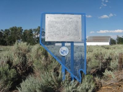
Luther Canyon, west of this site, takes its name from Ira M. Luther, who from 1858-1865 had a sawmill there. The house behind the marker was his home. He was a delegate to the second Nevada Territorial Legislature. After 1865, the canyon came to be . . . — — Map (db m34516) HM
On Foothill Road (Nevada Route 206) south of Mountain Reach Court, on the right when traveling north.
This is the site of the settlement on the Emigrant Trail known as Mottsville, where Hiram Mott and his son Israel settled in 1851. Their homestead was the scene of an impressive number of firsts in Carson County, Utah Territory:
1851: Israel . . . — — Map (db m40102) HM
On Foothill Road (Nevada Route 206) near Canyon Creek Court, on the left.
In 1861, a blacksmith shop, a store, a boarding house, and two saloons comprised the village of Sheridan. The village had grown up around Moses Job’s General Store, established prior to 1855.
The Surveyor General, in his 1889-90 biennial . . . — — Map (db m21309) HM
On Courthouse Alley at Gillman Avenue, on the left when traveling north on Courthouse Alley.
One of the original businesses in Gardnerville, the East Fork Hotel once stood proudly on Main Street at Gilman Ave. In 1892-93, Brothers George and Charles Brown built a 20' x 50' building with a saloon in front and a small residence in the back . . . — — Map (db m236760) HM
Near Foothill Road, on the right when traveling north.
"We passed around a barren portion of the mountain, where there gushed from the base... almost a thousand springs of hot water in half a mile,... The springs form a hot water lake all along their course." - William R. Rothwell, Aug 18, 1850 — — Map (db m99871) HM
Near Main Street, on the right when traveling north.
"At the... foot of the mountains, the Mormons... have established a trading post.... Passing on from this place, as fast as we could,... to save what money we had, we continued up Carson Valley" - Edward Patterson, Jul 11, 1850 — — Map (db m99870) HM
On Nevada Route 206 east of Main Street, on the left when traveling east.
In 1864, the fledgling Nevada State Government was comprised of ten counties with twelve school districts, eight school houses, and eighteen schools. This was a time when no one seriously contemplated making Nevada a permanent home as people . . . — — Map (db m115736) HM
On Genoa Lane near Pioneer Drive, on the left when traveling west.
On this tree, early morning Nov. 26, 1897 occurred the blackest episode in the history of Nevada. Adam Uber of Calaveras Co. Cal. was forcefully taken from jail abused and hanged by an angry mob, for the pistol killing of Hans Anderson a local . . . — — Map (db m20655) HM
On Genoa Lane at Jackson Valley Road/Main Street (Nevada Route 206), on the right when traveling west on Genoa Lane.
Born: April 30, 1827, Tinn, Telemark, Norway
Emigrated to America from Norway: May 30, 1837
Carried the mail: January 1856 – May 1876 (Twice a month -
during the winter for 20 years.)
Distance: 90 miles between Placerville, Ca and . . . — — Map (db m20679) HM
On Jacks Valley Road/Main Street (Nevada Route 206), on the right when traveling south.
Born April 30, 1827 at Upper Tinns, Telemark District of Norway, John A. “Snowshoe” Thompson’s parents Tosten Olsen and Gro Johnsdotter baptized him as John Tostensen. At an early age he learned to “snow skate” (snow ski). In . . . — — Map (db m20712) HM
[Upper Marker:]
As a Tribute
To a great compatriot from Telemark
This plaque was presented
by the Norwegian Olympic Ski Team
Competing at Sqaw Valley
In February 1960
[Lower Marker:]
Dedicated to
John A. . . . — — Map (db m20748) HM
Near Jacks Valley Road/Main Street (Nevada Route 206) near 5th Street.
Served as first elected judge of Douglas County from 1864 – 66. Later on he served as District Attorney and Superintendent of Schools.
While in the practice of law he was considered one of the foremost jurists of his time and was engaged in . . . — — Map (db m20785) HM
Genoa's first two-story brick mansion
built for his bride in 1855-56 by Mormon
Station locator Stephen Kinsey, editor of
the first newspaper (handwritten). It was
the third land claim in Nevada. It was the
site of elegant socials and the Genoa . . . — — Map (db m135908) HM
Near Main Street north of Genoa Lane (Nevada Route 206), on the right when traveling north.
Look up at the mountains in front of you – note the various canyons. How do you think they factored into Mormon Station’s location?
The most prominent ridge to your left is Genoa Canyon. The creek that flowed out of this canyon served as the . . . — — Map (db m229119) HM
Near Jacks Valley Road/Main Street (Nevada Route 206) at Genoa Lane.
In 1851 Col. John Reese, with a little band of eighteen men crossed the great deserts and built the first trading post in Nevada, “Mormon Station”. Later came more members of the Mormon Faith who settled and established the town of Genoa. Among . . . — — Map (db m20686) HM
Near Jacks Valley Road/Main Street (Nevada Route 206) near Genoa Lane.
In early June, 1850, a party of Mormons led by Abner and Thomas Blackburn, Hampton S. Beatie and Joseph Dumont, established a trading post about a mile to the north of this site. In September, as they returned to Salt Lake City, a party of Bannock . . . — — Map (db m20698) HM
On Main Street at Genoa Lane (Nevada Route 206), on the right when traveling north on Main Street.
Panel One:
Utah Territory
The area now making up the state of Nevada was acquired by the United States after the Mexican-American War. This newly acquired land was generally labeled as unorganized territory until 1850. The State of . . . — — Map (db m227650) HM
On U.S. 395 at Genoa Lane, on the right when traveling south on U.S. 395.
Carson Valley is the birthplace of Nevada. By 1851, people settled at a place they called Mormon Station, renamed Genoa in 1856. With the early establishment of a post office and local government, the community can lay claim to the title of . . . — — Map (db m99652) HM
Near Foothill Road/Main Street (Nevada Route 206) near Genoa Lane.
In 1863, Al Livingston built this building and called it Livingston’s Exchange. In 1884, Frank Fettic bought it and renamed it Fettic’s Exchange. He operated it as a “Gentlman's Saloon” allowing no rough stuff or excessive drinking. It . . . — — Map (db m20661) HM
On Genoa Lakes Drive near Jacks Valley Road (Nevada Route 206).
The principle emigrant trail to California’s gold fields in the 1850’s passed about 50 yards east of here. In June, 1850, Hampton S. Beatie and Abner Blackburn, two Mormons from Salt Lake City, established Nevada’s first trading post a few yards . . . — — Map (db m21218) HM
On Main Street south of Genoa Lane, on the right when traveling north.
Built: Spring of 1886 Foundation: Rock
Building Size: 80 x 33 Feet – 16 Foot Ceiling
Flooring: Best Quality Wood Available
Constructed: By the Sons of Joseph Raycraft
Joseph, acting as a wagon master for 300 souls, headed west with . . . — — Map (db m98073) HM
Near Main Street north of Genoa Lane (Nevada Route 206), on the right when traveling north.
Fresh produce was difficult to come by along the California Trail. Emigrants would often pay sky-high prices for fruits and vegetables when they were available. The traders at Mormon Station were eager to take advantage of this demand. . . . — — Map (db m229118) HM
Near Main Street north of Genoa Lane (Nevada Route 206), on the right when traveling north.
Panel One: The Campbell Property
A glimpse into life in Genoa in the early and mid-1900s...
Almost 100 years after John Reese built his log cabin trading post, a man named Bernabe (Ben) Arribalsaga built the house in front . . . — — Map (db m227662) HM
“Brown was a heavy man, about 200lbs, noted as a lawless desperado whose name was terror to all who know, or had heard of him. He made his brags on the day of his death, which was his 30th birthday, that he had killed 11 men, and was going to . . . — — Map (db m115737) HM
On Genoa Lane at Main Street, on the right when traveling west on Genoa Lane.
You’re now standing at the western edge of the Great Basin. If you were an emigrant headed to California, you would have entered the Great Basin 450 miles back along the trail in southern Idaho, or 500 miles back in Salt Lake City if you had taken . . . — — Map (db m98142) HM
We Salute John “Snowshoe” Thompson
On his homemade snowshoes John carried the mail and supplies over the snowy Sierras for 20 winters. As he traveled, he saved the lives of seven people who were snowbound in mountain cabins. In . . . — — Map (db m20729) HM
On Main Street north of Genoa Lane (Nevada Route 206), on the right when traveling north.
What is this place?
Mormon Station State Historic Park is the site of a California Trail trading post. The John Reese party established the post in 1851 as a business venture. Travelers passing through often referred to Reese’s post as . . . — — Map (db m229108) HM
Near Main Street north of Genoa Lane (Nevada Route 206), on the right when traveling north.
The trading post at Mormon Station was an important supply stop for gold seekers on their way to California. Heading through Nevada, travelers followed the Humboldt River until it reached its end at the Humboldt Sink. What came next was a brutal 40 . . . — — Map (db m229306) HM
Near Main Street north of Genoa Lane (Nevada Route 206), on the right when traveling north.
This type of wagon is known as a “prairie schooner.” Designed to be as light and agile as possible, prairie schooners were the wagon of choice for emigrants traveling across the California Trail. The name stems from the white canvas covers giving . . . — — Map (db m229304) HM
Near Main Street north of Genoa Lane (Nevada Route 206), on the right when traveling north.
At trading stations and other remote settlements throughout the West, nearly all goods had to be brought in from elsewhere. This need for supplies led to the development of the freight wagon. Freight wagons were built for the sole purpose of hauling . . . — — Map (db m229303) HM
On US Highway 50 (U.S. 50) near Lake Parkway, on the left when traveling east.
(back) The Pony Express Started on April 3, 1860. The original route from Johnson Pass (Echo Summit) to Genoa went through Hope Valley to Woodfords Station.
On May 14, 1860 the new toll road over Daggett Pass opened to foot and horse . . . — — Map (db m432) HM
On Esmeralda Avenue at 5th Street on Esmeralda Avenue.
Built in 1909 by A.F. Neidt, a cement contractor who also poured most of the early sidewalks in Minden. The home was later occupied by Annie Hickey Raycraft, who offered room and board for "unmarried lady" school teachers. — — Map (db m23833) HM
"We soon entered the lower end of Carson Valley. The steep mountains on our right, are thickly covered with pines... on the east side of the valley, the mountains present no green thing; all is naked and dreary." - Franklin Langworthy, Oct. 9, 1850 — — Map (db m99867) HM
On 6th Street at Esmeralda Avenue, on the left when traveling south on 6th Street.
Grace Dangberg was the granddaughter of Heinrick Frederick Dangberg, a pioneer Carson Valley settler from a village near Minden, Germany, whose family founded Minden, Nevada.
Miss Dangberg, a distinguished Nevadan, devoted her considerable . . . — — Map (db m3191) HM
This, the second house built in Minden (1907), housed Henry Beck, the first manager of the Minden Milling Company, and was located across the street from from the mill at Fifth Street and Railroad Avenue, now Highway 395. — — Map (db m23898) HM
On Sixth Street at Esmeralda Avenue, on the left when traveling north on Sixth Street.
This house was designed for John Dangberg by Frederic DeLongchamps, a noted architect throughout the West. Construction was completed in 1912. John was one of the Dangberg Brothers who founded Minden in 1906. Dangberg Land and Livestock Company . . . — — Map (db m23933) HM
On Esmeralda Avenue at 7th Street, on the right when traveling west on Esmeralda Avenue.
Built in 1917 for local rancher M.E. Fay, the home was later owned by John and Norma Ellis. John, Norma and their son Darwin owned and operated the Minden Mercantile. — — Map (db m23936) HM
On Main Street (U.S. 395) near Esmeralda Avenue, on the right when traveling north.
Minden, the seat of Douglas County since 1916, was named for a town in Westphalia, Germany, where the founder of the D.F. Dangberg Land and Live Stock Company, was born in 1829. The company established Minden in 1905 to provide terminal facilities . . . — — Map (db m20877) HM
Built in 1906. the park became the “town square” for the first residential section of Minden. The first bandstand, a rectangular structure, was built in 1914. The present bandstand was built by the Minden Rotary Club in 1984 and . . . — — Map (db m20893) HM
On U.S. 395 at Esmeralda Avenue, on the right when traveling north on U.S. 395.
This site marks the end of the Virginia and Truckee rail extension from Carson City which was completed in 1906. A depot was built here as well as first home site for the station manager, Herb Coffin. Mr. Coffin’s home was a converted boxcar but a . . . — — Map (db m23430) HM
Near Foothill Road, on the right when traveling south.
"The trail, on leaving camp, entered a strip of upland, covered with wild sage and brush and through which run several mountain streams of much beauty." - Silas Newcomb, Aug 28, 1850 — — Map (db m99819) HM
On Kinsbury Grade (State Highway 207), on the right when traveling east.
Carson Valley below, now a broad expanse of cultivated and pasture lands, was originally a strip of meadow along the banks of the river where 49’ers, following the California branch of the emigrant trail, rested their stock and bought vegetables . . . — — Map (db m34518) HM
On Chestnut Street, on the right when traveling east.
"We have to cross the river four times... on each side of you there is a perpendicular wall of vast rock... overhanging the road so one has a feeling very near bordering on fear as he passes under those precipices" -- Lewis Beers, Aug 3, 1852 — — Map (db m149731) HM
On Tomera Road near Nevada Route 278, on the right when traveling west.
“The trail or road… ascends a considerable hill 1/3 mile ahead of us… the water here is cool, but too alkaline to be agreeable. Hot Springs in the river-bank, sulphur, &c.” —
J. Goldborough Bruff, Sep 7, 1849 . . . — — Map (db m81179) HM
On W. Hamilton Street at B Street, on the left when traveling west on W. Hamilton Street.
Carlin, the oldest town in present Elko County, was established as a railroad division point in December 1868, by the Central Pacific Railroad. It was named, by Central Pacific officials, after William Passmore Carlin, a Union officer who served his . . . — — Map (db m67264) HM
On Old Highway 40 (Chestnut Street), on the left when traveling north.
In December 1828, Peter Skene Ogden and his trapping brigade (Hudson's Bay Company's Fifth Snake Country Expedition) were the first European Americans to enter here. Joseph Paul, one of Ogden's trappers, died nearby - the first white man to die and . . . — — Map (db m136726) HM
On Tomera Road near Nevada Route 278, on the right when traveling west.
By the time emigrants reached this spot, they had enjoyed fairly good traveling for the past ten days or so, as they followed the Humboldt River road. But here they faced their first big physical challenge along the route. If they stayed along the . . . — — Map (db m81204) HM
Near Interstate 80 at milepost 292, on the right when traveling west.
Whichever direction your travels take you, you're going to have a similar experience to what the California-bound emigrants had. You're going to see the same country, except for the towns and the ranch meadows. The big difference, though, is that . . . — — Map (db m67507) HM
On Idaho Street, 0.1 miles north of 14th Street, on the left when traveling north.
Whichever direction your travels take you, you're going to have a similar experience to what the California-bound emigrants had. You're going to see the same country, except for the towns and the ranch meadows. The big difference, though, is that . . . — — Map (db m146802) HM
Near Interstate 80 at milepost 292, on the right when traveling west.
About two miles southwest of this marker, the Greenhorn Cutoff ascended and wound through the hills for about twelve miles to avoid river crossings in Carlin Canyon. — — Map (db m70353) HM
On Railroad Street at 7th Street, on the right when traveling north on Railroad Street.
Northern Nevada has been inhabited
for nearly 10,000 years. The Newe or
Western Bands of the Western Shoshone
Nation called this area home. The Newe
had seasonal campsites throughout
northern Nevada. During the spring,
they dispersed from the . . . — — Map (db m142657) HM
On Idaho Street, on the right when traveling west.
On December 29, 1868, representatives of the Central Pacific Railroad started laying out lots for the future town of Elko. By 1870, the thriving town had 5,000 people. There was an immense volume of freight and passenger traffic over the stageline . . . — — Map (db m1372) HM
Approximately 200 feet east of this site is the early location of Elko's first newspaper. Founded June 19, 1869 by former miner Edward Davison Kelly, when Elko was just six months old. The Independent has been in continuous publication ever since. — — Map (db m89505) HM
On Idaho Street, 0.1 miles north of 14th Street, on the left when traveling north.
Centuries of water runoff from mountain peaks cut channels through Nevada's mountain formations and deserts, creating river corridors that support a variety of wildlife and plants. One such river is the Humboldt, which flows across most of northern . . . — — Map (db m146801) HM
On Railroad Street at 7th Street, on the right when traveling north on Railroad Street.
Elko was named county seat when Elko
County was formed March 5, 1869.
The creation of a new county, carved out
of neighboring counties, was necessary
to handle the fast-growing mining
communities in northeastern Nevada. A
brick courthouse was . . . — — Map (db m142660) HM
Near Interstate 80 at milepost 292, on the right when traveling east.
This site is approximately 2½ miles from the Humboldt wagon trail. Hoppe-Lienhard traveled west with the Harlan-Young wagon train in 1847 to Fort Sutter. History reveals this party was part of the group which was responsible for the California . . . — — Map (db m67461) HM
Near Interstate 80 at milepost 292, on the right when traveling west.
California Trail ruts and swales wind across Northern Nevada some touched only by the forces of nature since they were made by emigrant wagon trains on their way west in the mid 1800s.
Many of these irreplaceable historic trail segments lie on . . . — — Map (db m67505) HM
On College Avenue at Idaho Street, on the right when traveling east on College Avenue.
Right in the Heart of the Golden West, Home means Nevada to Me. Nevada State Song
About the Sculpture The Sculpture symbolizes the past, present, and the future of Nevada. The passage of time, growth, and history of the state are . . . — — Map (db m146799) HM
On Idaho Street, on the right when traveling west.
Constructed on Sherman Creek in Huntington Valley, 60 miles south of Elko, by rancher Valentine Walther. It took Walther, family and friends seven years to complete and was finished in 1903. The house served as a home, post office, stage stop and . . . — — Map (db m1431) HM
Near Interstate 80 at milepost 292, on the right when traveling west.
You are at the entrance to The National California Emigrant Trail Interpretive Center. The purpose of the center is to gather and display historical knowledge about the emigrants who made the trek to California in the 1840s, 1850s, and 1860s. . . . — — Map (db m67509) HM
Near Interstate 80 at milepost 292, on the right when traveling west.
Across the valley you can see the canyon of the South Fork River, a major tributary to the Humboldt River. This portal is also the western end of the infamous Hastings Cutoff, which rejoined the main California Trail not far from the California . . . — — Map (db m67506) HM
Near Interstate 80 at milepost 292, on the right when traveling west.
The California Emigrant Trail extended approximately 2,000 miles from the Missouri River to California. Today you are standing on a segment of the trail that followed the Humboldt River for about 280 miles across northern Nevada. It was the only . . . — — Map (db m67508) HM
Basque immigrant, Peter Juaregui had a dream to open a hotel and bar to provide his fellow countrymen with a familiar place to gather, share news of the old country and to live during the off season from their ranching jobs. On December . . . — — Map (db m89425) HM
Near Interstate 80 at milepost 292, on the right when traveling east.
Across the Humboldt Valley southward from this point a deeply incised canyon is seen opening into the valley. Through that canyon along the South Fork of the Humboldt ran the disaster-laden route called the Hastings Cutoff. It joined the . . . — — Map (db m67460) HM
On Lamoille Highway (Nevada Route 227) east of Rosehip Court, on the left when traveling east.
Because heavy use denuded the grass from the main Fort Hall route of the California Emigrant Trail along the Humboldt River, many Emigrants left the river near Starr Valley. They skirted the East Humboldt Range and the Ruby Mountains along a . . . — — Map (db m89412) HM
On Nevada Route 226 just north of Nevada Route 18, on the right when traveling north.
This colorful historic camp originated with 1867 discovery of placer gold by John and Steve Beard. In 1871, W.O. Weed discovered the rich Mount Blitzen silver lodes, two miles northeast of the Beard Claims. The camp was named by C.M. Bensen, who had . . . — — Map (db m89411) HM
"We had to descend a bad hill to get down to the creek, where we nooned near some well springs." -- Byron McKinstry, Aug 10, 1850
Guidebook available
Trails West Inc, P.O. Box 12045 Reno NV 89510 — — Map (db m138454) HM
On 7th Street at Lake Avenue, on the right when traveling east on 7th Street.
Originating about 1868, Wells, Nevada focused around the Central Pacific Railroad. Chinese, Irish, and Italian immigrants were very instrumental in building the railroad and still today have a heavy emphasis on the Nevada economy. You may note that . . . — — Map (db m81177) HM
On County Route 754, on the left when traveling west.
In memory of those valiant pioneers who settled and built a city here, giving so much to us all in their pursuit of happiness and security. Today, we enjoy the fruits of their efforts.
The first settlers came in 1910, followed by many others . . . — — Map (db m1266) HM
On Wendover Boulevard (Business Route 80) 1 mile west of Alternate U.S. 93, on the right when traveling west.
In 1846, Lansford W. Hastings led a group of about 60 emigrant wagons on a route that diverged from the California Trail near Fort Bridger, Wyoming. After encountering almost impassable difficulties getting through the Wasatch Mountains via Weber . . . — — Map (db m226448) HM
Near Pilot Road, 0.2 miles north of Interstate 80, on the right when traveling north.
The Bidwell-Bartleson wagon train was the first emigrant party to see Pilot Peak in 1841. Four years later, Captain John c. Fremont also saw this distinctive landmark, but from the Cedar Range in Utah - some 75 miles away. He wanted to establish a . . . — — Map (db m67545) HM
On Highway 6 at Highway 265, on the right when traveling east on Highway 6.
Discovered 1863
Silver Peak is one of the oldest mining areas in Nevada. A 10-stamp mill was built in 1865, and by 1867 a 20-stamp mill was built. Mining camp lawlessness prevailed during the late sixties, and over the next 38 years, Silver . . . — — Map (db m3493) HM
On Veterans Memorial Hwy (U.S. 95), on the right when traveling south.
The remnants of Columbus are located on the edge of the Columbus salt marsh, five miles to the southwest.
The town was initially settled in 1865, when a quartz mill was erected at the site. This was a favorable location for a mill, because . . . — — Map (db m240321) HM
On Blue Bird Road (Nevada Route 264), on the left when traveling north.
This valley was settled when the Palmetto Mining District was discovered in 1866. In the 1870's the Griffing & Wyman's, as well as the Pacific Borax Works, were extracting borax at Fish Lake.
The Carson and Columbus Stage Line ran northward to . . . — — Map (db m135291) HM
On Ramsey Street at Columbia Street, on the left when traveling east on Ramsey Street.
This building was the communications center of Goldfield from 1908 until 1963. The Consolidated Telephone – Telegraph Company Building was one of the few spared by a fire that destroyed 53 blocks of the downtown area in 1923. Today, this building . . . — — Map (db m234151) HM
On State Highway 266 at State Highway 71 (State Route 774), on the right when traveling west on State Highway 266.
Gold Point was initially called Lime Point for the lime deposits found in 1868. Processing difficulties in the 1880’s discouraged silver mining locally.
Goldfield Ore discoveries in 1902 stimulated area mining interest and high grade hornsilver . . . — — Map (db m35148) HM
Goldfield came to be, and nearly vanished back into the sagebrush of the desert, an almost a decade. From its humble beginnings in 1902 of only three small mining claims, also known as grubstakes, the town exploded and was the largest city in the . . . — — Map (db m116111) HM
On Crook Avenue (U.S. 95) north of Franklin Avenue, on the right when traveling north.
For a 20-year period prior to 1900 the mining in Nevada fell into a slump that cast the entire state into a bleak depression and caused the loss of a third of the population.
The picture brightened overnight following the spectacular strikes in . . . — — Map (db m42666) HM
On Nevada Route 266, 19 miles west of Nevada Highway 95, on the left when traveling west.
Known as a contact point for Shoshones and Northern Paiute Indians, Lida Valley was the site of early prospecting in the 1860's.
Later prospectors organized a mining district in 1867 and laid out the town in 1872. Soon stores, shops, stables . . . — — Map (db m52961) HM
On Nevada Route 266, 31 miles west of U.S. 95, on the right when traveling west.
Thinking that local Joshua trees were related to palm trees, the 1866 prospectors named the mining camp Palmetto. Although a local 12-stamp mill worked the silver ore, the town died for lack of profitable material. New discoveries in the late 1860's . . . — — Map (db m35150) HM
On Veterans Memorial Hwy (U.S. 95), on the right when traveling west.
If you're looking for Grandpa you found him – about 26 miles south of Tonopah on US 95 – where you're standing right now.
Gran Pah, in Shoshone, means “great water,” and was the first name given to the mining district . . . — — Map (db m116115) HM
Near Un-named Dirt Road, 0.3 miles south of State Route 266, on the right when traveling south.
This area once had a saloon,
store and roadhouse. A post
office was applied for in 1899,
but did not open.
Please Respect This Site
Privately Owned By
Pigeon Spring Ranch — — Map (db m89557) HM
On Highway NV265, on the right when traveling south.
Updated Marker:
The Pittsburgh-Silver Peak Gold Mining Company bought the major mines in the area in 1906. Land speculators at nearby Silver Peak bought up the land. As a result, the mining company surveyed a new townsite north of Silver . . . — — Map (db m89417) HM
As a result of the mining excitement at Tonopah in 1901 and subsequent construction of the Tonopah and Goldfield Railroad, Millers was founded in 1904 as a station and watering stop on that line. The name honors Charles R. Miller, a director of the . . . — — Map (db m240322) HM
Near Interstate 80 at milepost 258, on the right when traveling east.
You have arrived at this place by driving east on Interstate Highway 80. Did you know that since entering Nevada you have been traveling along the route of the historic California Trail? From 1843 to 1869, an estimated 250,000 people made the trek . . . — — Map (db m67441) HM
Near Interstate 80 at milepost 258, on the right when traveling east.
Whichever direction your travels take you, you're going to have a similar experience to what the California-bound emigrants had. You're going to see the same country, except for the towns and the ranch meadows. The big difference, though, is that . . . — — Map (db m67440) HM
Near Interstate 80, on the right when traveling west.
In 1868, the town of Argenta was founded as the first Central Pacific Railroad station in Lander County. The town, 10 miles west of this marker, was named by Judge E.B. Crocker. A post office opened and the railroad established an eating station, . . . — — Map (db m81182) HM
Near Interstate 80 at milepost 258, on the right when traveling east.
7 miles southeast of here was a favorite pioneer crossing of the Humboldt River, Gravely Ford. Campsite of the Donner Party, here occurred the Snyder-Reed fight, as Snyder lashed at Reed he missed and hit Reed's wife. Reed then killed Snyder. Reed . . . — — Map (db m67443) HM
On Nevada Route 278 at Palisade Ranch Road, on the left when traveling south on State Route 278.
Located in the tank-like depths of Palisade (12-mile) Canyon, Palisade first named Palisades - surveyed and laid out by the Central Pacific Railroad in February, 1870. During the 1870's it rivaled Elko and Carlin as a departure point on the C.P. for . . . — — Map (db m135385) HM
On Main Street (U.S. 50) at Ruby Hill Avenue on Main Street.
This historic five-hole outhouse was built for prominent Eureka businessman, Frederick Bartine (1888-1964).
A native of Finland, Bartine immigrated here in 1901. Soon after, he prospered as owner of the Ruby Hill Water Works, the Bartine . . . — — Map (db m51694) HM
“Eureka!” a miner is said to have exclaimed in September, 1864, when the discovery of rich ore was made here—and thus the town was named. Eureka soon developed the first important lead-silver deposits in the nation and during the . . . — — Map (db m14690) HM
On Monroe Street at Ruby Hill Avenue, on the left when traveling north on Monroe Street.
When A. Skillman closed the Shermantown Reporter at Hamilton he moved is printing press to Eureka. Together with Dr. L.C. McKenny they started the Sentinel as a weekly paper in July 1870. It became a daily in June 1871 reporting local and . . . — — Map (db m14687) HM
On Highway 50 at Tan Hill Road, on the right when traveling east on Highway 50.
The Tannehill brothers built this cabin for a residence in 1864 and lived here about a year before selling their mining interest to a New York company in 1866. The cabin subsequently went through a number of owners, including the firm of Nathan & . . . — — Map (db m14688) HM
On Old Highway 40 (Nevada Route 789) at Guernsey Street, on the left when traveling east on Old Highway 40.
Golconda is a one time Utah Territory mining town whose hot springs, a landmark on the California Emigrant Trail, were of more enduring fame than its gold and silver boom.
In 1868, Golconda became an ore shipping station on the new Central . . . — — Map (db m67432) HM
On North Road, 5 miles east of U.S. 95, on the left when traveling east.
The Northern Paiute name Thocmetony (Shell-flower) was bestowed on this valiant daughter of Chief Winnemucca, and grandchild of the redoubtable Captain Truckee -- a friend and supporter of General John C. Fremont. Sarah sought understanding between . . . — — Map (db m59257) HM
366 entries matched your criteria. Entries 101 through 200 are listed above. ⊲ Previous 100 — Next 100 ⊳