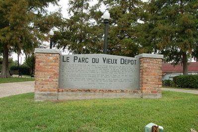
On Railroad Street at South Main Street, on the right when traveling west on Railroad Street.
The Village of Church Point was linked to the outside world by rail on April 19, 1907 when the Opelousas, Gulf and Northeast Railroad reached this point. The arrival of the OG& NE railroad brought an influx of commerce and industry to the area, . . . — — Map (db m87873) HM
On Rue Iry Lejeune at South Horecky Street, on the right on Rue Iry Lejeune.
Le Vieux Presbytère has been placed on the National Register of Historic Places in 1997 by the United States Department of the Interior. — — Map (db m196525) HM
On North Avenue F at West 5th Street, on the right when traveling north on North Avenue F.
Founded 1886 & soon emerged as center of state's rice industry. Historic district listed on National Register of Historic Places. Significant for its impressive c.1890-c.1930 commercial area & its superb Victorian residences. — — Map (db m85287) HM
On North Parkerson Avenue (State Highway 13) south of West 12th Street, on the right when traveling south.
Founded 1886 & soon emerged as center of state's rice industry. Historic district listed on National Register of Historic Places. Significant for its impressive c.1890-c.1930 commercial area & its superb Victorian residences. — — Map (db m147011) HM
On East Louisiana Avenue east of North Polk Street, on the left when traveling east.
At Rayne's founding, Dr. James Morris built his
Star Drug Store here in 1883, subsequently turned
into Alphonse Duclos Drugs, housing both telegraph
and postal services. It then became People's Drug
Store under Dr. John P. Mauboules and Dr. . . . — — Map (db m238473) HM
On Abbeville Highway (State Highway 35) south of Sunset Drive, on the right when traveling north.
English: Named for the merchant Jules Pouppeville and dating back to the 1850s, Pouppeville was once a stagecoach stop. The town was disassembled, carried north by oxen one mile to meet the railroad, and rebuilt at Rayne Station in 1881. . . . — — Map (db m103072) HM
On South Adams Avenue (State Highway 35) at East Texas Avenue (U.S. 90), on the right when traveling north on South Adams Avenue.
Early Cajun settlers of Southwest Louisiana, who established Poupeville, demonstrated their courage and determination by moving businesses and homes one mile north, relocating on the site of the Louisiana Western Railroad, the first train depot . . . — — Map (db m85297) HM
On The Boulevard (State Highway 98) at Oak Street, on the right when traveling south on The Boulevard.
In 1883, the town of Rayne was incorporated and J.D. Bernard served as its first mayor. The Bernard residence stands today as one of Rayne's few remaining early structures. Originally located on West South 1st. St., it was purchased by E.J. . . . — — Map (db m85291) HM
On Poplar Street near Cedar Street, on the left when traveling south.
Center Panel The Elizabeth Mill During Louisiana's timber boom, the Industrial Lumber Company purchased tens of thousands of acres of virgin pine forests. In 1907 The company founded the town of Elizabeth and began the construction of a . . . — — Map (db m125179) HM
On U.S. 165 at Third Street (U.S. 190), on the right when traveling south on U.S. 165.
Named for James A. Kinder, who received a homestead certificate for land in 1892. Kansas City, Watkins, and Gulf Railway arrived in 1890. Kinder was incorporated as a village in 1903. Patrick E. Moore served as first mayor. — — Map (db m103117) HM
On U.S. 165 near 9th Street, on the right when traveling south.
Center Panel People call Kinder "The Crossroads to Everywhere" because of the community's long history as a meeting place where people traded
goods and ideas and blended cultural experiences.
A Fork in the River Forges Kinder's Future . . . — — Map (db m201708) HM
On 6th Avenue (Louisiana Route 26) at North Sixth Street on 6th Avenue.
Center Panel Oberlin: A Settlement on the Edge of the Prairie
Oberlin is located at the edge of the Louisiana prairie. Beyond it, the landscape turns to pine forests:. Positioned as it is, Oberlin
stands as a unique mixture of two . . . — — Map (db m126071) HM
On River Road (State Highway 942) at St. Elmo Street (Parish Route 1435), on the right when traveling south on River Road.
Built in 1801 by Marius Pons Bringier as wedding gift for daughter Fanny, who married Christophe Colomb, a French refugee. Remodeled by Architect James Dakin 1837. Restored by Dr. & Mrs. E.G. Kohlsdorf 1941. — — Map (db m85285) HM
Near River Road (State Highway 942) 1 mile north of State Highway 44, on the right when traveling north.
Houmas Indian land grant sold to Conway and Latil in 1774. Sold to Revolutionary War hero Wade Hampton 1811. Greek revival mansion built by John Smith Preston in 1840. Restored by Dr. George Crozat in 1940. — — Map (db m109683) HM
Near State Highway 942, 0.3 miles west of Stafford Levy Road, on the right when traveling west. Reported missing.
Greek Revival mansion built by Marius Pons Bringier as wedding gift for his son Michael Douradou, who named the house for General Andrew Jackson's home in Tennessee. The Jacksons visited here in the 1820s. — — Map (db m141734) HM
On River Road (State Highway 44) 1.2 miles north of Sunshine Bridge (State Highway 70), on the left when traveling south.
Built in 1855 by Benjamin F. Tureaud, kinsman of Bringier family. Constructed of homemade red brick and Louisiana cypress. Purchased in 1888 by Dr. Julian T. Bringier. Retained by relatives until the 1940s. — — Map (db m85284) HM
On Lessard Street at Williams Street, on the right when traveling north on Lessard Street.
This quiet neighborhood between the river and the railroad retains a number of historic features related to the struggles and achievements of Louisiana African Americans. The Rosenwald School building in front of you was relocated from a site 15 . . . — — Map (db m155974) HM
Near Mississippi Street north of Church Street, on the left when traveling north.
French missionary priests arrived here in 1704 to evangelize the Chetimaches Indians. Around 1770, Spanish militiamen built a log chapel here. In 1819 the parish erected the first official church building, followed by a brick church in 1843. . . . — — Map (db m155327) HM
Near Opelousas Street east of St. Vincent Street, on the right when traveling east.
We dedicate this memorial in honor of our
Spanish ancestors from the Canary Islands
who, in the 18th century, sailed to Louisiana
where they settled and prospered, thus
fulfilling God's will as written in Holy
Scripture: Be fruitful and . . . — — Map (db m155328) HM
On Chetimatches Street north of Opelousas Street, on the right when traveling north.
This building built in 1868 served as the Ascension parish Courthouse and jail. On June 1, 2017, the Ascension Parish Council officially changed the name to Charles "Chalou" Trepagnier Building in honor of his 51 years as a law enforcer.
Born to . . . — — Map (db m123662) HM
On Mississippi Street (State Highway 18) near Crescent Park Circle, on the right when traveling south.
River travelers in the 1800s disembarked from their vessels on the levee behind you. For most of them, this crescent-shaped park was their first stop in the most developed river town north of New Orleans. Amid the whistles of riverboats and the . . . — — Map (db m155998) HM
On Houmas Street north of Opelousas Street, on the left when traveling north.
Made capital of Louisiana in 1830; Legislature met from January 4 to March 16 and reconvened in 1831. In 1848 the old State House, located across from this site, was razed, and its bricks used to prevent wavewash at the bayou's mouth. — — Map (db m85189) HM
On Mississippi Street (State Highway 18) at Iberville Street, on the left when traveling north on Mississippi Street.
Second Acadian Coast. Town founded by William Donaldson, 1806, on farm of Pierre Landry. Began as trading post about 1750. Home of Governor Francis T. Nicholls, of Dr. F.M. Prevost, who performed the first Caesarean section, 1824. Parish seat of . . . — — Map (db m223363) HM
Near Mississippi Street (State Highway 18) near Crescent Park Circle, on the right when traveling north.
Imagine the landscape in front of you in the late 1600s: the wild wetlands of the fierce Chitimaches Indians. Sieur de la Salle sailed his ship past here in 1682, claiming all he surveyed for France. But in 1806, Englishman William Donaldson . . . — — Map (db m156746) HM
On Nicholls Street near Houmas Street, on the left when traveling north.
This elegant memorial park recalls many eras of southern Louisiana history. The Ascension Parish Courthouse to your right is the most prominent landmarks today, but this square designed in 1806 has witnessed important events in regional . . . — — Map (db m155365) HM
Near Mississippi Street near Crescent Park Circle, on the right when traveling north.
This great waterway is the most prominent natural feature of Louisiana. The high bank, or levee, you are standing on protects Donaldsonville from flooding. A birds-eye view reveals we are located between two great river bends.Events on and around . . . — — Map (db m155312) HM
On State Highway 1, 0.2 miles south of State Highway 943, on the right when traveling south.
Scene of Civil War skirmish in fall of 1862. C.1850 Greek Revival plantation house owned 1854-1869 by Charles A. Kock, a prominent sugar planter. Listed on National Register of Historic Places in 1980. — — Map (db m96047) HM
On Ashland Road (State Highway 3251) 0.2 miles east of River Road (State Highway 75), on the right when traveling west.
Plantation home of Duncan Farrar Kenner, 1813-1887; statesman, lawyer, planter and Confederate minister to France and England in 1864. Home also known as Belle Helene. — — Map (db m96048) HM
On River Road (State Highway 405) 0.5 miles south of Preston Lane, on the left when traveling south.
Site of the plantation of the Jean Baptiste Gaudin Family from 1830 to 1874. Gaudin, a native of St. James Parish, established Gaudin Home Place from several small farms. He grew cotton then sugarcane. In time he would own over 1000 arpents . . . — — Map (db m87261) HM
On OakGrove-Port Vincent Highway (State Highway 42) at Diez Road, on the right when traveling east on OakGrove-Port Vincent Highway.
Old Spanish town at junction of Amite River and Bayou Manchac. Settled by Anglo-Americans, 1776-78, seeking Spanish refuge from American Revolution and by Canary Islanders (Islenos). Named for Spanish Governor Bernardo de Galvez. Town was abandoned . . . — — Map (db m85246) HM
On Duplessis Road, 0.2 miles east of Old Jefferson Highway (Louisiana Highway 73), on the right when traveling east.
The site of this cemetery, being one of the highest spots in east Ascension Parish, was used to bury those who died during crevasses. About the year 1785, Joseph Dupuy donated it as a non-sectarian cemetery, including slaves and Indians.
Joseph . . . — — Map (db m86105) HM
On Grand Bayou Road at Louisiana Highway 70, on the right when traveling south on Grand Bayou Road.
"Where we love is home—
home that our feet may leave
but not our hearts."
Oliver Wendell Holmes
Founded by
Gustave Joseph De La Barre
Circa 1900 — — Map (db m85518) HM
On State Highway 308, 0.2 miles south of Belle Alliance Road, on the left when traveling south.
Founded under Spanish rule c. 1778 by Canary Islanders, later joined by Acadians and others. Post believed to have been on site of "Belle Alliance Plantation," 841 acre grant to Don Juan Vives, early Spanish physician, officer in the Galvez . . . — — Map (db m86034) HM
On State Highway 308 at Madewood Road, on the right when traveling north on State Highway 308.
The first major building designed by noted architect Henry Howard. Construction of this Greek Revival mansion was begun in 1846, using materials from the land. Steamboats carried trade to Madewood on Bayou Lafourche. — — Map (db m87862) HM
On State Highway 1 at Franklin Avenue, on the right when traveling south on State Highway 1.
Nommée en l'honneur de l'Empereur Napoléon Ier, la ville est sur une ancienne voie de communication, 1730-1770, empruntée par les Francais puis par les Acadiens, pour aller de St-James jusqu'au port des Attakapas, sur le lac Verret.
Ce lac . . . — — Map (db m87863) HM
On Bayou Drive West, 0.5 miles south of Lee Drive.
Commemorates The Blessed Virgin who the people of Pierre Part believe intervened to save lives in natural disasters from 1882-1976. Restored by the citizens during the Bicentennial Year 1976. — — Map (db m98425) HM
On State Highway 451 near Iron Bridge Crossing (Sarto Lane).
Big Bend is located along Louisiana State Highway 451, adjacent to Bayou des Glaises in a loop through northeastern Avoyelles Parish, between Hamburg and Moreauville. The community was settled in the 19th century by people of both French and . . . — — Map (db m105604) HM
On Louisiana Route 115, 3 miles east of Interstate 49, on the right when traveling east.
Near this site on the main road from Opelousas to Avoyelles, Reuben Ray operated a ferry service across Bayou Boeuf. A surety bond granted by the State of Louisiana is dated 19 Sep 1816. In the early 19th Century before the advent of bridges and . . . — — Map (db m229930) HM
On Front Street (State Highway 29) south of Cappel Lane, on the right when traveling north.
The history of Cottonport began about 1823 when Joseph Ducote II married Marguerite Bordelon. On the bank of Bayou Rouge he cleared a cane brake, built a house, & planted these oak trees. About 1835 he donated some of his property for a road & a one . . . — — Map (db m97459) HM
On Highway 107 at Effie Highway (State Highway 115), on the left when traveling south on Highway 107.
Centerpoint, Louisiana was first settled in the early 1800's. It derives its name from being the center of Ward One in Avoyelles Parish. Many of the descendants of the early settlers of Centerpoint would come to settle in Effie. — — Map (db m110627) HM
On Highway 107 at Effie Highway (State Highway 115), on the left when traveling south on Highway 107.
Effie, Louisiana was established around 1898. The area was known as "Point Maigre" by early settlers. Benjamin F. Garlington became postmaster and renamed the area, "Effie", after his daughter. He ran the post office out of his house near this . . . — — Map (db m110602) HM
On State Highway 107 at Effie Highway (State Highway 115), on the left when traveling south on State Highway 107.
Vick, Louisiana was established around 1896. The postmaster was Joe Berlin, the son of the first settler of Vick, George Berlin. Joe would name the area "Vick" after his wife Victoria. Vick is well known for its rich farm land. — — Map (db m110610) HM
On State Highway 1176 north of Youngs Crossing, on the left when traveling north.
John Fogleman, a native of Virginia, was in this area in 1816, a witness to his sister's wedding in the St. Landry Courthouse. He married Polly Sandefur there Jan. 1, 1819. On Nov. 28, 1853, the estate of the deceased John Fogleman was sold in a . . . — — Map (db m107482) HM
On Main Street (State Highway 29) at College Street, on the right when traveling north on Main Street.
Site of Evergreen Home Institute (1856); Henry Clay Kemper, 1st headmaster. Later became Evergreen College; then Evergreen High School in 1904. These schools had a note-worthy influence on education in Avoyelles and Louisiana. — — Map (db m97455) HM
On L'Eglise Street (State Highway 107) north of Porterie Street, on the left when traveling north.
Incorporated 1860. Long recognized for its culinary artistry in the preparation of Cochon de Lait. The 1960 Louisiana Legislature officially designated Mansura "La Capitale de Cochon de Lait" in honor of its Centennial year. — — Map (db m97596) HM
On Spring Bayou Road (State Road 1190) east of Andrus Street, on the right when traveling east.
Large story and a half Acadian style residence built by Alfred Greenhouse and his wife Cecilia Bontempt. Greenhouse was a farmer, cattleman, landowner and hunter who often cared for cattle kept in the lowlands during the winter months. Indian . . . — — Map (db m117693) HM
On North Washington Street north of Laurel Lane, on the right when traveling north.
Raised Greek Revival dwelling with Victorian influence built in 1872 by Alfred and Elizka Bordelon. Occupied by direct descendants. Listed on the National Register of Historic Places. — — Map (db m122655) HM
On North Monroe Street south of Tarleton Street, on the left when traveling south.
Full two story Arts and Crafts dwelling with Colonial Revival facade. Built by Michel Bettevy, prominent local banker. Later home to Leroy Havard family and the family of Dr. Alton DeNux, former Mayor and State Representative. — — Map (db m120955) HM
On South Washington Street north of Acton Street, on the right when traveling north.
Victorian dwelling Colonial influence. Built by Alfred Bordelon who practiced dentistry and law in Cottonport and Marksville. Built along northern edge of Spanish land grant of Francois Bordelon. — — Map (db m120984) HM
On North Monroe Street, 0.2 miles south of Tarleton Street, on the right when traveling south.
Part of home built by Marksville's first mayor, Charles Brashear. Located originally at corner of Cappel and Monroe Sts. Later housed Bell's Tavern. In 1856, Adolph Lafargue opened a boys' school in building and published "The Villager" newspaper . . . — — Map (db m120887) HM
On West Bon Temps Street at Monroe Street on West Bon Temps Street.
Arts and Crafts style house
Circa 1920. Built as a spec
House by T. James and
Zepher Newton Brouillette.
Purchased as rental property
in May 1934 by Ceran R.
and Eliza Zimmer Guillot.
Similar to the house next
door, but smaller in size. — — Map (db m121174) HM
On Tarelton Street, 0.1 miles west of North Monroe Street, on the right when traveling west.
The two story plantation home of Judge Ralph Cushman was near this site. Cushman died of yellow fever in 1855, and is buried in this cemetery which bears his name. Other family cemeteries which were founded during this period include the Cannon . . . — — Map (db m120388) HM
On North Main Street (State Highway 107) 0.3 miles north of Andrus Street, on the right when traveling north.
Mule driven tramway. Flat cars on rails from Marksville to Red River, a distance of six miles. Carried supplies and produce to and from Ware's Landing on the river to a warehouse on this site. — — Map (db m120927) HM
On North Main Street (State Highway 107/115) near East Ogden Street, on the right when traveling north.
Marcos Litche, a native of Venice, Italy and a traveling peddler, migrated to the Avoyelles Post c. 1794. Because of a broken wagon wheel, the pleasant environment, and friendliness of the Indians and local residents, he decided to stay in this . . . — — Map (db m99098) HM
On North Washington Street, 0.2 miles north of East Ogden Street, on the right when traveling north.
A large Eastlake Victorian
one and a half story structure
with heavy Victorian ornamentation
stood on this site. Built by
Adolph Frank, German native.
Local folklore states that
Andrew Jackson stayed at an
earlier inn on this site. — — Map (db m122504) HM
On South Washington Street west of Tucker Street, on the right when traveling west.
Built by Alfred Dupuy for J. R. Smith. Later home to the Gardiner and Benjamin Laborde families. Full two story Victorian dwelling with upper and lower galleries. Strong Eastlake influence of both interior and exterior. — — Map (db m103560) HM
On West Bon Temps Street at North Monroe Street, on the right when traveling north on West Bon Temps Street.
Arts and Crafts style house
Circa 1948. Rufus and Enola
Dupuy Guillory purchased the
property in April 1948 from
Tillman and Mabel Graham.
Perma Stone (faux stone) was
Placed on the exterior walls
and posts of the chain fence.
One of the . . . — — Map (db m121176) HM
On Tunica Drive West (State Highway 1) at Cottage Street, on the right when traveling west on Tunica Drive West.
This c. 1820 Creole house is typical of the dwellings of early Avoyelles Parish families. The Bordelon family, who built the house, was one of the parish's pioneer families. Listed on the National Register of Historic Places in 1980. — — Map (db m97631) HM
On East Odgen Street near South Washington Street, on the right when traveling north.
Ducote, a local attorney and former Mayor, practiced law from this Victorian brick and frame building at the turn of the century. — — Map (db m103692) HM
On South Main Street at Bon Temps Street, on the right when traveling north on South Main Street.
Two story brick mercantile store with Victorian embellishments features business quarters downstairs and living quarters upstairs. Mr. Printz, an Italian immigrant, began his career as a fruit peddler in Avoyelles Parish. — — Map (db m174211) HM
On North Main Street (State Highway 107/115) west of East Odgen Street, on the right when traveling west.
Arts and Crafts two story brick building built by Dr. E. M. Laborde and Cliffe E. Laborde for commercial use downstairs and dental and legal offices upstairs. Tidewater Marine, Inc., founded here in 1956. — — Map (db m103567) HM
On East Mark Street at South Washington Street, on the left when traveling east on East Mark Street.
Victorian mercantile store built by Lewis P. Roy, Sr. Restored in 1984-85 by attorneys Tucker Melancon and Rodney Rabalais and certified public accountants Aloysia C. Ducote and Van P. Major. — — Map (db m103699) HM
On Tunica Drive East (State Highway 1) 0.1 miles north of Medic Avenue, on the right when traveling north.
Traveling through the prairie that is now Avoyelles, had a breakdown on his wagon. He stayed, the trading post he established became the city of MARKSVILLE — — Map (db m97469) HM
On West Mark Street at North Monroe Street, on the left when traveling south on West Mark Street.
Small brick edifice with
Victorian influence built
by William Peterman,
native of Pennsylvania
and a railroad attorney.
He married Belle Bordelorn
and later moved his practice
to Alexandria. — — Map (db m121177) HM
On North Main Street (State Highway 107/115) north of East Ogden Street, on the right when traveling north.
A two and one half story Eastlake Victorian structure with twin turrets stood on this site. Built by Alfred Mayer. Served for many years as the city's main hotel and renowned throughout state for its French cuisine. — — Map (db m99100) HM
On North Washington Street north of Edith Avenue, on the right when traveling north.
H. Molenar and J.A. Dalsuet photographed much of early Marksville and its early inhabitants. Most of the photographs that have survived were made by Molenar who had a studio on this site. — — Map (db m122654) HM
On North Main Street (State Highway 107/115) at State Highway 1192, on the right when traveling north on North Main Street.
A Spanish military post was established c.1780 in Marksville by Carlos de Grandpré, Civil Lieutenant Governor of the Red and Ouachita River Settlements to protect the Avoyel Indians from the encroachment of white settlers on Indian lands and to . . . — — Map (db m97870) HM
On Tunica Drive East (State Highway 1) north of Yuroni Trail, on the right when traveling north.
Lands granted to the Tunica tribe by the Spanish government comprise part of the present reservation. The Tunica-Biloxi Tribe is a fusion of the Tunica, Biloxi, Ofo, and Avoyel peoples. — — Map (db m97810) HM
On South Washington Street east of Tunica Drive East (State Highway 1).
Arts and Crafts style home built by Roy Watts and home to Carnot Dupuy for many years. Mr. Dupuy, a pharmacist, was mayor of Marksville in 1920 and also served on the School Board. — — Map (db m103559) HM
On Cottage Street at West Barbin Street, on the right when traveling south on Cottage Street.
A two and one half story Greek Revival frame structure with upper and lower galleries stood here. Built by Edwards on land purchased from Marc Eliche'. Later owned by Judge Aristide Barbin. — — Map (db m98055) HM
On Old Moncla Road near Chauffpied Elmer Road, on the right when traveling north.
Colonized in the late 1700s. Named for Dr. Joseph Thibault Moncla 1806-1883Emigrant of Moncla, France, and husband of Arsene Bordelon. This settlement, on the south bank of the Red River, included a ferry, . . . — — Map (db m138652) HM
On Main Street (State Highway 114) near Gautheir Street, on the left when traveling west.
Site of the organization of the first Corn Club, forerunner of the 4-H clubs, in Louisiana. Organized on Feb. 8, 1908, by V.L. Roy, Avoyelles School Superintendent. Two hundred fifty boys attended first meeting. — — Map (db m98024) HM
On Business U.S. 171 east of South Pine Street (Louisiana Highway 27), on the right when traveling east.
Center Panel
In 1912 when residents decided to divide Imperial Calcasieu Parish
into several smaller parishes, Beauregard Parish was born. The
people of Beauregard were optimistic about their future, and as . . . — — Map (db m229089) HM
On State Highway 26 at Don Gray Road, on the right when traveling east on State Highway 26.
Built 1919-used as a
school until 1928. Bought
by community families to
be used for cultural
and social activities.
Placed on the National
Register of Historic
Places December 2002. — — Map (db m125177) HM
Near Old Hoy Cemetery Road, 0.3 miles north of Louisiana Highway 26, on the right when traveling north.
A Hub in the Woods
In a large clearing of virgin pines trees, men built the large logging camp of Hoy around 1910. Hoy was one of many camps established by Long Bell Lumber Company, which operated one of the largest sawmill
systems in the . . . — — Map (db m229079) HM
Center Panel Sugartown Leads the Way
First surveyed as a township in 1807, Sugartown was established in 1816 when some of the first Anglo settlers began to arrive in the region.
Sugartown served as a way station for . . . — — Map (db m225772) HM
On Longville Road (Parish Road 217) east of Cedar Street, on the right when traveling east.
In 1906, the Long Bell Lumber Company of Kansas City,
Missouri, under the leadership of Robert A. Long, began
building a premier sawmill at Longville, Louisiana. The steam
driven sawmill could cut 350,000 feet of lumber per day. Long-
Bell also . . . — — Map (db m140558) HM
On Hennigan Street, 0.2 miles west of Main Street (Louisiana Route 110), on the left when traveling west.
Main Panel An Outlaw Arrives in Merryville
A rumored fugitive from Texas, Charles "Leather Britches" Smith brought his nasty disposition to Merryville in 1910. He was
a deadly shot. With his two Colt pistols, he could shoot purple martins in . . . — — Map (db m235490) HM
On Old Camp Ground Cemetery Road, 1 mile east of Pentecostal Church Road.
A memorial to the pioneers of Sugartown (early outpost of Southwest Louisiana), whose courage and fortitude helped subdue the historic "Neutral Territory" of the Sabine-Rio Hondo Strip, claimed and contended for by four nations - France, Spain, . . . — — Map (db m124845) HM
Near State Highway 507, 2.7 miles west of State Highway 147, on the right when traveling west.
Facts about the MountainThe mountain was named for James Christopher Driskill. He was born in Hancock County, Georgia, on June 17, 1817. In 1840 he married Eugenia Irwin Walker. In October 1859, Mr. Driskill sold his land in Georgia, and moved . . . — — Map (db m166115) HM
On Kepler Road (State Highway 507) at Old Sparta Road, on the right when traveling west on Kepler Road.
Founded in 1849 as first parish seat for Bienville Parish. Post office est. 1849. 1st Postmaster J. M. Denson. Incorp. 1852. 1860 pop. Of 250 composed of merchants, craftsmen and professionals. Had two churches, two Masonic Lodges, three private . . . — — Map (db m166144) HM
On Louisiana Route 157 north of Bodcau Dam Road, on the left when traveling north.
Historic site of Freedonia, where first session of Bossier Parish court was held September 25, 1843: presiding was Judge W.K. Beck. Site later named Society Hill, then Bellevue. First Police Jury meeting was held about two miles northeast on site of . . . — — Map (db m181438) HM
On Gray Street (State Highway 3049) north of Louisiana Street, on the right when traveling north.
A Caddo mound and village dating between approximately 1450 & 1650 A.D. were located northeast of Belcher. The mound consisted of a series of platforms that contained houses or meeting places for the village leaders. The houses were burned . . . — — Map (db m87132) HM
On Louisiana Route 3049, 1 mile north of Cedar Bluff Road, on the right when traveling north.
Ca. 1922 a country store was moved from Myrtis, La to this location to serve as the new commissary for the J.W. Lynn Plantation. At it's peak over 300 hundred families lived and worked on the plantation, with the commissary serving as the general . . . — — Map (db m174856) HM
On Caddo Street (State Highway 3049) east of East Street, on the left when traveling east.
The original house was built in 1899 by Ruben T. Glassell, a planter, and his wife Vyvian. It faced west and had a center hall in the dogtrot style. The house was enlarged about ten years later with the addition of a new roof, interior columns, . . . — — Map (db m175072) HM
On Main Street north of 2nd Street, on the right when traveling north.
The village is named for R.L. "Bob” Gilliam who owned property from which he donated right-of-way for the T.S. & N. Railroad which ran from Texarkana to Shreveport. The understanding was that the railroad would establish a depot on the banks of Red . . . — — Map (db m174855) HM
On Adger Road east of Piarce Lane, on the right when traveling east.
The home was built circa 1910 by Reuben Douglas and his wife, Lucy Parsons, after the Gilliam 1908 storm destroyed their first home. Reuben, one of the early landowners in the area, purchased 800 acres in 1900, which he named All's Well Farm. Reuben . . . — — Map (db m174463) HM
On Main Street at 2nd Street, on the left when traveling south on Main Street.
Home of the Sunflower Festival and Red River Crossroads Museum
After R.L. Gilliam donated property in 1898 for the railroad depot, the area was officially founded and named Gilliam.
An article published in the Shreveport Times on . . . — — Map (db m174227) HM
On 1st Street, 0.1 miles west of Main Street, on the right when traveling east.
From the mid-1890's to the early 1970's the Texarkana, Shreveport & Natchez/Texas & Pacific Railroads served the economic and personal needs of northeast Caddo Parish along a roadbed at this site. While the railroad was being built during the 1890's . . . — — Map (db m174224) HM
On Parkway Drive north of Briar Rose Street, on the left when traveling north.
The Hosston Post Office was established on May 27, 1901. The first Hosston Postmaster was Dee R. Allen who served from May 27, 1901 - March 16, 1908, and the last Postmaster was Charles V. Giles who served from June 3, 1966 - December 31, 2004. The . . . — — Map (db m174037) HM
On U.S. 71, 0.1 miles north of Camellia Street, on the right when traveling north.
The house was built around 1878 and occupied by the William Adams family. James Patrick Fuller and his wife Gertie McKinney Fuller purchased the house in 1919. Their family included daughters Pattie Mae and Audrie, who was born in the house in 1920. . . . — — Map (db m244247) HM
On East Magnolia Lane near U.S. 71, on the right when traveling east.
Settlement in the Ida area began before 1840, with increasing numbers coming from the East after the Civil War. They came by ox-drawn wagons or by steamboat. Earliest permanent settlers were Readrick Kelly, Chesley Green Williams, the Munnerlyn . . . — — Map (db m173788) HM
Near S. Land Avenue, 0.1 miles north of Savage Street, on the right when traveling north.
In the early 1900's this was a small logging community known as Ananies. In 1906, the first discovery oil well in the field, the Savage No. 1, was brought in. Around 1908 the name of the town was changed to Oil City, by 1910 the population had . . . — — Map (db m87161) HM
On West Front Street (State Highway 1) north of Main Street (State Highway 168), on the left when traveling north.
United Gas Public Service Company, discovered the Rodessa Oil Field one mile west of this historical marker on July 7, 1935. Rodessa was a “Boom Town” a few weeks later.
United’s L.L. Young No. 1, Lease 6875, Sec.21-23N-16W Rodessa Field Caddo . . . — — Map (db m128263) HM
771 entries matched your criteria. The first 100 are listed above. Next 100 ⊳