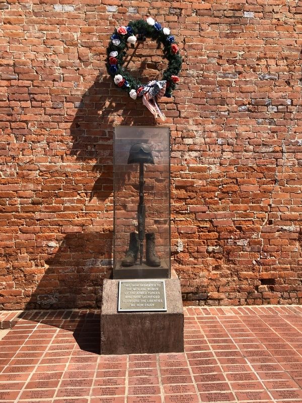
On South First Street (Arkansas Route 161) at Lakeshore Drive, on the right when traveling south on South First Street.
Following the Aug. 27, 1863, battle at Bayou Meto, Confederate Gen. John Marmaduke asked to be removed from under Gen. Lucius M. Walker’s command. The two generals were at odds over actions at Helena and Brownsville earlier in 1863. Marmaduke’s . . . — — Map (db m116265) HM
Near Barber Street just north of East 25th Street, on the right when traveling north.
This facility is dedicated to the men and women who answered their country's call to service. Their inspiring contribution will help preserve in the hearts and live of all Americans the spirit of patriotism, the love of Country and the willingness . . . — — Map (db m180368) WM
On U.S. 67 north of Betty Drive, on the right when traveling north.
This flagstaff donated by the following Randolph County veterans organization in memory of all comrades buried in this cemetery. — — Map (db m261014) WM
On N. Main Street at W. Sevier Street, on the right when traveling south on N. Main Street.
Saline County’s Everlasting Tribute
Here we enshrine forever the glorious memory of the living and the dead who through their valiant efforts and bitter sacrifice kept us a free people
Theirs Not to Reason Why, Theirs But to Do . . . — — Map (db m96594) WM
On Parker Avenue, on the left when traveling north.
I never saw such fighting done as was done by the negro regiment…The question that negroes will fight is settled; besides they make better soldiers in every respect than any troops I have ever had under my command.—General Blunt after . . . — — Map (db m59021) HM
On Parker Avenue, on the left when traveling north.
Security has always been a concern for the U.S. military. The army designed the second Fort Smith (1838-1871) as part of a line of forts from Minnesota to Louisiana to separate the territory occupied by Native American tribes from that settled by . . . — — Map (db m59020) HM
On Parker Avenue, on the left when traveling north.
"The walls were almost hidden by a wealth of vines and foliage, and the enclosed space was as green as nature and care could make it. Beautiful flower beds were kept well tended by the soldiers and added greatly to the beauty of the . . . — — Map (db m58615) HM
On Parker Avenue, on the right when traveling east.
This building, on the N.W. bastion of the wall, was the commissary of the fort. Built in 1839, used until 1871 when the fort was abandoned as a military post. From 1861-65 it served as a hospital, guard house, and refuge, now a museum.
Erected . . . — — Map (db m57921) HM
On Rogers Avenue east of 6th Street ( Highway 255), on the right when traveling east.
Dedicated to all men and women
wounded in all our wars.
My stone is red for the blood they shed.
The medal I bear is my country’s way
to show they care.
If I could be seen by all mankind
maybe peace will come in my . . . — — Map (db m92352) WM
On Parker Avenue, on the left when traveling north.
When army engineers originally designed the second Fort Smith in 1838, they planned for it to withstand attack. A key feature in achieving this goal was a stone wall about twelve feet high and from two to three feet thick. This wall surrounded the . . . — — Map (db m58434) HM
On Parker Avenue, on the left when traveling north.
This is the oldest building still standing in Fort Smith. Originally built as part of a larger fortification, over the years its appearance and use changed dramatically. The building held supplies used by explorers and soldiers, played a crucial . . . — — Map (db m58493) HM
On Parker Avenue, on the left when traveling north.
The U.S. Army built the original flagstaff at the second Fort Smith in 1846. As with many western military posts, the flagstaff stood tall so that its flag could be seen for miles. To attain a height of nearly 100 feet, the army joined two poles in . . . — — Map (db m58432) HM
The guardhouse, constructed in 1849, was a focal point of daily activity at the second Fort Smith. Not only did the men assigned to guard detail operate out of this building, but the officer of the day, who was responsible for the daily business of . . . — — Map (db m58132) HM
On Parker Avenue, on the left when traveling north.
You are now standing on what was once Officer’s Row at the second Fort Smith. From 1846 to 1865, two large buildings stood on the western edge of the parade ground and provided housing for officers and their families. Unlike the cramped quarters of . . . — — Map (db m58618) HM
For more than thirty years during the mid-1800s, soldiers drilled on the large parade ground before you. Flanked by the officer’s quarters to the right and the enlisted men’s barracks on the left, the parade ground was the center of life at the . . . — — Map (db m58125) HM
On Parker Avenue, on the left when traveling north.
Founded in 1817 by the U.S. Army to contain a volatile Indian feud, Fort Smith later served as a major supply depot for western military posts, and finally as headquarters of the Federal Court for the Western District of Arkansas. For over 80 years, . . . — — Map (db m59027) HM
On South Izard Street south of Court Avenue, on the left when traveling south.
This bell rang from the bell tower of the magnificent courthouse that graced this site for seventy-nine years before the present structure was built in 1976. The former courthouse was built in 1897 by Judge John S.R. Cowan of Hughes at a cost of . . . — — Map (db m172208) HM WM
On South Izard Street just south of Court Avenue, on the left when traveling south.
In God we Trust
Dedicated to veterans of St. Francis County
To the gallant men and women who served their country during Peace time and war with honor.
We shall not forget — — Map (db m172205) WM
On North West Avenue, on the right when traveling north.
Dedicated to the memory of Major O. L. Bodenhamer
June 27, 1891 - June 19, 1933
National Commander 1929-1930
The American Legion — — Map (db m305143) WM
On South School Avenue south of West Willoughby Road, on the left when traveling south.
Dedicated to those who served and those who waited
HQ & HQS Battery
Austin, Carl D. ∙ Baldwin, Alvin E. ∙ Bartle, Billy J. ∙ Blake, Harold G. ∙ Blood, Rueben S. ∙ Bohannan, Billy W. ∙ Brown, Marion E. . . . — — Map (db m62976) WM
Near South Lt Col Leroy Pond Avenue south of National Street.
Dedicated
to those men of the
First Marine Division, FMF
who gave their lives
in the service of
their country
World War II Korea Vietnam
Southwest Asia — — Map (db m224110) WM
On West Dewitt Henry Drive (State Highway 367) just west of West Mississippi Street, on the right when traveling west.
This monument pays tribute to the sacrifices made by families who lost a loved one in military services to the United States of America.
The heritage and patriotism of the Beebe community is depicted in the first scene.
The second scene . . . — — Map (db m183679) WM
On North Pecan Street at West Devitt Henry Drive (State Route 367), on the right when traveling north on North Pecan Street.
[The memorial consists of 4 steles arranged around a flagpole. Each side has 2 sides, an "inner" side facing the flagpole.]
[East stele, west (inner) side]
Built by a community with love for the veterans who protected their . . . — — Map (db m183153) WM
Near Center Street, on the left when traveling east.
In Memoriam
Jos. H. McCourt
1877 – 1900
Co. F. 8th Cal Inf. U.S.V. – Co. I. 35th Inf. U.S.V.
———
Bruno L. Putzker
1880 – 1899
Btry. K. 3rd U.S. Army
Berkeley men killed in action in . . . — — Map (db m52400) HM
Near Center Street east of Martin Luther King, Jr. Way, on the left when traveling east.
In the early 1920s Alameda County voters approved a special tax to construct buildings that would honor war veterans and provide a meeting place for their organizations. The City of Berkeley contributed the land for this building. Designed in the . . . — — Map (db m52399) HM
Point Arnold is named after Rear Admiral R.J. "Bear" Arnold, U.S.N.. During World War II, Arnold earned the Navy Cross for extraordinary heroism as the supply officer on the USS YORKTOWN at the Battle of Midway. Chief of the Bureau of Supplies and . . . — — Map (db m62994) HM
On Main Street, on the right when traveling north.
Dedicated to the memory of the men and women who made the supreme sacrifice in the service of the United States of America.
February 25, 1967 — — Map (db m19333) HM
[Displayed at the Copperopolis Elementary School are a bell and a cannon along with their accompanying markers:]
The Bell
This bell cast in 1860, the first school in Copperopolis in 1862. The bell yoke shows repair, break . . . — — Map (db m19793) HM
Presented
by the
N.S.G.W. No. 217
and
N.D.G.W. No. 147
of Richmond
In memory of those who served the United States in time of war. — — Map (db m144414) WM
On Highway 49 (Main Street) at Bridge Street, on the left when traveling north on Highway 49 (Main Street). Reported permanently removed.
This building, perhaps originally a livery stable, was the armory for the Coloma Greys, a local volunteer militia company. After the Greys disbanded in 1862, the building was used as a carriage house by Elias Weller, who lived in the large white . . . — — Map (db m17222) HM
On Coloma Road (California Route 49) at Mt Murphy Road, on the right when traveling south on Coloma Road.
This building, was the armory for the Coloma Greys, a local volunteer militia company who organized in 1857. A.A. Van Guelder was chosen as captain and the group attended the first Military Encampment in 1859. The Greys disbanded in 1862 due to . . . — — Map (db m215206) HM
On Wentworth Springs Road north of Georgetown Road ( Highway 193), on the left when traveling north.
A Military Company Was Organized
At Georgetown In August 1859, Called
The Georgetown Blues
This Is In Honor Of Them, And
Dedicated To All United States
Veterans Who Have So Honorably
Answered Their Nation’s Call To Duty
America . . . — — Map (db m55078) HM
On Rufus Allen Blvd at U.S. 50, on the left when traveling north on Rufus Allen Blvd.
To all Veterans of All Wars
this monument is dedicated this
day 31 May 1999, to honor all the
courageous young men and women,
both living and deceased
who served in all wars and conflicts
and did their duty no matter where they
served . . . — — Map (db m113201) WM
On Lake Tahoe Blvd (U.S. 50) east of Wildwood Avenue, on the right when traveling east.
This memorial is dedicated to all from our community who gave their lives and have served our country from all branches of service. We thank you for your sacrifice and you can rest assured that we will support your families and friends. You have . . . — — Map (db m113200) WM
On 4th Street at Shasta Street, on the right when traveling north on 4th Street.
This 57 mm anti-tank gun M1 was one of 16,000 built
between 1941 and 1944 for the U.S. Army. Pulled by
an armored half-track, the M1 weapon used
armor-piercing ammunition and was widely used in
the European theater of operations. It . . . — — Map (db m173311) HM WM
On Sidewinder Road North at Tucker Road, on the right when traveling south on Sidewinder Road North.
Camp Pilot Knob was a unit of the Desert Training Center, established by General George S. Patton Jr., to prepare American troops for battle during World War II. It was the largest military training ground ever to exist. At the peak of activity here . . . — — Map (db m50590) HM
On Main Street at Route 111, on the right when traveling east on Main Street.
Three miles east of Niland are the remains of Camp Dunlap, established 15 October 1942 as a training base of the 12th Marines, the Artillery Regiment of the 3rd Marine Division. The camp was named in honor of Brigadier General Robert H. Dunlap, . . . — — Map (db m172159) HM
On Ben Hulse Highway (California Route 78) at 1st Street, on the right when traveling south on Ben Hulse Highway.
Near this spot, situated on the west bank of the Colorado River, about 45 miles north of Fort Yuma, Camp Gaston was established in 1859 by Captain Henry S. Burton, Company F 3rd Artillery. The camp served as a supply post for the Hoffman Expedition . . . — — Map (db m138177) HM
On Three Flags Highway (State Highway 395) at County Route 168, on the right when traveling north on Three Flags Highway.
The Big Pine Veterans Memorial was established by the Big Pine Civic Club in the year 2000 to honor all veterans of the Owens Valley. The 80-foot tall pole proudly displays the "Stars and Stripes" with the California State flag and the POW/MIA . . . — — Map (db m54427) HM
On California Route 190 37 miles east of U.S. 395, on the left when traveling east.
Before
you is part of one of the largest military aircraft
training areas in the U.S. It has been used continuously since
the 1930s. Much of what is now the western portion of
Death Valley National Park was added under the condition
that . . . — — Map (db m194626) HM
Near California Route 190 1 mile north of Badwater Road, on the left when traveling north.
“Greater love has no man
than this, that a man lay down
his life for his friends.”
Dedicated to
the American people in memory of
the spirit of the Vietnam Veteran
by the Vietnam Veteran - Death
Valley Marathon team and
the . . . — — Map (db m271534) HM
On Shabbell Lane 0.3 miles north of U.S. 395, on the right when traveling north.
At the request of settlers, Colonel George Evans led a military expedition to this site on July 4, 1862. Hence its name “Independence”. Indian hostilities ceased and the camp closed. War again broke out in 1865 and the camp was reoccupied as Fort . . . — — Map (db m2954) HM
On Campus Drive, on the right when traveling east.
Dedicated with Pride and Appreciation to All Military Personnel from the Arvin and Lamont Area
"Operaton Desert Storm"
Janice Acree • Jose A. Garza • Javier Almaguer • Steven M. Gutierrez • John Alverez • Ted Johnson • Joe Baltierra • . . . — — Map (db m59203) HM
On California Route 223 0.8 miles south of Route 58, on the right when traveling south.
Dedicated to the memory of all the patriotic men and women who answered their country's call to service.
George W. Bush, President of the United States.
James B. Peake, Secretary, U.S. Department of Veterans Affairs.
William F. . . . — — Map (db m59200) HM
Near Lerdo Highway 1 mile west of Route 65, on the right when traveling west.
This plaque is dedicated to the men and women who have served in the Armed
Forces of the United States of America and to all the first responders of
this great nation.
Their dedication and commitment to the principals and values of our . . . — — Map (db m247132) HM
Near Randsburg Mojave Road near 20 Mule Team Parkway, on the right when traveling east.
Dedicated to all American war veterans
who have made the supreme sacrifice.
American Legion Post No. 476,
California City, California - 1979.
"Lest we forget" — — Map (db m243245) WM
On Rosamond Boulevard 10 miles east of Route 14, on the right when traveling east.
Originally developed from the McDonnell XF-88 penetration fighter, the F-101 was designed as a long-range bomber escort for the Strategic Air Command. The prototype made its first flight at Edwards AFB in September 1954. When high-speed, . . . — — Map (db m115497) HM
On Rosamond Boulevard 10 miles east of Route 14, on the right when traveling east.
The first XF-104 made its initial flight here at Edwards AFB in February 1954. In May 1958, a YF-104A set a world speed record of 1,404.19 mph over Edwards, and in December 1959, an F-104C set a world altitude record of 103, 395 feet here. The . . . — — Map (db m115470) HM
Near Rosamond Boulevard 10 miles east of Route 14, on the right when traveling east.
The YF-105 completed its maiden flight at Edwards AFB in October 1955, easily exceeding Mach One, even though it was powered by a J57 engine - much less powerful than its projected power plant, the J75. The D-model “Thud” added water injection to . . . — — Map (db m115494) HM
On Rosamond Boulevard 10 miles east of Route 14, on the right when traveling east.
The F-106 Delta Dart had a long and illustrious career at Edwards AFB. The prototype A-model made its first flight here on 26 Dec 56. On 15 Dec 59, Col Joe Rogers piloted as F-106 A to a world speed record of 1,525.695 mph (Mach 2.41) here. In Apr . . . — — Map (db m115495) HM
Near Popson Avenue near Wolfe Avenue, on the left when traveling west.
When first flown at Edwards AFB on January 20, 1974, the YF-16 was the most advance fighter in the world. The F-16B is a combat-capable two-seat version of the production F-16A. To date, over 4,000 F-16s have been manufactured worldwide and 122 B . . . — — Map (db m115097) HM
On Popson Avenue near Wolfe Avenue, on the left when traveling west.
The F-86, the Nation’s first swept-wing jet fighter, made its initial flight at what is now Edwards AFB on October 1, 1947. The first production model flew on May 20, 1948 and on September 15, 1948 an F-86A streaked to a world-record 670.9 mph. . . . — — Map (db m115092) HM
Near Popson Avenue near Wolfe Avenue, on the left when traveling west.
The United States Air Force has always relied upon the application of leading-edge technologies to fulfill its mission of airpower projection. From the XP-59 of 1942 to the B-2, C-17, and F-22 of today, the Flight Test Center has been essential to . . . — — Map (db m115095) HM
Near Mercury Boulevard 2.5 miles east of Rocket Site Road.
Leading the vision and evolution of Air Force rocket propulsion
technology from its earliest days, the Rocket Site's men and
women and their unique research, development, and test facilities
have provided the discoveries, developments, and . . . — — Map (db m153378) HM
On Rosamond Boulevard 10 miles east of Route 14, on the right when traveling east.
The F-102 was developed from the Convair XF-92 delta wing research aircraft of the late 1940s and the prototype made its initial flight in October 1953 at Edwards AFB. It became operational with the Air Defense Command in 1956. At the peak of . . . — — Map (db m115469) HM
On Rosamond Boulevard 10 miles east of Route 14, on the right when traveling east.
Two built by McDonnell Douglas (now Boeing) as Advanced Medium STOL Transport (AMST) with Short Take Off and Landing ability. First flight 26 Aug 1975, landing at Edwards AFB. Pioneered supercritical wing on large aircraft; advanced airlift state . . . — — Map (db m115466) HM
On Rosamond Boulevard 10 miles east of Route 14, on the right when traveling east.
The F-100 was the USAF’s first operational aircraft capable of flying faster than the speed of sound (760 mph) in level flight. The prototype YF-100A made its initial flight on 25 May 1953 and the first production aircraft was completed in October . . . — — Map (db m115496) HM
On Wofford Heights Boulevard, on the left when traveling east.
Dedicated to
American Prisoners of War and Missing in Action
The Loneliest Prayer
As I squat here in this lonely place
A man maybe even you forgot,
I wonder
Am I in living hell?
Am I alive or not?
I think its more than ten . . . — — Map (db m27367) WM
Near Lebec Road (Interstate 5), on the left when traveling north.
The first and only "Camel Brigade" of the United States Army Commanded by Lt. Edward F. Beale 1857-1864 San Antonio, Texas to Fort Tejon, California — — Map (db m140695) HM
Jefferson Davis, “Father of National Highways,” as Secretary of War 1853-57 sponsored the importation of 33 camels for transporting military supplies to the west coast. The camel trail survey ran from San Antonio, Texas to Fort Tejon which marks the . . . — — Map (db m32823) HM
Near Fort Tejon Road near Interstate 5, on the right when traveling south.
In 1856 the U.S. Army started an experiment using camel for supply transport in the southwest. The camels proved ill suited to the American southwest.
In November 1859 a civilian contractor turned over 28 camels to the Army at Fort Tejon. . . . — — Map (db m32821) HM
On La Vista Avenue 0.2 miles west of Neutralia Road, on the left when traveling west.
In memory of
the crew of the YB-49
"Flying Wing"
who lost their lives in the
pursuit of aviation:
Daniel H. Forbes Jr. ·
Glen W. Edwards ·
Charles H. LaFountain ·
Edward L. Swindell ·
Clare C. Leser
June 5, 1948
. . . — — Map (db m294017) HM
On Las Flores Avenue 0.1 miles east of China Lake Boulevard, on the left when traveling east.
The Grumman F11 F Tiger (later
F-1 1 A) was a new-technology,
supersonic follow-on to the F9F
Cougar/Panther fighters. The
Tiger went to the Fleet in 1957
but served actively only until the
Spring of 1961; the type
remained in training . . . — — Map (db m272477) HM
On Las Flores Avenue east of China Lake Boulevard, on the left when traveling east.
This is the first McDonnell-Douglas F/A-18A Hornet,
first flown in November 1978.
The F/A-18 has been and continues to
be a major asset in Naval Aviation.
Starting with the 1986 strikes against
Libya and currently with the fight . . . — — Map (db m272404) HM
On Las Flores Avenue 0.1 miles east of China Lake Boulevard, on the left when traveling east.
A more sophisticated follow-on to the MK III "Fat Man"
implosion-type device that was detonated over Nagasaki on 9 August
1945 to force an end to World War II. This was the first production
model. It was in service stockpiled from 1949 to . . . — — Map (db m153188) HM
On Las Flores Avenue 0.1 miles east of China Lake Boulevard, on the left when traveling east.
Designed as a mid-sized business jet by North
American Aviation, its name was derived from the
similarity of the shape of its wing and tail to the
F-86 Sabre jet, also designed by North American.
The aircraft on display came to the . . . — — Map (db m272476) HM
On Basic School Road at Gardner Field Road, on the right when traveling north on Basic School Road.
Gardner Field
1941 to 1945
985 Acres
350 Civilians Employed
3050 Soldiers Trained
8,916 Cadets Trained
Honoring Major John H. Gardner
Dedicated
to the memory of
John H. Gardner,
Major, Air Corps.
Born at . . . — — Map (db m285788) HM
On West F Street, on the right when traveling west.
The Sacrifices of few ensured the freedom of many. A grateful community remembers those who served in the Armed Forces of the United States during time of war and peace, whose courage and personal sacrifices defended and preserved our freedom. — — Map (db m79895) WM
On Tehachapi Boulevard at S Curry Street, on the left when traveling west on Tehachapi Boulevard.
This plaza was constructed to honor our nation's military and the many brave men and women who have dedicated their lives to protecting our freedom. The visitor center will also welcome visitors to Tehachapi and provide them with information about . . . — — Map (db m309971) WM
On Tehachapi Boulevard, on the left when traveling west.
United States Army: This We'll Defend June 14, 1775
United States Marine Corps: "Semper Fidelis" Always Faithful November 10, 1775
United States Navy: "Non sibi sed patriae" Not Self But Country October 13, 1775
United States Air Force: . . . — — Map (db m234143) WM
On Loma Alta Drive east of Lincoln Avenue, on the right when traveling east.
In the late 19th and early 20th centuries, African American soldiers
played a major role in the United States military. These men were known as
the Buffalo Soldiers.
Buffalo Soldiers was a nickname given by Native Americans to . . . — — Map (db m251709) HM
On Campus Drive 0.6 miles east of Baldwin Avenue, on the right when traveling east.
On June 12, 1775, a party of Maine
mariners, armed with pitchforks
and axes, inspired by the news of the
recent victory at Lexington, used
an unarmed lumber schooner to
surprise and capture a fully armed
British warship, HMS Margaretta.
. . . — — Map (db m259766) HM
Near Pebbly Beach Road east of Crescent Avenue, on the left when traveling east.
This memorial is dedicated to all veterans - men and women - who have served their country in harm's way in all branches of the armed forces of the United States of America. — — Map (db m69087) WM
Near Roxbury Drive just south of Olympic Boulevard, on the right when traveling south.
Beverly Hills Mayor Paul E. Schwab and the City Council dedicated
Roxbury Park on October 30, 1930. The park consisted of fifteen
acres and was constructed in phases over a two-year period.
On May 30, 1932, the Beverly Hills American Legion . . . — — Map (db m279807) HM
On Riverside Drive east of Bob Hope Drive, on the right when traveling east.
Burbank's tribute to
great Americans,
the Defenders of the Constitution,
yesterday, today and tomorrow.
Funded by:
A collection of proud patriots
assembled by Mr. Bob Hope and
Mayor Michael R. Hastings.
May 27, 1988.
. . . — — Map (db m246613) WM
On Tulare Avenue west of Hollywood Way, on the left when traveling west.
Designed by C.L. Kelly Johnson in 1952, the F-104 Starfighter made its initial flight in 1954 as the XF-104. It was the first
production aircraft to fly at twice the speed of sound and held numerous airspeed and altitude records. On May 18, . . . — — Map (db m272604) HM
[Contrary to] sleek aircraft designs preferred by Skunk Works founder Kelly Johnson, the F-117 Nighthawk's unique design
enabled it to reflect radar waves. With its angular panels bolstered by an external coating of radar-absorbent
material, . . . — — Map (db m272624) HM
After nearly 44,000 wind tunnel test hours, 13,000 material sample tests, six years of
development, and a trio of program rephasings mandated by Congress, the F-22 was
finally airborne. The Raptor 4001, the first F-22 air dominance fighter, . . . — — Map (db m272623) HM
On San Fernando Boulevard at Amherst Drive, on the right when traveling north on San Fernando Boulevard.
In memory of those founders and patriots
of this country
who served and gave their lives
with unselfish bravery and devotion
destroying tyranny and oppression
thereby establishing and defending
liberty and justice for all mankind. . . . — — Map (db m249984) WM
First conceived in 1937 by Lockheed chief engineer Hall L. Hibbard and his then assistant, Clarence "Kelly" Johnson, the twin-boomed P-38 was the
most innovative plane of its day. With its distinctive design, the P-38 was sleek but its twin . . . — — Map (db m272618) HM
Conceived in 1943, the Skunk Works division in Burbank, CA was formed by innovator Kelly Johnson to build America's first jet fighter.
German jets had appeared over Europe. Uncle Sam needed a counterpunch, and Johnson got a call. As with . . . — — Map (db m272621) HM
On June 27, 1942, the First Motion Picture Unit,
U.S. Air Force, was officially constituted and
activated by orders of the Adjutant General of
the United States Army.
The First Motion Picture Unit produced films
for our soldiers . . . — — Map (db m217303) WM
On Lancaster Boulevard east of 10th Street West, on the right when traveling east.
Iven Carl Kincheloe was the
"first of the Spacemen". In
September 1956, he was the
first human to fly beyond
100,000 feet when he piloted
the Bell X-2 (#1) to 126,200 feet
(23.9 miles). He was the holder
of several X-2 records.
A . . . — — Map (db m223398) HM
11832 entries matched your criteria. Entries 301 through 400 are listed above. ⊲ Previous 100 — Next 100 ⊳