The house a short distance south, Shirley was first occupied in 1613 and was known as West-and-Shirley Hundred. In 1664, Edward Hill patented the place, which was left by the third Edward Hill to his sister, Elizabeth Carter, in 1720. Here was born . . . — — Map (db m9602) HM
Kennons originally took its name from the plantation of the Kennon family. Kennons Creek, earlier known as David Jones Creek, served as a boundary for the earlier Wallingford Parish. Kennons Landing was the terminus for the Meadow Road, as well as . . . — — Map (db m9525) HM
This area was settled before 1622 by George Shinehow. Tobacco warehouses and docks were located at Swineyards and Willcox Wharf. A post office was established at Swineyards in 1848 and later located at Willcox Wharf. Landmarks have included Bethany . . . — — Map (db m9405) HM
In 1619 the first settlement was made at Westover, about 2 miles southeast. Two settlers died in the Powhatan uprising of 1622. Theodorick Bland bought Westover in 1666; William Byrd I acquired it in 1688. About 1730 his son, Colonel William Byrd . . . — — Map (db m9285) HM
Early colonists in Jamestown migrated westward, bringing Anglican worship there as early as 1613. Westover Parish was recognized in 1625 by the House of Burgesses. A church built in 1630 at Westover Plantation was moved to its present site in 1731. . . . — — Map (db m221020) HM
A short distance south is Westover Church. It was first built on the James River near Westover House early in the Seventeeth century. About 1730 the site was changed and the present building erected. Defaced in the campaign of 1862, the church was . . . — — Map (db m9401) HM
Westover Plantation was established in 1619, part of the rapid agricultural expansion that followed several years of mere subsistence for the English at Jamestown. Often, the English co-opted fields already cleared by Natives for farming or as . . . — — Map (db m30228) HM
Originally home to the Paspahegh Indians, Sandy Point was settled in 1617 as Smith's Hundred and after 1619 known as Southampton Hundred. St. Mary's Church was established here prior to the Powhatan Uprising of 1622. During the Revolutionary War . . . — — Map (db m9467) HM
Two miles east is the site of “The Forest,” home of Martha Wayles Skelton, widow of Bathurst Skelton. There she was married to Thomas Jefferson, January 1, 1772. The bridal couple drove in the snow to Jefferson’s home, . . . — — Map (db m86172) HM
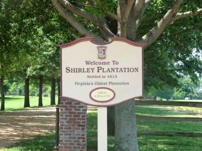
Wayside was settled after 1613 as part of West and Sherley Hundred. Landmarks have included St. John's Church, established in 1897 by the Rev. John Jones, a post office at Shirley and the Shirley Mill. In 1921 the Wayside Community Club assisted in . . . — — Map (db m9252) HM
Benjamin Harrison (1726-1791) - Virginia planter, politician, and signer of the Declaration of Independence - was born at nearby Berkeley plantation. He first served in the Virginia House of Burgesses in 1752, though elected in 1749, and remained in . . . — — Map (db m86174) HM
John Smith explored the upper Chickahominy River in December 1607. He left his boat and seven of his crew at Apocant, the highest town on the river in the upper part of what is today the lake. Two crew members departed with Smith and two . . . — — Map (db m61883) HM
Two miles south is Kittiewan, mid-eighteenth century manor house. Here lived Doctor William Rickman. From 1776 to 1780 he was director and Chief Physician of the Continental Hospitals of Virginia. — — Map (db m9434) HM
In 1617, Opechancanough, Chief of Powhatan's younger brother, gave land to the south to future governor Capt. George Yeardley. Yeardley patented it and a portion became Upper Weyanoke, a James River plantation. Archaeological investigations there . . . — — Map (db m9432) HM
The Quarter Place Trail is a half mile long, culminating at the Slave & African American Cemetery. The terrain slopes at the trailhead, levels off, and then steepens as it descends to the cemetery. The one-mile round trip walk is of moderate . . . — — Map (db m128689) HM
After three decades of public service, Patrick Henry retired in 1794 to Red Hill plantation in Charlotte County, which he regarded as "one of the garden spots of the world." He purchased the 700-acre estate and simple story-and-half house in 1794 . . . — — Map (db m128698) HM
Text Box #4)
The flags of the Commonwealth Courtyard honor Patrick Henry's election as the first governor of Virginia on June 29, 1776, when the boundaries of the commonwealth extended from the Atlantic Ocean to the Mississippi River. The Grand . . . — — Map (db m128702) HM
Red Hill, 2930 acres at Patrick Henry's death, was named by its previous owners after the red clay soil so common to the area. Henry reportedly referred to it as "one of the garden spots of Virginia." The view from here overlooking the Staunton . . . — — Map (db m128691) HM
Six miles south is Cub Creek Presbyterian Church, the oldest church in this section. The neighborhood was known as the Caldwell Settlement for John Caldwell, grandfather of John C. Calhoun of South Carolina. About 1738 he brought here a colony of . . . — — Map (db m66062) HM
Cub Creek Presbyterian Church, the oldest church in this area, stood four miles southwest of here. The neighborhood was known as the Caldwell Settlement for John Caldwell, great grandfather of U.S. senator and vice president John C. Calhoun, of . . . — — Map (db m182500) HM
Half a mile north is Greenfield, built in 1771 by Isaac Read. Read was a member of the House of Burgesses, 1769-1771, and of the Virginia conventions of 1774 and 1775. He served as an officer in the Revolutionary War, dying of wounds in 1777. — — Map (db m31024) HM
Charlotte County. Area 496 square miles. Formed in 1764 from Lunenburg, and named for Queen Charlotte, wife of King George III. Patrick Henry and John Randolph of Roanoke lived in this county, and Henry is buried here. . . . — — Map (db m31001) HM
Charlotte County. Area 496 Square Miles. Formed in 1764 from Lunenburg, and named for Queen Charlotte, wife of King George III. Patrick Henry and John Randolph of Roanoke lived in this county, and Henry is buried here. . . . — — Map (db m66002) HM
Abraham Wood, a trader and militia commander, commissioned Thomas Batte and Robert Hallom to explore the Appalachian Mountains in 1671. Their objective was to search the western slopes for tidal rivers, an indication that the Pacific Ocean was . . . — — Map (db m182503) HM
Seven miles west stood Roanoke Bridge, the colonial homestead of Joseph Morton, who patented land near by in the 1740s. He was an elder of Briery Presbyterian Church on its founding in Prince Edward County in 1755, and later a trustee. He served as . . . — — Map (db m40854) HM
A chapel was built here in 1765-1769 by order of the vestry of Cornwall Parrish. Following the disestablishment and a brief period of irregular use, the property passed to the Republican Methodists, a denomination then active in the South. It was . . . — — Map (db m66061) HM
Member of House of Burgesses, 1765-1775, of Virginia conventions, 1774-1788, including Constitutional Conventions, of first Supreme Court of Appeals of Virginia. A founder of Hampden-Sydney College. Lived and is buried at Mulberry Hill nearby. — — Map (db m31864) HM
Also called Three Chopt Road, this colonial route ran from Richmond to the Shenandoah Valley. It likely took its name from three notches cut into trees to blaze the trail. A major east-west route across central Virginia from the 1730s, it was . . . — — Map (db m5576) HM
The site was patented by William Taylor in 1737. The town was established by law in 1762, and was named for Queen Charlotte, wife of George III. Burgoyne’s army, captured at Saratoga in 1777, was long quartered near here. The legislature was in . . . — — Map (db m8643) HM
The Farm stands on a 1020-acre tract acquired by Nicholas Meriwether in 1735 and later owned by Col. Nicholas Lewis, uncle of Meriwether Lewis. A building on the property likely served as headquarters for British Col. Banastre Tarleton briefly in . . . — — Map (db m19582) HM
This building, in continuous use as a
courthouse for over 200 years, is one of America’s most historic. No other courthouse has been used by three early
American Presidents at the same time, The original wood frame courthouse was erected on a . . . — — Map (db m19723) HM
Three miles to the southeast, Thomas Jefferson began the house in 1770 and finished it in 1802. He brought his bride to it in 1772. Lafayette visited it in 1825. Jefferson spent his last years there and died there, July 4, 1826. His tomb is there. . . . — — Map (db m65069) HM
You are standing on land once inhabited by the Monacan Indians and bison. While much of the landscape has changed, the Rivanna River still runs through, connecting past to present.
1733. The property first came into European hands in a . . . — — Map (db m172972) HM
In this vicinity, in 1775, was the southern end of a causeway, with bridges, by which the swamp and stream were crossed. Here William Woodford's Virginia riflemen defended the passage. When Lord Dunmore's British regulars attempted to cross the . . . — — Map (db m29926) HM
A direct outgrowth of the New Mill Creek Society organized in 1772 by the Rev. Joseph Pilmoor, the first official Methodist missionary to America. Methodist meetings were held as early as 1770 in the Cutherell home, a regular preaching place for . . . — — Map (db m48923) HM
At this point stood St. Bride's Church. The parish church of St. Bride's Parish which was established in 1761. The church, sometimes known as Northwest Church, was built in 1762 and survived until 1853. — — Map (db m46530) HM
This plot is reserved in perpetuity for the Gregory family, who owned a working plantation here between 1797 and 1866.
This site was settled in 1610 by the Thomas Sheffield family under a royal patent of 2,300 acres from the Crown of England. The . . . — — Map (db m143045) HM
Established 1613 by Sir Thomas Dale.
First incorporated Virginia town 1614.
Home of John Rolfe, colony recorder, who married Pocahontas.
Rev. Alexander Whitaker ministered here.
Early port of Richmond.
Erected … 1938 by Bermuda Hundred . . . — — Map (db m17109) HM
Before determining to settle at Jamestown, the English sought a safe place to plant their colony further west along the James River. On that trip, John Smith and his fellow Englishmen found an Appamattuck Indian town in the vicinity of Bermuda . . . — — Map (db m17134) HM
The story of Dutch Gap demonstrates the importance of the river throughout history revealing a partnership of man’s use of land and water. Today, the river’s commercial and recreational activities continue, providing a backdrop to Dutch Gap’s . . . — — Map (db m16159) HM
On March 22, 1622, the Powhatan chiefdom launched a coordinated offensive against the English settlements along the James River. Sixty-six men, women and children were killed within the Henrico settlements including five dead at Henricus. Over . . . — — Map (db m87591) HM
Colonel Thomas Lygon, who came to the Virginia colony in the early 1640s from Worcestershire, England, patented several large parcels of land on the north bank of the Appomattox River in an area known as The Cowpens, near Mount My Lady, which was . . . — — Map (db m17131) HM
The trail at Dutch Gap traces the old channel of the James River. Before the river was rerouted, there was a ferry landing on the opposite shore called Osborne’s Landing. This may have been the location of the enigmatic Port Cotage referenced by . . . — — Map (db m87594) HM
In 1611, Farrar's Island was the site of the "Citie of Henrico," one of Virginia's first four primary settlement areas under the Virginia Company of London. Later, it was part of a 2,000-acre land patent issued posthumously to William Farrar in . . . — — Map (db m16018) HM
The Colonial Dames
Of America in the
State of Virginia
A.D. 1910
Erect this monument on the site
Of the Town of Henricopolis
To commemorate the college
And university which on
May 26, 1619.
The Virginia Company of
London decreed . . . — — Map (db m16149) HM
Near this spot, the Arrohateck Indians greeted John Smith and his compatriots during their May 1607 exploration upriver from Jamestown. Smith’s 1612 Map of Virginia shows Arrohateck towns on both shores of the James below present-day Richmond. . . . — — Map (db m16335) HM
(panel 1)
John Smith Explores the Chesapeake
Captain John Smith explored the Chesapeake Bay in the early 1600s seeking precious metals and a passage to Asia. He traveled the James, Chickahominy, and York rivers in 1607, and led . . . — — Map (db m128321) HM
Mt. Malady, the first hospital in the American colonies, was built in Coxendale near Henricus in 1612. It had 40 beds for 80 patients! Many colonists arrived in poor health from their long sea voyage. Others acquired diseases, such as . . . — — Map (db m87884) HM
In 1607, Opposunoquonuske, sister of the Appamattuck Indian chief Coquonasum, headed an Appamattuck town on the James River at the mouth of the Appomattox. On 24 May 1607, Opposunoquonuske received a party of Englishmen in a stately fashion, greatly . . . — — Map (db m54254) HM
The town of Osbornes was named for Captain Thomas Osborne who settled nearby at Coxendale in 1616. During the 17th and 18th centuries, Osborne's plantation wharf was a tobacco inspection station and local shipping center. Thomas Jefferson, . . . — — Map (db m16019) HM
Near this spot was built
Anno Domini 1611
The Church of Henricopolis
Under the auspices of
Sir Thomas Dale
High Marshall of Virginia
The Reverend Alexander Whitaker, M.A,
Minister
This cross is erected to
Commemorate the . . . — — Map (db m16147) HM
The 1917 Courthouse stands on the footprint of the first Chesterfield County courthouse built in 1749 and demolished in 1917, against the will of local citizenry. This early preservation case was the subject of heated debate between concerned . . . — — Map (db m133671) HM
On this spot were imprisoned 1770-1774
John Tanner
William Weber
Augustine Eastin
David Tinsley
Joseph Anthony
Jeremiah Walker
John Weatherford
Apostles of
Religious Liberty
“Whether it be right . . . — — Map (db m19527) HM
This area, known originally as "Cold Water Run," is the site of the first Chesterfield County courthouse, erected in 1750. In 1917 it was demolished and replaced by a larger Georgian Revival brick building that served the county until the 1960s. . . . — — Map (db m19523) HM
Two and one-third miles south stands Eppington, built in the late 1760s by Francis Eppes and his wife Elizabeth Wayles Eppes, half-sister to Martha Wayles Jefferson. Thomas Jefferson frequently visited Eppington. Lucy Jefferson, his daughter, died . . . — — Map (db m28911) HM
Free enterprise had its beginnings in the New World on this site in 1611. Sir Thomas Dale, following orders from the London Company to "find a more beautiful place," moved westward from Jamestown and built a town out of the wilderness.
The . . . — — Map (db m149631) HM
You are now on Farrar's Island. Here in 1611, Sir Thomas Dale established the "Citie of Henryco", one of Virginia's first four primary settlement areas under the Virginia Company of London. Later, this land was part of a 2,000-acre patent issued . . . — — Map (db m149633) HM
As the small band of Jamestown colonists explored the upper reaches of the tidal James River in May 1607, they stopped twice at the town of Arrohateck, home to an estimated 255 Algonquian-speaking natives. On both occasions they were welcomed by . . . — — Map (db m149628) HM
Dr. Pastore learned of the presence of Mt. Malady, the first hospital in North America, situated at the 1611 Citie of Henricus. He developed the concept of its reconstruction, promoted local interest in the project, acquired various parcels of . . . — — Map (db m149630) HM
Captain John Smith explored the Chesapeake Bay in the early 1600s seeking precious metals and a passage to the Pacific. He traveled the James, Chickahominy and York rivers in 1607, and led two major expeditions on the Chesapeake from Jamestown in . . . — — Map (db m149625) HM
Explore the places John Smith and the English colonists traveled in the early 1600s. Learn about the thriving American Indian communities and the bountiful richness that still exists in the region today.
For more than 3,000 miles, the . . . — — Map (db m149626) HM
Gabriel Archer wrote about a high rock cliff that projected into the channel of the Appomattox River upstream of its confluence with the James. When exploring the river in 1608, Smith found verdant marshes the likes of which can still be seen here . . . — — Map (db m181457) HM
A mile north, on the site of an important Appamatuck Indian village, Sir Thomas Dale established Bermuda Hundred in 1613. The hundred was a traditional English jurisdiction of one hundred families. Dale, the deputy governor and marshal of Virginia, . . . — — Map (db m11662) HM
The Early Years
Beginning around 1748, Richmond coal was shipped to the major coastal cities of Colonial America.The market was primarily for smithing and home heating since steam engine development for industry and transportation was still . . . — — Map (db m238290) HM
In 1700-1701, Huguenots (French Protestant refugees) settled in this region on land provided to them by the Virginia colony. The Huguenot settlement, known as "Manakin Town" centered at the former site of a Monacan Indian town, located south of the . . . — — Map (db m31544) HM
Local Coal Mining in the 18th and 19th Centuries
Outcroppings of coal along the south bank of the James River in what is now Powhatan County were discovered circa 1700. A hunter from the nearby Huguenot settlement, Manakintown, dislodged . . . — — Map (db m31569) HM
Mattoax was located to the south on the Appomattox River. John Randolph, Sr., built a house there in the 1770s that burned after 1810; it was the boyhood home of his son, John Randolph of Roanoke. Mattoax also was the residence of St. George Tucker, . . . — — Map (db m19637) HM
Built before 1732 by Henry Cary, this was the home of Colonel Archibald Cary, a Revolutionary leader of Virginia. The house was moved, 1929-30, to its present location off Cary Street Road in Richmond's West End. — — Map (db m24997) HM
Vanished now but for a trace, Falling Creek is the site of the first industrial ironworks in the New World. The close proximity of iron ore, wood for fuel and power provided by the falling water made the Falling Creek site perfect for this . . . — — Map (db m32587) HM
Nearby on Falling Creek is the first ironworks in English North America. It was established by the Virginia Company to supply iron for the colony and for export to England. Construction began in 1619. The works, including a blast furnace, were . . . — — Map (db m16015) HM
This is the location of the first iron furnace established in the New World, started in 1619 and completed in 1622. Iron ore had been extracted from James River outcrops as early as 1608, and these samples were shipped to England. The Virginia . . . — — Map (db m101038) HM
This is one of the oldest roads leading from the east to the Shenandoah Valley; It crosses the Blue Ridge at Snicker’s Gap. The ferry right over the Shenandoah River was granted, 1766. Washington used this road many times. Some distance to the east . . . — — Map (db m1840) HM
Initially known as "Battletown" for the Saturday night brawls that took place at the local inns, the town of Berryville was officially chartered in 1798 and named for Benjamin Berry, a local businessman. The new town became the county seat when . . . — — Map (db m157717) HM
Organized near this spot by Wm. and Daniel Fristoe in 1772. Constituted by elders John Marks and John Garrard, the later serving as its pastor. James Ireland served as pastor from 1778–1806 and is buried here. — — Map (db m1831) HM
The short story of "Our Land is Our Legacy" begins with Virginia's Tidewater planters migrating to the northern Shenandoah Valley to take advantage of the fertile lands and abundant water. What we now know as Clarke County was primarily colonized . . . — — Map (db m157715) HM
This 16-square-mile scenic landscape illustrates the changing patterns of rural life since the 1730s as shown in its plantations, farms, mills, churches, and African American communities. The first settlers came from various places, including New . . . — — Map (db m5595) HM
Clark County. Area 171 Square Miles. Formed in 1836 from Frederick and added to from Warren. Named for George Rogers Clark, conqueror of the Northwest. Lord Fairfax and General Daniel Morgan, Revolutionary hero, lived in this . . . — — Map (db m3483) HM
Three miles south is Greenway Court, residence of Thomas, Sixth Lord Fairfax, proprietor of the vast Northern Neck Grant, which he inherited. Born in Leeds Castle, England, in 1693, Fairfax settled in Virginia, in 1747, for the rest of his life. He . . . — — Map (db m1755) HM
Lord Fairfax worshipped here in the “Old Chapel” of colonial Frederick Parish, established 1738. This stone building dates from 1790 and witnessed the early ministry (1810–1885) of Bishop Meade. Governor Edmund Randolph and Col. Nathaniel Burwell . . . — — Map (db m1852) HM
Clark County. Area 171 Square Miles. Formed in 1836 from Frederick, and added to from Warren. Named for George Rogers Clark, Conqueror of the Northwest. Lord Fairfax and General Daniel Morgan, Revolutionary hero, lived in this . . . — — Map (db m1394) HM
Ashby’s Gap was named in honor of John Ashby, a leader among local pioneers and reputedly the first person to haul a hogshead of tobacco through this gap. Part of the house standing just to the south may have been erected in the 1740s by Thomas . . . — — Map (db m1333) HM
Clark County. Area 171 square miles. Formed in 1836 from Frederick and added to from Warren. Named for George Rogers Clark, conqueror of the northwest. Lord Fairfax and General Daniel Morgan, revolutionary hero, lived in this . . . — — Map (db m1451) HM
This 30-square-mile scenic landscape illustrates the evolution of a unique rural community. Unlike the rest of the Shenandoah Valley, where mostly Scots-Irish and German immigrants settled on small farms, Virginia Tidewater gentry occupied most of . . . — — Map (db m1848) HM
This village developed around two late-18th-century gristmills and Nathaniel Burwell’s Carter Hall plantation, one of the preeminent estates in the area. The Burwell-Morgan Mill in the center of the village was a commercial gristmill, while the . . . — — Map (db m172179) HM
This post was originally placed here by George Washington under the direction of Lord Fairfax. It was erected in 1750 as a guidepost to direct strangers and travelers on the Old Dutch Wagon Road to Greenway Court, the home of Lord Fairfax. — — Map (db m1759) HM
Clark County. Area 171 Square Miles. Formed in 1836 from Frederick and added to from Warren. Named for George Rogers Clark, conqueror of the Northwest. Lord Fairfax and General Daniel Morgan, Revolutionary hero, lived in this . . . — — Map (db m3481) HM
Greenway Court
Has Been designated a
National
Historic Landmark
This site possesses National Significance
in Commemorating the History of the
United States of America
1980
Heritage Conservation and Recreation Service
United States . . . — — Map (db m70247) HM
The name “Conjurer's Field” was associated with this site as early as 1635, when a land patent containing this reference was issued. Tradition has it that long ago, a Native American "conjurer,’ or priestly magician-healer, settled here . . . — — Map (db m103889) HM
Conjurer's Neck, located on this peninsula formed by Swift Creek and the Appomattox River, was occupied by Native Americans as early as 1000-3000 BC. This general area supported a substantial Appamattuck Indian settlement by AD 1600. Richard Kennon, . . . — — Map (db m103876) HM
A prosperous Bermuda Hundred merchant, Richard Kennon was in Virginia prior to 1670 and represented Henrico County several times in the House of Burgesses.
Kennon married Elizabeth Worsham in 1675 and settled here on Conjurer's Neck after . . . — — Map (db m103890) HM
Craig County. Area: 333 square miles. Formed in 1851 from Botetourt, Roanoke, Giles, and Monroe. Named for Robert Craig, member of Congress. Craig Healing Springs are in this county.
West Virginia. West Virginia was . . . — — Map (db m83890) HM
Culpeper County. Area 284 square miles. Formed in 1748 from Orange, and named for Lord Culpeper, Governor of Virginia 1680–1683. The battle of Cedar Mountain, 1862, was fought in this county.
Rappahannock County. . . . — — Map (db m8293) HM
Two miles south is the grave of Betty Washington Lewis, the younger sister of George Washington. She was born in Westmoreland County in 1733 and married Fielding Lewis in May 1750, becoming his second wife. Her husband purchased land in 1752 and . . . — — Map (db m4429) HM
On the hill to the south the famous Culpeper Minute Men were organized in 1775. John Marshall, later chief Justice of the Supreme Court, was a Lieutenant. — — Map (db m8321) HM
In 1749 at the age of 17, George Washington received a commission from the College of William & Mary to become Surveyor for the newly formed Culpeper County, his first surveying job.
He is shown here with a "circumferentor", a . . . — — Map (db m171380) HM
The hilltop northeast of this spot is Cole's Hill. The mountain to the west is Mount Pony. Both were used by Pope as signal stations, 1862. — — Map (db m4582) HM
Culpeper County. Area 384 Square Miles. Formed in 1748 from Orange, and named for Lord Culpeper, Governor of Virginia, 1680-1683. The Battle of Cedar Mountain, 1862, was fought in this county.
Orange County. Area . . . — — Map (db m23774) HM
1656 entries matched your criteria. Entries 201 through 300 are listed above. ⊲ Previous 100 — Next 100 ⊳