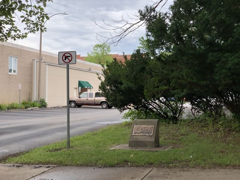
On South Broad Street north of East Tompkins Street, on the right when traveling north.
Site of Beecher Chapel, first brick church in Galesburg, built in 1858 and named after its first minister, Edward Beecher. Often used as a stop on the Underground Railroad. Razed 1966. — — Map (db m230127) HM
On South Street, on the right when traveling east.
On October 7, 1858, Abraham Lincoln and Stephan A. Douglas met in Galesburg for the fifth of seven joint debates. From a platform erected along the east side of Old Main on the Knox College campus, Lincoln said: "He is blowing out the moral lights . . . — — Map (db m316206) HM
On South Cherry Street just south of East South Street, on the right when traveling south.
[Left panel]
Lincoln and Douglas
debated here on October 7, 1858.
Their joint meeting was one of seven across Illinois as they
contested Stephen A. Douglas's seat in the Senate that summer and fall. Here in . . . — — Map (db m150565) HM
Near Kilbourne Road north of Old Grand Avenue, on the right when traveling north.
Once the slaves escaped, they faced an ever-present danger of being recaptured, severely punished, and sold back into slavery. To avoid this danger, freedom seekers employed a variety of methods including traveling by night, wading in streams to . . . — — Map (db m308058) HM
On Kilbourne Road 0.1 miles north of Old Grand Avenue, on the right when traveling north.
The Mother Rudd Home is the oldest building in Warren Township. It served as a stagecoach stop, inn, tavern and post office. After the organization of the township in 1850, it was the official town hall and all caucuses and elections were held here. . . . — — Map (db m55519) HM
Near Kilbourne Road north of Old Grand Avenue, on the right when traveling north.
From all indications, a main line of the Underground Railroad ran through Lake County from Illinois across the state line to Wisconsin. Several sites have been identified as stops in Gurnee, Ivanhoe, Millburn and Waukegan. Oral tradition indicates . . . — — Map (db m308050) HM
On Kilbourne Road north of Old Grand Avenue, on the right when traveling north.
1501 - African Slaves in the New World
Spanish settlers bring slaves from Africa to Santo Domingo (now the capital of the Dominican Republic).
1619 - Slaves in Virginia
Africans brought to Jamestown were the first slaves imported . . . — — Map (db m308034) HM
Near Kilbourne Road north of Old Grand Avenue, on the right when traveling north.
1820 - Missouri Compromise
Missouri is admitted to the Union as a slave state, Maine as a free state. Slavery is forbidden in any subsequent territories north of latitude 36° 30'.
1850 - Compromise of 1850
In exchange for . . . — — Map (db m308037) HM
Near Kilbourne Road north of Old Grand Avenue, on the right when traveling north.
The first African slaves brought to North America arrived in Virginia in the early 17th Century. A secret network of activists was formed to aid escaped slaves obtain freedom. These individuals offered shelter and food to escaped slaves traveling . . . — — Map (db m308056) HM
Near Kilbourne Road near Old Grand Avenue, on the right when traveling north.
Illinois played a significant role in the Underground Railroad. A large number of the slaves who came to Illinois escaped from Kentucky and Tennessee with the majority fleeing from Missouri. Although most Underground Railroad passengers reached . . . — — Map (db m308060) HM
The fertile prairies in Illinois attracted the attention of French trader Louis Jolliet and Father Jacques Marquette as they explored the Mississippi and Illinois Rivers in 1673. France claimed this region until 1763 when she surrendered it to Great . . . — — Map (db m272438) HM
On East 8th Road (Illinois Route 178) north of Local Road 2199, on the right when traveling north.
Philanthropist - Pioneer Abolitionist - Publisher - Census of Universal Emancipation, Fore-Runner of "Western Citizen" now "Chicago Tribune". He Gave His Life and Fortune For Freedom — — Map (db m197995) HM
On La Salle Street (Illinois Route 23) at Jackson Street, on the right when traveling north on La Salle Street.
First Lincoln-Douglas Debate
Abraham Lincoln's first heated exchanged with Stephen A. Douglas on Aug 21, 1858 in Ottawa was received coolly by his advisors. They insisted Lincoln had treated Douglas entirely too "tenderly." . . . — — Map (db m65302) HM
On West Madison Street at La Salle Street ( Route 23), on the right when traveling east on West Madison Street.
In 1859, Jim Gray, a slave who escaped from Missouri, was apprehended in Illinois by slave hunters. Gray was taken to Ottawa for a hearing before Justice John Dean Caton of the Illinois Supreme Court's northern division.
On October 19, with a . . . — — Map (db m201759) HM
On Columbus Street (Illinois Route 71) just south of Lafayette Street, on the right when traveling south.
On August 21, 1858, the first of seven debates between Abraham Lincoln and United States Senator Stephen A. Douglas took place in this park. Approximately 10,000 people gathered to hear the two candidates discuss the question of slavery in America. . . . — — Map (db m65299) HM
On West Prospect Avenue at Christie Street, on the right when traveling west on West Prospect Avenue.
This tablet marks the home of
John Hossáck
It was here he directed the underground
freedom of slaves 1859
Erected by
Illini Chapter D.A.R.
1947 — — Map (db m185011) HM
On Columbus Street (Illinois Route 71) at Jackson Street, on the right when traveling south on Columbus Street.
On August 21, 1858, the first of the famous debates between Abraham Lincoln and Stephen A. Douglas was held in Washington Square. Here ten thousand heard the two candidates debate for a seat in the United States Senate.
Principally, the great . . . — — Map (db m65325) HM
On Main Street south of High Street, on the right when traveling south.
Prudence Crandall (1803-1890) was a white teacher who gained fame for conducting an advanced academy for Black women in Canterbury, Connecticut. Sparked by discussions with Maria Davis, a Black woman who shared abolitionist literature with her, . . . — — Map (db m250332) HM
On Main Street north of Ottawa Street, on the right when traveling south.
James Butler "Wild Bill" Hickok was born May 27, 1837, in a house that stood on this block. His parents, William A. and Polly Butler Hickok, settled in Troy Grove (then called Homer) in 1836 after living for a time at Tonica (then called Bailey's . . . — — Map (db m199848) HM
On West Main Street at West Main Street on West Main Street.
By 1856 Abraham Lincoln had realized that his former political party, the Whigs, was in ruins. The political landscape had changed to the point that Lincoln accepted an invitation to attend an Anti-Nebraska Editors Convention held at the . . . — — Map (db m56884) HM
On East Side Square (Illinois Route 4) at Hoch Street, on the right when traveling north on East Side Square.
16th, President of the United States
Born: February 12, 1809, Hodgenville, Kentucky
Assassinated: April 15, 1865, Washington D. C.
Presidential Term: March 4, 1861 - April 15, 1865
On College Avenue (Illinois Route 140) at Clawson Street, on the left when traveling east on College Avenue.
College Avenue Presbyterian Church, established 1837, formerly Upper Alton Presbyterian Church, heralds Elijah Parish Lovejoy, editor and martyr to freedom, as its first pastor.
Emerson wrote, "The brave Lovejoy gave his breast to the bullets . . . — — Map (db m142158) HM
On College Avenue (Illinois Route 140) at Clawson Street, on the right when traveling west on College Avenue.
This is the third church to be built here since 1836.
The first church was made of stone and was built late in 1836 on the present site. The land and church's bell were donated by Enoch Long.
Elijah Parish Lovejoy was the first pastor . . . — — Map (db m144833) HM
On Market Street south of West Broadway, on the left when traveling north.
Rich in heritage and haunted by history, many threads of our nation's past can be discovered here in Alton.
Located at the confluence of the Mississippi, Illinois, and Missouri rivers, Alton is one of America's great river towns. It was . . . — — Map (db m133286) HM
Near East 5th Street at Monument Avenue, on the left when traveling east.
Elijah Parish Lovejoy (Nov. 9, 1802 - Nov. 7, 1837) was a newspaper editor, social reformer, and Presbyterian minister whose death at the hands of an angry mob at Alton, Illinois, made him an enduring symbol of the fight for human liberty and . . . — — Map (db m133297) HM
On College Avenue (Illinois Route 140) at Clawson Street, on the left when traveling east on College Avenue.
Elijah Parish Lovejoy was the first pastor of Upper Alton Presbyterian Church, now College Avenue Presbyterian Church. A minister, teacher, newspaper editor, and martyr to free speech and the abolition of slavery, he was fatally shot on Nov. 7, . . . — — Map (db m142159) HM
Near East 5th Street at Monument Avenue, on the left when traveling east.
Considered by many to be the first casualty of the Civil War, abolitionist editor and Presbyterian minister Rev. Elijah P. Lovejoy was killed defending the freedom of the press.
Editor of the St. Louis Observer, Lovejoy wrote . . . — — Map (db m133295) HM
On William Street north of West Broadway ( Route 100), on the right when traveling south.
"Lovejoy's tragic death for freedom in every sense marked his sad ending as the most important single event that ever happened in the new world." - Abraham Lincoln in a letter to his friend Rev. James Lemen, March 2, . . . — — Map (db m144832) HM
On West Broadway west of Market Street, on the right when traveling east.
The seventh and last debate between Abraham Lincoln and Stephen A. Douglas in the 1858 U.S. Senatorial Campaign was held at this site on October 15. Approximately five thousand people gathered in front of the old City Hall to hear the two . . . — — Map (db m154153) HM
On Market Street south of West Broadway, on the left when traveling north.
The two life-like statues represent a monumental event in our nation's history—the Lincoln-Douglas debates.
For a decade, the Illinois U.S. Senate seat was held by Stephen A. Douglas, one of the most famous politicians of his time. . . . — — Map (db m133288) HM
On William Street north of West Broadway (State Road 100), on the left when traveling north.
The warehouse of Godfrey, Gilman & Co. was situated at the foot of William Street near where the flour mill is located today. Broadway was a one lane street at that time called Short Street. The building was stone, three stories on the street . . . — — Map (db m211806) HM
On Henry Street at East 12th Street, on the right when traveling north on Henry Street.
The stately house down the block once housed the co-author of the 13th Amendment, which abolished slavery in the United States.
In giving freedom to the slave, we assure freedom to the free—honorable alike in what we give and what we . . . — — Map (db m133291) HM
On North Main Street (Illinois Route 143/159) at Liberty Street, on the right when traveling west on North Main Street.
Site of the courthouse where, in 1824, political enemies convicted Governor Edward Coles of illegally freeing his slaves. "To preserve to a continuous line of generations that liberty obtained by the valor of our forefathers, we must make . . . — — Map (db m143182) HM
On South Main Street (Illinois Route 159) south of West Schwartz Street, on the right when traveling south.
Edward Coles, the second governor of Illinois, was born into one of the wealthiest families in Virginia in 1786 and graduated from William & Mary. Although raised on a plantation, Coles was an anti-slavery advocate who persistently urged Presidents . . . — — Map (db m182845) HM
On North Main Street (Illinois Route 159) north of West E Street, on the right when traveling south.
This Federal-style home was built in 1836 for Dr. John Weir (1809-1878) and his first wife, Hepzibah Damon (1810-1838). His first patients entered the house through a side entrance on the north face of the building. Weir, both a surgeon and . . . — — Map (db m187506) HM
On Illinois Route 100, on the right when traveling west.
Miles of rich farmland, scenic vistas and proximity to the river attract residents to Godfrey today, just as it did the early settlers of the 1800s. In 1817, Jacob and Sarah Lurton traveled from Louisville, Kentucky with their family and settled . . . — — Map (db m220777) HM
On North Randolph Street, on the right when traveling south.
Macomb's historic Oakwood Cemetery is burial ground of approximately 300 Civil War soldiers.
It also is the last resting place for various conductors of McDonough County's legendary Underground railroad, most notably the area's Allison and . . . — — Map (db m181708) HM
On S. East Street at Front Street on S. East Street.
Horace Greeley's New York Tribune reported on the Bloomington convention for its national readership: "It was most emphatically a convention of the people, where all classes, opinions and shades of belief were represented---but all inspired . . . — — Map (db m57458) HM
On Mill Street (Illinois Route 7) at Franklin Street on Mill Street.
The Village of Maeystown, originally known as Maeysville was founded in 1852 by Jacob Maeys, a German immigrant from Bavaria. Maeys purchased 100 acres and had the land surveyed and subdivided into streets and lots with the intention of attracting . . . — — Map (db m144864) HM
Pictured in the crowd listening to Abraham Lincoln's speech is Joseph O. King, a prominent merchant who later became mayor of Jacksonville. He helped found a political group that agitated for the exclusion of slavery from the free . . . — — Map (db m57653) HM
On East Brick Road 0.1 miles east of North Chana Road, on the right when traveling west.
The Chicago and Iowa trail, usually known as the C & I trail, passed through here. Travelers by stage coach, covered wagon, or on horseback between Chicago and Iowa frequently stayed overnight at Capt. Stinson's inn. This center of community life in . . . — — Map (db m131316) HM
Near 306th Lane/Broad Street (County Route 2159E) south of County Route 2, on the left when traveling south.
Free Frank and Free Lucy came to Illinois in 1830, bringing with them four of their seven children. Their son Solomon and eldest daughters, Juda and Sarah, remained in bondage in Kentucky. Solomon's freedom was purchased in 1835. Free Frank . . . — — Map (db m302307) HM
On County Road 2 at 306th Lane/Broad Street (County Road 2159E), on the right when traveling east on County Road 2.
Free Frank McWorter was born in slavery in South Carolina in 1777. His owner took him to Kentucky,
where he met his wife Lucy, enslaved on a
neighboring farm. With the permission of his
owner, Frank worked for wages. He . . . — — Map (db m302476) HM
On 306th Lane/Broad Street (County Road 2159E) south of County Route 2, on the left when traveling south.
John Bixler was an early resident. While living in Kentucky in 1824, Bixler freed his slave, Kezia Clark, and her one-year-old daughter, Louisa. Bixler and Clark left Kentucky, settling in Indiana, Illinois and Missouri, before coming to New . . . — — Map (db m302364) HM
On County Road 2 at 306th Lane/Broad Street (County Road 2159E), on the right when traveling east on County Road 2.
Frank McWorter and his family worked all of their lives to gain freedom and abolish slavery. McWorter purchased freedom for his wife in 1817 and himself in 1819. He traded his saltpeter operation in 1829 so that son Young Frank could return a . . . — — Map (db m302485) HM
On County Road 2 at 306th Lane/Broad Street (County Road 2159E), on the right when traveling east on County Road 2.
The National Park Service has determined that the New Philadelphia town site has made a significant contribution to the understanding of the Underground Railroad in American history and therefore meets the requirements for inclusion in
The . . . — — Map (db m302493) HM
On East Kaskaskia Street west of Ferry Street, on the left when traveling south.
Thomas Mather was born in Simsbury, Connecticut, in 1795. His father, William Mather, fought in the Revolutionary War and was a direct descendant of Cotton Mather. The New England minister associated with the Salem Witch Trials. Thomas Mather . . . — — Map (db m161322) HM
On South 8th Street 0.1 miles south of East Jackson Street, on the left when traveling south.
In the empty lot before you once stood two small houses. The 1850 census tells us two families lived here. The Jenkins and the Blanks shared walls and a common goal: to improve the lives of African Americans. Both families became advocates for . . . — — Map (db m190190) HM
On South 8th Street at East Cook Street, on the right when traveling south on South 8th Street.
(Six panels (three on each side) that contain one line of historical information)
•Born in North Carolina around 1810, but unclear if enslaved or free. In 1846 filed his Certificate of Freedom papers with the Sangamon County Recorder of . . . — — Map (db m227803) HM
On South 8th Street at East Cook Street, on the right when traveling south on South 8th Street.
(Six panels (three on each side) that contain one line of historical information)
•Was a successful barber and entrepreneur who lived at 322 North 12th Street
•He owned a Barbershop at Ninth and Jefferson St
•Told his family to leave . . . — — Map (db m227806) HM
On South 5th Street at East Jackson Street, on the left when traveling south on South 5th Street.
In mid-August, 1908, white Springfield residents lynched
two African Americans during what became known as
the Springfield Race Riot. The mob action was one of many such Incidents in the United States which claimed the lives of thousands of . . . — — Map (db m288506) HM
The Underground Railroad refers to the efforts of enslaved African Americans to gain their freedom by escaping bondage. Acts of self-emancipation made runaways "fugitives" according to the laws of the time. While most began and completed their . . . — — Map (db m48450) HM
On South 8t Street at East Cook Street, on the right when traveling south on South 8t Street.
(Six panels (three on each side) that contain one line of historical information)
•Escaped from slavery in Missouri and settled in Springfield, IL
•Used his home as an Underground Railroad station
•Organized secret raids to free . . . — — Map (db m227797) HM
On South 8th Street at East Cook Street, on the right when traveling south on South 8th Street.
(Six panels (three on each side) that contain one line of historical information)
•Was a successful entrepreneur and shoemaker who made shoes for Abraham Lincoln
•His business sat a block east of the Lincoln and Herndon Law Office and . . . — — Map (db m227801) HM
On East Market Street at South Main Street, on the left when traveling west on East Market Street.
Abraham Lincoln first publicly challenged U.S. Senator Stephen A. Douglas's "Nebraska Bill" during a Whig county convention August 26, 1854, in the Scott County courtroom located at this site. Because the bill allowed for the expansion of slavery, . . . — — Map (db m182043) HM
On Abend Street at Mascoutah Avenue, on the right when traveling north on Abend Street.
Gustavus Koerner came to Belleville from Germany in 1833. He took a law degree from the University of Heidleberg in 1832. Shortly after, he was arrested during a political demonstration. He escaped and joined a party of emigrants. In Illinois his . . . — — Map (db m140531) HM
On West Main Street at North Illinois Street ( Route 159), on the right when traveling west on West Main Street.
Abandoning hope of political reform in Germany, members of the Friedrich Engelmann family, including daughter Sophie, immigrated to the Belleville area in 1833. Sophie's suitor, Gustave Koerner, accompanied them after participating in a failed . . . — — Map (db m153301) HM
On West Main Street at North Illinois Street ( Route 159), on the right when traveling west on West Main Street.
A native of Connecticut, Trumbull arrived in Belleville in 1837 to practice law. He successfully challenged the last legal justification for slavery in Illinois. Before moving from town in 1848, he entered politics, serving a term in the Illinois . . . — — Map (db m153287) HM
On North 5th Street north of Madison Street, on the right when traveling north.
The oldest black town in the United States, Brooklyn, Illinois, had its origins in the northern part of the present town. Despite the black code laws meant to discourage African-American settlements in Illinois, Brooklyn's oral history recounts the . . . — — Map (db m186738) HM
On Bethel Meadows Road north of Bethel Road, on the right when traveling north.
Founded in 1809 by Rev. James Lemen, Sr. In 1840 the 200 members made it the largest Baptist congregation in Illinois. A 40' x 60' frame building was built by the members in 1840. Rev. John Mason Peck preached at the dedication service. The church . . . — — Map (db m176309) HM
Near South Carrol Avenue south of East Jefferson Street, on the right when traveling south.
This house has been placed on the
National Register of Historic Places
by the United States Department
of the Interior
Built 1857 — — Map (db m262288) HM
On U.S. 20 at Browns Mill Road, on the right when traveling west on U.S. 20.
The second round in a seven-round bout between political giants Stephen A. Douglas and Abraham Lincoln was held in Freeport on August 27, 1858. In what has become a legendary struggle, Lincoln and Douglas contested for a seat in the United States . . . — — Map (db m93499) HM
Near East Douglas Street (Illinois Route 75) at North State Avenue, on the left when traveling east.
In an era before television, radio and the Internet, political rallies were both public entertainment and a necessary element to the exercise of democracy. The prospect of having both candidates on the same stage at the same time arguing a hotly . . . — — Map (db m233493) HM
Near East Douglas Street (Illinois Route 75) at North State Avenue, on the left when traveling east.
The two "articles" shown from the Freeport Weekly Bulletin, an openly Democratic newspaper, give some indication of the disdain in which some held Lincoln in 1858. Having opposed the Mexican-American War (1846-1848) while he was a member of . . . — — Map (db m233433) HM
Near East Douglas Street (Illinois Route 75) at North State Avenue, on the left when traveling east.
President Roosevelt’s Speech The following is the text of the President's reply: Congressman Hitt, and my fellow countrymen: We meet today to commemorate one of those numerous scenes of this country in which the whole future of the . . . — — Map (db m233346) HM
Near East Douglas Street (Illinois Route 75) at North State Avenue, on the left when traveling east.
The newspaper article headlined "The People for Lincoln" proclaims that Lincoln won the popular vote, defeating Douglas. However, in 1858, United States Senators were elected by the state legislatures, not by popular vote. (The 17th Amendment to . . . — — Map (db m233494) HM
Near East Douglas Street (Illinois Route 75) at North State Avenue, on the left when traveling east.
The issue of slavery was so heavily contested in the early days of the United States, that when the Constitution was adopted (1787), slavery was largely omitted from its lines in order to secure agreement on its ratification. Northern states . . . — — Map (db m233361) HM
Near East Douglas Street (Illinois Route 75) at North State Avenue, on the left when traveling east.
In the 1850's, Stephen A. Douglas, United States Senator from Illinois, was chairman of the powerful Senate Committee on Territories. After the admission of California as a state in 1850, Douglas began to work, along with others, to secure the . . . — — Map (db m233408) HM
On North West Avenue (Illinois Route 26) just north of West Galena Avenue (Business U.S. 20), on the right when traveling south.
On August 27, 1858, Abraham Lincoln and Stephen A. Douglas, on a platform erected near State and Douglas Streets, met in the second of their seven joint debates. Douglas answer to Lincoln’s “Freeport Question” helped him to win the senatorial race, . . . — — Map (db m233242) HM
Near East Douglas Street (Illinois Route 75) at North State Avenue, on the left when traveling east.
Within this block was held the second joint debate in the sensational contest between Abraham Lincoln and Stephen A. Douglas, August 27, 1858. ☆ ☆ ☆ ”I am not for the dissolution of the Union under . . . — — Map (db m233337) HM
Near East Douglas Street (Illinois Route 75) at North State Avenue, on the left when traveling east.
Born in Vermont in 1813, Stephen Arnold Douglas (he spelled his last name with two "s" at one time), came to Illinois in 1833 after having studied law in upstate New York. A strong believer in the political ideals of Andrew Jackson, Douglas was a . . . — — Map (db m233422) HM
On East Douglas Street (Illinois Route 75) just east of North State Avenue, on the left when traveling east.
The Civil WarAs Lincoln assumed the presidency in March 1861, states in the South began to secede from the Union. Four long years of a bloody civil war followed in which some 618,000 Americans died and an additional 375,000 were . . . — — Map (db m233497) HM
Near Court Street east of North 4th Street, on the left when traveling east.
Nance Legins-Costley of Pekin and her three eldest children were the first
enslaved persons Abraham Lincoln helped free. Nance was born in 1818 into
indentured servitude in Kaskaskia, Illinois Territory. She was sold in 1827 in
Springfield to . . . — — Map (db m253036) HM
Near Court Street east of North 4th Street, on the left when traveling east.
William Henry ‘Bill’ Costley was the oldest son of Benjamin and Nance (Legins)
Costley and was born 1840 in Pekin. Born into indentured servitude with his two
older sisters Amanda and Eliza Jane, they and their mother had their freedom
confirmed . . . — — Map (db m253035) HM
On West Wayne Street at Van Buren Street, on the left when traveling east on West Wayne Street.
Fort Wayne's first Republican congressman, Samuel S. Brenton, was a Methodist minister who vigorously opposed the expansion of slavery into the new western territories. Born in 1810 in Kentucky, Brenton was an ordained Methodist minister by the age . . . — — Map (db m250354) HM
On South Main (County Route 650E) at Linville Avenue, on the right when traveling north on South Main.
Albert S. White, for whom Whitestown is named, was president of the Indianapolis & Lafayette Railroad. White was a United States senator and Representative from Indiana and a leading abolitionist. He was appointed to a select federal commission by . . . — — Map (db m175788) HM
On Riverside Drive at Pearl Street, on the right when traveling east on Riverside Drive.
Emancipation Proclamation (1863) did not free slaves in Kentucky. In April 1864, Hannah Toliver, a free black woman living in Jeffersonville, was arrested for aiding a fugitive slave from Kentucky. In May, she was convicted and sentenced to seven . . . — — Map (db m100710) HM
On Walnut Street south of New Street, on the left when traveling south.
Elijah Anderson was an African-American blacksmith who lived and worked in Lawrenceburg from 1850 to 1854. He once told a friend that he had helped at least 1000 slaves escape to freedom in all sorts of weather.
Anderson left Lawrenceburg in . . . — — Map (db m206618) HM
On East Washington Street east of North Broadway Street, on the right when traveling east.
Side one:
Luther Donnell was convicted in Decatur Circuit Court (1849) of aiding fugitive slaves, Caroline and her four children, to escape to Canada. In Donnell v. State, Indiana Supreme Court reversed the conviction, claiming that under . . . — — Map (db m44752) HM
On County Road N80NE at Road E280N, on the right when traveling south on County Road N80NE.
Caroline and her four children escaped Kentucky slave owner October 31, 1847; they crossed Ohio River near Madison. After passing near here, Fugit Township black and white residents hid family close to Clarksburg. While hidden, family seized . . . — — Map (db m44743) HM
On State Road 120 at State Road 15, on the right when traveling east on State Road 120.
Side One:
In 1847, three Kentucky men tried to capture Thomas Harris, fugitive slave in Bristol; a justice of the peace ruling freed Harris, who fled. In 1848, the Elkhart Circuit Court convicted the three men of causing a riot in 1847. In . . . — — Map (db m30744) HM
On East Main Street at East 3rd Street, on the right when traveling east on East Main Street.
As early as 1821, enslaved blacks seeking freedom crossed the Ohio River from Louisville to New Albany. Antebellum and Civil War periods brought more fugitives. Many freedom-seekers were aided by other slaves, free blacks, and anti-slavery whites -- . . . — — Map (db m30841) HM
On West Main Street (Indiana Route 111) west of West First Street, on the right when traveling west.
In summer 1862, national newspapers reported violence against blacks in Toledo, Cincinnati, Chicago, and New Albany, where on July 21, a fight between black and white men sparked two days of attacks by white mobs on blacks and their property. One . . . — — Map (db m180404) HM
On Culbertson Avenue at Bank Street, on the left when traveling east on Culbertson Avenue.
Railroad organized 1847, after years of legislation to provide transportation to move goods and people to and from the state's interior. Completed to Michigan City 1854 when last rail was laid in Putnam County. New Albany's economy expanded with the . . . — — Map (db m206987) HM
On East Main Street (State Road 111) at East 3rd Street, on the right when traveling east on East Main Street.
This church was built by the 2nd Presbyterian congregation and in 1889 sold to the 2nd Baptist Church. It is one of the outstanding church buildings in Indiana. The clock was a landmark for river pilots. The organ, a museum piece, was built in . . . — — Map (db m207038) HM
2121 entries matched your criteria. Entries 201 through 300 are listed above. ⊲ Previous 100 — Next 100 ⊳