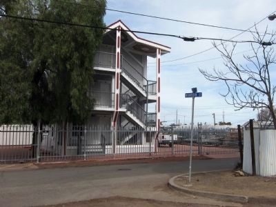
On Foster Street at Richardson Street, on the left when traveling east on Foster Street.
Joe DiMaggio was born here 11/25/1914. The 8th of 9 children to parents Giuseppe and Rosalia. Later moved to San Francisco, but returned often to this neighborhood to visit family. The home burned down in 1948. — — Map (db m53000) HM
On Railroad Avenue north of East 6th Street, on the right when traveling north.
Plaque One:
Coach Camitz led the Mallards to a record of 34 and 2, won three East Bay championships, 4 bowl games, recorded 27 shutouts, and outscored opponents 1,037 to 83. From 1962 to 1964 seasons the Mallards had a string of 16 shutouts . . . — — Map (db m217077) HM
On Cutting Boulevard east of Canal Boulevard, on the right when traveling east.
What is this?
This little boat is called an El Toro. The design was
developed in 1940 by several amateur boat builders so
that anyone who was the least bit handy could cut the
boat out of 2 pieces of plywood and put it together. . . . — — Map (db m188807) HM
The Willie Mays
Junior Giants Fields
are dedicated with affection and appreciation
on this day of May 21st in the year 2022
Willie Howard Mays Jr., nicknamed "The Say Hey Kid"
is a former New York and San Francisco Giants
"Hall of . . . — — Map (db m211935) HM
On Parker Avenue near 4th Street, on the right when traveling south.
In Memory of Vernon Lefty Gomez, born Nov. 26, 1908, in Rodeo. New York Yankees pitching great from 1930-1942. Set World Series record with 6 victories and no defeats leading team to 7 pennants and 6 World Series Championships. Inducted into the . . . — — Map (db m18033) HM
Born in San Francisco in 1918, Byron Athan joined the Army in 1941, and retired in 1964, as a Lieutenant Colonel. He served during WWII in the Pacific Theater and at the Pentagon. Byron enrolled in law school at the University of San Francisco prior . . . — — Map (db m202056) HM
On Coloma Road (California Route 49) south of Mt Murphy Road, on the right when traveling south.
At this site was one of California’s first bowling alleys. It was actually three buildings, with single-lane bowling alleys in each of the side buildings. The establishment, also known as the Metropolitan Saloon and Sporting Hall, featured gambling . . . — — Map (db m17598) HM
Horseback riding was a focus of the Tahoe summer experience. William Tevis Jr. was an ardent lover of horses. He became an internationally known, prize-winning polo player and horseman, and spent many hours riding and "bronco-busting" in rodeos and . . . — — Map (db m112979) HM
In 1968, Echo Summit served as a high-altitude training center and site of the U.S. Olympic Men's Track and Field Trials. Four world records were shattered here on the track carved out of the El Dorado National Forest. The U.S. team selected for the . . . — — Map (db m89152) HM
On M Street 0.2 miles west of Ventura Avenue, on the left when traveling west.
This Monument is dedicated May 30, 1956, by the citizens of Fresno to the memory of Fresno's own Billy Vukovich, who met his death while leading the Indianapolis 500 Mile race May 30, 1955.
Billy Vukovich, who lived all his life in Fresno, won . . . — — Map (db m47249) HM
Born Ralph Capabianca Giordano on May 27, 1905, in Rionero In Vulture, Italy.
Young Corbett III embarked on his successful boxing career in Fresno, California in 1919, winning the Welterweight Championship of the world on February 22, 1933. — — Map (db m47250) HM
On Ventura Avenue 0.1 miles east of Cedar Avenue, on the right when traveling west.
Located at this corner was a 20-acre baseball field named for the legendary Frank Chance. Constructed in 1935, the park served as the spring training grounds for the San Francisco Seals as well as for games played by Fresno's Twilight League. Frank . . . — — Map (db m47337) HM
Near Draper Street, on the right when traveling north.
On the night of November 2, 1916, Fred French, while performing his duties of deputy night watchman for the community of Kingsburg, encountered Lew Cowan behaving in a drunken and disorderly manner in the pool hall. Cowan and French engaged in a . . . — — Map (db m95379) HM
Near Berding Street 0.3 miles Francis Street, on the right when traveling east.
Dedicated to Joseph Carl Oeschger in Recognition of his contribution to sports and to the youth who participate.
An all around athlete who began his career in Ferndale, he went on to professional baseball where he distinguished himself as a . . . — — Map (db m246032) HM
The first Fortuna Rodeo was held on August 27 & 28, 1921 in the newly created Rohner Park, and was sponsored by the Humboldt County Stockman’s Association. At this time the rodeo was a pro-am event and saw such talent as Jesse Stahl, Clay Carr, . . . — — Map (db m219693) HM
Waterfowl hunting was a primary recreational activity on Humboldt Bay from the early 1900s to the 1970s, and remains popular today.
During the duck season, members of the Humboldt Fish and Game Club would meet at the hunt cabin on the . . . — — Map (db m139549) HM
On Airport Road 0.7 miles north of East Line Street.
Fifty years ago, the eastern edge of the Sierra Nevada was the site of intense atmospheric research to explore the cause and dynamics of the newly appreciated and powerful mountain wave phenomenon known locally as the Sierra Wave.
This . . . — — Map (db m156150) HM
Here at Manzanar's main baseball field,
thousands of fans gathered for epic match-ups
between the Scorpions, Padres, Has Beens, and
other teams in the camp's 12 leagues. Baseball
was a powerful symbol of an American way of
life that boosted . . . — — Map (db m243190) HM
Located on the hills in front of you, on the historic Tejon Ranch, the Arvin-Sierra Glider Port was the site for the West Coast Soaring Championships. Many of America’s famous glider pilots made record flights from here, soaring over the mountains . . . — — Map (db m156337) HM
On Chester Avenue, on the left when traveling north.
The water tower was originally built in 1933 and was located at Bakersfield High School on the corner of 14th and C streets. The tower was built to provide water to the campus independent of the city’s water supply and had access to four wells that . . . — — Map (db m237365) HM
On Butte Avenue, on the left when traveling north.
The Whitehouse Saloon
The Whitehouse Saloon was thought to first open as Whitehouse in the late “Teens” under the management of H.B. “Moses” Elder and his brother Emmett Elder. It was closed down by Prohibition in 1920 and operated as . . . — — Map (db m53855) HM
Near 75th Street West north of Rosamond Boulevard.
Willow Springs opened in 1953, and was purchased by Bill Huth in 1962. Under Huth's ownership,
the track grew to include the Streets of Willow and Horse Thief Mile road courses, a paved oval track, a
dirt oval track, and a karting circuit, in . . . — — Map (db m250424) HM
On East F Street, on the left when traveling east.
1906-1914: City of Los Angeles builds and operates plant to make cement for Los Angeles Aqueduct and also constructs town named Aqueduct to house workers and families.
1910: Aqueduct train station and post office are renamed Monolith. . . . — — Map (db m52988) HM
On Woody Road 0.2 miles south of Highway 155, on the left when traveling south.
Joseph Weringer, Sr., Born 1855 in Vienna, established the “Weringer Brewery and Bowling Alley” in Bakersfield in 1881. In 1889 he moved here and established the original townsite of Woody, named after pioneer rancher Sparrel Woody. . . . — — Map (db m113825) HM
Near Mount Curve Avenue East at Lake Avenue, on the left when traveling west.
marker at amphitheater:
Built by
United States
Works Progress
Administration -
1938.
marker at basketball courts:
Improved by
Works Progress
Administration -
1937. — — Map (db m243384) HM
Near Mount Lowe Road near Mount Lowe Railroad Trail.
Originally planned as a small clubhouse for friends,
Professor Lowe's Alpine Tavern became the temporary
end of track when funds for construction ran out, then
became the principal tourist attraction, terminus of the
Alpine Division, and . . . — — Map (db m248796) HM
On Santa Anita Avenue at Huntington Drive, on the right when traveling south on Santa Anita Avenue.
The City of Arcadia was founded by Elias J. “Lucky” Baldwin from part of his large landholdings (Santa Anita Rancho) in the San Gabriel Valley. Baldwin was responsible for incorporating Arcadia as a City and became Arcadia’s first . . . — — Map (db m140512) HM
On First Avenue at Huntington Drive, on the right when traveling south on First Avenue.
Downtown Arcadia was born in 1887 with founder Elias J. "Lucky" Baldwin's Oakwood Hotel complimenting a new Santa Fe train station at First Avenue and Santa Clara Street. Expansion came with City incorporation in 1903 and again with the opening . . . — — Map (db m200045) HM
Near Huntington Drive west of Baldwin Avenue, on the left when traveling west.
Early in 1942 the US government designated Santa Anita Park for special usage during the war years.
Pursuant to Executive Order 9066 signed by President Franklin D. Roosevelt, from March 30, 1942 until October 27, 1942 the facility was used as . . . — — Map (db m165491) HM
On Huntington Drive at First Avenue, on the right when traveling west on Huntington Drive.
Oldest operating racetrack in California - opened Christmas Day 1934.
Founded by Dr. Charles H. Strub & Associates.
Designed in Art Deco style by architect Gordon B. Kaufmann.
Introduced Santa Anita Handicap in 1935 - oldest . . . — — Map (db m201111) HM
Near Huntington Drive east of Baldwin Avenue, on the left when traveling east.
Set against the backdrop of the San Gabriel Mountains in an area of near year-round ideal weather, Santa Anita Park has been considered one of the most beautiful and finest horse race tracks in the world since its opening on Christmas Day 1934. . . . — — Map (db m198317) HM
On Huntington Drive at First Avenue, on the right when traveling west on Huntington Drive.
Record — 89 starts: 33-15-13.
Won inaugural Hollywood Gold Cup 1938.
Defeated War Admiral in 1938 match race.
Lost Santa Anita Handicap by a nose 1937, 1938.
Won handily in third attempt 1940.
Champion older male 1937, 1938. . . . — — Map (db m201113) HM
On Santa Clara Street at First Avenue, on the left when traveling east on Santa Clara Street.
Located along Arcadia’s Huntington Drive, just east of Santa Anita Avenue, the Thoroughbred Racing Walk of Champions is a tribute to the horse racing community that has been an integral part of Arcadia history for more than 100 years.
The . . . — — Map (db m145251) HM
On Santa Clara Street at First Avenue, on the left when traveling east on Santa Clara Street.
Record — 20 starts: 19-1-0.
Owned by Jerry & Ann Moss, trained by John Shirreffs.
Purchased as a yearling for $60,000; Earned $7.3 million in 4-year racing career.
Won 17 graded stakes races, including 13 Grade 1 events.
Won Lady's . . . — — Map (db m201116) HM
On Saint Catherine Way north of Crescent Avenue, on the right when traveling north.
The sport of big game fishing originated in Avalon when Charles Frederick Holder caught a 183 pound Blue Fin Tuna with sport fish tackle on June 1, 1898. This angling milestone inspired him to form the Tuna Club of Santa Catalina Island, an . . . — — Map (db m49856) HM
On Saint Catherine Way north of Crescent Avenue, on the right when traveling north.
The Tuna Club of Avalon marks the birthplace of modern big game sportfishing. In 1898, led by Dr. Charles Frederick Holder, the club's founding members adopted the rules of conduct stressing conservationist ethics and sporting behavior. Today, their . . . — — Map (db m49678) HM
On Avalon Canyon Road south of Tremont Street, on the left when traveling south.
This tower was erected by Wm. Wrigley Jr.
in honor of the baseball
players who gave or risked
their lives in the defence
of their country in the
Great World War, Jan 15, 1926.
The Avalon Men's Softball League
rededicates the . . . — — Map (db m186317) HM
On Moreno Drive 0.1 miles north of Olympic Boulevard, on the left when traveling north.
Federal Emergency Administration of Public Works.
John M. Garmody, Administrator of Public Works.
Franklin D. Roosevelt, President of the United States.
Beverly Hills High School, 1939. — — Map (db m183132) HM
On South Beverly Drive at Olympic Boulevard, on the right when traveling south on South Beverly Drive.
This marks the VIP and driver entrance of the legendary,
80,000-capacity Beverly Hills Speedway.
The oval-shaped, 1.25-mile racetrack was located
on a 200-acre site south of Wilshire between Beverly
and Lasky drives from 1919 to 1924. The . . . — — Map (db m279290) HM
On Wilshire Boulevard at Bedford Drive, on the right when traveling east on Wilshire Boulevard.
This marks the main public entrance of the legendary,
80,000-capacity Beverly Hills Speedway.
The oval-shaped, 1.25-mile racetrack was located
on a 200-acre site south of Wilshire between Beverly
and Lasky drives from 1919 to 1924. The . . . — — Map (db m292857) HM
On South Santa Monica Boulevard at North Camden Drive, on the right when traveling north on South Santa Monica Boulevard.
Established in 1937 by the national and international sprint
bicycle champion Hans Ohrt, the shop served Beverly Hills
residents at this location for nearly 40 years.
Generations of local children got their bikes from this
store, as did . . . — — Map (db m257683) HM
On Roxbury Drive just south of Olympic Boulevard, on the right when traveling south.
George H. Mayr Lawn Bowling Green, donated 1947 to
Beverly Hills Lawn Bowling
Club & City of Beverly Hills
through the generosity of
George H. Mayr.
Lawn Bowling or "bowls” is a
challenging game of skill for
all ages. The object is . . . — — Map (db m293144) HM
This official Olympic Flagpole
was used at Squaw Valley, California
in the pageantry ceremonies
of the VIII Olympic Winter Games
held in February 18-28, 1960.
Walt Disney, Chairman of Pageantry. — — Map (db m246540) HM
On Country Club Drive at Sunset Canyon Drive, on the left when traveling east on Country Club Drive.
The Sunset Canyon Country Club opened in 1921
as a private nine-hole golf course and country club.
In 1927 fire destroyed many club buildings. This
arch was built in 1927 as an entrance gate for a new
clubhouse. The City of Burbank owned the . . . — — Map (db m154850) HM
On Indian Hill Boulevard at Harrison Avenue, on the right when traveling north on Indian Hill Boulevard.
In 1916 the city purchased the land for this first city park
with $5,000 in bond money. Originally called Triangle Park,
this land was owned by Helen Renwick, a local community
leader. It was not developed into a park site until 1926 when
funds . . . — — Map (db m149837) HM
On Royal Boulevard north of Del Monte Drive, on the left when traveling north.
Built in 1927. Excellent example of Mediterranean Revival architecture. Residence of world heavyweight wrestling champion Ed “Strangler” Lewis between 1933 and 1940. — — Map (db m137362) HM
John "Whitney" Guild, a third generation Hermosan, was born into a surfing family. As a pro surfer he had a top 16 AAAA ranking and his contest victories span five decades with over 30 wins. He was a team rider for Greg Noll, Bing, and Jacobs . . . — — Map (db m281545) HM
Near Civic Center Drive at Town Center Drive, on the left when traveling east.
In 1959, Norbert Olberz and his wife Irene opened a little
ski shop in La Cañada Flintridge. They anted up all of
their savings and set up shop in a 900 square foot
store on Foothill Blvd. The first year was lean for
the pioneering couple. . . . — — Map (db m267717) HM
Near Avenue H west of Route 14, on the right when traveling west.
Tractor racing returned to the
Rural Olympics with the introduction
of the Antique Tractor Race in 1982.
Red Dog won in 1984 and set a new
record in 1986.
He won this race eight times and was
in the top three places nearly every
year.
Leesa . . . — — Map (db m245908) HM
On Boathouse Lane south of Parsons Landing, on the right when traveling south.
Created in 1932 for the rowing events of the Xth Olympiad, the Stadium was the first manmade rowing course in the United States. Its width allowed four teams to race abreast, eliminating additional heats and allowing oarsmen to enter the finals . . . — — Map (db m247818) HM
The Transpacific Yacht Race, 2,225 nautical miles to Honolulu, is one of the great ocean races of the world. First launched in 1906, the race now features as many as 80 yachts, all completing for a place on the Transpac Walk of Fame. Past winners . . . — — Map (db m72450) HM
On Olvera Street south of Cesar E Chavez Avenue, on the left when traveling south.
Built to house athletes during
the 1932 Olympic Games in Los
Angeles, this cabin was used by
Mexican team members. Donated by the
Rotarians to Olvera Street in 1933, it
has been used by the same merchant
ever since. — — Map (db m239922) HM
On Figueroa Street south of 7th Street, on the right when traveling south.
The Foy's on Figueroa
From this intersection emerged much of Los Angeles' history. Early on, the junction was on the outskirts of town; later, it became a fashionable residential area and then the center of business and commerce for the . . . — — Map (db m210197) HM
On Chick Hearn Court just west of Figueroa Street, on the left when traveling west.
A broadcasting icon, Bob Miller is the voice of hockey in Southern California. For 44 years, Miller described the on-ice action to generation of Kings fans with class, enthusiasm and grace. While helping introduce hockey to so many, thus . . . — — Map (db m205065) HM
On Chick Hearn Court west of Figueroa Street, on the left when traveling west.
The first player in LA Kings history to hoist the Stanley Cup, Dustin Brown's legacy with the organization
is his reputation as a fierce on-ice competitor, his significant role in history-defining moments and his
unparalleled commitment to his . . . — — Map (db m234533) HM
On Chick Hearn Court just west of Figueroa Street, on the left when traveling west.
Los Angeles Lakers
1979-1991, 1995-1996
Basketball Hall of Fame
Inducted 2002
NBA Championship Teams
1980, 1982, 1985, 1987, 1988
1992 United States Olympic Gold Medalist
NBA Most Valuable Player . . . — — Map (db m205081) HM
Near Figueroa Street just west of Figueroa Street, on the left when traveling west.
Elgin Baylor - the first Los Angeles Lakers superstar - was a once-in-a-lifetime player. A true innovator, influencer, dynamic scorer, and dominant rebounder. Often copied but never equaled, Elgin literally changed the sport itself from a game . . . — — Map (db m205076) HM
On Chick Hearn Court just west of Figueroa Street, on the left when traveling west.
As the first and only "voice" of the Lakers for more than 40 years, Francis "Chick" Hearn taught the game of NBA basketball to Los Angeles. While providing his "words-eye-view" for an unprecedented streak of 3,339 consecutive games, his style . . . — — Map (db m205067) HM
Near Chick Hearn Court just west of Figueroa Street, on the left when traveling west.
After nearly five decades as a player, coach and team executive, Jerry West is one of the true icons and legends that the game of basketball has ever known. His fearless style of play and emotional, "wear his heart on his sleeve" demeanor, made . . . — — Map (db m205074) HM
On Chick Hearn Court just west of Figueroa Street, on the left when traveling west.
As the NBA's only six-time Most Valuable Player, as well as two-time NBA Finals MVP, 19-time All Star, Rookie of the Year, and six-time NBA champion (including five with the Lakers), Kareem Abdul-Jabbar is indisputably one of the greatest . . . — — Map (db m205082) HM
On Chick Hearn Court just west of Figueroa Avenue, on the right when traveling east.
33,643 - Total points scored by Bryant
5,640 - Total points scored by Bryant in the NBA playoffs
836 - Regular season wins
599 - Games played in Staples Center
33 - Player of the Week awards throughout his career
20 - Seasons . . . — — Map (db m240989) HM
On 7th Street just east of Olive Street, on the left when traveling east.
Symbolizing dedication of citizens
to make Southern California
a world sports center.
Declared
Historic Cultural Monument No. 69
by the Cultural Heritage Board,
Municipal Arts Department,
City of
Los Angeles. — — Map (db m177370) HM
On Chick Hearn Court just west of Figueroa Street, on the left when traveling west.
Arguably the most popular player in Kings history, Luc Robitaille was a catalyst for elevating the game of hockey on the West Coast. He had his jersey No. 20 retired on January 20, 2007. In 2009 he was inducted into the Hockey Hall of Fame. The . . . — — Map (db m205078) HM
On Chick Hearn Court just west of Figueroa Street, on the right when traveling east.
A dominant figure both on and off the court throughout his legendary 19-year NBA career, Shaquille O'Neal utilized his extraordinary combination of size, strength and athleticism to lead the Los Angeles Lakers to three consecutive NBA . . . — — Map (db m205071) HM
On Chick Hearn Court at Figueroa Street, on the right when traveling east on Chick Hearn Court.
At Home in Los Angeles, At Last
The opening of the Staples Center in 1999 meant that Los Angeles' home teams really were its home teams.
For years, teams with Los Angeles in their names - the Lakers basketball team and the Kings . . . — — Map (db m206227) HM
Near Chick Hearn Court just west of Figueroa Street, on the left when traveling west.
The holder of 61 National Hockey League scoring records, Wayne Gretzky is the most dominating player ever to participate in a team sport. His career as a King truly established hockey's popularity in Los Angeles and the western United States. . . . — — Map (db m205072) HM
Near Vin Scully Avenue 0.3 miles east of Stadium Way.
The only Major League Baseball stadium since 1923
to be conceived, constructed and financed by
private proprietorship.
Ground breaking September 17, 1959.
Opening
game April 10, 1962.
Dedicated April 12, 1962
to the enjoyment of the loyal . . . — — Map (db m186767) HM
Near Vin Scully Avenue 0.3 miles east of Stadium Way.
One of the game's fiercest competitors, the hard-throwing right-hander pitched 14 seasons (1956-69) for the Brooklyn and Los Angeles Dodgers, ranking second on the franchise career list in wins (209), games pitched (518), strikeouts (2,486), innings . . . — — Map (db m306740) HM
Near Vin Scully Avenue 0.3 miles east of Stadium Way.
The durable right-hander spent 16 of his 23 Major League seasons with the Dodgers and
more than made his mark in team history, ranking as the franchise's all-time leader in
wins (233), games pitched (550), innings pitched (3,814), strikeouts . . . — — Map (db m229162) HM
Near Vin Scully Avenue 0.3 miles east of Stadium Way.
The Duke of Flatbush was among the game's most feared hitters during his 16 seasons
with the Brooklyn and Los Angeles Dodgers (1947-62), playing on a pair of World
Championship teams (1955 and 1959) and in six World Series overall. The . . . — — Map (db m229158) HM
Near Vin Scully Avenue 0.3 miles east of Stadium Way.
Gil Hodges' first two positions in the Major Leagues were at third base and catcher,
but the Indiana native eventually found a home at first base and became an anchor
to the Dodger dynasty that captured five N.L. pennants between 1949 and . . . — — Map (db m229157) HM
On April 15, 1947, at Ebbets Field in Brooklyn, N.Y., Jack Roosevelt Robinson, at the age of 28, became
the first African-American in the 20th century to play for a Major League Baseball team. A dynamic
player who appeared in six World Series . . . — — Map (db m186835) HM
Near Vin Scully Avenue 0.3 miles east of Stadium Way.
Jack Roosevelt Robinson made a historic entrance into Major League Baseball in 1947 as
the first African-American player in the history of the game. His outstanding debut season
netted him the inaugural Rookie of the Year award, which now bears . . . — — Map (db m229154) HM
Near Vin Scully Avenue 0.3 miles east of Stadium Way.
One of the most recognizable voices in all of Spanish-language broadcasting, Jaime
Jarrín joined the Dodgers at the Los Angeles Coliseum in 1959. He arrived in the United
States from his native Ecuador on June 24, 1955- the same day pitcher Sandy . . . — — Map (db m229161) HM
Near Vin Scully Avenue 0.3 miles east of Stadium Way.
Junior Gilliam played his entire 14-year Major League career (1953-66) in a Dodger
uniform, both in Brooklyn and Los Angeles, contributing to four World Championship
clubs (1955, 1959, 1963 and 1965) and seven pennant winners overall. He appeared . . . — — Map (db m229156) HM
Near Vin Scully Avenue 0.3 miles east of Stadium Way.
Harold Pee Wee Reese played 16 seasons at shortstop for the Brooklyn and Los Angeles
Dodgers (1940-42, 1946-58) and was a member of seven Brooklyn pennant-winning
teams, including the World Championship club of 1955. A 10-time National . . . — — Map (db m229159) HM
Near Vin Scully Avenue 0.3 miles east of Stadium Way.
In 10 seasons with the Brooklyn Dodgers (1948-57), Campy was a force both at the plate
and behind the plate. The catcher played on five pennant-winning clubs, including the
World Champions of 1955. That season, the eight-time All-Star became a . . . — — Map (db m229153) HM
Near Vin Scully Avenue 0.3 miles east of Stadium Way.
Among the most dominating pitchers in the game's history, the left-hander won 165
games s and compiled 2,396 strikeouts in 2,324.1 innings with 40 shutouts in his 12-year
Dodger career (1955-66). A three-time Cy Young Award winner and National . . . — — Map (db m229152) HM
Thomas Charles Lasorda,
Los Angeles, N.L., 1977-1996.
One of baseball's most engaging personalities
and a great ambassador for his sport. Managed
Dodgers with an impenetrable passion, claiming
to "bleed Dodger blue.” In his 47th . . . — — Map (db m186815) HM
Near Vin Scully Avenue 0.3 miles east of Stadium Way.
Tommy Lasorda had a tough act to follow when he succeeded future Hall of Famer Walter
Alston as Dodger manager with four games left in the 1976 season. But like Alston,
Lasorda went on to enjoy a lengthy and highly successful tenure at the helm. . . . — — Map (db m229163) HM
Near Vin Scully Avenue 0.3 miles east of Stadium Way.
The voice of the Brooklyn and Los Angeles Dodgers for a MLB-record 67 seasons from
1950 to 2016, inviting generations of fans to "pull up a chair" and listen to vivid
play-by-play descriptions mixed with colorful stories. Scully's "It's Time for . . . — — Map (db m186843) HM
Walter Emmons Alston was a virtual unknown when he took over the helm of the Brooklyn
Dodgers in 1954, but he became well-known in a hurry. The long-time minor league
skipper guided his first Dodger team to 92 wins and followed that by piloting . . . — — Map (db m229155) HM
Near Multnomah Street 0.3 miles east of Soto Street, on the left when traveling east.
The speedway originally opened in 1924 and was taken over
by the American Legion Post 127 of Glendale in 1927. Legion
Ascot was the most famous of several Ascot speedways. The
first Ascot was named after England's Ascot horse track.
In its . . . — — Map (db m228798) HM
Near Oxnard Street just east of Louise Avenue, on the left when traveling east.
Not all the gold left Los Angeles after the 1984 Olympics. Some of it stayed in
Encino to fund a youth cycling
program at the velodrome in Balboa Park.
The gold came in the form of
the Games' unexpected $250-million surplus. Forty . . . — — Map (db m282879) HM
Near Beverly Boulevard at Genesee Avenue, on the left when traveling south.
This is the site of the ballpark where the Hollywood Stars of the Pacific Coast League
played from May 2, 1939, through September 5,
1957. More than 1,700 games were played in the
park, which had a seating capacity of 11,200.
The Stars . . . — — Map (db m166087) HM
Near Griffith Park Drive 1 mile north of Crystal Springs Drive, on the right when traveling north.
This plaque is placed to commemorate the centennial
anniversary of golf in Griffith Park. The oldest 18-hole
municipal course West of the Rockies, the original course
opened for play in 1914. It was a model of city course
stewardship and . . . — — Map (db m165741) HM
Near Griffith Park Drive 1 mile north of Crystal Springs Drive, on the right when traveling north.
On January 5th 1920, World Series-winning Boston Red Sox
pitcher George Herman “Babe” Ruth was playing here on his
favorite Los Angeles golf course. He was approached by New
York Yankees Manager Miller Huggins who had come all the
way from . . . — — Map (db m168977) HM
On Hollywood Boulevard just west of Highland Avenue, on the right when traveling west.
For 50 years, the Los Angeles Dodgers have not only led the league in wins, pennants, world championships, and attendance, they have been an agent for social change
and a unifier of fans from all walks of life. — — Map (db m170021) HM
Near Vista Del Mar 0.6 miles south of Imperial Highway.
The coastal bluffs of Isadore B. Dockweiler State Beach have played host to modern Hang Gliders since 1966, and are considered to be the birthplace of modern Hang Gliding in
the United States. The soft gentle slopes and smooth coastal breezes . . . — — Map (db m118364) HM
Near Pico Boulevard at Patricia Avenue, on the right when traveling east.
On Friday January 6, 1961, the first day of the 35th L.A. Open, Arnold Palmer, voted Golfer of the Year and Professional Athlete of the Year, took a 12 on this hole.
As an inspiration to all golfers, the Los Angeles Junior Chamber of Commerce . . . — — Map (db m170232) HM
Near Figueroa Street south of Exposition Boulevard, on the right when traveling south.
Bud Greenspan's
"16 Days of Glory,"
the official film
of the games of the XXIIIrd Olympiad.
Buried on June 18, 1987
by Mayor Tom Bradley and the Disney Channel.
Time capsule to be opened on July 28, 2034.
second marker: . . . — — Map (db m239675) HM
Near Figueroa Street south of Exposition Boulevard, on the right when traveling south.
Olympian.
International Olympic Committee member.
Sport Administrator.
Anita L. DeFrantz was a vice president of the Los Angeles Olympic Organizing Committee, the group
that staged the highly successful 1984 Olympic Games. The . . . — — Map (db m237937) HM
On Adams Boulevard at Grammercy Place, on the right when traveling west on Adams Boulevard.
Classical Revival style. Architect - Alfred F. Rosenheim. Built 1910. Declared 1978, Historic-Cultural Monument No. 197, City of Los Angeles, Cultural Heritage Commission, Cultural Affairs Department.
This property, Eugene W. Britt House, . . . — — Map (db m185094) HM
Near Charlie Sifford Drive 0.3 miles west of Western Avenue, on the left when traveling west.
Chester Washington Golf Course is the first golf course
to be integrated in the county. In 1955, events at the site led to the integration of all county-owned golf
courses and the addition of a nondiscrimination clause
to county facility . . . — — Map (db m196868) HM
On Exposition Boulevard, on the right when traveling east.
The ultimate origin of the ancient Olympic Games is lost in the prehistoric past. In the ninth century before the Christian Era the young men of Greece were already accustomed to gather on the sacred grounds of Olympia to honor their god Zeus by . . . — — Map (db m216070) HM
Near Charlie Sifford Drive 0.3 miles west of Western Avenue, on the left when traveling west.
Charlie Sifford was born on June 2, 1922, in Charlotte, North Carolina. Considered the Jackie Robinson of golf, Sifford made history
when, in 1961, under pressure from the California Attorney General, the PGA permitted Charlie Sifford full . . . — — Map (db m196874) HM
Near Figueroa Street south of Exposition Boulevard, on the right when traveling south.
1939 - Member of the 1939 Tournament All State basketball team
1939-1940 - All Conference Football, Wisconsin Valley Conference
1942 - All American, University of Wisconsin
1943 - All American, University of Michigan
1943-1944 - . . . — — Map (db m237906) HM
Exposition Park, originally named Agricultural Park, was developed in 1876 as a showground for agricultural and horticulture fairs. The property became state land in 1880, the same year USC was founded, but during the 1890s, it fell into private . . . — — Map (db m218541) HM
6068 entries matched your criteria. Entries 201 through 300 are listed above. ⊲ Previous 100 — Next 100 ⊳