The Creek Indian War of 1835-1836,
which centered on Columbus, began when
a group of Indians revolted rather
than move from East Alabama to
Oklahoma they attacked travelers and
settlers and threatened Columbus.
State militia . . . — — Map (db m101487) HM
Site of the last armory of the Columbus Guards, a noted military company chartered by the Georgia Legislature in 1843 and organized in 1835. They served voluntarily in the Indian War, 1836; the War with Mexico, 1846; the War Between the States, the . . . — — Map (db m43951) HM
This marker is erected in memory of those pioneer settlers who laid the foundation of Vilulah Community and built its early progress upon the principles and practices of its Church.
Meeting under a bush-arbor in 1867, seventeen members . . . — — Map (db m12937) HM
In the cemetery about 300 yards from here are buried Major-General John Twiggs, a hero of the American Revolution, for whom Twiggs County is named, and his son, Major-General David Emanuel Twiggs, who achieved military distinction in the Mexican . . . — — Map (db m61699) HM
Near this site was the home of Captain John McIntosh Kell, Executive Officer of the Confederate cruisers Alabama and Sumter. After entering the United States Navy at the age of 17, he served in the Mexican War and in 1853 on Perry’s expedition to . . . — — Map (db m53584) HM
In 1846, when President Polk called for volunteers to fight against Mexico, a company of men organized promptly in Griffin. Calling themselves “The Fannin Avengers”, they marched to Columbus where the company became part of a regiment . . . — — Map (db m27576) HM
About 3/4 miles from here, in the Grier family cemetery, is the marked grave of Gen. Aaron Grier, born near here Dec. 2, 1794. When quite young, with Gen. Floyd, he fought the Creek Indians, distinguishing himself at the Battles of Autossee and . . . — — Map (db m24909) HM
Taylor County was created by Act of Jan. 15, 1852 from parts of Macon, Marion and Talbot Counties. It was named for Zachary Taylor (1784-1850), 12th President of the U.S., Major-General, Commander of the Army of the Rio Grande. Known as “Old . . . — — Map (db m27232) HM
Lee, born in Westmoreland County, Virginia, graduated from West Point in 1829 and joined the engineers. He saw action in the Mexican War. He served as superintendant of West Point 1852-55. He refused the offer to command the US troops at the . . . — — Map (db m82755) HM
Thomas, born in Southampton County, Virginia, graduated from West Point in 1840 and joined the artillery. He saw action in the Seminole War and the Mexican War and had frontier duty. He commanded the 14th Corp at Chickamauga. He became known as the . . . — — Map (db m82748) HM
[Front side:]
We resolve that these dead shall not have died in vain
Honor • Gratitude
[Plaque on rear side:]
We resolve... "that these dead shall not have died in vain"
Black Hawk War 1832
Brown, Wm.
Mexican War 1847-48 . . . — — Map (db m257064) WM
Born in Ireland in 1814, Michael K. Lawler came here to Gallatin County in 1819. After serving as a captain in the Mexican War, he lived on his farm near here until the outbreak of the Civil War. In May 1861 he recruited the 18th Illinois Volunteer . . . — — Map (db m154627) HM
Lindorf Ozburn, born in Jackson County, Illinois in 1823, married Diza Glenn, John A. Logan's cousin. Ozburn, who served with Logan in the Mexican War, joined the Illinois 31st Infantry at the beginning of the Civil War. On Logan's promotion to . . . — — Map (db m208665) HM
The Mexican-American War lasted from 1846 until 1848. Border disputes along the Rio Grande River with Mexico, and the granting of statehood to Texas were the main causes of the war. President James Polk requested a declaration of war and Congress . . . — — Map (db m272006) HM
(North facing side)
In memory of
soldiers of the
Revolutionary
War
buried in
Knox County
(West facing side)
In memory of
soldiers of the
War of 1812
buried in
Knox County
(South facing side)
In memory of . . . — — Map (db m262149) WM
Richard J. Oglesby was born in Kentucky, journeyed to Decatur as a young orphan, and later became one of Decatur's most prominentand best-loved citizens. Oglesby made a small fortune in the California Gold Rush and fought in both the . . . — — Map (db m56877) HM
It shot a six pound iron ball, giving it its name, it could also shoot an explosive shell or canister. Six pounders, incidentally, were fired by six man crews and pulled by a team of six horses. It was born in 1839 at the Algar Foundry in Boston. A . . . — — Map (db m195831) HM
Thomas Ford was Illinois' eighth governor. He was born in Pennsylvania in 1800, where his widowed mother struggled to raise the family amidst poverty. The family moved to Illinois in 1805. Ford studied law for one term at Transylvania University in . . . — — Map (db m182841) HM
The Godfrey Cemetery, originally known as Monticello Cemetery, was part of the property owned by Benjamin Godfrey that was donated to the Monticello Seminary in February 1840. Four acres of the property were to be used for interments for the . . . — — Map (db m144940) HM
1775 • 1918
Memorial
in honor of
our sons and daughters
who served their nation
in freedom's cause and in memory
of who gave their those of our number
who gave their last full measure
of devotion in
the six great wars . . . — — Map (db m143598) WM
William H. Bissell 1811-1860. The eleventh governor of Illinois lived in this vicinity before he was thirty, serving as pioneer physician, teacher, and lawyer. He was elected as a democrat to the state legislature, becoming speaker of the house, . . . — — Map (db m144918) HM
Colonel William R. Morrison
One of Waterloo's most renowned and distinguished citizens was Colonel William R. Morrison, to whom the city owes its library.
The library building at the corner of Library and Park Streets was Colonel . . . — — Map (db m219967) HM
Stephen A. Douglas was born in Brandon, Vermont, in 1813. He attended schools there and in New York state. In 1833, he settled in Winchester, Illinois, five miles southwest, where he taught school. In 1834 he moved to Jacksonville, eight miles . . . — — Map (db m182098) HM
A native of Kentucky, John J. Hardin moved to Jacksonville in 1831 when he was twenty-one. Like other young men of their generation. Hardin and Abraham Lincoln served in the Black Hawk War. Both men were lawyers and Whig politicians who . . . — — Map (db m57634) HM
Union Training Camp
The State of Illinois established Camp Butler in August 1861 in response to President Abraham Lincoln's second call for volunteers to suppress the rebellion. Named for William Butler, the state treasurer, its location . . . — — Map (db m157748) HM
On the Pillar
1776 - 1781
1812 - 1814
1846 - 1848
1861 - 1865
1898 - 1898
On the Base
Erected in
1907
in memory of the
Soldiers and Sailors
of
Shelby County
Individual . . . — — Map (db m11131) WM
(obelisk)
Erected by the citizens of New Athens as loving tribute to its loyal sons, who answered the call for their country defense on land and on sea during
The Mexican War 1846—1848
The Civil War 1861—1865
The Spanish . . . — — Map (db m170693) WM
This Memorial Hall, the first of its kind in the United States, dedicated to our Veterans of all wars, was completed in the year 1903 with dedication ceremonies on June Third of that year by our twenty-sixth President Theodore Roosevelt with these . . . — — Map (db m95722) HM WM
Five Indiana regiments were formed at this rendezvous point in 1846-1847 for service in the Mexican War. The first 3,000 men departed for active duty under Brigadier-General Joseph Lane during July, 1846. — — Map (db m206973) HM
Both civil and military, who gave us our country, our flag and our Constitution; to those of 1812, the Mexican, the Civil, the Spanish American and World War; and to all loyal citizens, who have aided the United States by defending and promoting the . . . — — Map (db m200549) WM
Dedicated 1905
In honor of those who served in the Civil,
Mexican, and Spanish-American Wars
and the War of 1812 by the Women of Tri-Creek. — — Map (db m307767) WM
To Indiana's Silent Victors
War with Mexico 1846 1847 1848 Indiana Regiments No's. 1, 2, 3, 4, 5 4585 men
Indian and British War 1811-1812 Battle of Tippecanoe Indians defeated Nov. 7, 1811
War of the Revolution Capture of . . . — — Map (db m105767) WM
Originally known as , "Obelisk Square", this park was completed in 1930 and is situated between the American Legion Mall and the Indiana World War Memorial. Its main feature is the Obelisk fountain. This portion of the Plaza was designed originally . . . — — Map (db m132836) HM
The son of Indiana's sixth governor, Lew Wallace was a man of boundless ambition and restless spirit. Born April 10, 1827, in Brookville, Ind., Wallace was a lawyer, soldier, politician and author. A Mexican War veteran, he led the 11th Indiana . . . — — Map (db m187302) HM
( Dates Carved Around Top )
1847 • 1861 • 1896 • 1917
( Left Panel )
Mexican War
1847
( Rest - Unreadable )
( Above Front Panel)
G. A. R.
( Front Panel )
(Eagle & Crest)
G. A. R.
L. W. . . . — — Map (db m48597) WM
Estab. Dec. 1829, the Cemetery predates Waynetown (then Middletown) which was estab. July 1830. The last burial was in 1908. William Bratton, the only member of the Lewis and Clark Expedition (1804 - 1806) to be buried in Indiana, is buried here. . . . — — Map (db m81731) HM
An armed conflict between the USA and the United Mexican States from 1846-1848. It followed in the wake of the 1845 American annexation of the independent Republic of Texas. US Battle deaths 1,733 — — Map (db m222450) HM
Total Servicemembers…78,718
Battle Deaths…1,733
Other Deaths in Service…11,550
Wounded…4,152
Total Rush County Servicemembers…2 — — Map (db m223498) WM
(South Face, Center Panel)
Civil War • Spanish American War • Mexican War • World War I • World War II.
This memorial is dedicated to all those from
Tippecanoe County who in the Armed Service of all wars made the
Supreme . . . — — Map (db m34343) WM
Shortly after the town's founding an application was made to the postal authorities at Washington for a post office under the name "Franklin".
It was refused because a Franklin post office already existed in Indiana and the department would . . . — — Map (db m174726) HM
As the Mormon Battalion began their march to an unknown future in July 1846, they looked back on their families, fearing for their welfare and wondering when they would meet again. They marched from Iowa to California, where they were discharged. . . . — — Map (db m264592) HM
Drusilla Hendricks depended on her 16-year-old son, William, to help care for her family of six. Her husband, James, had been partially paralyzed during a battle in Missouri. Since the Church needed able-bodied young men to march with the battalion, . . . — — Map (db m264613) HM
Elizabeth had benefited from the help of her parents-in-law many times while her husband, William, served as a missionary. This time felt different. This time he would have to leave Elizabeth and their children with "no dwelling, save a wagon." . . . — — Map (db m264615) HM
Fanny Taggart arrived at Winter Quarters after her husband, George, had already left with the Mormon Battalion. With no means of her own and a stepdaughter, Eliza Ann, to care for, she "felt like bursting into tears." At the advice of Brigham Young, . . . — — Map (db m264617) HM
Building a permanent home for Latter-day Saints required unexpected sacrifices.
Shortly after Latter-day Saints began gathering here in 1846, they received a difficult request. The United States government asked for a battalion of 500 men . . . — — Map (db m264588) HM
Sarah Allen was grieving the loss of two children and had recently recovered from cholera herself when she bade farewell to her husband, Ezra. A miscommunication with merchants left her without provisions, and she chose to stay behind when her wagon . . . — — Map (db m264620) HM
When Sophronia's husband, Henry, joined the battalion, he lamented leaving her on land belonging to a friend "with but little provisions, 3 dollars in money, [and] one cow." Before Henry marched away, he looked back one last time and saw Sophronia . . . — — Map (db m264616) HM
Private
Company G 1st Regiment
Missouri Mounted Infantry
Mexican War
Pvt Carson died of some unknown illness
at this point on July 13, 1846
and was buried on the following day — — Map (db m64202) WM
"The commands are given, the companies break into column....hardy, dashing looking fellows, those men, tanned up in their march from Fort Scott, from whence they have just joined us....The men are nearly all quite young....They are mounted on . . . — — Map (db m36137) HM
This reconstructed infantry barracks, one of two at Fort Scott, serves to remind us of life for an infantry soldier here in the 1840s and 50s.
During wartime, infantry fought on foot, but during peacetime, life in the infantry meant isolation, . . . — — Map (db m36186) HM
Eighteen Miles a Day
Hundreds of freight wagons laden with trade items once lumbered by here, passing just uphill from where you are standing. Large caravans took six to ten weeks to travel the 900 miles between Mexico (present-day New . . . — — Map (db m65512) HM
On 19 September 1846, the more than 500 men and officers of the Mormon Battalion arrived here. These Mormons (members of the Church of Jesus Christ of Latter-day Saints) had volunteered to fight in the war with Mexico, enlisting at Council . . . — — Map (db m175836) HM
For over three decades starting in 1827, Elm Grove Campground, one mile east of near the bridge on Cedar Creek, was an important frontier camp site. Thousands of Santa Fe traders, Oregon and California emigrants, missionaries, mountain men, . . . — — Map (db m20093) HM
Lone Elm is one of the most historic and important frontier trail camp sites in America and was used as a campground and rendezvous point for all three of our nation's great western roads to the frontier.....the Santa Fe, Oregon, and California . . . — — Map (db m34334) HM
The Travelers
For more than four decades, tens of thousands of travelers camped here. The Lone Elm campground was one or two nights out from the frontier "jumping off" points on the Missouri River. The great lone elm tree that gave this . . . — — Map (db m34355) HM
The Fort Leavenworth Military Road
Created in 1837, this road was originally created to run from Fort Leavenworth south to Fort Gibson in Oklahoma. It was actually part of the route that Congress had designated as the border line of the . . . — — Map (db m50613) HM
Located today at 59th Terrace and Bluejacket in the city of Shawnee, Gum Springs was the site of the Shawnee Indian church and meeting house, as well as the location of several excellent springs, all near the intersection of the Fort Leavenworth . . . — — Map (db m50693) HM
[Battles listed chronologically]
Palo Alto : Resaca de la Palma : Monterey : Cerro Gordo : Contreras : San Antonio : Cherubusco : Vera Cruz : Molino del Rey : Chapultepec : City of Mexico
Belmont ∙ Fort Henry ∙ Fort Donelson . . . — — Map (db m81734) WM
On 3 September 1846, the Mormon Battalion camped near here on its way to fight in the war with Mexico. This small army of more than 500 men and officers had been recruited at Council Bluffs, Iowa, from among the Mormon pioneers (members of The . . . — — Map (db m80663) HM
The Mormon Battalion camped here for five days beginning 27 August 1846. The battalion's more than 500 volunteers and officers had been recruited from the Mormon pioneers (members of The Church of Jesus Christ of Latter-day Saints) at Council . . . — — Map (db m45056) HM WM
It all started over trade that promised great profits. Once Mexico won independence from Spain in 1821 Americans were welcomed and encouraged to trade. Trade quickly flourished, creating opportunities and profits linking the economies of Missouri . . . — — Map (db m40127) HM
The Mormon Battalion camped here on 8 September 1846. The more than 500 volunteers in this little army were enlisted to fight in the war with Mexico. They had been recruited from among the Mormon pioneers (members of The Church of Jesus Christ of . . . — — Map (db m95885) HM
With the Revolution won and the signing of the Treaty of Paris in 1783, the United States was extended westward to the Mississippi River. To the west of the Mississippi, the French Tricolor waved over French Louisiana until the purchase of that . . . — — Map (db m56947) HM
A foremost champion of the Union, a staunch friend of the stricken South, defender of constitutional freedom. Born Columbia 1817, died 1895 and buried in city cemetery. Veteran Mexican War, leader famed First Kentucky Union Cavalry, hero of many . . . — — Map (db m83387) HM
Home site of John Pollard Gaines.
1795-1857. Fought in War of 1812.
In state legislature, 1825-36.
Major in the 1st Kentucky Cavalry and
an aide-de-camp to Gen. Winfield
Scott, in Mexican war. Elected to
Congress, 1847-49, while prisoner
of . . . — — Map (db m133213) HM
(side 1)
Poet, Lawyer and Soldier
Theodore O'Hara was born in this city, Feb. 11, 1820. He read law with Judge Wm. Owsley. Newspaper work included editing Frankfort Yeoman and Louisville Times. He served in Mexican War, . . . — — Map (db m121558) HM
An early army post, built in 1804,
at junction of Licking and
Ohio
Rivers. In War of 1812 used as a
military prison. Kentucky troops
assembled here for the Canadian
invasion, 1813. Used for training
volunteers during Mexican-American
War. . . . — — Map (db m228719) HM
Born in Kentucky
April 19, 1791 - August 6, 1880
Transylvania University 1812
War of 1812 - Aide De Camp to Andrew Jackson
River Raisin - Pensacola - New Orleans
Mexican War - Major General of the Volunteers
Commanded 1st Volunteer . . . — — Map (db m22100) HM
Gen. William O. Butler, born Kentucky 1791, died here, 1880. War of 1812: River Raisin, Pensacola, and New Orleans. Gen. Andrew Jackson's staff 1816-17. Cited for heroism in Mexican War 1846-48. Practiced law here. Congressman 1839-43. Defeated as . . . — — Map (db m22131) HM
Brig. Gen. James S. Jackson, USA, killed in battle of Perryville on Oct. 8, 1862, is buried in south end of cemetery. Born Woodford Co., Ky., 1823. First Lt., Mexican War, then practiced law in Greenup. He came Hopkinsville, 1855. Elected to . . . — — Map (db m88916) HM
(Front): John Cabell Breckinridge, 1821-75, one of four Kentuckians - more than any state, except New York - who were U.S. Vice Presidents. Others were Adlai E. Stevenson, Richard M. Johnson, and Alben W. Barkley. In U.S. Congress, 1851-55. . . . — — Map (db m130963) HM
Kentuckians explored the western frontier after the War of 1812. When Texas rebelled against Mexican rule in 1836, many Kentuckians had friends or relatives there and took an interest in the fate of the new Texas Republic.
500 Kentuckians . . . — — Map (db m206460) HM
Edward Henry Hobson was born in Greensburg, Kentucky, on July 11, 1825. He was educated in the common schools of Greensburg and Danville, Kentucky. He worked for his father who was a successful merchant in Greensburg. In 1846 Hobson enlisted for . . . — — Map (db m96862) HM
Reuben Creel, Greensburg native, appointed by Lincoln as consul from U.S. to Chihuahua, Mexico, 1863. Served until 1866. His son Enrique C., in turn, served as ambassador from Mexico to U.S., 1907-09. Reuben went to Mexico with Gen. Ward, Greensburg . . . — — Map (db m96866) HM
The 61st formed in Kentucky, from parts of Hardin, Barren counties. Home of the Buckners. Simon Bolivar Buckner, graduate of West Point, captain in Mexican War, CSA general in the Civil War, governor of Kentucky, 1887-91, candidate for US . . . — — Map (db m39987) HM
Col. Richard Taylor of Va., veteran of French and Indian War and the Revolution, built original part of "Springfield" ca. 1790. Boyhood home of son "Old Rough and Ready" Zachary Taylor (1784-1850), veteran of 1812 and Black Hawk wars. Mex. War hero . . . — — Map (db m100859) HM
Gen. Zachary Taylor (1784 – 1850), distinguished lifelong soldier and twelfth President of the United States, buried here in family cemetery. Commissioned Lt. in 1808. Served in War of 1812; Black Hawk War, 1832; Seminole War, 1836 – 43. . . . — — Map (db m21405) HM
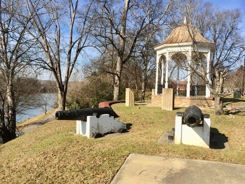
Used in war with Mexico–1846. Re-bored and rifled about 1861 to use 3.8 in. James or Hotchkiss shells indicating Civil War use. Mr. Marion Humphries, a local jeweler and businessman, was instrumental in fitting the cannon with a complete new . . . — — Map (db m123967) HM
Here a mill operated continuously by same family for over one hundred years. Elias Barnes, Sr., a Rev. War soldier, built mill on Silver Creek by 1796. It passed to Elias, Jr., a blacksmith, and then to his son James, a captain in the Mexican . . . — — Map (db m273101) HM
Born, 1808, about five miles west. Moved to Mo., 1830. As Brig. Gen., Mo. Militia, quelled Mormon riots with no bloodshed, 1838; refused execute Prophet Smith and others court-martialed. In 1846, Mexican War, formed lst Reg. Mo. Mounted Volunteers . . . — — Map (db m83594) HM
Gen. Albert Sidney Johnston
Born February 2 - 1803
Washington, KY.
Killed at Shiloh, Tenn.
April 6 - 1862
Graduated West Point 1826,
Black Hawk War,
War for Texas Independence,
Mexican . . . — — Map (db m275270) HM
Liberty of Texas 1836
From here 18 “Paducah Volunteers” led by Capt. Amon B. King embarked for Texas in 1835 in response to Sam Houston's appeal for aid in fight for freedom from Mexico. Two weeks after The Alamo, in battle at . . . — — Map (db m158792) HM
Born on July 25, 1824 in Floydsburg, Oldham Co., he was one of eight children born to Col. Jacob and Isabella Watson Oglesby, who, with two of his siblings, died in the 1833 cholera epidemic. Oglesby was raised by an uncle and moved to Decatur, . . . — — Map (db m174576) HM
Laid out, 1809, named for Elijah
and Elza Creel, pioneers whose
son, Reuben, served US in Mexico;
his son Enrique served Mexico in
US. An interpreter for Gen. W. T.
Ward during Mexican War, Reuben
stayed on there, was appointed US
Consul, . . . — — Map (db m244688) HM
Zero Milestone
Jefferson Davis Highway
Fairview, Ky. - Biloxi, Miss.
Erected 1930 by
United Daughters of the Confederacy
Jefferson Davis
Born June 3, 1808
in Christian, now Todd Co. KY.
Died December 6, 1889
in New Orleans, . . . — — Map (db m3034) HM
N. Adams, POW • W.C. Arnett • Milton Barlow • John Bell • James Blackburn • Joseph C.S. Blackburn • Charles Boler • Abraham “Abe” Buford • John Buford • Andrew J. Cogar • N. Maffett Crutcher • James Davis • John C. Davis • John W. Davis • Lewis . . . — — Map (db m202984) WM
One of America's most important literary figures, Ralph Waldo Emerson (May 25, 1803 - April 27, 1882), wrote these words that turned out to be prophetic. Before the Mexican-American War began, Emerson predicted that "the U.S. will conquer Mexico, . . . — — Map (db m114882) HM
Three Louisiana men played prominent roles in the Mexican-American War. Though John Slidell was born in New York, he moved to New Orleans in 1819, started a successful law practice, and eventually became an important leader of the Democratic Party . . . — — Map (db m114832) HM
Panel 1 Fifteen years before Americans began fighting each other in the Civil War, they were at war with their neighbors to the south in Mexico. The Mexican-American War began in 1846 and lasted less than two years with the Americans achieving a . . . — — Map (db m114839) HM
To honor
Zachary Taylor
U.S. Army General and twelfth President
of the United States
Known to Americans as
"Old Rough and Ready"
and who lived for a time some 200 yards
southwest of this spot
This marker placed in 1951 by . . . — — Map (db m87482) HM WM
"Old Rough and Ready," America's 12th president, lived on this site in the home pictured above. He called the cottage Buena Vista after his famous 1847 victory in the Mexican War. The pale horse pictured was Taylor's favorite, "Whitey." It would . . . — — Map (db m87824) HM
About 2 miles NW occupied 1844-45 by the 4th Infantry Regiment part of the "Army of Observation" to be near the Texas border should hostilities occur with Mexico. The camp located on the old Texas Road. Lt. Ulysses S. Grant was stationed there and . . . — — Map (db m109434) HM
President Thomas Jefferson negotiated the Louisiana Purchase with French Emperor Napoleon Bonaparte in 1803. The Louisiana Purchase was the largest peacetime land acquisition in U.S. history, containing territory that eventually comprised 15 states. . . . — — Map (db m106110) HM
[Panel 1]:
On and near this site since 1718 has centered the military activities of both regular and citizen soldiers of France, Spain, the Confederacy and the United States. On either side were the redoubts forming the “Great . . . — — Map (db m24684) HM
Born at Fairview, KY. June 3, 1808
U.S. Army 1828-1835
Served in Black Hawk War
Congressman U.S. 1845-1846
Colonel Mississippi Volunteers in War with Mexico
Rendered Gallant Service in the taking of Monterey and Buena Vista where he was . . . — — Map (db m51521) HM
806 entries matched your criteria. Entries 201 through 300 are listed above. ⊲ Previous 100 — Next 100 ⊳