14719 entries match your criteria. The first 100 are listed. ⊳
Waterways & Vessels Topic
By Tim Carr, August 1, 2009
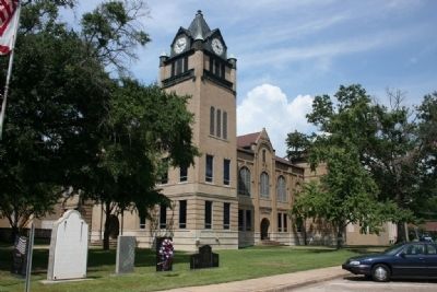
Autauga County Courthouse
| 1 ► Alabama, Autauga County, Prattville — A County Older Than the State, Autauga County — |
| On East 4th Street west of North Court Street, on the right when traveling west. | |||
| 2 ► Alabama, Autauga County, Prattville — Autauga Creek — |
| Near West Main Street, 0.1 miles west of South Chestnut Street, on the right when traveling east. | |||
| 3 ► Alabama, Baldwin County, Bay Minette — Bottle Creek Site — |
| On Courthouse Square (U.S. 31) at Hand Avenue, on the left when traveling east on Courthouse Square. | |||
| 4 ► Alabama, Baldwin County, Daphne — The Eastern Shore Trail — |
| On N Main St. | |||
| 5 ► Alabama, Baldwin County, Fairhope — Welcome to the Fairhope Pier — Fairhope’s ‘town square’ — |
| On 4 N Beach Road. | |||
| 6 ► Alabama, Baldwin County, Fort Morgan — First Battle of Fort Bowyer — September 14, 1814 — |
| Near Fort Morgan Road (Alabama Route 180) 2 miles west of Dune Drive, on the right when traveling west. | |||
| 7 ► Alabama, Baldwin County, Gulf Shores — "Damn The Torpedoes!" The Campaigns for Mobile, 1864 - 1865 — |
| On Fort Morgan Road (Alabama Route 180) 1.2 miles west of Dune Road, on the right when traveling west. | |||
| 8 ► Alabama, Baldwin County, Gulf Shores — Here ends the Alabama Scenic River Trail — |
| Near Fort Morgan Road (Alabama Route 180) 1.2 miles west of Dune Drive, on the right when traveling west. | |||
| 9 ► Alabama, Baldwin County, Gulf Shores — Navy Cove / Pilot Town — |
| On Fort Morgan Road (Alabama Route 180) west of Pontoon Lane, on the right when traveling west. | |||
| 10 ► Alabama, Baldwin County, Lottie — History of Lottie, Alabama — |
| On Jack Springs Road at Lottie Road (County Road 61), on the right when traveling south on Jack Springs Road. | |||
| 11 ► Alabama, Baldwin County, Orange Beach — Bay Circle — |
| On Canal Road at Bay Circle, on the right when traveling west on Canal Road. | |||
| 12 ► Alabama, Baldwin County, Orange Beach — Perdido Pass — |
| On Perdido Beach Boulevard (Alabama Route 182) east of Parkway Drive, on the right when traveling east. | |||
| 13 ► Alabama, Baldwin County, Spanish Fort — Bay of the Holy Spirit — |
| On Battleship Parkway (U.S. 98) near Interstate 10, on the right when traveling east. | |||
| 14 ► Alabama, Baldwin County, Spanish Fort — Fort McDermott — |
| On Confederate Drive, on the right when traveling north. | |||
| 15 ► Alabama, Baldwin County, Spanish Fort — The Final Assault — |
| On Cora Slocomb Drive, 0.3 miles north of General Canby Drive. | |||
| 16 ► Alabama, Baldwin County, Stockton — Public Education in Baldwin County / Little Red Schoolhouse Historic Site — |
| On Alabama Route 225, on the left when traveling north. | |||
| 17 ► Alabama, Baldwin County, Tensaw — Boatyard Landing and Aaron Burr Spring / Peirce's School and Mill — |
| On Boatyard Road (County Road 80) 0.2 miles west of Fort Mims Road, on the left when traveling west. | |||
| 18 ► Alabama, Baldwin County, Tensaw — Mims Plantation — Fort Mims Historical and Archaeological Site — |
| Near Fort Mims Road, 0.4 miles Boatyard Road, on the right when traveling west. | |||
| 19 ► Alabama, Baldwin County, Tensaw — Montgomery Hill Landing / Mims Ferry and Holley Creek — |
| On Holly Creek Landing Road, 1.1 miles west of Holly Creek Road, on the right when traveling west. | |||
| 20 ► Alabama, Barbour County, Blue Springs — Pea River Electric Membership Corporation — |
| On Alabama Route 10, 0.3 miles west of County Road 41, on the right when traveling west. | |||
| 21 ► Alabama, Barbour County, Eufaula — The City of Eufaula — Creek Heritage Trail — |
| On East Broad Street east of North Livingston Avenue, on the right when traveling west. | |||
| 22 ► Alabama, Barbour County, Eufaula — William Thomas "Tom" Mann / Eufaula, Alabama — 1932-2005 / Fishing Lure Capital of the World — |
| On East Broad Street east of North Livingston Avenue, in the median. | |||
| 23 ► Alabama, Barbour County, Louisville — The Battles of Hobdy's Bridge and Pea River — Creek Heritage Trail — |
| On North Main Street (Alabama Route 51) 0.6 miles south of West Street, on the right when traveling south. | |||
| 24 ► Alabama, Calhoun County, Anniston — George W. Ingram — 1918-1941 — U.S. Navy — |
| On East 17th Street at Quintard Avenue, on the right when traveling west on East 17th Street. | |||
| 25 ► Alabama, Calhoun County, Oxford — Boiling Springs Road — Choccolocco Park Interpretive Trail — |
| Near Leon Smith Parkway. | |||
| 26 ► Alabama, Calhoun County, Oxford — George W. Ingram — 1918-1941 — |
| Near Recreation Drive east of Mc Cullars Lane, on the right when traveling east. | |||
| 27 ► Alabama, Chambers County, Valley — West Point Manufacturing Company — |
| On 20th Avenue (U.S. 29) 0.1 miles north of 61st Street West, on the right when traveling east. | |||
| 28 ► Alabama, Cherokee County, Centre — Pathkiller - Childers - Garrett Ferry — |
| On College Street (County Route 20) 0.1 miles south of South River Road, on the right when traveling north. | |||
| 29 ► Alabama, Cherokee County, Gaylesville — Chattooga River — |
| On Riverside Lane at Canyon Drive (Alabama Route 35), on the left when traveling west on Riverside Lane. | |||
| 30 ► Alabama, Chilton County, Clanton — USS Chilton — |
| On 2nd Avenue North west of 5th Avenue South, on the right when traveling west. | |||
| 31 ► Alabama, Chilton County, Verbena — Mitchell Dam — |
| Near Mitchell Dam Road, 0.5 miles east of County Road 93. | |||
| 32 ► Alabama, Clarke County, Gainestown — Gainestown — |
| Near Walker Springs Road (County Road 29) at Madison Road (Route 33). | |||
| 33 ► Alabama, Clarke County, Gainestown — The Canoe Fight — |
| On Madison Road (County Road 33) at Tennessee Road, on the right when traveling north on Madison Road. | |||
| 34 ► Alabama, Clarke County, Thomasville — Tallahatta Springs — |
| On Tallahatta Springs Road (County Road 44) 2.1 miles east of Elam Road (County Road 7), on the right when traveling east. | |||
| 35 ► Alabama, Clay County, Ashland — Clay County and the Creek Indian War of 1813-14 / Clay County and the Creek Indian Confederacy — |
| On Court Square (Alabama Route 9) at 1st Avenue North, on the right when traveling west on Court Square. | |||
| 36 ► Alabama, Colbert County, Cherokee — Chickasaw Hospitality — Natchez Trace Parkway — |
| Near Natchez Trace Parkway (at milepost 327.3), 1.4 miles east of N Pike (County Route 21), on the left when traveling east. | |||
| 37 ► Alabama, Colbert County, Cherokee — Colbert Ferry — |
| Near Natchez Trace Parkway (at milepost 327.3), 1 mile north of N. Pike (County Road 21). | |||
| 38 ► Alabama, Colbert County, Cherokee — Colbert's Stand — |
| On Park Road, 0.4 miles north of Natchez Trace Parkway, on the left when traveling east. | |||
| 39 ► Alabama, Colbert County, Cherokee — George Colbert Memorial — |
| Near Natchez Trace Parkway (at milepost 327.3), 1 mile north of N. Pike (County Road 21). | |||
| 40 ► Alabama, Colbert County, Cherokee — Safe Crossing — Natchez Trace Parkway — National Park Service, U.S. Department of the Interior — |
| Near Natchez Trace Parkway (at milepost 327.3), 1.6 miles east of N Pike (County Route 21), on the left when traveling east. | |||
| 41 ► Alabama, Colbert County, Muscle Shoals — Building a New Future — |
| Near Reservation Road, 1 mile east of Alabama Route 133, on the left when traveling east. | |||
| 42 ► Alabama, Colbert County, Muscle Shoals — Explore the River — |
| On Reservation Road. | |||
| 43 ► Alabama, Colbert County, Muscle Shoals — History of Muscle Shoals, Alabama — |
| On Avalon Avenue. | |||
| 44 ► Alabama, Colbert County, Muscle Shoals — How Does Wilson Dam Work? — |
| On Reservation RD. | |||
| 45 ► Alabama, Colbert County, Muscle Shoals — Natural and Cultural Preservation/Protecting Resources — |
| Near Reservation Road, 1 mile east of Alabama Route 133, on the left when traveling east. | |||
| 46 ► Alabama, Colbert County, Muscle Shoals — Origin of the Francis Turbine — |
| On Wilson Overlook, 0.1 miles north of Reservation Road, on the left when traveling north. | |||
| 47 ► Alabama, Colbert County, Muscle Shoals — TVA: A History of Progress and Innovation / A Valley of Hardships — |
| Near Reservation Road, 1 mile east of Alabama Route 133, on the left when traveling east. | |||
| 48 ► Alabama, Colbert County, Muscle Shoals — Wilson Dam — |
| 49 ► Alabama, Colbert County, Muscle Shoals — Wilson Dam and the TVA System — |
| On Reservation Road. | |||
| 50 ► Alabama, Colbert County, Muscle Shoals — Wilson Dam: Cornerstone of the TVA System — |
| Near Reservation Road, 1 mile east of Alabama Route 133, on the left when traveling east. | |||
| 51 ► Alabama, Colbert County, Muscle Shoals — Wilson Dam: Setting the Stage — |
| Near Reservation Road, 1 mile east of Alabama Route 133, on the left when traveling east. | |||
| 52 ► Alabama, Colbert County, Sheffield — Old Railroad Bridge — |
| Near Ashe Boulevard, 0.4 miles north of NE 16th Street. | |||
| 53 ► Alabama, Colbert County, Sheffield — President Franklin Delano Roosevelt — |
| On South Montgomery Avenue at West 1st Street, on the right when traveling south on South Montgomery Avenue. | |||
| 54 ► Alabama, Colbert County, Tuscumbia — Cold Water Falls — |
| On S. Main Street. | |||
| 55 ► Alabama, Colbert County, Tuscumbia — Tuscumbia Big Spring — |
| On Spring Park Road, on the left when traveling west. | |||
| 56 ► Alabama, Covington County, Florala — Lake Jackson — |
| On 3rd Street (Alabama Route 55) north of 2nd Avenue, on the right when traveling north. | |||
| 57 ► Alabama, Cullman County, Cullman — Alabama's Aquatic Biodiversity — |
| On County Road 1043. | |||
| 58 ► Alabama, Cullman County, Cullman — What happens to my wastewater? — |
| On County Road 1043. | |||
| 59 ► Alabama, Cullman County, Cullman — Where does your drinking water come from? — |
| On County Road 1043. | |||
| 60 ► Alabama, Dallas County, Cahaba — Captive Boys in Blue — |
| Near Capitol Avenue east of Vine Street. | |||
| 61 ► Alabama, Dallas County, Cahaba — The Crocheron Columns |
| Near 2nd Street North. Reported permanently removed. | |||
| 62 ► Alabama, Dallas County, Cahaba — Yankees in Cahawba — |
| Near Second Street North east of Vine Street. | |||
| 63 ► Alabama, Dallas County, Selma — Lieutenant John Tillman Melvin — United States Navy R.F. — |
| On Lauderdale Street at Alabama Avenue, on the right when traveling south on Lauderdale Street. | |||
| 64 ► Alabama, Dallas County, Selma — Redoubt No. 24 — Selma Fortifications 1863-1865 — Battle of Selma — |
| On Satterfield Street at Riverview Avenue, on the right when traveling south on Satterfield Street. | |||
| 65 ► Alabama, DeKalb County, Fort Payne — Indians, Settlers, and Tourists — Little River Canyon National Preserve — |
| Near Little River Falls Overlook Trail, 0.1 miles west of State Road 35. | |||
| 66 ► Alabama, Elmore County, Wetumpka — High Water Mark — 57 Feet 11 Inches — (12 Feet 11 Inches Above Flood Stage) — |
| On Orline Street, 0.1 miles south of Hill Street, on the right when traveling south. | |||
| 67 ► Alabama, Elmore County, Wetumpka — Lock 31 — Elmore County — |
| On Dozier Street south of West Bridge Street, on the left when traveling south. | |||
| 68 ► Alabama, Elmore County, Wetumpka — The Mound at Fort Toulouse-Fort Jackson Park — Alabama Indigenous Mound Trail — |
| Near West Fort Toulouse Road, 0.6 miles west of Jackson Park Road. | |||
| 69 ► Alabama, Escambia County, Pollard — Pollard Methodist Church — |
| On Lamosa Street at Misella Street, on the right when traveling east on Lamosa Street. | |||
| 70 ► Alabama, Escambia County, Pollard — Pollard Station — |
| On Canterbury Street at Richmond Avenue, on the right when traveling north on Canterbury Street. | |||
| 71 ► Alabama, Etowah County, Gadsden — William Luther Sibert Major General U.S. Army (Ret.) — 1860-1935 — |
| On Forrest Avenue east of North 10 Street, on the right when traveling east. | |||
| 72 ► Alabama, Geneva County, Geneva — Geneva, Alabama — |
| On South Commerce Street north of East Town Avenue when traveling north. | |||
| 73 ► Alabama, Hale County, Greensboro — Gayle - Tunstall House — |
| On Main Street at Ward Street, on the right when traveling east on Main Street. | |||
| 74 ► Alabama, Hale County, Moundville — Protection and the Palisade — Moundville Archaeological Park — |
| Near River Bank Road, 0.9 miles west of Mound Parkway. | |||
| 75 ► Alabama, Henry County, Shorterville — Chattahoochee River Crossing — |
| On Hartford Road (Alabama Route 10) 0.6 miles east of County Road 46, on the left when traveling east. | |||
| 76 ► Alabama, Houston County, Columbia — Columbia, Alabama — |
| On South Main Street at West Church Street (Alabama Route 52), on the right when traveling south on South Main Street. | |||
| 77 ► Alabama, Houston County, Columbia — Omussee Creek Mound and Mississippian Period Societies — Creek Heritage Trail — |
| On Omussee Creek Road, 0.5 miles north of Picnic Road, on the right when traveling north. | |||
| 78 ► Alabama, Houston County, Dothan — Dothan Dixie Standpipe — Houston County — |
| On East Powell Street at North St Andrews Street, on the left when traveling east on East Powell Street. | |||
| 79 ► Alabama, Houston County, Dothan — The Steamboat Era — Size: 82 Feet Long by 24 Feet High — Painting completed January 2000 Artist Wes Hardin |
| On North Foster Street, 0.1 miles north of East Troy Street, on the right when traveling north. Reported missing. | |||
| 80 ► Alabama, Jackson County, Bridgeport — Trail of Tears — |
| On Bradley Avenue, 0.5 miles east of Hoffman Avenue, on the left when traveling east. | |||
| 81 ► Alabama, Jefferson County, Bessemer — Sweet Home / Henry W. Sweet — |
| On Arlington Avenue at 19th Street South, on the right when traveling west on Arlington Avenue. | |||
| 82 ► Alabama, Jefferson County, Birmingham — East Lake Park — |
| Near 1st Avenue North (U.S. 11) south of 83rd Street North. | |||
| 83 ► Alabama, Jefferson County, Birmingham — Julius Ellsberry — |
| Near 16th Street North north of 5th Avenue. | |||
| 84 ► Alabama, Jefferson County, Birmingham — Osmond Kelly Ingram — 1887 - 1917 — |
| On 17th Street North at 6th Avenue North, on the right when traveling south on 17th Street North. | |||
| 85 ► Alabama, Jefferson County, Birmingham — Roebuck Spring — |
| On Roebuck Boulevard, on the left when traveling east. | |||
| 86 ► Alabama, Jefferson County, Birmingham — The Cascade — |
| Near Valley View Drive west of Richard Arrington Jr Boulevard South. | |||
| 87 ► Alabama, Lamar County, Sulligent — John Hollis Bankhead — Ancestral Home — 1842 — 1920 — |
| On East Main Street (U.S. 278) at Bankhead Street, on the right when traveling east on East Main Street. | |||
| 88 ► Alabama, Lauderdale County, Elgin — Jesse James Gang Canal Payroll Robbery/Trial of Frank James — |
| On Lee Highway (County Route 72) at Houstontown raod (Route 33), on the right when traveling east on Lee Highway. | |||
| 89 ► Alabama, Lauderdale County, Florence — First Muscle Shoals Canal / Second Muscle Shoals Canal — 1836-1838/1890-1918 — |
| On McFarland Park Road, 0.4 miles south of Coffee Road (Alabama Route 20), on the left when traveling south. | |||
| 90 ► Alabama, Lauderdale County, Florence — Founding of Florence — March 1818 — |
| On West Tennessee Street at South Court Street, on the right when traveling east on West Tennessee Street. | |||
| 91 ► Alabama, Lauderdale County, Florence — Locust Street Historic District — 1818 — |
| On North Locust Street at West Mobile Street, on the right when traveling north on North Locust Street. | |||
| 92 ► Alabama, Lauderdale County, Florence — Rear Adm. John Murray Hood — City of Florence Walk of Honor — |
| Near Hightower Place, 0.3 miles south of Veterans Drive (Alabama Route 133). | |||
| 93 ► Alabama, Lauderdale County, Florence — W.W. II Anchor — |
| On Veterans Park Drive, 0.3 miles east of South Cox Creek Parkway (Alabama Route 133), on the left when traveling east. | |||
| 94 ► Alabama, Lauderdale County, Florence — Wilson Dam — |
| Near South Cox Creek Parkway, 0.5 miles east of Veterans Drive (Alabama Route 133), on the right when traveling south. | |||
| 95 ► Alabama, Lauderdale County, Killen — Killen and the Canal System — |
| On 6 Pence Rd. | |||
| 96 ► Alabama, Lauderdale County, Killen — Muscle Shoals Canal — 1836 - 1918 — |
| On U.S. 72 at Lock 6 Road on U.S. 72. | |||
| 97 ► Alabama, Lauderdale County, Rogersville — Covington/Second Creek / Wheeler Dam/Lake — |
| On Lee Highway (U.S. 72) 0.4 miles east of County Route 113, on the right when traveling east. | |||
| 98 ► Alabama, Lauderdale County, Rogersville — Elk River Shoals — |
| On Lee Highway (U.S. 72) at County Route 635, on the right when traveling east on Lee Highway. | |||
| 99 ► Alabama, Lauderdale County, Rogersville — Samuel Burney: 1763-1849 Revolutionary War Veteran / Burneys Creek/First Creek Wheeler Lake — |
| On Lee Highway (U.S. 72) at County Route 66, on the right when traveling west on Lee Highway. | |||
| 100 ► Alabama, Lauderdale County, Rogersville — Wheeler Dam • Wheeler Reservoir/Locks — 1936 — |
| On Wheeler Dam Highway (Alabama Route 101) 0.5 miles south of County Route 584, on the left when traveling south. | |||
14719 entries matched your criteria. The first 100 are listed above. Next 100 ⊳