After filtering for West Virginia, 184 entries match your criteria. The first 100 are listed. ⊳
Waterways & Vessels Topic
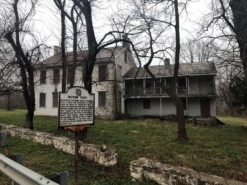
By Devry Becker Jones (CC0), April 6, 2019
Watkins' Ferry Marker
| 1 ► West Virginia, Berkeley County, Falling Waters, Marlowe — Watkins' Ferry — |
| On Williamsport Pike (U.S. 11) east of Ripple Way, on the right when traveling west. | |||
| 2 ► West Virginia, Berkeley County, Kearneysville — Shaw Run Wetland Complex — West Virginia 9 — Charles Town to Martinsburg — |
| On Route 9 Bike Path, 0.2 miles south of Short Road (County Road 36/1), on the right when traveling south. | |||
| 3 ► West Virginia, Boone County, Madison — Madison — |
| On State Street (West Virginia Route 85) at Avenue C, on the left when traveling south on State Street. | |||
| 4 ► West Virginia, Boone County, Peytona — Peytona — |
| On Daniel Boone Parkway (West Virginia Route 3) at Roundbottom Road (Local Route 119/21) when traveling west on Daniel Boone Parkway. | |||
| 5 ► West Virginia, Boone County, Whitesville — Battle of Coal River — September 12, 1861 — |
| On Coal River Road (West Virginia Route 3) at Red Martin Lane, on the right when traveling west on Coal River Road. | |||
| 6 ► West Virginia, Boone County, Whitesville — Big Coal River — An Important and Historical Water Trail Serving Man and Industry — Coal Heritage Trail — |
| On Coal River Road (West Virginia Route 3) at Bridge Avenue, on the left when traveling east on Coal River Road. | |||
| 7 ► West Virginia, Brooke County, Weirton — USS Frank E. Evans DD-754 — |
| On Military Drive at Marshaling Yard Drive, on the right when traveling south on Military Drive. | |||
| 8 ► West Virginia, Brooke County, Wellsburg — George Washington Crossing, 1770 — |
| On West Virginia Route 2, 0.1 miles north of Cross Creek Road, on the right when traveling north. | |||
| 9 ► West Virginia, Brooke County, Wellsburg — Wellsburg Wharf — |
| On Main Street at 6th Street, on the right when traveling south on Main Street. | |||
| 10 ► West Virginia, Cabell County, Barboursville — D.A.R. Toll House Museum — Barboursville Chapter — |
| On Main Street west of Mohawk Drive, on the right when traveling west. | |||
| 11 ► West Virginia, Cabell County, Huntington — James River Company — |
| On 5th Avenue (U.S. 60) at 6th Street, on the left when traveling east on 5th Avenue. | |||
| 12 ► West Virginia, Fayette County, Ansted — Hawk’s Nest Tunnel — |
| On Midland Trail (U.S. 60), on the left when traveling west. | |||
| 13 ► West Virginia, Fayette County, Ansted — Hawk's Nest Tunnel Disaster — |
| Near East Main Street (U.S. 60) at Holley Street. | |||
| 14 ► West Virginia, Fayette County, Fayetteville — Enduring Beauty — New River Gorge National River — |
| On Access road to Lower New River Take-Out parking near Fayette Station Road (County Route 82). | |||
| 15 ► West Virginia, Fayette County, Fayetteville — From Coal Mining to Rock Climbing — New River Gorge National River — National Park Service, U.S. Department of the Interior — |
| On Fayette Station Road (County Road 82), on the right when traveling east. | |||
| 16 ► West Virginia, Fayette County, Fayetteville — Spanning the Gorge — New River Gorge National River — National Park Service, U.S. Department of the Interior — |
| On Fayette Station Road (County Road 82), on the right when traveling east. | |||
| 17 ► West Virginia, Fayette County, Fayetteville — Townsend’s Ferry — |
| On Fayette Station Road (State Road 82) near the Tunney Hunsaker Bridge. | |||
| 18 ► West Virginia, Fayette County, Lansing — Industrial Past of the New River Gorge — New River Gorge National Park and Preserve — National Park Service, U.S. Department of the Interior — |
| On Visitor Center Road. | |||
| 19 ► West Virginia, Fayette County, Lansing — The Bridge — |
| On Visitor Center Road. | |||
| 20 ► West Virginia, Fayette County, Lansing — Welcome to New River Gorge National River — |
| On Visitor Center Road. | |||
| 21 ► West Virginia, Fayette County, Mount Hope — The Dunloup Creek Watershed — What's in a Name? — |
| Near West Virginia Route 211 at West Virginia Route 16, on the right when traveling west. | |||
| 22 ► West Virginia, Fayette County, Mount Hope — The Dunloup Creek Watershed — Bridging Dunloup Creek — |
| Near West Virginia Route 211 at West Virginia Route 16, on the right when traveling west. | |||
| 23 ► West Virginia, Fayette County, Nuttallburg — Nuttallburg and Short Creek — New River Gorge National River — National Park Service, U.S. Department of the Interior — |
| On Keeneys Creek Road (County Road 85/2) 3.3 miles west of San Mountain Road, on the right when traveling west. | |||
| 24 ► West Virginia, Fayette County, Prince — America's Best Idea — New River Gorge National River — National Park Service, U.S. Department of the Interior — |
| On Stanaford Road (West Virginia Route 41) at Prince Army Camp Road (County Road 41/39), on the left when traveling north on Stanaford Road. | |||
| 25 ► West Virginia, Fayette County, Thurmond — 1873 — |
| On Thurmond Road (County Road 25/2) south of Beury Mountain Road (County Road 25/2), on the left when traveling north. | |||
| 26 ► West Virginia, Fayette County, Thurmond — 1889 — |
| On Thurmond Road (County Road 25/2) south of Beury Mountain Road (County Road 25/2), on the left when traveling north. | |||
| 27 ► West Virginia, Fayette County, Thurmond — 1908 — |
| On Thurmond Road (County Road 25/2) south of Beury Mountain Road (County Road 25/2), on the left when traveling north. | |||
| 28 ► West Virginia, Fayette County, Thurmond — 1968 — |
| On Thurmond Road (County Road 25/2) south of Beury Mountain Road (County Road 25/2), on the left when traveling north. | |||
| 29 ► West Virginia, Fayette County, Thurmond — 1972 - 1985 — |
| Near Thurmond Road (County Road 25/2) south of Beury Mountain Road (County Road 25/2), on the left when traveling north. | |||
| 30 ► West Virginia, Fayette County, Thurmond — 1978 — |
| Near Thurmond Road (County Road 25/2) south of Beury Mountain Road (County Road 25/2), on the left when traveling north. | |||
| 31 ► West Virginia, Fayette County, Thurmond — Changing Town — New River Gorge National River — National Park Service, U.S. Department of the Interior — |
| On Thurmond Road (County Road 25/2) 0.2 miles north of Beury Mountain Road (County Road 25/2), on the right when traveling north. | |||
| 32 ► West Virginia, Fayette County, Thurmond — New River Gorge National River — National Park Service, U.S. Department of the Interior — |
| On Thurmond Road (County Road 25/2) 0.1 miles south of Beury Mountain Road (County Road 25/2), on the right when traveling north. | |||
| 33 ► West Virginia, Greenbrier County, Hickory Grove — Blue Sulphur Springs, WV — Pavilion — |
| On Blue Sulphur Springs Road (County Road 25) just south of Spring Valley Road (County Road 31), on the right when traveling north. | |||
| 34 ► West Virginia, Greenbrier County, Hickory Grove — 65 — The Pavilion — Legends & Lore — |
| On Blue Sulphur Springs Road (County Road 25) just south of Spring Valley Road (County Road 31), on the left when traveling south. | |||
| 35 ► West Virginia, Greenbrier County, White Sulphur Springs — The Springhouse — |
| 36 ► West Virginia, Greenbrier County, White Sulphur Springs — The Springhouse — |
| 37 ► West Virginia, Hancock County, New Cumberland — Brickyard Bend — |
| Near North River Avenue at Jefferson Street. | |||
| 38 ► West Virginia, Hancock County, New Cumberland — Brickyard Bend — |
| On Ridge Avenue (West Virginia Route 2) at Ballantyne Road, on the right when traveling north on Ridge Avenue. | |||
| 39 ► West Virginia, Hancock County, New Cumberland — Captain John Porter / Chelsea China Company — |
| On North River Avenue at Jefferson Avenue, on the right when traveling south on North River Avenue. | |||
| 40 ► West Virginia, Hancock County, New Cumberland — Ohio River — |
| On North River Avenue at Jefferson Street, on the right when traveling south on North River Avenue. | |||
| 41 ► West Virginia, Hardy County, Moorefield — Battle of Moorefield — |
| On U.S. 220, 0.4 miles south of Harness Road, on the left when traveling south. | |||
| 42 ► West Virginia, Hardy County, Moorefield — Battle of Moorefield — Running for the Hills — |
| On Harness Road just east of Hyde Street, on the left when traveling east. | |||
| 43 ► West Virginia, Harrison County, Bridgeport — In Memory of Aaron Smith — |
| On Meadowbrook Road (West Virginia Route 24). | |||
| 44 ► West Virginia, Harrison County, Bridgeport — Simpson Creek Covered Bridge — |
| On Despard-Summit Park Road (County Route 24/7) near Bridgeport-Meadowbrook Road (County Route 24). | |||
| 45 ► West Virginia, Harrison County, Clarksburg — U.S.S. West Virginia Bow Flag Staff — |
| On W. Main Street. | |||
| 46 ► West Virginia, Harrison County, Salem — Salem Fork Pilot Watershed — |
| 47 ► West Virginia, Jackson County, Ravenswood — Ravenswood / Ohio River Ford — |
| On West Virginia Route 68, 0.2 miles east of U.S. 33, on the left when traveling north. | |||
| 48 ► West Virginia, Jackson County, Sherman — Battle of Buffington Island — |
| On West Virginia Route 68 south of Little Sandy-Median Road (County Route 8), on the left when traveling south. | |||
| 49 ► West Virginia, Jefferson County, Bolivar — History in the Mountains — |
| Near Shenandoah St.. | |||
| 50 ► West Virginia, Jefferson County, Harpers Ferry — Daring Escapes — Harpers Ferry National Historical Park — National Park Service, U.S. Department of the Interior — |
| Near Potomac Street just north of Shenandoah Street, on the right when traveling west. | |||
| 51 ► West Virginia, Jefferson County, Harpers Ferry — Early Travel — |
| Near South Potomac Street. | |||
| 52 ► West Virginia, Jefferson County, Harpers Ferry — Island Access |
| On Shenandoah Street (Business U.S. 340), on the right when traveling east. Reported damaged. | |||
| 53 ► West Virginia, Jefferson County, Harpers Ferry — Lewis and Clark — |
| On Potomac Street, on the left when traveling south. | |||
| 54 ► West Virginia, Jefferson County, Harpers Ferry — Shenandoah Canal — |
| On Shenandoah Street (Business U.S. 340), on the right when traveling east. | |||
| 55 ► West Virginia, Jefferson County, Harpers Ferry — Tailrace — |
| Near Potomac Street, 0.1 miles north of Shenandoah Street, on the right when traveling north. | |||
| 56 ► West Virginia, Jefferson County, Harpers Ferry — The Iron Horse Wins — |
| Near South Potomac Street. | |||
| 57 ► West Virginia, Jefferson County, Harpers Ferry — The Mule Falters — |
| Near South Potomac Street. | |||
| 58 ► West Virginia, Jefferson County, Harpers Ferry — The Race to the Ohio — |
| Near South Potomac Street. | |||
| 59 ► West Virginia, Jefferson County, Kearneysville — "Prato Rio" — |
| On Kearneysville-Virginia Line Road, 0.5 miles west of Leestown Pike, on the right when traveling west. | |||
| 60 ► West Virginia, Jefferson County, Kearneysville — “The Bower” — |
| On Leetown Road at Paynes Ford Road, on the left when traveling north on Leetown Road. | |||
| 61 ► West Virginia, Jefferson County, Shepherdstown — In Honor of James Rumsey — |
| On Rumsey Monument Road, on the right. | |||
| 62 ► West Virginia, Jefferson County, Shepherdstown — Pack Horse Ford Chapter, D.A.R. — |
| On German Street (West Virginia Route 230) at King Street, on the left when traveling west on German Street. | |||
| 63 ► West Virginia, Jefferson County, Shepherdstown — Shepherd College / Shepherdstown — |
| On South Duke Street (West Virginia Route 480) at Shepherd Grade Road, on the right when traveling west on South Duke Street. | |||
| 64 ► West Virginia, Jefferson County, Shepherdstown — Shepherdstown — |
| On North Duke Street / Shepherdstown Pike (State Highway 480), on the right when traveling north. | |||
| 65 ► West Virginia, Jefferson County, Shepherdstown — Shepherdstown — Blending the past and the present.... — |
| On North King Street (Route 480) 0.3 miles east of Shepherd Grade Road, on the right when traveling east. | |||
| 66 ► West Virginia, Jefferson County, Shepherdstown — The James Rumsey Bridge — |
| On North Duke Street / Shepherdstown Pike (West Virginia Route 480), on the right when traveling north. | |||
| 67 ► West Virginia, Jefferson County, Shepherdstown — Waterfront Commerce and the Mecklenburg Warehouse — |
| On North Princess Street, 0.1 miles north of Bones Wright Street, on the right when traveling north. | |||
| 68 ► West Virginia, Jefferson County, Shepherdstown — Welcome to Historic Shepherdstown — |
| On German Street (West Virginia Route 230) west of Princess Street (West Virginia Route 230), on the right when traveling west. | |||
| 69 ► West Virginia, Kanawha County, Charleston — 1837 - 1869 — |
| Near Greenbrier Street (U.S. 60) near Quarrier Street, on the right when traveling north. | |||
| 70 ► West Virginia, Kanawha County, Charleston — 980 A.D. - 1536 A.D. — |
| Near Greenbrier Street (U.S. 60) at Quarrier Street, on the right when traveling north. | |||
| 71 ► West Virginia, Kanawha County, Charleston — Charleston — |
| On Kanawha Boulevard East west of Court Street, on the right when traveling east. | |||
| 72 ► West Virginia, Kanawha County, Charleston — Daniel Boone — The Western Virginia Pioneer 1788-1799 — |
| On Kanawha Blvd E (U.S. 60), on the right when traveling east. | |||
| 73 ► West Virginia, Kanawha County, Charleston — Oil — |
| Near Greenbrier Street (U.S. 60) at Quarrier Street, on the right when traveling north. | |||
| 74 ► West Virginia, Kanawha County, Charleston — The New Deal In Your Community — Kanawha Boulevard — |
| On Kanawha Boulevard (U.S. 60), on the right when traveling east. | |||
| 75 ► West Virginia, Kanawha County, Charleston — The New Deal In Your Community — Kanawha Boulevard — |
| On Kanawha Blvd E (U.S. 60), on the right when traveling east. | |||
| 76 ► West Virginia, Kanawha County, Charleston — Victims of July 19, 1961 Flood — |
| On Virginia Street East west of Court Street, on the right when traveling east. | |||
| 77 ► West Virginia, Kanawha County, South Charleston — Respect for an Ancient Culture — |
| On Oakes Avenue just north of 7th Avenue, on the right when traveling north. | |||
| 78 ► West Virginia, Lewis County, Westfield — Blaker's Mill Pond — |
| Near Jackson Mill Road (County Road 10) 0.3 miles west of Sycamore Lick Road (County Road 10), on the right when traveling west. | |||
| 79 ► West Virginia, Marion County, Fairmont — Sage of Valley Falls — |
| Near Valley Falls Road (County Route 31/14) 2.8 miles east of East Grafton Road (West Virginia Route 310), on the left when traveling west. | |||
| 80 ► West Virginia, Marion County, Metz — Marion County / Wetzel County — |
| On U.S. 250, 0.3 miles south of Pogue Run Road, on the right when traveling south. | |||
| 81 ► West Virginia, Marshall County, Benwood — Marshall County / Ohio County — |
| On West Virginia Route 2, 2.4 miles south of Interstate 470, on the right when traveling south. | |||
| 82 ► West Virginia, Marshall County, Benwood — Marshall County / Ohio County — |
| On Marshall Street North at 48th Street, on the right when traveling north on Marshall Street North. | |||
| 83 ► West Virginia, Marshall County, Proctor — ML 2 — Zachary Taylor — |
| On West Virginia Route 2 south of Woodland and Graysville Road, on the left when traveling south. | |||
| 84 ► West Virginia, Mason County, Point Pleasant — 12 Main Street — |
| On Main Street just south of 1st Street, on the right when traveling north. | |||
| 85 ► West Virginia, Mason County, Point Pleasant — 803 Main Street — |
| On Main Street just north of 8th Street, on the left when traveling north. | |||
| 86 ► West Virginia, Mason County, Point Pleasant — 906 Main Street — |
| On Main Street just north of 9th Street, on the right when traveling north. | |||
| 87 ► West Virginia, Mason County, Point Pleasant — American Legion Murals — |
| On 2nd Street at Point Pleasant Biking & Walking Trail, on the left when traveling west on 2nd Street. | |||
| 88 ► West Virginia, Mason County, Point Pleasant — Colonel Andrew Lewis — 1720 - 1781 — |
| On Main Street, 0 miles west of 1st Street, on the right when traveling south. | |||
| 89 ► West Virginia, Mason County, Point Pleasant — Point Pleasant — |
| On Point Pleasant Biking & Walking Trail at 4th Street, on the right when traveling north on Point Pleasant Biking & Walking Trail. | |||
| 90 ► West Virginia, Mason County, Point Pleasant — Point Pleasant River Museum — Corner of First and Main Streets — |
| On Main Street just south of 1st Street, on the right when traveling north. | |||
| 91 ► West Virginia, Mason County, Point Pleasant — Point Pleasant River Museum — Lakin Ray Cook Learning Center — 316 Main Street, Point Pleasant, WV — |
| On Main Street near 3rd Street, on the right when traveling north. | |||
| 92 ► West Virginia, Mason County, Point Pleasant — Silver Bridge Collapse — |
| On 6th Street at Main Street on 6th Street. | |||
| 93 ► West Virginia, Mason County, Point Pleasant — Str. Weber W. Sebald — |
| On 1st Street just east of Main Street, on the left when traveling east. | |||
| 94 ► West Virginia, Mason County, Point Pleasant — The Sallie Marmet Anchor — |
| On South Main Street south of 1st Street, on the right when traveling south. | |||
| 95 ► West Virginia, Mason County, Point Pleasant — Water Panther Stone — (A Petroglyph) — |
| On Main Street just south of 1st Street, on the right when traveling south. | |||
| 96 ► West Virginia, Mineral County, Keyser — Key Terrain — December 1944 — |
| On West Piedmont Street (West Virginia Route 46) just west of North Davis Street, on the left when traveling west. | |||
| 97 ► West Virginia, Mingo County, Kermit — Lewis' Expedition — |
| On U.S. 52, on the right when traveling south. | |||
| 98 ► West Virginia, Monongalia County, Cheat Lake — Fueling a Community: The Henry Clay Iron Furnace — |
| Near Clay Furnace Trail. | |||
| 99 ► West Virginia, Monongalia County, Cheat Lake — Ice’s Ferry — |
| On Cheat Road (County Route 857), on the right when traveling north. | |||
| 100 ► West Virginia, Monongalia County, Maidsville — Monongalia County / Pennsylvania — |
| On Blue Horizon Drive (U.S. 19) 0.5 miles north of Cassville-Mt Morris Road (West Virginia Route 39), on the right when traveling north. | |||
184 entries matched your criteria. The first 100 are listed above. The final 84 ⊳