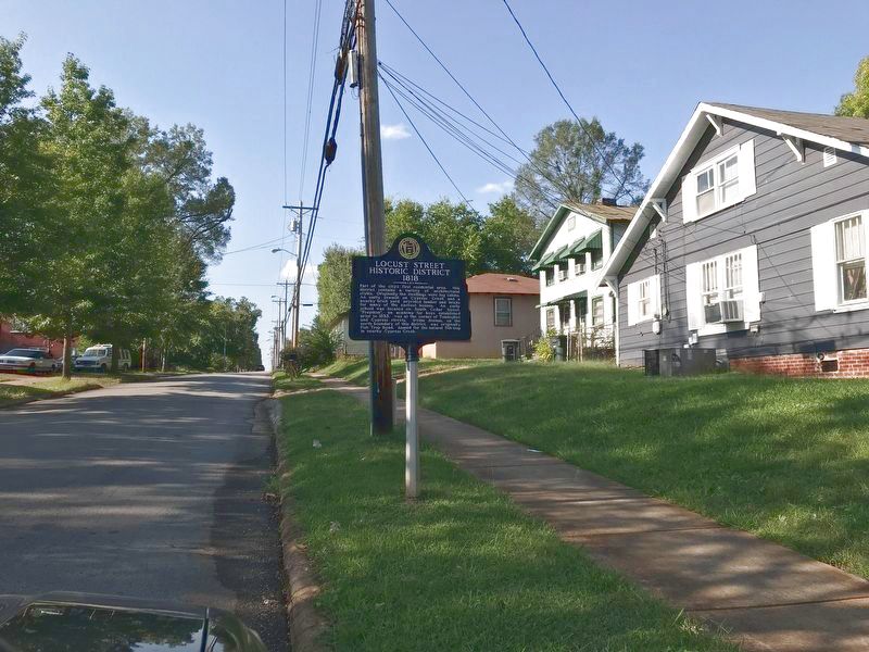
On North Locust Street at West Mobile Street, on the right when traveling north on North Locust Street.
Part of the city's first residential area, this district contains a variety of architectural styles. Originally the dwellings were log cabins. An early sawmill on Cypress Creek and a nearby brick yard provided lumber and bricks for many of the . . . — — Map (db m156926) HM
Near Hightower Place 0.3 miles south of Veterans Drive (Alabama Route 133).
Commander of the Hawk, the fastest U.S. ship in the Spanish-American War, Rear Admiral John M. Hood then commanded the Fourth Division of the Atlantic Fleet in World War I. The USS John Hood (DD-655) was named for him.
Inducted . . . — — Map (db m219331) HM
On Veterans Park Drive 0.3 miles east of South Cox Creek Parkway (Alabama Route 133), on the left when traveling east.
This anchor was used on the fleet Submarine U.S.S. Balao (SS-285). The Balao was commissioned in February 1943.
She received 9 battle stars for sinking 7 Japanese ships during her W.W. II service. The Balao was decommissioned in June 1963. . . . — — Map (db m69658) HM
Near South Cox Creek Parkway 0.5 miles east of Veterans Drive (Alabama Route 133), on the right when traveling south.
Construction of Wilson Dam began in 1918 and was completed in 1924. The Dam is 137 feet high and stretches 4,541 feet across the Tennessee River.
Wilson Dam is a hydroelectric facility. It has 21 generating units with a net dependable capacity . . . — — Map (db m73997) HM
In 1911, Admiral Richard H. Jackson commanded the Yangtze River Patrol during the Chinese Revolution. By 1926, he rose to the rank of Commander of the Battle Fleet. His eyewitness account of the 1941 attack on Pearl Harbor was included in the . . . — — Map (db m273873) HM
The Florence Canal resulted from a desire to tame the shallow and craggy Muscle Shoals. In 1830, amid urgings for a navigable solution, James Kerney of the Board of Engineers for Internal Improvements completed plans for a thirty-five-mile canal . . . — — Map (db m268971) HM
The geology and natural history of northwestern Alabama are defined primarily by two features: the Tennessee River, the Muscle Shoals, and Karst topography. Before the U.S. Army Corps of Engineers completed the Florence Canal in 1890, the Muscle . . . — — Map (db m268969) HM
Hoping to further improve navigation along the Tennessee River, the United States Army Corps of Engineers included a two-chambered lock in the Wilson Dam plans. This lock permitted ships and barges to cross easily from the east side of the dam to . . . — — Map (db m268970) HM
Two hundred feet from where you are, in 40 feet of water, are the remains of Lock Six, the headquarters for a locking system of 9 locks that provided river traffic around the rapids and shoals. The river fall of 136 feet in about 37 miles prevented . . . — — Map (db m141979) HM
Lock Six, headquarters of Muscle Shoals Canal, was located 1.3 miles south of here. An 1836 attempt to build a bypass canal around the shoals proved unsuccessful. On November 10, 1890 the canal from Rogersville to Florence was successfully . . . — — Map (db m28452) HM
On Lee Highway (U.S. 72) 0.4 miles east of County Route 113, on the right when traveling east.
(side 1)
Covington/Second Creek
Goodsprings Church
This site, one mile east of Elgin, has been referred to as “The Indian Mound.” There were white landowners here as early as 1833. Prior to 1936, there was a . . . — — Map (db m79914) HM
On Lee Highway (U.S. 72) at County Route 635, on the right when traveling east on Lee Highway.
(side 1)
At this location is the Elk River that flows into the Tennessee River approximately four miles south of here. That location is the easternmost point of a massive underwater formation which was exposed until the early 1900s. The . . . — — Map (db m133187) HM
On Lee Highway (U.S. 72) at County Route 66, on the right when traveling west on Lee Highway.
(side 1)
Samuel Burney: 1763-1849
Revolutionary War Veteran
Samuel Burney, Sr., was born on January 30, 1763, in Guilford Co., NC. He was among 17 known Revolutionary War veterans to settle in the area that became Lauderdale . . . — — Map (db m84299) HM
On Wheeler Dam Highway (Alabama Route 101) 0.5 miles south of County Route 584, on the left when traveling south.
Wheeler Dam
Wheeler Dam is located south of here on the Tennessee River, between Lauderdale County on the north and Lawrence County on the south. It is located 275 miles above the mouth of the Tennessee River at Paducah, Ky. on the Ohio River. . . . — — Map (db m105132) HM
On Lauderdale County 1 (County Route 1) 0.8 miles north of Lauderdale County 14 (County Route 14), on the left when traveling north.
Birds Come From All Directions to Enjoy the Tasty Treats Hidden Beneath the Mud
In the late summer. fall, and winter, reservoir levels in the Tennessee River Valley drop drastically to expose areas of mudflats. although unsightly to some, theses . . . — — Map (db m105713) HM
On Wheeler Dam Highway (Alabama Route 101) at County Route 412 on Wheeler Dam Highway.
In January 1933, just before TVA was formed, the US Army corps of Engineers began working on Wheeler Lock and Dam to improve navigation on the treacherous upper Muscle Shoals and Elk river Shoals.
When TVA was created that May, it took over . . . — — Map (db m229351) HM
On Wheeler Dam Highway (Alabama Route 101) at County Route 412 on Wheeler Dam Highway.
Many people may not relize that NASA’s first voyage to the moon was intended to travel through the lock at TVA's Wheeler Dam. NASA planned to ship its Saturn rocket booster (which would eventually carry astrounts to the moon for the Apollo program . . . — — Map (db m229349) HM
Near Wheeler Dam Rd (State Highway 101) north of County Road 150, on the right when traveling north.
The Tennessee River has its headwaters in the mountains of Tennessee, Virginia, North Carolina and Georgia. The main stream forms at Knoxville, where the Houston and the French Broad Rivers join. The valley, 41,000 square miles in area, receives . . . — — Map (db m47486) HM
On Murphy Drive 0.2 miles east of Wrights Mill Road (County Road 33), on the right when traveling east.
Side 1
Under President Franklin D. Roosevelt's New Deal (1933-1942), the Civilian Conservation Corps (CCC) was established to provide work for single young men. The CCC's Company 4448, Camp Alabama SP-12, began work in September 1935 to . . . — — Map (db m85164) HM
On Murphy Drive at Wrights Mill Road (County Road 33), on the left when traveling east on Murphy Drive.
Side 1
A popular recreation area for more than 100 years. Original dam located a short distance below Chewacla Lake Dam. Mill located on the west bank and ground both corn and wheat. Earlier mill owners from 1840's were Echols, Hiram . . . — — Map (db m85168) HM
On West Point Parkway (U.S. 29 at milepost 197), 0.6 miles south of County Road 390, on the right when traveling south.
Side 1
Here in 1897 the first iron bridge in Lee County was built. In 1903 George W. Bean bought the mill, operating it until his death in 1952. About 1910 Bean installed an iron overshot wheel to replace the old turbine. Later, the dam . . . — — Map (db m73533) HM
On Pettusville Road (County Road 55) 0.2 miles north of Dunnavant Road, on the left when traveling north.
Pettusville was named for Dr. Thomas Coleman Pettus (1816-1890) who came from Lunenburg Co., Virginia and purchased land that encompassed Bailes Hollow in the late 1840s. Dr. Pettus discovered seven "medicinal springs” deep in the hollow. The . . . — — Map (db m154186) HM
On High Street south of North Street Southeast, on the right when traveling north.
Cottonport
The town of Cottonport flourished in the early years of Limestone County. It was settled in 1818 and chartered in 1824. It was located approx. 1½ miles S.E. near the point where Limestone Creek flowed into the Tennessee River and . . . — — Map (db m256322) HM
Near Church Street Southwest south of Clinton Avenue West.
(Preface) Welcome to the Huntsville Water Trail at Big Spring Park, a celebration of our city's history, spirit, and ingenuity. Follow these signs to learn how the Big Spring helped shape Huntsville's creation, and how it's still helping us . . . — — Map (db m167110) HM
On Georgetta Drive 0.2 miles east of Monte Sano Blvd SE, on the right when traveling north.
He proposed this pool to the residents, found the site, raised funds and crews, and put both to work. He trained residents of all ages and professions to operate bulldozers, bend and tie rebar, pour concrete, and plumb a pool. (The deck on the . . . — — Map (db m108684) HM
Near Fountain Circle Southwest near West Side Square. Reported missing.
Once John Hunt started bringing settlers in, the town began growing fast. Within five years, LeRoy Pope — who had big plans for the area — bought Big Spring and much of the land around it, including the site of John Hunt's cabin.
Then in 1823, . . . — — Map (db m279897) HM
Near Spragins Avenue Northwest east of Church Street Northwest.
This canal was constructed to the Tennessee River to facilitate the transportation of cotton to market. Developers were: Thomas Fearn, LeRoy Pope, Stephen S. Ewing, Henry Cook, and Samuel Hazard. — — Map (db m27844) HM
Near Williams Avenue Southwest west of Church Street Southwest.
The light beacon and fog bell in Big Springs International Park were presented as a gift from Norway in 1973.
The light beacon served as one of the guiding lights to the mariner from 1903 to 1966 being situated on the west coast of Norway at . . . — — Map (db m85545) HM
Near Spragins Street Southwest south of Spring Street Southwest.
This inexhaustible source of pure water was a marvel to Indian and frontiersman alike prior to the 19th century. John Hunt, an early settler, built a cabin near this site by 1805. The spring became a major attraction at the land sales of 1809, . . . — — Map (db m279906) HM
Near Fountain Circle Southwest near West Side Square.
By 1957, the Big Spring that was once so essential to Huntsville's origin and growth, was no longer the city's primary water supply. However, Big Spring Park lives on as a source of pride for the city and a monument to its founding.
Even with all . . . — — Map (db m167104) HM
Near Fountain Circle Southwest near West Side Square.
After the building of the dam and pump system in 1823, Huntsville enjoyed more than a century of continued growth.
In 1843, LeRoy Pope's son, William generously sold Big Spring to the city for the paltry sum of one dollar, and in 1858 the city . . . — — Map (db m167108) HM
Tennessee Valley Authority
(1933-Present)
The Tennessee Valley Authority (TVA) serves the people of the Tennessee Valley to make life better. TVA accomplishes this mission through its work in energy, the environment, and economic . . . — — Map (db m247202) HM
Near Church Street Southwest south of Clinton Avenue West, on the left when traveling south.
Roughly 7-20 million gallons of water emerge from The Big Spring every day. Even in the 19th and 20th centuries, when people used the spring as their main water supply, most of the water generated by The Big Spring flowed down the Indian Creek Canal . . . — — Map (db m167111) HM
On Church St SW, on the right when traveling north.
The mission of Huntsville Utilities is to supply our community with clean safe, great-tasting drinking water.
We're proud to have been recognized with numerous regional and national accolades over the years for outstanding public service. . . . — — Map (db m189504) HM
The Big Spring served as Huntsville's main water source for more than 150 years. But since the late 1950s, Huntsville Utilities has supplied our water through a combination of groundwater wells and surface water plants on the Tennessee River. Today . . . — — Map (db m189505) HM
On 6th Street at Record Street, on the right when traveling east on 6th Street.
Originally called “The Prairie” by the Chickasaw Indians who settled here, Triana was incorporated November 13, 1819 as the second town in Madison County. The community purportedly was named after Rodrigo de Triana, the crewman who first . . . — — Map (db m70237) HM
On South Walnut Avenue at West Morgan Street, on the left when traveling north on South Walnut Avenue.
Drainage canal constructed between 1845
and 1863 by slaves of General Nathan Bryan
Whitfield, builder of Gaineswood, to prevent
water from overflowing and flooding his
plantation. The water from 2,070 acres south
and east of Gaineswood . . . — — Map (db m37993) HM
On Snow Point Road north of Jackson Rd, on the right when traveling north.
A Mission of Service
TVA was created to serve the public, to make life better for the people of the Tennessee Valley region.
It's our goal to make our region the best in the country in which to live, work and play. To that end, we
are tasked . . . — — Map (db m281071) HM
On Snow Point Road north of Jackson Rd, on the right when traveling north.
A Valley of Hardships
Before the Tennessee Valley Authority, life in the Tennessee River Valley was full of adversity. The Tennessee River continually flooded homes, farms and entire towns and stripped the land of fertile soil. River navigation . . . — — Map (db m281074) HM
On Obrig Avenue south of Greenwood Street, on the right when traveling south.
Many of Guntersville's earliest citizens are buried in this historic cemetery. Judge Louis Wyeth (1812-1889) and his wife deeded the property to be used as a cemetery in 1881, but a few burials had occurred as early as the 1870s. Many military . . . — — Map (db m290805) HM
On Florida Short Route/Gunter Avenue (U.S. 431) at Lurleen B Wallace Drive, on the right when traveling south on Florida Short Route/Gunter Avenue.
(Side A) This area's proximity to the Tennessee River and Indian trails made it a crossroads for early habitation, settlement, and trade. Archaeological studies reveal it was first inhabited about 12,000 years ago by Paleo-Indians. They . . . — — Map (db m33305) HM
On Snow Point Road north of Jackson Rd, on the right when traveling north.
How the Dam Works
The dam is 3,979 feet long and 94 feet high at its highest point. There are four generating units inside
the dam. When all are operating, they can generate 124 megawatts of electricity.
Here's how it works: potential . . . — — Map (db m281063) HM
On Snow Point Road north of Jackson Rd, on the right when traveling north.
Promoting Your Prosperity
From the beginning, TVA was charged with giving the people of the Tennessee Valley region a better
opportunity to prosper. Today that means delivering low-cost electricity and bringing good jobs to the
region. TVA . . . — — Map (db m281061) HM
On Snow Point Road north of Jackson Rd, on the right when traveling north.
Rolling Goods Down the River
Located on the north side of the river is Guntersville Lock. The commercial challenge at the turn of the 20th century
was getting automobiles that came to Guntersville on rail cars across the river to markets . . . — — Map (db m281066) HM
On Snow Point Road north of Jackson Rd, on the right when traveling north.
TVA Goes to War
During World War II, the U.S. needed to generate a lot of electricity for heavy industry. TVA answered the call by building 12 hydroelectric plants and one steam plant simultaneously, helping the nation build 50,000 planes for . . . — — Map (db m281077) HM
On South Wintzell Avenue (Alabama Route 188) south of Tapia Avenue, on the right when traveling south.
The Blessing of the Fleet is a tradition that began centuries ago in Mediterranean fishing communities. The practice is predominantly Catholic, though sometimes Episcopalian, and a blessing from the local priest is meant to ensure a safe and . . . — — Map (db m117257) HM
On South Wintzell Avenue (Alabama Route 188) at Tapia Avenue, on the left when traveling south on South Wintzell Avenue.
Originally called "Reviere D'Erbane," the bayou acquired present name from French-maintained battery of artillery on West Bank for defense. First permanent settlement on south Mobile County mainland. Founded 1786 when Joseph Bouzage (Bosarge), . . . — — Map (db m117256) HM
On South Wintzell Avenue (Alabama Route 188) near Tapia Avenue, on the right when traveling south.
The stream near the site, known as Bayou la Batre, was known during the period of French occupation as "Riviere d'Erbane," then as "Rivere la batterie" because of the French artillery battery located on its banks. The town's name consists of bayou, . . . — — Map (db m117255) HM
Near Bienville Boulevard east of Albatross Street, on the right when traveling east.
The huge timbers you see are a ship's keel section, washed ashore in the fury of Hurricane Georges in the fall of 1998. A house was destroyed with it's impact. The remains formed the bottom ridge line of the ship and would have held the ribs of . . . — — Map (db m87217) HM
Near Bienville Boulevard east of Albatross Street, on the right when traveling east.
When British forces arrived at Mobile Bay to assault Fort Bowyer on Mobile Point, half of the British army under the command of Sir John Kean, who was recovering from wounds suffered during the defeat at New Orleans, was landed on Dauphin Island to . . . — — Map (db m122427) HM
On Bienville Boulevard 0.1 miles east of Albatross Street, on the left when traveling east.
The platform that you can see east of Dauphin Island is operated by one of many oil and gas companies operating in Alabama waters. These platforms are extracting natural gas (methane), a relatively clean-burning petroleum product. The platform . . . — — Map (db m122548) HM
Near Interstate 10 1 mile Mississippi/Alabama State Line.
This 'Mark 8' 2,700 pound
armor piercing (AP) projectile
is fired from one of the nine
16-inch, 45 caliber Mark 45
"Big Guns" aboard Battleship
USS Alabama (BB 60). It travels
at a speed of 2,300 feet per
second or 1,568 miles per . . . — — Map (db m245676) HM
Medal of Honor Citation
For distinguished gallantry and valor above and beyond the call of duty as Commanding Officer of U. S. submarine GROWLER (SS-215) during her fourth war patrol in the Southwest Pacific from 10 January to 7 . . . — — Map (db m74811) WM
Near Battleship Parkway at Old Spanish Trail (U.S. 98).
The small boat you are looking at is a United States Coast Guard 26 - Foot Motor Surfboat, Mark V. Manufactured from 1960 through the 1990's, the USCG used this basic rescue boat at shore-stations where the boat was driven into the surf for near . . . — — Map (db m191533) HM
Near Battleship Parkway at Old Spanish Trail (U.S. 98).
The vessel you are looking at is a United States Coast Guard 41-Foot Utility Boat-Large or (UTB). Manufactured in the 1970's, the (UTB) was a standard utility boat used by the USCG for a variety of inshore missions at Search and Rescue Stations in . . . — — Map (db m191526) HM
On Bay Bridge Road (Alternate U.S. 90) at Magazine Road South, on the right when traveling east on Bay Bridge Road.
Near here in circa 1860, Timothy Meaher unloaded approximately 110 smuggled Africans of Yoruba ethnicity from the schooner Clotilda, the last known documented slave ship to force enslaved people of African descent to the United States. He shared his . . . — — Map (db m161845) HM
Near Virginia Street 0.1 miles east of South Ann Street.
This memorial is dedicated to
US Navy, US Marine Corps, and
Confederate States Navy personnel
who lost their lives in the
Battle of Mobile Bay, Civil War
August 5, 1864 — — Map (db m86446) WM
Near Virginia Street 0.1 miles east of South Ann Street.
This memorial is dedicated to the gallant crew of the CSS Horace L Hunley and their commander 1st Lt George E Dixon
Co A 21st Ala Inf CSA who
perished on the attack on
the USS Housatonic Feb 17 1864 — — Map (db m86251) WM
Near Virginia Street 0.1 miles east of South Ann Street.
This memorial is dedicated to the
officers and men of the CSS Alabama
who perished during the attack of the USS Kearsarge
on June 19, 1864
Yeo George Applebee • FN Christian Pust
Stew A G Bartelli • Sea John Roberts
Cox Henry . . . — — Map (db m86441) WM
On Saint Stephens Road (U.S. 45) at Rosemont Avenue, on the right when traveling south on Saint Stephens Road.
On this site stood the Gov. John Gayle home, birthplace of William Crawford Gorgas, world famous sanitarian, Panama Canal Zone, 1902-14; Surgeon Gen. & Maj. General; conqueror of dread plagues of yellow fever and malaria. — — Map (db m98590) HM
Near Battleship Parkway at Old Spanish Trail (U.S. 98).
On February 17, 1864, the Confederate torpedo boat/submarine H. L. Hunley attacked and sank the Union warship U.S.S. Housatonic making it the first combat submarine to sink an enemy warship. Built in Mobile, Alabama in 1863, the . . . — — Map (db m191534) HM
On Government Street (U.S. 90) at South Bayou Street, on the right when traveling west on Government Street.
Rear Admiral, Confederate States Navy,
Brigadier General, Confederate States Army,
Commander of the Alabama, the greatest
sea raider of all times.
— — — —
In this house, a gift of the
people of Mobile, . . . — — Map (db m86572) HM
On St Louis Street at North Water Street, on the right when traveling east on St Louis Street.
Throughout the 19th and first half of the 20th century, large warehouses and commercial buildings lined Water and Commerce Streets to service the port of Mobile. One St. Louis Centre, known locally as the McGowin-Lyons Building, was the largest and . . . — — Map (db m86354) HM
On North Royal Street at St Michael Street, on the right when traveling north on North Royal Street.
When Mobile was laid out, this was the city's north-east boundary point.
Royal Street ran along a bluff overlooking the Mobile River. There were no streets between Royal and the river, only marshland. — — Map (db m86347) HM
Near Virginia Street 0.1 miles east of South Ann Street.
National Cemetery
Mobile National Cemetery was established in May 1866 on 3 acres of land in Magnolia Cemetery. The City of Mobile donated the land to the federal government. The Cemetery was divided into four sections with a central . . . — — Map (db m86914) HM
On Bay Bridge Cutoff Road 0.1 miles north of Chin Street, on the left when traveling south.
The Old Plateau Cemetery, known as the Africatown Graveyard, is the final resting place of enslaved Africans, African-Americans, and a Buffalo Soldier. The burial ground dates back to 1876, sixteen years after Africans arrived on the Clotilda . . . — — Map (db m86308) HM
On North Joachim Street 0.1 miles south of Congress Street.
One of the premier antebellum structures in the city, the house was built by Charles Richards, a riverboat captain originally from Maine. The building is considered to have Mobile's finest cast iron, featuring figures in a garden setting and . . . — — Map (db m241961) HM
On Battleship Parkway, on the right when traveling south.
The Fallen Guardians Monument
Dedicated to the personnel who lost their lives
while performing Coast Guard missions in Alabama
Eternal Father, Lord of Hosts, watch o’er the ones who guard our coasts, protect them from the raging seas and give . . . — — Map (db m136756) WM
On North Water Street 0.1 miles north of St Anthony Street, on the right when traveling north.
The first submarine successfully used in warfare was completed at this site in 1863. Designed by James McClintock and Baxter Watson, and financed by Horace L. Hunley, it was built by W. A. Alexander at the Mobile machine shop of Park and Lyons. . . . — — Map (db m86244) HM
Panel 1: "The Lookout: the Eyes of the WWII Submarine"
Panel 2: "Submarine Lookout":
Standing his watch on a perch high above the deck,
the lookout was the eyes of the submarine while
surfaced. Often while submerged he was . . . — — Map (db m74809) HM WM
The monument is dedicated to the men and women of the U.S. Coast Guard and its predecessor agencies who have served their nation from facilities in Mobile in an unbroken chain since the assignment of the revenue cutter "Alabama" to the port city in . . . — — Map (db m162425) HM WM
Near Battleship Parkway (U.S. 90) east of Dunlap Drive.
Named for the State of Alabama. 6th naval fighting ship to bear the name. Built by the Norfolk Navy Yard, Portsmouth, Virginia. Authorized by Congress 27 March 1934. Keel laid 1 February 1940 – Launched 16 February 1942. Sponsored by . . . — — Map (db m74366) HM WM
Near Battleship Parkway at Old Spanish Trail (U.S. 89).
The vessel in front of you is a United States Navy Mark III Patrol Boat. Developed in the mid-1970's, it was designed to be a special operations boat for U.S. Navy Seals. It was also designed as a high speed weapons platform for the Naval Inshore . . . — — Map (db m191536) HM
On Conti Street at South Joachim Street, on the right when traveling west on Conti Street.
In 1864, Wallace Turnage, a seventeen year old slave was owned by a merchant, Collier Minge, whose house stood on this site. Turnage escaped wartime Mobile by walking 25 miles down the western shore of Mobile Bay. After surviving three weeks in the . . . — — Map (db m193903) HM
On Bay Bridge Road (Alternate U.S. 90) at Bay Bridge Cutoff Road, on the right when traveling west on Bay Bridge Road.
Last known survivor of the last known slave ship to enter the United States
Circa 1859, Cudjoe Lewis, a native of the Yoruba tribe in what is now the West African country of Benin, was one of over a hundred African men and women . . . — — Map (db m112228) HM
On Conecuh County Road 5 (County Road 5) at Burnt Corn Loop, on the right when traveling south on Conecuh County Road 5.
The historical Burnt Corn Spring is located near this point on the Old Federal Road - the spring poured into the west branch of the creek that took its name. James Cornells had a residence at the spring before 1813. In the summer of 1813, a war . . . — — Map (db m203710) HM
On Old Stage Road (County Road 5) 0.1 miles north of Hollinger Road, on the left when traveling north.
John Poebles had an established toll bridge over Little Escambia Creek in the early 1800’s. A dispute over the bridge arose between Poebles and John Hollinger. As a result Hollinger built a toll free bridge adjacent to Poebles’ toll bridge. — — Map (db m84378) HM
On Alabama Route 41 at milepost 72 at Tinela Road, on the right when traveling north on Alabama Route 41.
Bell's Landing
Bell's Landing, located 1.5 miles southwest of this site, was a busy river port for nearly a century. The Bell family, early settlers, chose the high bluff on the east side of the Alabama River because it was safe from . . . — — Map (db m313752) HM
Citation to Accompany the Award of The Air Force Cross
to
Jon D. Harston
Staff Sergeant Jon D. Harston distinguished himself by extraordinary heroism in military operations against an opposing armed force . . . — — Map (db m95475) WM
On North Bainbridge Street at Dexter Avenue, on the right when traveling south on North Bainbridge Street.
Alabama Bicentennial Park
Alabama Bicentennial Park commemorates Alabama's
200th anniversary of statehood. The park's bronze relief
sculptures present sixteen moments from Alabama history,
complemented by narratives that provide historical . . . — — Map (db m182565) HM
Near Water Street west of Whitman Street, on the right when traveling west.
Twelve miles above Montgomery the Coosa and Tallapoosa rivers unite to form the Alabama which meanders over four hundred miles on its way to Mobile Bay. This river has played major role in region's history, being a thoroughfare for Native Americans, . . . — — Map (db m26591) HM
1540 expedition of Spanish explorer Hernando de Soto was first to penetrate Alabama interior. After advancing down Coosa Valley these adventurers camped nearby at Towasa (TO THE WEST) and then followed river on its southern course. In 1702. . . . — — Map (db m224812) HM
Also called Hostile Bluff or Thirteen Mile Bluff, this spot located in a deep bend of the Alabama River was once the key to the Southeast and a strategic point in Colonial days. The first steamboat, the Harriet, arrived at this point in 1821, and . . . — — Map (db m86120) HM
Role of MIA
The Montgomery Improvement Association (MIA) was founded on December 5, 1955, to implement the 382-day Montgomery Bus Boycott that jumpstarted the 20th-century Civil Rights Movement. The MIA, as its name suggests, remains . . . — — Map (db m310043) HM
On East Jefferson Street at North Lawrence Street, on the right when traveling east on East Jefferson Street.
Side 1
Montgomery and Electricity
Gaslights in 1854, electric lights in 1883 and the electric trolley in 1886 made Montgomery a state leader in applying modern technology for lighting and motive power. Steam was used first for . . . — — Map (db m71367) HM
On Dexter Avenue at South McDonough Street, on the right when traveling east on Dexter Avenue.
The six streets which cross Dexter Avenue between Court Square and the State Capitol are named for Oliver Hazard Perry, James Lawrence, Thomas Macdonough, Issac Hull, Stephen Decatur and William Bainbridge, all naval officers of the War of 1812. . . . — — Map (db m99545) HM
On Madison Avenue at North Bainbridge Street, on the right when traveling west on Madison Avenue.
Montgomery native Ray W. Scott Jr. launched the Bass Anglers Sportsman Society (B.A.S.S.) in 1967 from a small office upstairs at 513 Madison Avenue. From this beginning, B.A.S.S. became the largest sportfishing organization in the world. Scott . . . — — Map (db m98551) HM
On Commerce Street at Water Street, on the left when traveling north on Commerce Street.
Side 1
The Domestic Slave Trade
Beginning in the seventeenth century, millions of African people were kidnapped, sold into slavery, and shipped to the Americas as part of the Transatlantic Slave Trade. In 1808, the United States . . . — — Map (db m86427) HM
In October. 1821, steamboat Harriett arrived at city wharf, introducing a new method of transporting goods as Montgomery became increasingly important market center for region. Until early years of 20th century Steamboats continued to ply river. In . . . — — Map (db m224806) HM
Of the various detachments that removed the Cherokee People from their home lands in the southeastern United States, three of them landed in Decatur at what became Rhodes Ferry Park. Due to the difficulty of navigating the Muscle Shoals portion of . . . — — Map (db m140846) HM
On Bee Line Hwy (U.S. 31), on the left when traveling north.
For whom this lake in Tennessee River is named lived 1836-1906. His home 16 miles west. Lt. Gen. in Confederate Army 1864-5. Maj. Gen. U. S. Army 1898. Named by Alabama to Hall of Fame, Washington, 1922. — — Map (db m27760) HM
On Wilson Street (U.S. 20), on the right when traveling west.
Ingalls Iron Works was established in 1910, by Robert Ingalls, in Titusville Alabama. It became the largest steel company in the region. Looking for new opportunities for the steel his company fabricated, Ingalls opened Ingalls Shipyard in 1937 to . . . — — Map (db m86507)
Near Oak Street north of Market Street when traveling north.
On this river in front of you, 2,300 Cherokee people arrived in waves, forced from their Tennessee Valley homeland in 1837 to 1838. The steamer Knoxville towed flat boats loaded with Cherokee families. Heavy rains soaked their clothes. Cold . . . — — Map (db m140855) HM
18690 entries matched your criteria. Entries 101 through 200 are listed above. ⊲ Previous 100 — Next 100 ⊳