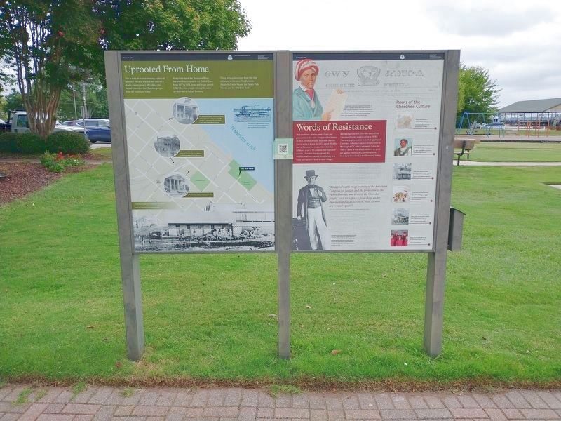
This is a site of painful memory, a place of upheaval. Decatur was just one stop on a deadly journey over 1,000 miles — the forced removal of the Cherokee people from the Tennessee Valley.
Along the edge of the Tennessee River, this town bore . . . — — Map (db m189597) HM
Near Highway 67 South 0.2 miles north of Willowbrook Street, on the right when traveling north.
Known as the "Crossroads of North Alabama,” the Town of Priceville incorporated in April 1975, though its earliest settlers migrated to the foot of Priceville Mountain just after the War of 1812. The community was rich farmland once owned by the . . . — — Map (db m191691) HM
Near Lock and Dam Road 0.5 miles south of Marina Parkway, on the right when traveling south.
What is a Snagboat?
Snagboats remove snags – underwater trees, stumps, or branches – that created obstructions to river navigation. A large grapple or clamshell on the snagboat’s beam pulled these obstacles from the river. Equipped with a scoop . . . — — Map (db m236057) HM
Near Lock and Dam Road 0.5 miles south of Marina Parkway, on the right when traveling south.
In June 1985, the U.S. Army Corps of Engineers, Mobile District, opened the Tennessee - Tombigbee Waterway. This carefully planned engineering effort created a year-round commercial navigation route 234 miles long. Stretching from the rugged north . . . — — Map (db m179089) HM
On Lock and Dam Road 0.5 miles south of Marina Parkway, on the right when traveling south.
The U.S. Snagboat Montgomery was designated a National Historic Landmark in June of 1989. Serving as one of the South’s last steam~powered sternwheelers, the Montgomery was used by the U.S. Army Corps of Engineers to maintain seven navigable rivers. . . . — — Map (db m179079) HM
Near County Highway 165 2.3 miles south of Nuckols Road (Road 39).
Fort Mitchell served as a primary point of concentration for creeks being sent westward to Indian Territory before, during, and after the Second Creek War (1836-1837). By the terms of the 1832 Treaty of Washington, Creek heads of household and . . . — — Map (db m101840) HM
On Alabama Route 165 at Terminal Road (Route 54), on the right when traveling north on Alabama Route 165.
East of here, on the Chattahoochee River, was the "fort among the Apalachicolas," most northern of the Spanish settlements in eastern North America. A palisaded "strong house" built by Captain Enrique Primo de Rivera to check activities of English . . . — — Map (db m101252) HM
Near 13th Street at 3rd Avenue, on the right when traveling east.
To the native people of the Chattahoochee River Valley, the Creek or Muskogulgi Indians, the shoals of the river were a source of recreation and food. In the spring, the women and children of Coweta Town came here to fish, using dip nets, spears, . . . — — Map (db m69045) HM
Near Dillingham Street at Brickyard Road (Route 61).
The town of Coweta was actually two separate Native American settlements and dozens of affiliated outlying communities occupied at different times in what is now northeastern Russell County. "Coweta Tallahassee" (old Coweta), regarded by most . . . — — Map (db m101328) HM
Near 13th Street south of 3rd Avenue, on the right when traveling east.
The Creek Indians believed this section of the river was inhabited by a giant Tie-Snake, a mythical monster that snared the unwary and dragged them down into the watery underworld. The Tie-Snake was but one of many strange creatures and natural . . . — — Map (db m69067) HM
On Lake Davidson Lane at Helena Road ( Road 261), on the right when traveling east on Lake Davidson Lane.
Side 1
During the final years of the Civil War, Montgomery merchants, Hannon, Offutt & Company, built a rolling mill here along the banks of Buck Creek. Called the Central Iron Works, the plant’s construction was superintended by Thomas . . . — — Map (db m76241) HM
On Cook Springs Road 0.1 miles south of Interstate 20, on the right when traveling south.
Near this site, and founded by entrepreneur Lafayette Cooke, for whom the community of Cook Springs was named, the hotel resort, operated from 1884 to 1954, was a grand example of mineral-springs resorts developed around the nation during that era. . . . — — Map (db m217684) HM
On Hardwick Road at Mays Drive, on the left when traveling north on Hardwick Road.
United Daughters of Confederacy
chartered 1914
The Coosa River was a factor in area
until impounded 1946
to form Lake Logan Martin — — Map (db m217719) HM
On Student Union Drive 0.5 miles south of University Drive, on the right when traveling south.
1860 Captain W. A. C. Jones of Livingston designed and built the bridge of hand-hewn yellow pine put together with large pegs, clear span 88 feet, overhead clearance 14 feet, and inside width 17 feet, across the Sucarnoochee River on old State . . . — — Map (db m92661) HM
On County Road 433 north of 1st Avenue, on the right when traveling north.
Historical records indicate that DeSoto and his men, as they traveled the South in search of gold, were the first white men to see the Lincoln area. With the ceding of the Creek Indian Territory in 1837, the population of the area increased. The . . . — — Map (db m33282) HM
On W. North Street at Court Square West, on the left when traveling west on W. North Street.
Seven Battle Stars
☆ ☆ ☆ ☆ ☆ ☆ ☆
World War II
☆ Iwo Jima Operation
☆ Okinawa Gunto Operation
First of the 31 ship convoy with occupation troops
to dock at Yokohama on VJ Day, . . . — — Map (db m12212) HM
On County Road 21 at Desoto Caverns Pkwy (County Road 76), on the left when traveling north on County Road 21.
Here was northern terminus
of 60 miles of toll road
operated from Wetumpka.
Built of wooden boards.
Prior to railroads this was
an important artery of travel.
Chartered to connect navigable
parts of the Alabama, Coosa,
and Tennessee River. — — Map (db m288230) HM
Near Horseshoe Bend Road (Alabama Route 49) 2.1 miles north of Freeman Road, on the left when traveling north.
Originally the name "Creek" referred only to
Muskogee Indians living near Ochese Creek in
central Georgia. Over time the name spread to
include all Muskogee people along the rivers of
present-day Georgia and Alabama. At one time
the region held . . . — — Map (db m223985) HM
On Barnett Boulevard (Alabama Route 14) west of Freeman Avenue, on the right when traveling west.
Construction began on Thurlow Dam in 1928 and the dam went into operation on December 31, 1930 as part of Alabama Power Company's development of the Tallapoosa River The dam was named in honor of Oscar. G. Thurlow, a Chief Engineer, Vice . . . — — Map (db m254008) HM
On Main Avenue at 1st Street, on the right when traveling south on Main Avenue.
In 19th-century Northport, the land was fertile, cotton was king
and the riverbank was a hub for commerce and activity. Warehouses
were built for cotton storage as early as 1824 near this site along
the banks of the Black Warrior River. The . . . — — Map (db m285148) HM
Near 21st Avenue south of 6th Street, on the right when traveling south.
After the devastation of the Civil War and nearly 20 years of decline, Mayor William Carlos Jemison and other civic leaders energetically promoted a “New South” vision of a community that would prosper through hard work, trade, industrial . . . — — Map (db m217187) HM
Near Greensboro Avenue north of 2nd Street (Jack Warner Parkway).
The remains of Burns' Shoals now lie nearly 40 feet underwater. This rock outcropping was the first of the shoals known as the "Falls of Tuscaloosa" and represents the "Fall Line" or contact point of the Coastal Plain and the Appalachian Plateau, . . . — — Map (db m28904) HM
On 21st Avenue 0.1 miles north of Jack Warner Parkway, on the right when traveling north.
Early River Improvements
Navigation improvements to the Black Warrior River began in 1875 with a project to clear snags, trim overhanging trees, and dredge through shoals. In 1886, the U.S. Congress authorized constructing three locks . . . — — Map (db m235681) HM
During his term our state moved from frontier to urbanity. The University of Alabama was officially opened. Construction was begun on our first canals and railroads, supplementing existing steamboats and unpaved roads. The Choctaws exchanged their . . . — — Map (db m29023) HM
On Capstone Drive at Colonial Drive, on the right when traveling west on Capstone Drive.
Built 1829 as University dining hall.
Remodeled as a residence 1840.
Occupied by Gorgas family 1879-1953
(Reverse):
Preserved as a memorial to:
General Josiah Gorgas (1818-1883)
Chief of Ordnance, C. S. A. 1861-1865 . . . — — Map (db m29301) HM
On McFarland Boulevard East (U.S. 82), on the right when traveling north.
5 inch / 25 caliber
“Dual Purpose” secondary artillery gun
The U.S.S. Tuscaloosa was equipped with eight such guns, located in single turrets, four on either side of the ship. Developed in the 1920’s, its purpose was for both . . . — — Map (db m35507) HM
Near Greensboro Avenue north of Jack Warner Parkway (County Road 88).
Mike Medeiros was affectionately known by the community as Captain Mike. Captain Mike always greeted his passengers on the Bama Belle Riverboat with energy, optimism and a desire to make their experience a wonderful memory. He was a role model for . . . — — Map (db m156404) HM
On Greensboro Avenue north of 2nd Street (Jack Warner Parkway), on the left.
Navigation improvements to the Black Warrior River (1888-1895) spurred marine commerce throughout the 20th century. Local ship-builders included the Perkins Brothers, Herman & Son, Corp of Engineers Boatyard, and Baker Towboat. Vessel types included . . . — — Map (db m28924) HM
Near Greensboro Avenue north of 2nd Street (Jack Warner Parkway).
Plied for thousands of years by Indians, then by early explorers and American settlers, this river extends 169 miles from the Sipsey and Mulberry Forks near Birmingham to its confluence with the Tombigbee at Demopolis. It drains 6228 square miles of . . . — — Map (db m28901) HM
Near Jack Warner Parkway Northeast north of Hackberry Lane.
From 1887-1915, seventeen locks and dams were constructed on the Warrior - Tombigbee Rivers. The first 3 were built on the fall line in Tuscaloosa. This was the site of No. 3, later No. 12.
The Warrior - Tombigbee Development Association, . . . — — Map (db m28786) HM
On Healing Springs Avenue (County Road 34) at Cemetery Road, on the left when traveling west on Healing Springs Avenue.
As early as 1872, Healing Springs was known as a
health resort because of its 17 mineral springs which
had been found to be therapeutic for many diseases.
William Wooten owned the springs and built a small
hotel and several cottages for . . . — — Map (db m293760) HM
On Jefferson Davis Highway (U.S. 43) 0.4 miles south of Sullivan Lane, on the right when traveling south.
Named for Thomas Bassett, a British Loyalist and native of Virginia. Migrated to Tombigbee area from near Augusta, Ga. circa 1772 to escape persecution by American patriots. Received in 1776, from King George III, a grant of 750 acres on the west . . . — — Map (db m122336) HM
On County Road 63 north of County Road 41, on the right when traveling north.
Tread softly. Traveler: the
long, winding trail has led you to
Brushy Creek.
He who dips his toes
into her alluring waters
shall never want for peace of mind
or a
contented heart.
God made Brushy Creek. — — Map (db m281080)
Near Seward Highway (State Highway 1) west of Bushnell Road, on the right when traveling west.
“Whenever the [upriver Dena'ina<] needed anything,... they come down to Alexander Creek to trade for beluga grease, seal oil...and they gave [coastal Dena'ina] caribou skins and marten skins. They helped each other, for the were the . . . — — Map (db m283052) HM
James Cook was born in Yorkshire, England, on October 27, 1728. He was apprenticed to serve on sailing ships built in Whitby, near his birthplace, to carry coal along the English coast. At age 26, he joined the Royal Navy, took part in actions . . . — — Map (db m72493) HM
Commercial farming of Atlantic salmon using ocean net pens is important to the economy in several areas of the Pacific Northwest, especially along the coast of British Columbia.
However, net pen fish farming has been banned in Alaska since 1990 . . . — — Map (db m70735) HM
1 to 4 years in fresh water
Most coho migrate to sea after one or two years in fresh water.
Sept 1-Nov 15 The adult cohos are the last of the Pacific salmon to arrive in the river to spawn.
Nov 15-April 1 The eggs incubate over the winter. . . . — — Map (db m70734) HM
Athabascans were highly nomadic, traveling in small groups to fish, hunt, and trap.
Athabascan territory, the largest area of all the Alaska Native peoples, was home to 11 different linguistic groups who lived along five major riverways: the . . . — — Map (db m72795) HM
On Lakeshore Drive 0.4 miles west of Wisconsin Street, on the right when traveling east.
Completed 1940 connecting Lake Hood and Lake Spenard. Increased takeoff area for floatplanes & made possible Lake Hood seaplane base. — — Map (db m305878) HM
On Tatitlek Ave north of Egan Drive, on the right when traveling north.
On the morning of October 4, 1980 the M /S PRINSENDAM, a 427 foot-long luxury cruise ship with 329 passengers and 190 crew members, was enroute to Japan after sailing up the Inside Passage from Vancouver. At 1:00 a.m. she broadcasted a distress . . . — — Map (db m310629) HM
Widely used today on the Yukon and Copper Rivers, the fishwheel was introduced in Alaska near the turn of the 20th century. It is thought to have been prominent in the Pacific Northwest, particularly the Columbia River, prior to making its way to . . . — — Map (db m173903) HM
On Tok Cut-Off Highway (State Highway 1 at milepost 1), 1 mile east of Richardson Highway (State Highway 1/4), on the right when traveling east.
The river says something different every day.
Under Summer's long sun, it rocks
and rolls. Glaciers melt, waters
rise. In upland rivers you can hear big
stones rolling down. First salmon and
then more people come. The . . . — — Map (db m255511) HM
On Glenn Highway (State Highway 1 at milepost 144), on the left when traveling east.
If you put a small leaf boat in this creek, where would it journey?
Set adrift on Mendeltna's
quiet creek, a leaf boat
floats under the highway bridge, bumps the nose of a curious
grayling, then catches the creek's current . . . — — Map (db m255331) HM
On Railroad Depot Rd, on the right when traveling north.
When you ride the rails, you hurdle yawning canyons
and wide rivers that challenged the engineering know-how of the day.
The Hurricane Gulch bridge, one of the marvels of the line,
crosses a gorge more than 900 feet across and . . . — — Map (db m283588) HM
The Nenana River, below you, joins up with the Tanana River 60 miles downstream. The waters of the Nenana and Tanana are part of the enormous Yukon River watershed, which ultimately empties into the Bering Sea. The Yukon River drainage . . . — — Map (db m257608) HM
This is a typical riverboat of the early and mid-1900's. The long, narrow shape is fashioned after the early pole boats. It is a non-planing displacement design that can carry large loads with minimal power and easily push against the swift . . . — — Map (db m257579) HM
Fish camps played an enormous role in the lives of native Alaskans. These small summertime
settlements were often set up about 30 miles from the village and served as the family's summer home. Salmon was caught using fishwheels, then were . . . — — Map (db m257597) HM
In Alaska, the remote areas of the state are know[n] as "The Bush" and the term "Bush Pilot" refers to the bold and adventuresome pilots who fly in and out of these remote locations. Even today, Bush Pilots provide an important lifeline to . . . — — Map (db m257582) HM
This smokehouse is a typical building you would find at a traditional
Athabascan fish camp. The smokehouse was a key component of every
fish camp, as it was the only means for the Athabascans to preserve the
thousands of salmon they caught . . . — — Map (db m257593) HM
At the turn of the century the news of the Klondike Gold Rush brought thousands to Alaska to seek their fortune. Because there were no roads and a vast river system, sternwheel riverboats were the best way to haul the prospectors and their . . . — — Map (db m257592) HM
The Kuskokwim River (Kusquqvak in Central Yup'ik) runs 724 miles (1,130 km) through Southwest
Alaska and is the setting for dozens of communities and thousands of people. For several
millennia, indigenous people have fished these waters, . . . — — Map (db m256334) HM
Jim Binkley was born in 1920 in Wrangell, Alaska. His father was a pioneer riverboat captain who came to Alaska during the gold rush of 1898. Captain Jim ran the entire length of the Yukon River and its major tributaries which supplied the . . . — — Map (db m257556) HM
Transportation
As the transportation hub for Interior Alaska, Fairbanks features extensive road, rail, and air connections to the rest of Alaska and "The Outside". At Fairbanks' founding, the only way to reach the new city was . . . — — Map (db m257477) HM
My husband William Foster and I, decided to try our luck in the gold rush for Alaska, so set out in January 1898 aboard the vessel "Corona" on her maiden voyage. On the way North, she veered off her course, and struck a rock and sank in about . . . — — Map (db m257517) HM
On Hoselton Road 0.2 miles north of Airport Way, on the left when traveling north.
Image captured from 16mm film of the 1941 annual spring float test of the Wien Fairchild 71 at Pike's Landing. According to Noel Wien's son Richard, the plane was towed from Weeks Field to Pike's Landing for the test run. He also said that Pike's . . . — — Map (db m257016) HM
Known as the "Last Lady of the River" the Sternwheeler Nenana was constructed in Nenana, Alaska in 1932 and launched in 1933. She is 237 feet long, 42 feet wide. She had 24 staterooms in addition to space for 32 crew as well as 300 tons of cargo. . . . — — Map (db m256648) HM
Fairbanks flooded in 1967; there was a fear that the
SS Nenana might float away, so holes were drilled in
her hull. Drilling holes in the hull caused the Nenana
to sink into the pond where she was moored.
You can still see where those . . . — — Map (db m256630) HM
Davidson Ditch Pipeline was built to supply water to gold mining dredges in the interior of Alaska. It was a 90-mile water conduit from multiple river drainages south of the Yukon River that terminated at the gold fields just north of Fairbanks. . . . — — Map (db m257487) HM
The Lavelle Young was built in 1898. She was 140 ft. long, 32 ft. wide, and had a draft of 3 ft. She could travel at about 12 m.p.h. Her crew consisted of a captain, mate, engineer, purser, and steward. She could carry about 28 . . . — — Map (db m256926) HM
Captain Charles Wilbur Adams, the first Captain of the SS Nenana, was also the owner and Captain of the Steamer LaVelle Young that in 1901 offloaded E.T. Barnette, his wife, crew and supplies onto the banks of what was to become Fairbanks, . . . — — Map (db m256665) HM
Most steamers were very loud and could
be heard coming for many miles. The
Nenana's engine room had been
designed to include a condenser; the
used steam could be cooled resulting in
clean distilled water recycled back
through the boilers . . . — — Map (db m256624) HM
The passage to Tanacross was not possible due to low water levels. Captain Adams dropped Barnette, his trade goods and family on the banks of the Chena Slough. Captain Adams stayed long enough to construct two cabins. One was for . . . — — Map (db m256897) HM
First Captain Charles Adams, nephew [of]
Howard Adams, had worked as a mess boy
in the early days of the Steamer Nenana.
Howard served as the last Captain retiring
the boat from passenger service in 1949.
Then as a cargo steamer in . . . — — Map (db m256621) HM
The Steamer SS Nenana was fabricated in Seattle?
The materials were then shipped from Seattle to
Seward by regular steamship lines, then transported
450 miles on the Alaska Railroad to Nenana. — — Map (db m256688) HM
This house was located at
923 Eighth Avenue, between
Cowles and Kellum. Kittie Hensley
was one of the first owners of this
early 1900's cabin. She also owned
the Florence S., a sternwheeler that
plied the Yukon & Tanana Rivers
and . . . — — Map (db m256719) HM
"Nenana marks the end of the period of practical shipbuilding, during which master shipwrights accumulated knowledge as apprentices and craftsmen, and constructed ships using measurements obtained from half hull models that were then scaled up to . . . — — Map (db m256649) HM
The Chamber of Commerce bought the SS Nenana in 1957 from the Alaska Railroad then sold it to the
Greater Fairbanks Opportunities Inc., an offshoot of businessmen from the Chamber of Commerce.
The Greater Fairbanks Opportunities Inc. brought . . . — — Map (db m256668) HM
There were only three captains on the
SS Nenana during its tenure.
Charles Adams
Captain Charles Adams was the first in 1933 of the three captains of the "SS Nenana" also known as "The Last Lady of the River". He remained captain until . . . — — Map (db m257421) HM
The Nenana built accommodations for 52 passengers but was never licensed to carry more than 16 by the Steamboat Inspection Service. During World War II Federal officials and military were not
considered "Passengers for hire." The Nenana would . . . — — Map (db m256664) HM
The Greater Fairbanks Opportunities leased the boat?
Newsminer July 1, 1958
Boatel Is Open
Fairbanks boatel, the sternwheeler Nenana which is docked near 2nd avenue and Lathrop street, opened last week, for the summer . . . — — Map (db m256690) HM
The SS Nenana was originally in a different place
in the park? She was moved more then [sic] 200 ft.
to be placed where she is now. She was originally
placed in a man made pond, facing the Pioneers Museum. — — Map (db m256661) HM
The SS Nenana fulfilled a significant role during World War II. She transported equipment and personnel needed to construct airfields and other military installments, including facilities and aircraft for the Lend Lease Act of 1941. She supplied . . . — — Map (db m256653) HM
During World War II the SS Nenana played an essential role, transporting equipment and personnel needed to construct airfields and other military install[ations], including facilities and aircraft for the Lend-Lease Act of 1941.
[Photo . . . — — Map (db m256691) HM
It took three days to bring the SS Nenana to Fairbanks from Nenana. The vessel traveled cautiously with a sounding boat out in front to test the river depth and check for sandbars.
She was still hung up on a sand bar by the mouth of the Chena . . . — — Map (db m256667) HM
Sternwheelers were the main transportation for the Interior in the early 1900's. The difficult terrain and lack of roads made the rivers a useful and efficient means of travel. The Tanana and Yukon Rivers naturally spread out in . . . — — Map (db m256895) HM
In August 1901, the sternwheeler Lavelle Young was chartered by E. T. Barnette from Captain C. W. Adams to transport Barnette, his wife Isabelle, three men in Barnette's employ, and 130 tons of supplies for Barnette's future . . . — — Map (db m256896) HM
has been designated a
National Historic Landmark
This vessel possesses national significance in
commemorating the history of the United States
of America. The S. S. Nenana is the last
steamer of her type remaining in the . . . — — Map (db m256655) HM
On 1st Avenue east of Barnette Street, on the right when traveling east.
Steamboats crowded the Chena River in the few months between break-up and freeze-up, bringing passengers and much-needed merchandise to the isolated community. — — Map (db m256551) HM
On 1st Avenue west of Cushman Street, on the right when traveling west.
Eight hundred people lived in Fairbanks in the winter of 1903. By the summer of 1904 the population had swelled to 5,000.
The thriving town had two newspapers and numerous hotels, like the two story
Pioneer. It featured 100 rooms, steam heat, . . . — — Map (db m256490) HM
On 1st Avenue east of Cushman Street, on the left when traveling east.
The role of transportation in advancing the civilization of the north can be traced from the very first forms of river travel between settlements on Alaska's river systems. Long before the first Russian traders sailed . . . — — Map (db m257398) HM
On 1st Avenue west of Lacey Street, on the right when traveling west.
The 1967 flood in Fairbanks made one thing clear-the city and nearby Fort Wainwright needed better flood control.
Planning Ahead
The Chena River has a history of flooding, but the damage from the 1967 flood was so extensive that it . . . — — Map (db m256591) HM
On 1st Avenue east of Cushman Street, on the left when traveling east.
It All Started with Gold
In 1901, Felix Pedro and Tom Gilmore were panning the creeks in the unexplored wilderness of the Tanana Valley. The same year, trader E. T. Barnette was traveling the river system to find a location for a trading . . . — — Map (db m257318) HM
On 1st Avenue east of Cushman Street, on the left when traveling east.
Riverboats have plied the rivers of Alaska and the Yukon for more than 100 years. They were the primary mode of transportation to the gold fields of Interior Alaska, bringing prospectors and supplies to the growing boom towns along . . . — — Map (db m257436) HM
On 1st Avenue west of Lacey Street, on the right when traveling west.
In 1967, Fairbanks experienced the greatest flood in its history, as the Chena River
seemingly swallowed the city whole.
It's Raining, It's Pouring
Fairbanks residents expect cooler and shorter days and a little rain in August, but . . . — — Map (db m256584) HM
This Anchor
from the Navy Inactive Ship Facility
in Bremerton, Washington,
was presented as a gift to the
Citizens of Fairbanks from the
Gold Crew of the USS Alaska (SSBN 732)
on the occasion of the crew's official . . . — — Map (db m257127) HM
The Chena River affected all who lived in its valley. During the warm months fish camps sprang up along its banks. Caribou descended the hills to cross the river on their migration to calving grounds. Moose browsed along its backwaters, and . . . — — Map (db m257189) HM
Dredges were brought in to mine gold-bearing deposits in the Fairbanks mining district after 1920. This bucket-line or ladder dredge has 68 buckets, each with a capacity of 6 cubit feet. The bucket line was driven by a 150 horsepower motor that . . . — — Map (db m144242) HM
Near Steese Highway (at milepost 8.4), on the right when traveling north.
On November 16, 1973, through Presidential approval of pipeline legislation, Alyeska Pipeline Service Company received permission to begin construction of the 800-mile trans Alaska pipeline, its pump stations and the Marine Terminal at Valdez. . . . — — Map (db m20215) HM
On Glacier Spur Road, on the left when traveling north.
Plunging from the slopes of Thunder Mountain, Steep Creek rapidly makes its way to the Mendenhall Valley. The last 2,300 feet of this stream’s short journey to Mendenhall Lake has evolved into important habitat for sockeye and coho salmon. Steep . . . — — Map (db m311387) HM
Dedicated to the men and women who have given
their lives to the Alaska commercial fishing industry.
The purpose of this Memorial is to demonstrate support for the
commercial fishing industry by individuals, families, and . . . — — Map (db m257928) HM
18824 entries matched your criteria. Entries 201 through 300 are listed above. ⊲ Previous 100 — Next 100 ⊳