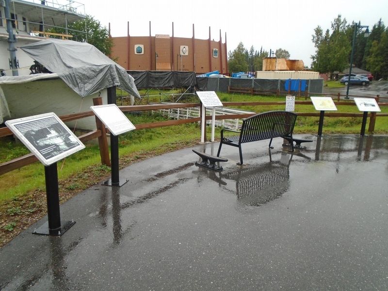
"In memory of Jack Williams,
a moving force in the fund-raising
and volunteer efforts that produced
major restorations of Kitty Hensley House,
the Harding Railroad Car, the Lavelle Young
wheelhouse, and the Sternwheeler Nenana,
all . . . — — Map (db m256650) HM
1955
The idea that sparked the creation of Pioneer Park came from a Fairbanks Golden Days Celebration Committee meeting. Robert Sheldon of Pioneers of Alaska Fairbanks Igloo No. 4 took the idea to the Fairbanks Pioneer Igloos to . . . — — Map (db m256603) HM
The Harding Car was built in 1905 in Chicago, Illinois and carried passengers until 1945. It was donated to the City of Fairbanks in 1959, and moved to the Park in 1965.
The Harding Car, also known as the Denali Car, is the train car that . . . — — Map (db m256596) HM
On 1st Avenue at Cushman Street, on the left when traveling east on 1st Avenue.
Completed in 1942
Constructed in just 8 months in 1942, this 2,450 kilometre highway provided an essential transportation link to the northwest of North America during the Second World War, and has since remained a major . . . — — Map (db m257084) HM
On 1st Avenue east of Barnette Street, on the right when traveling east.
In 1913 Fairbanks merchants invited Lilly and James V. Martin to bring their airplane to Fairbanks. The Martins shipped their crated airplane from Seattle. When it reached Fairbanks, Martin and his wife, who was England's first woman aviator, . . . — — Map (db m256495) HM
On 1st Avenue west of Lacey Street, on the right when traveling west.
The 1967 flood in Fairbanks made one thing clear-the city and nearby Fort Wainwright needed better flood control.
Planning Ahead
The Chena River has a history of flooding, but the damage from the 1967 flood was so extensive that it . . . — — Map (db m256591) HM
Noble Dick, M D · President • Wm S Burton · Vice President
Herb Kirby · Secretary • Curtis Adams · Treasurer
Jack Winston · Director • Brice Howard · Director
Arthur S Brown · Director
Don Adler · Harry Arend · Roy Ferguson · Kenneth . . . — — Map (db m257103) HM
On 1st Avenue at Cowles Street, on the left when traveling west on 1st Avenue.
has been designated a
National Historic Landmark
This site possesses national significance
in commemorating the history of the
United States of America
—————————
This property
has been placed on the
National Register
of . . . — — Map (db m257155) HM
On 1st Avenue east of Cushman Street, on the left when traveling east.
Residents of interior and northern Alaska are fortunate to have excellent health care resources. Strong support from the people in Fairbanks and the surrounding area has been the key in developing fine facilities and services. . . . — — Map (db m257337) HM
On 1st Avenue east of Cushman Street, on the left when traveling east.
This plaque marks the original site of the Fairbanks USO organized by volunteers and chartered through USO World Headquarters in 1942. Its Mission was to serve the morale support needs of the men and women in the armed forces stationed away from . . . — — Map (db m256561) HM
On 1st Avenue east of Cushman Street, on the left when traveling east.
Following the initial organization of Igloo #1 in February 1907 at Nome, Igloo #2 in June
1907 at Candle, and Igloo #3 at St. Michael, these igloos met in convention at Nome August 4, 1908, and created the "Grand Igloo, Pioneers of Alaska." . . . — — Map (db m257405) HM
On 1st Avenue west of Lacey Street, on the right when traveling west.
In 1967, Fairbanks experienced the greatest flood in its history, as the Chena River
seemingly swallowed the city whole.
It's Raining, It's Pouring
Fairbanks residents expect cooler and shorter days and a little rain in August, but . . . — — Map (db m256584) HM
On 1st Avenue just east of Cushman Street, on the left when traveling east.
presents this Clock Tower and Carillon
to the City of Fairbanks
September 20, 1990
commemorating the First Fifty Years of
Rotary Club Service in the Alaskan Interior
1940 - 1990
Rotary Club of Fairbanks, Alaska
During the . . . — — Map (db m257121) HM
It took a tremendous amount of determination and fortitude to live in the Tanana Valley in the early days of Fairbanks Survival during the long winters that isolated the community from the outside world required fellowship. People had to depend . . . — — Map (db m257208) HM
Although the use of the riverfront changed over the years, the people of Fairbanks retained their love for the Chena River. Today, the riverfront's parks and trails make it one of the most attractive recreational areas in Fairbanks, but not too . . . — — Map (db m257212) HM
On Glacier Spur Road 3 miles Second St., on the right when traveling north.
The Civilian Conservation Corps left a legacy of labor and public service.
This shelter represents a piece of the nation's past and attests to the historic popularity of this site. It represents work for the public good and
one of the most . . . — — Map (db m282994) HM
On Franklin Street at Marine Way (Alaska Route 7), on the left when traveling north on Franklin Street.
She was a thirty-six year resident of
Juneau who contributed to its beauty
with her skilled gardening and talented
ikebana flower arrangements.
With a fond loving memory of her caring spirit,
her family & friends share the joy & beauty . . . — — Map (db m258044) HM
On Calhoun Avenue north of West 4th Street, on the left when traveling north.
Built by the Civilian Conservation Corps — 1935
Olaf Torkelson, Juneau Street Commissioner from 1924-1936, was instrumental in the success of this project. The overpass was built to provide safe access for children who attended Capital School . . . — — Map (db m181738) HM
On The Trail of Time at Glacier Spur Road, on the left when traveling east on The Trail of Time.
Natural and cultural forces reshaped the landscape through plant succession and human development.
Small changes had dramatic effects over time. On a daily basis the movement of the glacier was often unnoticeable As the glacier sets, . . . — — Map (db m282929) HM
On Front Street at Spruce Mill Way, on the right when traveling south on Front Street.
Our fire department: From buckets to pumpers
Ketchikan Fire Department started in 1900 with a bucket brigade. You were a member if you had a bucket and could carry it full of water. Such rudimentary protection was inadequate in a bustling . . . — — Map (db m181985) HM
On South Valley Way at Elmwood Avenue, on the left when traveling south on South Valley Way.
The Matanuska Colony Historic District was established in 1991 to recognize the unique history and architecture of the Matanuska Colony Community Center, built in 1935 and 1936 as the central area of the Matanuska Colony Project. . . . — — Map (db m254646) HM
On East Elmwood Avenue east of Chugach Street, on the right when traveling east.
This house was constructed in 1935 as the farm home
of a Matanuska Valley Colonist family. It was relocated
in July 1995 from Farm Tract No. 94 to this permanent
site within Palmer's Historic District. Working together to
preserve our local . . . — — Map (db m254888) HM
On East Elmwood Avenue east of South Valley Way, on the left when traveling east.
HISTORICAL BACKGROUND
The Matanuska Colony Project created headline news
around the world. It was a story of hope in the 1930s
Great Depression. President Franklin D. Roosevelt
promised to build new communities and put people to
work . . . — — Map (db m254747) HM
On East Elmwood Avenue east of South Valley Way, on the left when traveling east.
CONSTRUCTION WORKERS
Hired as transient workers, unemployed men from
California assisted in building a tent city before
constructing the colonists' farm houses. To discourage them
from staying, they received half their pay in Alaska and . . . — — Map (db m254764) HM
On East Elmwood Avenue east of South Valley Way, on the left when traveling east.
COMMUNITY CENTER
You are in the administrative center of the Matanuska Valley Colony Historic District.
Today, some of the public buildings have been rehabilitated. The teacher[s'] dormitory is a hotel, the school serves as the . . . — — Map (db m254825) HM
On East Elmwood Avenue east of South Valley Way, on the left when traveling east.
DAVID R. WILLIAMS
ARCHITECT
David Reichart Williams, appointed
as chief architect for the Federal
Emergency Relief Administration,
planned 84 of the 100 resettlement
communities.
After researching Alaska's climate and
agricultural . . . — — Map (db m254829) HM
On East Elmwood Avenue east of South Valley Way, on the left when traveling east.
HISTORIC DISTRICT 1935-1936
The Historic District is a tribute to Franklin D. Roosevelt's New Deal, David R. Williams and the Colonists.
MATANUSKA COLONY COMMUNITY CENTER
Listed on The National Register of Historic Places . . . — — Map (db m254843) HM
On East Elmwood Avenue east of South Valley Way, on the left when traveling east.
INDUSTRIAL COMPLEX
The Matanuska Colony Project provided
not only farms, schools and administration buildings, but also
power and processing plants. The cannery, creamery, and
vegetable sorting center helped to distribute farm . . . — — Map (db m254844) HM
On Elmwood Avenue east of Eklutna Avenue, on the left when traveling east.
The Bill Hermann Tennis Courts
were constructed in the 1970s
with a donation from Bill Hermann.
Bernard "Bernie" Nieman faithfully
cared for these courts for 30 years.
Courts were reconstructed in 2022 by Mat-Su Tennis Association . . . — — Map (db m254876) HM
On Glenn Highway (State Highway 1 at milepost 61.6) east of Chickaloon Way, on the left when traveling east.
This log home was originally built by Ray Roberts and his family with the help
from local friends and neighbors in 1949. The cottonwood logs were harvested at
Kings River and milled on the Roberts' property. The interior of the home was . . . — — Map (db m255259) HM
On Chickaloon Way north of Glenn Highway Milepost 61.6 (Alaska Highway 1), on the right when traveling north.
Rita was instrumental in forming the Alpine Historical Society
and was the first president serving in that capacity from 1983 to
1984. Rita and her husband Gene moved to Alaska in 1969. For
three years, they lived at Fort Richardson Army Base . . . — — Map (db m254924) HM
On Glenn Highway (State Highway 1 at milepost 61.6) east of Chickaloon Way, on the left when traveling east.
The Matanuska River valley has always been a transportation corridor. Before 1900 the
Chickaloon-Knik-Nelchina Trail connected coastal Dena'ina and the interior Ahtna Hwt'aene'
(Peoples) including Nay'dini'aa Na' (Chickaloon Native Village). In . . . — — Map (db m254959) HM
On Glenn Highway (State Highway 1 at milepost 61.6) east of Chickaloon Way, on the left when traveling east.
Walt was a coal miner at Jonesville coal mine from 1945 until 1967. He
worked as a millwright and master mechanic. He enjoyed exploring the
mountains and valleys around the mining area and learned about the
indigenous plants and local history. . . . — — Map (db m255254) HM
On Harbor Drive (Local Route F-99) at Maksoutoff Street, on the left when traveling west on Harbor Drive.
The 'Cottage-by-the Sea' was constructed in 1897 by Norwegian prospector Captain Hans Christian Pande. While Alaska was still a Territory, the W.P. Mills Company donated this house to the Sitka Woman's Club for a clubhouse, which led to the . . . — — Map (db m241980) HM
On Harbor Drive (Local Route F-99) at Maksoutoff Street, on the right when traveling east on Harbor Drive.
Norman E. Staton Sr. and Ethel L. (Milonich) Staton, lifelong Alaskans moved from Ketchikan to Sitka in 1955 opening their first restaurant, the Pioneer Grill on Katlian Street and their second, the Sitka Café on Lincoln Street before opening . . . — — Map (db m181259) HM
On 1st Avenue at Broadway, on the left when traveling west on 1st Avenue.
This Avenue of Mountain Ash Trees
was planted in June 1986
by volunteers
A gift from the Skagway Garden Club
Dedicated to the future of Skagway.
"The Garden City of Alaska" — — Map (db m257883) HM
On 5th Avenue east of Broadway, on the left when traveling east.
The authorization of Klondike Gold Rush National Historical Park in 1976 included the mandate to preserve and protect the Gold Rush heritage of Skagway. With the purchase of the Moore Homestead from the Kirmse family in 1977, a key element for . . . — — Map (db m257809) HM
Building Alaska's highways was, and is, no easy feat. The Alaska Road Commission (ARC) was one of the first groups to battle Alaska's tough working conditions.
Trail to Road
ARC crews blazed a 10-foot-wide dog team and pack horse . . . — — Map (db m255747) HM
The original ARC garage, which
this building resembles, housed
graders and other road
machinery in winter and
functioned as a maintenance
shop in summer. — — Map (db m255745) HM
On Puerco Loop east of Petrified Forest Road, on the left when traveling south.
In this vast, nearly treeless landscape, it may sound strange to call the Civilian Conservation Corps (CCC) Roosevelt's Tree Army, but it has meaning here. President Franklin D. Roosevelt created the CCC in 1933 as part of his New Deal program for . . . — — Map (db m286291) HM
Iowa Congressman John Fletcher Lacey strongly advocated the protection of public lands and the resources within them. Lacey is most prominently known by his namesake of the Lacey Act of 1900, which protected both plants and wildlife. However, he . . . — — Map (db m255987) HM
On Naco Road east of Ok Street, on the right when traveling west.
Bisbee architect F. C. Hurst designed this building in 1906. Hurst had also designed the Bisbee Central School in 1905.
Designed as a combination city hall and fire station, the design was titled "City Fire Hall Building". The original . . . — — Map (db m195860) HM
On East Fremont Street (State Highway 80), on the right when traveling east.
Architect Frank Walker designed this building in Victorian style adapted to Western Territorial. It is constructed of fired red brick. It has been in continuous service since 1882 for Mayors, Marshals and official city offices. In the 1880s it . . . — — Map (db m27918) HM
On East Toughnut Street, on the right when traveling east.
The devastating fires of 1881 and 1882 brought major changes to the Tombstone Fire Department. A new fire station was completed in 1881, a new Rescue Hook and Ladder Co. was formed, and a new water source was obtained. Thirty six miles of fifteen . . . — — Map (db m53403) HM
Under the forebearer of this American Elm George Washington assumed command of the Continental Army at Cambridge, Massachusetts, on July 3, 1775.
This sprig of the "Washington Elm" was donated to the Arizona State Teachers College at . . . — — Map (db m263603) HM
The Horace M. Albright Training Center is a National Park Service facility for employee development. Established in 1963 and named for the National Park Service's second director, the training center serves as an educational program center for . . . — — Map (db m39602) HM
Maybe those mountains are hard to climb. Those trees so hard to cut.
But the air is pure, the water fine. And we're climbing right out of the rut....
For besides helping ourselves, you see. We are helping Mother and Dad.
- Robert L. . . . — — Map (db m78836) HM
Established in 1904 by the Kolb Brothers as a photographic studio and operated by Emery Kolb until his death in 1976. Kolb is now operated as a book store and information center by the Grand Canyon Association, a non-profit organization. Proceeds . . . — — Map (db m39546) HM
Responding to mounting political and public pressure, Congress authorized a ten-year program in 1955 to regenerate and modernize the national parks dubbed "Mission 66" for the target date of 1966, the National Park Service's 50th anniversary. The . . . — — Map (db m39587) HM
He laid the foundation of the National Park Service, defining and establishing the policies under which its areas shall be developed and conserved unimpaired for future generations. There will never come an end to the good that he has done. — — Map (db m169438) HM
Throughout their longstanding friendship, Congressman Morris K. Udall and Senator John S. McCain set an example of bipartisan comity, collegiality, and leadership.
Though members of different political parties, these two great leaders and . . . — — Map (db m292135) HM
Colorado River Storage Project
In recognition of the vision of the Colorado River Storage Project Act of 1956 and the significant contributions the act has made to the development of the Upper Colorado River Basin states, this plaque . . . — — Map (db m40350) HM
Glen Canyon Dam, Colorado River Storage Project, dedicated by the First Lady, Mrs. Lyndon B. Johnson, September 22, 1966.
United States Department of the Interior, Stewart L. Udall, Secretary.
Bureau of Reclamation, Floyd E. Dominy, . . . — — Map (db m40370) HM
Rock Bolts
Since Navajo sandstone tends to fracture vertically, rock bolts lock rock slabs together, thereby minimizing rock falls into the canyon. These bolts extend from 45 to 75 feet (14-23 meters) into the canyon wall. They are assembled . . . — — Map (db m40346) HM
This stainless steel turbine runner was removed in 1989 from the Bureau of Reclamation's Crystal Dam Powerplant in Montrose, Colorado. Weighing about 8½ metric tons, it is the rotating part of a Francis-type reaction turbine (named after its . . . — — Map (db m40371) HM
Near Alternate Arizona Route 89 0.1 miles north of Jordan Road.
Carl Richards constructed this building in 1947 as his blacksmith shop. At the time, auto garage work was just a sideline. Richards is known as Sedona's first 'Fire Chief' because he kept the town's first fire truck in his garage. If there was a . . . — — Map (db m78744) HM
On The Apache Trail (Arizona Route 88 at milepost 242) south of Route 188.
Before dam modifications could begin, a $21.3 million bridge was built to relocate traffic off the top of Roosevelt Dam. Roosevelt Lake Bridge is the longest two-lane, single-span, steel-arch bridge in North America. The bridge, spanning 1,080 feet . . . — — Map (db m134161) HM
On Coolidge Dam Road (Route 3) 9 miles south of US 70 (U.S. 70), on the right.
Built by
The United States of America
Department of Interior
Bureau of Indian Affairs
Irrigation Service
Calvin Coolidge
President of the United States of America
Roy O. West Secretary of the Interior • Hubert Work Secretary of . . . — — Map (db m81530) HM
On U.S. 70 at milepost 306, on the left when traveling east.
Melvin Jones was born on January 13, 1879, near this site in Fort Thomas. He lived here for the first eight years of his life, during the Indian Wars here. In 1917, Melvin Jones formed Lions Clubs International with 20 delegates representing 27 . . . — — Map (db m28051) HM
Near South 8th Avenue south of West 8th Street, on the right when traveling south.
In June 1920, the State Lodge of Odd Fellows and Rebekahs announced that a home for orphans and the elderly would be built on the 13-acre Beebe Homestead in Safford. Construction started in December from plans drawn by architect William Bray of . . . — — Map (db m195857) HM
Near The Apache Trail (Arizona Route 88 at milepost 241).
After nearly nine years of work, $430 million in construction cost, 450,000 cubic yards of concrete, and 849 miles of reinforcing steel, another vivid chapter in Arizona history has been rewritten. Modifications to Roosevelt Dam were required . . . — — Map (db m34107) HM
Near The Apache Trail (Arizona Route 88 at milepost 241).
The construction of Roosevelt Dam involved several thousand people over the course of the project. Hiring was straightforward; a foreman would simply size up a man and decide if he could do the work. Jobs requiring diverse skills were plentiful. . . . — — Map (db m34108) HM
On North 84th Avenue at West Jefferson Street, on the right when traveling north on North 84th Avenue.
In 1919, this building was constructed as a meeting place for the General Federation of Women's Clubs – Peoria Woman's Club.
Originally located at the northwest corner of 83rd Avenue and Washington Street, the Clubhouse was restored and relocated . . . — — Map (db m30401) HM
Near West Washington Street near North 11th Avenue, on the left when traveling west.
Department of Library, Archives and Public Records
Board Members:
Frank Kelly, Chairman, Speaker of the House • Stan Turley, President of the Senate • John Hays, State Senator • Polly Rosenbaum, State Representative • Sharon Turgeon, . . . — — Map (db m27629) HM
On Eva Street at North 5th, on the right when traveling west on Eva Street.
Born of the selfless and compassionate services of those individuals
who gave medical, spiritual and other assistance to the sick and needy
in the Sunnyslope area. After the turn of the century, the Desert Mission
grew to be the center of these . . . — — Map (db m111478) HM
On Indian School Road at Miller Road, on the left when traveling east on Indian School Road.
An early Civic Leader of Scottsdale, Charles Miller purchased this property and the 120 acres to the North and West from Scottsdale founder Winfield Scott.
He with two others Founded the Scottsdale Light and Power Company, which brought . . . — — Map (db m40594) HM
Near North Pipe Spring Road 0.3 miles north of Route 389, on the left when traveling north.
I have personally visited Pipe Spring several times and realize the desirableness of having this area established as a National Monument for the benefit of motorists traveling between Zion and Grand Canyon Parks. —Director Stephen . . . — — Map (db m149343) HM
Near North Pipe Spring Road 0.3 miles north of Route 389, on the left when traveling north.
He laid the foundation of the National Park Service, defining and establishing the policies under which its areas shall be developed and conserved unimpaired for future generations. There will never come an end to the good that he has done. — — Map (db m149341) HM
Near Grandview Avenue near West Beale Street (Business Interstate 40).
Dedicated in Memory of
Charles Metcalfe
1855-1943
He deeded in perpetuity this land as a park for the use of Kingman youth. Recognized as a civic leader and land developer, He proposed development of Hualapai Mountain Park. He held . . . — — Map (db m29362) HM
In February of 2021, Kingman Main Street met with . Anne Butler to discuss the commissioning of a bronze sculpture of resident historian im Hinckley. From concept to casting, this project has taken just over a year to complete. This statue is the . . . — — Map (db m280505) HM
On West Andy Devine Avenue (Old U.S. 66) at North 1st Street, on the right when traveling west on West Andy Devine Avenue.
Engine 3759
Engine No. 3759, is a mighty steam engine from an era nearly 100 years ago. An era of iron horses that sped across thousands of miles; an era that has always been entwined with Kingman. But just what is No. 3759, besides one of . . . — — Map (db m194743) HM
On Signal Hill Trail north of Signal Hill Road, on the right when traveling north.
In 1933, President Franklin D. Roosevelt established the Civilian Conservation Corps (CCC) as part of his New Deal program to provide employment for millions of youths who could not find jobs during the depression years. The CCC not only offered . . . — — Map (db m250010) HM
On South Stone Avenue, on the right when traveling south.
Jewish pioneers, among Arizona's earliest settlers, began arriving in the 1850s and for half a century they worshipped in private homes and rented quarters. In 1904, the Hebrew Ladies Aid Society, now the Sisterhood of Temple Emanu-El, . . . — — Map (db m83237) HM
On East Broadway Boulevard, on the right when traveling east.
Constructed in 1928, the tower is listed on the National Register of Historic Places and has been designated as a Tucson Landmark.
The tower's Spanish colonial revival sheathing was designed by Tucson architect Roy Place and added in 1932. . . . — — Map (db m26288) HM
On South 6th Avenue at West Oklahoma Street, on the right when traveling north on South 6th Avenue.
[Marker Front:]
This ground was the location
of the
First Municipal Airport
in the
United States
The Tucson City Council approved the
financing for the airport, July 21, 1919
and
the City of Tucson in cooperation . . . — — Map (db m8432) HM
Near The Apache Trail (Arizona Route 88 at milepost 241).
On September 20, 1906 the first stone was laid in place. Over the next five years, 350,000 cubic feet of block would be cut, shaped, and fashioned into the Roosevelt Dam.
The blocks of stone were carved out of the canyon walls. They were . . . — — Map (db m34106) HM
On East Apache Trail (Arizona Route 88 at milepost 199), on the right when traveling east.
This entrance marker is constructed of hand-hewn blocks which once made up the façade of Roosevelt Dam. They were given to the Superstition Mountain Historical Society by the United States Bureau of Reclamation. The larger blocks weigh upwards of . . . — — Map (db m34060) HM
On North Main Street north of 12th Street, on the left when traveling north.
Built in 1948, this Contemporary Pueblo Revival building initially housed all town government administration and the Town Council chambers. The Town had a mayor and council-commissioner form of government. With limited staff, each Councilmember was . . . — — Map (db m195851) HM
On North Willow Street near 10th Street, on the right when traveling north.
The Florence Woman's Club was organized in 1897. In 1929, architects Lescher & Mahoney designed this Spanish Colonial Revival Style clubhouse. The original light fixtures are suspended from the ceiling, and an ornate Spanish-style fireplace is . . . — — Map (db m26746) HM
On South Central Avenue, on the right when traveling north.
This Colonial Revival adobe was the home of George Brockway and his wife Esther. Brockway was the town medical doctor, Pinal County Hospital Superintendent and Territorial Prison physician. He owned a drugstore, and in 1908 became the first mayor of . . . — — Map (db m26712) HM
On East Gurley Street (Arizona Route 89) at Marina Street, on the left when traveling west on East Gurley Street.
Prescott's first library consisted of over 300 volumes brought to the Territory in 1864 by Secretary of State Richard C. McCormick. In 1870, a group of local women opened a reading room with 263 books collected from local citizens and out-of-town . . . — — Map (db m20814) HM
In its' early days as a small, scattered and isolated settlement, Sedona had few emergency services.
In 1948 the Sedona School burned to the ground. This motivated the new Chamber of Commerce to start a "Firefight Fund". Sedona blacksmith and . . . — — Map (db m133032) HM
On South Grand Avenue at East 7th Street, on the right when traveling north on South Grand Avenue.
[south side] The Grand Avenue United Methodist Church was organized in 1887 with seventy-four members as a congregation of the Methodist Episcopal Church and became the first Methodist congregation organized in Stuttgart. This . . . — — Map (db m262900) HM
On Poplar Street at 2nd Street, on the right when traveling east on Poplar Street.
This building constructed in 1918-19 cost a total of $75,000 including the site, furnishings, and fixtures. Listed on the National Register of Historic Places, it served as the U.S. Post Office for Rogers for over four decades. These 1918 . . . — — Map (db m90744) HM
On Mount Hebron Road (County Road 238) 0.2 miles south of Stratsman Lane, on the right when traveling south.
1.6 acres for the
purpose of establishing
a church & cemetery.
Donated by L.E. Mason
& Ann Mason (wife)
Deeded July 20, 1861.
Trustees;
Thomas Bingham
Samuel H. Johnson
John Mason — — Map (db m224875) HM
On War Eagle Road, on the right when traveling east.
The Ozark Arts and Crafts Fair was founded on War Eagle Mills Farm by Lester and Blanche Elliott and friends in October 1954 for the purpose of giving recognition to Ozark artists and craftsmen who work with their hands and hearts to preserve the . . . — — Map (db m52066) HM
On Spring Street west of Hillside Avenue, on the right when traveling west.
This is one of only four free public libraries in Arkansas funded by philanthropist Andrew Carnegie. It was built of native limestone and completed in 1912 on this site which was donated by Eureka Springs resident Richard C. Kerens. The architect . . . — — Map (db m80137) HM
On Spring Street east of Pine Street, on the left when traveling east.
This spring derived its name from early townspeople who declared the water to have a pleasant, sweet taste. The spring was originally located in the deep ravine below the present site. A long wooden stairway led from the spring to the narrow . . . — — Map (db m80115) HM
On Main Street (State Highway 23) north of Benton Street, on the left when traveling south.
These two large limestone public buildings anchor this part of downtown Eureka Springs. They span the deep ravine cut by Leatherwood Creek which flows in a tunnel beneath all the buildings on this entire part of Main Street.
[Photo 1.]
This . . . — — Map (db m59964) HM
Near East Van Buren (U.S. 62) just west of County Road 205, on the right when traveling west.
When Judas, betrayer of Jesus, repented and returned the thirty pieces of silver, the chief priests refused them, then “took counsel and bought with them the Potter’s Field to bury strangers in”. Matthew 27:3-10 KJB thus began the tradition. Names . . . — — Map (db m229498) HM
On Spring Street, on the left when traveling north.
Eureka Springs claims an estimated fifty-six miles of stone walls. Skilled stonemasons constructed most of the walls between 1885 and 1910. The limestone used was sometimes quarried on site but the majority was transported to the town site by horse . . . — — Map (db m63299) HM
On Main Street east of South 4th Street, on the right when traveling east.
Here, during Reconstruction years, were the offices of the Freedmen's Bureau. The building was, at different times, used as a harness shop, grocery store, barber shop and saloon, and for many years was a residence. — — Map (db m234853) HM
9308 entries matched your criteria. Entries 101 through 200 are listed above. ⊲ Previous 100 — Next 100 ⊳