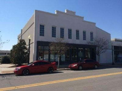
On South Palafox Street, 0.1 miles south of Main Street, on the right when traveling south.
This building was erected in 1896 and rented to numerous businesses until the 1950s. One of the most significant tenants in the early 1900s was Samuel Charles, one of Pensacola's most prominent black businessmen, whose shoe repair shop became . . . — — Map (db m72239) HM
On Perdido Key Drive, on the right when traveling east.
Site of the floor safe of the original Flora-Bama, built in 1964,
by Theodore "Ted” Tampary, who, with his wife Ellen, had the
foresight to establish the iconic watering hole on the state line
after Florida traded two miles of pristine white . . . — — Map (db m134214) HM
On State Road 100, 0.1 miles east of U.S. 1, on the left when traveling east.
The Holden House was designed and built in 1918 by Sam Bortree (1859–1918) as a gift for his daughter, Ethel (1892–1977), and son-in-law, Thomas Holden (1892–1974). Holden was the town pharmacist and prominent in business, civic . . . — — Map (db m72918) HM
Near Briarwood Drive, 0.1 miles west of Old Brick Road, on the right when traveling west.
Welcome to the former homestead of Isaac I. Moody, Jr. one of four founding fathers of Flagler County. As the county's first major real estate developer and banker, the first politician of note and the prime mover in the development of the "Old . . . — — Map (db m220426) HM
Near Old Kings Road South, 0.3 miles south of Audubon Road, on the left when traveling south.
The last step in producing sugar on my plantation involved getting it ready to ship north to market. Once the molasses drained from the hogsheads in the curing room, slaves transferred both the sugar and the molasses to this loading area between . . . — — Map (db m234835) HM
Near Bulow Plantation Ruins, 1 mile east of Old Kings Road.
When the Bulow Plantation was active, these boat slips harbored both work and pleasure crafts. The slips have, fortunately, survived time because John Bulow reinforced the embankments with ale and wine bottles which were discarded from house . . . — — Map (db m191598) HM
Near Old Kings Road (County Road 2001) at Old Beach Road, on the right when traveling north.
This was the largest sugar mill in Florida. It was operated by Charles William Bulow and John Joachim Bulow from 1820 until it was burned by the Seminoles in 1836.
Sugar cane was planted in January and February and was ready for harvesting by . . . — — Map (db m100525) HM
Near Old Kings Road South, 0.2 miles north of Plantation Oaks Boulevard, on the right when traveling north.
Running a successful sugar plantation like mine required a lot of energy. Before the 1800s, sugar mills were largely operated by animal power. Horses or oxen turned the gears that moved the large rollers used to crush cane. By the time I built . . . — — Map (db m234825) HM
Near Bulow Plantation Ruins, 1 mile east of Old Kings Road.
Vats and drying racks were used for the production of indigo. The vats were large, holding up to two thousand gallons of liquid. The stems and leaves were cut and laid in the larger vat. The stems were covered with a urine and water mix and left to . . . — — Map (db m191593) HM
Near Old Kings Road South, 0.2 miles north of Plantation Oaks Boulevard, on the right when traveling north.
After granulating and cooling in the sugar house, my sugar was still not ready to ship out. Although it was granulated, the sugar was still wet with molasses. Slaves scored and spaded this cooled sugar into hogsheads, or large barrels, located . . . — — Map (db m234827) HM
On Old State Road A1A, 0.5 miles west of N Oceanshore Boulevard, on the left when traveling south.
Owen and Louise Young retained several staff members to tend the gardens, orchards, buildings and farm animals. No employee was more devoted to Mr. and Mrs. Young than Francisco Lopez, who served as the Young’s cook, chauffeur and groundskeeper . . . — — Map (db m144839) HM
Near Waterfront Park Road, 0.8 miles north of Colbert Lane, on the left when traveling north.
Welcome to the
Intracoastal Waterway
One of the most popular features of Waterfront Park is the body of water that winds along the paved paths. This waterway is part of a massive marine highway, known as the Intracoastal Waterway. It is . . . — — Map (db m239834) HM
On Colbert Lane south of Harbor View Drive (Road 100), on the left when traveling north.
Due to an unprecedented construction boom after World War II, Lehigh Portland Cement Company expanded its Allentown, Pennsylvania operation. To curtail the cement shortage they opened new plants across the United States, Bunnell, Florida being . . . — — Map (db m101651) HM
Near Colbert Lane, 0.1 miles north of Harbor View Drive, on the left when traveling north.
Due to an unprecedented construction boom after World War II, Lehigh Portland Cement Company expanded its Allentown, Pennsylvania operation. To curtail the cement shortage they opened new plants across the United States, Bunnell, Florida being . . . — — Map (db m188863) HM
Near Old State Road A1A, 0.5 miles west of North Oceanshore Boulevard, on the left when traveling south.
This log building was erected in the 1940s to serve as Owen D. Young’s office. The original three room log cabin was constructed from a Northern manufacturer’s prefabricated kit. The large office room is dominated by a coquina rock fireplace and . . . — — Map (db m144834) HM
Near North Oceanshore Boulevard, 0.3 miles west of State Road A1A.
In the 1920s the automobile revolutionized the American way of life. It transformed the nations economy and gave hard working Americans a way to explore beyond their local geography. Families were able to go on weekend vacations to places previously . . . — — Map (db m112211) HM
On Old State Road A1A, 0.5 miles west of North Oceanshore Boulevard, on the right when traveling south.
Citrus is one of Florida’s most revered symbols, but few people realize that St. Augustine was the birthplace of the nation’s citrus industry. Here at Washington Oaks, orange groves have been established since the late 1700s. The Youngs acquired . . . — — Map (db m144788) HM
On 6th Street at Avenue D, on the left when traveling south on 6th Street.
Dr. John Gorrie (1803-1855) was an early pioneer in the invention of the artificial manufacture of ice, refrigeration, and air conditioning. He was granted the first U.S. patent for mechanical refrigeration on May 6, 1851 (U.S. Patent No. 8080). Dr. . . . — — Map (db m27028) HM
On Water Street, 0.1 miles north of Avenue D, on the right when traveling north.
(side 1)
History records the first shipment of cotton to leave this Port, arrived New York, 1822.
Beginning 1836, forty-three, three-storied brick, Cotton Warehouses and Brokerages lined Apalachicola's water front. Their granite-columned . . . — — Map (db m101141) HM
On Northwest Avenue A (U.S. 98/319) at Tallahassee Street, on the right when traveling west on Northwest Avenue A.
The Carabelle Town Center was once part of the Franklin Lumber Company mill site owned by James Coombs, which operated along the north shore of the Carrabelle River from 1875 to 1928. Ships came from around the world seeking cypress timber, . . . — — Map (db m190602) HM
On Avenue B South (Business U.S. 98) east of Marine Street, on the right when traveling west.
Marvin N. Justiss was born November 16, 1898. He married Thelma Massey in Pensacola, Florida and moved to Carrabelle in 1929. They had one daughter, Virginia Justiss Sanborn. Marvin Justiss came to Carrabelle and began building both homes and . . . — — Map (db m121999) HM
Near Forest Road 127, 0.8 miles south of Fort Gadsden Road, on the left when traveling south.
In 1838 the steamship Irvington, carr[y]ing 200 bales of cotton on a downstream run, burned and sank four miles upstream from here. This 115 foot side-wheeler was constructed in 1836 in Marion, Indiana. These boilers and parts were dredged from the . . . — — Map (db m114622) HM
On River Landing Road, 0.4 miles south of U.S. 90, on the right when traveling south.
The wooden wrecks visible along the shoreline here are all that remain of once luxurious paddlewheel steamboats that plied the Apalachicola River from 1820s to the 1930s.
Marine archaeologists documented a large number of these vessels between . . . — — Map (db m230791) HM
On River Landing Road, 0.4 miles south of U.S. 90, on the right when traveling south.
The Apalachicola River flows 107 miles from its source at the Jim Woodruff Dam to its mouth at Apalachicola Bay.
A vital ecological and water resource, it has a long history as a waterway for commercial, military, and recreational use. It is . . . — — Map (db m231584) HM
On East Jefferson Street (U.S. 90) just east of North Adams Street, on the left when traveling east.
Gadsden, Florida's fifth county, was formed in 1823. It once ran from Georgia to the Gulf of Mexico, from the Suwannee River to the Apalachicola River. Quincy, the county seat, was incorporated in 1828. Previously known as Middle Florida, the new . . . — — Map (db m29677) HM
On East Washington Street at North Adams Street (State Road 267), on the right when traveling west on East Washington Street.
Pioneer commercial banking house in Gadsden County, E.P. Dismukes, President, opened 20 August 1889, under State Charter No. 1, issued twelve days earlier under the Act creating a State Banking System; original capital, $60,000. Became strong . . . — — Map (db m79488) HM
On North Main Street (U.S. 129) south of Northwest 5th Avenue, on the right when traveling south.
The Coca Cola bottling plant is located next to the Crystal Ice House and the old railway depot in the heart of historic downtown Trenton. It was originally built by Mr. J. F. Haigler in 1925. In 1956 the Florida Coca-Cola Company of Daytona Beach . . . — — Map (db m126397) HM
On Northwest 4th Avenue east of Northwest 1st Street, on the left when traveling east.
Originally the old Crystal Ice and Cold Storage Building was built by Clyde Townsend's father in 1925, before being bought by “J.F.” Haigler, owner of the Coca Cola franchise in Trenton. During many a day, Mr. Haigler would sit in a . . . — — Map (db m126400) HM
On Riverside Drive SW at Avenue J SW, on the right when traveling north on Riverside Drive SW.
Shortly after Florida became a state in 1845, its leaders began to consider draining the swampy areas of south Florida to create prime farmland as an inducement to settlement. In 1850 Florida received title to all swamp and overflowed lands within . . . — — Map (db m16414) HM
On Cape San Blas Road, 1.1 miles west of State Road 30A, on the right when traveling west.
A major Confederate saltworks, with daily capacity of 150 bushels, before completion, was located 200 feet north. Brick foundations were salvaged from ruins of the old City of St. Joseph. Salt processed by evaporation of seawater was one of . . . — — Map (db m27029) HM
On Spring Street (U.S. 41) east of Bridge Street, on the left when traveling east.
Native Americans grew crops for their own consumption for
generations before white settlers immigrated here in the 1830s
seeking farmland, fortunes, and homesteads.
Farmers found the soil rich and the climate favorable for
growing the famous . . . — — Map (db m146344) HM
On Bridge Street (State Road 29) at Park Avenue, on the right when traveling north on Bridge Street.
In 1895, prominent landowner and cattleman Captain Francis A. Hendry (1833-1917) platted a townsite at LaBelle, which was first settled as a center for cattle and citrus industries. A post office, general store, school, and a church were . . . — — Map (db m72614) HM
On Russell Street, 0.1 miles west of South Brooksville Avenue, on the right when traveling east.
Side 1
In 1885, Brooksville had a population of 500. Residents depended on horse-drawn wagons and stagecoaches to transport goods and passengers to the outside world. Four innovative businessmen formed the Brooksville Railroad Association and . . . — — Map (db m206334) HM
On Russell Street just west of South Brooksville Avenue, on the left when traveling west.
This historic sidewalk, dated January 6, 1914, was taken from the corner of Howell Ave and Olive Street in Brooksville, Fl. The sidewalks were raised to accommodate the entry and exit into horse drawn carriages, allowing passengers to be raised from . . . — — Map (db m169200) HM
On Commercial Way (U.S. 19) 0.1 miles north of Centralia Road (County Road 476), on the right when traveling north.
Side 1:
This site was once the location of one of Florida's largest lumber mills. As demand for insect and rot resistant cypress increased, the J.C. Turner Lumber Company began the logging of over 15,000 acres of Red Tidewater Cypress, . . . — — Map (db m110443) HM
On East Main Street (Florida Route 17) east of South Lake Avenue, on the right when traveling east.
This is the oldest structure on Main Street still retaining most of it's original features. Built in 1894, it has served as a shoe shop, Dressmaker's shop, Tea Room, Book Store, Art Studio, and an Attorney's Office. The architecture present is . . . — — Map (db m218007) HM
Built by Sebring Real Estate Company 1923 2nd floor served as first Highlands County Courthouse from 1923 to 1927 This property has been placed on the National Register of Historic Places — — Map (db m218113) HM
On North Ridgewood Drive (Florida Route 17) at North Mango Street, on the left when traveling north on North Ridgewood Drive.
Highlands County is a subtropical paradise where George Sebring founded a new town in 1912. In 1923 Mr. Sebring welcomed Mike and Sadie Kahn & a strong friendship formed. They opened a store on Ridgewood Drive & Mr. Sebring gave Mike a lot for a . . . — — Map (db m157299) HM
Now the Greater Sebring Chamber of Commerce Built in 1916 through a community effort This property has been placed on the National Register of Historic Places — — Map (db m218667) HM
Near Cottage Drive south of Main Drive, on the left when traveling south.
These buildings were designed and built during 1930-1935 by Alexander Blair for the Red Hill Estate of John A. Roebling II, son of Washington A. Roebling, who built the Brooklyn Bridge. The industrial vernacular buildings (structures meant to house . . . — — Map (db m72522) HM
On Brandon Boulevard (State Road 60), on the right when traveling east.
In 1876 James H. Brandon, son of town
founder John Brandon and wife Martha,
built this large two-story frame home for
his wife Johanna and their seven
children. They loved entertaining guests
in their Folk Victorian southern mansion.
. . . — — Map (db m27201) HM
On South Oregon Avenue at West Swann Avenue., on the left when traveling south on South Oregon Avenue.
Alfred Reuben Swann was born and raised in Tennessee. After wintering in Tampa, he foresaw a bright future for the community. In 1905, he began living in Tampa much of the year and became a major figure in the city's residential and commercial . . . — — Map (db m69882) HM
On East 8th Avenue at North 18th Street, on the left when traveling east on East 8th Avenue.
Civic leader and historian, Tony Pizzo, was born in the family home at this location on September 22, 1912. Tony's pride in his community inspired him to research and document history that would have been lost without his efforts. His enthusiasm . . . — — Map (db m33055) HM
This structure has been
recorded by the
Historic American
Buildings Survey
of the United States Department
of the Interior for its Archives
at the Library of Congress — — Map (db m30453) HM
On North Howard Avenue at West Gray Street, on the left when traveling north on North Howard Avenue.
Benjamin Field
In 1896, this land was gifted to the City of West Tampa as a public park by George N. Benjamin, a prominent entrepreneur & early West Tampa leader. The park was built & 2 year later it was used by Theodore Roosevelt & the . . . — — Map (db m136019) HM
On Jackson Street (U.S. 41) near North Franklin Street, on the right.
On this site, after the devasting hurricane of 1848, McKay, a native of Scotland, built his first permanent home of finished lumber from Mobile, Ala. Here, with his wife Matilda,they raised their children. McKay was a dominant factor in the . . . — — Map (db m27265) HM
On North Orange Avenue at East Harrison Street, on the right when traveling north on North Orange Avenue.
From the late 19th century until the mid 1970s, Central Avenue was the principal business and entertainment district of Tampa's African American community. In 1974, Urban Redevelopment razed all but a few of the buildings and converted the area . . . — — Map (db m94179) HM
Near North Howard Avenue north of West Cherry Street, on the left when traveling north.
Centro Español de West Tampa has been placed on the National Register of Historic Places by the United States Department of the Interior 1974 — — Map (db m47463) HM
Near South Harbour Island Boulevard, on the right when traveling south. Reported missing.
"Knight's Point" is dedicated in memory of Charley Knight, a native Tampan, well-known property appraiser and prominent collector of Native-American artifacts. Knight always had a keen interest in and fond feelings for the 177-acre tract of . . . — — Map (db m216411) HM
On East 9th Avenue at North 14th Street, on the right when traveling west on East 9th Avenue.
This building, constructed in 1895, was among the first brick structures in Ybor City. It originally housed the Cherokee Club (known briefly as the Osceola Club), one of the earliest social clubs in Tampa. Cherokee Club members included Edward . . . — — Map (db m176195) HM
On East 7th Avenue near North 22nd Street, on the right when traveling east.
The Columbia is the oldest and largest Spanish restaurant in the United States. It was opened as a cafe for cigarmakers by Casimiro Hernandez, Sr. When he died in 1930 his son Casimiro Hernandez, Jr. then brought it to its present glory.
The . . . — — Map (db m213639) HM
On East Columbus Drive at North 13th Street on East Columbus Drive.
In 2003, this historic Ybor City boarding house was relocated from 1822 E. 14th Avenue and rehabilitated as part of a project by the Federal Highway Administration and the Florida Department of Transportation incooperation with the City of Tampa. — — Map (db m44029) HM
On North Avenida República de Cuba (14th Street) near East 9th Avenue, on the left when traveling north.
In 1886 two cigar factories were completed
at Tampa signaling the founding of the
industry in the area. Pioneer manufacturer
was Vincente Martinez Ybor, a native of
Spain, who had made cigars at Havana and
Key West. Ybor's move to Tampa was . . . — — Map (db m31704) HM
On East 7th Avenue at North 33rd Street, on the right when traveling east on East 7th Avenue.
The name Gary was officially recognized with the establishment of the Gary post office in 1898. The official plat of "Gary-Town" was recorded in May 1903. The Gary neighborhood included both Gary-Town and Spanish Park, located to its east. The . . . — — Map (db m33926) HM
On West Main Street, 0.1 miles west of North Renfrew Avenue, on the left when traveling east.
The grateful citizenry of Tampa dedicated this roadway to the memory of George Guida for his commitment to improving the quality of life for all. A business and civic leader, banker and builder of many of our public service buildings, such as Jesuit . . . — — Map (db m214928) HM
On North Nebraska Avenue at East 11th Avenue, on the right when traveling north on North Nebraska Avenue.
Organized in 1901, the German-American Club was one of the few non-latin ethnic clubs in Tampa. Club members laid the cornerstone for a building on the northeast corner of Nebraska Avenue and 11th Avenue on February 23, 1908, followed by a . . . — — Map (db m32372) HM
Near Tampa General Circle north of Columbia Drive.
Gordon Keller was a beloved citizen of Tampa -- City official, merchant, civic leader, friend -- from 1883 until his death, July 10, 1909. A grief-stricken community subscribed funds to build "a permanent monument" to him, and Gordon Keller Memorial . . . — — Map (db m69977) HM
Near USF Alumni Drive, 0.1 miles west of Leroy Collins Boulevard, on the left when traveling west.
Harvey Firestone
1868 - 1938
Fort Myers
Founder of Firestone Tire and Rubber Company whose pioneering innovations revolutionized the commercial rubber industry, and who advanced scientific research in Florida and co-founded the . . . — — Map (db m246192) HM
On North 17th Street north of East 5th Avenue, on the right when traveling north.
Emilio Pons, a pioneer Tampa cigar manufacturer, and an outstanding public servant, established the first cigar factory of local origin on this site in 1887.
Here on October 12, 1894, Jose Marti, the Cuban liberator, delivered his last . . . — — Map (db m32828) HM
On North 15th Street near East 7th Avenue, on the right when traveling north.
During the fabulous pioneer days of Ybor City the famed Hotel De La Havana was located on this corner. The three story frame structure was the first hotel erected in the Latin Quarter. Its proprietors were Jose Rubin and Jacinto Olavarria. . . . — — Map (db m8775) HM
On North MacDill Avenue at West Main Street, on the right when traveling south on North MacDill Avenue.
His was a life of achievements – a great lawyer, pioneer land developer, public servant and a Tampa booster. Had the honor of serving as State's Attorney, Tampa City Attorney, Port Commissioner, and Supt. of Public Works. In 1892, converted 200 . . . — — Map (db m49593) HM
On North Ashley Drive north of East Whiting Street, on the left when traveling north.
On July 14, 1939, the Tampa Morning Tribune announced the war department's decision to build the "Southeast Air Base" in Tampa. The land selected was a 6000 acre marshy area known as Catfish Point. As part of President Roosevelt's New Deal Program, . . . — — Map (db m34118) HM
Near USF Alumni Drive, 0.1 miles west of Leroy Collins Boulevard, on the left when traveling west.
Israel J. Morejon
Tampa
Created innovative solutions across multiple industries, most notably state-of-the-art LED lighting technologies, nano projectors, wireless modem technology, optical tomography for cancer detection systems, . . . — — Map (db m246227) HM
On West Platt Street at South Magnolia Avenue, on the right when traveling east on West Platt Street.
In 1913, Jessamine Link established Magnolia Troop One, the second Girl Scout Troop in the United States. This was just one year after Juliette Gordon Low organized the country's first Girl Scout troop in Savannah, Georgia in 1912. What is now Hyde . . . — — Map (db m101550) HM
Desde esta escalinata
En el año 1893
José Martí
Apóstol de la Libertad
de Cuba
Con elocuentes palabras
pidió a los tabaqueros
Cubanos emigrados que le
ayudasen a conquistar la
independencia de su país,
aportando hombres, . . . — — Map (db m14431) HM
On E. 9th Avenue near N. 19th Street, on the right when traveling west.
Francisco Ferlita, a native of Santo Stefano, Sicily, established a bakery on this site in 1896. Bread sold for three cents and five cents, and often on credit. In 1922 the wooden structure was destroyed by fire, and a yellow brick building was . . . — — Map (db m8703) HM
Near USF Alumni Drive, 0.1 miles north of Leroy Collins Boulevard, on the left when traveling west.
Michael J. DeLuca
1956 -
Boca Raton
Electrical Engineer, IP attorney, and prolific inventor for his groundbreaking "voltage scaling" technology that significantly improves the battery life of portable computerized devices as well as . . . — — Map (db m246485) HM
On East 7th Avenue (County Road 574) at North 16th Street, on the right when traveling west on East 7th Avenue.
Molly Ferrara, nee Antinori, daughter of Sicilian immigrants, was a native of Ybor City. In 1954, she was elected Alcaldesa of Ybor City, the only woman to hold this distinction. One of the Tampa's few successful businesswomen during her time, she . . . — — Map (db m151027) HM
On North Howard Avenue north of West St. Louis Street, on the left when traveling north.
In 1907 William T. Morgan erected this three story cigar factory and soon his Juan De Fuca label attained wide acceptance throughout the country. By 1910, the company had to move to larger quarters to accommodate 1,000 workers. After Morgan . . . — — Map (db m47247) HM
On University Drive east of North Brevard Street, on the left when traveling west.
Built circa 1855 by Gen. Jesse Carter for his daughter Josephine. He employed Mrs. Louisa Porter as teacher. The first class included Josephine Carter, Janie Givens, Mary Lesley, Mary Kelly, Eugenia Spencer, Lizzie Spencer and Hayden Porter. Jessie . . . — — Map (db m33902) HM
On East Kennedy Boulevard (U.S. 41) near East Street, on the right when traveling west.
Erected in 1859, as a residence, by Capt. William Brinton Hooker, on the northwest corner of Madison and East Streets. A Georgia native, he moved to Florida in 1830 and signed its first Constitution in 1839. In 1843 Hooker settled in Hillsborough . . . — — Map (db m28332) HM
Near USF Alumni Drive, 0.1 miles west of Leroy Collins Boulevard, on the left when traveling west.
Robert Cade
1927 - 2007
Gainesville
University of Florida professor, scientist, physician, musician and inventor who led the team that invented the hydrating sports drink Gatorade, protecting countless amateur and professional . . . — — Map (db m246486) HM
Near USF Alumni Drive, 0.1 miles west of Leroy Collins Boulevard, on the left when traveling west.
Sara Blakely
Clearwater
Tampa Bay native and graduate of Florida State University for inventing the renowned undergarment SPANX® and building a billion dollar enterprise that has influenced fashion worldwide
September . . . — — Map (db m246287) HM
Near USF Alumni Drive, 0.1 miles west of Leroy Collins Boulevard, on the left when traveling west.
Shin-Tyson Wu
1953 -
Boca Raton
University of Central Florida professor whose contributions to liquid crystal research and the resulting patent portfolio for next-generation liquid crystal displays, adaptive optics, laser beam . . . — — Map (db m246447) HM
On East 7th Avenue (State Road 45), on the right when traveling west.
When local segregation forced the withdrawal
of Afro-Cubans from El Club Nacional Cubano,
an organization of black and white Cubans
involved in Cuban independence, Afro-Cuban
cigarmakers founded a society in 1900 as Los
Libres Pensadores de . . . — — Map (db m31708) HM
On West Bay Street near South Magnolia Street, on the right when traveling east.
At this site on a small stream was located the first settlement of Tampa Bay. Its inhabitants were Spanish-Cuban fishermen and straw-hat makers. It is believed they settled here toward the end of the eighteenth century, during Spain's second rule . . . — — Map (db m69853) HM
On West Kennedy Boulevard near University Drive, on the right when traveling west.
Henry B. Plant built this ornate Moorish structure at a cost of $3 million. Opened in 1891, it became the social and cultural center of early Tampa. During the Spanish American War it was headquarters for troops going to Cuba and housed such . . . — — Map (db m20020) HM
Near West Cypress Street, 0.5 miles west of North Reo Street, on the left when traveling west. Reported missing.
Salt was an essential commodity during the Civil War because it was required for the preservation of meat and fish. When the Confederate states no longer had access to vital sources of salt in West Virginia and Louisiana, southerners compensated . . . — — Map (db m214934) HM
On 601 Nebraska Ave (State Road 45) near E. Zack Street, on the left when traveling south.
By 1902, the Seaboard Air Line (SAL) was formed and the Atlantic Coast Line (ACL) had taken over the rail system of Henry B. Plant. Tampa Union Station (TUS) built in 1912, was designed by architect J.F. Leitner in Italian Renaissance style, and . . . — — Map (db m4653) HM
On E. 7th Avenue, on the right when traveling west. Reported permanently removed.
Las Novedades was founded on this site when Ybor City was a tiny village. Its proprietor was Manuel (Canuto) Menendez. The coffee shop was a favorite rendezvous for the pioneer cigarmakers of Sanchez y Haya Cigar Factory located across the . . . — — Map (db m152237) HM
On North Franklin Street near East Zack Street, on the left when traveling north.
In 1899, Colonel Peter O. Knight created Tampa Electric Company to serve the energy needs
of a growing Tampa community. Some 28 employees served 1200 customers with electricity from the region's first power plant, one powered by the water of the . . . — — Map (db m15750) HM
On North Habana Avenue at West Kathleen Street, on the left when traveling north on North Habana Avenue.
In 1908 John Drew built this cigar factory for Andres Diaz and company of New York. One of the most modern of its day, it produced fine Havana cigars under the labels Terreno, Flor de A. Diaz and La Flor de Scott. West Tampa was . . . — — Map (db m47001) HM
Near U.S. 301, 0.2 miles south of East Dr. Martin Luther King Jr. Boulevard, on the right when traveling south.
The Barbary States were a collection of North African states, many of which practiced state-supported piracy in order to exact tribute from weaker Atlantic power Morocco was an independent kingdom, Algiers, Tunis, and Tripoli owed a loose . . . — — Map (db m194012) HM WM
On North Howard Avenue at West Union Street, on the left when traveling north on North Howard Avenue.
A cigar factory built on this site in June 1892 by Hugh C. Macfarlane brought the first industry to the community of West Tampa. First operated by A. Del Pino and Company, it failed financially. In 1894 the O'Halloran Cigar Company occupied the . . . — — Map (db m46945) HM
Near U.S. 301, 0.2 miles south of East Dr. Martin Luther King Jr. Boulevard, on the right when traveling south.
During the multinational occupation of post-World War Il Germany, the Soviet Union blocked the Western Allies’
railway, road and canal access to the sectors of Berlin under Allied control. Their aim was to force the western powers to allow the . . . — — Map (db m194108) HM WM
On North 15th Street near East 7th Avenue (State Road 574), on the left when traveling north.
In Oct. 1885, John T. Lesley sold to V. Martinez Ybor & Co. the first tract of land on which was built the original Ybor City. Purchased for $9,000 cash, Tampa citizens underwrote $4,000 of this amount to the new owners in pledged land and notes. . . . — — Map (db m8662) HM
On 9th Avenue near 14th Street. Reported permanently removed.
The second brick building erected in Ybor City. The Cherokee Club was a popular rendezvous for the elite in the 1890's. Later became known as El Pasaje Restaurant. Its fame spread throughout the Americas.
Jose Marti slept here on his first . . . — — Map (db m152236) HM
On East 7th Avenue near North 21st Street, on the right when traveling west.
With the advent of the cigar industry in 1886,
the Italians were attracted in mass to the environs
of Ybor City. They found employment in cigar
factories, the building of the Tampa Bay Hotel,
the construction of railroads, and farming. . . . — — Map (db m8780) HM
Pam loved all aspects of nature and had a special feeling for these wetlands. She spearheaded a community effort to prevent this site from becoming yet another dense development. She fought for almost 3 years and never gave up. Despite difficult . . . — — Map (db m13647) HM
On East 7th Avenue, on the right when traveling west.
Born in Valencia, Spain on September 7, 1818 and died in Ybor City on December 14, 1896 and buried at Oaklawn Cemetery in downtown Tampa.
In 1853 at an early age the adventurous Spaniard left his native land and traveled to Cuba which was . . . — — Map (db m171087) HM
On West Columbus Drive east of North MacDill Avenue, on the right when traveling west. Reported missing.
Hugh C. MacFarlane, an immigrant from Scotland, purchased land in November 1886 and built a cigar factory that started production on June 15, 1892. MacFarlane and other developers offered free land and buildings, bringing in more cigar factories and . . . — — Map (db m214929) HM
On Henderson Boulevard (State Road 685) at South Bradford Avenue, on the left when traveling south on Henderson Boulevard.
William Benton Henderson was a leading figure in the development of Tampa and Hillsborough County in the late 19th and early 20th centuries. A Georgia native, Henderson arrived in Tampa in 1847 and served as a lieutenant in the Confederate army. . . . — — Map (db m132918) HM
On Jackson Street (U.S. 41) near North Franklin Street, on the right when traveling east.
William F. Poe Plaza is named in honor of William F. Poe, Sr. in recognition of the many significant improvements he initiated in downtown Tampa during his five years of service as Mayor of Tampa from October 1974 to October 1979.
For many . . . — — Map (db m34188) HM
On June 12, 1986, the Tampa City Council passed Ordinance No. 9297-a
naming this park:
“Ybor Centennial Park By Which Name It Shall Hereafter And Forever Be Known.”
Signed: Bob Martinez, Mayor; Sandra W. Freedman. . . . — — Map (db m8750) HM
903 entries matched your criteria. Entries 201 through 300 are listed above. ⊲ Previous 100 — Next 100 ⊳