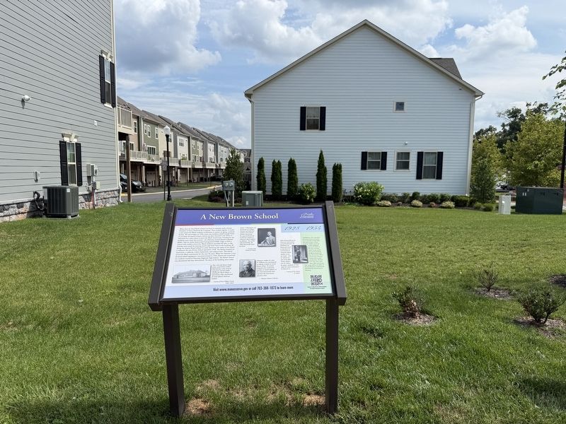
On Prince William Street east of Jefferson Street, on the right when traveling east.
What does the local Black community have in common with a former President of Sears, Roebuck & Company? They worked together to build a new school for Black students in Manassas to replace an aging, outdated facility. The story began in 1926, . . . — — Map (db m305520) HM
On West Street just south of Center Street (Virginia Route 28), on the left when traveling south.
The railroad that brought such destruction to Manassas became the catalyst for its recovery. Returning residents and new arrivals built hotels, factories and businesses along the rail line. Trains exported local products to regional markets. As . . . — — Map (db m143055) HM
On Center Street (Virginia Route 28) just east of Peabody Street, on the right when traveling east.
After the Civil War, Manassas was segregated by race in all facets of life. Navigating the restrictions of the law and social customs, local Black residents, many of them newly freed from slavery, established their own businesses. When enslaved, . . . — — Map (db m214263) HM
On Battle Street north of Quarry Road, on the left when traveling north.
Although early Manassas residents knew Albert Speiden as a church deacon, Town Council member, the first resident of the Manassas Volunteer Fire Company, and a devoted husband and father, he was also a renowned architect who designed hundreds of . . . — — Map (db m305501) HM
Near Battery Heights Boulevard south of Quarry Road when traveling south.
On the morning of August 27, 1862 Mayfield Fort saw its only action of the Civil War. After marching 56 miles in 48 hours, General Thomas "Stonewall" Jackson, with the entire left wing of the Army of Northern Virginia, gained the rear of John . . . — — Map (db m213682) HM
Near Battery Heights Boulevard south of Quarry Road, on the right when traveling north.
Rumors of Confederates at Manassas filtered north towards Alexandria, causing worry in the Lincoln administration. The Federal Army of the Potomac, commanded by General George McClellan was away, encamped along the James River after a failed . . . — — Map (db m213683) HM
Near Battery Heights Boulevard south of Quarry Road, on the right when traveling north.
Turn around and look at the fort towering above you. Think about building something this big with heavy equipment, digging and moving all that dirt by hand, and doing so in just a matter of months. Now imagine a six-sided structure, totally . . . — — Map (db m213672) HM
Near Battery Heights Boulevard south of Quarry road, on the right when traveling north.
As thousands of men from across the South converged on Manassas Junction, it was evident to Confederate leaders in Richmond that this was where northern and southern forces would eventually oppose one another. Confederate President Davis ordered . . . — — Map (db m213675) HM
On Prince William Street at Main Street, on the right when traveling west on Prince William Street.
Manassas Junction was twice destroyed by fire in the Civil War and badly damaged by fires in 1905 and 1911. The Confederates burned their base here in March 1862 to avoid seizure by the Federals and Stonewall Jackson destroyed the Federal base in . . . — — Map (db m2456) HM
Near Battery Heights Boulevard south of Quarry Road, on the right when traveling north.
On April 17, 1861 the Virginia Secession Convention voted to leave the Union. While secession was not official until a statewide referendum in May, state leaders began to mobilize the military to defend critical areas of Virginia, including . . . — — Map (db m213673) HM
Near Battery Heights Boulevard south of Quarry Road, on the right when traveling north.
Bull Run Bridge was the first Civil War battle for the 2nd New York Heavy Artillery. On the morning of August 27th, 1862 the New Yorkers lost one soldier killed, six wounded, and 53 missing. One of the wounded was Adam Worth. Born in Germany, . . . — — Map (db m213685) HM
Near Dean Park Lane 0.4 miles west of Wellington Road, on the right when traveling west.
Watersheds are areas of land that drain into a particular body of water. Rain that falls within a watershed's boundaries flows to the lowest point. Eventually, all the rain water in the Chesapeake Bay watershed collects in the Bay.
On . . . — — Map (db m305510) HM
On Hendley Road south of Wellington Road, on the left when traveling south.
In 1770 Patrick Hamrick sold this land to Rutt Johnson who used the land for crops and fruit trees and later added livestock. This property became known as CLOVER HILL FARM prior to 1852. During the Civil War the Johnson family left the area. . . . — — Map (db m40212) HM
On Portner Avenue at Princeton Park Drive, on the right when traveling north on Portner Avenue.
The only visible clue we have about the existence of gardens at Liberia comes form a photograph of the house taken in March 1862. Daffodils blooming beside the front walk were natural ornaments that survived the destruction of the Civil War, and . . . — — Map (db m305725) HM
On Main Street, on the right when traveling south.
In this vicinity stood a number of small earthworks erected by the Confederates in the summer of 1861 to protect the railroad and their army’s base here. The Confederates evacuated Manassas in March, 1862, destroying what militarily useful material . . . — — Map (db m2470) HM
Near Portner Avenue at Princeton Park Drive, on the right when traveling north. Reported permanently removed.
Eliza and Phillip, Frances and Nathaniel, Susan and George. These and more than 70 others, their names lost to history, were enslaved to the Weir Family of Liberia. Decade after decade, two generations of men, women and children, regarded as . . . — — Map (db m173360) HM
Near Portner Avenue at Princeton Park Drive, on the right when traveling north.
Eliza and Phillip. Frances and Nathaniel. Susan and George. These and more than 80 others, their names lost to history, were enslaved to the Weir Family of Liberia. Decade after decade, two generations of men, women, and children, regarded as . . . — — Map (db m305726) HM
On Center Street (Route 28) just east of Peabody Street, on the left when traveling east.
First Baptist was the first church to exclusively serve the African American community in Manassas, establishing its roots when a group of men and women, only recently freed from slavery, met outdoors under a tree in the yard of a schoolhouse on . . . — — Map (db m214264) HM
On West Street just south of Center Street ( Route 28), on the left when traveling south. Reported permanently removed.
During the summer of 1862, Manassas Junction became a major supply hub for Union armies operating in Virginia, making it a target for the Confederates. On August 27, Confederate General Thomas J. "Stonewall" Jackson unleashed his 24,000 troops on . . . — — Map (db m143054) HM
On Battle Street north of Prince William Street, on the left when traveling north.
During the summer of 1862, Manassas Junction became a major supply hub for Union armies operating in Virginia, making it a target for the Confederates. On August 27, Confederate General Thomas J. "Stonewall" Jackson unleashed his 24,000 troops on . . . — — Map (db m305481) HM
On Wellington Road 0.1 miles south of Prince William Street, on the right when traveling south.
Despite being born into slavery in 1848 and without the benefit of a formal education, Jane "Jennie" Serepta Dean's vision changed the lives of countless area African Americans. While working as a domestic servant in Washington, she travelled home . . . — — Map (db m143088) HM
On Prince William Street just west of Wellington Road, on the left when traveling west.
Though little known outside of Manassas, Jennie Serepta Dean was a significant figure in the field of education during the waning years of the nineteenth century. Born enslaved in 1848 in Prince William County, Dean received only a basic . . . — — Map (db m217220) HM
On Quarry Road at Centerville Road ( Route 28), on the right when traveling east on Quarry Road. Reported permanently removed.
This structure reputedly is the oldest dwelling in Manassas. Part of the building is of log and is supposed to have been built before the Civil War. Most of the original houses of the hamlet of Tudor Hall—subsequently Manassas, were in the fields . . . — — Map (db m2415) HM
Near Portner Avenue just south of Princeton Park Drive, on the right when traveling north. Reported permanently removed.
Would you believe this house once occupied 2,000 acres of farmland and forest? Built in 1825 "Liberia" was the home of William and Harriet Weir. Because they lived far from settled areas — Brentsville, located five miles away, was the closest . . . — — Map (db m173362) HM
On Portner Avenue north of Diane Court, on the right when traveling north.
Currently situated on 18 acres, this house once occupied 2,000 acres of farmland and forest. Built in 1825, Liberia was the home of William and Harriet Weir. Because they lived far from settled areas — Brentsville, located five miles away, was . . . — — Map (db m305728) HM
On Portner Avenue north of Diane Court, on the left when traveling south.
What are these colorful boxes behind the fence? Do you hear the buzzing sound? You are looking at an apiary — a home for honey bees! These tiny insects do the hard work of pollinating plants. They are critical to creating a healthy landscape and . . . — — Map (db m305729) HM
On Liberty Street south of Prince William Street, on the left when traveling south.
Liberty Street. In the post-Civil War years, African-Americans who were bound by a strong sense of community settled near the Brown School and the Manassas Industrial School on what was then known as Liberty Avenue. As early as 1895, . . . — — Map (db m168231) HM
On Center Street (Virginia Route 28) at West Street on Center Street.
Loy E. Harris - The Man
Through the years, Manassas has prospered because "community minded" people saw opportunities to make our City a better place.
Loy E. Harris was one of these people. In the years before his death on August 17, . . . — — Map (db m143058) HM
On Mathis Avenue, on the right when traveling south.
Built by the Weir family in 1825, this Federal-style home is one of the few pre-Civil War dwellings that remains in the area. Once a prosperous 2,000-acre plantation, Liberia had a general store, a post office, and a school, and boasted a successful . . . — — Map (db m174912) HM
On Quarry Road at Zebedee Street, on the left when traveling east on Quarry Road.
The Kate Hooe House at 8920 Quarry Road is the only known building in the historic district believed to date from the pre-Civil War period, when Manassas was a small village at the junction of two railroad lines. This wood frame house contains a . . . — — Map (db m23798) HM
On Fairview Avenue at Center Street ( Highway 28), on the right when traveling south on Fairview Avenue.
In this vicinity stood the Civil War era Orange & Alexandria Railroad repair shops. Just east of Manassas City Hall stood the sidings and turntable of the railroad, used to reverse the direction of a train. When the Confederates evacuated the . . . — — Map (db m23825) HM
On Prescott Avenue at Quarry Road, on the right when traveling north on Prescott Avenue.
After the county seat moved to Manassas in 1892, and the Southern Railway continued to prosper, the area outside the core downtown and along the railroad track experienced a building boom. The new clapboard homes ranged in style from Italianate, . . . — — Map (db m23797) HM
On Maple Street, on the right when traveling west.
Prussian-born Robert Portner, Alexandria brewer and businessman, built Annaburg in 1892 as his show place summer home and escape from the city. It became the center of beauty and interest with 35 rooms, electricity, and reportedly, one of the first . . . — — Map (db m28356) HM
On Church Street (State Highway 28) at West Street, on the left when traveling west on Church Street. Reported permanently removed.
As Manassas grew and prospered in the late 19th and early 20th centuries, the historic district filled with prominent homes, churches, and commercial buildings. The town had two banks and two newspapers. Telephone service began in 1895. Albert . . . — — Map (db m23826) HM
On Prince William Street at Main Street, on the right when traveling west on Prince William Street. Reported permanently removed.
During the cold winter night of December 5, 1905, a smoldering fire began in Blossom's Alley across the tracks from the train depot. It soon raged through the young town of Manassas, destroying 35 homes, the post office, and business bordered by . . . — — Map (db m23773) HM
On Main Street at Center Street ( Highway 28), on the right when traveling south on Main Street.
When the Civil War ended, newcomers and residents rebuilt the burned and devastated landscape around this vital railroad junction. The resulting town of Manassas, incorporated in 1873, quickly became the transportation and commercial hub of Prince . . . — — Map (db m23828) HM
Near Prince William Street close to Wellington Road, on the left when traveling west. Reported permanently removed.
The Manassas Industrial School for Colored Youth, founded by Jennie Dean and chartered in 1893 as a private residential school for African-American children, provided academic and vocational training in a Christian setting. By 1909, students had . . . — — Map (db m143087) HM
Near Dean Park Lane 0.5 miles west of Wellington Road, on the left when traveling west.
Imagine the sounds and smells of cows, horses, and pigs filling the air and harvested crops overflowing from a large silo. If you were standing in this spot in 1910, that's exactly what you would have experienced. This site, today a public park . . . — — Map (db m305516) HM
On Prince William Street west of Wellington Road, on the left when traveling west.
The grounds on which you are standing were once a bustling school, with numerous classrooms and residential buildings, a dairy barn, orchard and farm, and other amenities meant to sustain and educated African-American students from all over . . . — — Map (db m213668) HM
On Battery Heights Boulevard south of Quarry Road, on the right when traveling north.
You are standing at the base of Mayfield Fort, one of twelve earthwork defenses constructed in this area by the Confederate Army. Built to protect the junction of the Orange and Alexandria and Manassas Gap Railroads, this fort is the only one . . . — — Map (db m213671) HM
On Prince William Street at Battle Street, on the right when traveling east on Prince William Street.
Eight months after their victory at the First Battle of Manassas (five miles north of here), the Confederates abandoned Manassas Junction, burning more than a million pounds of provisions and destroying the railroad line as they left. Days later, . . . — — Map (db m143053) HM
On Center Street (Virginia Route 28), on the left when traveling east.
Built circa 1907. Served as the main community center for Manassas until the mid 1930s. It later was used by the Manassas Journal newspaper. — — Map (db m2472) HM
On Main Street just south of Center Street ( Route 28), on the right when traveling south. Reported permanently removed.
The decades of post-war growth in Manassas were nearly lost in 1905 when a disastrous fire destroyed more than 30 homes and businesses. Undeterred, local residents rebuilt bigger and better, setting the town on the path for the city we know . . . — — Map (db m152427) HM
On Main Street south of Center Street ( Route 28), on the left when traveling north.
The decades of post-war growth in Manassas were nearly lost in 1905 when a disastrous fire destroyed more than 30 homes and businesses. Undeterred, local residents rebuilt bigger and better, setting the town on the path for the city we know . . . — — Map (db m305502) HM
Near Battery Heights Boulevard south of Quarry Road, on the right when traveling north.
Of the miles of fortifications constructed by the Confederate Army between 1861 and 1862, only a handful of sites survived development. Mayfield Fort is the oldest and most formidable of the former earthworks preserved today.
After the . . . — — Map (db m213686) HM
Near Battery Heights Boulevard south of Quarry Road, on the left when traveling south.
On July 16, 1861, the Union Army commanded by General Irvin McDowell began its march out of Washington, D.C. towards Bull Run. McDowell's mission was to dislodge or destroy General P.G.T. Beauregard's forces stationed here. On July 17, initial . . . — — Map (db m213676) HM
On Foster Drive 0.2 miles west of Dean Drive, on the right when traveling south.
Rose Hill Cemetery is tucked away in an industrial area today, but when it was established in 1887, this was a rural area on the outskirts of Manassas. Created at a time when local ordinance segregated burying grounds by race, this was one of the . . . — — Map (db m214241) HM
On West Street just south of Center Street ( Route 28), on the right when traveling south.
On of the railroad traditions of Manassas was that it was on the route of Southern Railway's Fast Mail train No. 97. The "Fast Mails" were a 19th century creation of the railroads and the U.S. Post Office Department to expedite long distance mail . . . — — Map (db m143057) HM
On Battle Street south of Center Street, on the right when traveling south. Reported permanently removed.
One mile west was the junction of the Orange and Alexandria and Manassas Gap Railroad lines. The point became known as Manassas Junction. During the Civil War both sides used the area as a supply base. The site of the first depot was probably about . . . — — Map (db m700) HM
On Prince William Street west of Wellington Road, on the left when traveling west.
The work to establish the Manassas Industrial School was supported by many well-known people. Their financial contributions and vocal support of the school were instrumental in helping Jennie Dean raise the funds needed to buy the land and . . . — — Map (db m213669) HM
On Liberty Street north of Grant Avenue ( Route 234), on the right when traveling north. Reported permanently removed.
The earliest story on record of educating local African American students began ca. 1869, when the Manassas Village Colored School opened on the corner of Liberty and Prince William Streets. This two-room frame structure was a private school, . . . — — Map (db m214238) HM
On Liberty Street south of Prince William Street, on the right when traveling south.
The earliest story on record of educating local Black students began ca. 1869, when the Manassas Village Colored School opened on the corner of Liberty and Prince William Streets. This two-room frame stucture was a private school, offering . . . — — Map (db m305491) HM
Near Battery Heights Boulevard south of Quarry Road, on the left when traveling south.
You are standing on land once owned by the Hooes, an established family of considerable wealth in 18th century Virginia. Robert Howson Hooe purchased "Mayfield," in 1779 and shaped it into a bustling farming operation before passing it along to . . . — — Map (db m213687) HM
Near Prince William Street 0.1 miles west of Wellington Road, on the left when traveling west. Reported permanently removed.
Welcome to Manassas Industrial School/Jennie Dean Memorial, part of The Manassas Museum System. This Memorial tells the story of an institution of learning that was unique in Northern Virginia and of the visionary African-American woman who . . . — — Map (db m143085) HM
On Wellington Road south of Prince William Street, on the right when traveling south. Reported permanently removed.
The point of the Manassas Industrial School for Colored Youth, as stated in its Chartered, was "ultimately and primarily to improve the moral and intellectual condition of the youth placed under its care and influence." This was accomplished . . . — — Map (db m213665) HM
On Prince William Street west of Wellington Road, on the left when traveling west. Reported permanently removed.
The Manassas Industrial School offered both academic and vocational training. Originally the standard course of study combined both elements for a general education. As facilities and resources grew, students were able to concentrate on . . . — — Map (db m213666) HM
On Prince William Street west of Wellington Road, on the left when traveling west. Reported permanently removed.
Educational Opportunities for African-Americans were severely limited in Virginia during the late 19th Century. While the doctrine of "separate but equal" facilities for blacks was supposedly law of the land, the reality was very different. . . . — — Map (db m213667) HM
Near Prince William Street west of Main Street, on the right when traveling east.
The Manassas Garden Club worked with Museum officials in 1990 to establish a garden at the new Museum. A wildflower garden trail was establisehd on either side of an original stone retaining wall (1921). Club members maintained the tail and . . . — — Map (db m305475) HM
On Center Street (Virginia Route 28) at East Street, on the right when traveling east on Center Street.
The right of citizens of the United States to vote shall not be denied or abridged by the United States or by any State on account of race, color, or previous condition of servitude.
— 15th Amendment of the United States . . . — — Map (db m213670) HM
On West Street just south of Center Street ( Route 28), on the right when traveling south. Reported permanently removed.
As the twentieth century dawned, an emerging town stood on what was once battle-scarred land. Incorporated in 1873, Manassas included churches, businesses, banks, newspapers, a small force of police and firemen, and hundreds of homes. The . . . — — Map (db m143056) HM
On West Street south of Center Street ( Route 28), on the left when traveling north.
As the twentieth century dawned, an emerging town stood on what was once battle-scarred land. Incorporated in 1873, Manassas included church, businesses, banks, newspapers, small police and fire departments, and hudnreds of homes. The influence . . . — — Map (db m305498) HM
On Portner Avenue at Princeton Park Drive, on the right when traveling north on Portner Avenue. Reported permanently removed.
The Randolph G. Corbin Turberville Memorial Garden was made possible with a generous gift from the late Ellen B. Turberville in memory of her son. Randy, as he was known, was a lawyer, Army veteran, and early supporter of the Manassas . . . — — Map (db m173353) HM
Near Prince William Street just west of Main Street, on the left when traveling west. Reported permanently removed.
In the early summer of 1861, preparations for war made Manassas Junction one of the most famous places on earth. The railway junction held great strategic significance for the Confederacy, and the new nation assembled its largest army to defend . . . — — Map (db m143060) HM
Near Prince William Street west of Main Street, on the right when traveling east.
In the early summer of 1861, preparations for war made Manassas Junction one of the most famous places on earth. The railway junction held great strategic significance for the Confederacy, and the new nation assembled its largest army to defend . . . — — Map (db m305478) HM
Near Portner Avenue just south of Breeden Avenue, on the left when traveling south.
We are often asked why this cemetery is so close to the house. The answer is simple — it's not the original site! The Weir cemetery was first located to the east, in what is now known as Point of Woods East/Lakeside. In 1989, with the . . . — — Map (db m173355) HM
Near Battery Heights Boulevard south of Quarry Road, on the right when traveling north.
On May 8, 1861 General Robert E. Lee, then commanding Virginia forces, ordered General Phillip Cocke to take units from across central and northern Virginia to build camps and begin training at Tudor Hall (Manassas Junction). Two important rail . . . — — Map (db m213674) HM