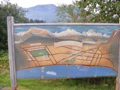
Fort Seward was the first permanent military base in Alaska. Completed in 1904 on 100 acres of land donated by the Presbyterian Church, it remained active until 1944. Named for William H. Seward, the U.S. Secretary of State who arranged the . . . — — Map (db m70810) HM
Commemorating the Founders
of
Port Chilkoot
World War II Veterans
and their families
who bought Fort Wm. H. Seward in 1947
and pioneered their futures here.
Steve Homer • Ted and Mimi Gregg • Carl and Betty Heinmiller • Marty and . . . — — Map (db m70803) HM WM
Near Cannery Road 2 miles north of Second Street, on the left when traveling north.
Keet stands as a reminder of legendary moments In Icy Strait Point's history. Breaching forward over Brown Bear Bay, He welcome fishermen home and world travelers to Hoonah, Alaska
Keet is a sentinel of tomorrow's bright future. A gift to Huna . . . — — Map (db m282803) HM
On Front Street at Marine Way, on the right on Front Street.
The willingness to sacrifice is the prelude to freedom. The Veterans Memorial Sea Walk, also known as the Sea Walk, is dedicated to Hoonah's veterans whose Soyal service during times of war and peace defines the character of this great nation and . . . — — Map (db m282525) WM
You are standing in a parking lot built in 1930.
The access road to the powerhouse site
provided the first public road to the glacier.
People drove over a trestle to reach the lot.
By 1937 a Glacier Highway Recreation Guide touted the . . . — — Map (db m282870) HM
On Glacier Spur Road, on the left when traveling north.
Cold air moving down the glacier’s surface pours into the lower Mendenhall Valley influencing the temperature and wind patterns. Temperatures here are generally 10 degrees cooler than 5 miles down the valley. People who live near the glacier . . . — — Map (db m310902) HM
On South Franklin Street, on the right when traveling north.
Alaska Centennial 1867-1967
Met in this building on March 3, 1913
Named President of the Senate was L.V. Ray of Seward, and named Speaker of the House was Earnest B. Collins of Fox.
State of Alaska
William A. Eagan, Governor . . . — — Map (db m288040) HM
On Glacier Spur Road 3 miles Second St., on the right when traveling north.
The Civilian Conservation Corps left a legacy of labor and public service.
This shelter represents a piece of the nation's past and attests to the historic popularity of this site. It represents work for the public good and
one of the most . . . — — Map (db m282994) HM
Near Glacier Spur Road, on the left when traveling north.
From this vantage point you can spot and identify many features unique to a glacial landscape. Although the glacier has been retreating, it has left many clues of its former movement and present power. BEACH with glacial rock deposits; Blue-gray . . . — — Map (db m310904) HM
On Franklin Street at Marine Way (Alaska Route 7), on the left when traveling north on Franklin Street.
She was a thirty-six year resident of
Juneau who contributed to its beauty
with her skilled gardening and talented
ikebana flower arrangements.
With a fond loving memory of her caring spirit,
her family & friends share the joy & beauty . . . — — Map (db m258044) HM
On Jacobsesen Drive 0.2 miles north of Mt Roberts Street, on the left when traveling north.
Welcome to
Juneau
Yak'éi haat yeey.aadí
"It is good that you all have come."
Alaska's capital is steeped in history, Native heritage, art, and natural beauty. Juneau has something for everyone. This place is the homeland of Tlingit . . . — — Map (db m308259) HM
The L’uknax.ádi, who are the Raven moiety, are identified as the Coho clan. The name derives from a salmon stream south of Klawock. They separated from the Gaanaxteidi clan after they migrated to the Chilkat area. The L’uknax. Ádi are also . . . — — Map (db m310840) HM
On Glacier Spur Road, on the left when traveling north.
Plunging from the slopes of Thunder Mountain, Steep Creek rapidly makes its way to the Mendenhall Valley. The last 2,300 feet of this stream’s short journey to Mendenhall Lake has evolved into important habitat for sockeye and coho salmon. Steep . . . — — Map (db m311387) HM
Near Glacier Spur Road, on the left when traveling north.
Looking out over the landscape to the west, vegetation is thriving on the raised moraine where the Moraine Ecology Trail is located. As you look down the valley, notice how the spruce/hemlock forest is starting to appear and life is returning to a . . . — — Map (db m310910) HM
On East Glacier Trail at Glacier Spur Road, on the left when traveling east on East Glacier Trail.
As you look out from this vista point notice the change in the forest patterns from right to left. Starting from the glacier, across the lake to the lake shore, the rocks and till are rather barren. Continuing your gaze to the left, small shrubs of . . . — — Map (db m310853) HM
On Auke Street, on the right when traveling south.
Meet one of Juneau's most loved and celebrated humpback whales.
Flame (SEAK ID 1538) was born in 2001. She winters off Maui, Hawaii, and
returns to Southeast Alaska each summer to feed. Flame is a local icon,
known for her loyalty to Juneau . . . — — Map (db m282867) HM
On 5th Street east of Franklin Street, on the left when traveling east.
In the turbulence of World War II, as Japan invaded the Aleutian Islands, Aleut Americans
were removed from their homes by the United States government and sent to isolated
internment camps in Southeast Alaska. Between June 1942 and August . . . — — Map (db m258026) HM
On Ferry Way at Marine Way (Alaska Route 7), on the right when traveling east on Ferry Way.
Originally, all gold was deposited within a lode or vein in the rock. Over time, these lodes eroded, resulting in loose placer gold.
A Lasting Legacy
The mines provided employment, as well as electrical power and fire protection, for . . . — — Map (db m258042) HM
On Marine Way (Alaska Route 7), on the right when traveling south.
This sculpture was commissioned by Sealaska Corporation. It was designed by Ray Peck and
welded by Larry Sommers. The Raven on the left and the Eagle on the right, are the two major
moieties of the Tlingit tribe, which inhabits southeast . . . — — Map (db m258071) HM
On Marine Way (Alaska Route 7), on the right when traveling south.
When a Tlingit leader, Kawa.ée (Kowee), in 1880 guided Joe Juneau and Richard Harris to gold deposits near here, the resulting gold rush put a new town on the map. Named for Joe Juneau, it was the first new settlement after Russia sold . . . — — Map (db m258043) HM
On 4th Street at Seward Street, on the left when traveling east on 4th Street.
Built in 1928 to house the Scottish Rite Temple, the Thomas B. Stewart Legislative Office Building was purchased by the City and Borough of Juneau in 2007 and deeded to the Legislative Council in 2007. The Legislative Affairs Agency, under the . . . — — Map (db m258028) HM
On Main Street north of 3rd Street, on the right when traveling north.
Celebrating the first 25 years of Alaska Statehood,
1959 - 1984
Summer is the bountiful time of easy living for brown bears in
Southeast Alaska, and they have arranged their lives to advantage,
stuffing themselves on greens, berries, . . . — — Map (db m258040) HM
On Main Street at West 4th Street, on the left when traveling north on Main Street.
Natives of Southeast Alaska have made totem poles such as this one for thousands of years.
This pole depicts four Haida clan stories. It was carved in 1940 by master carver John Wallace of Hydaburg. Described as "the last of the professional . . . — — Map (db m181736) HM
Alaska's first legislature met in 1913 in the Elks Lodge, on Franklin Street, just uphill from the distinctive arched facade of what was the historic Gastineau Hotel. The first law passed by the Territorial Legislature gave women the right to . . . — — Map (db m257938) HM
Two regional airlines founded here in the mid-1930's, eventually merged with Alaska Airlines. In that sense, they still serve Juneau today. Each began as a one-plane flying company.
Sheldon “Shell” Simmons' Alaska Air Transport Company was . . . — — Map (db m181843) HM
Dedicated to the men and women who have given
their lives to the Alaska commercial fishing industry.
The purpose of this Memorial is to demonstrate support for the
commercial fishing industry by individuals, families, and . . . — — Map (db m257928) HM
On Calhoun Avenue at Indian, on the left when traveling north on Calhoun Avenue.
A sum of $40,000 was authorized under the Public Building Act of 1910 and construction began in 1912. Governor Walter D. Clark held the first open house January 1, 1913.
State of Alaska
Governor Walter J. Hickel
Alaska Centennial . . . — — Map (db m181739) HM
Near South Franklin Street 0.5 miles north of Mr. Roberts Street.
At the Alaska Juneau mill from 1917-1944, ore was sorted, crushed, and treated to extract gold. Electric-powered engines hauled trains of 40 ore cars along the main haulage route from the mine two miles away in Silver Bow Basin to the AJ mill, . . . — — Map (db m42823) HM
On Whittier Way at West Willoughby Avenue when traveling south on Whittier Way.
Monument against east wall of house off Whittier Way:
This memorial is dedicated to all
Alaska Native Veterans,
Southeast who served in the
United States Armed Forces. Let us not dwell on their passing
but remember their . . . — — Map (db m69127) WM
On South Franklin Street, on the right when traveling north.
built September 16, 1913
has been placed on the
National Register
of Historic Places
by the United States
Department of the Interior — — Map (db m181762) HM
Aquileans is a series of sculptures for the Juneau Waterfront whose origins are found in the archetypes of the Alaskan landscape. Its main images reside within two ecological characters whose spirits have long guided the people of this . . . — — Map (db m257975) HM
Born: 17 March 1925 Juneau, Alaska.
Died: 22 May 1986 Ketchikan, Alaska
Sudong, Korea 2 November 1950-For conspicuous gallantry and intrepidity at the risk of his life above and beyond the call of duty as a platoon . . . — — Map (db m61871) WM
Because Juneau cannot be reached by road, the waterfront has always been Juneau's doorway to the outside world. Today travelers and freight continue to arrive at this waterfront by sea and air.
The first vessels on the Gastineau Channel were the . . . — — Map (db m181775) HM
On 3rd Street at Seward Street, on the right when traveling west on 3rd Street.
"I love this country and the ideals upon which it was founded…More than anything else, I care about the men and women who make up our military forces…I do not want to see them either kill or be killed in a war that is not moral or . . . — — Map (db m181757) HM
On Calhoun Avenue north of West 4th Street, on the left when traveling north.
Built by the Civilian Conservation Corps — 1935
Olaf Torkelson, Juneau Street Commissioner from 1924-1936, was instrumental in the success of this project. The overpass was built to provide safe access for children who attended Capital School . . . — — Map (db m181738) HM
The Cape Decision lighthouse was the last one built in Alaska. Need for it grew as ship traffic and the size of the ships increased. Southeast Alaska was booming with many salmon canneries, herring salteries and whale oil reduction plants. Large . . . — — Map (db m181646) HM
Perched high on a cliff, Cape Hinchinbrook lighthouse marks the entrance to the sheltered waters of Prince William Sound. The wreck of the steamer Oregon on Hinchinbrook Island in 1906 prompted the light's installation. Foul weather during . . . — — Map (db m181634) HM
Facing the open Gulf of Alaska, Cape Saint Elias lighthouse stands on Kayak Island, where in 1741, Russian voyagers first set foot on North American soil. The Cape's bald pinnacle serves as a key landmark in daylight. The light provides guidance at . . . — — Map (db m181632) HM
Scotch Cap and Cape Sarichef lighthouses mark the north and south entrances to Unimak Pass in the Aleutian Islands. Both sites were declared to be too isolated for family life.
Scotch Cap was the first light on Alaska's outside coast and is the . . . — — Map (db m181636) HM
Cape Spencer lighthouse stands on a barren, isolated rock at the entrance to Cross Sound, where the sheltered Inside Passage meets the open Gulf of Alaska. The original lighthouse still stands. It is a single-story, reinforced concrete building . . . — — Map (db m181631) HM
On Marine Way (Alaska Route 7) at Seward Street, on the right when traveling west on Marine Way.
[Totem pole effigies, top to bottom]
• EAGLE
• WOLF
• KILLER WHALE
• THUNDERBIRD
• BROWN BEAR
The Raven and Eagle totem poles honor the Raven and Eagle
clans that once were present among our Tlingit, Haida, and
Tsimshian . . . — — Map (db m258001) HM
Downtown Juneau has been bustling with commerce since the 1880s, well before the advent of the automobile. Hillside homes were linked by stairways and boardwalks, now named and maintained as city streets. Muddy summers and snowy winters prompted . . . — — Map (db m257955) HM
Near South Franklin Street 0.1 miles south of Peoples Wharf, on the right when traveling south.
"After a while, no matter where you work in the cycle,
you can't get away from the fish. Catch a five minute rest
on a heap of wet raingear, close your eyes, and you
see fish. Fish tails, fish eyes, fish guts, fish
you dream about . . . — — Map (db m282807) HM
The intersection of Front and Franklin streets is the heart of downtown Juneau. On the site where the Triangle Building now stands, the first prospectors camped through the winter of 1880-81, establishing local government and planning the Juneau . . . — — Map (db m257948) HM
The drug store on the corner was once the jewelry store of Emery Valentine. In addition to serving several terms as mayor and founding the Juneau Volunteer Fire Department, he built
the elegant Queen Anne structure that housed his store and . . . — — Map (db m257941) HM
The nearby Alaskan Hotel is the oldest operating hotel in Alaska. When its front doors swung open in 1913, the keys were attached to a balloon and sent skyward, symbolizing that the doors would always be open to guests. Structures uphill from it . . . — — Map (db m257940) HM
Eldred Rock is the oldest original lighthouse still standing in Alaska. It is a two-story building topped by a light tower. The ground floor was built of reinforced concrete, the first time that material was used for a lighthouse facing Alaska's . . . — — Map (db m181635) HM
Known as the "Fighter in Velvet Gloves" for her powerful but graceful and dignified speaking skills, Elizabeth Peratrovich's
continued efforts to eliminate discrimination in Alaska culminated in her powerful testimony before the 1945 . . . — — Map (db m257971) HM
Southeast Five Finger was the first name given this lighthouse site due to its location on the southeastern-most island of the Five Finger Islands group. The original, wood boathouse and carpenter shop remain.
A keeper thawing frozen water pipes . . . — — Map (db m181645) HM
The waterfront was the center of regional air transportation because float-planes were so well-suited for reaching the outlying places they served. There is little flat terrain in Southeast Alaska, and it was hard to find a place for a wheeled . . . — — Map (db m181803) HM
Although most materials needed by the historic mining industry came in downtown, one important commodity was off-loaded at the Dupont Dock, about 5 miles south of town. Dynamite was considered too much of a threat to deliver to the town's commercial . . . — — Map (db m181783) HM
Hard rock mining in Juneau yielded an ounce of gold for every 20 tons of ore.
On the mountainside above South Franklin [Street] are the ruins of the Alaska Juneau Gold Mining Company Mill where mining history was made. Instead of . . . — — Map (db m257936) HM
A square, white wooden tower housed the Guard Islands light, with a separate keeper's house nearby. When a reinforced concrete building replaced the old light tower in 1922, a second house was built so two keepers could live there with their . . . — — Map (db m181640) HM
Áak'w Village District
This area was known as Áak'w Indian Village
in the 1890s. No trip to Juneau would be
complete without sampling the world class
cultural offerings layered over the area.
Tlingit Spoken Here
This map . . . — — Map (db m257931) HM
[Totem pole effigies, top to bottom]
• CLAN MEMBER WITH HAT
• EAGLE
• FROG
• BEAVER
• BEAR
The Haida of Southeast Alaska, known as the Kaigani Haida,
migrated from Haida Gwaii in Canada to Southeast Alaska
in the late . . . — — Map (db m257960) HM
Near Marine Way near South Franklin Street, on the left when traveling west.
This bronze sculpture was commissioned by the city and borough of Juneau during its centennial anniversary year, and is dedicated to the mine whose work provided the lifeblood of Juneau during it first six decades.
In the late 1800’s, . . . — — Map (db m42809) HM
On Calhoun Avenue at West 4th Street, on the right when traveling north on Calhoun Avenue.
This totem pole tells the story of the harnessing of the atom. The pole was carved in 1967 by Tlingit carver Amos Wallace of Juneau. His Tlingit name was Jeet Yaaw Dustaa of the T'akdeintaan Clan of the X'áakw Hít Tlingit (Freshwater-marked Coho . . . — — Map (db m181737) HM
Will Rogers & Wiley Post. Wiley Post was a famed aviator who, in 1935, flew into Juneau with Will Rogers, a humorist much loved by the American public. The two friends were on a private adventure trip in Post's plane. After spending several days in . . . — — Map (db m181846) HM
[Totem pole effigies, top to bottom]
• CLAN HAT WITH KILLER WHALE
• CLAN MEMBER
• KILLER WHALE
• EAGLE
• BEAR
The Kaagwaantaan, who are of the Eagle moiety, are identified
as the Wolf clan. They migrated northward from the . . . — — Map (db m257970) HM
[Totem pole effigies, top to bottom]
• STAR/LITTLE DIPPER HOUSE
• DOG SALMON
• LUCKY LADY
• CLAN MEMBER
• RAVEN WITH THE BOX OF DAYLIGHT
The L'eeneidí clan is of the Raven moiety. Their name derives from Teel' Héeni (Dog . . . — — Map (db m257981) HM
This reproduction of the Liberty Bell was placed on permanent display at the Treasury by direction of Secretary of the Treasury John W. Snyder. It is a duplicate of the original Liberty Bell in tone as well as in structural details and . . . — — Map (db m70759) HM
For more than 100 years, lighthouses have guided mariners through Alaskan waters.
Lighthouses capture our imagination as lonely sentinels of the sea. They played a vital role in Alaska's development because for more than 70 years, ships . . . — — Map (db m181647) HM
Widely spaced along Alaska's Inside Passage, these three lighthouses were among the first built, and the first discontinued.
The lighthouse on Lincoln Rock, near Ketchikan, was unusually difficult to build. The small, rocky pinnacle on which it . . . — — Map (db m181637) HM
Between 1929 and 1932, passengers could fly between Juneau's waterfront and downtown Seattle on scheduled weekly flights of Alaska-Washington Consolidated Airways. The fare was $105.
Juneau's harbor was home to three pioneer flying companies that . . . — — Map (db m181821) HM
On Marine Way (Alaska Route 7) at South Franklin Street ( Route 7), on the left when traveling west on Marine Way.
The City and Borough of Juneau Assembly Honors the Contributions of Filipinos in Juneau by naming this downtown location Manila Square.
Juneau Assembly Members: Dale Anderson - Don Etheridge, Jr. - Jeannie Johnson - Ken Koelsch - Frankie . . . — — Map (db m68849) HM
Local ferries once plied a triangular route linking Juneau, Douglas, and Thane. These three communities, each centered on a major mine, eventually merged into one. In 1935, a bridge was constructed linking Douglas Island with the mainland.
In . . . — — Map (db m181794) HM
The lighthouse on Mary Island is the second one seen by ships heading up Alaska's Inside Passage. The beacon guides mariners into Revillagigedo Channel leading to Ketchikan. Like most of Alaska's lighthouses, it was built soon after the Klondike . . . — — Map (db m181642) HM
Steamships brought passengers as well as goods. During the heyday of steam travel, there was a ship at the dock almost every day. In 1918, the Canadian Pacific Line's Princess Sophia was bound for this harbor when the ship foundered on a reef . . . — — Map (db m181792) HM
Ships arriving in Juneau in the 1930's could count on being met at the dock by a small, white dog named Patsy Ann. A local dentist, Dr. E.H. Kaser, brought the English bull terrier as a puppy from Portland, Oregon in 1929. Although loved and . . . — — Map (db m181734) HM
Fifty years after Patsy Ann met her last ship, admirers led by June Dawson organized the Friends of Patsy Ann. The group raised funds and commissioned a statue so Patsy Ann could once again greet visitors on the dock.
Sculpted by Ann Burke . . . — — Map (db m69663) HM
South Franklin Street was a recreation area catering to single men who worked in the mines. Its saloons, cafes and movie houses stayed open 24 hours a day to serve the men on all three shifts. Many of the saloons and dance halls had "feminine . . . — — Map (db m257957) HM
The red-roofed, white buildings at Point Retreat are a familiar sight to local boaters and passengers on cruise ships sailing between Juneau and Glacier Bay. The original, wooden light tower at Point Retreat was only 6 feet tall, but it stood 19 . . . — — Map (db m181638) HM
Near Marine Way (Alaska Route 7) south of Ferry Way, on the right when traveling south.
[Approach Guidelines are informational and not transcribed]
Unique and Valuable
Tidewater glacier areas are essential habitats for harbor seals in Alaska. Such habitats
are only available to seals in southcentral and . . . — — Map (db m257979) HM
On South Franklin Street at Admiral Way, on the left when traveling south on South Franklin Street.
Racism and
Discrimination
From the beginning of the gold mining boom,
pervasive racism disrupted the lives of the Tlingit.. They were forced to adopt new ways and punished for practicing traditional ways.
Restrictions radically altered . . . — — Map (db m282196) HM
On Seward Street/Heritage Way south of Front Street, on the right when traveling south.
[Totem pole effigies, left side top to bottom]
• TLINGIT, HAIDA, TSIMSHIAN
• EAGLE
• MAN HOLDING UP THE WORLD
[Totem pole effigies, right side top to bottom]
• RAVEN
• SUN & MOON IN RAVEN'S WINGS
• STRONG MAN
• . . . — — Map (db m258024) HM
Sentinel Island Lighthouse guards the entrance to Favorite Channel, linking Lynn Canal to Juneau's Auke Bay. The original, wood frame structures included a keeper's house with an attached light tower and out-buildings, including a wharf and . . . — — Map (db m181644) HM
Near Main Street at 4th Street, on the right when traveling north.
Visionary
An ardent expansionist, Seward pursued his vision of “Manifest Destiny” to expand the borders of the United States through peaceful means. Some of his interests included a port in the Caribbean, Hawaii, Guam, British Columbia, and . . . — — Map (db m181745) HM
On South Franklin Street 0.1 miles west of Peoples Wharf when traveling south.
The Shangukeidí, who are of the Eagle moiety, identified as the Thunderbird clan. Their oral traditions vary in identifying the clan's original homeland. One accounts points to the Naas River in British Columbia, from where they migrated to the . . . — — Map (db m282193) HM
"After a while, no matter where you work in the cycle, you can't get away from the fish. Catch a five minute rest on a heap of wet raingear, close your eyes, and you see fish. Fish tails, fish eyes, fish guts, fish mouths, fish. You talk about . . . — — Map (db m257912) HM
On 5th Street east of North Franklin Street, on the left when traveling east.
A building rich with history
Juneau’s gold rush in the 1880s initiated efforts by various missionaries to convert the Native peoples to their faith. American missionaries were instructed to suppress the use of native languages and as a . . . — — Map (db m70758) HM
Near Admiral Way at South Franklin Street, on the right when traveling west.
The Alaska Juneau (AJ) mine operated from 1917 to 1944, producing 90 million tons of gold bearing ore, and was one of the largest mines in the world at the time. In the 1930's the AJ mine employed around 1000 people, produced 12,000 tons of ore per . . . — — Map (db m181772) HM
When a Tlingit leader, Kawa.ée (Kowee), in 1880 guided Joe Juneau and Richard Harris to gold deposits near here, the resulting gold rush put a new town on the map. Named for Joe Juneau, it was the first new settlement after Russia sold . . . — — Map (db m257958) HM
On Calhoun Avenue at Indian, on the left when traveling north on Calhoun Avenue.
Carved by Tlingit carvers:
Charlic Tagook — Klukwan
William Brown — Saxman
Carving began in 1939 / Carving was completed in 1940
Featured on this totem pole, from top to bottom, are Raven, a man, a giant cannibal (Guteel), . . . — — Map (db m181740) HM
[Stylized map of downtown Juneau]
[Illustration captions, clockwise from top center, read]
Last Chance Mining Museum
Originally the support buildings for the
Alaska Juneau Gold Mining Company
End of Basin Road • Built 1914-1916 . . . — — Map (db m257933) HM
[Stylized map of downtown Juneau]
[Illustration captions, clockwise from top center, read]
Valentine Building
202 Front Street • Built 1904-1913
Percy's
218 Front Street • Built 1913
Lewis Building
140 Front Street • . . . — — Map (db m257959) HM
On 3rd Street at North Franklin Street, on the right when traveling west on 3rd Street.
has been placed on the
National Register
of Historic Places
by the United States
Department of the Interior
built • restored
1925 • 2000 — — Map (db m181759) HM
Tree Point is Alaska's most southerly of the Southeast lighthouses. It marks the first landfall for northbound ships crossing Queen Charlotte Sound, 30 miles of coastal water open to the Pacific. Mariners used Tree Point Lighthouse to guide them . . . — — Map (db m181641) HM
The U.S. Navy's arrival in Juneau quickly followed the discovery of gold. Upon receiving word of the 1880 strike, the navy dispatched a steam launch, which anchored in the harbor. Disembarking here was a naval detachment under the command of Lt. . . . — — Map (db m181802) HM
On The 'Sea Walk' at the Cruise Ship Landing Pier west of South Franklin Street.
'Lest We Forget'
The Naval Battle of Guadalcanal was as ferocious and decisive as any battle of World War II. It was not won cheaply. The night action of Friday the thirteenth of November, 1942 was the last day of life . . . — — Map (db m77160) HM WM
Waterfront cold storage buildings supported the fishing industry while warehouses stored the freight that came and went. All goods coming into town — from the nuts and bolts of industry to walnuts and bolts of calico — were offloaded here. Outbound . . . — — Map (db m181784) HM
On Main Street at 4th Street, on the right when traveling north on Main Street.
This statue was erected in 2017 to commemorate the 150th anniversary of the Treaty of Cession that was negotiated with Russia by Seward, resulting in the transfer of Alaska to the United States.
Seward is considered to be among the most important . . . — — Map (db m181743) HM
Family and Early Political Life
William Henry Seward was born in Florida, New York, on May 16, 1801. His father, a wealthy landowner, was a slaveholder prior to New York abolishing slavery in 1827. Seward would later become instrumental in . . . — — Map (db m181752) HM
On Marine Way at Admiral Way, on the right when traveling south on Marine Way.
[Totem pole effigies, top to bottom]
• EAGLE
• BERNERS BAY MOUNTAIN
• SHARK
The Wooshkeetaan clan is of the Eagle moiety. A living history and legendary migration persists in the story of a name, Wooshdaxk'i Tláa (Mother . . . — — Map (db m257973) HM
On Marine Way (Alaska Route 7) at Seward Street, on the right when traveling west on Marine Way.
[Totem pole effigies, top to bottom]
• DIVING WHALE
• RAVEN
• FROG
• BEAVER
• SALMON
The Raven and Eagle totem poles honor the Raven and Eagle
clans that once were present among our Tlingit, Haida, and
Tsimshian cultures. . . . — — Map (db m257997) HM
On The Trail of Time at Glacier Spur Road, on the left when traveling east on The Trail of Time.
Natural and cultural forces reshaped the landscape through plant succession and human development.
Small changes had dramatic effects over time. On a daily basis the movement of the glacier was often unnoticeable As the glacier sets, . . . — — Map (db m282929) HM
On East Glacier Trail at Glacier Spur Road, on the left when traveling east on East Glacier Trail.
The spot on which you stand was underneath the Mendenhall Glacier in 1921. The photo above was taken approximately ¼ mile south of here, near the 1930 parking area. — — Map (db m283005) HM
244 entries matched your criteria. The first 100 are listed above. Next 100 ⊳