On Business U.S. 17 at Belin Drive, on the right when traveling north on U.S. 17Business .
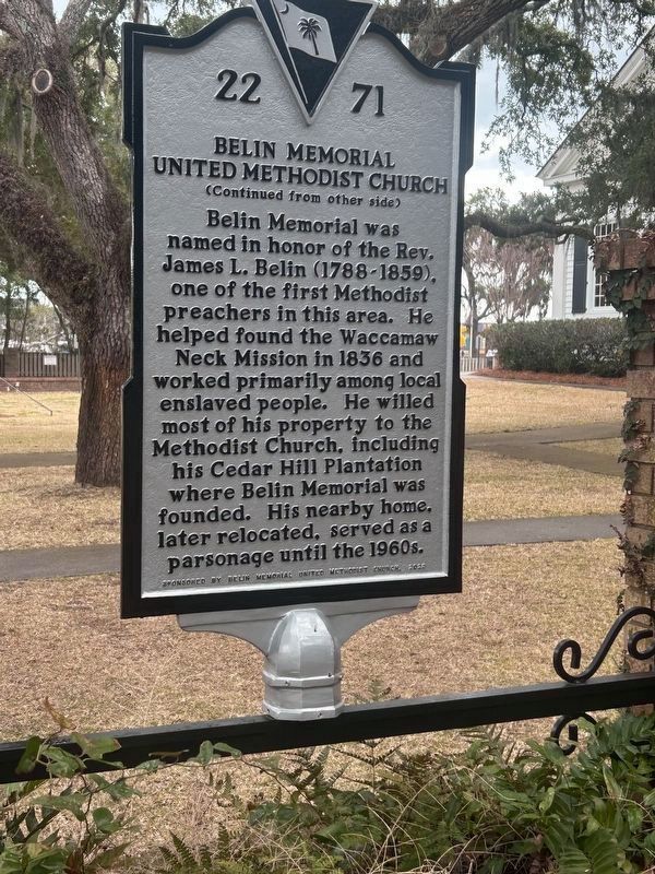
Belin Memorial United Methodist Church (U.M.C.) organized in 1925. The first church building was a frame chapel previously used on a local plantation. It was relocated to this site and dedicated in 1926. The Rev. William T. . . . — — Map (db m293722) HM
Established on four former rice
plantations in 1931 by Archer and Anna Hyatt Huntington, Brookgreen Gardens is a non-profit, outdoor
museum. It is designated as a National Historic Landmark because of Anna Hyatt Huntington’s
significance as an . . . — — Map (db m141716) HM
Title to the land that comprised Brookgreen plantation is traced to a patent for 48,000 acres granted to Robert Daniell in 1711. The property passed to the Allston family when William Allston bought it circa 1740. William Allston Jr. acquired it in . . . — — Map (db m80998) HM
On Jetty Drive north of Terrapin Road, on the right when traveling north.
Established by and comprised of the planters of All Saints Parish, this social club was dedicated to epicurean pursuits. Although formed before 1816, the organization was probably dissolved during the Civil War. Nearby Drunken Jack Island was the . . . — — Map (db m4868) HM
Sacred to the Memory of Joseph & Theodosia Burr Alston and their Son Aaron Burr Alston. This last died in June 1812 at the age of 10 years and his remains are interred here. The disconsolate Mother perished a few months after at sea. And on the 10th . . . — — Map (db m40376) HM
On Henry Flagg Loop near William Alston Loop, in the median.
Joseph Alston (1779–1816) was educated at the College of Charleston and at Princeton. He inherited The Oaks Plantation and in 1801, married Theodosia, daughter of Aaron Burr. Alston was a member of the S.C. House (1802–12), its speaker . . . — — Map (db m16512) HM
On Henry Flagg Loop near William Alston Loop, in the median.
Daughter of Aaron Burr and one of the most learned women of her era; wife of Governor Joseph Alston, who is buried west of here, with Aaron Burr Alston, their ten-year-old son; sailed from Georgetown on Dec. 30, 1812 on the schooner Patriot . . . — — Map (db m16462) HM
On Business U.S. 17 0.1 miles north of Spivey Avenue, on the right when traveling north.
(center panel)
Remember Me
Let us never forget
These South Carolinians
who gave their lives
in the War Against
Global Terrorism
Iraq / Afghanistan
Donated Veterans Day 2013 . . . — — Map (db m272153) WM
On Henry Flagg Loop near William Alston Loop, in the median.
Washington Allston, “the American Titian,” artist and author, was born at Brookgreen, Nov. 5, 1779. He studied in London, Paris, and Venice. He had a studio in London 1811–1818; in Boston 1818–1830; in Cambridge, . . . — — Map (db m16463) HM
On his southern tour in 1791 President George Washington spent the night of April 28 here at Brookgreen Plantation. He was the guest of its owner, Dr. Henry Collins Flagg, a surgeon in the Revolution, and his wife, the former Rachel Moore Allston. . . . — — Map (db m16797) HM
On Myrtle Avenue south of County Road S-22-266, on the right when traveling south.
This summer house was built between 1838 and 1848 by All Saints Academy for the summer residence of its headmaster. Robert F. W. Allston, Governor of SC 1856-58, actively participated in leadership of the academy. After some years, the academy's . . . — — Map (db m54) HM
On Kings River Road (Local Route 22-255) north of Waverly Road (Local Route 22-449), on the left when traveling north.
Anglican services were held on Waccamaw Neck by 1737, with a chapel built on land purchased from Percival Pawley. All Saints Parish, Waccamaw, created out of Prince George Winyah Parish in 1767, was the third Anglican parish created in present-day . . . — — Map (db m17021) HM
On State Road S-22-10, on the left when traveling south.
This house, built by 1848, served as the summer parsonage for All Saints Episcopal Church or many years. Evening summer services were held here by the congregation, which included a number of rice plantation owners who spent summers at Pawleys . . . — — Map (db m53) HM
On State Road S-22-10, on the left when traveling south.
This house stands on land owned by R. F. W. Allston, governor of SC 1856-58. His nephew Joseph Blyth Allston obtained the land in 1866 and it is thought he then moved this circa 1800 house onto his property. After Hurricane Hugo struck SC in 1989, . . . — — Map (db m56) HM
On Myrtle Drive (Local Route S-22-10) south of South Causeway Road (Local Route 22-266), on the left when traveling south.
This house, built on 10 acres of beach land by 1858, was owned by the LaBruce family, who were successful rice planters in this area of All Saints Parish. According to local tradition, two small dwellings on the property were slave cabins. The . . . — — Map (db m17018) HM
On State Road S-22-10, on the left when traveling south.
By 1842 this house was here on Pawleys Island and was owned by Robert Nesbit (1799-1848). A native of Scotland and a rice planter in this area, Nesbit also owned nearby "Caledonia" plantation. The house on Pawleys remained in the Nesbit family until . . . — — Map (db m55) HM
On State Road S-22-10, on the left when traveling south.
Plowden Weston, Lt. Gov of SC 1862–64, obtained land here in 1844 and by 1858 had built this beach residence. The Weston family sold the property to William St. Julien Mazyck in 1864, who sold the house to Atlantic Coast Lumber Company in . . . — — Map (db m37510) HM
On Myrtle Avenue (State Highway S-20-10) near South Causeway Road, on the left when traveling north.
Pawley’s Island
This island, located about ½ mile east, was used by plantation householders who lived on the seashore from May to November to escape malaria, or “summer fever.” A number of houses built about 1850, and the . . . — — Map (db m39647) HM
On Myrtle Avenue 0.4 miles south of North Causeway Road, on the right when traveling south.
(side 1)
In 1946, the Georgetown Ministerial Association resolved to erect a place of Christian worship for summer residents on Pawleys Island/ Partnering with the local Laymen's Evangelistic Club to secure a building, trustees incorporated . . . — — Map (db m182447) HM
This summer residence was owned by Robert F. W. Allston (1801–1864) when the state of SC granted the marsh behind it to him in 1846. Allston was a large property owner, a successful rice planter, and served as governor of SC 1856–58. The house . . . — — Map (db m51) HM
On Myrtle Avenue at South Causeway Road (South Carolina Highway 22-266), on the right when traveling north on Myrtle Avenue.
This causeway was built between January 1845 and November 1846 by Robert Francis Withers Allston, who owned a summer residence on Pawleys Island. Known as Governor Allston's bank, it connected the island to the mainland. Allston was a large property . . . — — Map (db m27320) HM
Near Ocean Highway north of Red Rose Boulevard, on the right when traveling north.
This building was built prior to 1850 and located at Waverly Plantation. The building was moved to its present location in 1970. It was the only school available on lower Waccamaw
neck and operated until early 1920's. Some of the families whose . . . — — Map (db m150604) HM
On Duncan Avenue at Godfrey Road, on the right when traveling west on Duncan Avenue.
St. John A.M.E. Church was established in the spring of 1867 with Rev. Saby Green as the first pastor. Early meetings were held under a brush arbor until a log framed church was built at Litchfield in 1867. The current brick sanctuary replaced . . . — — Map (db m159027) HM
On State Road S-22-10, on the left when traveling south.
This house, one of the oldest on Pawleys, was reputedly moved here after 1858. It stands on land once owned by area rice planter Joshua J. Ward (1800–1853), who was Lt. Gov. of SC 1850-52. The house has hand-hewn sills and joists and . . . — — Map (db m50) HM
Near Ocean Highway (U.S. 17) north of Red Rose Boulevard, on the right when traveling north.
This building was located at Waverly plantation & was moved to the hammock shop complex
in spring of 1983. It is the oldest building in the complex, built in the early 1800's it was the original post office for what is now the Pawleys Island area & . . . — — Map (db m150603) HM
On 30th Avenue South at South 3rd Street on 30th Avenue South.
Atlantic Beach, nicknamed "The Black Pearl," was established about 1934 as an oceanfront community for blacks denied access to other area beaches by segregation. Many became year-round residents, but most spent their vacations here. From the . . . — — Map (db m23511) HM
On North Ocean Boulevard (State Highway 65) at Sea Mountain Highway (State Highway 9), on the right when traveling north on North Ocean Boulevard.
Sonny’s Pavilion, built in 1949 by N.F. “Sonny” Nixon, was an open-air pavilion on the Grand Strand. The rhythm & blues of the post-World War II era—later called beach music—was played on jukeboxes at area pavilions where . . . — — Map (db m27329) HM
On U.S. 17 at Heather Lakes Drive, on the left when traveling north on U.S. 17.
During the colonial era the Boundary House, on the S.C.-N.C. line 1.3 mi. SE, was both a private residence and “public house.” In 1775 Isaac Marion (d. 1781), eldest brother of future partisan leader Gen. Francis Marion, lived there. On May 9, 1775, . . . — — Map (db m5345) HM
On State Highway 90 at Edge Road, on the left when traveling west on State Highway 90.
Chestnut Consolidated Schools, which was located here 1954-1970, was built under the equalization program of Gov. James F. Byrnes, intended to preserve segregation by building new schools for blacks. Named to honor Horry County educator J.T. . . . — — Map (db m52518) HM
On U.S. 17 at Mineola Avenue (Local Road 50), on the right when traveling south on U.S. 17.
In memory of Rebecca Randall Bryan. “On March 22, 1856, Thomas Randall conveyed to Abraham W. Bessent and John S. Thomas, trustees of the Baptist Church, this plot of ground, with title to exist for so long as it continued a location of . . . — — Map (db m16805) HM
On U.S. 17 east of Mineola Avenue, on the left when traveling north.
On Jan. 1, 1740 George Whitefield (1714-1770), Anglican evangelist, stopped at a tavern nearby on his way to Savannah. Whitefield, the most famous revivalist of the Great Awakening in colonial America, wrote in his diary that since it was New . . . — — Map (db m224804) HM
On Mineola Avenue south of Watson Avenue and Edgewood Drive, on the right when traveling south.
Little River was one of the earliest
settled sections of Horry County.
Pre-contact Native Americans made
temporary encampments nearby to
collect fish and shellfish. White
settlers established plantations by
the 1730s. In the 19th century,
the . . . — — Map (db m269183) HM
On Prat Road 0.6 miles east of Ocean Hwy (U.S. 17), on the right when traveling east.
Called a "rice trunk," this device is based on the centuries-old practice of using hollow tree trunks to carry water in and out of rice fields. Here, the apparatus helps us manage marshes as wildlife habitat. Since the 1930s, when . . . — — Map (db m199788) HM
On Seashore Drive at Atalaya Road, on the left when traveling south on Seashore Drive.
Atalaya is the former winter home of renowned sculptor Anna Hyatt Huntington and her husband Archer Milton Huntington, a well-known scholar of Hispanic studies, a businessman and poet. It was designated a National Historic Landmark in1992 . . . — — Map (db m199585) HM
On Seashore Drive at Atalaya Road, on the left when traveling south on Seashore Drive.
"Find figure work very dull. All figures are so alike that only the pose varies them. I do not see how sculptors can go on finding interest with only composition and design to vary. With animals it's different. You have tremendous variety and . . . — — Map (db m199785) HM
Near Seashore Drive at Atalaya Road, on the left when traveling south.
The Huntingtons enjoyed dogs and had several which traveled with them to Atalaya each winter Echo, Anna's greyhound, and Kelpie, one of her Scottish deerhounds, served as models for some of her sculptures. Anna eventually became one of the most . . . — — Map (db m199784) HM
Near Seashore Drive at Atalaya Road, on the left when traveling south.
The garage housed the Huntington's customized recreational vehicle, seen below This vehicle transported Archer and Anna from Connecticut to Atalaya each winter along with their menagerie of animals. including monkeys, dogs and a macaw. — — Map (db m199786) HM
Near Seashore Drive at Atalaya Road, on the left when traveling south.
The delicious smell of pitch pine combines to give us fierce appetites for crabs and clams. -Anna Hyatt Huntington Diary Entry March 9, 1930 The Huntingtons enjoyed seafood so much that they built a room devoted to it! Here, house-staff . . . — — Map (db m199787) HM
Near Seashore Drive at Atalaya Road, on the left when traveling south.
The stables housed Anna's riding horses Polly and Bob. Old Stevie lived here as well. "An old hopeless stallion, starved and wretched," Anna bought him from a local farmer for $25 as a model for Rocinante, Don Quixote's emaciated steed. So weak . . . — — Map (db m199783) HM
On U.S. 17 BUS near Swale Avenue, on the left when traveling south.
In Honor and Remembrance of the heroes and victims in the fight against terrorism and to celebrate the enduring spirit of all Americans — — Map (db m199878) WM
Near HWY 17 BUS (State Highway 17) at County Road S-22-559 (State Highway S-22-55), on the right when traveling north.
This stretch of our Marshwalk is dedicated to the Murrells Inlet boat captains of the past who established the fishing industry that we depend upon today. Early in the 20th century, seagoing inlet captains began to take small parties out for . . . — — Map (db m100705) HM
On State Highway 707 0.2 miles south of McDowell Short Cut Road (State Highway 477), on the right when traveling north.
Marker Front:
St. James Rosenwald School, which stood here from the late 1920s until the early 1970s, was one of several African-American schools in Horry County funded in part by the Julius Rosenwald Foundation. Rev. Smart Small, Sr. . . . — — Map (db m27331) HM
Near Jetty Drive 0.3 miles north of Pratt Road, on the left when traveling north.
Oyster consumption began more than 4,000 years ago by Native Americans. Today, oysters are considered a delicacy. These water-filtering bivalves are also invaluable sources of food and habitat for marine life.
Through over-harvesting and . . . — — Map (db m311325) HM
On 3rd Avenue South at South Willow Drive, on the right when traveling south on 3rd Avenue South.
Elisha Tillman died in 1824. His son, John M. Tillman (1798-1865), inherited the Ark plantation and lived there until his death. In 1860, some of the farm products at the Ark were cattle, swine, wool, Indian corn, sweet potatoes, rye, peas, beans . . . — — Map (db m199459) HM
On Pampas Drive at Mallard Lake Drive, on the left when traveling west on Pampas Drive.
Hospital care was one of the integral missions of the newly created U. S. Army Air Base on land donated by the City of Myrtle Beach. As the base was built at the outset of World War II, the hospital was located about one mile east of here in an . . . — — Map (db m102235) HM WM
On Farrow Parkway at South Kings Highway, on the right when traveling north on Farrow Parkway.
In 1948, the War Assets Administration transferred to the Town of Myrtle Beach the Army Air Base. Since the maintenance and operation of an airport is a year-round proposition, it was easy to see that the town had embarked upon a big venture. When . . . — — Map (db m102148) HM
Near Farrow Parkway at South Kings Highway, on the right when traveling north.
During the Korean War, the United States Air Force expressed interest in acquiring the Myrtle Beach Airfield from the City of Myrtle Beach to base a fighter wing there. An agreement was reached for the joint use of the base for both Air Force and . . . — — Map (db m272109) WM
On Farrow Parkway at South Kings Highway, on the right when traveling north on Farrow Parkway.
The 354th Day Fighter Wing was originally composed of three fighting squadrons — the 353rd, 355th and 356th Day Fighter Squadrons. In 1957, an Air Force-wide reorganization of flying units reduced the number of F-100s assigned to the Myrtle . . . — — Map (db m102151) WM
On Mustang Street at Shine Avenue, on the right when traveling west on Mustang Street.
The 353rd Tactical Fighter squadron was formed on November 15, 1942. During World War II the fighter squadron was known as the "Fighting Cobras,“ and served with distinction in England, France and Germany, flying the P-39, P-51 and P-47 . . . — — Map (db m102103) WM
On Farrow Parkway at South Kings Highway, on the right when traveling north on Farrow Parkway.
On November 19, 1956, the Air Force resurrected the unit as the 354th Fighter-Day Group and stationed it at Myrtle Beach Air Force Base. It was then re-designated the 354th Tactical Fighter Wing in July 1958, flying the RF-80, and during 1959 began . . . — — Map (db m102127) WM
On Farrow Parkway at South Kings Highway, on the right when traveling north on Farrow Parkway.
In August 1990, the 354th was once again deployed for combat operations this time in the Persian Gulf in support of Operation Desert Shield. By the end of the conflict, the 354th's A-10s were credited with destroying 950 tanks, 900 artillery . . . — — Map (db m102163) WM
On Farrow Parkway at South Kings Highway, on the right when traveling north on Farrow Parkway.
The 354th Fighter Wing has a long and distinguished past. The wing saw action in every major conflict in which the United States was involved, except for the Korean War. Activated at Hamilton Field in California on November 15, 1942, as the 354th . . . — — Map (db m102125) WM
On Farrow Parkway at South Kings Highway, on the right when traveling north on Farrow Parkway.
The 354th Tactical Fighter Wing (TFW) had its genesis as the 354th Fighter Group (FG) in November 1942 at Hamilton Field, California. In October 1943, it was moved to England and began aerial combat operations flying P-51s. In November 1944, it . . . — — Map (db m102126) WM
On Farrow Parkway at South Kings Highway, on the right when traveling north on Farrow Parkway.
During the period that A-7Ds operated at the Myrtle Beach Air Force Base, the tactical fighter squadrons carried out important peace time deployment and reinforcement responsibilities in three key theaters of operation. In the European Theater, . . . — — Map (db m102150) HM WM
On Thunderbolt Street at Shine Avenue, on the right when traveling east on Thunderbolt Street.
(panel 1)
Activated on November 15, 1942, at Hamilton Field, California, the first 355th Tactical Fighter Squadron pilots, nicknamed the “Pugnacious Pups,” flew the P-39 Aircobra. After deploying to England in 1943, the squadron . . . — — Map (db m120831) HM
On Thunderbolt Street at Shine Avenue, on the right when traveling east on Thunderbolt Street.
The 355th Tactical Fighter Squadron Operations (Fighting Falcons) were located in the area now occupied by the Myrtle Beach Police Department Office and Training Facility.
The squadron was activated in November 1942 at Hamilton Field, . . . — — Map (db m120830) HM
On Corsair Avenue at Airdrome Avenue, on the right when traveling south on Corsair Avenue.
November 1956 saw the reactivation of the 356th as the "Green Demons" at Myrtle Beach Air Force Base, flying the F-100D Super Sabre. The 356th participated in numerous deployments to Europe during the late 1950s and early 1960s, and also deployed . . . — — Map (db m102101) WM
On Mustang Street at Shine Avenue, on the right when traveling west on Mustang Street.
The 356th Tactical Fighter Squadron Operations (Green Demons), building 347, was located in the area now occupied by the Myrtle Beach Police Department office and Training Facility. The 356th Tactical Fighter Squadron was activated in November . . . — — Map (db m102102) WM
Near South Kings Highway (Business U.S. 17) near Mallard Lake Drive, on the right when traveling north.
The Civilian Conservation Corps (CCC) was established by President Franklin D. Roosevelt in 1933 as a part of a relief effort during the Great Depression. Three million men were put to work in the CCC during its ten-year existent .
Integrity, . . . — — Map (db m260161) HM
On Farrow Parkway at South Kings Highway, on the right when traveling north on Farrow Parkway.
The A-10 Thunderbolt II was assigned to the Myrtle Beach Air Force Base from 1977 to 1993. It was manufactured by the Fairchild Republic Corporation and traces its name, Thunderbolt II, back to the Republic Aircraft Corporation's Army Air Corps . . . — — Map (db m102152) WM
On Farrow Parkway at South Kings Highway, on the right when traveling north on Farrow Parkway.
Named after a type of pirate vessel the Corsair was the United States Navy's famed F-4U fighter aircraft of World War II. It was manufactured by the Chance Vought Corporation, which eventually became the LTV Corporation and manufacturer of the . . . — — Map (db m102153) WM
On Farrow Parkway at South Kings Highway, on the right when traveling north on Farrow Parkway.
In the Fall of 1956, officers and airmen from the United States Air Force were assigned to newly constructed Myrtle Beach Air Force Base to start a new fighter wing. Their task was reactivation of the famous World War II “Pioneer Mustang . . . — — Map (db m102124) WM
The Airmen’s Dining Hall, building 245, a large facility capable of simultaneous feeding of several hundred airmen, was located in this area of The Market Common.
The Dining Hall was centrally located with respect to the Airmen’s Dormitory . . . — — Map (db m120506) HM
On Farrow Parkway at South Kings Highway, on the right when traveling north on Farrow Parkway.
Settlers from the Waccamaw Neck attempted to extend thei plantations to what was called Long Bay. Many families received land in 1735 just south of the Withers Swash when the colonial government began issuing grants. Independent farmers and . . . — — Map (db m102106) HM
On 3rd Avenue South at South Willow Drive, on the right when traveling south on 3rd Avenue South.
Beginning in 1740, experiments by Miss Eliza Lucas (who later married Charles Pinckney) and a few others who were also experimenting with indigo, helped lead to the successful cultivation of indigo in South Carolina. The indigo plant was the . . . — — Map (db m199547) HM
On Johnson Avenue at Phillis Boulevard, on the right when traveling south on Johnson Avenue.
The Audio Visual Facility, building 502, at this location provided a complete line of audio visual services in support of all of the units on the base.
The facility was equipped with two darkrooms for photography work and had the capability to . . . — — Map (db m113446) HM
On Johnson Avenue at Phillis Boulevard, on the right when traveling south on Johnson Avenue.
The Auto Craft Center, building 255, was located on Wainwright Boulevard, now Johnson Avenue. The building was constructed in 1962.
The Auto Craft Center offered a wide range of services and had a large selection of equipment and tools. The . . . — — Map (db m113445) HM
On Mustang Street at Shine Avenue, on the right when traveling east on Mustang Street.
The Aircraft Avionics Maintenance shops, building 325, were housed in an environmentally controlled building near this location. The Avionics Squadron administrative offices were located in this building.
The shops contained a full complement . . . — — Map (db m113455) HM
On Blizzard Street at DeVille Street, on the right when traveling east on Blizzard Street.
The Base Civil Engineering Complex, building 219, was located within this area of The Market Common. It contained the Base Civil Engineering Administrative Offices, specialty maintenance shops and storage for material used in maintaining base . . . — — Map (db m113453) HM
Near Airdrome Avenue at Huger Street, on the left when traveling south.
Base Operations, building 362, housed the functions associated with the operations of transient aircraft arriving and departing the base.
It maintained a full complement of flight planning services for transient pilots, including a weather . . . — — Map (db m120777) HM
On Phyllis Boulevard at Johnson Avenue, on the right when traveling east on Phyllis Boulevard.
Base Supply, building 214, contained 154,000 square feet of space. This building housed the administrative offices of the Supply Squadron. It also provided storage for the hundreds of items used in carrying out all Base functions, as well as . . . — — Map (db m113444) HM
On Howard Avenue north of Pampas Drive, on the right when traveling south.
Located across the street from the hospital on Pampas Drive, the bowling center, building 132, was constructed in 1961.
The center offered many hours of fun and relaxation. The 18-lane center offered league bowling each weekday evening, while . . . — — Map (db m113487) HM
On Hackler Street at Howard Avenue, on the left when traveling east on Hackler Street.
General Howard was the only fighter pilot awarded the Congressional Medal of Honor for heroic combat flying in the European Theater of Operations during World War II.
While flying his P-51 on a bomber escort mission near Berlin in 1944, he . . . — — Map (db m102039) WM
On Howard Avenue at Reed Street, on the right when traveling south on Howard Avenue.
General Howard was the only fighter pilot awarded the Congressional Medal of Honor for heroic combat flying in the European Theater of Operations during World War II.
While flying his P-51 on a bomber escort mission near . . . — — Map (db m113454) HM
On Farrow Parkway at Hendrick Avenue, on the right when traveling west on Farrow Parkway.
General Hall served at Myrtle Beach Air Force Base as Commander of the 354th Tactical Fighter Wing during the period April 1984 to January 1986. He is a native of Oklahoma City, Oklahoma, and earned a bachelor's degree from the University of . . . — — Map (db m102767) WM
On Farrow Parkway at Hendrick Avenue, on the right when traveling west on Farrow Parkway.
General Jenkins served at Myrtle Beach Air Force Base as Vice Commander and then Commander of the 354th Tactical Fighter Wing from August 1987 to March 1990. He accumulated more than 3,100 flying hours in tactical fighter aircraft, including the . . . — — Map (db m102230) HM WM
Near Harrelson Boulevard at Jetport Road, on the right when traveling north.
General Jenkins served at Myrtle Beach Air Force Base as Vice Commander and then Commander of the 354th Tactical Fighter Wing from August 1987 to March 1990.
He accumulated more than 3,100 flying hours in tactical fighter aircraft, . . . — — Map (db m121751) HM
On Johnson Avenue at Knoles Street, on the right when traveling north on Johnson Avenue.
Brigadier General Thomas M. Knoles, a command pilot in the United States Air Force, was born in 1927 in Flagstaff, Arizona, and graduated from Flagstaff High School in 1945. He attended the University of Arizona prior to enlisting in the Army Air . . . — — Map (db m102100) WM
Near Harrelson Boulevard at Jetport Road, on the right when traveling north.
Brigadier General Thomas M. Knoles, a command pilot in the United States Air Force, was born in 1927 in Flagstaff, Arizona, and graduated from Flagstaff High School in 1945. He attended the University of Arizona prior to enlisting in the Army Air . . . — — Map (db m121702) HM
Near Harrelson Boulevard at Jetport Road, on the right when traveling north.
Brigadier General William Donald Curry Jr. was born in Minneapolis in 1926. He entered the service from Marshalltown, IA, during WWII and served as a B-24 Crew Chief until entering the US Military Academy. Upon graduation in 1950, he was . . . — — Map (db m121709) HM
On Farrow Parkway at Johnson Avenue, on the right when traveling west on Farrow Parkway.
Captain Paul Johnson of Dresden, Tennessee, was a pilot with the 354th Tactical Fighter Wing, Myrtle Beach Air Force Base, during the Desert Storm Combat Operations over Iraq. On January 21, 1991, Captain Johnson flying an A-10 was tasked with a . . . — — Map (db m102196) WM
On Hackler Street at Howard Avenue, on the left when traveling east on Hackler Street.
Captain Stephen Phillis, a native of Rock Island, Illinois, was an A-10 pilot at the Myrtle Beach Air Force Base during the time when the United States military was preparing for Operation Desert Storm in response to the lraqi occupation of Kuwait. . . . — — Map (db m102041) WM
On Phillis Boulevard at DeVille Street, on the right when traveling east on Phillis Boulevard.
Captain Stephen Phillis, a native of Rock Island, Illinois, was an A-10 pilot at the Myrtle Beach Air Force Base during the time when the United States military was preparing for Operation Desert Storm in response to the Iraqi occupation of Kuwait. . . . — — Map (db m113456) HM
On Howard Avenue at Pampas Drive, on the right when traveling south on Howard Avenue.
This is the site of the former Myrtle Beach Air Force Base Chapel, building 112, located on what was then Third Street and Farrow Boulevard.
The Base Chapel program supported both Protestant and Catholic religious education programs and . . . — — Map (db m113486) HM
On Pampas Drive at Mallard Lake Drive, on the left when traveling west on Pampas Drive.
Chaplain Baldwin served as the Senior Installation Chaplain at Mytle Beach Air Force Base during the period June 1989 to 1992. During this period he also accompanied the 354th Tactical Fighter Wing on deployment to King Fahad International Airport, . . . — — Map (db m102237) HM WM
On Carver Street 0.1 miles west of 21st Avenue North, on the right.
Charlie and Sarah Fitzgerald opened Charlie's Place as a supper club in 1937. It was a stop on the "Chitlin' Circuit," nightclubs where black entertainers such as Billie Holiday, the Mills Brothers, Little Richard, Ruth Brown, Otis Redding, and . . . — — Map (db m160868) HM
On Moser Drive at Reed Street, on the right when traveling north on Moser Drive.
Chief Master Sergeant Gary Moser was raised in Raeford, North Carolina, and joined the United States Air Force in 1968. His early assignments included tours of duty in Thailand, Germany and North Carolina.
Chief Master Sergeant Moser served . . . — — Map (db m120864) HM
On Farrow Parkway at Howard Avenue, on the left when traveling west on Farrow Parkway.
Chief Master Sergeant James Cope
Chief Master Sergeant James Cope was 1st Sergeant in the 356th Fighter squadron and the 354th Armament and Electronics Squadron. Chief Master Sergeant (CMSgt) is the ninth, and highest, enlisted rank in the . . . — — Map (db m102231) HM WM
On Farrow Parkway at Hendrick Avenue, on the right when traveling west on Farrow Parkway.
Chief Master Sergeant Jimmy E. Davis is a native of Georgetown County, South Carolina. He graduated from Winyah High School in Georgetown, South Carolina, and enlisted in the United States Air Force shortly thereafter. After completing basic . . . — — Map (db m102229) HM WM
On Pampas Drive at Murray Avenue, on the right when traveling west on Pampas Drive.
CMSAF Murray served at Myrtle Beach Air Force Base from 1986-1992. During this period, he served as the non-commissioned officer in charge of the 356th Aircraft Maintenance Unit (AMU) Support Section, the 56th Aircraft Generation Squadron . . . — — Map (db m120836) HM
On Hackler Street at Howard Avenue, on the left when traveling east on Hackler Street.
In 1961, Dominican Republic Dictator Raphael Trujillo was assassinated. In the following years, turmoil and conflict were the order of the day on the island. President John F. Kennedy made it clear that it was time for democracy in the Dominican . . . — — Map (db m102073) WM
Near Harrelson Boulevard at Jetport Road, on the right when traveling north.
Born December 1921 in Washington, D.C., Colonel Albert R. Neville entered military service in January 1940 as an enlisted man in the US Army. In 1941 he won a competitive appointment to West Point, graduating in 1945 with his wings.
He was . . . — — Map (db m121714) HM
On Pampas Drive at Mallard Lake Drive, on the left when traveling west on Pampas Drive.
Colonel Branch was born and raised in south Texas where he learned to fly in a Piper Cub. In 1951, he joined the United States Air Force and was commissioned and rated as pilot in 1952. He completed advanced training in the F-86 and was sent to . . . — — Map (db m102239) HM WM
On Farrow Parkway at Hendrick Avenue, on the right when traveling west on Farrow Parkway.
Colonel Cook was born in Pennington, New Jersey, in 1921. He attended Randolph Macon Academy in Virginia and graduated Bucknell University in 1942. He enlisted in the Army Air Corps in 1942 and was commissioned a Second Lieutenant in 1943. Upon . . . — — Map (db m102228) HM WM
On Pampas Drive at Mallard Lake Drive, on the left when traveling west on Pampas Drive.
Colonel Charles M. "Charlie" Thrash was stationed at Myrtle Beach Air Force Base on three different occasions. During these three tours he filled nearly every flying-related leadership position in the 354th Tactical Fighter Wing and amassed more . . . — — Map (db m102238) HM WM
On Farrow Parkway at Shine Avenue, on the right when traveling east on Farrow Parkway.
Colonel Brown is a native of Elizabethtown, North Carolina. He graduated from the United States Air Force Academy in 1978.
After completing pilot training at Laughlin Air Force Base in Del Rio, Texas, he was assigned to Myrtle Beach Air Force . . . — — Map (db m113440) HM
Near Harrelson Boulevard at Jetport Road, on the right when traveling north.
Colonel Forney was born June 1920 in Sioux Falls, SD where he attended Washington High School graduating in 1938. He received a degree in Business Administration in 1942 from the University of South Dakota.
In 1942 he was commissioned a . . . — — Map (db m121742) HM
On DeVille Street at Nevers Street, on the right when traveling north on DeVille Street.
Colonel Deville, was born and raised in Eunice, Louisiana, in the heart of Cajun country. He received his bachelor's degree in industrial technology from Louisiana State University and his masters in business management from Georgia College. . . . — — Map (db m102104) WM
242 entries matched your criteria. The first 100 are listed above. Next 100 ⊳