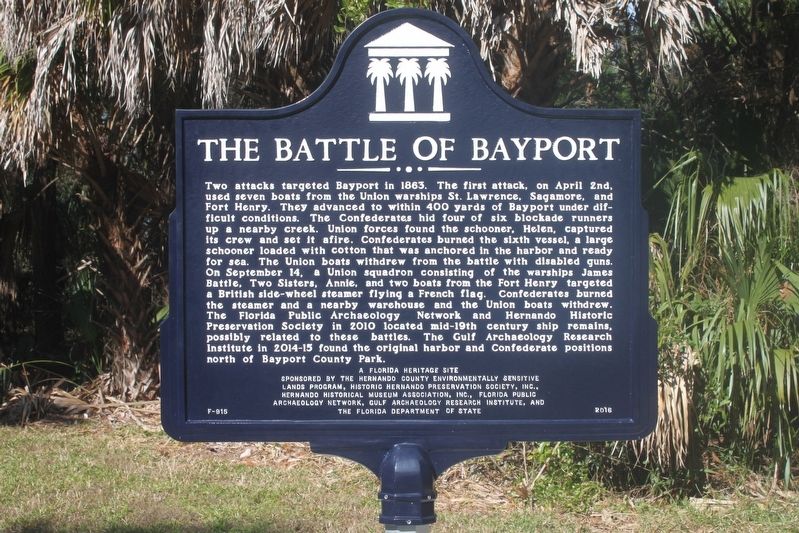
Near Cortez Boulevard (County Road 550) 1.5 miles south of Pine Island Drive.
(side 1)
Bayport in the Civil War
Bayport was a shallow-water gulf port town in the 1850s. The town was designated the Hernando County Seat and a port of delivery by Congress in 1854. Before the Civil War, the port shipped lumber cut . . . — — Map (db m110440) HM
Near Cortez Boulevard (County Road 550) 6.5 miles west of Commercial Way (U.S. 19), on the right when traveling west.
Bayport's Early Historic Period
During the First Spanish Period (1565-1763) Florida served as a military defense port. In 1763, under British control, agricultural commerce became important. Control of Florida returned to Spain in 1783. In . . . — — Map (db m93297) HM
Near Cortez Boulevard (County Road 550) 6.5 miles west of Commercial Way (U.S. 19).
(side 1)
The Bayport Area Before Human Occupation
The fossilized remains of many prehistoric animals and plants are buried in the Bayport area. During the Eocene Period, 45 million years ago (MYA), the Gulf covered this region. . . . — — Map (db m93296) HM
On Russell Street 0.1 miles west of South Brooksville Avenue, on the right when traveling east.
Side 1
In 1885, Brooksville had a population of 500. Residents depended on horse-drawn wagons and stagecoaches to transport goods and passengers to the outside world. Four innovative businessmen formed the Brooksville Railroad Association and . . . — — Map (db m206334) HM
On Aviation Loop Drive at Sam Pearson Way, on the right when traveling west on Aviation Loop Drive.
Side 1
At the beginning of World War II, a group of Hernando County leaders
met with U.S. Senator Claude Pepper and expressed a desire to have a
military airfield built in the county. In November 1942, the Brooksville
Army Airfield consisting . . . — — Map (db m297163) HM
Near Chinsegut Hill Road 0.3 miles west of Snow Memorial Highway.
Seminole Indians inhabited this area in the early 1800s. In 1842, a South
Carolina lawyer, Col. Bird Pearson, claimed 6,000 acres from the US
government and named the site Tiger Tail Hill. In 1851, Pearson sold the
land to a fellow South . . . — — Map (db m288951) HM
On Chinsegut Hill Road at Snow Memorial Highway, on the right when traveling west on Chinsegut Hill Road. Reported permanently removed.
In 1842, South Carolinian Bird M. Pearson staked a claim on 160 acres and called it Mount Airy, one of the few surviving plantations in Florida and one of the oldest houses in Hernando County. Pearson built the manor house's east wing in 1847 and . . . — — Map (db m67006) HM
On Cortez Boulevard (State Road 50) 0.2 miles west of East Jefferson Street (U.S. 98), on the right when traveling east.
The first colony of Muskogee-speaking Upper Creek Indians from Alabama was established nearby in 1767. British surveyor/naturalist Bernard Romans identified the settlement as "New Yufala, planted in a beautiful and fertile plain." It later became . . . — — Map (db m93307) HM
On Howell Avenue north of West Fort Dade Avenue, on the left when traveling north.
Founding Fathers
W.J. Barnett, Mayor • T.J. Cook, Alderman • F.B. Coogler, Treasurer • William M. Garrison, Tax Assessor • James A. Jennings, Clerk • Christopher C. Keathley, President of Council • Frank E. Saxon, Marshall • W.H. Townsend, . . . — — Map (db m237699) HM
On North Main Street north of Broad Street (U.S. 98), on the right when traveling north.
Hernando County originally embraced Hernando, Pasco and Citrus counties. It was created by the Territorial Legislature in 1843 and named for Hernando DeSoto. In 1844 its name was changed to Benton County in honor of Senator Thomas Hart Benton of . . . — — Map (db m123567) HM
On North Main Street at East Jefferson Street, on the right when traveling north on North Main Street.
Dedicated in memory of the Service Members of Hernando County who gave their lives in the Global War on Terrorism during Operation Iraqi Freedom and Operation Enduring Freedom
Operation Iraqi Freedom
USMC Sgt. Lea Robert Mills 4/28/2006 . . . — — Map (db m237700) WM
On North Main Street north of Broad Street (U.S. 98), on the right when traveling north.
In loving memory of those who gave their lives in the service of their country World War I World War II Korea Vietnam Erected by American Legion in cooperation with the Hernando County Action ‘76 Committee and the Florida State Bicentennial . . . — — Map (db m132461) WM
On Russell Street just west of South Brooksville Avenue, on the left when traveling west.
This historic sidewalk, dated January 6, 1914, was taken from the corner of Howell Ave and Olive Street in Brooksville, Fl. The sidewalks were raised to accommodate the entry and exit into horse drawn carriages, allowing passengers to be raised from . . . — — Map (db m169200) HM
On Citrus Way (County Road 491) south of Ponce de Leon Boulevard (U.S. 98), on the right when traveling south.
The first St. Stanislaus Church was built here in 1915 by a small group of Polish farmers who had purchased land in this area of Hernando County in an effort to begin a new community. Priests from St. Leo Abbey would come out once a month to . . . — — Map (db m37326) HM
Near Cortez Boulevard (State Road 50) at Hope Hill Road, on the right when traveling east.
Though mass was first celebrated for Brooksville Catholics at the Hope residence on Easter Sunday 1874 by Bishop Augustin Verot, a formal Catholic mission was not established until 1892. At that time Fr. Roman Kirchner, the Benedictine Pastor of St. . . . — — Map (db m44010) HM
One of the area's early white settlers, Charlotte Crum is the first known burial in the Brooksville Cemetery. Her death occurred immediately following the Second Seminole War (1833-1842), and is symbolic of the epic collision that occurred in . . . — — Map (db m259761) HM
On Broad Street (U.S. 41) at Stromberg Avenue, on the right when traveling north on Broad Street.
(Side 1)
Garden Grove was carved out of the Chocochatti Hammock, first inhabited by the Upper Creek Nation and then by pioneer families such as the Hopes and Crums. The area remained largely undeveloped up to the 1920s. By that time, the . . . — — Map (db m139121) HM
Near Lake Lindsey Road (County Road 476) 0.1 miles east of Lingle Road (County Road 439), on the left when traveling east.
It’s July 23, 1539…
Conquistador Hernando de Soto and his advance guard of 12 horsemen have just passed the small Indian village of Vicela…
I have decided not to stop here. We must press on further north and reach the chiefdom of . . . — — Map (db m126575) HM
On Broad Street (U.S. 41) at Wilson Boulevard, on the right when traveling north on Broad Street.
In 1924-26, a group of Slovak and Czech immigrants moved down from New York and Pennsylvania to establish a farming community in Florida, and bought about 10,000 acres in Hernando County. They founded a town here, which they named after Thomas G. . . . — — Map (db m281941) HM
On Richloam-Clay Sink Road at Riverland Road, on the left when traveling south on Richloam-Clay Sink Road.
In 1921, the Atlantic Coast Line Railroad (ACL) decided to relocate its depot in Riverland to Richloam. Soon after, in 1922, Postmaster Lucius Sidney "Sid” Brinson moved the Riverland Post Office to the growing community of Richloam and . . . — — Map (db m119132) HM
Near Richloam Clay Sink Road 0.1 miles east of Riverland Road, on the right when traveling east.
It’s July 20, 1539…
Here at the Indian village called Luca, Calvary Captain Baltasar de Gallegos reports back to Hernando de Soto –
My mission to meet with the great Chief Urriparacoxi was unsuccessful. The chief hid in the . . . — — Map (db m126574) HM
Near Interstate 75 at milepost 307, 8.9 miles north of Cortez Blvd (U.S. 98), on the left when traveling north.
The light of freedom still burns brightly in our world today because of the service and sacrifice of America's men and women in uniform.
Our Nation's servicemen and women have fought the forces of tyranny and won victories for liberty, human . . . — — Map (db m246854) WM
On Cortez Boulevard (State Road 50) at Treiman Boulevard (U.S. 301), on the right when traveling east on Cortez Boulevard.
Shortly after Florida became a U.S. Territory, Fort Brooke was constructed at the mouth of the Hillsborough River and Fort King was established near the present site of Ocala. In 1825, work was begun by the federal government on an overland route . . . — — Map (db m41865) HM
On Spring Lake Highway (County Road 541) south of Old Spring Lake Road, on the right when traveling north.
This building was constructed by the Works Progress Administration (W.P.A.) in 1938. It was originally proposed to be a building that could be used as a polling place on election days and as a community recreation hall.
The School Board saw the . . . — — Map (db m93387) HM
On Richloam-Clay Sink Road 0.1 miles south of Riverland Road, on the right when traveling south.
This is the site of the former Schroder Land and Timber Company (SLTC) clubhouse. John Schroder, owner of the SLTC, purchased large tracts of land in Hernando and Pasco counties, including the area later known as Richloam. Built around 1916, the . . . — — Map (db m135933) HM
On Cortez Boulevard, on the right when traveling south.
The interior of Central Florida opened for settlement by whites in the mid-1840s following the end of the Second Seminole War. In the absence of roads and railroads, coastal and inland waterways provided the transportation routes essential to . . . — — Map (db m67109) HM
On Commercial Way (U.S. 19) 0.1 miles north of Centralia Road (County Road 476), on the right when traveling north.
Side 1:
This site was once the location of one of Florida's largest lumber mills. As demand for insect and rot resistant cypress increased, the J.C. Turner Lumber Company began the logging of over 15,000 acres of Red Tidewater Cypress, . . . — — Map (db m110443) HM
In the Tampa Bay area’s subtropical climate, butterflies can thrive among many varieties of plants. In fact, most live their entire lives around plants like the ones in this garden, which was created as a butterfly habitat.
The plants . . . — — Map (db m106502)
As manatees move about in the warm water, you may see various parts of their anatomy. These include:
Snouts
If you hear a rushing noise like that of a snorkeler who’s blowing water out of his tube, be sure to scan the water’s surface for . . . — — Map (db m106503)
Manatees can communicate with each other by making squeaks, chips and squeals.
Most manatee communications occur between a mother and her calf. Perhaps you will hear a mother manatee calling her calf if they become visually separated. . . . — — Map (db m106504) HM
Great Blue Heron
This is the largest member of the heron family. Its long legs allow it to wade in deeper water than the other herons. The great blue’s powerful neck whips its sharp beak at its prey with great speed. Its favorite meal is . . . — — Map (db m106507) HM
Manatee photo-identification is a research technique that uses the unique pattern of scars and mutilations on a manatee’s trunk and tail fluke to identify an individual animal over time.
In Florida, the scars are primarily a result of . . . — — Map (db m106500) HM
Clean brackish water, created by the mixing of clean fresh water and salt water, is important to the health of the estuary.
Stormwater runoff however, can create problems.
What is Stormwater Runoff?
It is excess rain that flows over . . . — — Map (db m106499)
Range
The monarch butterfly is native to North, Central, and northern South America. It has been accidentally introduced to numerous islands in the Pacific and Atlantic.
Habitat
In the spring and summer, the monarch butterfly’s . . . — — Map (db m106501) HM
Mangroves are the basis of the estuary’s food chain and are important nurseries for fish, crustaceans and shellfish. Seventy-five percent of the game fish and ninety percent of the commercial species in south Florida are dependent on mangrove . . . — — Map (db m106506) HM
On Nesmith Road at Joe King Road, on the right when traveling west on Nesmith Road.
The community that became known as Bealsville was settled in late 1865 by former slaves from nearby plantations in Hopewell, Springhead and surrounding areas. The original settlers were Steven Allen, Issac Berry, Peter Dexter, Neptune Henry, Mills . . . — — Map (db m101009) HM
On North Pinewood Avenue at East Brandon Boulevard (State Road 60), on the left when traveling north on North Pinewood Avenue.
In 1910, the United Daughters of the Confederacy,
Tampa Chapter No. 113, began to raise funds for a
monument to honor the soldiers and sailors of the
Confederate States of America, The Hillsborough
County Commission granted the chapter, . . . — — Map (db m32979) HM
On North Pinewood Avenue north of East Brandon Boulevard (State Road 60), on the left when traveling north.
The earliest marked grave, dated 1857, was that of Susan Carson, mother of Martha Carson Brandon. Traveling by wagon train, John Brandon, his wife Martha (cousin of Kit Carson) and six sons left Mississippi and arrived at Fort Brooke (Tampa) in . . . — — Map (db m57356) HM
On Brandon Boulevard (State Road 60), on the right when traveling east.
In 1876 James H. Brandon, son of town
founder John Brandon and wife Martha,
built this large two-story frame home for
his wife Johanna and their seven
children. They loved entertaining guests
in their Folk Victorian southern mansion.
. . . — — Map (db m27201) HM
On North Moon Avenue at West Morgan Street, on the right when traveling north on North Moon Avenue.
"Freemasons" have helped build and lead America for over 200 years. The members of the Brandon Masonic Lodge, chartered Jan. 22, 1890, have done the same for their respective communities during the past 100 years. Originally named Hacienda Lodge No. . . . — — Map (db m100984) HM
On West Sadie Street at North Knights Avenue, on the right when traveling west on West Sadie Street.
During WWI, the original sandstone brick "Twin Towers" were built on land once belonging to the Brandon family. This school consolidated the area's one-room schoolhouses to better educate the young. The first principal, John T. Bushong, expanded . . . — — Map (db m100982) HM
On East Brandon Boulevard (State Road 60) at North Pinewood Avenue, on the left when traveling east on East Brandon Boulevard.
(West face)
1861
To the Honor and Courage
of the patriots of the
Confederate States
of America,
This monument is dedicated by
Tampa Chapter,
No.113, U. D. C.,
and the citizens of Tampa.
January 1911.
Memoria . . . — — Map (db m26385) WM
On Lakewood Drive at Limona Road, on the right when traveling north on Lakewood Drive.
Lakewood Drive, part of old Seminole Indian trails, led to Fort Brooke and "Pease Creek". In 1876 Judge Joseph Gillette Knapp of Wis. settled and named Limona after citrus trees left by the Spanish. In 1877 the Elgin Watch Co. formed Limona Park . . . — — Map (db m57213) HM
On Ronele Drive at South Kings Avenue on Ronele Drive.
Many communities in Hillsborough County were either established or
experienced rapid growth following the arrival of the railroad in the 1880s.
One such community was New Hope, which began to flourish after it was
connected to other towns and . . . — — Map (db m303853) HM
Near U.S. 301 0.2 miles south of East Dr. Martin Luther King Jr. Boulevard, on the right when traveling south.
In July 1958, Lebanon was threatened by a civil war between Maronite Christians and Muslims. Tensions with Egypt had escalated earlier in 1956 when pro-western President Camille Chamoun, a Christian, did not break diplomatic relations with the . . . — — Map (db m265144) HM WM
Near U.S. 301 0.2 miles East Dr. Martin Luther King Jr. Boulevard, on the right when traveling south.
The Boxer Rebellion, Boxer Uprising or Yihetuan Movement, was an anti-foreign, pro-nationalist movement by the Righteous Harmony Society in China between 1898 and 1901, opposing foreign imperialism and Christianity. The uprising took place . . . — — Map (db m194027) HM WM
Near U.S. 301 0.2 miles south of East Dr. Martin Luther King Jr. Boulevard, on the right when traveling south.
A remnant of U.S. forces separated from South Vietnam in April 1975 in what President Gerald Ford termed a “humiliating withdrawal." U.S military involvement in southeast Asia had officially said it wasn’t over yet. In what many consider to be . . . — — Map (db m194326) HM WM
Near U.S. 301 0.2 miles south of East Dr. Martin Luther King Jr. Boulevard, on the right when traveling south.
The Philippine-American War, also known as the Philippine War of Independence or the Philippine Insurrection (1899 -1902), was an armed conflict between the United States and Filipino revolutionaries. The conflict arose from the struggle of the . . . — — Map (db m194588) HM WM
Near U.S. 301 0.2 miles East Dr. Martin Luther King Jr. Boulevard, on the right when traveling south.
The United States occupation of the Dominican Republic occurred from 1916 to 1924. It was one of the many interventions in Latin America undertaken by American military forces. On May 13 1916, [1] Rear Admiral William B. Caperton forced the . . . — — Map (db m194517) HM WM
Near U.S. 301 0.2 miles south of East Dr. Martin Luther King Jr. Boulevard, on the right when traveling south.
The second United States occupation of the Dominican Republic began when the United States Marines Corps entered Santo Domingo on April 28, 1965 in the Dominican Civil War. They were later joined, beginning the following day by most of the United . . . — — Map (db m194506) WM
On U.S. 301 0.2 miles south of East Dr. Martin Luther King Jr. Boulevard, on the right when traveling south.
Unified Task Force (UNITAF) was an American-led, United Nations-sanctioned multinational force which operated in Somalia between 5 December 1992 - 4 May 1993. A United States initiative (code-named Operation Restore Hope), UNITAF was, charged . . . — — Map (db m194693) HM WM
Near U.S. 301 0.2 miles south of East Dr. Martin Luther King Jr. Boulevard, on the right when traveling south.
This Howitzer was manufactured at the French government armory in Bourges, France in 1918. Designed by: Albert Deport, Etienne Sainte-Claire Deville and Emile Rimailho.
Designed: 1891-1896
Number built: 21,000+
Width: 6 ft . . . — — Map (db m194875) HM WM
Near U.S. 301 0.2 miles East Dr. Martin Luther King Jr. Blvd (Florida Route 574), on the right when traveling south.
Type: Light Tank
Origin: United States
Designer: U.S. Army Ordinance Department
Manufacture: American Car and Foundry Company Cadillac Division of General Motors Massie-Harris
Produced: 1941-1944
No. . . . — — Map (db m193210) HM
Near U.S. 301 0.2 miles south of East Dr. Martin Luther King Jr. Boulevard, on the right when traveling south.
The USS Cole bombing was a terrorist attack against the United States Navy guided-missile destroyer USS Cole (DDG-67) on 12 October 2000, while it was being refueled in Yemen’s Aden harbor. Seventeen American sailors were killed and 39 injured in . . . — — Map (db m194008) HM WM
Near Aldermans Ford Park Drive 0.3 miles south of Plant City-Picnic Road (County Road 39).
In 1848, James Alderman settled near this site, a densely forested area, and cut down the steep banks of the Alafia River to make it easier for horses and wagons to ford it. The area became known as Alderman's Ford.
As the land to the south of . . . — — Map (db m111055) HM
Near Alderman Ford Park Drive at County Route 39, on the left when traveling south.
1st Lt. Irving McDowell, 1st Artillery USA. Later Major General & Commander of Union Forces at the Battle of Bull Run (Manassas). Garrisoned this fort in June 1850. — — Map (db m151007) HM
On Allen Street at East Laura Street, on the right when traveling south on Allen Street.
The Bing Rooming House was built in 1928, during the period of Plant City's railroad expansion. This two-story, thirteen-room house is a good example of Frame Vernacular construction, typical of that period, and is decorated with intricate mill work . . . — — Map (db m131761) HM
On North Collins Street at East Gilchrist Street, on the left when traveling north on North Collins Street. Reported permanently removed.
(Front face)1863 - 1865 Erected by Plant City Chapter #1931 United Daughters of the Confederacy November 17, 2007
By 1863 the Confederate Army was suffering severe food shortages. Capt. John T. Lesley was commissioned to recruit from . . . — — Map (db m46292) HM
On N. Wheeler Street at W. Damon Street, on the right when traveling north on N. Wheeler Street.
Freedom Rising
Artist: Duane Scott
In honor of the men and women who are
Veterans of the Armed Forces of the
United States of America
Who have served, fought, and died
since the birth of our Nation . . . — — Map (db m231398) WM
On Horton Road north of State Road 60, on the right when traveling north.
In 1866, freed slaves from East Hillsborough County founded the community of Bealsville - named for Alfred Beal, a member of one of the original families. Since the beginning of the community, education was important to its residents. Instruction . . . — — Map (db m57221) HM
Near South Palmer Street at East Drake Street, on the right when traveling north.
Plant City Railroad Platform and Tower
Dedication December 2013
This structure keeps alive Plant City's railroad heritage and was made possible by community leaders and the below contractors and vendors who gave of . . . — — Map (db m312908) HM
On West Dr Martin Luther King Jr Boulevard east of South Howard Street, on the left when traveling west.
Plant City's first church building was erected here by the Methodist congregation established at Ichepucksassa in 1850 by Rev. Samuel Knight. The congregation relocated from Shiloh to the new Town of Plant City where a church was erected under the . . . — — Map (db m111090) HM
On Palmer Street east of East North Drane Street, on the right when traveling north.
Area one square mile with the center three blocks west of this point. The town plat covered land originally owned by pioneer John G. Thomas; 55 acres platted for Judge Henry L. Mitchell and 65 acres platted for Simon Peter Thomas, son of the . . . — — Map (db m51324) HM
On Turkey Creek Road at Connell Road, on the right when traveling south on Turkey Creek Road.
Turkey Creek School was established in 1873 in a one room log cabin at Beaty's Corner. By 1903, two small schools (Bledsoe and Pleasant Grove) were consolidated into the Turkey Creek School on property located along Edwards Road.
It was one . . . — — Map (db m150550) HM
Sponsored By
Plant City Garden Club
This garden is in tribute to the
members of the armed forces
past, present & future.
The Blue Star Marker
became an icon in WWII for
sons & daughters away at war.
Today it honors all . . . — — Map (db m231451) HM
The Veterans’ Memorial
Monument Park
At Courier Field
Dedicated in Honor of
and with Appreciation to
the Men and Women who Served
in the United States Armed Forces.
Their Loyalty, Bravery and . . . — — Map (db m231391) WM
Near McMullen Road 0.9 miles south of Boyette Road, on the left when traveling south.
It’s June 20, 1539…
Juan Ortiz, a lost Spaniard from an earlier expedition with Pánfilo de Narváez, is found by De Soto’s men not far from here. He tells his story –
Ten years ago I was captured by Chief Ucita. I later escaped to the . . . — — Map (db m126571) HM
Near Interstate 75 at milepost 238, 2.5 miles south of College Avenue (Florida Route 674), on the right when traveling south.
The light of freedom still burns brightly in our world today because or the service and sacrifice of America's men and women in uniform.
Our Nation's servicemen and women have fought the forces of tyranny and won victories for liberty, human . . . — — Map (db m260615) WM
On Interstate 75 1.8 miles south of College Avenue (Florida Route 674), on the right when traveling north.
The light of freedom still burns brightly in our world today because of the service and sacrifice of America's men and women in uniform.
Our Nation's servicemen and women have fought the forces of tyranny and won victories for liberty, human . . . — — Map (db m256038) WM
On Gulf City Road 0.2 miles north of Cockroach Bay Road, on the left when traveling north.
It’s May 30, 1539…
Spanish conquistador Hernando de Soto has arrived here in La Florida, Land of Flowers, and stepped ashore –
My men can now offload our nine ships. We have sailed with 500 tons of materials needed for our . . . — — Map (db m126569) HM
On Mammoth Trail 0.2 miles south of Gulf City Road, on the right when traveling south.
In the ponds in front of you one of the richest Ice-Age fossil discoveries in the world took place in 1983-84. When amateur paleontologists reported a large accumulation of fossils to the Florida Museum of Natural History, the Leisey Shell Pit and . . . — — Map (db m120625) HM
On South Tamiami Trail (U.S. 41) at 5th Avenue Southeast, on the right when traveling south on South Tamiami Trail.
Ruskin College opened in 1910 as a coeducational industrial and liberal arts college. It was located on part of a large tract of land purchased by Dr. George McA. Miller beginning in 1907 for the purpose of establishing a cooperative college and a . . . — — Map (db m44841) HM
On E.G. Simmons Park Drive 3.2 miles west of South Tamiami Trail (U.S. 41).
(Left panel)
De Soto Trail
1539-1540
You are standing along the historic route of the conquistador Hernando de Soto and his expedition through the Florida Native American territories in his quest for gold and glory. . . . — — Map (db m126570) HM
Near Anderson Boulevard (Florida Route 679) 1.5 miles west of Pinellas Bayway South, on the left when traveling west. Reported unreadable.
This structure was built in response to the Spanish American War. It had two mounted 8-inch guns. The structure was completely rebuilt in 1901 to mount two 3-inch rapid fire guns. These light weight guns would protect the mine fields in the north . . . — — Map (db m254608) HM
Near Anderson Boulevard (Florida Route 679) 1.5 miles west of Pinellas Bayway South, on the left when traveling west.
This structure was built to mount two 6-inch rifles. These guns were mounted on an ingenious disappearing carriage, which would drop down behind the wall after firing so that they could be reloaded. After loading, a large weight would raise the gun . . . — — Map (db m254598) HM
Near Anderson Boulevard (Florida Route 679) west of 3500 Pinellas Bayway South, on the left when traveling west.
The minefields that protected both shipping channels would be planted only during drills or wartime. Most of the time, the mining equipment would be stored in these two buildings. Both buildings were equipped with an overhead crane to handle heavy . . . — — Map (db m254619) HM
Near Anderson Boulevard (Florida Route 679) 1.5 miles west of Pinellas Bayway South, on the left when traveling west. Reported unreadable.
The train wheels inside the picket fence area are the remains of one of the locomotives used to transport materials for the Engineering Department and the Quartermaster Department on Fort Dade. Many flat and dump cars were used.
Before . . . — — Map (db m254840) HM
Near Anderson Boulevard (Route 679) 1.5 miles west of Pinellas Bayway South, on the left when traveling west.
This station was used to locate enemy ships and relay their positions to gunners. The tower had two telescopes, the larger was 30X power and the smaller was 15X power. They were used to triangulate enemy ships. Information was transmitted to the . . . — — Map (db m254927) HM
Near Anderson Boulevard (Florida Route 679) 1.5 miles west of Pinellas Bayway South, on the left when traveling west.
At this location the first permanent light tower was built in 1848. The tower was designed to be round and made of brick. The tower was to be 40 feet high, 20 feet around at the base and 10 feet 6 inches at the top. Wooden circular staircase . . . — — Map (db m254726) HM
Near Anderson Boulevard (Florida Route 679) 1.5 miles west of Pinellas Bayway South, on the left when traveling west.
A fog bell was placed approximately 1,300 feet northwest of the light tower during WWI. The bell was located next to a two story wooden "bell house" or tower which protected the clockworks from the weather.
This picture is of a serviceman . . . — — Map (db m254629) HM
Near Anderson Boulevard (Florida Route 679) 1.5 miles west of Pinellas Bayway South, on the left when traveling west.
In 1927 a foghorn was installed next to the fog bell. It remained in place until at least 1943 before being relocated behind the new addition at the rear of the Radio Beacon Equipment building The horns were mounted on a small tower.
Foghorns . . . — — Map (db m254846) HM WM
Near Anderson Boulevard (Florida Route 679) 1.5 miles west of Pinellas Bayway South, on the left when traveling west. Reported unreadable.
From 1898 to 1921, the Army planned to defend Tampa Bay by planting two lines of mines in each shipping channel, for a total of 84 mines. The concrete wharf was built to handle the mining operations in both the North and Southwest channels. It was . . . — — Map (db m254720) HM