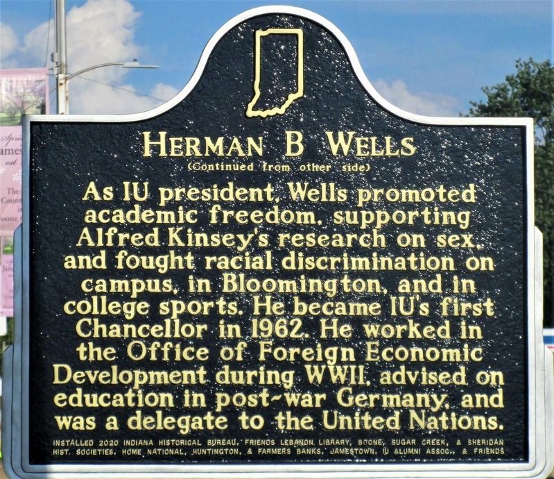
On West Main Street (U.S. 136) west of North High Street, on the right when traveling west.
Prominent educator and statesman Herman B. Wells was born in Jamestown, Indiana. During the Great Depression, he directed research for the Indiana Bank Commission, producing state banking reforms. In 1938, Wells was elected President of Indiana . . . — — Map (db m175678) HM
On Main Street (a.k.a.: US 136) west of High Street, on the right when traveling west.
Jamestown War Memorial
Dedicated to the
memory of all
Veterans of all Wars
Great is he who
lays down his life for
his Country in the name
of Freedom.
Erected by the people
in the year of Our Lord . . . — — Map (db m43762) WM
On County Road 950 North at North 200 East, on the right when traveling west on County Road 950 North.
Boone County Bridge 41, over Sugar Creek was a triple stone
arch built in 1901 by Theodore Eck and Charles Ridout
of Lebanon, IN. The cost was $4000.00. B.F. Baker, county
surveyor, served as engineer and construction supervisor.
In 1905 the . . . — — Map (db m289084) HM
On South Lebanon Street (State Road 39) south of South Street (State Road 32), on the right when traveling south.
Enroute to Washington, D.C., to become 16th President of the U.S., addressed citizens of Lebanon and Boone County from rear of railroad passenger car at this place on the evening of February 11, 1861. — — Map (db m3811) HM
On Meridian Street at Main Street, on the right when traveling south on Meridian Street.
( Center - Engraved in Stone: )
In Memory of our
Boone County Veterans
who Bravely Served
in Our Wars.
Erected by The American Legion
Brown - Dolson Post 113
Lebanon, Ind.
( Left Bronze Plaque: ) . . . — — Map (db m21359) WM
On West Main Street west of West Street, on the right when traveling west.
This property has been
placed on the
National Register
of
Historic Places
2011
by the United States
Department of Interior
thanks in part to
Bud Falke — — Map (db m251052) HM
On North Lebanon Street (Indiana Route 39) north of West Camp Street, on the right when traveling north.
Brothers Mel and Don Kenyon impacted American open wheel racing in a way which, perhaps, will never be duplicated. Mel began his career in 1954, driving stock cars. When Don left the Air Force, in 1958, they bought a midget with his mustering out . . . — — Map (db m265556) HM
On Main Street west of Meridian Street, on the right when traveling west.
In Memory
of Revolutionary Soldiers
Buried in
Boone County Indiana
Arthur Andrews 1753 - - 1834
John Ferguson 1759 - - 1839
William Gipson 1753 - - 1835
James Hill 1745 - - 1854
Henry Johns 1757 - - 1833
John Leap 1735 - - . . . — — Map (db m241648) WM
On West Main Street just east of North Lebanon Street ( Route 39), on the right when traveling west.
A progressive politician and lifelong Democrat, Ralston met the challenges posed by Indiana’s transition to a more urban and industrial state. Born 1857 in Ohio, he opened a law office in 1886 in Lebanon, where he lived until elected governor in . . . — — Map (db m175673) HM
Near Country Club Drive north of Artman Avenue, on the left when traveling north.
Henry C. Ulen, an international
contractor from Boone County,
founded multiple construction
companies in the early 1900s. His
companies' infrastructure projects.
including the Marathon Dam in Greece,
parts of the Trans-Iranian and . . . — — Map (db m250683) HM
The Boone County REMC built Indiana's first electric cooperative line to the Clark Woody farm 5 miles west of this site with funds borrowed from the Rural Electrification Administration, July 22, 1935. — — Map (db m27673) HM
On State Road 47 west of Evans Road, on the left when traveling east.
Ka-wi-a-ki-un-gi Village "Place of Thorns" (Thorntown) was center of 64,000 acre Thorntown Indian Reserve. Granted to Eel River Miamis in 1818, ceded to U.S. in 1828. — — Map (db m21352) HM
Black southerners established a thriving, free community around Thorntown in Sugar Creek Township by the early 1850s. Most became farmers and some owned property, despite Indiana's constitutional prohibition of black settlement. By 1870, this . . . — — Map (db m174247) HM
On South Main (County Route 650E) at Linville Avenue, on the right when traveling north on South Main.
Albert S. White, for whom Whitestown is named, was president of the Indianapolis & Lafayette Railroad. White was a United States senator and Representative from Indiana and a leading abolitionist. He was appointed to a select federal commission by . . . — — Map (db m175788) HM
On South Main Street (County Route 650E) just south of Linville Avenue, on the right when traveling south.
Commemorating the historic Lafayette & Indianapolis Railroad. On May 1st, 1865, at 1:07a.m., the Lincoln Funeral Train passed through Whitestown with mourners lining the tracks in the middle of the night to pay homage to the assassinated 16th U.S. . . . — — Map (db m175790) HM
Near South First Street at West Oak Street, on the left when traveling north.
Abraham Lincoln enroute to Washington as President Elect on February ll, 1861 addressed the Citizens of Zionsville at the Railroad Depot which stood on this site. — — Map (db m8326) HM
On Whitestown Road east of County Road 950 East, on the right when traveling east.
Located in Eagle Township in Boone County, Indiana, this
intact family farmstead includes a farmhouse and related
outbuildings, and was named a Historic District on the
National Register of Historic Places by the National Park
Service in 2011.
. . . — — Map (db m231487) HM
On Michigan Road (U.S. 421) at Valley Meadow Drive, on the left when traveling north on Michigan Road.
With proceeds from the sale of 170,580 acres of Indian land granted by the Federal Government, Indiana built its first north-south road. Surveyed 1829, passable by 1834, "completed" in 1837, its cost was $242,000.00. — — Map (db m67191) HM
On South Main Street just south of West Hawthorne Street, on the right when traveling south.
Site of
First Post Office, Lot No. 4, 1853
Postmaster: John W. Vaughn
First Dry Goods Store and Grocery Store, Lot No. 4, 1852
Wiley & Vaughn
First House erected
John Miller’s hous, Lot No. 1, 1852
and Boarding House
Zion . . . — — Map (db m175807) HM
On W. Hawthorne Street at S. 2nd Street, on the left when traveling west on W. Hawthorne Street.
Patrick H. Sullivan, 1794-1879, was the first white settler in Boone County, 1823, and built the first log cabin. In 1857, he bought this site and lived here until 1872. He served in the War of 1812. — — Map (db m67190) HM
On West Pine Street at South 1st Street, on the left when traveling west on West Pine Street.
On these grounds stood one of Zionsville’s first and finest hostelries. It was a two story frame structure, erected in Civil War days, and razed in 1938. It served as a rooming house, meeting place, and occasionally as the village social . . . — — Map (db m175824) HM
On South Main Street at East Cedar Street, on the right when traveling north on South Main Street.
In the beautiful Eagle Creek valley of southeastern Boone County, a new town was planned on land owned by Elijah and Mary "Polly" Cross.
Convinced by Lebanon businessman William Zion, a director of the Lafayette & Indianapolis Railroad, the . . . — — Map (db m8328) HM
On West North Street at Magnolia Street, on the right when traveling west on West North Street.
Kokomo native Ryan White was diagnosed with AIDS in 1984 after contracting the virus from a contaminated hemophilia treatment. He faced intense discrimination from his community in a time of fear and misunderstanding about AIDS and was prevented . . . — — Map (db m216621) HM
On E. 276th Street 0.8 miles east of U.S. 31, on the left when traveling east.
Free people of color left the South starting in the 1820s as threats to freedom and property escalated with slavery expansion. In 1835, Hansel and Elijah Roberts and Micajah Walden of North Carolina bought land in Hamilton County near anti-slavery . . . — — Map (db m98840) HM
On East 106th Street west of North College Avenue, on the right when traveling west.
In 1832 a school was organized and regular church services began in a log cabin owned by Isaac Sharp.
It was known as…
Sharp's Meeting House. — — Map (db m252673) HM
On East 106th streeet just east of Broadway Street, on the right when traveling west.
Settlers, Isaac and Nancy Sharp, donated this site for the Pleasant Grove school, church, and cemetery. School and regular church services began in 1832 at this location in a log cabin known as the "Sharp Meeting House". The first burial was in 1837 . . . — — Map (db m252675) HM
Near Eller Road at East 106th Street, on the right when traveling south.
The Ambassador House was built as a log structure c. 1826 by Thomas and Sarah West. Around 1895, Addison and India Harris enlarged the home and built the stone pillars and outbuilding. Addison served as U.S. Ambassador to Austria-Hungary from . . . — — Map (db m231486) HM
On Brooks School Road just east of East 116th Street, on the right when traveling south.
By the early 1900s, Indianapolis was home to multiple medical education institutions which required corpses for dissection-based learning. Extant laws failed to provide enough bodies for this use, generating a lucrative black market. In 1902, . . . — — Map (db m210940) HM
Near Allisonville Road 0.6 miles north of East 126th Street.
This was a home where children were born and neighbors came to call.
Travelers stopped here for a warm bed and a generous table. They played music and talked about books and ideas and the wider world beyond the river.
Judges held court . . . — — Map (db m233143) HM
On Maple Avenue at South 10th Street, on the right when traveling east on Maple Avenue.
Built c. 1905 this Arts & Crafts building served as both residence and piano studio until 1951 when it became the clinic of beloved Noblesville physician Dr. James Dillon. The interior features inlaid wood floors, quarter sawn oak trim and . . . — — Map (db m310934) HM
On 9th Street at Logan Street, on the right when traveling north on 9th Street.
Built in the 1880s by Margaret Allison, this building housed a jewelry store in the 1880s and a cigar factory in the 1890s. The carrara glass facade on the first floor is a unique feature in downtown Noblesville. — — Map (db m27840) HM
On Conner Street (State Road 32/38), on the right when traveling east.
Built in the 1870s by the Bachman family, this building housed a bookstore, clothier and cigar store in the 1800s. In the 1900s, several restaurants were here, including the “Billy Bee Restaurant” in 1929 and 1930. — — Map (db m27885) HM
On North 9th Street, on the right when traveling south.
From Hamilton County Home
North Cumberland Road
Built 1857, additions 1878,1903,1905 and 1910
Deactivated in 1983 destroyed by fire February 1985 — — Map (db m264925) HM
On North 9th Street south of Clinton Street, on the right when traveling south.
Erected by Mary H. Roudebush c. 1901, this building was sold in halves to each of two young entrepreneurs in 1916. P. P. Paskins Restaurant and Walter Bordner Monument Works shared the simple structure for over 50 years. — — Map (db m129350) HM
On Forest Park Driveway 0.2 miles west of Cicero Road, on the left when traveling west.
Known internationally as one of America’s most popular and successful short-track racers, Bryan Clauson was also a proud Noblesville Miller. Despite his passing in 2016, at only age 27, his mark was already indelible. 112 USAC wins ranks him in . . . — — Map (db m175607) HM
On Conner Street (State Road 32/38), on the right when traveling east.
This three-unit block was built in 1884 by H. M. Caylor as a dry goods store. Typical of Victorian Gothic style, second-story details feature decorative arched stonework around the windows and the Corbel table bearing the Caylor name. — — Map (db m27886) HM
On Logan Street at North 10th Street, on the left when traveling east on Logan Street.
Built in 1891 by the Castor family, the third floor of this building was owned by the Cherokee Lodge of the Independent Order of Red Men for many years. The mayor's office was located here in the mid 1890s. — — Map (db m233034) HM
On Monument Street at North 10th Street, on the right when traveling west on Monument Street.
This property
has been placed on the
National Register
of Historic Places
by the United States
Department of the Interior
Cole-Evans house
c. 1840 — — Map (db m231460) HM
On Conner Street (Indiana Route 32), on the right when traveling west.
Hamilton County formed 1823. Noblesville platted 1823, selected county seat 1824, incorporated 1851. Located east of downtown commercial area; boundaries are Conner and Logan streets (east and west) and 10th and 17th streets (north and south). . . . — — Map (db m216704) HM
On Logan Street east of North 10th Street, on the right when traveling east.
Hamilton County formed 1823. Noblesville platted 1823, selected county seat 1824, incorporated 1851. Located east of downtown commercial area; boundaries are Conner and Logan streets (east and west) and 10th and 17th streets (north and south). . . . — — Map (db m258500) HM
On Conner Street (State Road 32/38) at 9th Street, on the right when traveling east on Conner Street.
This was the site of the old Corner Drug Store, a three story building & popular gathering spot, which stood from c.1850 until it was razed in 1914. The present structure was then built & continued as a drugstore until 1995. — — Map (db m27872) HM
Built by Daniel Craycraft in 1889, this Queen Anne building housed Meade Vestal's law office. Vestal was a prominent Democrat and Circuit Court judge. The second floor loggia is unique for a commercial building. — — Map (db m27842) HM
On Monument Street 0.5 miles west of Kings Lane, on the right when traveling west.
In memory of those
who died while serving
their country
Gold Star Veterans Korean War
Charles Chii Dress •
John Frederick Christy •
Robert Townsend Copple •
Malcom Darrell Ireland •
Charles R. Kenley •
Robert P. . . . — — Map (db m161450) WM
On South 9th Street at Maple Avenue, on the left when traveling south on South 9th Street.
In 1897 the cornerstone was laid to this gothic revival church, home until 1989 of the county's oldest Christian congregation. Designed by architects Wing & Mahurin, it showcases a central rosette window and 6-story bell tower. — — Map (db m232628) HM
On 9th Street at Logan Street, on the right when traveling north on 9th Street.
Moving from a modest first floor site on Logan Street, this “modern banking house” was constructed in 1910 as the first new building of the decade. It features a limestone facade and ionic pilisters (sic) in the neo-classical style. — — Map (db m27917) HM
F. M. Bachman, a German immigrant, constructed this c.1880 building for his grocery business. The building is best known for housing the Morris 5&10¢ Store, located here from the 1920s to the 1950s. — — Map (db m27845) HM
On Conner Street (State Road 32/38) at 10th Street, on the left when traveling east on Conner Street.
J. Frank Becker built the “Becker House” in 1884 and used it as a bakery, restaurant, and boarding house. John Dietrich bought the property in 1905, calling it the Grand Hotel which had a “fireplace in every room.” — — Map (db m27887) HM
On North 8th Street north of Conner Street, on the right when traveling north.
(Large Stone Benches)
(Left Bench) ““ From these honored dead we take increased devotion to that cause for which. . .”
(Right Bench) “. . .they gave the last full measure of devotion”“ . . . — — Map (db m38156) WM
On North 10th Street south of Harrison Street, on the right when traveling south.
This property
Harrell House
has been placed on the
National Register
of Historic Places
by the United States
Department of the Interior — — Map (db m231466) HM
On Conner Street (State Road 32/38), on the left when traveling east.
The long-standing carriage & wagon manufactory of Heylmann & Sons had its beginnings here. Built in 1872, it is one of downtown's oldest remaining structures. A facade remodeling in 1918 updated it for a new tenant, the gas company. — — Map (db m27888) HM
On Logan Street at 8th Street, on the left when traveling east on Logan Street.
This building has been continuously used as a tavern since it was built by James L. Evans in 1889. It was strategically located on this corner to service railroad passengers with food and drink downstairs and boarding upstairs. — — Map (db m27863) HM
On Conner Street (State Road 32/38), on the left when traveling east.
Built in 1898, this Chicago school style facility was home to a growing carriage business. It features a system of ramps connecting three levels. From 1935-1999, Hudler Press printed weekly editions of The Noblesville Times. — — Map (db m232620) HM
The Joseph Block was built by two wealthy brothers, Julius and Louis Joseph, around 1900. It first housed a furniture and hardware store and later the House of Crane, a popular cigar shop and pool hall until 1928. — — Map (db m27864) HM
On South 8th Street at Maple Avenue, on the right when traveling south on South 8th Street.
Restoration made possible by the Hamilton County Visitor
and Convention Commission, the City of Noblesville
and the U.S. Department of the Interior,
National Park Service's Historic Preservation Fund
administered by the Indiana Department . . . — — Map (db m231481) HM
Constructed in 1888 by Albert H. Lacy, this building appears to be 4 stories, but the blind windows mask a decked roof. The tenants have included a hardware store for over 100 years and the Knights of Pythias for over 40 years. — — Map (db m27862) HM
On Logan Street east of North 8th Street, on the left when traveling east.
Speculating after the discovery of natural gas, Charles Oursler and Lucius Lybrand built this two-story block in 1888. The first tenants were the post office in the west storefront and a series of grocery stores next door. — — Map (db m233193) HM
On 9th Street at Logan Street, on the right when traveling north on 9th Street.
Built c. 1870, this building once housed the City Theater on the third floor and the local newspaper on the second. Purchased by Masonic Lodge No. 57 in 1884, and updated with a stepped gable, it was home to the Masons until 1915. — — Map (db m27865) HM
On Logan Street at North 10th Street, on the right when traveling east on Logan Street.
In 1914, Charles and Everett Neal merged their paper, the Enterprise, with the Noblesville Daily Ledger. In 1926, the Neals constructed this building and the Noblesville Daily Ledger remained at this location until . . . — — Map (db m232980) HM
On Conner Street (State Road 32/38) at 9th Street, on the left when traveling east on Conner Street.
This brick structure was built as two buildings in the late 1880s. Around 1920 they were modified with the single facade. Occupants included a hardware store, pool hall, and the New York Store Company, a large department store. — — Map (db m27883) HM
On Maple Avenue west of South 9th Street, on the right when traveling west.
A crowd of fascinated residents gathered to witness the construction of the first brick street in the town of Noblesville — then an exciting modern innovation. Although this photo of the square being paved is dated 1892, there is no evidence that . . . — — Map (db m232635) HM
On South 8th Street close to Maple Avenue, on the left when traveling south.
Norman Norell, 1900-1972. Fashion designer Norman (Levinson) Norell was born near here. The Levinsons settled in Noblesville in 1857 and opened a men’s clothing store. They relocated to Indianapolis in 1907, where theater productions inspired . . . — — Map (db m210939) HM
On Connor Street (State Highway 32/38), on the right when traveling east.
Real estate investor Louis Joseph built this building for Margason Hardware in 1907. In 1927, Greek confectioner Harry Plackas moved his candy business to this site, where he & his family lived over the "sweet shop" until 1940. — — Map (db m232548) HM
On Allisonville Road, on the right when traveling west.
First bridge spanning White River at Potter's Ford was commissioned 1860 and named after the landowner, William Potter. In 1870, Hamilton County Commissioners voted for construction of this "Howe Truss" bridge. It was finished 1871 and . . . — — Map (db m8165) HM
A single-step parapet sports the name R. R. Stephenson, the judge and politician who built this block in 1888. Two storefronts housed the gas company and a brother's plumbing business. Since 1938 it has been home to taverns. — — Map (db m27913) HM
On Hannibal Street west of South 8th Street, on the right when traveling west.
This brick home was built
c.1864 by Leonard Wild for Mr.
Wilson on the site of William
Conner's 1837 town house. It is
a classic example of T-plan
Italianate architecture exhibiting
ornate ironwork and fine
interior woodwork. — — Map (db m231482) HM
On Maple Avenue west of South 9th Street, on the right when traveling west.
Built in 1898 by George C. Richwine, this building was used to sell carriages, buggies, wagons and bicycles. When transportation changed, the building was used to sell automobiles from the 1920s to the 1950s. — — Map (db m232631) HM
On 9th Street at Maple Avenue, on the left when traveling south on 9th Street.
In 1915 George C. Richwine built a combination apartment house and business block on the site of his home and buggy shop. Then considered a monstrosity, this unusual California mission style glazed brick building is revered today. — — Map (db m27889) HM
Site of the First Presbyterian Church from 1850-1903, this building was erected in 1904 by Stella Shirts. A central staircase between two ground-floor retail spaces leads up to four offices that retain much original woodwork. — — Map (db m27890) HM
On Logan Street at 9th Street, on the left when traveling east on Logan Street.
Built in 1867 and rebuilt in 1887, this building has continuously held dry goods stores: 1898-1920, C. W. Sowerwine; 1920-1925, Osbon Dry Goods; c.1925-1981, Willits Department Store; 1982-2001, Watson's Carpet. — — Map (db m27866) HM
On Canal Way west of Meadows Boulevard, on the left when traveling west.
These canal-bed earthworks are remnants of construction on the Central Canal from 1836-39. It was planned to link the Hoosier interior with interstate markets, via the Wabash & Erie Canal, as part of the 1836 Internal Improvement Act. Indiana's . . . — — Map (db m41624) HM
On North 8th Street north of Conner Street, on the right when traveling north.
The Noblesville Commercial
Historic District
has been placed on the
National Register of Historic Places
by the united States
Department of the Interior
- - + - - + - - + - -
The District is roughly bounded . . . — — Map (db m37887) HM
On Logan Street east of North 9th Street, on the right when traveling east.
The Noblesville Post Office occupied this brick and limestone building from 1906 to 1931. Later, a west-end addition created a total of four bays occupied by a medley of shops and offices, including jewelers, cobblers and barbers. — — Map (db m232979) HM
On North 9th Street at Clinton Street, on the left when traveling north on North 9th Street.
The Union Traction Company, Indiana's largest interurban line, built this station in 1906. During its heyday in 1910, 35 trains a day passed through Noblesville, making it "one of the banner stations of the line". — — Map (db m233035) HM
On Conner Street (Indiana Route 32) at South 8th Street, on the right when traveling east on Conner Street.
Built in 1883 by the Lowther family, Lowther's shoe store sold shoes and oxfords "in the patterns & colors that lead the fashion." In 1932 it became the Uptown Café, a restaurant still bearing that name at the turn of the 21st century. — — Map (db m310938) HM
On Conner Street (State Road 32/38), on the left when traveling east.
Built c. 1880, the Wainwright Trust Company was located here until the 1930s. The county's first abstract company, Wainwright and Hall, was forerunner to the Trust Company formed in 1901 — — Map (db m27914) HM
On Allisonville Avenue at Covered Bridge Way, on the right when traveling west on Allisonville Avenue.
Potter's Bridge was built in 1871 by Josiah Durfee of Noblesville for a mere $13,000. It connects the land called "Potter's Ford,” named for William A. Potter (1838-1883) who owned and farmed the surrounding land.
Why Were Bridges . . . — — Map (db m163077) HM
The Wild building was built in 1880 by Leonard Wild, the “merchant prince and largest builder of his home city”. Designed by Huebner and Mueller of Indianapolis, it housed Wild's dry goods store for more than 15 years. — — Map (db m27874) HM
On Conner Street east of 9th Street, on the right when traveling east.
In the early 1900s, part of the Citizens State Bank building on the corner was reconfigured with the adjacent structure to enlarge the Craycraft Dry Goods Store. The business remained in the Craycraft family until 1962. — — Map (db m232598) HM
Near West 1st Street at South Main Street, on the right when traveling west.
George and Hannah Boxley, first white settlers in Adams Twp., built the log cabin which still stands on this property in 1827. The Boxley's, early leaders in the community, used their home as a station on the Underground Railroad prior to the Civil . . . — — Map (db m216543) HM
On West First Street west of South Main Street, on the right when traveling west.
Born in Virginia, George Boxley, first settler in Adams Township, Hamilton County, came to Indiana, as a fugitive from justice. Accused of helping slaves to escape and fomenting a slave rebellion in 1816 in Spotsylvania County, Virginia, Boxley . . . — — Map (db m216521) HM
On Strawtown Avenue 0.3 miles west of Essig Avenue, on the right when traveling west.
We have recreated a large full-scale archaeological
excavation out of concrete. You can see the
stratigraphy in the levels of the soil by noticing the
different colors of the concrete. See if you can identify
these archaeological . . . — — Map (db m163109) HM
On Strawtown Avenue 0.3 miles west of Essig Avenue, on the right when traveling west.
We have uncovered multiple dwelling structures,
stockade walls, hearths, storage pits, middens
(trash pits), and thousands of artifacts. Many of the
material cultural items have long since decomposed,
but fragments remain.
Notice the . . . — — Map (db m163108) HM
On Strawtown Avenue 0.3 miles west of Essig Avenue, on the right when traveling west.
Welcome to the mock archaeological excavation.
Archaeology is one way we learn about the past life ways
of the people who once lived here. Archaeology is the
scientific study of man's material culture. Archaeologists
study artifacts and other . . . — — Map (db m163107) HM
On Strawtown Avenue west of Essig Avenue, on the right when traveling west.
The park's name evokes its natural prairie environment and pays homage to Native American people who once occupied this site. This unique
environment, nurtured by the White River, has served as an ecological and cultural crossroads throughout . . . — — Map (db m163111) HM
Near Strawtown Avenue west of Essig Avenue, on the right when traveling west.
Although much of the day-to-day living was done outside of the home, the family home played an important role in the lives of Strawtown's early Native American communities. The family resided in the home and many of their food items and personal . . . — — Map (db m216812)
Near Strawtown Avenue west of Essig Avenue, on the right when traveling west.
Community buildings, as the name implies, belonged to the community and served a different purpose and were larger than a single family home. Community buildings could have served as the meeting place for discussing issues within the tribe. These . . . — — Map (db m216807)
Near Strawtown Avenue west of Essig Avenue, on the right when traveling west.
The Oliver Phase people once built a village here at Strawtown Koteewi Park. The Oliver Village site (A.D. 1200-1450) located at Strawtown Koteewi Park is thought to be the beginnings of the Oliver Phase peoples. Based on archaeological evidence, . . . — — Map (db m216817)
Near Strawtown Avenue west of Essig Avenue, on the right when traveling west.
This stockade wall and ditch are representative of what was found at Strawtown Koteewi Park. The Oliver Village is often referred to as the Strawtown Enclosure because the village was "enclosed" by a stockade wall and ditch. The ditch was well . . . — — Map (db m216795)
Near Strawtown Avenue west of Essig Avenue, on the right when traveling west.
People from many interesting cultures made the area of Strawtown Koteewi Park their home. As you explore this exhibit you will see recreated structures from the Late Woodland time period. Although these structures are not exact replicas of the ones . . . — — Map (db m216792)
On Hoovert Street west of North Union Street, on the right when traveling east.
In 1837, an enslaved family of three escaped from Missouri; settled six miles north of here 1839 with name Rhodes. In 1844, Singleton Vaughn arrived at their home to claim them; family resisted until neighbors arrived. Vaughn agreed to take . . . — — Map (db m216703) HM
On West Main Street (U.S. 40) west of State Street ( Route 9), on the right when traveling west.
“I gravitated towards Barefoot Boy out of the rest [of James Whitcomb Riley’s poems]
because it resonated with me.
I could relate with the boy because I was always a kid who didn’t have a care in the world,
always the first to jump out of my . . . — — Map (db m210259) HM
On East Main Street (U.S. 40) west of Apple Street, on the right when traveling west.
The use of the rooster as a Democratic party symbol originated in Greenfield in the 1840 campaign. The rooster was later adopted by the state and national Democratic parties. — — Map (db m273) HM
On West Main Street (U.S. 40) west of Pennsylvania Street, on the right when traveling west.
Birthplace
James Whitcomb Riley
“The Hoosier Poet”
October 7, 1849–July 22, 1916
Editor, author, poet, lecturer and entertainer. One of the best known Hoosiers of all time, Riley first wrote under the name "Benj. F. Johnson of Boone" . . . — — Map (db m213261) HM
756 entries matched your criteria. The first 100 are listed above. Next 100 ⊳