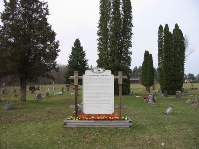
On State Highway 21 east of 16th Avenue, on the left when traveling east.
On July 11, 1859, Mr. Halvor Olson offered this 1/2 acre of his land to be used as a cemetery for the members of the Evangelical Lutheran Church (Hauge Synod) here in the Roche a Cree (Arkdale) settlement. People of the community outside the . . . — — Map (db m7368) HM
On 18th Avenue 0.3 miles north of Cumberland Avenue, on the right when traveling south.
On this site once stood a Lutheran Church of the Norwegian Synod, from the years 1887 to 1921. This church developed because of a disagreement on some doctrinal points with the United Lutheran Church which stood one half mile south of here.
. . . — — Map (db m4657) HM
On Cypress Avenue west of 18th Avenue, on the left when traveling west.
In 1850, a group of Norwegian settlers from Koshkonong, the foremost Norwegian settlement colony in the United States at the time, left their southern Wisconsin home and migrated north, settling here in "Roch-a-Cree" or Roche-a-Cri. Imbued with . . . — — Map (db m36123) HM
On 18th Avenue at Cumberland Avenue, on the left when traveling south on 18th Avenue.
In 1853, Norwegian immigrants to this area, organized the Norwegian Evangelical Church of Roche-a-Cri, in 1860. A log church was constructed one mile south of this location. It was destroyed by fire in 1866. A frame church was then erected on this . . . — — Map (db m4658) HM
Near State Highway 13 0.3 miles north of Czech Avenue, on the left when traveling north.
This prominent butte, perhaps the steepest hill in Wisconsin, was called La Roche-a-Cri by 17th and 18th century French voyageurs. Rising 300 feet above the surrounding plain, this landmark undoubtedly guided Indians and early pioneers. Indians of . . . — — Map (db m19822) HM
On Main Street (State Highway 13) at West Third Street, on the right when traveling north on Main Street.
Korea
Lest We
Forget
In Honor
of all
Veterans,
POWs – MIAs
24th Infantry
"Victory Division"
Designed by Cpl. Donald E. Hahn
34th and 19th Reg.
Tribute to
Cpl. Mitchell Red Cloud Jr. . . . — — Map (db m37091) WM
On Bighorn Drive 0.6 miles west of County Highway Z, on the left when traveling west.
Ira and Ransom Gleason, father and uncle to Charlotte and Francis Marion Rous set aside the original acre of land for this cemetery, from the land they obtained through the Public Lands Act of 1820. This plaque in memory of Edna Rous Russell and . . . — — Map (db m7534) HM
Near County Road D near 10th Avenue, on the right when traveling east.
Duty, Honor, Country
We dedicate this monument to
all our service men and women
in all wars and conflicts.
United States Army
United States Marines
United States Navy
United States Air Force
United States Coast Guard . . . — — Map (db m41686) WM
Sugarbush Hill which you see across the valley is one of the highest points in the northern highland geological province. This province, which includes some 15,000 square miles in northern Wisconsin, is underlain by the crystalline rock on an . . . — — Map (db m33686) HM
On State Highway 32 0.1 miles south of Starks Settlement Road, on the left when traveling south.
In 1927 this tract of land was purchased for the Laona School Forest, the first in Wisconsin and the United States. It was dedicated April 22, 1928.
Motivated by the suggestion of Dean H.L. Russell, of the College of Agriculture, University . . . — — Map (db m33539) HM
On State Highway 55 0.7 miles north of County Highway M.
This is the home of the Sokoagon Band of the Chippewa tribe. According to tradition handed down from one generation to the next, the first chief of the Band was Getshee Ki-ji-wa-be-she-shi, or the Great Marten.
Each summer the Sokoagon Band . . . — — Map (db m33479) HM
On East Huron Street (State Highway 116) at North Church Street, on the left when traveling east on East Huron Street. Reported missing.
Before women achieved the right to vote, clubs often served as women's political and cultural forums. Foreseeing the political power of a statewide alliance of women, Lucy Smith Morris organized Wisconsin's women's clubs into one coalition in 1896. . . . — — Map (db m286685) HM
On Water Street at West Cumberland Street, on the left when traveling north on Water Street.
On these banks of the Upper Fox River June 7, 1673, explorers Marquette and Jolliet visited the Mascoutin Indian Tribe that lived here. For many years traders and missionaries camped here while visiting the Indians. In 1846 Nathan Strong, a . . . — — Map (db m20165) HM
Near Lake Street at Illinois Avenue, on the right when traveling south.
The Native Americans who occupied this land 10,000 years before the arrival of European settlers referred to this magnificent body of water as Daycholah. From lookouts like this, Native Americans viewed the lake and paid homage to "the spirit who . . . — — Map (db m69373) HM
On Lawson Drive at Sunset Drive, on the left when traveling west on Lawson Drive.
"No Hurry" was built for Victor and Jesse Lawson by Electric Launch Company of Bayonne, New Jersey in 1909. The 55 foot boat is made of cypress, white oak and mahogany and was powered by two electric motors and 140 batteries. The Lawsons built the . . . — — Map (db m67831) HM
On Lawson Drive 0.1 miles west of Sunset Drive, on the right when traveling west.
Chapel Car "Grace" was one of seven such cars operated by the American Baptist Publication Society from 1891 to 1948. The car was commissioned in May 1915. Its first assignment was in Northern California. Its last work in Orem, Utah. The car was . . . — — Map (db m67833) HM
On Mill Street (County Highway A) north of Water Street, on the left when traveling north.
On this site in 1845 Anson Dart built the first dam and sawmill, raising the level of Green Lake and forming the Millpond and Dartford Bay.
In 1850, John Sherwood opened a new outlet from the pond with a mill race and built a 4-story grist . . . — — Map (db m34040) HM
On Mill Street at Water Street, on the right when traveling north on Mill Street.
In memory of those who made the supreme sacrifice in World War II Robert L. Miller Paul A. Pagel David A. Barton Charles H. Thrasher Marvin E. Bierman Myron T. King — — Map (db m62743) WM
At 100 feet in length, the Queen of the Lake was the largest of five steam boats and boat launches operated by the Norton Family on Big Green Lake. Built near this site in the mid-1890’s, and powered by coal and wood, the Queen was famous for its . . . — — Map (db m200423) HM
On South Lawson Drive 0.2 miles south of South Street, on the right when traveling south.
Chief Highknocker, whose Indian name was Hanageh, was the son of Chief Big Soldier. He was born in 1820 in his father's camp on the east shore of Green Lake. He spent his boyhood in what later became Green Lake County. In later years, because . . . — — Map (db m300235) HM
On State Highway 23 1 mile west of Highway 73, on the right when traveling west.
Friday night, March 28, the Army moved in and started operation at the new radar installation four miles west of Green Lake. The site, situated on the crest of the hill on Highway 73, 1/4 mile south from the intersection with 23, is rapidly being . . . — — Map (db m204865) HM
On West Main Street (State Highway 23/73) east of North 1st Street (County Highway D), on the right when traveling east.
1914 — 1918
Dedicated to those of Bennie Kasierski Post No. 366 who offered their lives in humanity's defense in the war of the nations and in memory of those of the nation who gave their last full measure of devotion.
In Memory Of All . . . — — Map (db m39652) HM
On North Second Street at West Main Street (Wisconsin Highway 73), on the right when traveling north on North Second Street.
Princeton's Cattle Fair, a monthly market, held on the first Wednesday of each month for over 100 years in this area, emerged from early county fairs beginning in 1856.
Erected 1973 — — Map (db m36439) HM
On West Water Street at Short Street on West Water Street.
World War I
Memorial
In memory of
Bernard Kasierski · Leo Leonard · Jacob Lese · Walter Shave · Edward L. Drill · Stanish Naperalla · William Malzham · Sylvester Rutkowski · Joseph Gebert
"Their ultimate sacrifice shall
live in our . . . — — Map (db m39630) HM
On County Highway C north of Interstate 90/94, on the right when traveling east.
You are standing on what was once the bottom of a glacial lake in which Castle Rock, the formation rising before you, was an island. Thousands of years of erosion by water, ice and wind created the surface features you see in this area.
The . . . — — Map (db m4230) HM
Near County Highway C north of Interstate 90/94, on the left when traveling north.
Lt. Volk was the first Wisconsin Air National Guard pilot killed in the Korean Conflict. Jerome Volk was born March 17, 1925, and attended Rufus King High School in Milwaukee. Volk enlisted, went to pilot training, and was commissioned during . . . — — Map (db m39165) HM
Following the Civil War, state officials reorganized the Wisconsin Militia and in 1879 renamed it the Wisconsin National Guard. Adjutant General Chandler P. Chapman of Madison, a veteran of the famed Iron Brigade, purchased 440 acres near the . . . — — Map (db m31744) HM
Near County Highway C north of Interstate 90/94, on the left when traveling north.
The thanks of the Nation is extended through the President, Commander in Chief of the Army and Navy of the United States to the people of The Winnebago Tribe in Wisconsin for their unswerving loyalty and patriotism, the splendid service . . . — — Map (db m37190) HM
On Main Street (State Highway 71) 0.5 miles west of Academy Street (State Highway 80/82), on the right when traveling west.
This 32 mile state trail was formerly the mainline of the Chicago and North Western Railway. The conversion from “rail to trail” represented a new concept in recreational development. Utilizing the abandoned railbed, it was the first . . . — — Map (db m18708) HM
On North Wisconsin Street (County Highway HH) north of West Julius Street (County Highway N), on the right when traveling south.
“Keep hopping, hoeing and hoping” said an editorial in 1867 when hops were selling for 50¢ a pound, pickers by the thousands worked in the fields, merchants were selling silks, laces, paisley shawls and grand pianos, and farmers were . . . — — Map (db m52853) HM
On Wright Street west of Rogers Street, on the right when traveling west.
Missing in Action John T. Delmore Prisoner of War Charles T. Graves George W. Buffum
Charles P. Tucker Killed in Action Edwward W. Pray Leslie Spence
Abner O. Heald Gilbert J. Pfeifer
Austin Conklin Warren Risley . . . — — Map (db m140975) WM
Near Interstate 90/94 at milepost 74, on the right when traveling east.
The Iron Brigade became one of the most celebrated units of the Civil War (1861-1865). Of its five regiments, three came from Wisconsin: the Second, Sixth, and Seventh Wisconsin Volunteer Infantry. (The other two regiments were the Nineteenth . . . — — Map (db m4119) HM
Near Interstate 90/94 at milepost 74, on the right when traveling east.
From its source at Lac Vieux Desert to the Mississippi River at Prairie du Chien, the Wisconsin River descends 1,071 feet in 430 miles. Twenty-six power dams utilize 640 feet of the fall of the river to produce an annual average of one billion . . . — — Map (db m4132) HM
Near Interstate 94, on the right when traveling west.
A living memorial to and in honor of all Wisconsin veterans, living and dead, of all wars in which the United States of America has engaged. Color guard of the 8th Wisconsin Infantry Regiment with Old Abe at Vicksburg, Mississippi, 1863 The . . . — — Map (db m88598) HM WM
On East State Street (State Highway 82) near Oak Street, on the left when traveling west.
A Mauston native, lawyer, and World War I veteran, Loomis served in the state legislature (1929-1934), was first state director of the Rural Electrification Administration (1935-1936), represented Wisconsin at the World Power Conference (1936), and . . . — — Map (db m20386) HM
On County Road O 0.2 miles west of State Highway 58, on the left when traveling west.
Built by the Rock Valley Union Chapel Society. Used as a community center, church & Sunday school and 4-H meetings in the late 1940's. Lindinia Town Insurance Company was also organized here. This chapel marks the site of Stewart's Settlement . . . — — Map (db m56423) HM
Near Interstate 90/94 at milepost 75, on the right when traveling west.
“There are some who can live without wild things, and some who cannot.” For those who cannot, Aldo Leopold’s A Sand County Almanac helps reveal the unsuspected natural riches hidden in these sand counties of Wisconsin.
At . . . — — Map (db m4227) HM
Near North Main Street (State Highway 80) at Maple Street.
Erected to the
Memory of the
Heroes of the War
of 1861–65 by Post
245 G.A.R. Dept. of
Wis. the W.R.C. No. 90
Dept. of Wis. and by
the Citizens of
Necedah.
____
Dedicated . . . — — Map (db m32788) HM
On State Highway 80 0.2 miles south of 32nd Street, on the left when traveling north.
Mrs Salter killed here by the Indians June 13 – 1863
2 Indians Jo and Jim Dandy killed by Salter and burried here This ax handle killed the 2 Indians and Mrs. Salter
Puck-a-Gee — — Map (db m31455) HM
Near South Adams Street (State Highway 16/80) near East Court Street.
To Commemorate the
Sacrifices and Heroic
Devotion of the Brave
Men, the Soldiers of
1861 — 65
Erected by W.P. Mitchell
Post No. 61 G.A.R.
The W.R.C. No. 108
and Citizens of
New Lisbon
. . . — — Map (db m32829) HM
Near Gordon Street west of Center Street (State Route 33).
If you had been here 12,000 years ago, you would be standing at the bottom of an 1825 square mile lake called Glacial Lake Wisconsin. It was formed when glacial ice blocked the Wisconsin River, allowing water to back up to Stevens Point. The . . . — — Map (db m158771) HM
On Byington Road 0.2 miles south of Geier Road, on the right when traveling north.
On this farm homesteaded by her parents
Mr. and Mrs. Anson Case
Belle Case Lafollette
was born April 21, 1859
Wife of a governor and United States Senator and mother of a governor and United States . . . — — Map (db m312379) HM
On Washington Street at County Highway FF on Washington Street.
Though today only faint traces of early structures remain, this was the site of much industrial activity in the early days of the Village of Wonewoc. From the original log dam and sawmill of the Willard brothers in 1851 to the Power House and Dam . . . — — Map (db m33910) HM
Near Gordon Street west of Center Street (State Route 33).
Old rivers, like the Baraboo, have wide flood plains and many wide curves called meanders. These sharp bends and twists frequently become so curved that a loop is formed, separated by only a narrow neck of land. The river eventually cuts across the . . . — — Map (db m158701) HM
Near Gordon Street west of Center Street (State Route 33), on the left when traveling west.
Explored by white lumber prospectors in 1842, this site was settled in 1851 and platted as the Village of Wonewoc in 1854. Long the center of a thriving agricultural district with a vibrant local market, the village was originally a lusty lumber . . . — — Map (db m158700) HM
On North Langlade Road 0.3 miles south of Wisconsin Highway 52 / 64, on the left when traveling south.
This plain was made thousands of years ago by rivers of water flowing from hills of melting glacial ice that lay a short distance north and east of here. The summer flood waters first laid down gravel, which was then covered by four feet of fertile . . . — — Map (db m36822) HM
On Superior Street at 7th Avenue, on the right when traveling south on Superior Street.
Built in 1877 by Francis A. Deleglise Father Phillip St. Louis, a Catholic priest of Phlox, Wisconsin, celebrated the first Mass in this house on May 2, 1880——— This tablet is presented by Antigo Council No. 1002 Knights of . . . — — Map (db m297598) HM
On Superior Street (U.S. 45) at Milton Street on Superior Street.
Born in Canton Valais, Switzerland.
Emigrated to America in 1848.
Enlisted in Co. E. 6th Wis. Vol. Inf. 1861.
Served in the Iron Brigade
under Gen. Bragg. Wounded at Antietam
and taken prisoner at Gettysburg.
Honorably discharged in . . . — — Map (db m33768) HM
Near Aurora Street at 7th Avenue, on the left when traveling south.
-G-A-R-
1861•1865
To Our Dead Comrades
Erected by J. A. Kellogg W.R.C. No. 70. 1905
Roster
John A. Kellogg Post No. 78
G. A. R.
F. E. Allen •
J. B. Beemer •
W. B. Brainard •
C. Beadlestone • . . . — — Map (db m78924) WM
On Clermont Street north of 6th Avenue, on the right when traveling north.
This property has been placed on the
National Register of Historic Places
by the United States Department of the Interior
Antigo Post Office 1916 — — Map (db m129809) HM
By the 1920s, the once vast forests of Wisconsin had been reduced from more than 30 million acres to about 2 million through farm clearing and lumbering practices that left large cut-over areas. In 1927 the Wisconsin legislature passed the County . . . — — Map (db m33725) HM
Near County Highway K 0.6 miles east of Antigo Street (U.S. 45), on the left when traveling east.
This tolling bell originally hung on a dam near Prairie du Sac, WI. and was manned by "Cap" Dinsmore, (father of Lee Dinsmore) during World War II to warn against flooding or sabotage. It has been donated to our cemetery by Lee and Perk Dinsmore to . . . — — Map (db m39279) HM
On State Highway 55 north of State Highway 64, on the left when traveling north.
The Village of Langlade and Langlade County were named for Charles Michel de Langlade, who has been called the "Father of Wisconsin." Born at the trading post of Mackinac in 1729, de Langlade's character, military ability, and influence left a . . . — — Map (db m36825) HM
On State Highway 55 3.7 miles north of State Highway 52 W, on the left when traveling north.
In March 1863 Abraham Lincoln signed an Act of Congress which enabled the states of Michigan and Wisconsin to begin construction of a road between Fort Howard at Green Bay and Fort Wilkins near Copper Harbor. It took one year to build the . . . — — Map (db m36896) HM
On East Main Street west of Center Avenue (County Highway K), on the right when traveling west.
This building
The
Lincoln County
Courthouse
has been placed on the
National Register
of
Historic Places
by the United States
Department of the Interior — — Map (db m77665) HM
On East 2nd Street (State Highway 64) at East 1st Street (State Highway 64), on the left when traveling west on East 2nd Street.
Incorporated in 1883, Merrill built this City Hall in 1888–1889 for $16,275. The building was designed by architect T. D. Allen of Oshkosh, Wisconsin in the Richardsonian Romanesque style and was constructed of local brick, sandstone, and virgin . . . — — Map (db m224079) HM
On East Second Street (State Highway 64) at Pier Street, on the right when traveling west on East Second Street.
This property
has been placed on the
National Register
of Historic Places
by the United States
Department of the Interior
Merrill Post Office
1915 — — Map (db m77652) HM
On State Highway 107 0.1 miles south of Big Hill Road, on the right when traveling north.
In honor of
Pere Rene
Menard
Born at Paris Sept. 7th, 1605
entered the Jesuit order
Nov. 7th, 1624.
Sailed for Quebec in March
1640. Lost hereabouts in
July 1661, while enroute
to Huron village to baptize
Indian refugees.
. . . — — Map (db m125043) HM
On West 1st Street (State Highway 64) west of North Polk Street, on the right when traveling west.
This building (1911) is an outstanding example of library design in “Prairie School” architecture by Claude and Starck. The library was established (1889) through a bequest from T.B. Scott, lumberman, legislator, and Merrill’s first . . . — — Map (db m8391) HM
On West 1st Street (State Highway 64) east of Grand Avenue (State Highway 107), on the right when traveling west.
This bridge was constructed in 1904 to replace a wooden - truss bridge and is a rare surviving example of a stone - arch bridge in Wisconsin. Plans for the new bridge were drawn up by city engineer Charles V. Sheldon. The current bridge features . . . — — Map (db m8591) HM
Near Quarter Road 0.3 miles south of Joe Snow Road.
The love for agriculture runs deep here at Helene's Hilltop Orchard.
My Great-Great Grandparents established themselves here on this land as a dairy farm in 1919, but they grew BIG pumpkins even then!
My parents, Dave and Helen Pagoria . . . — — Map (db m287649) HM
Near North 4th Street at East Washington Avenue, on the right when traveling north.
History of Baldwin Locomotive Works
The age of steam locomotives had it origin with the Baldwin Locomotive Works. Baldwin Locomotive Works of Philadelphia and later Eddystone, Pa, was one of the most successful builders of steam . . . — — Map (db m251528) HM
On N. 4th Street south of E. Birchwood Avenue, on the right when traveling south.
The Lake Ice bear which many years ago spent summers in Sawdy Pond has returned!
Tomahawk's bear was originally a Hamm's beer advertising display. It sat on the beer cooler at Leon and Florence Weizenicker's Lake Ice business. When George . . . — — Map (db m237472) HM
On E. Washington Avenue east of N. 4th Street, on the left when traveling east.
The Kwahamot Water Ski Club had its beginning during the city's 1960's "Aqua Days" celebration. The idea of waterskiing for the public arose when the Jaycees, coordinators of the event hired professional skiers to perform. Local resident, Rod . . . — — Map (db m244292) HM
Near E. Washington Avenue east of N. 4th Street, on the left when traveling east.
Frank Winter, along with his brother-in-law and business partner, Fred Dreger, founded the Tomahawk Boat Mfg. Co. in Tomahawk, WI in 1945. At first the firm made wooden boats, primarily of cedar strip construction, but eventually of plywood. In . . . — — Map (db m251381) HM
On Berlin Lane at Naugart Drive, on the right when traveling south on Berlin Lane.
In the 1850s, in the midst of Wisconsin's lumber boom, a large group of Germans helped settle Marathon Lincoln Counties. This unique group hailed from Pomerania, a former Prussian province in present-day northern Germany and Poland. Immigration . . . — — Map (db m86955) HM
On Berlin Lane at Naugart Drive, on the right when traveling south on Berlin Lane.
In the 1850s, in the midst of Wisconsin's lumber boom, a large migration of Germans helped settle Marathon County. This group hailed from Pomerania, a former Prussian province in present-day northern Germany and Poland. Immigration continued for the . . . — — Map (db m86951) HM
On Old U.S. Highway 51 South, 0.1 miles south of School Road, on the right when traveling south.
Son of a Menominee Indian Princess •
Son-in-Law of Chief Oshkosh •
Treaty-Maker • Interpreter •
Indian Trader • Firm Friend of White Men. — — Map (db m1780) HM
Near Main Street (County Highway B) 0.2 miles west of 11th Street, on the right when traveling west.
To the memory of those buried in this cemetery who at one time were in the service of their country.
Dedicated - May 30, 1928
American Legion 1928 V.F.W. 1999 — — Map (db m131324) WM
On 2nd Street north of Main Street, on the right when traveling north.
This Property
Joseph Dessert
Library
Has Been Placed on the
National Register
of Historic Places
by the United States
Department of the Interior — — Map (db m76370) HM
On Norrie Road west of Bradley Street, on the left when traveling west.
On the shore of this peaceful lake was once the busy little town of Norrie. Norrie was originally part of Hatley, but during the 1880 Prohibition this part of town was named after Gordon Norrie.
It was said that one of the largest stands of . . . — — Map (db m138940) HM
On Meridian Road 0.3 miles north of County Road U, on the right when traveling north.
This spot in Section 14, in the Town of Rietbrock, Marathon County is the exact center of the northern half of the Western Hemisphere. It is here that the 90th meridian of longitude bisects the 45th parallel of latitude, meaning it is exactly . . . — — Map (db m128787) HM
John Gesicki was a lifelong Poniatowski resident who owned and operated Gesicki's Store and Tavern and Moonlight Gardens in Poniatowski for over 50 years. He is credited with promoting the significance of the geographic 45-90 latitude and . . . — — Map (db m268755) HM
Latitude
Latitude is the angular distance on Earth measured North or South of the equator (0° latitude) in degrees, minutes, and seconds. The equator is considered the longest latitude line on Earth measuring 24,901.55 miles. You . . . — — Map (db m268758) HM
On County Highway S 0.1 miles north of County Highway U, on the left when traveling north.
In 1877, Maria Baesemann, daughter of John and
Ernestine, died at the age of twenty and was buried in her
favorite spot at the top of the hill overlooking Rib River.
Henceforth, the place was known as the Baesemann Cemetery.
On January 16, . . . — — Map (db m138593) HM
Imagine this area over two billion years ago, covered by the waters of an ancient Precambrian sea. This ocean deposited sand on the sea floor, and these ripple marks on the rocks in front of you formed by wave action in the sand.
Over time, the . . . — — Map (db m16319) HM
Geologists have determined that Rib Mountain is more than 1.7 billion years old — one of the oldest rock formations on earth. In fact, three large quartzite hills, or monadnocks, are found here in the Wausau area.
The largest monadnock, Rib . . . — — Map (db m16316) HM
Near Park Road 2.2 miles west of County Highway N, on the right when traveling west.
Towering 1,940 feet above sea level, Rib Mountain is the third highest point in Wisconsin. From here, you can look out over the patchwork of homes, factories and farm land that covers the landscape.
You may even see a hawk or turkey vulture . . . — — Map (db m8466) HM
The summit of this rock is the
highest known point in the state
–1940 feet above sea level–
This land, forty acres in area,
was presented to the commonwealth
on January 26, 1923, by the estate of
Jacob Gensman
The . . . — — Map (db m8479) HM
Near Park Road west of County Highway N. Reported missing.
This park is located on the summit of Rib Mountain, one of the most prominent isolated hills in Wisconsin. Just as the stump covered field enables us to picture the forest that has long since been cut – so by the study of the old worn down stumps . . . — — Map (db m307135) HM
On State Park Road, on the right when traveling south.
During our nation's Great Depression, three million young men across the country enrolled in the Civilian Conservation Corps (CCC). This all-volunteer corps was instituted in 1939 as part of President Franklin D. Roosevelt's "New Deal" . . . — — Map (db m312371) HM
On State Park Road, on the right when traveling south.
In 1936, the State of Wisconsin dedicated a portion of Rib Mountain State Park to create the ski area. The Kiwanis Club and Wausau Chamber of Commerce raised funds to purchase 80 additional acres, with the State acquiring more parcels over the . . . — — Map (db m309951) HM
Near Park Road 2.2 miles west of County Highway N, on the right when traveling west.
From the 1840's to 1920's, logging overshadowed all other industries in Wisconsin. The state's northern pine forests became "pineries," providing logs to meet the nation's increasing demand for building materials.
Timber cut from these pineries . . . — — Map (db m74237) HM
For ourselves and for every person who has found pleasure, peace and kinship with nature in these lovely acres, these lands are inscribed by the Kiwanis Club of Wausau.
Charles E. Parker was the prime mover in the acquisition of this land by . . . — — Map (db m16313) HM
As you hike these trails, take a moment to enjoy the park's scenic beauty and appreciate the contributions of the many workers and volunteers who have developed and maintained the land.
The Civilian Conservation Corps
Centered around . . . — — Map (db m307136) HM
On Grand Avenue south of Alexander Avenue (Business U.S. 51), on the left when traveling south.
This memorial is dedicated to all the Military Veterans of our Country, the Men and Women who gave their time, often their lives, to preserve Our American Way of Life. To them we say, "Thank You!" — — Map (db m42923) HM
On Kort Street west of West Grand Avenue, on the left when traveling west.
On June 23, 1911, near this location, Wausau native John Schwister became a pioneer of Wisconsin aviation. Research indicates that on this date Schwister flew the state's first home-built airplane capable of sustained, powered flight. Constructed . . . — — Map (db m6056) HM
On North 5th Street south of Washington Street, on the left when traveling south.
In Memory of
Veterans
Battle of the
Bulge
Triumph of Courage
World War II
Dec.16, 1944 – Jan. 25, 1945
This is undoubtedly the greatest American
battle of the war and will, I believe, be
regarded as an ever . . . — — Map (db m42768) HM
Near Scott Street (State Highway 52) near Washington Street.
On this site known as
Big Bull Falls
Wisconsin Pinery
now the City of Wausau
George Stevens
pioneer lumberman
established the first
white settlement
1839
This tablet placed by
Wausau Chapter
Daughters of the . . . — — Map (db m42558) HM
Near Scott Street (State Highway 52) near Washington Street.
In the early 1800s, timber supplies were coming to an end in the eastern United States. The Westward Expansion—the settlement of the prairies and mountainous regions west of the Mississippi—was driving the hunger for more timber with which to . . . — — Map (db m44309) HM
Near Scott Street (State Highway 52) near Washington Street.
The earliest American settlers were drawn to Big Bull Falls for the timber business, but other businesses soon sprouted. Lumbermen and their families needed supplies and services. Soon after George Stevens built the first sawmill Wausau began to . . . — — Map (db m44645) HM
On West Stewart Avenue (State Highway 52) at South 8th Avenue, on the right when traveling east on West Stewart Avenue.
Rural Teacher Training needs became apparent in Marathon County before the turn of the century. John F. Lamont, Marathon County School Superintendent, investigated the problem and urged Senator A. L. Kruetzer to introduce legislation in the 1887 . . . — — Map (db m87007) HM
Near Mcindoe Street, on the right when traveling north.
The Wisconsin Workmen's Compensation Act of 1911 assured victims of work-related accidents or illnesses just compensation regardless of fault. With this law, enacted on May 3, 1911, Wisconsin became the first state to have a constitutional system . . . — — Map (db m17859) HM
On North 3rd Street north of Washington Street, on the left when traveling north.
Here, on January 21, 1886, electric lights first brightened downtown Wausau. Wausau Historic Landmarks Commission Wisconsin Public Service Corp. January 21, 1986 — — Map (db m213208) HM
On Grand Avenue (Business U.S. 51) at Ruder Street, on the left when traveling south on Grand Avenue.
Resting eternally in this hallowed ground where you are now standing are the remains of original settlers; the pioneers, the woodsmen, and the rivermen from this area's earliest years as a center of the timber industry. An earlier cemetery in the . . . — — Map (db m76667) HM