On North Mansion Road at Duane Lake Road, on the right when traveling north on North Mansion Road.
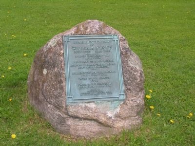
Home, Erected 1784
- Of -
William North
Born 1755 Died 1836
—————————
Soldier Throughout The
Revolution
Aide De Camp To Baron Steuben
Adjutant General Of The Provisional . . . — — Map (db m27494) HM
On Liberty Street, on the right when traveling west.
Dedicated May 18th, 1995 In
Commemoration Of The 125th Anniversary
Of The Schenectady Police Department
----------------
In Remembrance of those Police Officers Who Gave
The Ultimate Sacrifice For Their Community
---------------- . . . — — Map (db m50312) HM
On The loop to SUNY/Schenectady, on the right when traveling west.
From the beginning, it was the waterway that attracted people to Schenectady. Dutch settlers founded Schenectady in 1661 as part of the New Netherland Colony. The name "Schenectady" is said to be derived from the Mohawk word for "on the side of the . . . — — Map (db m146740) HM
On State Street (New York State Route 5) at Washington Avenue, on the right when traveling east on State Street.
Updated 2008 Marker:
The Chamber of Schenectady County
Welcomes You To
Schenectady
Settled by Arent Van Curler 1661
Burned by the French and Indians
Feb. 8, 1690
The original 1924 marker read:
Erected by Chamber of . . . — — Map (db m15074) HM
On Washington Ave at State Street (New York State Route 5), on the right when traveling south on Washington Ave.
Hotel Van Curler
Built 1925
Has been placed on the
National Register
Of Historic Places
By the United States
Department of the Interior
— — Map (db m50859) HM
Head of navigation on the Mohawk, this thriving gateway post funneled traders, soldiers and settlers west for over 160 years. Warehouses -- filled with furs, grain, salt, potash and other goods -- lined the far bank of the Binnekill. Hundreds of . . . — — Map (db m53146) HM
Founded in the Wilderness
Beyond Feudal Control
Inherits the Spirit of Liberty
And Progress * Here Our
Forefathers Established
A College Free From
Sectarianism * They
Helped to Develop The
Steam Railroad and Inland
Water . . . — — Map (db m58355) HM
On River Street west of Harborside Drive, on the right when traveling west.
While on a scouting trip in Schenectady to locate an industrial site for the Edison Machine Works, Harry Livor noticed two empty factory buildings adjacent to the Erie Canal. They had recently been built for the McQueen
Locomotive Works, a rival . . . — — Map (db m159851) HM
On State Street (New York State Route 5) at Lafayette Street, on the right when traveling east on State Street.
This memorial erected on the
100th anniversary of the founding
of the locomotive industry in this city and is dedicated to all Schenectadians who died
for their country.
Dedicated September 24, 1948 — — Map (db m134991) WM
On North Jay Street at Union Street, on the left when traveling east on North Jay Street.
Benvenuti
Welcome to
Schenectady's Little Italy
-------------------------------
This Gateway and Street are dedicated to Italian immigrants who came to Schenectady during the great European immigrations to the United States beginning at . . . — — Map (db m39547) HM
In 1847, master mechanic John Ellis and lawyer Platt Potter teamed up with the Norris brothers to brìng locomotive manufacturing to Schenectady. After raising $40,000 from
progressive citizens to recruit the new ìndustry and $10,000 from the . . . — — Map (db m159948) HM
Work began here in Rotterdam in 1908 on Erie Barge Canal Lock 8. In addition to constructing Lock 8, engineers built a three-span moveable dam (about 510 feet wide) that raises boats heading upstream as much as 15 feet when the dam is activated. . . . — — Map (db m130555) HM
The site of Schenectady was bought of the Indians by Van Curler in 1661 and a patent granted 1690. Union College was chartered in 1795. The city was incorporated in 1798 and in 1831 became the western terminus of the Mohawk and Hudson Railroad. . . . — — Map (db m58551) HM
On State Street (New York State Route 5), on the left when traveling east.
At this site Thomas Edison arrived at Schenectady Aug. 20, 1886 to found his Machine Works which in 1892 became the General Electric Company. — — Map (db m4337) HM
The American Locomotive Company (ALCO) and its predecessor, Schenectady Locomotive Works, manufactured locomotives from 1849 until 1969. For 120 years they designed and sold high quality, state-of-the-art locomotives to railroads and governments on . . . — — Map (db m125514) HM
The American Locomotive Company (ALCO) and its predecessor, Schenectady Locomotive Works, manufactured locomotives from 1849 until 1969. For 120 years they designed and sold high quality, state-of-the-art locomotives to railroads and governments on . . . — — Map (db m125519) HM
About 3000 feet from modern Lock 8 is Lock 23, built in 1841 during the enlargement of the Erie Canal (1836-1862). It replaced original Erie Canal Lock 26.
Enlarging the canal became imperative by the mid-1830's after user demand outstripped the . . . — — Map (db m93716) HM
Near New York Empire State Trail south of Canal Street & Lock Street, on the left when traveling north.
You are standing at the remains of Lock 25 of the Historic Erie Canal.
Construction of the Erie Canal began in 1817 and opened in its entirety in 1825. The Erie Canal is considered the engineering marvel of the 1800s. When the federal . . . — — Map (db m193907) HM
On Harborside Drive, on the right when traveling south.
"Big Boy” was a lot of rolling steel - a whopping 1,250,000 pounds, or 612.5 tons of it with its tender included. The American Locomotive Company built 25 of these mammoth locomotives for the Union Pacific Railroad between the years . . . — — Map (db m125487) HM
Near AlCO Heritage Trail, 0.1 miles west of River Street, on the left when traveling west.
Nearing the completion of America's first transcontinental railroad in 1868, Schenectady Locomotive works filled an important order: four recently built engines numbered #60, #61, #62, and #63 were dismantled and shipped
around Cape Horn to San . . . — — Map (db m159913) HM
On Union Street (New York State Route 146) at McKellan Avenue, on the right when traveling east on Union Street.
Home of Harriet Leonard Colburn. First Regent 1911 of
Schenectady Chapter NSDAR.
Suffragist, musician,
leader of civic organizations. — — Map (db m135613) HM
Railroads and railroading are an integral part of our nation's songbook. By the early 20th century, that included songs such as John Henry, the mythical steel-drivin' man;" The Wabash Cannonball, a locomotive with "no equal;” . . . — — Map (db m125474) HM
On Front Street at North Church Street, on the right when traveling east on Front Street.
Commemorating Massacre of Feb. 8-9,1690. One Hundred and Fourteen French and Ninety-Six Indians Entered During Night at North Gate, Located at this Point. Assault was Commenced Here. Seventy Houses were Burned, Sixty Persons Killed and . . . — — Map (db m77520) HM
Near Erie Blvd. west of Rush Street, on the left when traveling north.
In 1830, Peter Cooper, the inventor of America's first steam locomotive, demonstrated to executives at the Baltimore & Ohio Rail Road that his locomotive, Tom Thumb was economically competitive with canal transportation because of its lower cost . . . — — Map (db m159761) HM
On Erie Boulevard at South Ferry Street, on the right when traveling south on Erie Boulevard.
Thomas Edison was a brilliant inventor and entrepreneur.
Charles Steinmetz was a mathematical genius in the field of electrical engineering. Both epitomized the American dream for success. Edison was profoundly hearing-impaired and Steinmetz . . . — — Map (db m130634) HM
On Front Street, on the right when traveling east.
Here Was Born
Joseph C. Yates,
Nov. 9, 1768.
He was the First Mayor of Schenectady,
State Senator, Judge of the
Supreme Court, and Governor of the
State of New York,
Died at his Residence, East Corner
Governor's Lane, March . . . — — Map (db m33771) HM
On Veeder Street at State Street, on the right when traveling north on Veeder Street.
Count Casimir Pulaski - Polish friend of America in the Revolutionary War distinguished himself on General George Washington’s staff in the Battle of Brandywine. Commissioned Brigadier General. Fought at Germantown and other battles in winter of . . . — — Map (db m128129) HM WM
On Union Street at North Church Street, on the right when traveling east on Union Street.
This was at intersection of Union and Church Streets. Built 1734. Taken Down and Rebuilt on present site 1814 Burned 1861 and Rebuilt 1863.
During massacre, Feb. 8-9, 1690, on south East Corner of these Streets, eight persons were Killed and . . . — — Map (db m200275) HM
On Front Street at North Ferry Street, in the median on Front Street.
Built in 1705, as a triple stockade. Rebuilt in 1735, on heavy hewn timbers set on stone wall ten feet high. Fort was one hundred feet square, with blockhouse at each corner, twenty four feet square and twenty feet high. Was capable of holding . . . — — Map (db m32506) HM
On South Ferry Street at State Street (New York State Route 5), on the right when traveling north on South Ferry Street.
Located at centre of
present State Street in east line
of stockade, which extended north,
through a point nine feet west
of northeast corner of present
State and Ferry Streets.
Watch house was located southwest
of, and near this . . . — — Map (db m7251) HM
On Harborside Drive at Mohawk Harbor Way, on the right when traveling south on Harborside Drive.
Imagine what it was like before Americans began their love affair with the automobile. Local travel outside the cities was often difficult, uncomfortable and limited to horse-drawn carriages. The highway system we now take for
granted was . . . — — Map (db m159899) HM
In 1901, the Schenectady Locomotive Works, manufacturer of steam locomotives since 1848, merged with seven smaller companies (including Brooks Locomotive Works and Richmond Locomotive Works) to form ALCO, the American Locomotive Company . . . — — Map (db m159873) HM
On State Street, on the right when traveling west.
A rural cemetery est. 1857. At rest are early settlers, veterans, notable women, politicians, industrialists, African-Americans, inventors — — Map (db m127896) HM
On North Brandywine Avenue (New York State Route 146), on the left when traveling north.
A rural cemetery est. 1857.
At rest are early settlers,
veterans, notable women,
politicians, industrialists,
African Americans, inventors. — — Map (db m135163) HM
On Harborside Drive, 0.1 miles north of Mohawk Harbor Way, on the right when traveling north.
Shortly after the outbreak of WWII in 1940, the U. S. Government invited ALCO and nine other industrial companies to prepare for the possible involvement of the United States in the war by manufacturing heavy armor for the
U.S. Army. Within . . . — — Map (db m159895) HM
In its early years, Schenectady was a frontier community, centered on farming and trade with the Five Nations of the Iroquois Confederacy (or Haudenosaunee). Life for early settlers was highly focused on the Mohawk River. One of the most precious . . . — — Map (db m146897) HM
Near North Brandywine Avenue (New York State Route 146).
Historic Vale Cemetery Vale Cemetery opened in 1857 as a non-denominational, not-for-profit cemetery and a classic example of the Rural Cemetery Movement. The Rural Cemetery Movement envisioned cemeteries as public places with parks, lakes, . . . — — Map (db m135164) HM
On Schoharie Turnpike (County Route 74), on the right.
The Eastern New York chapter of the Nature Conservancy purchased the original 97 acres of this sanctuary in 1970 from Lansing and Lucille Christman, son and daughter-in-law of the late William W. Christman. William (Will) Christman devoted his . . . — — Map (db m13904) HM
U.S. Army
Rotterdam Housing Area
Home of Jimmy Carter
October 1952 - October 1953
James Earl Carter, Jr., President of the United States
1977-1981, and his wife Rosalynn, lived in Quarters
Number 7 when he . . . — — Map (db m6870) HM
Nott Memorial
Has Been Designated A
National Historic Landmark
This Site Possesses National Significance
In Commemorating The History of The
United States of America
1986
National Park Service
United States Department of . . . — — Map (db m23365) HM
This area was the site of rich Native American agricultural fields and extensive trade paths. In the 17th century and 18th centuries, Dutch colonists and other European settlers farmed here and transported their goods on those same paths. Boats and . . . — — Map (db m126661) HM
On State Street (New York State Route 5) at Layfayette Street, on the right when traveling east on State Street.
(south side)
In memory of the
soldiers & sailors from
Schenectady County,
who aided in the
suppression of the
Great Rebellion of
1861-5.
(north side)
Erected by the
Ladies Monument
Association of the City
of . . . — — Map (db m128133) WM
On Erie Boulevard at South Ferry Street, on the right when traveling south on Erie Boulevard.
George Westinghouse Jr.
An engineer, inventor and industrial giant, he was born in Central Bridge, Schoharie
County, October 6, 1846 and moved to Schenectady as a youth. At the start of the Civil War in 1861 he joined the Union Army. In 1863 . . . — — Map (db m211623) HM
The stonework surrounding you is the remains of lock 23 of the Enlarged Erie Canal. Canal boats, drawn by mules and horses, passed through the chambers on either side of you on their way toward revolutionizing transportation in the mid-nineteenth . . . — — Map (db m25101) HM
On Western Avenue (U.S. 20) 1 mile west of Fuller Station Road, on the right when traveling east.
Col. Schenectady militia during American Revolution owned farm here 1765 to death in 1799. Buried on high knoll above reservoir. — — Map (db m144957) HM
On Alplaus Ave. at Bruce Drive, on the right when traveling west on Alplaus Ave..
Formerly “Aal Plaats” from Dutch meaning “place of eels.” French and Indians camped at Alplaus Creek on the eve of Schenectady Massacre 1690. — — Map (db m125364) HM
On Irving Street, on the right when traveling south.
1860 1941
In This Auditorium On October 8, 1917
At The 35-th National Convention Of The
Polish Roman - Catholic Union Of America
Ignacy Jan Paderewski
Polish Pianist And Statesman
Prime Minister Of Poland - 1919
Leader Of . . . — — Map (db m101770) HM
Freedom — Patriotism — Humanity
Erected by the County of Schenectady commemorating the valor and patriotism of the men of this County who served in the war with Spain, Philippine Insurrection, and China Relief Expedition . . . — — Map (db m13862) HM
On Nott Terrace at Nott Terrace Heights, on the left when traveling south on Nott Terrace.
This is an RS-3 diesel-electric locomotive built by Alco in Schenectady as 1 of 1,370 RS-3's from May 1950 through August 1956. This locomotive was designed and used as [a] road switcher.
The RS-3 is powered by a 1,600 horsepower twelve . . . — — Map (db m135001) HM
On 1st Street south of Depot Street, on the left when traveling north.
"the party being extreemly anxious to get down ply their ores very well, we Saw Some cows on the bank which was a joyfull Sight to the party and Caused a Shout to be raised for joy at [blank] P M we Came in Sight of the little french Village . . . — — Map (db m61650) HM
On Park Tour Road, on the left when traveling south.
In memory of The Noble Son of Poland Brig. General Thaddeus Kosciuszko Military Engineer Soldier of the War of Independence who under the command of General Gates selected and fortified these fields for the great Battle of Saratoga in which the . . . — — Map (db m9690) HM
This historic burial plot contains the remains of descendants of Harmen Albertse Vedder, an original settler of Schenectady. He purchased the land and built a home in 1672. Harmen died around 1715 and is probably buried here. After purchasing this . . . — — Map (db m23020) HM
Constructed in 1892 for Thomas Edison's research on lighting and later for Doppler Radar development for the United States Government was restored in 1998 by Warren Camp with support from The City of Schenectady and The New York State Economic . . . — — Map (db m66125) HM
On Wendle Avenue at Adams Road, on the right when traveling south on Wendle Avenue.
A pioneer in electrical engineering. He was president of the American Institute of Electrical Engineers, Consulting Engineer of the General Electric Company and Professor of Engineering at Union College. A civic leader he was chairman of the . . . — — Map (db m50131) HM
On Front Street at Fairgrounds Ave. when traveling west on Front Street.
Here in 1800
A Bathing Green, Bath House
And Mineral Spring Were
Used By Visitors From Six
Boarding Houses and Five
Private Summer Homes.
Here In 1900
Shoppers Going to Front St.
And Workers Walking Through
The Tunnel . . . — — Map (db m65729) HM
The Town of Colonie includes 10.2 miles of riverfront along the Mohawk River and Erie Canal. The bike-hike trail which parallels the river and canal is part of the 359 mile NYS Canalway Trail stretching from Buffalo to Albany. Points of interest . . . — — Map (db m127029) HM
On New York State Route 14, on the left when traveling east.
Lakeside Camp. Prideaux's army encamped here at Sodus Bay on the evening of July 1st, 1759. They were formed on the lake the following morning by 6:00 to continue their expedition. Each boat was numbered and each man, whether officer or . . . — — Map (db m79631) HM
Near Freeman's Bridge Road, on the right when traveling north.
Farm of John F. Seeley, 19th Century broom corn grower, broom manufacturer. First bridge erected here in 1855 by Volney Freeman — — Map (db m125398) HM
On Broadway near Fairview Ave., on the right when traveling west.
On this corner site stood
first Bellevue Blacksmith
shop, from 1885 to 1925.
Started by Julius Zander,
followed by Julius Zemke.
— — Map (db m49268) HM
Near Interstate 90 at milepost 187 at Lock 13 Living History Rest Area.
Mighty floods sweep down the Mohawk almost every spring. Builders of the original Erie Canal recognized the river's power and laid out their artificial waterway well above flood levels. Barge Canal engineers dredged river channels and replaced stone . . . — — Map (db m97601) HM
On Erie Blvd at Union Street, on the right when traveling west on Erie Blvd.
The Seventeenth Century
The Schenectady Stockade is one of the oldest communities in America. Founded by the Dutch on land purchased from the Mohawk Indians in 1661, it came under English rule three years later. From the earliest days a timber . . . — — Map (db m58817) HM
Locomotive 1673
Locomotive # 1673, a Mogul 2 – 6 – 0 type engine, was built by Schenectady Locomotive Works in 1900 and logged over 1,000,000 miles for the Southern Pacific Company, primarily in southern Arizona. In 1955 it was donated to . . . — — Map (db m49938) HM
Under Chapter 532, Laws of 1922, the Superintendent of Public Works was authorized to develop the potential water power at the new Barge Canal dams located at Crescent and Vischer Ferry. All contract work at both plants was completed in . . . — — Map (db m128350) HM
On Johnson Ave., on the right when traveling north.
Battle of Johnstown fought
Oct. 25, 1781. American
forces led by Col. Willett
British forces under Maj.
Ross and Capt. Butler.
Bicentennial
Fulton Co. 1975
— — Map (db m58940) HM
On North William Street (New York State Route 29) near West Main Street (New York State Route 67), on the right when traveling south.
This is the only colonial period courthouse still in use in New York State. Tryon County was formed in March 1772 after much lobbying by Sir William Johnson. He donated most of the money needed to build a new courthouse designed by Samuel Fuller of . . . — — Map (db m51896) HM
Near Lake Road (County Route 88) east of Duanesburg Churches Road (County Route 127), on the left when traveling east.
Known as Duane's Bush in the late 18th Century, the Schenectady County Forest (in which you are standing) constitutes No. 92 of the 100 "Great Lots" formed by James Duane when he divided and sold his 50,000 Acres in 100-acre parcels.
According . . . — — Map (db m211417) HM
On Broadway at W Strand Street, on the right when traveling south on Broadway.
What is a Heritage Area? A Heritage Area has a mission to Preserve its historic resources, Educate the general public as to these resources and their roles in the development of local government, provide varieties of Recreation for the . . . — — Map (db m59278) HM
On Interstate 87, on the right when traveling north.
Where the Hudson River runs eastward before turning south is a series of falls, an obstacle to navigation but also a source of power. These lay athwart the north-south trail between Albany and Montreal. The Queensbury Patent of 23,000 . . . — — Map (db m56852) HM
The North Creek Railroad Station, the northernmost terminus of the Adirondack Railroad, is listed on the State and National Historic Registers as a fine example of a 19th Century rural station. The depot itself was built in 1871, and remains . . . — — Map (db m138521) HM
On South Campus Ave at East Walnut, on the right when traveling south on South Campus Ave.
In 1833, Samuel Eells founded Alpha Delta Phi (ΑΔΦ), the first fraternity west of the Allegheny Mountains and the first fraternity at Miami University. The formation of Miami's Alpha (founding) chapters followed in the next two . . . — — Map (db m107741) HM
The Rail Locomotive No. 220, built in 1915 by the American Locomotive [C]ompany of Schenectady, New York, was the last coal-burning, steam ten-wheeler used on the Central Vermont Railway. As a medium-sized 4-6-0 engine (4 leading wheels, 6 driving . . . — — Map (db m109153) HM
172 entries matched your criteria. The first 100 are listed above. The final 72 ⊳
* Inflectional forms of words are their plurals, singulars, and possessives as well as gramatical tenses and similar variations.