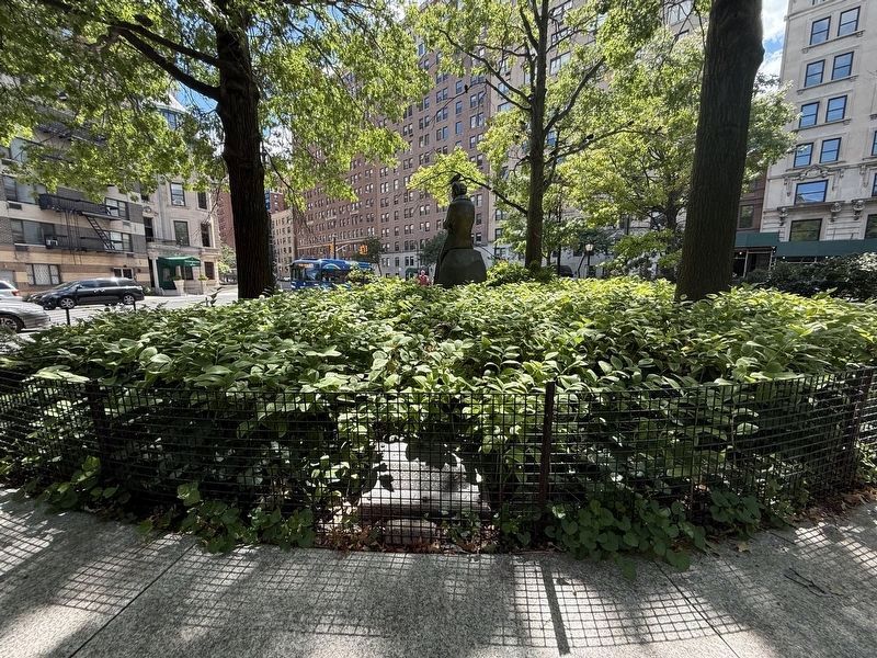
On Riverside Drive at West 72nd Street, on the left when traveling north on Riverside Drive.
Born in New York City on October 11, 1884, she was orphaned at age ten and educated in England. She married Franklin Delano Roosevelt in 1905 and bore six children between 1906 and 1916. She became a leader in New York State’s Democratic Party in . . . — — Map (db m170326) HM
On Riverside Drive north of West 72nd Street, on the right when traveling south.
This monument by sculptor Penelope Jencks honors humanitarian and First Lady Anna Eleanor Roosevelt (1884-1962). Dedicated under the oak trees at 72nd Street on October 5, 1996 in the presence of then First Lady of the United States Hillary . . . — — Map (db m283361) HM
On Washington Square West near Washington Sqaure North.
October 11, 1884 - November 7, 1962
Humanitarian, Reformer, Stateswoman
made this her Greenwich Village home from 1942 until 1949 — — Map (db m214277) HM
The first lady of The United States (1933 - 1945), as a political activist known for her unwavering support for human rights, lived here from 1959 to 1962. As a delegate to The United Nations (1946 - 1952), she chaired the commission that drafted . . . — — Map (db m152503) HM
On Kosciuszko Street east of Lewis Avenue, on the left when traveling east.
This Bedford-Stuyvesant playground is named after First Lady and United Nations Delegate Eleanor Roosevelt (1884-1962). A niece of President Theodore Roosevelt (1858-1919), Anna Eleanor Roosevelt was born into a socially prominent New York . . . — — Map (db m265028) HM
Near New York State Route 9H 0.2 miles north of Fischer Road, on the right when traveling south.
From the early 1950s through the mid 1960s, the defunct Ichabod Crane Schoolhouse was revived as an ad hoc community meeting hall. On October 10, 1952, former First Lady Eleanor Roosevelt visited the schoolhouse to officially dedicate the Ichabod . . . — — Map (db m244478) HM
On East Road east of Road 3, on the left when traveling south.
Four Freedoms
In January 1941 as Axis powers launched alarmingly successful assaults on three continents, FDR took the occasion of his eighth State of the Union address to warn Americans that their own way of life was in peril. In the . . . — — Map (db m204146) HM
On East 36th Street east of Park Avenue, on the right when traveling west.
Franklin Delano Roosevelt
January 30, 1882 - April 12, 1945
Anna Eleanor Roosevelt
October 11, 1884 - November 7, 1962
125 East 36th Street, Manhattan
Franklin and Eleanor Roosevelt lived here, in their "14-foot mansion,” . . . — — Map (db m198699) HM
First Lady Eleanor Roosevelt took a great interest in Greenbelt and visited the town on numerous occasions. Mrs. Roosevelt participated directly in extensive planning and development. She believed that decent housing and a nurturing environment . . . — — Map (db m2474) HM
On Willow Grove Road (County Route 4) 0.3 miles west of Jungle Inn Road, on the right when traveling east.
Willow Grove Mine was toured by Eleanor Roosevelt. In 1940, a mine explosion claimed 73 Lives. Mining first started in this country in 1795 when William Boggs started a coal bank. In 1830, Mike Fink was the first one to float down the Ohio River. . . . — — Map (db m272289) HM
On Park Place / Wayne Shorter Way south of Center Street, on the left when traveling south.
"There is no more liberating, no more exhilarating experience than to determine one's position, state it bravely and then act boldly. Action creates its own courage; and courage is as contagious as fear."
On East 36th Street west of Lexington Avenue, on the right when traveling west.
Franklin and Eleanor Roosevelt lived here, in their “14-foot mansion”, after their extended honeymoon in 1905. Their first two children were born here. In 1908, they moved to 47-49 East 65th Street. Elected to the New York Senate in 1910, Franklin . . . — — Map (db m226216) HM
On West Washington Street east of North Taggart Avenue, on the right when traveling east.
In commemoration of her visit to Clarksville High School, on June 16, 1958. Eleanor Roosevelt entered these doors to speak inside the Clarksville High School Gymnasium.
A crowd of nearly 1000 people, including Supreme Court Justice Sherman . . . — — Map (db m206964) HM
On West Walnut Street east of North Capital Avenue, in the median.
Franklin Delano Roosevelt (FDR) and Anna Eleanor Roosevelt (AER) were one of the first power couples in American politics. FDR's sweeping vision helped rescue the United States from the worst economic depression in its history and led the country . . . — — Map (db m132850) HM
On Scotts Run Road (County Road 19/25) at Number Three Hill Road (County Road 19/26), on the right when traveling south on Scotts Run Road.
First Lady Eleanor Roosevelt visited Scott's Run in 1933 in the height of the Great Depression when FDR was creating the New Deal. She visited households without fanfare (including Lou Birurakis' mother) and even went into the mines. Upon seeing the . . . — — Map (db m176173) HM
On Crescent Road 0.2 miles west of Greenhill Road, on the right when traveling west.
First Lady of the Land, First Lady of the World, wife of our 32nd President, First Chairman of the U.N. Commission on Human Rights. From this point she surveyed the site and spurred the work of building Greenbelt, the first garden community in the . . . — — Map (db m188) HM
Near Eleanor Roosevelt National Historic Site near Route 9G.
On a quiet bank of Fall Kill, a lively discussion bubbled over lunch between Eleanor Roosevelt and her close friends, Nancy Cook and Marion Dickerman. What if skills training in handcrafts could keep farmers afloat during tough times? Financed by . . . — — Map (db m176862) HM
Near Eleanor Roosevelt National Historic Site east of Route 9G.
Fall Kill, which means "valley stream” in Dutch, flows by the Roosevelt's cherished picnic spots. Val-Kill combines these Dutch roots with the English translation.
Val-Kill was a dynamic, active area on the Roosevelt's property. It served as . . . — — Map (db m176864) HM
Near Eleanor Roosevelt National Historic Site near Route 9G.
President Roosevelt, joined by his wife
and friends at the rustic, unfiltered
pool around 1927, which was replaced
by the current pool in 1935.
Cannonball! Imagine shrieking laughter and splashing water. The pool party at Stone . . . — — Map (db m176866) HM
Near Glensevern Road (New Brunswick Route 774) north of Route 774, on the left when traveling north.
On this site, in 1885, James Roosevelt, businessman and country gentleman of Hyde Park, New York, built the cottage shown below. The Cottage was intended to be a summer retreat for his wife, Sara Delano, and their son Franklin Delano Roosevelt. . . . — — Map (db m293357) HM
On Riverside Drive at West 72nd Street, on the left when traveling north on Riverside Drive. Reported permanently removed.
Riverside Park is one of only eight officially designated scenic landmarks in the City of New York. Rugged bluffs and rocky outcroppings created through prehistoric glacial deposits once descended directly to the Hudson River shore. They were . . . — — Map (db m170420) HM
Near Albany Post Road (U.S. 9) at FDR Drive, on the left when traveling north.
I felt like the moon, the stars, and all the planets had fallen on me. - President Harry S. Truman, Roosevelt’s successor.
I’m walking south on Michigan Boulevard and I can’t stop crying. Everybody’s crying. - Studs Terkel, writer. . . . — — Map (db m83112) HM
On 60th Avenue at L Street, on the right when traveling north on 60th Avenue.
The first service of the Sylvan Baptist Church was held on the first Sunday in July, 1925, under a brush harbor on this site. The church was organized with six Baptist believers in Christ. Deacons Earl Luckett, John Lane, William Lane, Ambrose . . . — — Map (db m125050) HM
Near Ohio Drive Southwest 0.2 miles south of West Basin Drive Southwest, on the right when traveling north.
FDR believed that the failure of an international organization after World War I led directly to World War II. Under Roosevelt's urging, representatives from 26 countries signed a "Declaration by United Nations" in 1942. After FDR died, Eleanor . . . — — Map (db m197637) HM
Susan Brownell Anthony
Woman Suffrage Leader
Visited October 19, 1878
"To secure both national and 'domestic tranquility,' to 'establish justice,' to carry out the spirit of our Constitution, put into the hands of all women....the . . . — — Map (db m53838) HM
On Hull Street (U.S. 360) at East 14th Street, on the left when traveling west on Hull Street.
Dorothy I. Height, civil rights leader, was born in Richmond and lived in this neighborhood until 1916. For more than 50 years she worked for racial justice and gender equality. Serving on the national staff of the Young Women's Christian . . . — — Map (db m131549) HM
On Q Road just south of A Road, on the right when traveling south.
Between 1933 and 1937, three different types of houses were built in Arthurdale. Fifty Hodsgon Houses were built in 1933-1934, seventy-five Wagner Houses in 1935, and forty Stone Houses in 1936-1937. Because Mrs. Roosevelt was an advocate of . . . — — Map (db m169946) HM
Sir Winston Churchill visited the Barbara Fritchie House while en route with Franklin D. Roosevelt from "Shangri-la" to Washington, D.C. — — Map (db m78351) HM
On Whitetop Mountain Road (County Route 600) at Mud Creek Lane, on the left when traveling north on Whitetop Mountain Road.
The White Top Folk Festival was held annually
from 1931 to 1939, (except 1937) on Whitetop
Mountain—the second highest peak in Virginia.
Annabel Morris Buchanan, John Powell, and
John A. Blakemore organized the event that featured banjo . . . — — Map (db m65774) HM
On R Street Northwest at 21st Street Northwest, on the right when traveling west on R Street Northwest.
From 1890 to 1910, some of the nation’s finest architects built mansions at or near Dupont Circle in Queen Anne, Richardsonian Romanesque, Italian Renaissance or Colonial Revival style.
Wealthy couples living elsewhere built most of the . . . — — Map (db m89393) HM
On Dumford Road east of North Valley Road, on the right when traveling east.
Lewis A. Jackson, Aviator
Lewis Albert Jackson (December 29, 1912-January 8, 1994) was an African American aviator remembered for training Tuskegee Airmen during World War II. As a teenager in Indiana, he began flight lessons and soloed in . . . — — Map (db m247609) HM
On Main Street at Freed Street, on the left when traveling west on Main Street.
1941 World War II 1945
[Honored Dead]
President Franklin D. Roosevelt
Joseph Adomaitis • Leo Albosta • Andrew Carlin
Philip Duffy Jr. • Philip Gorham • Dominick Klapps
Nello Marconi • Joseph McManamon • John O'Donnell
Carl Pahler . . . — — Map (db m213998) WM
On Mimosa Boulevard at Bulloch Avenue, on the left when traveling north on Mimosa Boulevard.
Built in the early 1840's by Major James Stephen Bulloch. His second wife, married in 1832, was Martha Elliott. Their second daughter, Martha (Mittie) Bulloch and Theodore Roosevelt married here in 1853. Their son Theodore Roosevelt was the 25th . . . — — Map (db m55963) HM
On Water Street Southwest just south of M Place Southwest, on the left when traveling north.
This Potomac Riverfront has hosted numerous celebrations, and the views during the Cherry Blossom Festival from the Southwest Waterfront are unrivaled, attracting the likes of President Wilson and Eleanor Roosevelt. — — Map (db m239003) HM
The community of Green Park had its own post office, telegraph, grocery store,
and golf course. Residents of the Green Park area held the first horse shows and the
earliest summer cottages were built near Green Park. The Green Park Hotel . . . — — Map (db m229062) HM
On Broad Street south of Northway, on the left when traveling south.
First Lady Eleanor Roosevelt personally visited Greendale in 1936 as this massive project was underway. After touring several houses and this downtown area, she said Greendale "is absolutely wonderful" and "is laid out beautifully". Thousands of . . . — — Map (db m183642) HM
On Ocean Drive (State Highway 3), on the right when traveling east.
Upon his inauguration in 1933, U.S. President Franklin Roosevelt pledged a “Good Neighbor” policy toward Latin American nations based on mutual cooperation and respect. This proved valuable during World War II when several of these countries, . . . — — Map (db m286714) HM
On North 6th Avenue at University Boulevard, on the right when traveling south on North 6th Avenue.
In 1917, Governor Robert L. Williams sent an executive request to the legislature asking for funds to build campus homes for the presidents of Oklahoma’s six regional normal schools. Williams was successful, and by the Spring of 1918, President T. . . . — — Map (db m276998) HM
On Main Street at Library Place, on the right when traveling north on Main Street.
Marian Anderson was born in Philadelphia on February 27, 1897. Although her early musical training was sporadic, a scholarship enabled her to study abroad under distinguished teachers.
When Arturo Toscanini heard her perform at the Salzburg . . . — — Map (db m193431) HM
On Granada Boulevard north of Southwest 40 th Street (State Road 976), on the left when traveling north.
Ruth Bryan Owen was the daughter of famed orator and Democratic presidential nominee William Jennings Bryan. She was born in Jacksonville, Illinois, on October 2, 1885. During World War I, she served as a nurse in the Egyptian-Palestine campaign. . . . — — Map (db m82381) HM
Near Sycamore Street Northwest (New Brunswick Route 774) north of Narrows Road, on the left when traveling north.
The Roosevelt Campobello International Park is a unique example of international cooperation - jointly administered, staffed, and funded by the peoples of Canada and the United States. Established by international treaty in 1964, the . . . — — Map (db m293356) HM
Near Oklahoma Boulevard (U.S. 64) at College Avenue, on the right when traveling east.
After a fire in 1935 destroyed Northwestern’s first building, the “Castle on the Hill,” funds to replace it were provided by the Oklahoma Legislature and the Federal Public Works Administration. The new building, Jesse Dunn Hall, was designed by . . . — — Map (db m265968) HM
On Tracy Place Northwest at Kalorama Road Northwest, on the right when traveling west on Tracy Place Northwest.
Sheridan-Kalorama has been home to many influential women. While she lobbied our political leaders to support Nationalist China, Madame Chiang Kai-Shek lived nearby at 2443 Kalorama Rd. Others include presidential wives Eleanor Roosevelt, a wise . . . — — Map (db m112604) HM
On East Howard Street (U.S. 176) at North Trade Street (U.S. 176), on the left when traveling east on East Howard Street.
Constructed 1925 as retail showroom and office for Tryon Toy Makers and Wood Carvers, famous craft enterprise founded by Charlotte Yale and Eleanor Vance in 1915. Designed by Tryon architect J. Foster Searles to evoke the European inspiration for . . . — — Map (db m40924) HM
University Hall was completed in 1893. It is constructed of Amherst Sandstone. The bell tower rises to a height of 148 feet. The structure houses administrative offices, classrooms, and the legendary Gray Chapel. Among the celebrities who have . . . — — Map (db m12845) HM
On Mt Pleasant Road 0.1 miles north of Iris Lane, on the right when traveling north.
Originally called "Westmoreland Homesteads," Norvelt was established April 13, 1934, by the federal government as part of a New Deal homestead project. With 250 homes, Norvelt provided housing, work, and a community environment to unemployed workers . . . — — Map (db m55589) HM
On West Jackson Street at South Center Street, on the right when traveling west on West Jackson Street.
Weimar native Etta Moten (1901-2004) was one of the most acclaimed African American women of the twentieth century. At an early age, she began singing in local African Methodist Episcopal churches where her father pastored. In 1916, she moved with . . . — — Map (db m263174) HM
On East Main Street (U.S. 11) west of North Commerce Street, on the right when traveling west.
Composer, musician, teacher, folklorist, and co-founder of the White Top Folk Festival 1932-1938. She was instrumental in having First Lady Eleanor Roosevelt attend the festival in 1933. Buchanan organized the Marion Monday Afternoon Music Club in . . . — — Map (db m209811) HM
Near Broad Street south of Northway, on the right when traveling south.
First Lady Eleanor Roosevelt, who had a high regard for the welfare of children and a great concern for impoverished people, visited Greendale in 1936 to personally inspect this "Greenbelt" project. After clambering through one of the two-story . . . — — Map (db m184167) HM
Near Sagamore Hill Road, on the right when traveling east.
“Tired of living here and there in rented houses,” wrote Eleanor Roosevelt, in 1937 she and her husband Ted Jr. purchased four acres of Sagamore Hill from his mother. The Georgian-style home, built in 1938, sat at the south end of the . . . — — Map (db m90365) HM
Near Doctor Mary McLeod Bethune Boulevard just west of Doctor MLK Jr. Boulevard, on the right when traveling west.
Mary McLeod Bethune Home
has been designated a
National
Historic Landmark
This site possesses national significance in commemorating the history of the United States of America
1975
National Park Service
United . . . — — Map (db m192160) HM
On Kennedy Avenue just west of Barker Avenue, on the left when traveling west.
Victory Gardens, also called "War Gardens" or "Food Gardens for Defense", were vegetable, fruit, and herb gardens planted at private residences and public parks in the United States, United Kingdom, Canada, Australia and Germany during World . . . — — Map (db m230187) HM
Near Old Clinton Road 0.5 miles north of Hammock Road, on the left when traveling north.
1 Lawn and Meadow Habitat
This area, adjacent to historic buildings and the modern-day parking lot, is maintained as it was circa 1940. At that time it was the center of a summer estate called "Salt Meadow" by its owners Esther Lape and . . . — — Map (db m264940) HM
On Cherokee Drive west of Pumphouse Rd, on the right when traveling east.
This rock bridge was created to access Goat Hill where Project homes were intended to be built and part of the water system was built. However, the home construction was attempted and halted. The water system storage tank was built on Cherokee Drive . . . — — Map (db m287170) HM
On S. Main Street (Delaware Route 54) near McCabe Street, on the right when traveling south.
Constructed in 1904, this was once the residence of John G. Townsend, Jr. (1871-1964), agricultural pioneer and statesman. His long and distinguished public career included service as Governor of Delaware (1917-21), United States Senator . . . — — Map (db m37344) HM
On South Elm Avenue just south of West 6th Street, on the left when traveling south.
1 • Helen Keller Southern Magnolia Planted on July 9, 2000 by family in honor of Venus Guess a devoted mother and grandmother. The towering Helen Keller Southern Magnolia may have been one of the trees Helen Keller climbed in the yard . . . — — Map (db m214868) HM
On Eliot Street at St. Antoine, on the right when traveling east on Eliot Street.
Between 1910 and 1940 Detroit’s African American population increased dramatically. Faced with restrictions on where they could live, many African Americans were forced into substandard housing. In 1935 First Lady Eleanor Roosevelt broke ground for . . . — — Map (db m172651) HM
On Kessler Road, on the left when traveling north.
Plant a Victory GardenAfter World War II began, nearly all of America’s industries converted to wartime production. Companies that built radios, cars and refrigerators began to manufacture jeeps, trucks and planes. This placed a great strain on . . . — — Map (db m54509) HM
On East 62nd Street just east of Third Avenue, on the right when traveling east.
This land was owned originally by the family who built the Old Merchant’s House, 29 East Fourth Street, a landmark of early 19th century domestic life. These houses were built for working-class people in the late 1860’s and early 1870’s. They . . . — — Map (db m203088) HM
Near Haviland Road 0.5 miles east of U.S. 44, on the left when traveling east.
Eleanor Roosevelt, joined by the state superintendent of public works (left) and the bridge designers (right), cuts the ribbon at the August 25, 1930, opening of the Mid-Hudson Bridge.
Background photograph courtesy New York State Bridge . . . — — Map (db m145280) HM
Near Northwest Wall Street near Northwest Newport Avenue, on the left when traveling north.
This is the site of the Pilot Butte Inn, which was known far and wide as an excellent small hotel. Built by Philips Brooks of the Brooks Mill Family, the Inn was the focal point for community activities for many years. A massive lava rock fireplace, . . . — — Map (db m157947) HM
On Vermont Route 110 1 mile north of Route 14, on the right when traveling north.
The farmhouse on this site, dating from the late-18th century, was purchased by Irene and Robert Slater in 1934, along with a barn and 145 acres of land. During the Great Depression, like many Vermont farmers, the Slaters took in tourists to . . . — — Map (db m85971) HM
On Beechurst Avenue (West Virginia Route 7) north of 7th Street when traveling north.
In 1891, a small group of glass-making artisans from Seneca County, Ohio, founded the Seneca Glass Company. For almost 100 years, Seneca Glass Company’s highly skilled craftspeople manufactured glassware and exquisitely etched lead crystal by hand, . . . — — Map (db m74624) HM
On West Park Avenue at Connecticut Avenue, on the right when traveling west on West Park Avenue.
From 1938 to 1954, Monongalia High was the only African American high school in the county. New Deal WPA funds paid for the new school. Dedicated by Eleanor Roosevelt on May 27, 1938, it served black high school students until 1954, when the . . . — — Map (db m213807) HM
On George Washington Highway (U.S. 50) 2 miles west of Garrett Highway (U.S. 219), on the right when traveling west.
Preston County. Formed from Monongalia in 1818 and named for James Preston, 13th governor of Virginia. Here is model Federal homestead project, sponsored by Mrs. Eleanor Roosevelt, the wife of Franklin Delano Roosevelt, 32nd President.
. . . — — Map (db m156429) HM
On West Virginia Route 7 near the state line with Maryland, on the right when traveling west.
Preston County. Formed from Monongalia in 1818 and named for James Preston, 13th governor of Virginia. Here is model Federal homestead project, sponsored by Mrs. Eleanor Roosevelt, the wife of Franklin Delano Roosevelt, 32nd President.
. . . — — Map (db m75147) HM
World-renowned contralto. As a child she sang in this church. Toured Europe & U.S. starting in the 1930s. Her concert at the Lincoln Memorial, 1939, drew 75,000 people. First African-American in Metropolitan Opera, 1955. Delegate to UN, 1958. Died . . . — — Map (db m81908) HM
Her contralto voice sang out in the twentieth century -- her life testified to her passion for music and the power of her voice to speak directly to the soul, encountering societal resistance as an African-American seeking educational and . . . — — Map (db m40421) HM
On 7th Street Southwest south of G Street Southwest, on the right when traveling north. Reported unreadable.
Who are these famous Civil Rights leaders?
Barbara Jordan (upper left)(some text missing due to illegibility)
Patsy Mink (wearing... (some text missing due to illegibility) ... supporter of civil rights . . . — — Map (db m130649) HM
On West Fort Street at North 13th Street, on the right when traveling north on West Fort Street.
President Franklin D. Roosevelt and First Lady Eleanor Roosevelt visited Boise on September 27, 1937. The president’s motorcade passed by numerous schools on the tour of the city’s North and East End neighborhoods. Excited students stood outside . . . — — Map (db m267014) HM
On HIghlands Parkway (U.S. 58) close to Old Park Road (County Route 754), on the right when traveling west.
Whitetop, Mt. Rogers. Visible at great distances, Whitetop Mountain was known as the “Meadow Mountain” in colonial times. With a climate similar to southern Canada, this beloved mountain is Virginia’s second highest peak and immediately . . . — — Map (db m71555) HM
On M Street Southeast east of Water Street Southeast, on the right when traveling east.
The Seafarers Yacht Club is the oldest African American boat club on the East Coast. It was founded in 1945 by Lewis T. Green, Sr., a vocational arts teacher in the DC Public Schools who built boats as a hobby. Needing a dock, he contacted the . . . — — Map (db m89445) HM
The event that brought the civil rights movement in St. Augustine to international attention was the arrest of Mary Parkman Peabody (1891-1981), the 72-year old mother of the Governor of Massachusetts, for trying to be served in a racially . . . — — Map (db m7610) HM
On West 4th Street (Indiana Route 18) near South Garfield Street, on the right when traveling east. Reported missing.
Samuel Plato (circa 1882-1957), African American architect and contractor, lived in Marion (circa 1903-1921). House here attributed to him; he also designed and built structures throughout the U.S. One of few black architects to win federal . . . — — Map (db m265671) HM
On West Michigan Street at North Senate Avenue, on the right when traveling east on West Michigan Street. Reported missing.
African-American leaders formed the Young Men’s Prayer Band in 1900. It became a branch of the city YMCA by 1910. Black and white leaders helped raise funds for a new building here, which opened as the Senate Avenue YMCA in 1913. Booker T. . . . — — Map (db m127963) HM
On North Miro Street at Anette Street, on the left when traveling east on North Miro Street.
Fannie C Williams Pioneer in Public EducationAs one of New Orleans' premier educators in the first half of the twentieth century, Fannie C. Williams steered this school through decades of challenge and change. An active civic leader, she was . . . — — Map (db m115964) HM
Near Sea Street south of Water Street, on the right when traveling north.
Franklin Delano Roosevelt's Campobello Island home can be seen from Eastport. After FDR contracted polio while at Campobello in 1921, local fisherman took him across the bay to Eastport. Using a ruse to fool reporters, they
spirited FDR onto a . . . — — Map (db m183539) HM
On Main Street at North Pearl Street, on the left when traveling west on Main Street.
The 1927 Eola Hotel is the tallest building in downtown Natchez. Named for Eola Levy, the daughter of developer Isadore Levy, it became a center for social activity for the city. Celebrities who visited the hotel in the mid-1900s . . . — — Map (db m114303) HM
Near Valley Boulevard (U.S. 321) at Green Hill Road, on the right when traveling north.
Serving as the heart of the Green Park community, this grand hotel offered the best of amenities including a post office, bowling alley, casino and shooting gallery. Historic guests included U.S. Presidents Coolidge and Hoover, Eleanor Roosevelt, . . . — — Map (db m210576) HM
On Von Karmen Road west of Wattendorf Memorial Highway, on the right when traveling west.
This F-14-D Tomcat is dedicated in memory of LT Kara Hultgreen United States Navy. On 25 October, 1994 the Black Lions of Fighter Squad 213 were conducting training operations in preparation for deployment to the Persian Gulf aboard the aircraft . . . — — Map (db m184032) HM WM
On Tracy Road (U.S. 41) at Justus Street, on the left when traveling north on Tracy Road.
In 1932, Myles Horton and Don West founded Highlander Folk School, located ½ mile north of this site. It quickly became one of the few schools in the South committed to the cause of organized labor, economic justice. and an end to racial . . . — — Map (db m150471) HM
On Roosevelt Drive at California Lane, on the left when traveling north on Roosevelt Drive.
The city of Dalworthington Gardens began as a result of President Franklin D. Roosevelt's Depression-era policies. Roosevelt supported the "back-to-the-land" movement, encouraging urban workers to live on and cultivate rural property. Roosevelt . . . — — Map (db m184237) HM
On North Mary Peake Boulevard 0.3 miles south of West Walker Road, on the right when traveling south.
This was the commercial hub of Aberdeen Gardens, a mini-mall that included a grocery store, barbershop and tavern. Although it has seen many changes since the neighborhood was created in 1939, it has been a vital part of the community. . . . — — Map (db m166457) HM
Near Water Street at Ballard Street (Virginia Route 1020), on the right when traveling west. Reported missing.
Since the October 19, 1781, victory at Yorktown, Virginia, five U.S. Navy ships have been named Yorktown. The first (1840) was constructed at Gosport Shipyard, the present-day Norfolk Naval Shipyard. The 16-gun ship sloop hit a reef in the . . . — — Map (db m293531) HM
On West Virginia Route 7 east of #8 Hollow Road, on the left when traveling east.
Scotts Run By the 1930s 10,000 residents representing 28 nationalities and tied to the coal industry crowded the hillsides, victims of severe poverty brought on by a coal recession and Great Depression. "The Shack" and Scotts Run Settlement . . . — — Map (db m50473) HM
On Coopers Rock Road (County Road 73/73) 0.2 miles west of County Road 73/12, on the right when traveling west. Reported missing.
Monongalia County. Formed, 1776, from District of West Augusta. All or parts of 21 other counties, including three in Pennsylvania, were carved from it. Named for the Monongahela River, bearing an Indian name, which means the "River of Caving . . . — — Map (db m83470) HM
On South Mountaineer Highway (West Virginia Route 92) south of Robert Lewis Drive (County Route 92/13), on the left when traveling south.
Preston County Formed from Monongalia in 1818 and named for James Preston, 13th governor of Virginia. Here is model Federal homestead project, sponsored by Mrs. Eleanor Roosevelt, the wife of Franklin Delano Roosevelt, 32nd President.
. . . — — Map (db m224725) HM
On West Virginia Route 26 near at the Pennsylvania state line, on the right when traveling south.
Preston County. Formed from Monongalia in 1818 and named for James Preston, 13th governor of Virginia. Here is model Federal homestead project, sponsored by Mrs. Eleanor Roosevelt, the wife of Franklin Delano Roosevelt, 32nd President.
. . . — — Map (db m74509) HM
On Seneca Trail (U.S. 219) 0.3 miles north of Hock Back Road (County Road 118), on the right when traveling south.
Preston County. Formed from Monongalia in 1818 and named for James Preston, 13th governor of Virginia. Here is model Federal homestead project sponsored by Mrs. Eleanor Roosevelt, the wife of Franklin Delano Roosevelt, 32nd President. . . . — — Map (db m153129) HM
On Main Street (U.S. 219) at Fountain Street, on the right when traveling south on Main Street.
This house was built in 1890 by Dr. Humboldt Yokum. The son of Dr. George Yokum, he grew up in the house next door. Humboldt acted as peace emissary during the controversy over moving the county seat. He rode into Elkins to head off the faction of . . . — — Map (db m24789) HM
Near Old Clinton Road 0.5 miles north of Hammock Road, on the left when traveling north.
I had my first long drive through the countryside yesterday. I had spent Wednesday night with Miss Esther Lape at her home in Westbrook, Connecticut, and in the evening we stood on an upstairs porch and saw the moon shine on the fields, with the . . . — — Map (db m264922) HM
Near State Street south of Battery Place, on the right when traveling south.
Edison's Laboratory and Home
West Orange, New Jersey
This site features Thomas A. Edison's home, laboratories, and library. Edison developed the practical phonograph and the movie camera here.
Eleanor Roosevelt's . . . — — Map (db m207517) HM
Passamaquoddy Bay takes its name from the Native American Passamaquoddy Tribe. The word means People of the Pollock-Spearing Place. The Passamaquoddy have a rich heritage, once occupying much of what is now eastern Maine and western New . . . — — Map (db m63617) HM
The House of Hospitality is one of Balboa Park's most honored structures. Originally built for the 1915 Panama-California Exposition, it was designed by renowned architect Carleton Winslow in the florid Spanish Baroque style of the 17th century. . . . — — Map (db m280678) HM
Sloss House, originally known as The Pines, was built in 1883 and was the residential home of faculty and university administrators before university departments. Thomas Sloss (1858-1937), Iowa State University's superintendent of buildings from . . . — — Map (db m276705) HM
On West Kenwood Drive at Kenwood Hill Road, on the right when traveling east on West Kenwood Drive.
The Little Loomhouse
Lou Tate Bousman (1906-79), born in Bowling Green, Ky. During Arts & Crafts movement, at Pres. Hoover’s request, she traveled Appalachia preserving historic coverlet patterns. Her work with Mrs. Hoover led to the . . . — — Map (db m161569) HM
Near Searsport Avenue (U.S. 1), on the right when traveling west.
Originally a cigar making factory, the building shown became Perry's Tropical Nut House when owner Irving Perry started selling pecans in 1926. The business flourished as automobile traffic along Route 1 grew and it soon became . . . — — Map (db m59506) HM
186 entries matched your criteria. The first 100 are listed above. The final 86 ⊳
Thin black lines indicate changes in relevance. Between each pair of lines entries are ordered geographically but all have the same relevance.
* Inflectional forms of words are their plurals, singulars, and possessives as well as gramatical tenses and similar variations.