416 entries match your criteria. The first 100 are listed. Next 100 ⊳
Historic Trees Historical Markers
An historic tree is one that was witness to an historic event, or maybe it was planted by, or otherwise directly associated with a famous historic figure. These have been marked with a historical marker.
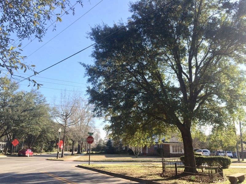
On Cotton Avenue at Highland Avenue on Cotton Avenue.
The Tree That Owns Itself
Planned and Dedicated
April 19, 1961
Replacing the Walker Oak
Felled by Wind April 9, 1961
Original Deed Granted by
City of Eufaula
to the
Post Oak Tree
April 8, 1936 . . . — — Map (db m101286) HM
Plaque A 85-90 Million Years Old
Possibly a Bald Cypress
from the Cretaceous Period
or the Age of Dinosaurs Plaque B
325 Million Years Old
A Member of the Giant Club Mosses
from the early Coal Age — — Map (db m29287) HM
The Moon Tree was grown from seeds that journeyed to the moon and back aboard Apollo 14 during the period of January 31-February 9, 1971.
The seed was germinated by the U.S. Forest Service in Gulfport, Mississippi, and the seedling was presented to . . . — — Map (db m108374) HM
On Railroad Avenue at Mountain Street, on the right when traveling west on Railroad Avenue.
Here stood
The giant Black Spanish Oak
Under which
Traditionally
Sequoyah
Taught his newly invented
Alphabet
Tree felled by a storm
1934 — — Map (db m28036) HM
Near Tuskegee Street (Alabama Route 81) at Shiloh Street, on the right when traveling north.
It was under this tree that participants in the U.S. Public Health Study of Untreated Syphilis in Negro Males in Macon County, Alabama, met to wait for Nurse Rivers, the Shiloh School nurse, to come and either administer treatment, update health . . . — — Map (db m95113) HM
This American Liberty Elm was named after “The Liberty Tree: Our Country’s first Symbol of Freedom.” On the morning of August 14, 1765, the people of Boston awakened to discover two effigies suspended from an elm tree in protest of . . . — — Map (db m85848) HM WM
On East South Boulevard at Morrow Drive, on the right when traveling west on East South Boulevard.
The Plantanus orientalis is a descendant of the tree
under which Hippocrates taught the students of
medicine on the Greek Island of Kos around 400 B.C.
Hippocrates is often called the father of
western medicine because his philosophy . . . — — Map (db m289672) HM
Washington took command of the American Army under grandparent of this elm, Cambridge, Mass., July 3, 1775
Raised and given by Maryland D.A.R. and Alice Paret Dorsey as part of 200th anniversary of birth of Washington, . . . — — Map (db m155635) HM
On U.S. 231 at Florey Street, on the right when traveling south on U.S. 231.
The Town of Vincent is located on land that was granted to the Kidd family by the Governor of Alabama in the 1800's. In 1859, the land was willed to three Kidd daughters, one daughter's name was Anna Bella Vincent after whom the town was named. The . . . — — Map (db m61623) HM
Under the forebearer of this American Elm George Washington assumed command of the Continental Army at Cambridge, Massachusetts, on July 3, 1775.
This sprig of the "Washington Elm" was donated to the Arizona State Teachers College at . . . — — Map (db m263603) HM
On East University Boulevard 0.2 miles west of North Campbell Avenue, on the right when traveling west.
This seedling was grown from the very seeds that journeyed to the moon and back on board Apollo 14. It symbolizes the major role forests played in developing our American Heritage and the vital role forests have in our future.
This planting made . . . — — Map (db m83012) HM
On North Broad Street 0.1 miles south of Hackney Avenue, on the right when traveling south.
From a Sycamore near this spot, L.V. Grime and C.B. Hawley were lynched on Aug. 24, 1882 for the hold up – murder of Andrew Hall, Wells Fargo Packer, and Dr. S.T. Vail. The culprits had a fair hearing before JP Allen on Wednesday eve, and at 2 . . . — — Map (db m34116) HM
On West Gurley Street just west of South Cortez Street, on the left when traveling west.
(Statehood Tree marker) (north side of monument) Statehood Tree Planted Feb. 14, 1912 • • • Monument presented to people of Arizona by Cub Scouts of Prescott, 1960 (Centennial Witness Tree marker) (south side of monument) The . . . — — Map (db m157657) HM
On S Walton Boulevard. Reported permanently removed.
To insure protection during its lifetime, owner Bill Bradford on April 11, 1975, legally willed to itself this tree and all land within a radius of 10 feet from its trunk and donated its use to the city of Bentonville as a mini-park in celebration . . . — — Map (db m50368) HM
Near Hawthorne Street at Ouachita Avenue, on the right when traveling south.
So named by the Hon. Henry B. Murphy, Garland County Judge, in honor of Mr. Ed. B. Mooney. Mr. Mooney was instrumental in saving this tree when in 1913 the court house was completely destroyed by fire and this tree was severely damaged. The tree, . . . — — Map (db m264390) HM
On West Division Street at South Main Street, on the right when traveling west on West Division Street.
This tree is believed to have been planted in 1912 when the railroad station was built. Local residents remember the days when its limbs were so long that they nearly touched the ground. A cannon sat next to this tree prior to World War II but this . . . — — Map (db m161918) HM
On East Ash Street west of 2nd Street, on the right when traveling east.
This Bois D'Arc tree is also known as an Osage Orange, Hedge Apple, or Bow Wood tree. Historically, the wood was used by Native Americans to make strong and resilient bows and arrows. The early settlers also used it to make hubs, spokes, fence . . . — — Map (db m225453) HM
Built by legendary Berkeley architect
William Charles Hays, Wonderland was
designed as a creative sanctuary to soak in the history and wonder of the world. This California Coastal Oak was planted on Jan. 3, 1918 as two trees that united as one. . . . — — Map (db m239022) HM
Near Skyline Boulevard 0.5 miles north of Joaquin Miller Road.
Until at least 1851, Redwood trees on this site were used as landmarks to avoid striking the treacherous submerged Blossom Rock in San Francisco Bay west of Yerba Buena Island. Although by 1855 the original stems had been logged, today's trees are . . . — — Map (db m100564) HM
The massive and majestic Hooker Oak, which occupied this site, was named in honor of renowned British Botanist Sir Joseph Dalton Hooker. The Hooker Oak was acclaimed to be the largest Valley Oak in the world before it fell on May 1, 1977.
Age . . . — — Map (db m100595) HM
Near Glenn Drive south of Meadowview Drive, on the right when traveling south.
Judge Joseph Lewis planted this Mediterranean Sweet Orange seedling near the toll bridge at Bidwell’s Bar, Butte County, California in 1856. It has survived hard times and is the oldest living orange tree in California. “From its example and . . . — — Map (db m143395) HM
Imported from Mazatlan, Mexico, the Mother Orange Tree was purchased on the streets of Sacramento when it was only a 2 to 3 year-old seedling in a tub. She was planted in 1856 and quickly grew into a California legend. The leafy greens of her robust . . . — — Map (db m62787) HM
To commemorate The Mother Orange Tree of Butte County planted at this spot by Judge Joseph Lewis in 1856.
The Bidwell Bar Bridge, first suspension bridge of California, transported from New York via Cape Horn 1853. Completed 1856. . . . — — Map (db m100596) HM
Near Big Trees Parkway near Ebbetts Pass Scenic Byway (California Highway 4).
In the spring of 1852, Augustus T. Dowd, while hunting, discovered a grove of truly immense trees, now known as the Calaveras North Grove. Several stockholders of the Union Water Company (who employed Augustus as a hunter) developed a plan to . . . — — Map (db m34120) HM
On North Grove Trail, on the left when traveling west.
Here at Calaveras Big Tree State Park, it's a regrettable fact that the most famous trees are those most harmed by human action. Both the Mother of the Forest and the Big Stump remind us of how people placed their own curiosity and pleasure above . . . — — Map (db m95184) HM
This city in the days of ’49
was called
“Hangtown”
This was the site of Elstner’s Hay Yard on which stood the ‘Hangman’s Tree’ where vigilantes executed many men for various crimes. The stump of the tree is under this . . . — — Map (db m10504) HM
Near Mattole Road (Lower Bull Creek Flats Road) 4.3 miles west of U.S. 101, on the left when traveling west.
Recognized by the American Forestry Association as the National Champion Coast Redwood, Sequoia sempervirens, November 1991. Height • 363 feet Circumference • 53.2 feet Average crown spread • 62 feet — — Map (db m165464) HM
On Avenue of the Giants (Route 254), on the right when traveling west.
• Ancient Redwood - Age 950-1000 Years
• Original height 298 ft Current height 248 ft.
• Survived lightning which removed its top, loggers axe & forest fire in 1908, flood of 1964
• Trunk diameter is 14.5 ft. top diameter is 3 ft.
• Total . . . — — Map (db m231675) HM
On Three Flags Highway (Highway 395) at County Route 168, on the right when traveling north on Three Flags Highway.
This Giant Sequoia is reported to have been planted to commemorate the opening of Westgaard Pass to automobile traffic. The tree was named in honor of President Theodore "Teddy" Roosevelt. — — Map (db m54428) HM
Near White Mountain Road 10 miles north of California Route 168, on the right when traveling north.
In 1953, Dr. Edmund P. Schulman was searching this grove of
bristlecones for old trees to extend his tree ring chronology. With
his discovery of the "Pine Alpha" tree, he became the first person
in the world to document 4,000-year-old trees. . . . — — Map (db m304420) HM
On Buttonwillow Drive 0.5 miles north of California Highway 58, on the left when traveling north.
A lone tree landmark on an old trans-valley trail. It was an ancient Yokuts Indian meeting place, later a location for white stock rodeos. Miller and Lux established their headquarters and store here about 1885. The town of Buttonwillow takes . . . — — Map (db m50251) HM
On 162nd Street at Harvard Boulevard, on the right when traveling east on 162nd Street.
This is a fourth generation of the elm tree under which General
George Washington took command of the Continental Army on July 3, 1775;
and the Declaration of Independence was first read to the people of Cambridge, Massachusetts. — — Map (db m164425) HM
Near Dunsmore Avenue 0.5 miles north of Markridge Road, on the left when traveling north.
In recognition of the leadership of Assistant City
Manager Bob McFall to preserve this heritage oak
during the 2009 Station Fire, the Community Services
& Parks Department has designated this stately tree as
"The McFall Oak." — — Map (db m239335) HM
Near Bonita Drive south of Opechee Way, on the right when traveling south.
The Oak of Peace played an important role in the history of California.
It was at this site on January 11, 1847, that the surrender of the
Californios to the United States Army was arranged. Jésus Pico,
emissary of U.S. Lt. Colonel John C. . . . — — Map (db m234878) HM
On Louise Avenue just south of Ventura Boulevard, in the median.
Declared Historic Cultural Monument No. 24 by the Cultural Heritage Board, Municipal Arts Department, City of Los Angeles.
newer plaque, now missing:
Lang Oak
Encino's 1000-year-old oak,
trunk diameter 24 . . . — — Map (db m165309) HM
On Commercial Street at Vignes Street, on the left when traveling east on Commercial Street.
Here once stood the grandest of all sycamore (Sha’var) trees measuring 60 feet high with a canopy spreading 200 feet wide. The tree was given the Spanish name of El Aliso. The original inhabitants of this area, the Kizh (keech) or Gabrieleño were . . . — — Map (db m177327) HM
On Haverford Avenue east of Temescal Canyon Road, in the median.
Site of Founders' Oaks,
where Pacific Palisades was
founded, January 14, 1922.
Landmarked, July 16, 1955.
Pacific Palisades History
and Landmarks Society. — — Map (db m219461) HM
On National Boulevard at Military Avenue, on the right when traveling east on National Boulevard.
Planted circa 1875. Declared Historic Cultural Monument No. 19 by the Cultural Heritage Board, Municipal Art Department, City of Los Angeles. — — Map (db m188853) HM
On Figueroa Street at 39th Street, on the right when traveling south on Figueroa Street.
This historic palm tree stood for more than 25 years at the entrance of the Southern Pacific Station. At this railroad portal of the city it became a familiar landmark to many thousands of Los Angeles and Southern California citizens and . . . — — Map (db m155323) HM
This Australian tree is a true conifer, even though its broad leaves do not resemble
those of more familiar conifers such as pines. Look high up for its large cones.
The tree was planted in 1890 near the home of the J. De Barth Shorb . . . — — Map (db m281437) HM
On Arroyo Drive south of Hermosa Street, on the right when traveling south.
panel 1:
Under this oak — the legend runs — the first Easter Services in California
were held by Father Crespi in 1770.
panel 2:
Near this spot the Cathedral Oak stood. Time destroyed its roots. This monument is . . . — — Map (db m134912) HM
On Whittier Boulevard north of Mar Vista, on the right when traveling north.
Paradox Hybrid Walnut Tree
Planted in 1907 as an experiment for the
University of California.
California Registered Historical
Landmark No. 681.
Dedicated 1963
By Whittier area community beautiful
Grand Parlor Native . . . — — Map (db m241036) HM
Near Mariposa Grove Road 2.1 miles east of Wawona Road (California Route 41).
Creating an Experience to Match the Dignity of the Trees People have revered this Grove and its mighty trees for thousands of years. Through ecological restoration, the health and resilience of these giants will be protected and all visitors . . . — — Map (db m160409) HM
Near Mariposa Grove Road 2.8 miles east of Wawona Road (State Route 41).
Standing relatively short at 209 ft. (63.7 m), the Grizzly Giant measures 96 ft. (29 m) in circumference and 28 ft. (8.5 m) in diameter at the base. What do you notice first about this big tree? Is it the blackened fire scars at the base of the . . . — — Map (db m159099) HM
Near Mariposa Grove Road 2.1 miles east of Wawona Road (California Route 41).
”You can save a place, but it’s never really safe. It always takes people caring. It always takes vigilance. It always takes effort to keep those forces at bay that want to crowd in, want to change it, want to over-commercialize it. Once it’s . . . — — Map (db m160410) HM
Walk through this living tree and look for evidence of it healing itself. Bark of this sequoia is growing inward in an attempt to close over its wound — the large tunnel carved in 1895. Thought to have served as a lower elevation winter . . . — — Map (db m84231) HM
Near White Mountain Road 13 miles north of Ancient Bristlecone Pine Forest Visitor Center, on the right when traveling north.
Al Noren retired in 1954 as White Mt. District
Ranger after 35 years with the U.S. Forest
Service. He discovered The Patriarch in 1948
and in 1951 it was added to the American Forestry
Assn's List of Big Trees as the Largest . . . — — Map (db m304459) HM
Near Pacific Street, on the right when traveling south.
This Chestnut tree, form the lawn of the White House, was originally planted in front of Colton Hall on September 20, 1966 by First Lady, Lady Bird Johnson. It was later replanted in Friendly Plaza. — — Map (db m63327) HM
Near Pacific Street, on the right when traveling south.
This "Moon Tree" is a Coast Redwood grown from a seed that in January 1971 was carried to the moon and brought back to earth by Major Stuart Roosa, Command Module Pilot for Apollo 14.
The seed was planted and nurtured into a seedling at the . . . — — Map (db m63500) HM
"Redwoods are...ambassadors from another time."
-John Steinbeck
Travels with Charley (c. John Steinbeck 1962)
Every tree has a tale to tell, and the tree's rings tell us its story. A California redwood grows by . . . — — Map (db m267809) HM
In 2022, Artemis I launched into space from the Kennedy Space Center carrying tree seeds that would journey 270,000 miles from Earth during its 25-day mission. Traveling in the Orion spacecraft, the seeds flew farther than any spacecraft designed . . . — — Map (db m291151) HM
On Macadamia Lane, on the right when traveling west.
These Australian nut-producing trees are the oldest Macadamia tetraphylla in California. They were planted prior to 1890 by a local spiritualist health colony, the Societas Fraternia. Members experimented with many varieties of fruits and nuts to . . . — — Map (db m50018) HM
This American Liberty Elm was named after "The Liberty Tree:
Our Country's first Symbol of Freedom.” On the morning of
August 14, 1765, the people of Boston awakened to discover two
effigies suspended from an elm tree in protest of the . . . — — Map (db m143673) HM
Near North Lake Boulevard (State Highway 28) west of Grove Street, on the right when traveling east.
For over 125 years a grand pine tree known as the “Big Tree” stood in the centerline of Highway 28 in the heart of Tahoe City.
In 1940 the Federated Women’s Club literally joined hands around the tree when the California Division of Highways’ . . . — — Map (db m34524) HM
On Arlington Avenue at Magnolia Avenue, on the right when traveling east on Arlington Avenue.
To honor Mrs. Eliza Tibbets,
and to commend her good work
in planting at Riverside in 1873
the First Washington
Navel Orange Trees
in California,
native to Bahia Brazil,
proved the most valuable
fruit introduction yet made by
the United . . . — — Map (db m154354) HM
On Arlington Avenue at Magnolia Avenue, on the right when traveling east on Arlington Avenue.
To Commemorate the introduction of the first Marsh Grapefruit Trees into California, brought to Riverside from Lakeland, Florida in 1890 by Twogood and Cutter, pioneer nurserymen, and to honor J.E. Cutter who planted here one of those first . . . — — Map (db m82144) HM
On Victoria Avenue at Myrtle Avenue, in the median on Victoria Avenue.
Roosevelt Palm, originally Queen Victoria Palm planted by
President Theodore Roosevelt, May 8, 1903.
Marked March 27, 1965 by Jurupa Parlor No. 296
Native Daughters of the Golden West, Riverside, California. — — Map (db m308675) HM
The Native Sons and Native Daughters of the Golden West planted it on July 19, 1939, and dedicated it September 9, 1948, on the occasion of the celebration of Admission Day and the Centenary of the founding of the modern City of Sacramento. — — Map (db m11886) HM
Near Road 2N11 1 mile west of Road 2N10, on the right when traveling west.
Over 400 years ago, as the Spanish adventurer Cabrillo was
exploring what is now Southern California, the mighty pine
above you had just peeked through the soil. By the time
Benjamin Davis Wilson discovered our valley in 1845, this tree
had . . . — — Map (db m197487) HM
On Euclid Avenue (California Route 83) near Holt Boulevard, in the median.
This is one of nine young pepper trees purchased and planted on Euclid Avenue by the students of Ontario's nine public elementary schools in observance of Arbor Day, March 8, 1954.
The young trees were planted as replacements for mature trees . . . — — Map (db m124287) HM
On South Center Street at West Cypress Avenue, on the left when traveling north on South Center Street.
These twin Deodar Cedar trees mark the intersection designated as the town center by its founders, Edward Judson and Frank Brown, when they laid out the town plan in 1881. Over the years, in honor of their vision for the city of Redlands, the . . . — — Map (db m269846) HM
Here stands the world's first electrically-lighted outdoor Christmas tree, unveiled at the Hotel del Coronado on December 24, 1904 — — Map (db m70553) HM
Native to the Canary Islands this unusual tree was planted at The Del prior to the turn of the century where it thrives in our temperate southern California coastal climate.
The Dragon Tree was used as a backdrop in the Marilyn Monroe movie . . . — — Map (db m70552) HM
On Stow Lake Drive at John F. Kennedy Drive, on the right when traveling east on Stow Lake Drive.
Trees from historic spots
in the thirteen
original states of the Union
Planted by Sequoia Chapter
Daughters of the American Revolution
October 19, 1896.
Boulder placed April 19, 1920.
— — Map (db m285031) HM
On Skyline Boulevard (California Route 35 at milepost 14), on the right when traveling north.
Age Estimated - 1,860 Years
Height:
Before Top Broke - 225 Ft
In 1954 - 137 Ft
Diameter at Base - 14 Ft
Access courtesy of California Water Service — — Map (db m202567) HM
On Sixth Street 0.1 miles east of Palm Avenue, on the left when traveling east.
Oral tradition holds that this tree survives from the naming of "La Carpinteria" - the Carpenter Shop - on August 17, 1769 when the Portolá Expedition observed the Chumash building plank canoes at this site. — — Map (db m137942) HM
On Carpinteria Avenue west of Walnut Avenue, on the right when traveling west.
Wardholme Torrey Pine, 1888.
Largest known in existence.
Historical Landmark No. 1, City of Carpinteria.
Torrey Pine centennial celebration,
May 14, 1988.
Presented by:
City of Carpinteria,
Chamber of Commerce,
and . . . — — Map (db m138543)
On Montecito Street at Chapala Street on Montecito Street.
In 1876, a visiting sailor presented the seedling of this Moreton Bay Fig Tree to a little girl who planted it at 201 State Street. When the girl moved away a year later, her friend Adeline Crabb relocated the sapling to the location before you. . . . — — Map (db m115203) HM
Black Walnut Trees planted about 1885 by William A. Swope, Son-In-Law of Benjamin Campbell, and daughters Alda Swope Blaine, Ethel Swope Davis, and Lena Swope French. — — Map (db m24234) HM
The original Coast Redwood tree was planted
by our 26th President Theodore Roosevelt on
May 11, 1903. This majestic redwood was
located on the southwest corner of Campbell
Avenue at Winchester Boulevard. It stood in
that location, growing to a . . . — — Map (db m154876) HM
On Monterey Road (California Route 82) just north of Skyway Drive, on the right when traveling south.
The Northern California Black Walnut trees seen along this highway owe their existence to horticulturist Horace G. Keesling of San José. While passing this way by camp wagon on a blistering summer day in 1900, Keesling could find no roadside tree . . . — — Map (db m52138) HM
Posted as a sentry on the dark, damp night of November 17-18 1931,
Gordon Hampton, '35, a frosh of only six weeks on the
"Farm," stood under the adjacent oak tree to sound the alarm of any Cal
attempt to torch prematurely the tower of RR ties . . . — — Map (db m143594) HM
On Highway 9 south of Graham Hill Road, on the right when traveling south.
This redwood tree was planted in the early ninties by one of Felton’s early setters, George Featherstone, a man who knew the wonder and beauty of these trees. Born in Ottawa Canada in 1872, he came to the San Lorenzo Valley on March 17, 1888. He . . . — — Map (db m297099) HM
Named for Charles Henry “Mountain Charlie” McKiernan, who was one of the first white settlers in the Santa Cruz Mountain area. One of the largest trees of its species, this Sequoia sempervirens was originally over 300 feet high. The tree . . . — — Map (db m53479) HM
On East Monte Vista Avenue 0.1 miles west of Nut Tree Road.
Nut Tree began under a great black walnut tree as a ranch fruit stand on July 3, 1921. The founders, Edwin and Helen Power, pioneered highway merchandising and food service, creating a unique enterprise that symbolizes bountiful California. The Nut . . . — — Map (db m94545) HM
On West Monte Vista Avenue at Eldridge Avenue, on the left when traveling west on West Monte Vista Avenue.
This famous Black Walnut tree has provided the nuts for starting over 100 walnut groves in California. It gave shade for travelers and their teams who enjoyed the Wykoff Ranch hospitality of the cool water well nearby. It is said to have been . . . — — Map (db m91457) HM
On Tulare Lindsay Highway at Cairns Avenue, on the right when traveling east on Tulare Lindsay Highway.
In 1894 John Jolly (J.J.) Cairns planted rows of olive trees as a windbreak on the north side of his newly planted orange orchard. His daughters Laura and Ethel, stated that Cairns truly loved the beauty of the trees. He planted three rows on the . . . — — Map (db m155668) HM
There it is! The largest tree on earth. Directly in front of you stands the biggest tree on the planet, the General Sherman Tree. Some trees grow taller, and some are bigger around, but no tree has greater mass. The amount of space taken up by its . . . — — Map (db m87852) HM
Near North Ventu Park Road, on the right when traveling south.
"The hotel was built by James Hammell as the Grand Union Hotel in 1876 and was often called the "Conejo" or "Big" Hotel. In 1885, the site was purchased by Cecil Haigh. In 1965, his grandson, H. Allen Hays, donated 4 acres and the hotel to the . . . — — Map (db m78003) HM
On West Telegraph Road (Route 126 at milepost 16.7) at Sycamore Road, on the right when traveling west on West Telegraph Road.
In 1846 General John C. Fremont passed this site of the sycamore tree on his way to sign a treaty with General Andres Pico to secure California for future annexation to the United States. It served the Padres as a resting place; the community as . . . — — Map (db m114949) HM
On Heritage Oak Court 0.1 miles west of Tapo Canyon Road, in the median.
The Heritage Oak that stood on this site for more than 400 years was witness to the 4 historical periods of Simi Valley. From the Chumash Indians, to the largest land grant ever made to the Pico family in the Spanish period, through the pioneer . . . — — Map (db m132651) HM
Near Gunnison River Drive (North Palmer Street) 0.3 miles west of U.S. 50.
The ancient tree was once part of a grove of native cottonwoods under which the local Ute Indians would camp and hold council prior to 1881. An Indian trail passed nearby. It has been identified as the Ute Council Tree since 1930, when the local . . . — — Map (db m290967) HM
On Gunnison Avenue (State Highway 149) at 7th Street, on the left when traveling south on Gunnison Avenue.
The tree before you is the largest narrow leaf cottonwood tree in the State of Colorado and second in the nation to a tree located in Murray City, Utah. Indications are that the tree is approximately 140 years old. It was planted in the 19th . . . — — Map (db m292295) HM
On Roosa Avenue just south of El Paso Street, on the left when traveling south.
In 1971, Stuart “Stu” Roosa, a Durango native, was the command module pilot on the Apollo 14 mission. Roosa was born in Durango in 1933 and called Durango home. Stuart “Stu” Allen Roosa was born in Durango on August 16, 1933 and . . . — — Map (db m291392) HM
On East Kellogg Street 0.1 miles east of South Interocean Avenue (U.S. 385), on the right when traveling east.
This American Liberty Elm was named after "The Liberty Tree: Our Country's first Symbol of Freedom." On the morning of August 14, 1765, the people of Boston awakened to discover two effigies suspended from an elm tree in protest of the hated Stamp . . . — — Map (db m176792) HM WM
In front of you is one of the largest fossils in the park, a massive petrified redwood stump. The Big Stump is all that remains of a redwood tree that may have been more than 230 feet (70 meters) tall and 500-1,000 years old when the lahar buried . . . — — Map (db m240556) HM
On Charter Oak Avenue at Charter Oak Place, on the right when traveling east on Charter Oak Avenue.
Near this spot
stood the
Charter Oak
memorable in the history
of the
Colony of Connecticut
as the hiding place of the
Charter
October 31, 1687
The Tree Fell
August 21, 1856
1905
This monument
erected by the . . . — — Map (db m52339) HM
On Cow Hill Road at Airline Road, on the right when traveling south on Cow Hill Road.
The American Liberty elm was named after "The Liberty Tree": Our Country's First Symbol of Freedom. On the morning of August 14, 1765, the people of Boston awakened to discover two effigies suspended from an elm tree in protest of the hated Stamp . . . — — Map (db m264943) HM WM
On Jackson Hill Road at Main Street (Connecticut Route 157), on the left when traveling north on Jackson Hill Road.
Charter Oak Tree
The White Oak Tree in front of this monument was presented to the Town of Middlefield by the State of Connecticut in appreciation of John Lyman for his participation in he State Constitutional Convention of 1965. The Tre is a . . . — — Map (db m94841) HM
416 entries matched your criteria. The first 100 are listed above. Next 100 ⊳