860 entries match your criteria. Entries 201 through 300 are listed.⊲ Previous 100 — Next 100 ⊳
Historical Markers and War Memorials in Maine
By Devry Becker Jones (CC0), November 14, 2021
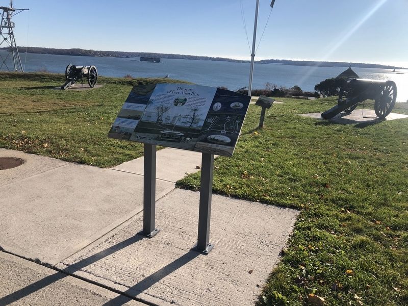
The story of Fort Allen Park Marker
| 201 ► Maine, Cumberland County, Portland, East End — The story of Fort Allen Park — |
| On Eastern Promenade at Morning Street, on the right when traveling north on Eastern Promenade. | |||
| 202 ► Maine, Cumberland County, Portland, East End — The U.S.S. Portland at war — |
| On Eastern Promenade just north of Morning Street, on the right when traveling north. | |||
| 203 ► Maine, Cumberland County, Portland, East End — War of 1812 Graveyard — |
| On Eastern Promenade at Quebec Street, on the right when traveling north on Eastern Promenade. | |||
| 204 ► Maine, Cumberland County, Portland, East End — Welcome To Fort Sumner Park — |
| On North Street just south of Melbourne Street, on the right when traveling north. | |||
| 205 ► Maine, Cumberland County, Portland, East End — Why build Fort Allen? — |
| On Eastern Promenade at Morning Street, on the right when traveling north on Eastern Promenade. | |||
| 206 ► Maine, Cumberland County, Portland, Libbytown — Veterans Memorial Bridge — |
| On Veterans Memorial Bridge (U.S. 1A) at Fore River Parkway (U.S. 1A) on Veterans Memorial Bridge. | |||
| 207 ► Maine, Cumberland County, Portland, Oakdale — Back Cove Trail — Welcome to the City of Portland Park System — |
| On Preble Street, 0.2 miles north of Marginal Way, on the right when traveling north. | |||
| 208 ► Maine, Cumberland County, Portland, Old Port — Elm Theater Mask — |
| On Temple Street just north of Free Street, on the right when traveling north. | |||
| 209 ► Maine, Cumberland County, Portland, Old Port — 9 — Friends (Quaker) Meeting House — Portland Maine Freedom Trail — |
| On Pearl Street at Federal Street, on the right when traveling north on Pearl Street. | |||
| 210 ► Maine, Cumberland County, Portland, Old Port — Home of Deacon Brown Thurston, 32 Union Street — Portland Freedom Trail — |
| On Fore Street at Union Street, on the left when traveling east on Fore Street. | |||
| 211 ► Maine, Cumberland County, Portland, Old Port — 13 — Mariner's Church — Portland Maine Freedom Trail — |
| On Fore Street. | |||
| 212 ► Maine, Cumberland County, Portland, Old Port — 12 — Secondhand Clothing Store of Lloyd Scott — Portland Freedom Trail — |
| On Exchange Street, on the left when traveling north. | |||
| 213 ► Maine, Cumberland County, Portland, Parkside — Spanish-American War Memorial — |
| On State Street (Maine Route 77) at Park Avenue, on the left when traveling south on State Street. | |||
| 214 ► Maine, Cumberland County, Portland, Stroudwater — Stroudwater Burying Ground — |
| On Westbrook Street, 0.1 miles west of Congress Street (Maine Route 22), on the left when traveling west. | |||
| 215 ► Maine, Cumberland County, Portland, Waterfront District — A Dirty History of Casco Bay — |
| On Commercial Street (U.S. 1A) just south of Franklin Street (U.S. 1A), on the left when traveling south. | |||
| 216 ► Maine, Cumberland County, Portland, Waterfront District — Casco Bay's four thousand years of sustainable, stable productivity — |
| On Commercial Street (U.S. 1A) just south of Franklin Street (U.S. 1A), on the left when traveling south. | |||
| 217 ► Maine, Cumberland County, Portland, Waterfront District — Today, you see a healthier Casco Bay / Take a closer look — |
| On Commercial Street (U.S. 1A) just south of Franklin Street (U.S. 1A), on the left when traveling south. | |||
| 218 ► Maine, Cumberland County, Portland, Waterfront District — Tug Stamford Propeller — |
| On Thames Street north of Hancock Street, on the right when traveling north. | |||
| 219 ► Maine, Cumberland County, Scarborough — Capt. Henry Barrows — |
| Near Bessey School Drive, 0.1 miles east of U.S. 1, on the right when traveling east. | |||
| 220 ► Maine, Cumberland County, Scarborough — Civil War Memorial — |
| On U.S. 1 at Broadturn Road / Pine Point Road (Maine Route 9), on the left when traveling north on U.S. 1. | |||
| 221 ► Maine, Cumberland County, Scarborough — Danish Village Archway — Danish Village — Scarborough, Maine — |
| On Sawyer Road, 0.1 miles south of Durant Drive, on the right when traveling south. | |||
| 222 ► Maine, Cumberland County, Scarborough — Durant Drive — |
| On Durant Drive at Sawyer Road, on the right when traveling east on Durant Drive. | |||
| 223 ► Maine, Cumberland County, Scarborough — J.B. McConnell — |
| Near Sawyer Road, 0.1 miles north of U.S. 1, on the right when traveling north. | |||
| 224 ► Maine, Cumberland County, Scarborough — Maj. Charles Greene, Jr. — |
| Near Bessey School Drive, 0.1 miles east of U.S. 1, on the right when traveling east. | |||
| 225 ► Maine, Cumberland County, Scarborough — Maj. Robert Biss — |
| Near Bessey School Drive, 0.1 miles east of U.S. 1, on the right when traveling east. | |||
| 226 ► Maine, Cumberland County, Scarborough — Robert Wentworth Scamman — |
| On Durant Drive, 0.1 miles east of Sawyer Road, on the right when traveling east. | |||
| 227 ► Maine, Cumberland County, Scarborough — Veterans Memorial — |
| Near Bessey School Drive, 0.1 miles east of U.S. 1, on the right when traveling east. | |||
| 228 ► Maine, Cumberland County, Scarborough — World War — 1917 - 1918 — Scarborough Remembers — |
| On Sawyer Road, 0.1 miles north of U.S. 1, on the right when traveling north. | |||
| 229 ► Maine, Cumberland County, Scarborough — World War II and Korean Conflict Memorial — |
| On Sawyer Road, 0.1 miles north of U.S. 1, on the right when traveling north. | |||
| 230 ► Maine, Cumberland County, South Portland — Civil War Memorial — |
| On Cottage Road at Mitchell Road, on the right when traveling east on Cottage Road. | |||
| 231 ► Maine, Cumberland County, South Portland — Civil War Memorial — |
| 232 ► Maine, Cumberland County, South Portland — Civilian Conservation Corps — |
| 233 ► Maine, Cumberland County, South Portland — Coast Artillery Corps at Fort Preble — |
| On Fort Road near McKernan Drive, on the right when traveling north. | |||
| 234 ► Maine, Cumberland County, South Portland — Coast Artillery Corps Memorial — |
| On Fort Road just south of McKernan Drive, on the right when traveling north. | |||
| 235 ► Maine, Cumberland County, South Portland — Early Settlement — |
| 236 ► Maine, Cumberland County, South Portland — East Yard — |
| On Slocum Drive west of Fort Road, on the right when traveling west. | |||
| 237 ► Maine, Cumberland County, South Portland — First Congregational Church of South Portland — |
| On Fort Road, on the left when traveling north. | |||
| 238 ► Maine, Cumberland County, South Portland — For All Time — |
| On Broadway just west of Walnut Street, on the right when traveling west. | |||
| 239 ► Maine, Cumberland County, South Portland — Fort Gorges — |
| 240 ► Maine, Cumberland County, South Portland — Fort Preble — |
| On Fort Road near Campus Center Drive, on the right when traveling north. | |||
| 241 ► Maine, Cumberland County, South Portland — Liberty Ship Memorial — |
| 242 ► Maine, Cumberland County, South Portland — Morris P. Cates — |
| On Fort Road at Campus Center Drive, on the right when traveling north on Fort Road. | |||
| 243 ► Maine, Cumberland County, South Portland — Rev. John O'Dowd — |
| Near Broadway. | |||
| 244 ► Maine, Cumberland County, South Portland — Shipbuilding — |
| 245 ► Maine, Cumberland County, South Portland — Shipbuilding — East and West Yards — |
| On Slocum Drive west of Fort Road, on the right when traveling west. | |||
| 246 ► Maine, Cumberland County, South Portland — Site of Former Schools — |
| On Pillsbury Street at Chase Street, on the right when traveling north on Pillsbury Street. | |||
| 247 ► Maine, Cumberland County, South Portland — South Portland and Its Liberty Ships — |
| 248 ► Maine, Cumberland County, South Portland — South Portland's Ships for Liberty — |
| 249 ► Maine, Cumberland County, South Portland — Spring Point Ledge Light — |
| On Lighthouse Circle at Fort Road, on the right when traveling east on Lighthouse Circle. | |||
| 250 ► Maine, Cumberland County, South Portland — The Ugly Ducklings — |
| 251 ► Maine, Cumberland County, South Portland — The Ultimate Sacrifice — |
| On Madison Street, on the left when traveling west. | |||
| 252 ► Maine, Cumberland County, South Portland — The Work Force — |
| 253 ► Maine, Cumberland County, South Portland — The Yard — |
| 254 ► Maine, Cumberland County, South Portland — Voyages for Victory — |
| 255 ► Maine, Cumberland County, South Portland — West Yard — |
| On Slocum Drive west of Fort Drive, on the right when traveling west. | |||
| 256 ► Maine, Cumberland County, South Portland — WWII: On the Home Front — |
| 257 ► Maine, Cumberland County, Steep Falls — Founder of Steep Falls — |
| On Main Street (Maine Route 11) at Pequawket Trail (Maine Route 113), on the right when traveling north on Main Street. | |||
| 258 ► Maine, Cumberland County, Steep Falls — Steep Falls Park — |
| On Main Street (Maine Route 11) at Pequawket Trail (Maine Route 113), on the right when traveling north on Main Street. | |||
| 259 ► Maine, Cumberland County, Steep Falls — Steep Falls World War II Veterans Memorial — |
| On Main Street (Maine Route 11) at Gains Road, on the right when traveling north on Main Street. | |||
| 260 ► Maine, Franklin County, Rangeley — The Whip Willow Farm / La ferme de Whip Willow — |
| On Main Street (Maine Route 4) just south of Dallas Hill Road, on the right when traveling south. | |||
| 261 ► Maine, Franklin County, Rangeley — Trophy Trout Discovered / La découverte de truites trophées — |
| On Main Street (Maine Route 4) just south of Dallas Hill Road, on the right when traveling south. | |||
| 262 ► Maine, Hancock County, Bar Harbor — “Hot Line” to Europe — Acadia National Park — National Park Service, U.S. Department of the Interior — |
| On Otter Cliff Road, on the right when traveling south. | |||
| 263 ► Maine, Hancock County, Bar Harbor — Acadia’s Founding Father — Acadia National Park — |
| Near Suier de Monts Road. | |||
| 264 ► Maine, Hancock County, Bar Harbor — Acadian Lights — |
| On Ocean Drive, on the right. | |||
| 265 ► Maine, Hancock County, Bar Harbor — 27 — Agamont Park and Early Artists / Le parc Agamont et les artistes — Bar Harbor, Maine — The Museum in the Streets — |
| On West Street, on the right when traveling east. | |||
| 266 ► Maine, Hancock County, Bar Harbor — Alessandro Fabbri, Lieutenant, U.S.N.R.F. — 1877 - 1922 — In Memory Of — |
| 267 ► Maine, Hancock County, Bar Harbor — Bar Harbor Soldiers Monument — |
| On The Shore Path, on the right when traveling east. | |||
| 268 ► Maine, Hancock County, Bar Harbor — 3 — Bar Island — Bar Harbor, Maine — The Museum in the Streets — |
| On West Street at Bridge Street, on the right when traveling west on West Street. | |||
| 269 ► Maine, Hancock County, Bar Harbor — Cadillac Mountain — |
| 270 ► Maine, Hancock County, Bar Harbor — Civil War Memorial — |
| On Mt. Desert Street (Maine Route 3) at School Street, on the right when traveling west on Mt. Desert Street. | |||
| 271 ► Maine, Hancock County, Bar Harbor — Cottage Street — |
| On Cottage Street at Federal Street, on the right when traveling west on Cottage Street. | |||
| 272 ► Maine, Hancock County, Bar Harbor — 28 — Criterion Theatre / Le Théâtre Criterion — Bar Harbor, Maine — The Museum in the Streets — |
| On Cottage Street east of Rodick Street, on the right when traveling west. | |||
| 273 ► Maine, Hancock County, Bar Harbor — Donald A. Wood Band Stand — |
| On Firefly Lane near Main Street, on the right when traveling east. | |||
| 274 ► Maine, Hancock County, Bar Harbor — Drink in the View — Acadia National Park — |
| Near Park Loop Road. | |||
| 275 ► Maine, Hancock County, Bar Harbor — Forever Protected — |
| 276 ► Maine, Hancock County, Bar Harbor — Frenchman Bay — |
| On Paradise Hill Rd. | |||
| 277 ► Maine, Hancock County, Bar Harbor — Gateway to Acadia — |
| On Park Loop Road, on the left when traveling north. | |||
| 278 ► Maine, Hancock County, Bar Harbor — George Bucknam Dorr — |
| Near Suier de Monts Road. | |||
| 279 ► Maine, Hancock County, Bar Harbor — Glacial Freight — |
| On Park Loop Road. | |||
| 280 ► Maine, Hancock County, Bar Harbor — Granite Foundations — Acadia National Park — |
| Near Park Loop Road. | |||
| 281 ► Maine, Hancock County, Bar Harbor — 10 — Holy Redeemer / Église de Holy Redeemer — Bar Harbor, Maine — The Museum in the Streets — |
| On Mount Desert Street (Maine Route 3) at Ledgelawn Avenue, on the right when traveling east on Mount Desert Street. | |||
| 282 ► Maine, Hancock County, Bar Harbor — Icy Depths — Acadia National Park — |
| On Park Loop Road, on the left when traveling south. | |||
| 283 ► Maine, Hancock County, Bar Harbor — Ocean Highways — Acadia National Park — |
| On Paradise Hill Road, on the left when traveling south. | |||
| 284 ► Maine, Hancock County, Bar Harbor — Once a Busy Waterfront — Acadia National Park — |
| On Park Loop Road, on the left when traveling north. | |||
| 285 ► Maine, Hancock County, Bar Harbor — Peregrine Falcons Return to Acadia — |
| 286 ► Maine, Hancock County, Bar Harbor — Picture Perfect? — Acadia National Park — National Park Service, U.S. Department of the Interior — |
| On Cadillac Summit Road. | |||
| 287 ► Maine, Hancock County, Bar Harbor — Sand Beach — |
| 288 ► Maine, Hancock County, Bar Harbor — Satterlee Field — |
| 289 ► Maine, Hancock County, Bar Harbor — Secrets of the Sand — Acadia National Park — |
| Near Park Loop Road, on the left when traveling south. | |||
| 290 ► Maine, Hancock County, Bar Harbor — Sieur de Monts Spring: The Heart of Acadia National Park — |
| 291 ► Maine, Hancock County, Bar Harbor — Signs of the Seasons — Acadia National Park — |
| On Paradise Hill Road, on the left when traveling south. | |||
| 292 ► Maine, Hancock County, Bar Harbor — Sounds of the Sea — Acadia National Park — |
| On Park Loop Road, on the left when traveling south. | |||
| 293 ► Maine, Hancock County, Bar Harbor — St. Saviour's Episcopal Parish Welcomes You — |
| On Mt. Desert Street (Maine Route 3) near School Street, on the right when traveling west. | |||
| 294 ► Maine, Hancock County, Bar Harbor — Stephen Tyng Mather — July 4, 1867 - Jan. 22, 1930 — |
| 295 ► Maine, Hancock County, Bar Harbor — The 1947 Fire — |
| On Paradise Hill Rd, on the left. | |||
| 296 ► Maine, Hancock County, Bar Harbor — 14 — The Abbe Museum & Congregational Church / Le Musée Abbe et L'Élise Congrégationaliste — Bar Harbor, Maine — The Museum in the Streets — |
| On Mt. Desert Street (Maine Route 3) at School Street, on the right when traveling east on Mt. Desert Street. | |||
| 297 ► Maine, Hancock County, Bar Harbor — The French Connection — Acadia National Park — |
| On Paradise Hill Road, on the left when traveling south. | |||
| 298 ► Maine, Hancock County, Bar Harbor — The Kedge — 1870 — |
| On West Street at Bridge Street, on the left when traveling west on West Street. | |||
| 299 ► Maine, Hancock County, Bar Harbor — The Village Burying Ground — |
| On Mt. Desert Street (Maine Route 3) at School Street, on the right when traveling west on Mt. Desert Street. | |||
| 300 ► Maine, Hancock County, Bar Harbor — 16 — The Village Green / Le Jardin Public — Bar Harbor, Maine — The Museum in the Streets — |
| On Main Street at Mt. Desert Street, on the left when traveling north on Main Street. | |||
860 entries matched your criteria. Entries 201 through 300 are listed above. ⊲ Previous 100 — Next 100 ⊳