480 entries match your criteria. The first 100 are listed. ⊳
Historical Markers and War Memorials
in the Willamette Valley Region
By Barry Swackhamer, September 26, 2017
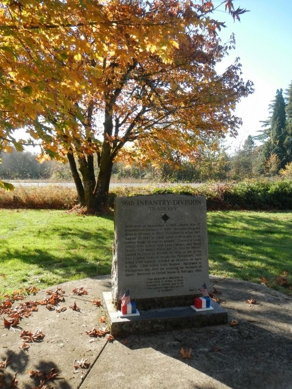
96th Infantry Division Marker
1 ► Oregon, Benton County, Corvallis — 96th Infantry Division — "Deadeyes" —  |
| Near Camp Adair Road near Pacific Highway West (Oregon Route 99W), on the left when traveling east. | |||
| 2 ► Oregon, Benton County, Corvallis — Alice E. Biddle — First Woman Graduate of Oregon State University — |
| Near SE Jefferson Way. | |||
| 3 ► Oregon, Benton County, Corvallis — Avery Park Applegate Trail Kiosk — Southern Route to Oregon — |
| On SW Avery Park Drive, on the left when traveling east. | |||
| 4 ► Oregon, Benton County, Corvallis — Benton County Courthouse — |
| On 4th Street, on the right when traveling south. | |||
| 5 ► Oregon, Benton County, Corvallis — Benton County State Bank — |
| On SW Madison Avenue, on the right when traveling west. | |||
| 6 ► Oregon, Benton County, Corvallis — Camp Adair — |
| Near Camp Adair Road near Pacific Highway West (Oregon Route 99W), on the left when traveling east. | |||
| 7 ► Oregon, Benton County, Corvallis — Capitol of Territorial Oregon — 1855 — |
| On SW 2nd Street at SW Adams Avenue on SW 2nd Street. | |||
| 8 ► Oregon, Benton County, Corvallis — City Hall — |
| On Southwest Madison Avenue at Pacific Hwy W (U.S. 20), on the right when traveling east on Southwest Madison Avenue. | |||
| 9 ► Oregon, Benton County, Corvallis — Early Town Development — The Corvallis Riverfront — |
| On SW 1st Street north of SW Jefferson Avenue, on the right when traveling north. | |||
| 10 ► Oregon, Benton County, Corvallis — Ecology of the Agricultural Reach — |
| On SW Campus Way 0.5 miles west of SW 35th Street, on the left when traveling west. | |||
| 11 ► Oregon, Benton County, Corvallis — Elementary Schools — Central Park — |
| Near NW Monroe Street. | |||
| 12 ► Oregon, Benton County, Corvallis — First Congregational Church — 1918-1932 — |
| On SW 8th St at SW Madison Ave, on the right when traveling north on SW 8th St. | |||
| 13 ► Oregon, Benton County, Corvallis — Home of Fred J. Porter — Corvallis City Engineer From 1909 to 1949 — |
| On SW Madison Ave at SW 8th St, on the right when traveling west on SW Madison Ave. | |||
| 14 ► Oregon, Benton County, Corvallis — Kearney Hall — |
| On Southwest Monroe Avenue, on the left when traveling west. | |||
| 15 ► Oregon, Benton County, Corvallis — Kings Valley Millstone — |
| On SW Avery Park Drive. | |||
| 16 ► Oregon, Benton County, Corvallis — L.G. Kline Building — |
| On Southwest Madison Avenue at SW 2nd St, on the left when traveling east on Southwest Madison Avenue. | |||
| 17 ► Oregon, Benton County, Corvallis — Madison Avenue — A Place For People — |
| On SW Madison Ave, on the left when traveling north. | |||
| 18 ► Oregon, Benton County, Corvallis — Oak Creek’s Watershed — |
| On SW Campus Way 0.5 miles west of SW 35th Street, on the left when traveling west. | |||
| 19 ► Oregon, Benton County, Corvallis — Oregon State University — National Historic District — |
| On SW Jefferson Way at SW 15th Street, on the right when traveling west on SW Jefferson Way. | |||
| 20 ► Oregon, Benton County, Corvallis — Peavy Hall War Memorial — |
| Near SW Jefferson Way at SW 30th St. | |||
| 21 ► Oregon, Benton County, Corvallis — River Transport — |
| On SW 1st Street north of SW Jefferson Avenue, on the right when traveling north. | |||
| 22 ► Oregon, Benton County, Corvallis — Site of Corvallis Public Schools — 1889-1946 — |
| Near NW Monroe Avenue. | |||
| 23 ► Oregon, Benton County, Corvallis — Site of the Earliest Boat Landing — Lower Town, Marysville, 1851 — |
| On Northwest Van Buren Avenue. | |||
| 24 ► Oregon, Benton County, Corvallis — Sustainable Farm Management — |
| On SW Campus Way 0.5 miles west of SW 35th Street, on the left when traveling west. | |||
| 25 ► Oregon, Benton County, Corvallis — The Corvallis Arts Center — |
| On SW Madison Ave, on the left when traveling north. | |||
| 26 ► Oregon, Benton County, Corvallis — The Corvallis Ferry — |
| Near NW 1st Street when traveling south. | |||
| 27 ► Oregon, Benton County, Corvallis — The Incubator House & Poultry Building — |
| On SW Washington Avenue at SW 8th Street, on the right when traveling east on SW Washington Avenue. | |||
| 28 ► Oregon, Benton County, Corvallis — The Opera House — |
| On Pacific Highway West at Pacific Hwy W (U.S. 20) on Pacific Highway West. | |||
| 29 ► Oregon, Benton County, Corvallis — The Timberwolves — |
| On Camp Adair Road near Pacific Highway West (Oregon Route 99W). | |||
| 30 ► Oregon, Benton County, Corvallis — The Trailblazers — |
| Near Camp Adair Road near Pacific Highway West (Oregon Route 99W), on the left when traveling east. | |||
| 31 ► Oregon, Benton County, Corvallis — The Van Buren Street Bridge — |
| Near NE 1st Street south of NW Harrison Boulevard. | |||
| 32 ► Oregon, Benton County, Corvallis — The Whiteside Theatre — |
| On Pacific Hwy W (U.S. 99) at SW Madison Ave, on the right when traveling north on Pacific Hwy W. | |||
| 33 ► Oregon, Benton County, Corvallis — The Wild West Division — Powder River! Let'er Buck! — |
| Near Camp Adair Road near Pacific Highway West (Oregon Route 99W), on the left when traveling east. | |||
| 34 ► Oregon, Benton County, Monroe — Applegate Trail — |
| On Dawson Rd, on the right when traveling east. | |||
| 35 ► Oregon, Benton County, Monroe — Ebenezer Schoolhouse — United Methodist Historic Site — |
| On Bellfountain Rd, on the left when traveling south. | |||
| 36 ► Oregon, Benton County, Monroe — The Applegate Trail — Southern Route to Oregon — |
| On Pacific Hwy (U.S. 99) at Main Street, on the right when traveling south on Pacific Hwy. | |||
| 37 ► Oregon, Benton County, Monroe — 323 — The Belknap Settlement — United Methodist Church Registered Historic Site No. 323 — |
| Near Orchard St. | |||
| 38 ► Oregon, Benton County, Monroe — Wilhelm Mill Water Wheel — Historical Site — |
| On Pacific Hwy W (Oregon Route 99), on the right when traveling west. | |||
| 39 ► Oregon, Benton County, Philomath — 385 — Historic Philomath College Building — |
| On Corvallis-Newport Highway (aka Main Street) (U.S. 20) at South 11th Street, on the right when traveling west on Corvallis-Newport Highway (aka Main Street). | |||
| 40 ► Oregon, Benton County, Philomath — Mt. Union Cemetery — |
| On Mt. Union Avenue, on the right when traveling north. | |||
| 41 ► Oregon, Benton County, Philomath — Reuben and Mary Jane Shipley — Benefactors of Mount Union Cemetery — |
| Near Mount Union Avenue north of Benton View Drive, on the right when traveling north. | |||
| 42 ► Oregon, Benton County, Philomath — Shipley Family Homestead — |
| On James Street 0 miles east of Newton St, on the left when traveling east. | |||
| 43 ► Oregon, Clackamas County, Estacada — Harold E. Babcock — |
| On SE Main Street north of Clackamas Highway ( Highway 211), on the right when traveling south. | |||
| 44 ► Oregon, Clackamas County, Government Camp — "Disparite Bad Beyond Discription" — Hardships of the Trail — |
| On Old Barlow Road near Barlow Road (Forest Road NF-3530), on the left when traveling east. | |||
| 45 ► Oregon, Clackamas County, Government Camp — "Sumate Prairie" — from an emigrant's journal original spelling — |
| On East Perry Vickers Road near East Chimney Rock Road, on the left when traveling south. | |||
| 46 ► Oregon, Clackamas County, Government Camp — A Final Rest — For One Pioneer Woman, the Oregon Trail Ended Here — |
| Near Mt. Hood Highway (Oregon Route 35), on the right when traveling east. | |||
| 47 ► Oregon, Clackamas County, Government Camp — Barlow Road — |
| On Barlow Road at Forest Road NF-3530, on the right when traveling east on Barlow Road. | |||
| 48 ► Oregon, Clackamas County, Government Camp — Government Camp — |
| On Government Camp Loop near East Wyeast Trail, on the right when traveling west. | |||
| 49 ► Oregon, Clackamas County, Government Camp — Government Camp — |
| On Government Camp Loop near 2nd Street, on the left when traveling west. | |||
| 50 ► Oregon, Clackamas County, Government Camp — Samuel Kimbrough Barlow — Susannah Lee Barlow — |
| On Government Camp Loop at 2nd Street (East Little Trail), on the right when traveling west on Government Camp Loop. | |||
| 51 ► Oregon, Clackamas County, Government Camp — Timberline Lodge — Mt. Hood National Forest — |
| On East Timberline Road near U.S. 26. | |||
| 52 ► Oregon, Clackamas County, Happy Valley — King 56 Aircrew Memorial — |
| On Willamette National Cemetery Road. | |||
| 53 ► Oregon, Clackamas County, Lake Oswego — George Rogers House - 1929 — |
| On Wilbur Street at Durham Street, on the left when traveling east on Wilbur Street. | |||
| 54 ► Oregon, Clackamas County, Lake Oswego — Green Street — |
| On Green Street at Furnace Street on Green Street. | |||
| 55 ► Oregon, Clackamas County, Lake Oswego — Iron Company Worker's Cottage — |
| On Wilbur Street west of Durham Street. | |||
| 56 ► Oregon, Clackamas County, Lake Oswego — Lakewood School - 1928 — |
| On South State Street at Middlecrest Road, on the right when traveling south on South State Street. | |||
| 57 ► Oregon, Clackamas County, Lake Oswego — Lower Oswego Creek Bridge — |
| On Old River Road east of Green Street, on the left when traveling south. | |||
| 58 ► Oregon, Clackamas County, Lake Oswego — Murphy Real Estate Building - 1940 — |
| On North State Street 0.1 miles south of A Avenue, on the left when traveling south. | |||
| 59 ► Oregon, Clackamas County, Lake Oswego — Old Town — |
| On Wilbur Street at Durham Street, on the right when traveling east on Wilbur Street. | |||
| 60 ► Oregon, Clackamas County, Lake Oswego — Oswego Landing — |
| Near Old River Road at Green Street. | |||
| 61 ► Oregon, Clackamas County, Lake Oswego — Salamander — |
| Near Old River Road near Furnace Road. | |||
| 62 ► Oregon, Clackamas County, Lake Oswego — The Durham Mill — |
| On McVey Avenue west of South State Street, on the right when traveling west. | |||
| 63 ► Oregon, Clackamas County, Lake Oswego — The First People — |
| Near Old River Road at Green Street. | |||
| 64 ► Oregon, Clackamas County, Lake Oswego — the man from k̓ašxəʼkšix returned with eels to feed his people — |
| Near Old River Road south of Furnace Road. | |||
| 65 ► Oregon, Clackamas County, Lake Oswego, Oldtown — Old Peg Tree — |
| On Leonard Street, on the left when traveling east. | |||
| 66 ► Oregon, Clackamas County, Oregon City — Abernethy Green — |
| Near Washington Street. | |||
| 67 ► Oregon, Clackamas County, Oregon City — Abigail Scott Duniway — Rebel for Rights — |
| Near Washington Street, on the right when traveling north. | |||
| 68 ► Oregon, Clackamas County, Oregon City — Area Commerce — |
| Near South Gronlund Road near Carver Road, on the right when traveling west. | |||
| 69 ► Oregon, Clackamas County, Oregon City — Baker Cabin Historical Society — |
| Near South Gronlund Road near Carver Road, on the right when traveling west. | |||
| 70 ► Oregon, Clackamas County, Oregon City — Baker Cabin Pioneer Church — |
| On South Gronlund Road near Carver Road, on the right when traveling west. | |||
| 71 ► Oregon, Clackamas County, Oregon City — Baker Site — |
| Near South Gronlund Road near Carver Road, on the right when traveling west. | |||
| 72 ► Oregon, Clackamas County, Oregon City — Canemah — |
| On 3rd Avenue at Hedges Street, on the right when traveling west on 3rd Avenue. | |||
| 73 ► Oregon, Clackamas County, Oregon City — Clackamas Chinook — An Artist Encounter With the First Peoples of the Oregon City Area — |
| Near Washington Street near Abernethy Road, on the right when traveling north. | |||
| 74 ► Oregon, Clackamas County, Oregon City — Coyote Creates Willamette Falls — Santiam Kalapuya — |
| Near Washington Street near Abernethy Road, on the right when traveling north. | |||
| 75 ► Oregon, Clackamas County, Oregon City — Coyote Creates Willamette Falls — Clackmas Chinook — |
| Near Washington Street near Abernethy Road, on the right when traveling north. | |||
| 76 ► Oregon, Clackamas County, Oregon City — Dr. Forbes Barclay — 1812 - 1873 — |
| On Center Street near 8th Street. | |||
| 77 ► Oregon, Clackamas County, Oregon City — Dr. John McLoughlin — "Father of Oregon" — |
| On McLoughlin Boulevard (Oregon Route 99) at S. 2nd Street, on the right when traveling south on McLoughlin Boulevard. | |||
| 78 ► Oregon, Clackamas County, Oregon City — Dr. John McLoughlin — 1784-1857 — |
| On Centre Street at 7th Street, on the left when traveling north on Centre Street. | |||
| 79 ► Oregon, Clackamas County, Oregon City — Dr. John McLoughlin — Father of Oregon — |
| Near Washington Street near Abernethy Road, on the right when traveling north. | |||
| 80 ► Oregon, Clackamas County, Oregon City — Earthquakes and Mountain Fog — The First People and the Mountain — |
| Near Washington Street near Abernethy Road, on the right when traveling north. | |||
| 81 ► Oregon, Clackamas County, Oregon City — End of the Oregon Trail — |
| Near Washington Street near Abernethy Road, on the right when traveling north. | |||
| 82 ► Oregon, Clackamas County, Oregon City — End of the Oregon Trail — 1845-46 — |
| Near Washington Street near Abernethy Road, on the right when traveling north. | |||
| 83 ► Oregon, Clackamas County, Oregon City — Eva Emery Dye — |
| On Center Street near 7th Street. | |||
| 84 ► Oregon, Clackamas County, Oregon City — Explosion of Steamer Gazelle — |
| On South McLoughlin Boulevard (Oregon Route 99E) 0.1 miles south of South 2nd Street, on the left when traveling north. | |||
| 85 ► Oregon, Clackamas County, Oregon City — Fishing At Tumwater — Ancient Fishing Site — |
| Near Washington Street near Abernethy Road, on the right when traveling north. | |||
| 86 ► Oregon, Clackamas County, Oregon City — Gardens — Living History of the Oregon Trail — |
| Near Washington Street near Abernethy Road, on the right when traveling north. | |||
| 87 ► Oregon, Clackamas County, Oregon City — George Abernethy's Historical Significance — You are currently standing on Abernethy Green! — |
| Near Washington Street near Abernethy Road, on the right when traveling north. | |||
| 88 ► Oregon, Clackamas County, Oregon City — Grinding Rock — |
| On South Gronlund Road near Carver Road. | |||
| 89 ► Oregon, Clackamas County, Oregon City — Historic Canemah Cemetery — |
| On 5th Avenue near Blanchard Street, on the right when traveling west. | |||
| 90 ► Oregon, Clackamas County, Oregon City — John Myers Building — Circa 1864 — |
| On Main Street at 6th Street, on the right when traveling south on Main Street. | |||
| 91 ► Oregon, Clackamas County, Oregon City — Joseph L. Meek — Born 1810 - Died 1875 — |
| On McLoughlin Boulevard (Pacific Highway) (State Highway 99) at 6th Street on McLoughlin Boulevard (Pacific Highway). | |||
| 92 ► Oregon, Clackamas County, Oregon City — Larry G. Dahl — Specialist 4, U. S. Army — |
| Near Tumwater Drive at S. 2nd Street, on the right when traveling south. | |||
| 93 ► Oregon, Clackamas County, Oregon City — Lot Whitcomb — Townsite Founder — |
| Near Washington Street near Abernethy Road, on the right when traveling north. | |||
| 94 ► Oregon, Clackamas County, Oregon City — McCald Building — Circa 1925 — |
| On Main Street, on the right when traveling west. | |||
| 95 ► Oregon, Clackamas County, Oregon City — McLoughlin House — National Historic Site — |
| On Center Street near 7th Street. | |||
| 96 ► Oregon, Clackamas County, Oregon City — Medorem Crawford — Wagon Master — |
| Near Washington Street near Abernethy Road, on the right when traveling north. | |||
| 97 ► Oregon, Clackamas County, Oregon City — OK Barber Shop — |
| On Main Street near 7th Street, on the right when traveling west. | |||
| 98 ► Oregon, Clackamas County, Oregon City — Old Oregon Trail — 1846 — |
| Near Washington Street near Abernethy Road, on the right when traveling north. | |||
| 99 ► Oregon, Clackamas County, Oregon City — Oregon — America's Manifest Destiny — |
| Near Washington Street near Abernethy Road, on the right when traveling north. | |||
| 100 ► Oregon, Clackamas County, Oregon City — M11 — Oregon City — Oregon History — |
| On McLoughlin Boulevard (Oregon Route 99) near S. 2nd Street, on the right when traveling south. | |||
480 entries matched your criteria. The first 100 are listed above. Next 100 ⊳