945 entries match your criteria. The first 100 are listed. ⊳
Historically Black Colleges and Universities Historical Markers
This series collects markers describing historical events, persons, and buildings related to the 100+ Historically Black Colleges and Universities (HBCUs).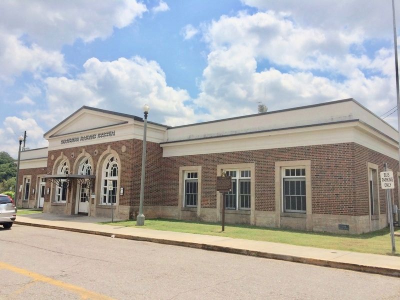
By Mark Hilton, August 5, 2017
Southern Railway Station
1 ► Alabama, Calhoun County, Anniston — 1 — Southern Railway Station Attack — January 2, 1961 — Anniston Civil Rights Trail —  |
| On West 4th Street east of Spruce Avenue, on the right when traveling east. | |||
| 2 ► Alabama, Calhoun County, Anniston — Trailways Attack — Seeking Justice — |
| On Noble Street at East 9th Street, on the right when traveling north on Noble Street. | |||
| 3 ► Alabama, Clarke County, Carlton — Mt. Nebo Death Masks — |
| On Mt. Nebo Road 0.4 miles north of Belqueen Road, on the right when traveling west. | |||
| 4 ► Alabama, Clarke County, Thomasville — Williams’ Temple CME Church — |
| On Davis Avenue East east of East Front Street. | |||
| 5 ► Alabama, Conecuh County, Lime Hill — Reverend Hillary James Hawkins, D.D. — 1905-1995 — |
| On Brown Hawkins Road at Fall Lane, on the left when traveling north on Brown Hawkins Road. | |||
| 6 ► Alabama, Dale County, Ozark — D. A. Smith High School / Professor D. A. Smith, Principal — Dale County / Dale County — |
| On Andrews Avenue, on the right when traveling south. | |||
| 7 ► Alabama, Dallas County, Selma — Tabernacle Baptist Church — Dallas County — |
| On Broad Street (Business U.S. 80) at Minter Avenue, on the right when traveling south on Broad Street. | |||
| 8 ► Alabama, Hale County, Gallion — Freetown — |
| On U.S. 80 2 miles east of State Highway 69, on the right when traveling east. | |||
| 9 ► Alabama, Jackson County, Stevenson — Averyville — |
| On Old Mount Carmel Road (County Route 85) at Ohio Avenue, on the left when traveling west on Old Mount Carmel Road. | |||
| 10 ► Alabama, Jefferson County, Birmingham, Fountain Heights — Emory Overton Jackson — 1908 - 1975 — |
| On 17th Street North, on the right when traveling south. | |||
| 11 ► Alabama, Jefferson County, Fairfield — Miles College Leaders, Students Active During Civil Rights Era — |
| Near Myron Massey Boulevard north of 55th Street, on the left when traveling north. | |||
| 12 ► Alabama, Limestone County, Athens — Fort Henderson / Trinity School - 1865-1970 — |
| On Browns Ferry Street (County Road 29) west of Allyn Street, on the right when traveling west. | |||
| 13 ► Alabama, Macon County, Franklin — Franklin's Educational Legacy — |
| On Tuskegee-Franklin Road (Alabama Route 49) 0.4 miles south of County Road 17, on the left when traveling south. | |||
| 14 ► Alabama, Macon County, Notasulga — Birthplace of Zora Neale Hurston — Notasulga, Alabama — Zora Neale Hurston (1891-1960) — |
| On Auburn Road (Route 14) 0.3 miles east of Tallapoosa Street, on the right when traveling east. | |||
| 15 ► Alabama, Macon County, Shorter — Prairie Farms Resettlement Community — |
| On Auburn Street (U.S. 80) at Tysonville Road (County Highway 97), on the left when traveling north on Auburn Street. | |||
| 16 ► Alabama, Macon County, Tuskegee — 9 — "Trade With Your Friends" — The Tuskegee Boycott — The Tuskegee Civil Rights and Historic Trail — |
| On Westside Street south of West Northside Street, on the left when traveling south. | |||
| 17 ► Alabama, Macon County, Tuskegee — 7 — Area Churches That Hosted Important Civil Rights Meetings — The Tuskegee Civil Rights and Historic Trail |
| On West Montgomery Road east of Peyton Road, on the right when traveling west. Reported missing. | |||
| 18 ► Alabama, Macon County, Tuskegee — Brief History of Tuskegee, Alabama — |
| On Westside Street at West Northside Street, on the right when traveling south on Westside Street. | |||
| 19 ► Alabama, Macon County, Tuskegee — 13 — Mount Olive Missionary Baptist Church — The Tuskegee Civil Rights and Historic Trail — |
| On Cedar Street south of Railroad Avenue, on the right when traveling north. | |||
| 20 ► Alabama, Macon County, Tuskegee — 10 — Rosa Parks — The Tuskegee Civil Rights and Historic Trail — |
| On West Martin Luther King Highway (U.S. 80) west of South Jericho Street, on the right when traveling east. | |||
| 21 ► Alabama, Macon County, Tuskegee — 12 — Samuel "Sammy" Leamon Younge, Jr. — The Tuskegee Civil Rights and Historic Trail — |
| On East Martin Luther King Highway (U.S. 80) east of North Maple Street, on the left when traveling east. | |||
| 22 ► Alabama, Macon County, Tuskegee — The Tuskegee Veterans Administration Hospital |
| On Hospital Road 1.4 miles north of East Water Street (Route 81), on the right when traveling north. Reported missing. | |||
| 23 ► Alabama, Macon County, Tuskegee — 11 — Tuskegee High School — The Tuskegee Civil Rights and Historic Trail — |
| On South Main Street (U.S. 29) at East Price Street, on the right when traveling north on South Main Street. | |||
| 24 ► Alabama, Macon County, Tuskegee — 8 — William P. Mitchell — (1912-1986) — The Tuskegee Civil Rights and Historic Trail |
| On North Elm Street north of West Northside Street, on the left when traveling north. Reported missing. | |||
| 25 ► Alabama, Macon County, Tuskegee Airmen National Historic Site — New Vistas — Tuskegee Airmen National Historic Site — |
| Near Chappie James Avenue. | |||
| 26 ► Alabama, Macon County, Tuskegee Airmen National Historic Site — The Control Tower — Tuskegee Airmen National Historic Site — National Park Service, U.S. Department of the Interior — |
| Near Chappie James Avenue. | |||
| 27 ► Alabama, Macon County, Tuskegee Institute — 1 — Amelia Boynton Robinson — The Tuskegee Civil Rights and Historic Trail — |
| On Franklin Road near Boy Scout Circle, on the left when traveling north. | |||
| 28 ► Alabama, Macon County, Tuskegee Institute — Birth of Trades Program — Tuskegee Institute National Historic Site — |
| On Lewis Adams Street at University Avenue, on the left when traveling south on Lewis Adams Street. | |||
| 29 ► Alabama, Macon County, Tuskegee Institute — Campus Architect — Tuskegee Institute National Historic Site — |
| Near University Avenue 0.2 miles east of Booker T. Washington Boulevard. | |||
| 30 ► Alabama, Macon County, Tuskegee Institute — Carver's Laboratory — Tuskegee Institute National Historic Site — |
| On University Avenue at North Water Street, on the right when traveling west on University Avenue. | |||
| 31 ► Alabama, Macon County, Tuskegee Institute — 2 — Charles Goode Gomillion — The Tuskegee Civil Rights and Historic Trail — |
| On Bibb Street 0.2 miles north of Hudson Street, on the left when traveling north. | |||
| 32 ► Alabama, Macon County, Tuskegee Institute — Dining and Social Center — Tuskegee Institute National Historic Site — National Park Service, U.S. Department of the Interior — |
| Near University Avenue 0.2 miles east of Booker T. Washington Boulevard. | |||
| 33 ► Alabama, Macon County, Tuskegee Institute — Enhancing Health Care — Tuskegee Institute National Historic Site — |
| On Booker T. Washington Boulevard at Benjamin F Payton Drive on Booker T. Washington Boulevard. | |||
| 34 ► Alabama, Macon County, Tuskegee Institute — Frederick Douglass Hall — 1904 — |
| Near University Avenue 0.2 miles east of Booker T. Washington Boulevard. | |||
| 35 ► Alabama, Macon County, Tuskegee Institute — Great Philanthropists — Tuskegee Institute National Historic Site — National Park Service, U.S. Department of the Interior — |
| On University Avenue 0.2 miles east of Booker T. Washington Boulevard, on the right when traveling east. | |||
| 36 ► Alabama, Macon County, Tuskegee Institute — Huntington Hall — 1900 — |
| Near University Avenue 0.2 miles east of Booker T. Washington Boulevard. | |||
| 37 ► Alabama, Macon County, Tuskegee Institute — 6 — Jessie Parkhurst Guzman — The Tuskegee Civil Rights and Historic Trail — |
| On NW Chambliss Street south of West Montgomery Road, on the left when traveling south. | |||
| 38 ► Alabama, Macon County, Tuskegee Institute — 4 — Julius Rosenwald — The Tuskegee Civil Rights and Historic Trail — |
| On Moton Drive at Booker T. Washington Boulevard on Moton Drive. | |||
| 39 ► Alabama, Macon County, Tuskegee Institute — Managing the School — Tuskegee Institute National Historic Site — |
| On University Avenue 0.2 miles east of Booker T. Washington Boulevard, on the right when traveling east. | |||
| 40 ► Alabama, Macon County, Tuskegee Institute — Porter Hall 1883 / Huntington Academic Building 1905 — |
| On University Avenue west of Tuskegee Airmen Circle, on the right when traveling west. | |||
| 41 ► Alabama, Macon County, Tuskegee Institute — Site of Olivia Davidson Hall — Men's Dormitory — |
| On University Avenue at Lewis Adams Street, on the right when traveling west on University Avenue. | |||
| 42 ► Alabama, Macon County, Tuskegee Institute — The Burnt Place — Tuskegee Institute National Historic Site — |
| On University Avenue at Tuskegee Airmen Circle, on the right when traveling north on University Avenue. | |||
| 43 ► Alabama, Macon County, Tuskegee Institute — The Tuskegee Airmen's Plaza — |
| On Campus Road east of Foster [West Outer] Drive, on the right when traveling east. | |||
| 44 ► Alabama, Macon County, Tuskegee Institute — 3 — The Tuskegee Institute Advancement League — The Tuskegee Civil Rights and Historic Trail — |
| On University Avenue east of Booker T Washington Boulevard, on the right when traveling east. | |||
| 45 ► Alabama, Macon County, Tuskegee Institute — Thrasher Hall — |
| On University Avenue west of Lewis Adams Street, on the right when traveling east. | |||
| 46 ► Alabama, Macon County, Tuskegee Institute — Tuskegee Chapel — Tuskegee Institute National Historic Site — National Park Service, U.S. Department of the Interior — |
| On Booker T Washington Boulevard. | |||
| 47 ► Alabama, Macon County, Tuskegee Institute — 5 — Tuskegee Civic Association — The Tuskegee Civil Rights and Historic Trail — |
| On West Montgomery Road at Chambliss Street, on the left when traveling west on West Montgomery Road. | |||
| 48 ► Alabama, Macon County, Tuskegee Institute — Tuskegee University — F-4C Phantom — |
| On University Avenue at Foster Drive, on the right when traveling east on University Avenue. | |||
| 49 ► Alabama, Macon County, Tuskegee Institute — Up From Slavery — Tuskegee Institute National Historic Site — |
| On University Avenue at Tuskegee Airmen Circle, on the right when traveling east on University Avenue. | |||
| 50 ► Alabama, Macon County, Tuskegee Institute — White Hall — 1910 — |
| Near University Avenue 0.2 miles east of Booker T. Washington Boulevard. | |||
| 51 ► Alabama, Madison County, Huntsville — Oakwood College — Founded 1896 — |
| On Adventist Blvd NW at Millennium Drive NW, on the right when traveling north on Adventist Blvd NW. | |||
| 52 ► Alabama, Madison County, Huntsville — Oakwood College — Founded 1896 — |
| On Adventist Blvd NW 0.2 miles west of Sparkman Drive NW, on the right when traveling west. | |||
| 53 ► Alabama, Madison County, Huntsville — Original Site of Alabama Agricultural and Mechanical University — (now located at Normal, Alabama) — |
| On Clinton Avenue SE at Monroe Street SE, on the right when traveling east on Clinton Avenue SE. | |||
| 54 ► Alabama, Madison County, Huntsville — Rev. Dr. Joseph E. Lowery Boyhood Home Site — (Dean of Civil Rights Movement) — |
| On Church Street Northwest, on the right when traveling north. | |||
| 55 ► Alabama, Madison County, Normal — Alabama Agricultural and Mechanical University / Alabama A&M University former names — Normal, Alabama — |
| On Meridian Street at Chase Road NE, on the right when traveling north on Meridian Street. | |||
| 56 ► Alabama, Madison County, Normal — Councill Training School — (1919 - 1970) — |
| On Meridian Street 0.2 miles north of Chase Road NE, on the left when traveling north. | |||
| 57 ► Alabama, Madison County, Normal — William Hooper Councill — Founder — Alabama A&M University — |
| On Meridian Street at Parker Drive NW, on the right when traveling north on Meridian Street. | |||
| 58 ► Alabama, Mobile County, Mobile — 1 — Andrew N. Johnson — |
| On Dauphin Street at North Lawrence Street, on the left when traveling east on Dauphin Street. | |||
| 59 ► Alabama, Mobile County, Mobile — 6 — Caldwell School — |
| On North Broad Street at Congress Street, on the right when traveling south on North Broad Street. | |||
| 60 ► Alabama, Mobile County, Mobile — 15 — Dr. Thomas N. Harris — |
| On St Francis Street at North Warren Street, on the left when traveling west on St Francis Street. | |||
| 61 ► Alabama, Mobile County, Mobile — 17 — Dunbar/Central High School — |
| On Dr Martin Luther King Jr Avenue east of Ryland Street, on the right when traveling east. | |||
| 62 ► Alabama, Mobile County, Mobile — 35 — St. Louis Street Missionary Baptist Church — |
| On North Dearborn Street at St Louis Street, on the right when traveling north on North Dearborn Street. | |||
| 63 ► Alabama, Montgomery County, Montgomery — Alabama State University / Tatum Street |
| On Hall Street at Tatum Street, on the right when traveling south on Hall Street. Reported missing. | |||
| 64 ► Alabama, Montgomery County, Montgomery — Alabama State University / Tullibody — |
| On South Jackson St. near Tuscaloosa Street. | |||
| 65 ► Alabama, Montgomery County, Montgomery — Aurelia Eliscera Shines Browder — Civil Rights Pioneer — |
| On Highland Avenue at Watts Street, on the right when traveling east on Highland Avenue. | |||
| 66 ► Alabama, Montgomery County, Montgomery — Bertha Pleasant Williams / Rosa Parks Branch Library |
| On Rosa L Parks Avenue at Early Street, on the right when traveling south on Rosa L Parks Avenue. Reported missing. | |||
| 67 ► Alabama, Montgomery County, Montgomery — Beulah Baptist Church — Organized 1880 — |
| On Rosa L. Parks Avenue at National Street, on the right when traveling north on Rosa L. Parks Avenue. | |||
| 68 ► Alabama, Montgomery County, Montgomery — Birth of Montgomery Bus Boycott — Boycott planned & publicized here at ASU's Councill Hall — |
| On Tullibody Drive at University Drive North, on the right when traveling north on Tullibody Drive. | |||
| 69 ► Alabama, Montgomery County, Montgomery — Charlie and Lucille Times — Civic Leaders and Civil Rights Activists — |
| On South Holt Street 0.1 miles north of Central Street, on the right when traveling north. | |||
| 70 ► Alabama, Montgomery County, Montgomery — Elijah Cook / City of Montgomery v. Rosa Parks — |
| On North Perry Street at Madison Avenue, on the right when traveling north on North Perry Street. | |||
| 71 ► Alabama, Montgomery County, Montgomery — First Baptist Church — (Brick-A-Day Church) — |
| On North Ripley Street at Columbus Street, on the left when traveling north on North Ripley Street. | |||
| 72 ► Alabama, Montgomery County, Montgomery — Historic Sites Near Fairview Environmental Park — |
| Near West Fairview Avenue east of Interstate 65. | |||
| 73 ► Alabama, Montgomery County, Montgomery — Home of Ralph David Abernathy — (March 11, 1926-April 30, 1990) — |
| On Hall Street at Tuttle Street, on the right when traveling north on Hall Street. | |||
| 74 ► Alabama, Montgomery County, Montgomery — Loveless School / Henry Allen Loveless — |
| On West Jeff Davis Avenue at Bragg Street, on the right when traveling east on West Jeff Davis Avenue. | |||
| 75 ► Alabama, Montgomery County, Montgomery — Marshall J. Moore House — |
| On South Jackson Street at Tuscaloosa St. on South Jackson Street. | |||
| 76 ► Alabama, Montgomery County, Montgomery — Old Ship A.M.E. Zion Church — |
| On Holcombe Street at Mildred Street, on the right when traveling north on Holcombe Street. | |||
| 77 ► Alabama, Montgomery County, Montgomery — South Jackson Street / Victor Hugo Tulane — |
| On South Jackson Street at High Street, on the right when traveling south on South Jackson Street. | |||
| 78 ► Alabama, Montgomery County, Montgomery — St. Paul A.M.E. Church — |
| On East Patton Avenue at Wesley Drive, on the right when traveling east on East Patton Avenue. | |||
| 79 ► Alabama, Montgomery County, Montgomery — The Frank M. Johnson, Jr. Federal Building and US Courthouse — |
| On Church Street at Lee Street, on the right when traveling north on Church Street. | |||
| 80 ► Alabama, Montgomery County, Montgomery — The Hon. Rufus A. Lewis — 1906 - 1999 — |
| On Rufus A. Lewis Lane at Dericote Street on Rufus A. Lewis Lane. | |||
| 81 ► Alabama, Montgomery County, Montgomery, Centennial Hill — Centennial Hill — |
| On South Union Street at High Street, on the left when traveling north on South Union Street. | |||
| 82 ► Alabama, Montgomery County, Pike Road — Georgia Washington School — |
| On Georgia Washington Road at Antioch Lane, on the right when traveling south on Georgia Washington Road. | |||
| 83 ► Alabama, Perry County, Marion — Lincoln Normal School — |
| On Lincoln Street at Lee Street, on the left when traveling west on Lincoln Street. | |||
| 84 ► Alabama, Tuscaloosa County, Tuscaloosa — First African Baptist Church — Tuscaloosa, Alabama — |
| On Stillman Boulevard at Ty Rogers Avenue, on the right when traveling east on Stillman Boulevard. | |||
| 85 ► Alabama, Tuscaloosa County, Tuscaloosa — First Presbyterian Church — Tuscaloosa — |
| On Greensboro Avenue at Stillman Blvd, on the right when traveling south on Greensboro Avenue. | |||
| 86 ► Alabama, Tuscaloosa County, Tuscaloosa — Stillman College — |
| On Stillman Boulevard, on the right when traveling east. | |||
| 87 ► Alabama, Wilcox County, Snow Hill — Snow Hill Normal and Industrial Institute — 1893 — |
| On Snow Hill Institute Road 0.3 miles north of County Road 26, on the right when traveling north. | |||
| 88 ► Arkansas, Independence County, Batesville — Lafferty Memorial Church — |
| On East Main Street at North 6th Street, on the right when traveling west on East Main Street. | |||
| 89 ► California, Los Angeles County, Los Angeles, San Pedro — S.S. Lane Victory — Port of Los Angeles — |
| Near Miner Street 1 mile south of Harbor Boulevard, on the left when traveling south. | |||
| 90 ► Connecticut, Capitol Region, Hartford, Northeast — Black Heroes in Hartford: Judge Boce Barlow — Connecticut's First Black Judge — (1915 - 2005) — |
| On Main Street south of Westland Street, on the right when traveling north. | |||
| 91 ► Delaware, Kent County, Cheswold, Kenton Hundred — Floyd Durham (1918-2010) — "A Founding Father of Delaware Aviation" — |
| On Durham Lane north of 7 Hickories Road (Delaware Route 42), on the right when traveling north. | |||
| 92 ► Delaware, Kent County, Dover, East Dover Hundred — …and His Accomplishments — |
| On Loockerman Plaza west of Federal Plaza, on the right when traveling west. | |||
| 93 ► Delaware, Kent County, Dover, East Dover Hundred — KC-42 — Delaware State College — First College for Blacks in Delaware — |
| Near U.S. 13. | |||
| 94 ► Delaware, Kent County, Dover, East Dover Hundred — KC-45 — Delaware State College High School — |
| On College Road 0.7 miles west of North Dupont Highway (U.S. 13), on the right when traveling west. | |||
| 95 ► Delaware, Kent County, Dover, East Dover Hundred — Delaware State University Arboretum — Trees and Shrubs of the Beautiful Delaware State University Campus — |
| Near Frontage Road south of Loop Road, on the right when traveling south. | |||
| 96 ► Delaware, Kent County, Dover, East Dover Hundred — Dr. Jerome Holland — Delaware State College President | 1953 - 1960 — |
| Near Frontage Road south of Loop Road, on the right when traveling south. | |||
| 97 ► Delaware, Kent County, Dover, East Dover Hundred — DSU Tuskegee Airmen Plaza — |
| Near Frontage Road south of Loop Road, on the left when traveling north. | |||
| 98 ► Delaware, Kent County, Dover, East Dover Hundred — Dupont School — Delaware State University — Making our mark on the world — |
| On College Avenue 0.7 miles west of North Dupont Highway (U.S. 13), on the right when traveling west. | |||
| 99 ► Delaware, Kent County, Dover, East Dover Hundred — Loockerman Hall — Delaware State University — Making our mark on the world — |
| On University Drive north of Loop Road, on the right when traveling north. | |||
| 100 ► Delaware, Kent County, Dover, East Dover Hundred — K-60 — Loockerman Hall — |
| Near North Dupont Highway (U.S. 13). | |||
945 entries matched your criteria. The first 100 are listed above. Next 100 ⊳