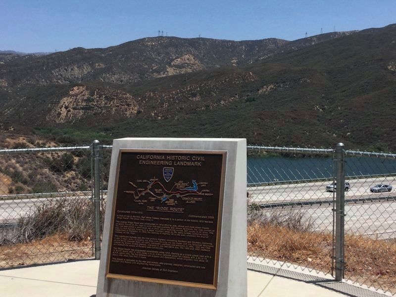
In front of you in the hills, high above freeway Interstate 5, is a portion of the historic 1915 two-lane “Ridge Route”. The power lines follow it.
The original Ridge Route was constructed in 1914-1915 by pick, shovel and mule drawn Fresno . . . — — Map (db m152085) HM
In 1904, astronomer George Ellery Hale obtained support from the Carnegie Institution of Washington to found the Mount Wilson Solar Observatory. Stellar telescopes were soon added: first the 60-inch, then the 100-inch, when "Solar" was removed . . . — — Map (db m143305) HM
In 1925 four cottages were removed to allow construction of the Bungalow.
The Bungalow could accommodate four
families. Many of the trees in the photograph are still present.
Can you find them? — — Map (db m248754) HM
The Lowe Observatory housed an Alvan Clark 16-inch (lens) refracting telescope, one of the finest of its time. Dr Lewis Swift, the famous comet-seeker of
the Warner Observatory in New York, was the first director. He and the Observatory were . . . — — Map (db m248552) HM
The increased light-grasp of this telescope made possible many notable advances in structural cosmology between 1924 and 1930. They have revised our ideas about the universe in which we live.
One of these advances was that spiral nebulae are . . . — — Map (db m200931) HM
The old Ridge Route thru the Angeles National Forest was opened in 1915 and hailed as a miracle of modern engineering providing safety with a maximum speed of 15 MPH and a saving of 44 miles over the former road. — — Map (db m152079) HM
Photo showing the Echo Mountain Complex,
known as the White City, as it appeared in the late 1890's.
The Chalet Hotel is the small low building at the far left.
The Echo Mountain House is the larger building just left of center.
To the right . . . — — Map (db m249059) HM
Because of its distinctive rock work and spectacular views, the Tumble Inn was known as one of the loveliest locations on the ridge. From here travelers had breathtaking views of the Liebre Mountains to the east and coastal ranges to the . . . — — Map (db m152077) HM
Welcome to the Vetter Mountain Fire Lookout Tower in the Angeles National Forest. As you can see from the spectacular vistas, Vetter Mountain is an ideal location for a fire lookout.
The Vetter Mountain Lookout was constructed in 1937 and . . . — — Map (db m201274) HM
Built in 1900 alongside the West Fork of the San Gabriel River and north of Mt. Wilson, the historic cabin was the first ranger station built in California with federal government funds - $75. In the late 1920's, new roads into the mountains . . . — — Map (db m154560) HM
This is how the Tavern looked circa 1920. It was built in
1895 & destroyed by fire in 1936. The hotel ruins were
dynamited in 1959 to allow for construction of the Mt. Lowe Trail
Camp. Debris from the hotel now covers most of the area in . . . — — Map (db m247614) HM
You are standing just above what was the basement
below the lobby. However, if you were 10 feet higher, this is the a
view you would have. The foundation for the wall at (Point "A")
can be seen to your right, and small remains of the 12 foot . . . — — Map (db m248788) HM
This grove presented by the
California State Society of the
Daughters of the American Revolution
in honor of
Mrs. John Whittier Howe Hodge,
State Regent 1938-1940,
commemorating the
D.A.R. Society's Fiftieth Anniversary. — — Map (db m291772) HM
A Brief History
The barn and two-room bunkhouse/store that were still being utilized at Adams’ Pack Station in 2011 were built 75 years earlier by the original owner of what has become the last remaining pack station in southern California. . . . — — Map (db m122240) HM
Discovered in the foothills of
Southern California
in 1905 by William Warren Orcutt,
petroleum geologist.
Artifact reputed to have
served as a baptismal font at
the nearby La Purisima Mission
destroyed by earthquake in 1821. — — Map (db m193775) HM
Anita May Baldwin
was the only daughter born to Arcadia's founder and owner of
Rancho Santa Anita, Elias J. "Lucky" Baldwin and his third wife,
Jane Virginia (Jennie) Dexter. Known for her generosity and
compassion, Anita Baldwin was a . . . — — Map (db m198153) HM
The City of Arcadia was founded by Elias J. “Lucky” Baldwin from part of his large landholdings (Santa Anita Rancho) in the San Gabriel Valley. Baldwin was responsible for incorporating Arcadia as a City and became Arcadia’s first . . . — — Map (db m140512) HM
A Short History
In 1912 the first promotional organization to appear in Arcadia was a woman’s club called the Cooperative Arcadians. This group of 15 women began by sponsoring programs that increased interest in matters of social . . . — — Map (db m200010) HM
Baldwin Lake casts a long shadow of history at the core of the Arboretum, its four acres bearing witness to a who's who of settlers and owners of note over the years. Before recorded history, Gabrielino villagers called this home place . . . — — Map (db m177669) HM
With the demise of the famous Red Line electric railway, land in the median of Huntington Drive directly across from the famous Santa Anita Park horse track became available on which to build a headquarters for the Arcadia Chamber of Commerce in . . . — — Map (db m145281) HM
Once common across the globe, cycads are now
threatened or endangered in the wild. Explore our
diverse collection and learn about these impressive plants.
Age of Cycads
The Jurassic Period is famous for its fantastically large . . . — — Map (db m198164) HM
Trains were a prominent part of Arcadia for several generations from the late 19th century to the mid-1900s. With the tracks and depots of three of the most prominent and popular lines converging here, the Atchison, Topeka and Santa Fe Railway, . . . — — Map (db m207736) HM
Downtown Arcadia was born in 1887 with founder Elias J. "Lucky" Baldwin's Oakwood Hotel complimenting a new Santa Fe train station at First Avenue and Santa Clara Street. Expansion came with City incorporation in 1903 and again with the opening . . . — — Map (db m200045) HM
Elias Jackson Baldwin, founder and first Mayor of the City of Arcadia, was born into an Ohio farming family on April 3, 1828, but spent his formative years growing up in nearby Indiana where a year at Wabash College in Crawfordsville completed . . . — — Map (db m135467) HM
In 1907, this yellow clapboard schoolhouse was built on the southwest corner of First Avenue and California Street, and it was named the Arcadia Grammar School. It replaced the temporary buildings, a packing shed, and a vacant remodeled saloon, . . . — — Map (db m200007) HM
Lights, Camera, Action!
Hollywood has long used the Forest and Baldwin Lake as a stand-in for exotic locations from around the world.
Filming began in the early 1930s before the Arboretum was founded, when shooting across the . . . — — Map (db m186380) HM
Today’s Los Angeles County Arboretum & Botanic Garden blends history and horticulture in a landscape ripe with cultural nuance, allowing history to be sampled in its native setting and savored as an integral link between humans and the land they . . . — — Map (db m143271) HM
On June 12, 1775, a party of Maine
mariners, armed with pitchforks
and axes, inspired by the news of the
recent victory at Lexington, used
an unarmed lumber schooner to
surprise and capture a fully armed
British warship, HMS Margaretta.
. . . — — Map (db m259766) HM
Constructed by Elias Jackson ('Lucky') Baldwin in 1881. Designed by A.A. Bennett, and intended for entertaining. There being no kitchen, meals were served from the nearby adobe (built by Hugo Reid in 1839) where Baldwin actually lived. Restored and . . . — — Map (db m153410) HM
The home place of Elias Jackson “Lucky” Baldwin, founder and first Mayor of the City of Arcadia, was this relatively simple adobe house, though during Baldwin's occupation (1875-1909) it was the larger and more inviting structure seen . . . — — Map (db m153423) HM
Constructed about 1890 in Rancho Santa Anita by Atchison Topeka & Santa Fe Railroad on its transcontinental main line. Elias J. “Lucky” Baldwin donated right-of-way and bricks in exchange for agreement to stop trains, maintain a depot and . . . — — Map (db m120309) HM
Early in 1942 the US government designated Santa Anita Park for special usage during the war years.
Pursuant to Executive Order 9066 signed by President Franklin D. Roosevelt, from March 30, 1942 until October 27, 1942 the facility was used as . . . — — Map (db m165491) HM
Oldest operating racetrack in California - opened Christmas Day 1934.
Founded by Dr. Charles H. Strub & Associates.
Designed in Art Deco style by architect Gordon B. Kaufmann.
Introduced Santa Anita Handicap in 1935 - oldest . . . — — Map (db m201111) HM
Set against the backdrop of the San Gabriel Mountains in an area of near year-round ideal weather, Santa Anita Park has been considered one of the most beautiful and finest horse race tracks in the world since its opening on Christmas Day 1934. . . . — — Map (db m198317) HM
Record — 89 starts: 33-15-13.
Won inaugural Hollywood Gold Cup 1938.
Defeated War Admiral in 1938 match race.
Lost Santa Anita Handicap by a nose 1937, 1938.
Won handily in third attempt 1940.
Champion older male 1937, 1938. . . . — — Map (db m201113) HM
The W. Parker Lyon Pony Express Museum was founded in
San Marino by William Parker Lyon, former Mayor of Fresno.
Lyon purchased 6 acres from Anita M. Baldwin in 1934 and
moved his museum to Arcadia. In 1935, it was opened on this site -
of . . . — — Map (db m210902) HM
The Derby has a storied past in the City of Arcadia and, for many years, thoroughbred horse racing has shared a large part of that story. Arcadia’s founder and first Mayor, Elias J. ‘Lucky’ Baldwin presided over the first Santa Anita Racetrack in . . . — — Map (db m207738) HM
Located along Arcadia’s Huntington Drive, just east of Santa Anita Avenue, the Thoroughbred Racing Walk of Champions is a tribute to the horse racing community that has been an integral part of Arcadia history for more than 100 years.
The . . . — — Map (db m145251) HM
Historic U.S. Army Balloon School at Ross Field was built on 184 acres donated
by Anita Baldwin on land she inherited from her father, Elias Jackson "Lucky"
Baldwin. It was named in honor of Lt. Cleo J. Ross who was the only soldier in . . . — — Map (db m268014) HM
Record — 20 starts: 19-1-0.
Owned by Jerry & Ann Moss, trained by John Shirreffs.
Purchased as a yearling for $60,000; Earned $7.3 million in 4-year racing career.
Won 17 graded stakes races, including 13 Grade 1 events.
Won Lady's . . . — — Map (db m201116) HM
This memorial is dedicated to all veterans - men and women - who have served their country in harm's way in all branches of the armed forces of the United States of America. — — Map (db m69087) WM
The Catalina Island Yacht Club has been a welcoming landmark in Avalon Bay since the building was completed in 1924. One of the oldest and most unique yacht clubs in Southern California, it has a proud history rich in the lore and tradition of . . . — — Map (db m49679) HM
On May 10, 1912, aviation pioneer Glenn L. Martin
was the first person to successfully cross the
Catalina Channel by air. Martin equipped an
ordinary land plane with pontoons and departed
from Newport Beach. He arrived in Avalon Bay
less than . . . — — Map (db m211467) HM
The sport of big game fishing originated in Avalon when Charles Frederick Holder caught a 183 pound Blue Fin Tuna with sport fish tackle on June 1, 1898. This angling milestone inspired him to form the Tuna Club of Santa Catalina Island, an . . . — — Map (db m49856) HM
In all the world there was no trip like a
nocturnal ride aboard Blanche W,
skimming through a spray of flying fish
darting from the waters of Catalina Island.
William Wrigley Jr. commissioned the
sightseeing boat in 1924 and named . . . — — Map (db m208327) HM
The Tuna Club of Avalon marks the birthplace of modern big game sportfishing. In 1898, led by Dr. Charles Frederick Holder, the club's founding members adopted the rules of conduct stressing conservationist ethics and sporting behavior. Today, their . . . — — Map (db m49678) HM
This tower was erected by Wm. Wrigley Jr.
in honor of the baseball
players who gave or risked
their lives in the defence
of their country in the
Great World War, Jan 15, 1926.
The Avalon Men's Softball League
rededicates the . . . — — Map (db m186317) HM
There are five panels at the memorial. The first panel is in front of the memorial to the right. There is a duplicate panel located at the entrance, left of the walkway:
Wrigley Memorial is dedicated to the memory of Wm. Wrigley Jr. It . . . — — Map (db m69075) HM
This mural is dedicated to the annual Avalon Fourth of July parade with iconic
attractions headed to the Casino area to line up in their positions for the parade.
The USC Marching Band always led the parade.
The Budweiser Clydesdale . . . — — Map (db m300823) HM
Swelled by the melting snows of towering mountains, our river has long nourished abundant life.
“Azusa” is the name of the Shoshonean village that existed for 6,000 years before Spanish explorers arrived in 1769 to find “a . . . — — Map (db m137818) HM
This single arch bridge was inspired by "The
Bridge to Nowhere", a concrete bridge built in
1936, located north of Azusa, in the San Gabriel
Mountains, spanning the East Fork of the San
Gabriel River. — — Map (db m260084) HM
This façade was inspired by the original Azusa
Theatre, that was once located at the corner of
Azusa Avenue and Sixth Street. Built as a silent
movie theatre by the Vosburg Bros. and Principal
Theatres, it opened on December 30, 1927. — — Map (db m260090) HM
Los Angeles County
Flood Control District -
Cogswell Dam.
Purpose: Flood control and water conservation.
Type: Rockfill.
Drainage Area: 39.2 square miles.
Storage Capacity: 12,300 acre-feet.
Crest Height: 265 feet. . . . — — Map (db m212989) HM
Los Angeles County
Flood Control District -
San Gabriel Dam.
Purpose: Flood control and water conservation.
Type: Earth and rock fill.
Drainage Area: 202.7 square miles.
Storage Capacity: 53,340 acre-feet.
Crest Height: 310 . . . — — Map (db m305763) HM
In-N-Out Burger opened on October 22, 1948 at 4:15 PM in Baldwin Park, California. The store was originally on Francisquito and Garvey, where the current freeway overpass is now located. It moved to this location in 1954.
On that first day . . . — — Map (db m162254) HM
Contained within this building are the remaining portions of an adobe house built by Francisco Salvador Lugo and his son Antonio María Lugo. Francisco Lugo was a prominent early landholder and Antonio served as the Alcalde of Los Angeles. They . . . — — Map (db m125567) HM
The view from Somerset (Bellflower) Boulevard in 1915, 10 years after the Santa Ana line first opened. On the left is PE substation #12. The Pacific Electric was an electrically powered interurban rail system. Power came from the company’s own . . . — — Map (db m133374) HM
Character actor Benson Fong (1914-1987) opened
Ah Fong's restaurant at this site in 1955. The eatery,
with hanging lanterns and Chinese décor, was popular
with celebrities and residents who dined on exotic
Cantonese style cuisine. In the . . . — — Map (db m279534) HM
Frank Lloyd Wright is perhaps the most celebrated and highly-recognized American architect.
His unique design for "The Anderton Court Shops" from 1952 represents the only retail
structure built by Wright in Southern California. He described . . . — — Map (db m200409) HM
At 8:45 a.m. on September 11, 2001, terrorists hijacked and crashed a passenger jet, American Airlines Flight 11, into the
North Tower of New York City's World Trade Center. As live television coverage began, Americans watched in horror as . . . — — Map (db m246996) HM
On this site, in October 1980, store owner Leopold
Pfefferberg-Page approached novelist Thomas Keneally,
who needed a briefcase, and said, "I tell the greatest
story of humanity...". Because of Leopold's zeal and
persistence, his story of . . . — — Map (db m292887) HM
Federal Emergency Administration of Public Works.
John M. Garmody, Administrator of Public Works.
Franklin D. Roosevelt, President of the United States.
Beverly Hills High School, 1939. — — Map (db m183132) HM
Beverly Hills Nurseries, once located at the "point" of
Wilshire and Santa Monica boulevards, was one of the
largest retail nurseries in California. Dating to 1906,
it was created by the Rodeo Land & Water
Company to supply the City's vast . . . — — Map (db m279285) HM
This marks the VIP and driver entrance of the legendary,
80,000-capacity Beverly Hills Speedway.
The oval-shaped, 1.25-mile racetrack was located
on a 200-acre site south of Wilshire between Beverly
and Lasky drives from 1919 to 1924. The . . . — — Map (db m279290) HM
This marks the main public entrance of the legendary,
80,000-capacity Beverly Hills Speedway.
The oval-shaped, 1.25-mile racetrack was located
on a 200-acre site south of Wilshire between Beverly
and Lasky drives from 1919 to 1924. The . . . — — Map (db m292857) HM
1920s
"A Greater Beverly
Hills" shouted the
Beverly Hills Citizen in a
front-page editorial in 1928
about the newly opened
Beverly Wilshire Apartment
Hotel. "Yesterday a scattered
community-field. Today
a model city. . . . — — Map (db m280040) HM
A café run by Mrs. Lily Cooper operated out of the drive-in
market that once occupied this site from 1928 to 1936.
In 1937, the café moved to its corner location at
9600 Brighton Way. The name was changed to
Brighton Coffee Shop in 1968 and . . . — — Map (db m289135) HM
Richard Carroll, a former Warner Brothers publicist, started
his men's fashion enterprise in Beverly Hills in 1949. The
renowned men's clothier operated at this site for 43
years and helped to establish Rodeo Drive and
Beverly Hills' Golden . . . — — Map (db m246997) HM
Built as the first Roman Catholic Church in Beverly Hills
and designed by architect James J. Donnellan.
Beverly Hills
Historic Landmark No. 45.
Built in 1924. Designated 2023.
Beverly Hills City Council and
Cultural Heritage . . . — — Map (db m292902) HM
At this location was Don Loper's famed couture salon, which
opened in 1951. An impresario of fashion, Loper was known
for his lavish gowns and Hollywood glamour. He designed
clothing for Hollywood starlets and in later years he
expanded his . . . — — Map (db m279289) HM
Edelweiss Chocolates is one of the oldest confectioners
in the United States. The chocolatier opened
at this site in 1942. After 31 years, the store was sold to
Swiss-born Herman Schmidt, who changed his name to
Edelweiss. The famous episode . . . — — Map (db m289137) HM
Designed by Master Architect
Benjamin Marcus Priteca, FAIA.
Art Deco Architectural Style.
Beverly Hills Historic Landmark No. 35.
Built in 1937 - Designated 2017.
Beverly Hills City Council and
Cultural Heritage . . . — — Map (db m292775) HM
Located on this site from 1929 to 1941 was one of
Beverly Hills' first women-owned businesses. Specializing in
elegant products from the era of hand-written notes, cards,
and letters. The store served a star-studded clientele
including . . . — — Map (db m279536) HM
Gearys opened its doors at this location in 1930.
The retailer was named for its founder, H.L. Geary.
In 1953 Geary retired and sold the firm to Fred and Ruth
Meyer and with the help of their son Bruce established
the brand as a luxury . . . — — Map (db m279351) HM
Replica of the store front of
Fred Hayman's world renowned
Giorgio Beverly Hills,
273 North Rodeo Drive,
1961-1998,
Beverly Hills' most distinguished
shop for well dressed men and women.
Replica completed 2009.
J. Seward . . . — — Map (db m289140) HM
Giorgio Beverly Hills, created by Fred Hayman and George
Grant, originally opened in 1961 at this site. The first luxury
boutique to be found on Rodeo Drive, its name was derived
from Grant's first name. Giorgio Beverly Hills introduced . . . — — Map (db m279345) HM
Doheny Greystone Estate, an estate built by Edward L. Doheny Jr.
Designed by Gordon Kaufmann.
Landscape by Paul Thiene. Beverly Hills Historic Landmark No. 4.
Built 1928. Designated 2013.
Beverly Hills City Council and
Cultural Heritage . . . — — Map (db m192005) HM
Established in 1937 by the national and international sprint
bicycle champion Hans Ohrt, the shop served Beverly Hills
residents at this location for nearly 40 years.
Generations of local children got their bikes from this
store, as did . . . — — Map (db m257683) HM
Opened in 1962, the bootery shop was owned and operated by
former professional baseball player Harry Harris. It quickly
grew into a local institution with its brightly
colored plastic scoop seats, neon signage, and tradition
of giving out a . . . — — Map (db m289136) HM
Built for hotelier Conrad Hilton and
designed by the prominent architectural
firm of Pereira & Luckman.
Beverly Hills Historic Landmark No. 10.
Built 1955. Designated 2013,
Beverly Hills City Council and
Cultural Heritage . . . — — Map (db m300747) HM
George H. Mayr Lawn Bowling Green, donated 1947 to
Beverly Hills Lawn Bowling
Club & City of Beverly Hills
through the generosity of
George H. Mayr.
Lawn Bowling or "bowls” is a
challenging game of skill for
all ages. The object is . . . — — Map (db m293144) HM
The original Lawry's restaurant was established in 1938 by
Lawrence L. "Lawry" Frank and Walter Van de Kamp and was
located in a modest one-story building at this site on
"Restaurant Row". In 1947, Lawry's restaurant moved from
its original . . . — — Map (db m292859) HM
This fountain is dedicated in honor of the pioneering
vision and civic generosity of Margaret Jane Anderson.
In 1911, Rodeo Land and Water Co. developer Burton Green
invited Andersen, the former manager of the successful
Hotel . . . — — Map (db m249654) HM
Opened in 1956, as a Schwab's Pharmacy, this old-style
pharmacy is one of the few in the area with a
luncheonette counter and soda fountain.
A little coffee shop with a soda fountain counter
called the Mortar & Pestle was originally . . . — — Map (db m292855) HM
On this site was the original inter-urban railway junction
(circa 1897), named after the original Hammel & Denker
ranch, which was subdivided in 1906 to create the
City of Beverly Hills. It was an important hub to bring
prospective . . . — — Map (db m279533) HM
Al Mendelson and Nate Rimer established a delicatessen called
Nate 'N Al at this site in 1945. Al and Nate had met in Detroit
and moved west to Southern California to open their own
delicatessen. The deli expanded over many years and . . . — — Map (db m279535) HM
Beverly Hills' original "hardware store to the stars"
was located on this site from 1927 to 1989. Operated by
Justin Platner and his family, it boasted a client list that
was a virtual who's who of Hollywood's Golden Age.
Gene Kelly famously . . . — — Map (db m279348) HM
Established on this site in 1950, the retail store was known as
a beloved Beverly Hills institution specializing in upscale
children's clothing for 70 years. Its exemplary services not
only included traditional sales and alterations, but . . . — — Map (db m279350) HM
The expedition of Don Gaspar de Portolá from Mexico passed this way en route to Monterey to begin the Spanish colonization of California. With Captain Don Fernando Rivera y Moncada, Lieutenant Don Pedro Fages, Sergeant José Francisco Ortega, and . . . — — Map (db m125155) HM
Designed by Master Architect Douglas Honnold, the
famous restaurant was located at this site.
Michael Romanoff, born Hershel Geguzin (1890-1971),
was a Hollywood restaurateur, self-styled Russian
aristocrat, and actor. The Daisy replaced . . . — — Map (db m246999) HM
Beverly Hills Mayor Paul E. Schwab and the City Council dedicated
Roxbury Park on October 30, 1930. The park consisted of fifteen
acres and was constructed in phases over a two-year period.
On May 30, 1932, the Beverly Hills American Legion . . . — — Map (db m279807) HM
Built as the first hotel in the City and associated
with architects Elmer Grey and Paul R. Williams.
Beverly Hills Historic Landmark No. 1.
Built 1912. Designated 2012.
Beverly Hills City Council and Cultural Heritage Commission, . . . — — Map (db m148025) HM
Designed by Architect Lewis A. Smith, the theater
was built in a fantastical amalgamation of architectural styles
and opened at this site in 1925. The theater was equipped
with a Wurlitzer Orchestral pipe organ to accompany
vaudeville . . . — — Map (db m279347) HM
Opened on November 1, 1963, at 246 North Canon Drive, the
"The Bistro" was the brainchild of Oscar-winning
director Billy Wilder and Kurt Niklas, the maître d' at
Romanoff's Restaurant before it closed in 1962.
The restaurant venture was . . . — — Map (db m289138) HM
3964 entries matched your criteria. Entries 101 through 200 are listed above. ⊲ Previous 100 — Next 100 ⊳