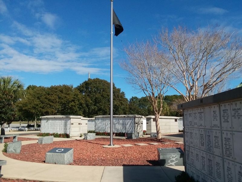
Dedicated to Navy Seabee Veterans of America
To remember,
respect and honor
the contributions
and sacrifices
made by our departed
companions, may they
all sleep the sleep
of eternal
bliss within these
hallowed grounds. — — Map (db m160810) WM
The North Hill Preservation District occupies a 50-block area bound by Blount, Wright, Palafox, DeVilliers and Reus Streets, and represents one of the best preserved residential historic districts in Florida. After the Civil War, wealthy families . . . — — Map (db m72242) HM
Florida Council of Chapters
the Retired Officers Association
Duty - Honor - Country
Dedicated to the memory of the officers of the uniformed services of the
United States of America — — Map (db m160809) WM
The British constructed the Officer's
Room and kitchen inside the western
gate of the Fort of Pensacola in 1775.
This kitchen served troops stationed
in the nearby blockhouse located
along the fort wall. University
of West Florida . . . — — Map (db m183464) HM
Built in 1832 during the American period,
this church served as an Episcopal house
of worship. It later became Pensacola's
first public library and an historical
museum. UWF archaeologists excavated
under the church floor and uncovered
the . . . — — Map (db m183522) HM
Side 1
Old Escambia County Court of Record Building (1912-1978)
During the early 1900s, the Florida Legislature established a new court of record to serve the rapidly-growing Escambia County. Completed in 1912, this Neo-Classical . . . — — Map (db m146500) HM
With the establishment of the Navy Yard in
1826 the first Naval Hospital was established
in Pensacola. Later this site, about three - fourths
of a mile from the Navy Yard, was selected
because of recurring yellow fever epidemics.
First occupied . . . — — Map (db m183417) HM
On this site, Pensacola Junior College (PJC) opened its doors on September 13, 1948. It was the first public junior college created by the Florida Legislature under the Minimum Foundation Program Act of 1947, signed into law by Governor Millard F. . . . — — Map (db m72248) HM
South Facing Side (Main Side)
A.D.1861. - A.D.1865.
The Uncrowned Heroes
of the
Southern Confederacy.
Whose joy was to suffer
and die for a cause they
believed to be just.
Their unchallenged devo-
tion and matchless . . . — — Map (db m72273) WM
At age nine, in 1859, Philip Keys Yonge moved to Pensacola with his family from Marianna, Florida. The Yonge family came to Florida from England during the British Colonial Period. He began a career in the lumber business in 1876 at the Muscogee . . . — — Map (db m80040) HM
In 1559, Don Tristan de Luna y Arellano sailed from Vera Cruz to Pensacola Bay in La Florida, to establish as the first permanent colony. The bay, also known as Ochuse and Panzacola, was reached by this sea pathway on August 15, 1559. A hurricane in . . . — — Map (db m183420) HM
Germalican
Designer 2nd German Air Force Training Squadron USA
Artist Mrs. Lydia Davis
Sponsor 2nd German Air Force Training Squadron USA
“The Staff Crew of 2010”
LtCol Frank Orkisz · Major Oliver Ruhe · Cpt Dirk Zickora · . . . — — Map (db m102471) HM
Front
Pensacola, an important early center of blues, ragtime, vaudeville and jazz activity, developed into a regional cornerstone of the “chitlin’ circuit” in later years. Touring blues, jazz and rhythm & blues acts, and local bands . . . — — Map (db m130678) HM
Construction began 1856, was lit 1859 and is still in use at the present time.
This lighthouse replaced the original lighthouse built 1824, the first lighthouse on the Gulf Coast. — — Map (db m50405) HM
This building, once occupied by a Woolworth’s five and dime store, played a role in the struggle for civil rights in Florida. In the 1950s and 1960s, African Americans in segregated communities began sit-ins to protest against “whites . . . — — Map (db m110472) HM
Site of
Pensacola’s First Lighthouse
and
First on Florida’s Gulf Coast
Lighted: December 20, 1824-December 31, 1858
Architect: Winslow Lewis
Tower: Conical 30-foot Brick
Light: 10 Whale Oil Lamps in 7-foot Lantern
Keepers: Jeremiah . . . — — Map (db m102635) HM
St. Michael Catholic Parish traces its foundation to Don Tristan De Luna's landing on Aug. 14, 1559. Accompanied by five priests of the Dominican Order and one lay brother, the first Catholic Mass in what is the United States was celebrated at the . . . — — Map (db m148529) HM
During the mid-1800s, 16 wharves reached into Pensacola Bay, along a three-mile stretch of waterfront from Bayou Texar to Bayou Chico. A few years later, around 1900, railroad companies invested in Pensacola's port facilities, improving wharves and . . . — — Map (db m91137) HM
This inlet, known as Pitt Slip, was once the site of the B. R. Pitt
planing mill. Benjamin Rafford Pitt arrived in Pensacola in 1866 and
established a mill that manufactured doors, sashes, blinds, and other
building materials. The business later . . . — — Map (db m177101) HM
Using a hand-powered well pump was easier and faster than hauling water from the well by hand.
After indoor plumbing was installed in the keepers' quarters in 1939, a generator-powered pump probably replaced the hand pump. The purpose of the pump . . . — — Map (db m252795) HM
Dedicated to all the men and women who are recipients of the nation's oldest military decoration
the Purple Heart.
The path traveled is red from
the blood I shed.
The medal I bear
is my country's way
to show they care.
If I could be . . . — — Map (db m177625) WM
The Advanced Redoubt had a unique mission among four 1800s forts at Pensacola: resisting land-based attacks on the Navy Yard. The redoubt saw little action, but during the Civil War it quickly repulsed a raid from the west by Brig. Gen. James H. . . . — — Map (db m252647) HM
Fort Barrancas and the Spanish Water Battery deteriorated after the US Army closed its base here in 1947. A hard freeze in 1950 caused the parapet of the water battery's rifle gallery to collapse, and plants overgrew the structure. Debris filled . . . — — Map (db m252705) HM
Dedicated
to all patriots that through their
service and support established the
United State of America.
Minutemen
"By the rude bridge that arched the flood,
Their flag to April’s breeze unfurled,
Here once the embattled farmers . . . — — Map (db m177627) WM
June 1, 1898, Col. Theodore Roosevelt and 170 of his Rough Riders (Indians, cowboys, policemen, clubmen, millionaires, etc.) welcomed here en route to Spanish-American War. There were 6 trains with men, horses and equipment of 1st U.S. Volunteer . . . — — Map (db m72270) HM
Salvador Pons was the second son of John Pons, a seaman from Maryland, and Maria Rosario, a free woman of color. As a property owner who could read and write, Salvador was able to serve the Pensacola community as City Alderman beginning in 1869 and . . . — — Map (db m80048) HM
As a result of General Bernardo de Gálvez's 1781
attack on Pensacola during the American Revolution,
the British returned West Florida to Spain in 1783.
The Second Spanish occupation shaped much of the
modern city's design including many street . . . — — Map (db m183477) HM
Indian trading post
established during the English occupation
1763-1783
and burial place of
Alexander McGillivray.
Born Ft. Toulouse, Ala. 1746
Died Pensacola, Fla. 1793
Made Chief of Creek Nation 1776
Commissioned British . . . — — Map (db m170763) HM
Here appeared Sarah Bernhardt, John Drew, Grace George, Billie Burke, Lillian Russell, Maude Adams, Anna Pavlova, Richard Mansfield, Mrs. Fiske, Mme. Modjeska, Amelia Bingham, Sousa's Band, etc.
Brick and iron balcony rail in present Saenger . . . — — Map (db m72256) HM
(Side 1)
Site of the First Methodist Church of Pensacola
Pensacola's first Methodist congregation was established in 1821 by Alexander Talley, M.D. It met in a series of small, wood frame churches until 1881, when construction of a . . . — — Map (db m72235) HM
Early Spanish explorers quickly
recognized the importance of
Pensacola and its waterways.
Remnants of conquistador Pánfilo
de Narváez's expedition sighted
Pensacola Bay as early as 1528. In 1539
and 1540, Francisco de Maldonado
waited in the . . . — — Map (db m177087) HM
The white, stuccoed, semicircular structure down in front of you is Batería de San Antonio, a battery built by Spain in 1797. After recapturing the Pensacola area from the British, the Spanish decided to build this fortification as part of a plan to . . . — — Map (db m252659) HM
Spencer Bibbs Academy was named for the first African American Supervisor of Colored Schools in Escambia County. Appointed to the position in the early 1900s, Supervisor Bibbs went before the school board in 1919 to ask for an east side school and . . . — — Map (db m177314) HM
Spencer Bibbs Academy was named for the first African
American Supervisor of Colored Schools in Escambia County.
Appointed to the position in the early 1900s, Supervisor Bibbs went
before the school board in 1919 to ask for an east side school . . . — — Map (db m177077) HM
After the Civil War, Pensacola's population grew rapidly. As new residents flocked to the city, its burial capacity became inadequate. Other pre-existing cemeteries were affiliated with specific religious denominations, making it difficult for those . . . — — Map (db m130679) HM
The Sisters of Mercy began the Catholic Church's work for blacks in Pensacola when they opened St. Joseph Colored and Creole School on September 8, 1879. St. Joseph Catholic Church, built in 1891, was the 1st African-American parish in the Diocese . . . — — Map (db m72247) HM
Established in 1781 East of Ferdinand VII Plaza and North of Church Street, named because of location of St. Michael's. Destroyed by fire during Civil War period, temporary quarters were used until present Church erected in 1885.
St. . . . — — Map (db m148533) HM
This cemetery has been a burial ground for those who died in Pensacola since the mid to late 18th century. There are thousands of unmarked burials. Markers, monuments, and tombs survive from the 1820s onward. Buried here are people of all ages, . . . — — Map (db m183431) HM
St. Michael's Cemetery is one of the two oldest
cemeteries in Florida. 'The earliest surviving
tombs date to the Second Spanish period,
though the cemetery was in use much earlier.
By the 1760s, a colonial road ran through
this area and the . . . — — Map (db m183496) HM
Born on the island of Trinidad in 1812, Stephen Mallory's family eventually made Key West their home. Mallory studied law, volunteered in the Florida militia during the second Seminole War, and became Inspector of Customs at Key West. In 1830 . . . — — Map (db m80042) HM
During the British period in 1767, this area became the Commanding Officer's Garden. Colonists established garden plots in an attempt to make the colony self-supporting. Houses in the fort district maintained corresponding garden lots, located north . . . — — Map (db m183465) HM
Dedicated to United States Submarine Veterans on eternal patrol.
Sailor, rest your oars
To perpetuate the memory of our shipmates, that their dedication, deeds and supreme sacrifice be a constant source of motivation toward greater . . . — — Map (db m160807) WM
Military and naval conflict dominated the 18th century. France, Spain, and Great Britain were aggressors in nearly constant warfare that often extended into North America. Spain established a fledgling colony near what is now the Pensacola Naval . . . — — Map (db m130767) HM
This excavated area includes a part of the space where the Commanding Officer's Compound was located. It included a building, outbuildings, a formal garden area, and an outdoor kitchen. In addition, it was the center of Fort business, especially . . . — — Map (db m80170) HM
This flag pole is located in the same general location as the pole that was used to raise the American flag over Florida officially for the first time. After signing the agreements in a building located near the dig site, soldiers of both the . . . — — Map (db m80165) HM
The Early Life of T. T. Wentworth, Jr.
Theodore Thomas Wentworth Jr. was born July 26, 1898, in Mobile, Alabama, to Elizabeth Goodloe and T. T. Wentworth, Sr. In 1900, the Wentworth family moved to Pensacola.
Young Tom helped . . . — — Map (db m91123) HM
This site commemorates a neighborhood that existed in Pensacola until
the late 1970's when construction of Interstate 110 uprooted long-established businesses, residences and churches. Once a vibrant, thriving
community, this was one of numerous . . . — — Map (db m177064) HM
Before indoor toilets became common, most Americans used outhouses. An outhouse (also known as a privy) is a small structure covering a pit toilet or removable waste receptacle. The replica privy in front of you is made of 90% reclaimed lumber that . . . — — Map (db m252825) HM
Built in 1910, this Arts & Crafts style house was the home of Phillip Keyes (P.K.) Yonge, a successful Pensacola lumber magnate who served on several state and local education boards. In 1905, he helped reincorporate the Florida Historical Society, . . . — — Map (db m146482) HM
Constructed in 1805, the octagonal
Tivoli Dance Hall and adjacent
tavern became entertainment
centers for Pensacola's diverse
populace, offering dancing, gaming,
and food and drink. Balls were
common and, by 1821, there was an
active theatre . . . — — Map (db m183442) HM
This building was erected in 1896 and rented to numerous businesses until the 1950s. One of the most significant tenants in the early 1900s was Samuel Charles, one of Pensacola's most prominent black businessmen, whose shoe repair shop became . . . — — Map (db m72239) HM
In the early 1800s, revolution and unrest loosened Spain's control over its colonies in the western hemisphere. As Spain dealt with greater crises elsewhere, Spanish Florida became vulnerable to British forces and their Native American allies, as . . . — — Map (db m183447) HM
The exhibit to your left shows part
of a trench excavated by UWF
archaeologists. This trench extended
into Plaza Ferdinand VII and revealed
the remains of two British forts. The first,
built in 1767, was called the Star Fort
and its palisade . . . — — Map (db m183460) HM
US Amphibious Force · United States Navy · United States Coast Guard 1790
Florida State LST Chapter
What a mighty God and country we served — — Map (db m160808) WM
Side 1:
This berth was once the home of the 255 foot Owasco class patrol gunboat, Sebago (WPG 42), which was commissioned in September 1945 as the United States’ most heavily armed war vessel per foot. The ship carried an initial . . . — — Map (db m110471) HM
State & National Suffragists, including Lavinia Engle, spoke at Pensacola Equal Suffrage League meetings here at City Hall 1914-1919. — — Map (db m217820) HM
Archaeologists discovered several wells in the courtyard of
Don Luís Joseph de Ullate's compound. This well, originally
made from wooden barrels stacked on top of each other
with their bottoms knocked out, supplied fresh water to the
Spanish. . . . — — Map (db m183484) HM
In 1775 William Bartram described Pensacola and the hospitality he received when even Gov. Chester urged him to be his houseguest. — — Map (db m91130) HM
Bartram wrote of the security and extent of intracoastal water ways from Virginia's Chesapeake Bay to the Mississippi, in 1774. — — Map (db m110475) HM
Obelisk west side
Born at Columbus, GA., June 6th, 1840,
Died in Washington, D.C. December 1st, 1897.
He fought for the Confederacy as Sergeant-
Major, Adjutant and Captain, at Shiloh, Corinth,
Chickamauga and other . . . — — Map (db m80076) HM
1873-1915. Supported Women's Suffrage and Pensacola Equal Suffrage League as owner & editor of Pensacola Journal, published here. — — Map (db m217787) HM
Middle Passage to Pensacola
Beginning in the early 1500s and continuing for more than three
centuries, about 12 million enslaved Africans were transported
across the Atlantic Ocean from Africa to the Americas. This
transportation, known . . . — — Map (db m177047) HM
(front)
The 1955 Pensacola Jaycees was the first Black Little League team to compete against a white team in the segregated South. Known as the Pensacola Negro team, the Jaycees became Northwest Florida's Little League champions after . . . — — Map (db m257397) HM
In June 2021, the remains of two individuals were found in the crawl space of the Boy Scout Building at Miraflores Park. Authorities confirmed the remains were over 75 years old. A bioarchaeologist from the University of West Florida identified . . . — — Map (db m280497) HM
[top] Here rests the remains of unnamed citizens whose lives shaped this land but whose names were lost to time. While their identities are not clear, archival records suggest that a diverse community, including people of . . . — — Map (db m280636) HM
Miraflores Park dates back to the late 19th century and lies within the Rivas land grant, later known as "New City" and "New Town." Developed by the Pensacola Land Company, many lots were occupied by tenants. Early residents were often considered . . . — — Map (db m280499) HM
[English]Miraflores, Lima PeruHeroic city of gardens with the image of Ricardo Palma, writer of Spanish-America, patriarch of Peruvian letters, academician of the Spanish language, author of “Peruvian Traditions” and . . . — — Map (db m280671) HM
Site of Alexander Stoddard home, founder of New York Underwriters Agency. A southern benefactor, the first to invest in the south after the War between the States. A friend of Pensacola, much of its development due to his efforts. The first azaleas . . . — — Map (db m280679) HM
Specifications/Performance
Wingspan 34 ft. 6 ins. • Length 44 ft. 5 ins. • Height 12 ft. 3 ins. • Maximum speed 705 mph. • Range 600 miles • Gross weight 20,600 lbs.
The Cougar, was the Navy's first swept-wing fighter. It entered . . . — — Map (db m249165) HM
The light of freedom still burns brightly in our world today because of the service and sacrifice of America's men and women in uniform.
Our Nation's servicemen and women have fought the forces of tyranny and won victories for liberty, human . . . — — Map (db m249166) WM
Decades of meaningful social, educational, and cultural activities for
Pensacola's Black community took place in this home. The Waters family,
White cattle farmers, built this single-story Queen Anne cottage with
coastal influences around 1890. . . . — — Map (db m308877) HM
Pensacola is a city of families. Among the most notable is the James family, whose matriarch Lillie Anna helped educate hundreds of children in her own home. Born Lillie Anna Brown in 1876, she was raised in the Tanyard neighborhood of Pensacola. . . . — — Map (db m298186) HM
In the closing phases of the First Seminole War (1817-1818), a U.S. supply boat was attacked by Creek Indians. The boat was ascending the Escambia River from Pensacola in Spanish West Florida, and was bound for Fort Crawford in the American Alabama . . . — — Map (db m242608) HM
Julian Ole Olsen, Sr. was a native Pensacolan born of Danish immigrants. He was instrumental in the development of Bayview Park, creating the Julian Olsen Youth Track Meet, youth athletics, amateur boxing matches, and was a former professional . . . — — Map (db m298197) HM
After graduation from the Civilian Pilot Training Program, James stayed on as an instructor for the Army Air Corps Aviation Cadet Program. In July 1943, he was commissioned into the Army Air Corps himself, starting his military career. During . . . — — Map (db m298193) HM
[front side]“Chappie” America's first African American Four Star General U.S.A.F. [back side]This is my country and I believe in her I’ll protect her against all enemies foreign and domestic World War II . . . — — Map (db m298196) HM
In the 1920s, Pensacola was in the midst of strict segregationist policies. What once was a diverse and accepting community became more and more fractured along racial lines during the 20th century. 'Separate but equal' resulted in massive . . . — — Map (db m298192) HM
This neighborhood retains many of its original buildings. The property that is now the main area of the museum was the original James family home. Chappie grew up here, though most of his siblings had moved out by the time he was born. As Lillie . . . — — Map (db m298195) HM
Mom and Pop Stores Some local businesses included Carrie's Coffee Shop, The Seminole Hotel, and The Crystal Ice Company. The H&O Café, one of the first black-owned restaurants in the city, was a neighborhood staple where many gathered for good . . . — — Map (db m298184) HM
General James' skills as a negotiator and tactician earned him several accolades. His most notable career moment came as he oversaw the withdrawal of US troops from Libya in 1969. A stand-off with Moammar Gadhafi (leader of the military coup) . . . — — Map (db m298194) HM
Former home of Celia Myrover
Robinson, Chair of FL Equal
Suffrage Association Press
& Suffrage Editor,
Pensacola Journal 1915-1917. — — Map (db m242603) HM
Single lots reserved exclusively for babies were established on the south side of the cemetery since its inception. However, in 1946, four contiguous lots were dedicated for the interment of babies. Later, a white fence, funded largely by the local . . . — — Map (db m298890) HM
Since the cemetery's establishment in 1876, burials have been done in coffins made of wood, copper, and/or steel. Some were safety or security coffins, which were configured with a tube inserted with a cord that was connected to the finger of the . . . — — Map (db m298498) HM
The usage of crypts has waned over the years since they first became popular in the first half of the 19th century and were more common in St. Michael’s Cemetery, which is located along Alcaniz Street. The crypt here is the only example in this . . . — — Map (db m298493) HM
A native of Massachusetts, Perry adopted Pensacola, becoming its only resident to rise to Confederate general and the first from here to serve as Governor of Florida. Educated at Lee Academy and Yale University, Perry moved prior to graduation to . . . — — Map (db m298492) HM
The body of Martha F. Screven was the first to be buried in the cemetery. Over 20,000 interments followed. With proper management, there is ample space to accommodate burials over the next 200 years. — — Map (db m298490) HM
From 1934 to 1999, many visitors fondly appreciated a goldfish pond that was located here in memory of Mabel Tart, wife of David H. Tart, Sr. She died at age 44, leaving behind a husband and four children. Her grave nearby in Section 57, Lot 2 was . . . — — Map (db m298899) HM
Built in 1908, the Gatehouse included a chapel (north side) and office and bathroom (south side). Its chapel offered Pensacola the first non-religious facility for hosting funerals and is still in use today. Originally, a stained glass window of . . . — — Map (db m298478) HM
Helen Fisher was the first Pensacola woman to marry a Naval aviator (Edward O. McDonnell). So many women followed that Pensacola earned the moniker, “mother-in-law to the Navy”. — — Map (db m298495) HM
While always open to all faiths and backgrounds, the cemetery was considered progressive at its inception to have an area (even numbered Sections 32-44.5) reserved for people of color. This included Native Americans, dark skinned Hispanics or . . . — — Map (db m298783) HM
In the early 20th century, several Greek families immigrated to Pensacola. Most are buried in this cemetery, which has no restrictions as to cemetery markers. Commonly, they will utilize orthodox crosses or symbology associated with their Greek . . . — — Map (db m298751) HM
Because of its higher ground, the north side of the cemetery was deemed as preferable. It was primarily sold to families by the whole lot, which offered up to 10 coffin burials. Whereas, the south side was sold by one-half lot or space. — — Map (db m298487) HM
A graduate and avid fan of Florida State University, Wally initiated the university's famous “tomahawk chop” while attending home football games in the 1980s. The arrow through his tombstone compliments this connection, as Wally, while watching the . . . — — Map (db m298491) HM
Mary Lewis Willis was the granddaughter of Betty Washington, who was the only sister of George Washington. After moving here with her husband, who was a brick manufacturer, she died from yellow fever and was buried near her house in Cantonment. Her . . . — — Map (db m298499) HM
317 entries matched your criteria. Entries 101 through 200 are listed above. ⊲ Previous 100 — Next 100 ⊳