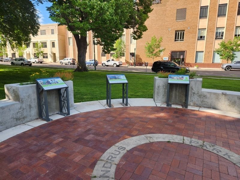
On West Bannock Street, on the right when traveling north.
By 1968, the Snake River Canyon south of Boise had been recognized as a unique ecosystem and critical nesting ground for birds of prey. Most of the area was managed by the Bureau of Land Management (BLM). Through the initiative of Morley Nelson, a . . . — — Map (db m267001) HM
On North 2nd Street, on the right when traveling south.
Mining was boom or bust. By the 1900s, a long decline in regional mining activity reduced the work of the Assay Office. Meanwhile, increased timber production resulted in the expansion of the US Forest Service (USFS). In 1932, the US Treasury . . . — — Map (db m305343) HM
On West Main Street, on the right when traveling west.
This is the old U.S. Assay Office
Built in 1870-71, and said to have
received more than 75,000,000 dollars
in gold and silver through its doors — — Map (db m305351) HM
On N 2nd Street, on the right when traveling south.
Because the chief assayer position was a political appointment, new presidents typically replaced them. Eleven different men occupied this office over sixty years. The rest of the small staff of clerks, lab workers, and guards could work here . . . — — Map (db m305339) HM
On East Warm Springs Avenue, on the right when traveling west.
In 1907, Reverend O.P. Christian of the National Children’s Home Society wrote a letter to Idaho Governor Frank R. Gooding asking for support in establishing an Idaho Children’s Home Society. Gooding responded pledging his full support, should such . . . — — Map (db m267453) HM
On East Warm Springs Avenue, on the right when traveling west.
In 1910, the current building at 740 Warm Springs Avenue was constructed for $42,700. The state legislature appropriated $20,000 to construct the building and fundraising efforts by the citizens of Boise provided the remaining funds. Designed by . . . — — Map (db m267450) HM
On East Warm Springs Avenue, on the right when traveling west.
From the inception of the Children’s Home Society of Idaho, some of Boise’s most recognizable historic philanthropic figures from the progressive era became integral parts of shaping the Children’s Home Society. These prominent local business men . . . — — Map (db m267452) HM
By the 1930’s the good work being done at Children’s Home was well-known throughout the state of Idaho. The plight of helpless children in need triggered true compassion from even the most disinterested.
Through diligent communication, . . . — — Map (db m267454) HM
The Children’s Home Society has always been more than just an orphanage. Founder O.P. Christian stated “Our field is the State of Idaho and our work is as wide as the needs of a destitute neglected child.”
One of the original roles that the . . . — — Map (db m267455) HM
For over half a century, the Children’s Home Society of Idaho had been a home for Idaho’s children in need of shelter and care. Tireless efforts from superintendents, executive directors, board members, medical professionals, teachers, community . . . — — Map (db m267457) HM
On South Broadway Avenue (U.S. 26), on the right when traveling south.
By the early 1950s, increased automobile traffic resulted in the need for a new bridge. In 1955, Smith and Milhollin, a local engineering firm, designed a new structure for the river crossing. Crews completed the bridge in record time in 1956, . . . — — Map (db m266594) HM
In Honor of Cynthia Mann who dedicated this block of land to help establish the Children’s Home Society of Idaho.
She expressed the philosophy that had guided her life in a letter to a friend shortly before her death in 1920: . . . — — Map (db m267459) HM
On East Warm Springs Avenue, on the right when traveling east.
Dona Larsen grew up on a farm in Cornish, Utah. She and her husband, Dorrell, moved to the Treasure Valley in 1956. Dona and Dorrell raised 10 children in Boise, who all graduated from East Junior High and Boise High School and then went on to . . . — — Map (db m267348) HM
On East Warm Springs Avenue, on the right when traveling east.
In 1911, a baseball field was built on this site and named Cody Park after C.W. "Jack" Cody, who purchased the Boise franchise in the Union Association and started a semi-professional baseball team. The team, the Boise Irrigators, played their games . . . — — Map (db m267355) HM
On East Warm Springs Avenue, on the right when traveling west.
First Burial: August 22, 1864
Established as a Masonic/I.O.O.F. Cemetery
September 14, 1872
Restored during the Centennial Year by
“Friends of the Pioneer Cemetery”
Boise City Celebrations, Inc
May 28, 1990 — — Map (db m267631) HM
On East Warm Springs Avenue, on the right when traveling west.
Robin was a counselor at Warm Springs Counseling Center from 1999 to her passing in 2017. She called herself The “Fun Czar”, championing playfulness and laughter as an important part of healing. Her kindness, compassion and beautiful smile were . . . — — Map (db m267458) HM
On Old Penitentiary Road, on the right when traveling east.
Added in 1931 to help move goods and inmates in and out of the facility. All incoming and outgoing vehicles were locked in the sally port and thoroughly searched before being allowed to proceed. — — Map (db m267448) HM
On Old Penitentiary Road, on the right when traveling east.
Trusty inmates had extra privileges, like this honor dormitory. Up to 30 inmates and 10 guards could be accommodated in this building. It had a dining hall, kitchen and was used as a storage area for the commissary. — — Map (db m267408) HM
On Old Penitentiary Road, on the left when traveling east.
Completed in 1902, the Warden’s House contained eight rooms and a basement. Total cost to construct the sandstone house: $3,100. The state saved almost $4,000 by using inmate labor. — — Map (db m267403) HM
On Old Penitentiary Road, on the left when traveling east.
Female inmates were housed here from 1905-1968. Male inmates built the sandstone wall in 1905, and the dormitory inside in 1920. The small ward held between two and twenty women at any given time. — — Map (db m267449) HM
On N Harrison Boulevard, on the left when traveling north.
Harrison Boulevard, one of Boise’s most picturesque thoroughfares, is named for President Benjamin Harrison, who signed the Admissions Act making Idaho a state. His visit in 1891 prompted the city council and local landowner Jeremiah Brumback to . . . — — Map (db m305943) HM
On West Fort Street, on the right when traveling north.
This cabin was the first home in Boise to shelter women and children
Restored and preserved by Pioneer Chapter Daughters of the American Revolution — — Map (db m267011) HM
On North 13th Street, on the right when traveling north.
Small, independent corner grocery stores once dotted Boise neighborhoods and were common fixtures in the North End. The stores connected residents on a daily basis, since most store owners and their customers lived near each other. Stores typically . . . — — Map (db m267506) HM
On West Irene Street at N 22nd St, on the right when traveling west on West Irene Street.
Small, independent corner grocery stores once dotted Boise neighborhoods and were common fixtures in the North End. The stores connected residents on a daily basis, since most store owners and their customers lived near each other. Stores typically . . . — — Map (db m306509) HM
America’s first teacher in space was Christa McAuliffe of New Hampshire. McCall, Idaho teacher Barbara Morgan, backup to Christa M. has accepted NASA’s offer to fly as the next teacher in space. David Marquart from Boise High School, was one of ten . . . — — Map (db m305306) HM
On North 9th Street south of W Sherman Street, on the left when traveling north.
In response to changes in curriculum and rapid growth in the North End, Longfellow School opened to students, grades 1-8, in 1906, incorporating many modern advances in school design. One innovation that received much attention was the placement of . . . — — Map (db m305319) HM
On North 13th Street, on the left when traveling north.
North Junior High was constructed on “Lemp’s Triangle,” a vacant lot that had been previously used as a ball field by local children. The school was designed by the firm of Tourtelotte and Hummel, and built by J. O. Jordan and Son. Constructed in . . . — — Map (db m267028) HM
On West Fort Street at North 13th Street, on the right when traveling north on West Fort Street.
President Franklin D. Roosevelt and First Lady Eleanor Roosevelt visited Boise on September 27, 1937. The president’s motorcade passed by numerous schools on the tour of the city’s North and East End neighborhoods. Excited students stood outside . . . — — Map (db m267014) HM
On West Fort Street at North 13th Street, on the right when traveling north on West Fort Street.
President Franklin Roosevelt’s tour of the American West in 1937 included a stop in Boise. The tour provided the president opportunities to promote New Deal public works and job stimulus programs and see first-hand how they benefitted American . . . — — Map (db m267016) HM
On North 15th Street, on the right when traveling north.
West panel of monument
Oregon Trail Memorial
This is the historic pathway of the Oregon Trail through the city of Boise. Follow the footsteps of Native Americans, fur traders, pioneers, soldiers, and entrepreneurs, from our past to . . . — — Map (db m305803) HM
On S 15th Street, on the right when traveling south.
As Boise’s North End began to grow, the necessity for a neighborhood school became clear. In 1899, developer Walter E. Pierce donated the west half of this block for a new, four room, brick schoolhouse that faced 16th Street. In February 1900, . . . — — Map (db m267107) HM
On South Broadway Avenue (U.S. 26) north of Broadway Alley Avenue, on the right when traveling north.
An Enterprising young seamstress, Anna E. Crane, filed a plat in March 1890 for land south of the Boise River. She came to Boise only a year earlier to join her brother, a dentist. Land speculators from Colorado followed her lead and planned . . . — — Map (db m267154) HM
Named for American Poet, James Russell Lowell (1819-1891), this school opened to students in 1913. Although a full two stories, only the first floor was finished. Students in the lower four grades attended Lowell while older students rode the . . . — — Map (db m305065) HM
On W State Street at N Cobblestone Lane, on the right when traveling west on W State Street.
This stately home was built in 1906 by landowner and farmer Oliver Francis Short. The one and a half stories and fifteen rooms were home to the Shorts and their two children. The Short farm played an important role in the agricultural community, . . . — — Map (db m227654) HM
On Main Street at Franklin Road, on the right when traveling north on Main Street.
All Idaho land surveys refer to a
beginning point --"Initial Point"--
16 miles directly south of here.
When he began surveying Idaho in 1867, Lafayette Cartee, first surveyor general of Idaho Territory, established the initial point on a . . . — — Map (db m53439) HM
This marker commemorates the men and women who achieved American independence. These Patriots, each believing in the noble cause of liberty, valiantly strove to found a new nation.
1775 - 1783
Dedicated in 2025 by Emma Edwards . . . — — Map (db m286974) WM
On U.S. 95 at milepost 136 at Illinois Avenue, on the right when traveling north on U.S. 95.
An ambitious railroad project to a high Seven Devils copper mine (elevation 6800 ft.) created a lot of excitement here in 1898-1899.
This would have been Idaho's highest mountain railroad if funding had been available to complete it. Construction . . . — — Map (db m23226) HM
On State Highway 55 at milepost 153, 0.5 miles west of Woodland Road, on the right when traveling east.
John Welch -- always known as Packer John -- hauled supplies from Lewiston to Idaho City during a major Boise Basin gold rush of 1863-1864.
He built a cabin (1/4 mile north of here) that immediately became an historic Idaho landmark. Territorial . . . — — Map (db m37957) HM
On U.S. 95 at milepost 128 north of Mesa Road, on the right.
For more than half a century, after 1910, an apple orchard of nearly 1400 acres, thought to be the largest in the United States under one management, covered this area.
Investors, mostly from the eastern U.S., bought 10-acre shares to finance the . . . — — Map (db m273131) HM
On U.S. 95 at South Commercial Avenue, on the left when traveling south on U.S. 95.
In 1946 Jack Morgan and his brother Ed purchased the logging division at New Meadows, Idaho, from Boise Payette Lumber Company.
The new company was called
J. I. Morgan, Inc.
In the years that followed, the company was . . . — — Map (db m110379) HM
Near Banks Lowman Road (County Highway 17) near Station Creek Loop Road, on the left when traveling west.
The Payette River is named for Francois Payette, a French-Canadian trapper and early explorer of the major tributaries of the Snake River. At that time, British, Canadian, and American fur companies competed for the region's abundant natural . . . — — Map (db m119236) HM
On Banks Lowman Road (County Highway 17) near Annie Lane, on the left when traveling west.
(This marker consists of three panels:)
The Payette River is a major tributary of the Snake River and drains about 3,200 square miles, an area about the size of Delaware and Rhode Island. Annual rainfall within the drainage ranges . . . — — Map (db m119311) HM
On State Highway 21 at milepost 95, 1.4 miles north of Grandjean Road, on the right when traveling north. Reported missing.
An immigrant from Denmark where he had studied forestry, he came to this part of Idaho in 1883 to mine, hunt and trap.
Before Idaho became a state in 1890, he built a winter cabin below Grandjean Peak on a site later occupied by Grandjean Ranger . . . — — Map (db m22638) HM
On State Highway 55 at milepost 64, just south of West Boise Street, on the left when traveling south.
Gold was struck in Boise Basin (over the ridge to the east) in 1862, and the rush to these new mines came through here.
Traffic came by steamer up the Columbia to Umatilla, and thence overland. At first there were only pack and saddle trains, but . . . — — Map (db m23235) HM
On Montgomery Street near Wall Street, on the left when traveling north.
In 1867 this building was built by James A. Pinney to house the post office and a book and specialty shop. In 1882 Mr. Pinney sold the building to S.C. Silsby for the sum of $1,000.00.
Around 1868 the northern most portion of the building was . . . — — Map (db m119062) HM
On Wall Street at Main Street, on the right when traveling east on Wall Street.
In July of 1871 construction began on this handsome brick building, which was completed by October of the same year.
The building was built by C.S. and E.A. Kingsley as a general store.
Several businesses have occupied this building . . . — — Map (db m109935) HM
On Main Street at East Walulla Street, on the right when traveling north on Main Street.
Originally George Kettler’s Blacksmith Shop with ox and horseshoeing sheds on both sides.
In more recent years it was owned by Tom and Florence Adams.
From 1948 – 1975 they published the “Idaho Mountaineer” newspaper and . . . — — Map (db m110260) HM
Near Main Street at East Walulla Street, on the right when traveling north.
This building was originally George Kettler's Blacksmith shop, built in 1889 with ox and horse shoeing sheds on both sides. As the horse and buggy gave way to the automobile, it became an early garage. In 1947, it was acquired by Tom and Florence . . . — — Map (db m119110) HM
On State Highway 21 at milepost 28 at Grimes Creek Road, on the left when traveling north on State Highway 21.
Named for George Grimes who, with Moses Splawn, led the party which on August 2, 1862 made the strike that started the Boise basin gold rush.
The party was searching for a rich basin described to Splawn a year earlier by an Indian. Farther up . . . — — Map (db m22600) HM
On East Walulla Steet near High Street, on the left when traveling north.
The Independent Order of Odd Fellows pioneer Lodge No. 1 was organized on February 16th 1864.
The building was completed by September 15, 1875 at a cost of $1,974.00 and the grand opening was held on November 19th 1875.
It is the oldest . . . — — Map (db m119107) HM
On State Highway 21 at milepost 38, 0.1 miles west of Lodgepole Lane, on the left when traveling north.
This roaring metropolis was founding early in October, 1862, about ten weeks after gold was discovered in Boise basin.
By the next summer, this was the largest city in the Northwest, with 6,275 people -- 5,691 of them men! Families followed, and . . . — — Map (db m273124) HM
On Wall Street at Commercial Street, on the right when traveling west on Wall Street.
Built in May, 1864 by G.B. Walker at a cost of $10975. Jointly used by Idaho Territory and Boise Co. Original site was on Buena Vista Bar west of City. Building was moved in 1930 to make way for gold mining, and move twice more before being placed . . . — — Map (db m119105) HM
On Wall Street at Commercial Street, on the right when traveling west on Wall Street.
This is the home of Lodge No. 1 of Idaho's Ancient Free and Accepted Masons.
This Masonic Temple, built in 1865 is the oldest Masonic Temple in Idaho, and reputedly the Oldest Temple west of the Mississippi, still in use.
Although the . . . — — Map (db m119064) HM
On Wall Street near Commercial Street, on the right when traveling west.
Dispensation from Oregon in 1863.
Charter June 22, 1864.
This building erected in Sept. 1865 after the original building at another location was destroyed by fire in May, 1865.
The Grand Lodge of Idaho A.F. & A.M. was formed in this . . . — — Map (db m119104) HM
On Main Street near Wall Street, on the right when traveling north.
In 1865 John Clarsey started the brick building that was to house the John Clarsey's saloon.
In 1867 Mr. Clarsey added a new club room to the south side of the saloon.
On the north side of the building was the Vantine & Co. General Store. The . . . — — Map (db m119060) HM
Near East Walulla Steet near High Street, on the left when traveling north.
The first Odd Fellows Lodge in the state of Idaho instituted by men of faith that never wavered. Through good times and bad, the members found solutions. The took great pride in belonging to this Lodge which is truly the "Shrine of Odd Fellowship" . . . — — Map (db m119108) HM
On East Walulla Steet at High Street, on the left when traveling west on East Walulla Steet.
Picturesquely set on East Hill above the City center, this simple two story frame building is actually the second Saint Josephs Church. The original church dedicated on November 15, 1863, burned to the ground in Idaho City's second fire on May 17, . . . — — Map (db m119109) HM
On Montgomery Street at Commercial Street, on the right when traveling north on Montgomery Street.
This building was constructed in 1865 by Elias Brown. It originally housed a newspaper office, restaurant and grocery store. It was one of several brick buildings known as "fireproofs" that were constructed after a disastrous fire swept through . . . — — Map (db m119061) HM
On Main Street at Commercial Street, on the right when traveling north on Main Street.
In September of 1863 the pioneer printers Joseph & Thomas Butler founded the newspaper called the “Boise News.”
It was later changed to the “Idaho World.”
The Idaho World boasts the title of Idaho’s oldest newspaper.
. . . — — Map (db m109942) HM
On State Highway 21 at milepost 20, 0.2 miles south of Stewart Way, on the left when traveling north.
The Old Toll Road to Idaho City crossed the ridge from Boise through the lowest point you can see in the skyline across the valley.
Climbing the More's creek canyon wall, it crossed this highway about here and swung north. The road was built and . . . — — Map (db m22599) HM
On Main Street at Wall Street, on the left when traveling north on Main Street.
"It's never too late - nor are the odds ever to great - to try. In that spirit the West was won, and in that spirit I now declare my candidacy for President of the United States."
U.S, Senator
Frank Church
March 18, 1976
At . . . — — Map (db m119034) HM
On Main Street at Wall Street, on the left when traveling north on Main Street.
In Memory Of
The boys who gave their lives in World War II from Boise County, Idaho
Stanley B. Banks • George Berry • Harry E. Brechenridge • Henry Luther Beckman • William S. Lawson • John Myers • Edgar Rae • Commodore Perry Ritter • . . . — — Map (db m119059) WM
On Ponderosa Pine Scenic Route (State Highway 21) at County Highway 558, on the right when traveling east on Ponderosa Pine Scenic Route.
At 4:00pm on July 29, the Lowman Fire exploded, consuming five square miles of forest.
In two hours it grew into a fire storm that destroyed parts of the dispersed Lowman community.
Saving lives was the first priority of fire fighters who . . . — — Map (db m110747) HM
On Banks Lowman Road (State Highway 17) near Forest Road 555, on the left when traveling west.
(Three panels make up this marker:)
In the 1930s, Gallagher CCC widened and surfaced this road, built Scott Mountain Road, developed Hot Springs and Pine Flat Campgrounds, erected fences to control livestock grazing, fought fires, and . . . — — Map (db m119235) HM
On State Highway 21 at milepost 77, 0.6 miles east of Kirkham Road, on the right when traveling east.
A talented artist, Emma Edwards went to work in 1890 to to design Idaho's state seal when she was only 18 years old.
Although her father had moved to California after serving as governor of Missouri (1844 to 1848), Emma preferred to . . . — — Map (db m22637) HM
On Ponderosa Pines Scenic Byway (State Highway 21) near Forest Road 364, on the left when traveling north.
(Three panels make up this marker:) In the summer of 1989, the Lowman Fire burned the area north and east of here. The fire consumed 72 square miles of forest, and area larger than the Boise metropolitan area. In addition, 26 structures in . . . — — Map (db m119233) HM
On Ponderosa Pine Scenic Route (State Highway 21), on the right when traveling east on Ponderosa Pine Scenic Route.
Imagine, the battle against this immense fire was launched from this small Ranger Station!
More than 2,300 people came from all over the country to work on the fire lines.
Many of them lived in “fire camps” scattered around the . . . — — Map (db m110749) HM
On State Highway 21 at milepost 72, 0.2 miles east of Banks Lowman Road, on the right when traveling north.
In 1907, Nathaniel W. Lowman settled here, and four years later, when he started a post office in his large log house, this community was named for him.
Only a few scattered settlers lived here then. Lowman got all its supplies once a year from a . . . — — Map (db m22616) HM
On Granite Street at Standifer Road, on the right when traveling east on Granite Street.
The Boise Basin Mercantile was built in the 1860's and was among the first stores in Placerville. The store holds the distinction of belonging to the first chain stores founded in Idaho. The owners operated similar businesses in Idaho City until the . . . — — Map (db m119031) HM
Near Granite Street (County Highway 343) near Mespile Road.
On June 4, 1865 near the tollgate on the road from Placerville to Centerville, George Wilson was murdered, robbed of his gold dust and his body hidden in a prospect hole full of water. Two musicians, banjo player L. Moulton and fiddler Fred Cursons . . . — — Map (db m119032) HM
On Standifer Road at Granite Street, on the right when traveling north on Standifer Road.
Originally constructed as the Magnolia Saloon in the 1860's, the building was partially damaged by a fire that destroyed the community's businesses in August 1899. Located on the town square, the saloon was rebuilt in 1900 allowing it to continue . . . — — Map (db m119030) HM
Completed in 1915; Arrowrock Dam introduced a number
of innovative design and construction techniques for large concrete dams it served as the prototype for
other gravity-arch dams in the Western United States, and its construction demonstrated . . . — — Map (db m263631) HM
Near Main Street near South 7th Avenue, on the right when traveling west.
Second generation Hollanders, the 10 Steunenberg children (6 boys, 4 girls) lived their formative years in Knoxville, Iowa. A.K. (Albert Keppel) Steunenberg, answering an advertisement for a printer, came to Caldwell in the late 1880's. He called . . . — — Map (db m110215) HM
Near Main Street near South 7th Avenue, on the right when traveling north.
In 1884, the Oregon Short Line Railroad reached "Bugtown," later renamed Caldwell after C.A. "Alexander" Caldwell, who served as the President of the Idaho & Oregon Land Improvement Company at the time.
The current depot facility is actually . . . — — Map (db m110213) HM
On U.S. 30 0 miles east of West Plymouth Road, on the right when traveling east.
After reaching Boise River, emigrant wagons had to travel 30 miles to find a good crossing about ¼ mile north of here.
They had to avoid a wide zone of shifting channels, so they descended Canyon Hill where the route is still visible. . . . — — Map (db m22326) HM
On Main Street near Avenue, on the left when traveling east.
Madame Marie Dorion passed through Caldwell area in 1811 as the only female traveler in the Wilson Price Hunt Party on what would become a portion of the Oregon Trail through Southern Idaho. She would return to the area with her husband, Pierre . . . — — Map (db m119274) HM
On Cleveland Boulevard at South 20th Avenue, on the right when traveling east on Cleveland Boulevard. Reported missing.
Planned by the Presbyterians of southern Idaho in 1884 and opened with 19 students in 1891, this is Idaho's oldest college.
William Judson Boone, the founder, remained president 45 years. From a modest beginning with a faculty of 8 (including two . . . — — Map (db m26193) HM
Near Marsing Murphy Road (State Highway 78) 0.2 miles east of Poplar Drive, on the right when traveling east.
Milford and Martha (Mattie) Shirley Givens pulled up Missouri roots and headed west in 1878, apparently bound for Portland, Oregon where relatives were settled. Their journey eventually led them along the South Alternative Route of the Oregon . . . — — Map (db m47134) HM
Near Marsing Murphy Road (State Highway 78) 0.2 miles east of Poplar Drive, on the right when traveling east.
Natural hot water available here
has been a popular attraction
for thousands of years.
A winter village site for about 5000 years, these hot springs had large pit houses typical of plateau communities northwest of here from 4,300 to about . . . — — Map (db m47336) HM
The historic Guffey Bridge is an elegant Parker-through truss railroad bridge, the State’s largest artifact, and the site of the most spectacular train wreck in Idaho.
The Boise, Nampa and Owyhee Railroad (BNO), was organized by owner Col. Wm. . . . — — Map (db m73344) HM
On Lincoln Road 0.2 miles east of Middleton Road, on the left when traveling east.
On August 20, 1854, the Alexander Ward Party of 20 men, women, and children were traveling on the Oregon Trail with five wagons, a day behind a larger party led by Alexander Yantis. The Wards pulled their wagons off the Trail for lunch and to water . . . — — Map (db m22398) HM
On East Main Street, on the right when traveling west.
From Middleton Mill
Operated and owned by
S.S. Foote
1871-1899
Placed here in memory of S.S. and Cordelia Foote by their grandchildren — — Map (db m267340) HM
On Lincoln Road 0.2 miles east of Middleton Road, on the left when traveling east.
In the 1830's, local tribes, including the Shoshone, Paiute, and Bannock began trading with Euro-American fur trappers and missionaries passing through southern Idaho. Peaceful exchanges beneficial to both groups increased in 1842 when wagon . . . — — Map (db m22333) HM
On Lincoln Road 0.2 miles east of Middleton Road, on the left when traveling east.
Only 2 young boys survived the Indian attack on Alexander Ward's 20 member party, Oregon bound on August 20, 1854.
Military retaliation for the slaughter so enraged the Indians that Hudson's Bay Co. posts Fort Boise and Fort Hall had to . . . — — Map (db m22328) HM
On Lincoln Road 0.2 miles east of Middleton Road, on the left when traveling east.
To the memory of the pioneers who were massacred by Indians near this spot August 20, 1854.
This monument is dedicated by Pioneer Chapter
Daughters of the American Revolution Boise, Idaho
William Ward Age 44
Margaret Ward " . . . — — Map (db m22336) HM
On Lincoln Road 0.2 miles Middleton Road, on the left when traveling east.
In early September, 1854, Major Granville Hallar set out with a US military force from their post in Oregon to avenge the Ward-party deaths. Upon arrival at the rebuilt Hudson Bay's Fort Boise near the mouth of the Boise River, the Indians they . . . — — Map (db m22366) HM
On 16th Avenue at Garrity Boulevard, on the right when traveling south on 16th Avenue.
In 1913, Eugene Emerson started a Christian school that his church developed into an accredited college on a campus he donated. The college, located on a campus 2 mile southwest of here, moved to university status in 1999.
Northwest Nazarene . . . — — Map (db m73204) HM
On 5th Street North at 11th Avenue North (Business U.S. 84) on 5th Street North.
The first L.D.S. church in Canyon County was purchased in 1910 from St. Paul's Congregation for $1000, and dragged with great difficulty through the mud from 1st St. and 14th Ave.S. to this site. It was remodeled, painted, and made ready for use as . . . — — Map (db m141314) HM
On U.S. 20/26 just east of Notus Road, on the left when traveling west.
Confederate refugees from Missouri started farming in this area in 1863 and 1864, when gold and silver mining camps created a great demand for flour and cattle.
Driven out from their Missouri River homes below Kansas City by extremely . . . — — Map (db m21988) HM