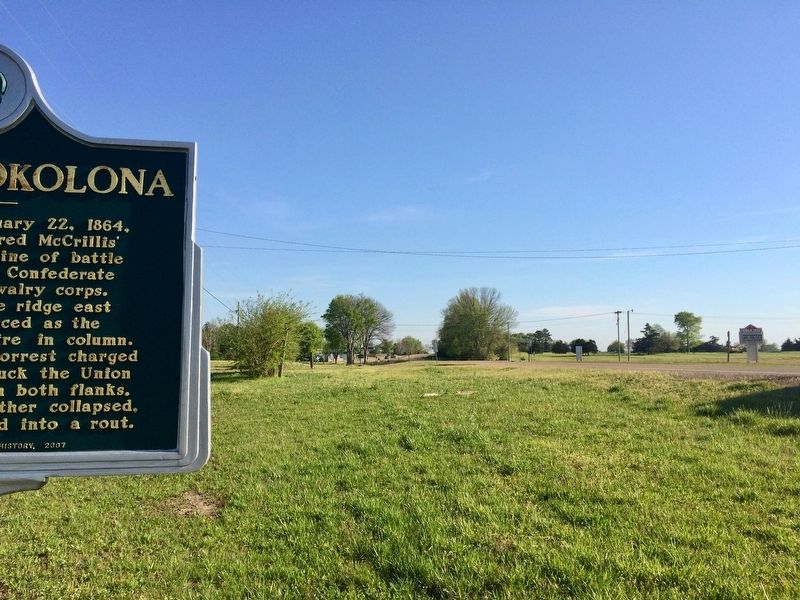
In this vicinity on February 22, 1864, Benjamin Grierson ordered McCrillis' Federal brigade into a line of battle opposite Col. Barteau's Confederate brigade of Forrest's cavalry corps. Barteau's men, from the ridge east of the railroad, advanced as . . . — — Map (db m102742) HM
On February 22, 1864, Col. Jeffrey Forrest, commanding a Confederate cavalry brigade, was killed in action in this vicinity, near the extinct town of Prairie Mount. Born in 1838, Forrest was the younger brother of Lt. Gen. Nathan Bedford Forrest, . . . — — Map (db m102744) HM
Chickasaw County's tribute
to the sons who wore the gray
and were faithful to the cause.
Erected under auspices of
Okolona Chapter U.D.C. No. 117.
— — Map (db m102750) WM
As a station on the Mobile and Ohio Railroad, Okolona was the site of a large hospital during the Civil War. In 1862, following the battle of Shiloh, hundreds of wounded Confederates were brought here by train. Those who died were buried in this . . . — — Map (db m102747) HM
Founded as Rose Hill 1845. Chartered as Okolona 1850. Named for Chickasaw Indian brave. Scene for three Civil War battles. First Mississippi Cavalry, C.S.A., was organized and equipped here. — — Map (db m102748) HM
Founded as Rose Hill 1845. Chartered as Okolona 1850. Named for Chickasaw Indian brave. Scene for three Civil War battles. First Mississippi Cavalry, C.S.A., was organized and equipped here. — — Map (db m102749) HM
The Okolona Normal and Industrial School was founded in 1902 by Dr. Wallace A. Battle. It educated African Americans through high school and provided industrial training for young adults. At its peak, the school's enrollment topped two hundred . . . — — Map (db m102740) HM
Throughout the Civil War, Confederate forces were stationed in Okolona, taking advantage of the agriculturally rich prairie region. With a large supply depot, the town was the object of Union Raids at least twice. On February 22, 1864, Maj. Gen. . . . — — Map (db m102746) HM
“Dedicated to the loving memory of all the brave young men from the Okolona area who have given their lives for their country in time of war.” — — Map (db m259122) WM
Front
Love's tribute
to a thousand
Southern
soldiers who
sleep in our
Confederate
cemetery, who
died in the war
1861—1865.
Right Side
List of Dead
Rear
List of . . . — — Map (db m102936) WM
(Side 1)
Formed in 1987 when three local musicians — Joe Lee Huffman, Willie Gene Huffman, and Robert Eaton — got together to play music and share supper, the Sparta Opry has become a community institution. Having offered more than 100 country, . . . — — Map (db m155271) HM
Preserved here is a portion of a nearly 200-year old road – the Old Natchez Trace. Maintaining this 500-mile long wilderness road in the early 1800's was a difficult if not hopeless task.
As you look down the sunken trench note the . . . — — Map (db m84832) HM
This home was built of hand-hewn, heart-of-pine lumber ca. 1836, and purchased in 1844 by John Tannehill. An 1887 remodeling added a second floor and a kitchen on the back connected by a breezeway. Also known as the Orr House, it is one of Fulton's . . . — — Map (db m102620) HM
In 1838 the Methodist Episcopal Church established the Bull Mountain Mission Circuit, which added the newly formed town of Fulton to its charge. Circuit riders began holding services in a log structure just northwest of this site. The first church . . . — — Map (db m102621) HM
In the early 1800s the area known as Fulton was first settled near the banks of the Tombigbee River. In 1836 after Itawamba County was formed, Kenneth Clarke, John D. Miller, and Robert A. Miller gave fifty acres of land to the Board of Police, and . . . — — Map (db m98609) HM
Established after the incorporation of the town in 1837, the Fulton Cemetery was formally deeded to D.N. Cayce, president of the Fulton Male Academy by William P. Harrison in 1850. Originally situated on four acres adjacent to the school, the . . . — — Map (db m205426) HM
The Fulton Grammar School was designed by architect J.B. Lawson and built with Work Projects Administration assistance in 1939. This one-story brick building of nineteen rooms included a library, music room, kindergarten, office, and a 550-seat . . . — — Map (db m102622) HM
It is believed this site began as a burial ground for the enslaved well before the Civil War. On November 19, 1895, an official deed conveyed this section of ground from Pleasant Cates to "George Clifton and others" for the sum of four dollars as a . . . — — Map (db m205425) HM
In 1941 the Itawamba Agricultural High School board of trustees voted to expand the school's curriculum to include college-level courses. In 1948 the Itawamba Junior College opened its doors with an enrollment of 114 students from Itawamba, Lee, and . . . — — Map (db m102623) HM
Front
Jazz bandleader and saxophonist James Melvin “Jimmie” Lunceford was born just outside Fulton on June 6, 1902. He formed his first band, the Chickasaw Syncopators, while teaching at Manassas High School in Memphis in 1927, and by . . . — — Map (db m96781) HM
Also known as the Cates-Gaither House, this one-story Greek Revival-style planters cottage was built in ca. 1859 by ship builder and merchant Pleasant Cates. The heavy framing includes original pegged joints. Named for the cedar trees on the . . . — — Map (db m96773) HM
Front
The 2,006.5-mile Underground Railroad Bicycle Route (UGRR) was created by the nonprofit organization Adventure Cycling Association. From Mobile, Alabama, to Owen Sound, Ontario, the trail memorializes the Underground Railroad, a . . . — — Map (db m102972) HM
Non-extant town est. on the Tombigbee River in 1838 by Winfield Walker. Named for President Martin Van Buren. Flourished briefly in the 1840's. Declined between 1850-60 when the railroad was built W. of the town. — — Map (db m205432) HM
Vernon Presley, the father of Elvis Presley, was born on April 10, 1916, in a house that once sat on this site. In 1933, Vernon married Gladys Smith, and in 1935 Elvis Aron Presley was born. Vernon moved his family to Memphis, Tennessee, in 1948 in . . . — — Map (db m205423) HM
This sign is placed by the Itawamba County Historical Society in recognition of the historical significance of this location. Vernon Presley, father of Elvis Presley, was born here on April 10, 1916 to Jesse Dee Presley and Minnie Mae Hood. The . . . — — Map (db m205424) HM
A.J. Staub Jr. and W.G. Stewart opened Staub-Stewart Hardware Company on this site on July 18, 1924. Joseph Edwin Staub, a hardware clerk, convinced the owners in 1941 to allow him to form J. E. Staub & Company, a construction company. J. E. Staub . . . — — Map (db m205430) HM
This woodland trail takes you through a lowland where rich soil and abundant moisture support a variety of large, water-tolerant trees including tulip poplar, sycamore, and water oak.
Baldcypress thrive in the swampy backwaters of a . . . — — Map (db m84763)
Named after an early setter, Donivan Slough is fed by water runoff from the field in front of you. Although water levels fluctuate seasonally at this site, it remains wet year round. This moist environment allows unique growing opportunities for . . . — — Map (db m107283) HM
Established in 1909, the Fawn Grove School served the Fawn Grove community. After a new school house was constructed here in 1926, the Fawn Grove School recorded its highest enrollment, 162 students, in 1931. The Fawn Grove School closed its doors . . . — — Map (db m102975) HM
The Bankhead Highway, established in 1916, was the first all-weather, transcontinental highway in the United States. It spanned some 3,600 miles. In Mississippi, the northern route roughly follows Highway 178 and the southern route, US Highway 278. . . . — — Map (db m123260) HM
W. 1 mi. Here, 1887~1904, G.A. & J. T. Holley bridged gap between rural schools and colleges for many who distinguished themselves in law, education, & business. — — Map (db m117204) HM
Born Virginia Wyette Pugh and raised on her grandparents' farm near Tremont, Tammy Wynette (1942-1998) might have remained an unknown local hairdresser, but with fierce determination and a voice and resilient life story that touched millions, . . . — — Map (db m117206) HM
The territory of the Chickasaw Nation
once included north Mississippi, west
Tennessee, northwest Alabama, and western
Kentucky. Until removal from Mississippi,
the Chickasaw people defended their
homeland from native invaders and
Europeans, . . . — — Map (db m169990) HM
The Abbeville Colored School was built in 1950
as part of Mississippi's school equalization
program, in which to forestall integration,
new schools were built for Black students.
Half of the funding for the original, four-
classroom building . . . — — Map (db m219952) HM
Following their defeat in the battle of Corinth, Confederate forces, now under Lt. Gen. John C. Pemberton, established a line of defense on the Tallahatchie River in November 1862. Union Gen. U.S. Grant, moving down the Mississippi Central Railroad, . . . — — Map (db m102633) HM
The first presidential debate of 2008 between Senator Barack Obama and Senator John McCain was held at this site on September 26, 2008. National and international media coverage of the event brought the world to Ole Miss and Oxford. . . . — — Map (db m219879) HM
Buried here between 1837 and 1865 are early settlers of Lafayette Co. Among these is the grave of John J. Craig, purchaser of the Indian lands that are now Lafayette Co. and donor of the site of Oxford. — — Map (db m102979) HM
Buckner's Trestle was a wooden bridge
built by the Mississippi Central Railroad
in the late 1850s. This trestle was the
site of two train wrecks. On February
25, 1870, the 3pm mail carrier left
Oxford heading south toward Water
Valley. The . . . — — Map (db m219834) HM
Site of Oxford's first African American church, organized by former slaves in 1869-70. First called Sewell Chapel. In 1900, the church was renamed Burns Methodist Episcopal Church. The original wooden building was replaced in 1910 by the present . . . — — Map (db m102880) HM
Cedar Oaks was built ca. 1857
by architect and builder William
Turner. After surviving the Union
occupation of Oxford during the
Civil War, the house was moved
to this site in 1963 by local
clubwomen after the house was
threatened by . . . — — Map (db m219924) HM
Delta Gamma, a national collegiate
women's fraternity, was organized
during the 1873 Christmas season
at the Lewis School, located here.
Its founders were three students,
Eva Webb, Mary Comfort and
Anna Boyd, who were unable to go
home to . . . — — Map (db m219875) HM
Site of the
drug store and medical office
of Dr. Thomas Dudley Isom
Considered to be the first white settler
of this region
Building circa 1889 – restored 1988
The Oxford Courthouse Square Historic District
National Register . . . — — Map (db m219916) HM
Built in 1931 as the home
of Murry and Maud Falkner,
the parents of Nobel Prize
winning author William
Faulkner. The house stands
on land purchased in 1898
by J.W.T. Falkner, William
Faulkner's grandfather. — — Map (db m219909) HM
Organized on May 8, 1842,
by the first pastor, William
Hosea Holcombe. On June 11,
1843, Charles G. Butler and
William H. Caruthers were
ordained the first deacons. — — Map (db m219921) HM
After the Civil War, many freedmen from Lafayette County moved into Oxford; settled in the area bounded by Jackson Avenue, Price Street, the railroad and 9th Street; bought land, built houses, schools and churches; and exercised the rights and . . . — — Map (db m102881) HM
The mansion ca. 1853 located on this site was burned by Union troops in 1864. Two original outbuildings are included in the present house, built in 1869. Jacob Thompson (1810-1885), a native of North Carolina, moved to Pontotoc, Mississippi, in . . . — — Map (db m102991) HM
Home of Lucius Quintus Cincinnatus Lamar from 1868 to 1888. Lamar was an educator at the University of Mississippi; a colonel, 19th Miss. Inf., CSA; a U.S. congressman; senator; Secretary of the Interior; and an associate justice of the U.S. Supreme . . . — — Map (db m102883) HM
Front
In Memory of
The Patriotism of the
Confederate Soldiers
Of Lafayette County,
Mississippi.
______
They Gave Their Lives
In A Just and Holy Cause.
Erected 1907
Left side (West)
A . . . — — Map (db m102994) WM
The original courthouse was burned in August 1864 by Union Troops led by Gen. A. J. Smith. Judge R. A. Hill secured Federal funds to construct the present courthouse which was completed and occupied in January 1872. — — Map (db m102877) HM
Lynching in America
Thousands of African Americans were victims of racial terror lynching in the United States between 1877 and 1950. During this era, racial terror lynching emerged as a stunning form of violent resistance to emancipation and . . . — — Map (db m219912) HM
Lynching in America
Thousands of black people were the victims of racial terror lynching in the United States between 1877 and 1950. The lynching of African Americans during this era was a form of racial terrorism intended to intimidate black . . . — — Map (db m219923) HM
On December 2, 1862, as the Confederates
fell back to the Yalobusha River, Union
Gen. U.S. Grant moved his headquarters
from Waterford to Abbeville. On the 4th,
he moved to Oxford, while his advance
crossed the Yocona River. W.T. . . . — — Map (db m102879) HM
As Gen. Pemberton's Confederates
fell back from the Tallahatchie River on
December 1-7, 1862, they fought a rear
guard action at Oxford on December 2. To
prevent the destruction of bridges over
the Yocona River, Union cavalry under
Col. T. . . . — — Map (db m219831) HM
Chartered in 1836 on Chickasaw cession land, Oxford was named for the university town in England and became home to the University of Mississippi in 1848. During the Civil War, Generals Grant and Sherman met in Oxford (1862), and the Square and many . . . — — Map (db m102878) HM
Lafayette County’s blues history has encompassed a wide range of activity by scholars, promoters, record companies, and musicians. The nightlife of Oxford has welcomed both local performers and national touring acts. The most famous musician . . . — — Map (db m102876) HM
E. 3 blocks. Here are buried L. Q. C. Lamar, statesman; A.B. Longstreet, author, educator; Wm. Delay, veteran of 3 wars; Sarah McG. Isom, first southern university faculty woman; & I.D. Isom; first white settler in county. — — Map (db m102682) HM
Founded 1836 as Oxford Methodist
Episcopal Church with circuit
rider Wm. Craig as first pastor.
Earliest presence of Methodism in
community. Church home of many
bishops, pastors and other church
leaders, as well as chancellors
of the . . . — — Map (db m219878) HM
Porter L. Fortune, Jr. served as Chancellor of the University of Mississippi from February 1969 through March 1984. With colleagues he conceived the idea of the cultural center at Ole Miss and worked throughout his administration to make the . . . — — Map (db m219874) HM
On this site was a five-teacher, wood
frame school building, ca. 1922-1936,
used for rural African American
education. It was one of more than 5,300
built in the South with matching funds
contributed by the Julius Rosenwald Fund,
black and . . . — — Map (db m219919) HM
Built c. 1848. From 1930 to 1962 home of novelist William Faulkner, who named it for the rowan tree, symbol of security and peace. Now maintained as a literary landmark by the University of Mississippi. — — Map (db m102988) HM
First Cathedral in Diocese.
Distinguished members: F.A.P.
Barnard, Rector, Chancellor of
University of Miss., President
of Columbia; Jacob Thompson,
Secretary of Interior: William
Faulkner, Nobel Prize winner. — — Map (db m219920) HM
Built in 1872 by the Mississippi Central R.R. (later part of the Illinois Central line), this depot replaced an earlier structure burned during the Civil War. For many years, the depot was a hub of activity for the town and the University of . . . — — Map (db m102679) HM
An example of Carpenter Gothic
architecture, this house was
designed and built ca. 1872 by
Swedish immigrant G.M. Torgerson,
who designed numerous buildings
in Oxford. In 1939, the house was
purchased by Theora Hamblett
(1895-1977), a . . . — — Map (db m219922) HM
University High School, established in 1930, was a cooperative
enterprise between the University of Mississippi and the City of
Oxford to establish a model Demonstration High School and a
Teacher Training Program. This was one of the first . . . — — Map (db m219899) HM
The creator of Yoknapatawpha County, whose stories about his people won him the Nobel Prize, is buried twenty steps east of this marker. — — Map (db m102882) HM
Winner of the 1949 Nobel Prize in Literature, William Cuthbert
Faulkner was born in New Albany on September 25, 1897, and moved
with his family to Oxford as a child. He made an indelible mark on
American letters by bringing a modernist literary . . . — — Map (db m219907) HM
Organized by Presbyterian settlers in 1836. Church building erected 1844-46 on land bought from N. Miss. College. Church and vicinity occupied by some 30,000 Union troops Dec., 1862. Wm. Faulkner married here, 1929. — — Map (db m219926) HM
In the early 20th century, the former Male
and Female Academy, which had been operated
by the College Presbyterian Church, was
acquired by the county and renamed the
Lafayette Agricultural High School. A brick
school was constructed in 1931. In . . . — — Map (db m219951) HM
Twenty-one houses in Community Green
were originally located on the University
of Mississippi campus. Seventeen were
built as early as 1939 using Public
Works Administration funds. The first
African American sorority on campus,
the Theta Psi . . . — — Map (db m219918) HM
Artist Theora Hamblett, a lifelong resident of
Lafayette County, was born in Paris, Mississippi
in 1895. Known for paintings of colorful trees,
childhood scenes, dreams and visions, much of
her work was associated with her religious
faith. . . . — — Map (db m219828) HM
Originally built for use as magnetic observatory. Used as Confederate morgue after Battle of Shiloh in April, 1862. Also used by Gen. U.S. Grant in fall of 1862 and later by forces of Gen. Nathan B. Forrest. — — Map (db m102673) HM
Built 1857-59 by Chancellor F.A.P. Barnard, the Observatory housed the Physics and Astronomy Department until 1939 and was the home of chancellors until 1971. The West Wing, called McCain Hall, was used by the NROTC, 1947-89. The Observatory was . . . — — Map (db m102769) HM
Frederick A. P. Barnard (1809-1889) was the third president and first chancellor of the University of Mississippi, serving from 1856 to 1861. He joined the University of Alabama's faculty in 1838, and he started a Phi Beta Kappa Chapter there. In . . . — — Map (db m219853) HM
A redshirt freshman defensive back for the Ole Miss football
team, Roy Lee “Chucky” Mullins suffered a tragic injury on
October 28, 1989, in the homecoming game against Vanderbilt that
left him paralyzed.
Chucky's battle with his physical . . . — — Map (db m219836) HM
James H. Meredith,
a Mississippi native of Kosciusko,
stepped into the pages of
history on October 1, 1962
when he opened the doors to
higher education at the
University of Mississippi and in
the South. As a major figure in
the . . . — — Map (db m102888) HM
Established during the Civil War,
this cemetery was used for both
Union and Confederate soldiers
who died in the hospital at the
University of Mississippi following
the Battle of Shiloh. Shortly after the
war, the Union dead were removed
and . . . — — Map (db m219842) HM
A Greenville native, Dr. David Sansing (1933-2019)
served in the U.S. Army before beginning his
teaching career in 1960. He served as a history
professor on the faculty at Ole Miss from 1970
until his retirement in 1994 and was the author
of . . . — — Map (db m219847) HM
Front
The University of Mississippi is internationally famous for its work in documenting and preserving African American blues culture. In 1983 the Center for the Study of Southern Culture acquired Living Blues magazine, which . . . — — Map (db m102770) HM
In 1920, this building was dedicated in honor of James Zachariah George (1826-1897). Born in Georgia, George moved with his family to Mississippi in 1834, settling two years later in Carroll County.
At the outbreak of war between the United . . . — — Map (db m219881) HM
One of sixteen buildings built with funds from a special appropriation in 1928, Guyton Hall housed the student health center and the two-year medical school from 1934 until 1955, when the medical school was expanded into a four-year program and . . . — — Map (db m219891) HM
Constructed in 1858 to accommodate
University of Mississippi students,
this railroad cut was named for
Dr. Eugene W. Hilgard (1833-1916),
its designer and engineer. A
native of Bavaria, Hilgard served
as State Geologist from 1855 to
1873. A . . . — — Map (db m219871) HM
Dr. Jeanette C. Phillips devoted her life to improving nutritional programs throughout Mississippi and the nation. She received her master's and doctoral degrees from the University of Mississippi in 1954 & 1973, respectively, and later served as . . . — — Map (db m219840) HM
In 1977 this building was dedicated in honor of Lucius Quintus Cincinnatus Lamar II (1825-1893).
Born in Putnam County, Georgia, Lamar moved to Mississippi in 1849. He joined the faculty of the University of Mississippi as adjunct professor of . . . — — Map (db m219857) HM
This building was dedicated in honor of Augustus Baldwin Longstreet (1790-1870), second president of the University of Mississippi.
Born in Augusta, Georgia, Longstreet graduated from Yale and studied at Tapping Reeve's Litchfield, Connecticut, . . . — — Map (db m219895) HM
Lyceum — The Circle
Historic District
has been designated a
National Historic Landmark
This district possesses national significance in
commemorating the history of the United States of America . . . — — Map (db m103003) HM
Named in honor of
James Wesley Silver
(1907-88)
History professor (1936-64)
“He changed my life,” wrote a distinguished alumnus of this
intellectually stimulating teacher, department chair (1946-57),
president of Southern Historical . . . — — Map (db m219852) HM
Agence France-Presse journalist Paul Guihard was one of more than 300 journalists who watched the chaos surrounding the admission of James Meredith to the University of Mississippi. He was murdered on campus near the student union around 9 P.M., . . . — — Map (db m102889) HM
The Lyceum, which opened for the first University of Mississippi class in 1848, symbolizes the origins, endurance, and triumphs of higher education in Mississippi. During the Civil War, the building served as a hospital for Union and Confederate . . . — — Map (db m102753) HM
The Old Chapel was originally constructed in 1853 as a dormitory. Its design was later modified to include a large hall for student assemblies, commencement exercises, and meeting rooms for literary societies and student organizations. During the . . . — — Map (db m102675) HM
The Mystical Seven secret fraternal
society, founded at Wesleyan
University in 1837, established
the Temple of the Star here at the
University of Mississippi in 1859. In
1879 the Temple of the Star merged its
members and rituals with Beta . . . — — Map (db m219844) HM
Front
To Our
Confederate Dead
1861-1865,
Left side
They fell devoted, but undying;
The very gale their names seem'd sighing:
The waters murmur'd of their name;
The woods were peopled . . . — — Map (db m102996) WM
Front
On October 1, 1962, James Meredith broke the rigid segregation in Mississippi's higher education when he became the first African American student at the University of Mississippi. Though federal courts had ordered his admission, . . . — — Map (db m102580) HM
This location was the site of some of the earliest intercollegiate athletic contests in the state of Mississippi. The University of Mississippi is documented to have played baseball here by spring, 1893, and the first Ole Miss football game was . . . — — Map (db m219849) HM
Constructed in 1889 at a cost of $35,000, this Romanesque Revival-style building served as the University's first library. Renamed in honor of James Alexander Ventress in 1985, this building has also served as the School of Law (1911-1929), State . . . — — Map (db m102677) HM
One of a number of bridge and ford
sites on the Yocona River, the
Dallas Jones Crossing was known
as Free Bridge at the time of the
Civil War. In 1898, during a Yellow
Fever outbreak in the Taylor and
Orwood communities, this crossing,
named . . . — — Map (db m235120) HM
Advance forces of
General Forrest
and
General Sturgis'
cavalry met in
skirmish here.
The 3rd, 7th, 8th, and 12th
Kentucky (Confederate)
met the 4th Missouri, 3rd,
9th Illinois and 2nd New
Jersey shortly before
forming . . . — — Map (db m89093) HM
Built circa 192, 102 East Main Street was the first brick store building in Baldwyn operated by Jones, Pyle, Haney and McDonald as Baldwyn Dry Goods stores. Barber and Beauty Shop located in the basement. Renovated in 2011 by Farmers and Merchants . . . — — Map (db m155373) HM
Built in 1925 by Ben Caldwell as a blacksmith shop and converted in the Baldwyn Garage in 1928 by Bill Parton and Carl Davis. Later became Bondie Tapp’s Grocery Store followed by the Baldwyn Florist operated by the Gentry, Bishop, Hinds, and . . . — — Map (db m154984) HM
When General Sherman advanced on Atlanta, General Forrest sought to destroy the Union supply line between Nashville and Chattanooga. He had nearly reached the Tennessee River when he had to turn back to meet a Union force marching southeast from . . . — — Map (db m8365) HM
504 entries matched your criteria. Entries 101 through 200 are listed above. ⊲ Previous 100 — Next 100 ⊳