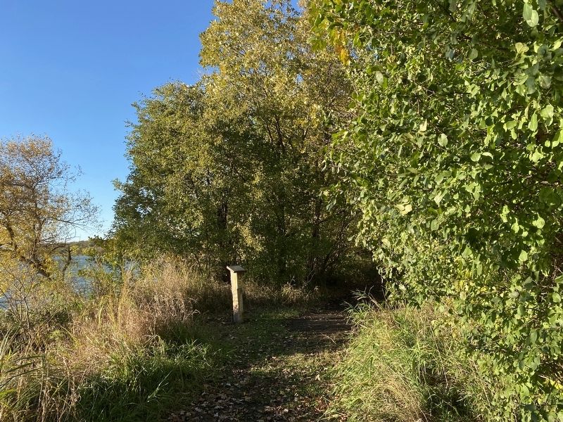
There are a number of large cottonwood trees along the west shore of the island. These shallow-rooted giants are exceptionally fast growing and require lots of water. It is one of the most common trees growing along the watercourses and lakeshores . . . — — Map (db m237247) HM
At the edge of the slough behind this post you can see the reddish stems of the dogwood. Notice the white, pea-sized berries. The inner bark of dogwood was used in a mixture with tobacco and called kinnikinnick. Indians favored this in their . . . — — Map (db m237241) HM
This cluster of shrubs is comprised of gooseberries. The plant is easily recognized by the sharp, half-inch spines on its stems. Songbirds seek out the ripe berries for food. Indians used the fruit, which ripens to a deep red in the fall, to flavor . . . — — Map (db m237239) HM
Scout Island was named for the annual Boy Scout encampment once held here. The island is now a peninsula bordered on the east and south by Tetonkaha Lake and on the west by Johnson Lake.
At the flagpole is a plaque dedicated to D.C. Mackintosh, a . . . — — Map (db m237236) HM
Here at the southeastern tip of Scout Island, exposure to wind and waves has washed soil away from the roots of trees and shrubs. The eroded soil settles to the bottom of the lake, eventually filling it in. The same thing that happens when dirt from . . . — — Map (db m237243) HM
From this vantage point, you can see the land formations described by explorer Joseph N. Nicollet and John Fremont when they camped at Oakwood Lakes in 1838. In Nicollet's words, "Wood is less scarce here. It is on all the tongues of land which . . . — — Map (db m237248) HM
Captain DeLozier Davidson and his soldiers from Fort Randall constructed this military fort in 1859. It served as a supply post for Fort Wadsworth, now called Fort Sisseton. Soldiers manned the fort, also called a breastwork, until December 1864 . . . — — Map (db m237191) HM
You are about to enter
Brookings County
home of roving Indians until 1862. The exploring party of Nicollet, scientist, and Fremont, "Pathfinder of the West," visited Oakwood Lakes, July 1838, leaving the first reliable record.
The . . . — — Map (db m181265) HM
Honor & Glory To All
Who Have Served
And Will Serve
US Army · US Navy
US Marine Corp · US Air Force
Merchant Marine · US Coast Guard
Pavers (by row):
* Indicates Servicemen Killed . . . — — Map (db m291171) WM
All early maps (1838-1879) showed the Hole-in-The-Mountain or Mountain Pass where Coteau Perce creek drained SW from Lake Benton to the Big Sioux. It is 8 miles SE. Nicollet & Fremont, first explorers, visited the "Hole" on July 6, 1838 and . . . — — Map (db m177443) HM
Called Elkton Firefighters to duty.
Originally hung in the late 1880's in the belfry of the wooden fire station on the northwest corner of the intersection of Elk and First Streets.
The fire house was demolished in the early 1940's and . . . — — Map (db m291154) HM
Created with its Twin North Dakota, 2 November 1889. Its 77,047 square miles ranks 15th in size. Those square miles include: exceptional corn land in the SE, grass land in the W, wheat land in the N and productive land all over. Its lowest . . . — — Map (db m179809) HM
The region between Lake Poinsett and Oakwood Lakes was a summer hunting area for the Sioux for over one hundred years. The Sioux who frequented the area used various names for the different features in this area.
* Oakwood Lakes was . . . — — Map (db m238363) HM
This 1880's one-room rural schoolhouse was, by 1900, one of more than 100 rural schools, about five in each of Brookings County's 22 mostly 36 square-mile townships. Rural schools were more than centers of learning. They were sources of pride and . . . — — Map (db m290468) HM
This park is named in honor of Dr. Alonzo Provost Peeke (1909-1992) and Roma Peeke (1909-1978). Doc Peeke served as a physician to the Volga community and surrounding area for more than 50 years, from 1929 to 1984. In this time Doc Peeke delivered . . . — — Map (db m290471) HM
This property donated by J. L. Hall for perpetual use by Boy Scouts of America Troop 56, Volga chartered Feb. 10. 1931 and by The Campfire Girls and for a bird refuge — — Map (db m290473) HM
The Lake Campbell Lutheran Church was originally the Medary Norwegian Evangelical Lutheran Congregation, Brookings County, Dakota Territory. The congregation was organized June 13, 1870 at the John Thompson home in Sverdrup Township Minnehaha . . . — — Map (db m179962) HM
Oakwood Lakes, called by the Sioux, Te-tonka-ha, meaning the place of the Great Summer Lodge, lie in a scenic state park 7 miles N and 3 W. First visitors of record were Nicollet & Fremont. July 8, 1838.
During the Indian Disturbances of . . . — — Map (db m179802) HM
Jokum and Maren Sundet and their three children, Ole, Mathea, and Karen, settled near the now defunct town of Medary in 1871. They built this home from local timbers in 1872. It was located a short distance Northwest of where the Interstate-29 . . . — — Map (db m290467) HM
Veterans Memorial
Dedication Date
June 24, 2018
This Volga Veterans Memorial is dedicated to local Veterans and their families. Their sacrifices continue to insure our freedom.
The Volga Veterans Memorial was built with the . . . — — Map (db m118931) WM
This park is compromised of land generously donated by longtime Volga residents and once active business families Emerson and Dorotha Wolfe and Marvin and Pat Blase. The swimming pool complex, picnic shelters, sand volleyball court, horseshoe pit . . . — — Map (db m290470) HM
Lake Hendricks Norwegian Colony of 1873
The first settlers at Lake Hendricks were 31 Norwegians, arriving July 14, 1873, with 11 covered wagons and 30 cattle. On May 14, 1873 they left Houston County, Minn., and Allamakee and Winneshiek . . . — — Map (db m179811) HM
Lake Hendricks State Park
This lake was named for Thomas A. Hendricks (1819-1885), Commissioner of the General Land Office, 1855-59, at which time the state boundary was surveyed and the lake named. Hendricks was a Member of Congress, 1851-55; . . . — — Map (db m184234) HM
In Memory of All American Veterans
This memorial honors all American veterans who, although separated by generations, shared a common, undeniable goal - to valiantly protect our country's freedoms.
The memories of these American . . . — — Map (db m251512) WM
In memory
of the
soldiers and sailors of
1861—1865.
Erected by
Robert Anderson
W.R.C. No 18.
Mustered Out
"Liberty has been bought with a great price"
"The unselfish workers of our country"
"They are beyond the . . . — — Map (db m112644) WM
(northwest section, side 1)
Day is done. Gone the sun.
From the lake. From the hills. From the sky:
All is well. Safely rest: God is nigh.
Fading light. Dims the sight.
And a star gems the sky. Gleaming bright.
From afar . . . — — Map (db m112664) HM
Albert D. Sahli is a native of Aberdeen and a 1947 graduate of Aberdeen Central High School. Coach Sahli received his bachelor's degree in 1951 and master's in 1956, both from Northern State University.
Coach Sahli's coaching career began in . . . — — Map (db m112035) HM
Dedicated to the memory of
Kent and Vera Baird
Prominent Residents of Aberdeen from 1925 - 1980
This portion of the Baird farm was donated by Roger, Virginia and Howard Baird in 2001 to the citizens of Aberdeen for their use as a park . . . — — Map (db m112670) HM
Brown County Courthouse
has been placed on the
National Register of Historic Places
By the United States
Department of the Interior
Built 1904 — — Map (db m130661) HM
Clark Swisher was a native of Vermillion, South Dakota and graduated from Vermillion High School in 1934. He want on to earn a Bachelor's Degree in 1938 from the University of South Dakota.
Coach Swisher began his coaching career at high . . . — — Map (db m112037) HM
Don Reshetar is a native of Minneapolis, Minnesota and a 1947 graduate of Minneapolis South High School. Coach Reshetar graduated with his bachelor's degree from Augustana College, in 1951 and master's degree from Northern State University in . . . — — Map (db m112036) HM
Two German-language newspapers, Dakota Freie Press (DFP) and Neue Deutsche Presse (NDP), were located a short distance from here at 524 South Main St. Owner and editor, Friedrich Wilheim Sallet, emigrated from East Prussia and published DFP for . . . — — Map (db m90571) HM
First United Methodist Church
has been placed on the
NATIONAL REGISTER
OF HISTORIC PLACES
by the United States
Department of the Interior
Built 1904 — — Map (db m131077) HM
This sculpture was commissioned by Absolutely! Aberdeen for the GROW! Campaign. It symbolizes Absolutely! Aberdeen's commitment to promote growth in and around the Aberdeen area. Each piece of the sculpture represents a specific element that we . . . — — Map (db m229636)
James Kretchman is a native of Faulkton, S.D. He first started his Northern experience as a scholar athlete in the 1950's. While playing football under Coach Clark Swisher Coach Kretchman earned Little All-American honors and he is still amongst . . . — — Map (db m112033) HM
Lyman Frank Baum was born May 15, 1856, in Chittenango, New York. He held a variety of jobs from actor to newspaper man to traveling salesman before settling in Aberdeen with his family in 1888.
Baum first opened a variety store called . . . — — Map (db m210350) HM
The Masonic Temple
Has been placed on the
National Register
Of Historic Places
By the United States
Department of the Interior
Built 1899 — — Map (db m145323) HM
World War II Plaque
In Memory of
Students and
Faculty of NSC
Who Served in
WWII
NSC Vets Club
Sidney L. Smith
American Legion
Post #24
Korea and Vietnam Plaque
In Memory of
Students and . . . — — Map (db m150923) WM
World War I Plaque a.
This Archway
Erected By
The Classes of 1916, '17, '18, '19 and '20
Northern Normal and Industrial School
Dedicated to the
Four Hundred and Forty-Two
Students,
Alumni and . . . — — Map (db m150644) WM
Founded on N S T C Campus
1940
(American Legion Logo)
Charles Dalthorp Ivan Huntsinger
Dr. Harry R. Darling Judge Harry E. Mundt
N. Peter Wenge — — Map (db m114786) HM
Left Side
Clark Swisher's
Commitment to
N.S.U. and his
Efforts for the
Community,
Exemplify his
Love of athletics
And his desire
For students
To achieve
Educational
Excellence.
Right Side
Head . . . — — Map (db m112032) HM
At this site on June 22, 1989,
The State Centennial Wagon
Train with 44 wagons made
their noon stop. Over 700
people welcomed the wagon
train with an old fashioned
BBQ and entertainment. — — Map (db m90516) HM
Perhaps our best known group of birds, waterfowl species such as ducks, geese and swans have webbed feet and water repellent feathers that allow them to float and swim easily. Often striking in plumage, waterfowl are found in a variety of watery . . . — — Map (db m102937) HM
Located at the mouth of Elm River, Columbia has a notable history.
Here was the wintering place of Waneta "Cuthead Band"of Yanctonaise Sioux.
Here was the site of the scout's camp from which in 1866, Sam J. Brown
started his famous "ride in . . . — — Map (db m179946) HM
A Wetland Enhancement Project Developed by Ducks Unlimited, Inc. in cooperation with the U.S. Fish and Wildlife Service and the North American Wetlands Conservation Act Council on Sand Lake National Wildlife Refuge to improve North America's . . . — — Map (db m103078) HM
In 1880, John Daly and his four sons - George, John Charles ("JC"), Edward and Austin arrived at this location from Michigan.
It was here that "Daly Corners" started. On the northwest corner was J.C. Daly's tree claim and his homestead was on . . . — — Map (db m206716) HM
who rose to distinction in
American Letters
resided on this spot 1881-1884
Here stood the
Garland Homestead
where he began his first book
"Main Travelled Roads" — — Map (db m206717) HM
Sand Lake National Wildlife refuge, a 2,498 acre refuge, was established in 1935 to protect critical nesting and migrating habitat for our nation's waterfowl. The James River, which flows through the refuge, was dammed by the Civilian Conservation . . . — — Map (db m102938) HM
This 108-foot tower was built by the Civilian Conservation corps in 1936. The Sand Lake CCC camp ran from 1925 through 1939 and housed several hundred men. They built many of the dikes, fences, and facilities you see on the Refuge today. The . . . — — Map (db m103080) HM
"Over increasingly large areas of the United States, spring now comes unheralded by the return of the birds, and the early mornings are now strangely silent, where once they were filled with the beautiful bird song." Silent Spring, . . . — — Map (db m102940) HM
WEST
Looking to the west, the giant Canada goose pens and display pool are below you. In the spring and summer, you'll see the giant Canada geese raising their goslings in the area. Just beyond the goose area is the tree-lined Refuge . . . — — Map (db m103079) HM
(east side)
History
The united Norwegion Luthern church.
In memory of the pioneer members of the Aurland congregation, organized in 1885. Rev Rogne was the first Pastor. The services wer held in homes & school houses until when in . . . — — Map (db m206714) HM
In Honor
and Memory
of our Men and Women
Who have Served
Our Country in all
Branches of the Service.
This Tribute was Partially
Funded by the July 4, 2003
Celebration that Included
an Awards Ceremony, Parade,
and B-1 . . . — — Map (db m137487) WM
On June 22, 1883 Mrs. Matt (Valborg) Hanhela became the first Finnish settler here to die (in childbirth). She and her infant son were the first to be buried here. Their grave is unmarked and unknown.
Ten acres of land for this cemetery and for . . . — — Map (db m206651) HM
(south side)
Finnish Pioneer Settlers of Other Savo Area Twps. in Territory qf Dakota. 1882–1886
Names of Finnish pioneers. Ada Twp. 129 Range 61. Wm. Pöykkö N.W.14. Markku Rusko S.E.22. Michael . . . — — Map (db m206705) HM
This property
Old Finnish Apostolic
Lutheran Church
has been placed on the
National Register
of Historic Places
by the United States
Department of the Interior — — Map (db m206650) HM
A pioneer in Brown County, Philip Cain Gelling was born on the Isle of Man in 1849. He came to the Dakota Territory from Illinois in 1882 and homesteaded on this site. Philip married Elizabeth Johnson in 1887. From that union 8 children were . . . — — Map (db m169929) HM
Savo Hall
has been placed on the
National Register
of Historic Places
by the United States
Department of the Interior
Built 1899 — — Map (db m206662) HM
This monument was created to forever make available the story of those Finnish people who early came to Brown and Dickey Counties, and settled there.
Erected by the Savo Finnish Historical Society under the direction of John G. Peterson, the . . . — — Map (db m206703) HM
The First Frederick school house was built in 1883.
Main-building was built in 1922 with four year curriculum.
The Original bell of Frederick school.
Purchased with money raised by student entertainment in April 1888.
Park . . . — — Map (db m137490) HM
Site of the
Tveit Homestead
Claimed in October 1882 by Iver Lars Tveit
Iver brought his bride Marta here in 1883, then his parents Lars & Ragnhilde in 1885
These Tveits were born and raised here: Lewis, Belle, Hilda, . . . — — Map (db m206665) HM
You Are Entering South Dakota
Created with its twin, North Dakota, 2 November 1889, its 77,047 square miles ranks 15th in size. Those square miles include; exceptional corn land in the SE, grass land in the W, wheat land in the N and . . . — — Map (db m177397) HM
Camp BF-2 (Sand Lake): 2 1/2 miles W and 2 1/2 miles S at headquarters. Company: 2749--6/28/35 - 7/31/39.
The Civilian Conservation Corps was a federal work-relief program during the Great Depression. From 1933 to 1942, the CCC provided work . . . — — Map (db m100979) HM
Ralph Herseth, 1909 - 1969, was born on a ranch near Houghten and grew to manhood here. He graduated from Columbia High School and attended North Dakota State College. As a farmer - rancher, he raised wheat, corn, and Aberdeen Angus cattle and . . . — — Map (db m180972) HM
A Wetland of International Importance (Marker 1)
Wetlands are one of the most important ecosystems on the planet. They improve our quality of life by providing us with clean water, food, flood control, and many forms of recreation. . . . — — Map (db m100980) HM
Oakwood post, established in 1835 by Major Joseph R. Brown for the American Fur Company, was an early trading post in Brown County. French explorers called it “place of the scrub oaks,” a landmark used by Indians and Whites alike. Pierre Le . . . — — Map (db m187060) HM
"Lest We Forget"
Dedicated to all the Veterans of the United States of America and to those who will come after us for their Service to God and Country — — Map (db m90796) WM
Madison Gregory was born in Huron County, Ohio in 1848. He married Ester Randall on December 26, 1870 in Kankakee County, Illinois. Three daughters were born to them in Kankakee County-Lillie Gregory Martin, Jennie Gregory, and Ethel Gregory . . . — — Map (db m125356) HM
"Grant Tooker, one of the early settlers, told of the first burial at Westport. In the late fall of 1883 a man named Albright died of consumption. He lived west of town. No one would volunteer to dig the grave, but when Grant's father offered to . . . — — Map (db m125357) HM
As I developed the design, foremost in my mind was the dignity and long history of indigenous people in this land. I wanted to encourage visitors to understand the deep culture and world view of the first peoples.
Women have always been a . . . — — Map (db m283230) HM
Orrion & Edith Barger
Orrion Russell Barger was born August 23, 1913 at Paynesville, MN and Edith M. Meyer was born November 22, 1913 at Howard, SD. Orrion and Edith (Meyer) Barger were married on November 1, 1941. On June 2, . . . — — Map (db m242613) HM
Named for Selah Chamberlain, a Milwaukee RR official, the site was scene of an encounter between Jean Baptiste Trudeau and the Teton Sioux in 1794 and when Samuel H. Morrow surveyed the area, in November of 1868, he found a ranch on American Creek . . . — — Map (db m184645) HM
The creation of Dignity of Earth & Sky spanned a period of three years, after careful research and with the help of native models and advisors. The entire figure, including her face and hands, were fabricated by the artist and team of three . . . — — Map (db m283240) HM
"Standing at a crossroads, Dignity echoes the interaction of earth, sky, and people. She brings to light the beauty and promise of the indigenous peoples and cultures that still thrive on this land. My intent is to have the sculpture stand as an . . . — — Map (db m124343) HM
In the 1930's St. Joseph's Indian School opened the Divine Infant Home on this site. The Divine Infant Home provided care for young infants and preschoolers when no other care was available.
The former Divine Infant Home was also a part of the . . . — — Map (db m242610) HM
The Fort Ridgely and South Pass Federal Wagon Road, surveyed and mounded in 1857 crossed here from NE to SW. First public road in the South Dakota area. — — Map (db m242461) HM
Dedicated July 7, 1974 by Governor Richard F. Kneip
Meriwether Lewis and William Clark with their party camped at several points
near this crossing. In September 1804, continuous rain had soaked their gear.
They stopped near Ocoma, above . . . — — Map (db m180987) HM
This Corps of Discovery II marker commemorates the bicentennial
of the Lewis and Clark expedition.
The geographic position of this marker has been established
using the satellite-based Global Positioning System.
This marker is part of the . . . — — Map (db m101382) HM
America's Shrine of Democracy, Mount Rushmore
National Memorial, is located near Keystone in
the Black Hills National Forest. The 60-foot
faces of four great American presidents
represent the birth, growth, development
and preservation of our . . . — — Map (db m283913) HM
On May 24, 2012, the South Dakota DOT Transportation Commission officially declared Interstate 90 from the Minnesota border to the Wyoming border as South Dakota's segment of the national Purple Heart Trail. The Purple Heart Trail was . . . — — Map (db m101380) WM
When the Corps of Discovery reached present-day Chamberlain on September 16, 1804, they were ready for a break. Since May, one member of the expedition, Sergeant Charles Floyd, had died, possibly of appendicitis. Another, Private George Shannon, . . . — — Map (db m98240) HM
Fr. Henry Hogebach – Founder
Fr. Henry Hogebach, SCJ, founded St. Joseph's Indian School in 1927. He devoted his life to the care and education of Native American children. His vision, patience and perseverance remains alive in our ongoing . . . — — Map (db m242611) HM
South Dakota's State Capitol is located in Pierre, a city that sits along the banks of the Missouri River near the Oahe Dam. The building was completed in 1910 and restored in 1989. The grounds feature Capitol Lake surrounded by memorials to . . . — — Map (db m283911) HM
Norm and Eunabel McKie of Rapid City, South Dakota, announced their gift of Dignity to the State of South Dakota in 2014, in honor of the 125th anniversary of South Dakota statehood.
The statue was erected in September 2016 at this site, . . . — — Map (db m283251) HM
Mitchell is home to the World's Only Corn Palace.
It was originally constructed in 1892 to celebrate
the harvest and stimulate the economic growth
of the community. Today, visitors still enjoy
celebrations at the Corn Palace and continue to
see . . . — — Map (db m283910) HM
Language
Although they speak the same language, there are three distinct dialects that each of the three divisions speak. Those dialects are seen in each division, named Dakota, Nakota, and Lakota. Regardless of the dialect, the meaning of . . . — — Map (db m267850) HM
This spot offers a spectacular view of the Missouri River, but the river is much different today from when Lewis and Clark traveled up it. Several huge dams now control its flow.
When the expedition came through, the river could go from a mere . . . — — Map (db m242480) HM
1405 entries matched your criteria. Entries 101 through 200 are listed above. ⊲ Previous 100 — Next 100 ⊳